| June 2019 | Flash Flood | Greenwood | 1 killed | Several roads were flooded in and around Greenwood. A motorist was driving east on Highway 10 and slid off the wet roadway into Heartsill Creek, where the vehicle overturned and he drowned. |
| June 2004 | Flash Flood | Greenwood | $1,000,000 | Torrential rain hit Greenwood where a total of near 6 inches of rain was reported. The rain caused widespread flooding with 90 homes and seven businesses effected. |
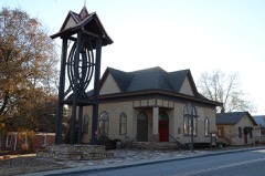
| July 2011 | Lightning | Greenwood | $200,000 | Lightning struck a church resulting in a major fire that consumed the structure. |
| March 2008 | Flash Flood | Greenwood | $200,000 | Heavy rain caused flooding that impacted homes and businesses in Greenwood and closed several roads across the area. |
| May 2019 | Tornado (EF1) | Greenwood | $150,000 | This tornado developed over northwest Greenwood, and moved east-northeast across the northern portion of town. It moved onto Fort Chaffee, where it dissipated. Homes were damaged, numerous trees were snapped or uprooted, and power poles were snapped by this tornado. Based on this damage, maximum estimated wind in the tornado was 100 to 110 mph. |
| September 2007 | Flash Flood | Greenwood | $100,000 | Heavy rain caused severe street flooding in Greenwood. Streets were closed and ten vehicles were stranded. High water also entered and damaged four homes and a business. The American Red Cross temporarily relocated two families due to the flood damage to their homes. |
| July 2006 | Thunderstorm Wind | Greenwood | $75,000 | Thunderstorm winds estimated at 75 miles an hour blew trees down onto six houses, causing major damage to three of them. Several bank signs and power lines were also blown down. |
| May 2020 | Hail | Greenwood | $50,000 | Golf ball size hail damaged vehicles, homes, and businesses. |
| March 2006 | Hail | Greenwood | $50,000 | Hail up to golfball size covered the ground. |
| August 2011 | Thunderstorm Wind | Greenwood | $40,000 | Strong thunderstorm wind blew down a large tree onto a home, resulting in significant structural damage. |
| April 2014 | Thunderstorm Wind | Greenwood | $30,000 | Strong thunderstorm wind blew down trees, two of which fell onto homes. |
| April 2020 | Hail | Greenwood | $25,000 | Golfball size hail damaged vehicles and the roofs of homes. |
| December 2014 | Thunderstorm Wind | Greenwood | $25,000 | Several wood trusses were blown over on the partially completed Greenwood Police Department. Damage also occurred to a metal roof of another building. |
| June 2017 | Hail | Greenwood | $25,000 | no account filed |
| May 2001 | Flash Flood | Greenwood | $20,000 | Heavy thunderstorm rains caused a few rural roads to be washed out near Greenwood. |
| June 2009 | Thunderstorm Wind | Greenwood | $10,000 | Thunderstorm winds estimated at 80 miles an hour ripped the siding off a school gym. A football goal post was also bent over. |
| April 2006 | Thunderstorm Wind | Greenwood | $10,000 | Thunderstorm winds estimated at 70 miles an hour blew down a few trees and some power lines. One of the trees fell on a house. |
| January 1999 | Hail | Greenwood | $10,000 | Nearby at Midland, large hail dented several cars. |
| January 2018 | Thunderstorm Wind | Greenwood | $5,000 | Strong thunderstorm winds damaged the roof of a home. |
| July 2012 | Thunderstorm Wind | Greenwood | $5,000 | Strong thunderstorm wind blew down power lines. |
| July 2012 | Thunderstorm Wind | Greenwood | $5,000 | Strong thunderstorm wind blew down power lines. |
| July 2012 | Thunderstorm Wind | Greenwood | $5,000 | Strong thunderstorm wind blew down power lines. |
| August 2006 | Thunderstorm Wind | Greenwood | $5,000 | Thunderstorm winds estimated at 70 miles an hour blew a roof off a barn and blew down a tree. |
| September 2005 | Thunderstorm Wind | Greenwood | $5,000 | Thunderstorm winds estimated at 60 miles an hour blew down numerous tree limbs, damaged a barn and blew the awning off a business. |
| May 2001 | Tornado (F0) | Greenwood | $5,000 | Brief tornado spin-up from updraft area that passed south of Fort Smith. Damage occurred on Fort Chaffee Military Reservation. Numerous trees were downed in an open field, but no structural damage to buildings was reported. |
| January 1999 | Hail | Greenwood | $5,000 | Hail of unknown size broke out car windows along Milltown Road 5 miles southeast of Greenwood. |
| April 2026 | Thunderstorm Wind | Greenwood | $2,000 | Strong thunderstorm wind snapped large tree limbs, some of which fell onto power lines. |
| February 2023 | Thunderstorm Wind | Greenwood | $2,000 | Strong thunderstorm wind snapped large tree limbs and blew down power lines. |
| August 2019 | Thunderstorm Wind | Greenwood | $2,000 | Strong thunderstorm wind blew shingles off a roof. |
| July 2018 | Thunderstorm Wind | Greenwood | $2,000 | Strong thunderstorm wind blew down trees and power lines. |
| February 1999 | Thunderstorm Wind | Greenwood | $2,000 | Winds of 70 mph caused some roof damage in Greenwood. |
| June 1998 | Thunderstorm Wind | Greenwood | $2,000 | Business signs were blown down in Greenwood |
| December 2008 | Thunderstorm Wind | Greenwood | $1,000 | Thunderstorm winds estimated at 70 miles an hour blew down several trees and power lines. |
| January 1999 | Hail | Greenwood | $1,000 | Quarter-sized hail covered the ground. Location of this report: off of AR Hwy 10 Spur west of Greenwood. One home just east of Greenwood lost several windows to the large hail. |
| April 2001 | Thunderstorm Wind | Greenwood | $500 | Thunderstorm winds blew down several signs. |
| April 1994 | Thunderstorm Wind | Greenwood | $500 | Thunderstorm winds blew down a tree. |
| April 1994 | Thunderstorm Wind | Greenwood | $500 | Thunderstorm winds knocked down a tree. |
| April 1999 | Thunderstorm Wind | Greenwood | $100 | A large tree was blown down in Greenwood. |
| June 1998 | Thunderstorm Wind | Greenwood | $100 | A tree was blown down, blocking a road near Greenwood |
| June 1998 | Thunderstorm Wind | Greenwood | $100 | A tree was blown down in Greenwood |
| July 1997 | Thunderstorm Wind | Greenwood | $100 | A severe thunderstorm produced strong winds which downed numerous large tree limbs in Greenwood. |
| July 1997 | Thunderstorm Wind | Greenwood | $100 | Isolated severe thunderstorms developed in Sebastian County of northwest Arkansas during the late afternoon and early evening of July 22nd and produced damaging winds. Strong thunderstorm winds downed trees and power lines and damaged outbuildings in Lavaca, and 3 power poles were blown down near Lavaca. Trees were blown down 3 miles northwest of Greenwood. |
| July 1997 | Thunderstorm Wind | Greenwood | $100 | no account filed |
| June 1996 | Thunderstorm Wind | Greenwood | $100 | no account filed |
| May 2025 | Thunderstorm Wind | Greenwood | - | Strong thunderstorm wind blew down a tree. |
| May 2025 | Thunderstorm Wind | Greenwood | - | Strong thunderstorm wind blew down trees on Highway 96. |
| June 2022 | Flood | Greenwood | - | Portions of several roads were flooded and closed. |
| June 2022 | Flash Flood | Greenwood | - | Portions of several roads, including W Denver Street, were flooded and closed. |
| April 2020 | Thunderstorm Wind | Greenwood | - | Strong thunderstorm wind snapped large tree limbs on Ware Road. |
| May 2020 | Flash Flood | Greenwood | - | Locally heavy rainfall resulted in flooding of several creeks and streams, which flowed over rural roads in and around Greenwood. |
| April 2020 | Thunderstorm Wind | Greenwood | - | Thunderstorm wind gusts were estimated to 60 mph by a storm chaser. |
| August 2020 | Thunderstorm Wind | Greenwood | - | Strong thunderstorm wind estimated to 60 mph snapped large tree limbs. |
| May 2019 | Thunderstorm Wind | Greenwood | - | Strong thunderstorm wind uprooted a few trees and snapped large tree limbs. |
| August 2019 | Thunderstorm Wind | Greenwood | - | Thunderstorm wind gusts were estimated to 60 mph. |
| April 2018 | Thunderstorm Wind | Greenwood | - | Strong thunderstorm wind blew down trees in town. |
| May 2017 | Thunderstorm Wind | Greenwood | - | Thunderstorm wind gusts were estimated to near 60 mph. |
| May 2017 | Thunderstorm Wind | Greenwood | - | Thunderstorm wind gusts were measured to 63 mph. |
| June 2017 | Thunderstorm Wind | Greenwood | - | Thunderstorm wind was estimated to 60 mph. |
| October 2017 | Thunderstorm Wind | Greenwood | - | A storm spotter measured thunderstorm wind gusts to 65 mph. |
| July 2016 | Thunderstorm Wind | Greenwood | - | Strong thunderstorm wind blew down a large tree. |
 Block