Block
From the record
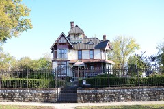
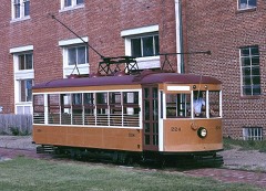
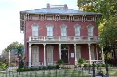
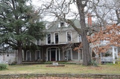
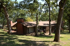
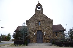
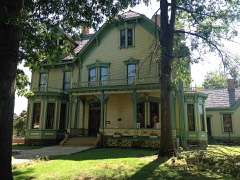
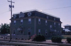
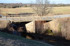
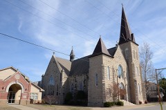
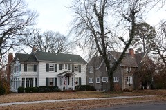
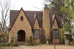
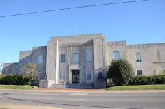
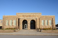
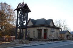
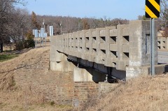
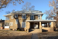
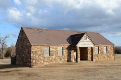
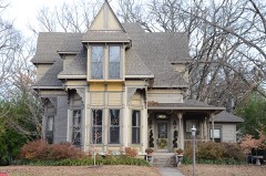
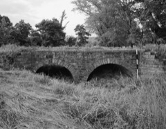
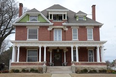
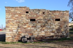
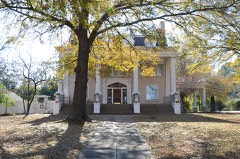
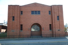
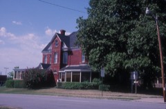
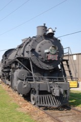
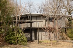
64 National Register listings published here, 1 of them a National Historic Landmark.
Sources: the National Register database, National Park Service
138 topographic sheets cover 57 settlements here, and 64 properties are on the National Register of Historic Places.
64 National Register listings published here, 1 of them a National Historic Landmark.
Sources: the National Register database, National Park Service
Every property in this county listed on the National Register of Historic Places, with the year it was listed and the federal nomination document.
Every wildfire the federal occurrence database records inside this county: 467 of them, burning about 7,713 acres. 22 started naturally and 69 were recorded as arson. Each settlement page carries the fires within five miles of it.
| Reported cause | Fires |
|---|---|
| Missing data/not specified/undetermined | 139 |
| Debris and open burning | 139 |
| Arson/incendiarism | 69 |
| Equipment and vehicle use | 44 |
| Smoking | 34 |
| Natural | 22 |
| Recreation and ceremony | 10 |
| Misuse of fire by a minor | 9 |
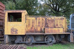
| Railroad operations and maintenance | 1 |
The five largest, by the area the report gives. One of them was set deliberately.
| Date | Cause | Size | Reported by | Name on the report |
|---|---|---|---|---|
| 8 January 2006 | Missing data/not specified/undetermined | 1,626 acres | Arkansas Forestry Commission | not named |
| 22 November 2002 | Missing data/not specified/undetermined | 1,200 acres | Oklahoma Division of Forestry | SUGARLOAF MOUNTAIN |
| 28 July 2011 | Missing data/not specified/undetermined | 410 acres | Arkansas Forestry Commission | GREENWOOD |
| 6 March 1994 | Arson/incendiarism | 250 acres | Ouachita National Forest | STATIONARY |
| 15 September 2006 | Debris and open burning | 210 acres | Arkansas Forestry Commission | not named |
| 11 August 2005 | Equipment and vehicle use | 202 acres | Arkansas Forestry Commission | KING FIRE |
| 24 March 2017 | Missing data/not specified/undetermined | 155 acres | Arkansas Forestry Commission | not named |
| 12 March 2006 | Natural | 124 acres | Ouachita National Forest | ROCK PILE |
Every settlement page carries the fires within five miles of it - see the settlement index below.
The NOAA Storm Events Database holds 1,039 reports for this county, causing 21 deaths, 344 injuries and about $173,474,050 in recorded property damage. Each settlement page carries the reports that name it.
| Kind of event | Reports |
|---|---|
| Thunderstorm Wind | 470 |
| Hail | 387 |
| Flash Flood | 106 |
| Tornado | 43 |
| Flood | 19 |
| Lightning | 9 |
| Funnel Cloud | 4 |
| Heat | 1 |
The most serious of them, by death, then injury, then recorded damage. The accounts are quoted exactly as the forecast office filed them.
| When | Event | Place named | Harm | What the report says |
|---|---|---|---|---|
| April 1968 | Tornado (F4) | not stated | 14 killed, 270 hurt, $2,500,000 | no account filed |
| April 1996 | Tornado (F2) | Ft Smith | 2 killed, 40 hurt, $150,000,000 | no account filed |
| August 2019 | Flash Flood | Lavaca | 1 killed, $400,000 | Portions of Highways 96 and 255 were closed near Lavaca. Portions of Highway 22 were closed near Fort Chaffee. Reportedly, 38 homes were flood-damaged in Fort Smith and seven were flood-damaged in Barling. A woman delivering newspapers drove into flood water across Kinkead Avenue on the east side of Fort Smith, and was washed off the road where she drowned. |
| June 2019 | Flash Flood | Greenwood | 1 killed | Several roads were flooded in and around Greenwood. A motorist was driving east on Highway 10 and slid off the wet roadway into Heartsill Creek, where the vehicle overturned and he drowned. |
| May 2019 | Flood | Oak Park | 1 killed | Near catastrophic flooding occurred along the Arkansas River with residential subdivisions and businesses flooded in Fort Smith. Numerous roads were closed. A man drove around a barricade near Fort Chaffee on the 28th, was washed off the road into the flooded river, and drowned. Monetary damage from this flood is unknown. |
| May 1986 | Thunderstorm Wind | not stated | 1 killed | no account filed |
| May 1986 | Thunderstorm Wind | not stated | 1 killed | no account filed |
| April 1980 | Tornado (F2) | not stated | 8 hurt, $250,000 | no account filed |
| May 1965 | Tornado (F2) | not stated | 8 hurt, $250,000 | no account filed |
| December 1967 | Tornado (F2) | not stated | 6 hurt, $25,000 | no account filed |
| February 1997 | Thunderstorm Wind | Ft Smith | 3 hurt, $12,000 | no account filed |
| December 1971 | Tornado (F1) | not stated | 1 hurt, $250,000 | no account filed |
| August 2006 | Thunderstorm Wind | Ft Smith | 1 hurt, $100,000 | Thunderstorm winds caused extensive damage in the downtown Fort Smith area. A wind gust of 64 miles an hour was measured at the airport. Stronger winds may have occurred where the damage was reported. The damage occurred from 7th and Garrison to 20th and Rogers. Windows were blown out of buildings with the flying glass injuring one person. Air conditioner units were blown off the roofs of buildings. Numerous trees were blown down with some of them falling on homes. 6000 homes were estimated to be without power. |
| March 1991 | Tornado (F1) | not stated | 1 hurt, $25,000 | no account filed |
| August 2011 | Thunderstorm Wind | Ft Smith | 1 hurt, $20,000 | Strong thunderstorm wind blew out the windows of a local McDonalds restaurant on Highway 71 on the south side of town. Several trees were uprooted by the wind. One tree landed on two cars, resulting in head and neck injuries to a person in one of the vehicles. |
| August 2014 | Lightning | Lavaca | 1 hurt | A man was struck and injured by lightning while standing on his porch, moving plants indoors out of the weather. The lightning struck a neighbor's tree about 30 yards from his porch. The victim was knocked unconscious and was taken to a nearby hospital. |
| November 2005 | Lightning | Ft Smith | 1 hurt | A woman who was struck and injured by lightning was taken to the hospital for treatment. |
| June 1992 | Thunderstorm Wind | not stated | 1 hurt | no account filed |
| April 1990 | Thunderstorm Wind | not stated | 1 hurt | no account filed |
| June 1987 | Thunderstorm Wind | not stated | 1 hurt | no account filed |
| December 1999 | Tornado (F1) | Ft Smith | $5,000,000 | A gustnado occurred at 122 am near Phoenix and 46th street in Fort Smith and was on the ground for approximately 20 seconds. 3 warehouses and 2 office buildings were heavily damaged. A motor home,construction trailer and cessna airplane were also destroyed. There was also damage to a hangar at the Fort Smith airport and minor damage was done to 2 commuter planes. |
| May 2025 | Tornado (EF1) | Enterprise | $1,500,000 | This is the second segment of a two segment tornado. The tornado moved into Sebastian County west of Bonanza and moved northeast toward White Bluff. It was weak between Highway 112, across the north side of Bonanza, to just west of Highway 71, with mostly small trees uprooted and large tree limbs snapped in that segment of the path. It strengthened as it approached Highway 71, where trees were uprooted or snapped. The tornado then moved across Fort Chaffee, where 40 buildings were damaged, and trees were snapped or uprooted, and then turned east-northeast, dissipating before crossing Highway 22. It produced a tornadic debris signature from the KSRX WSR-88D. Based on this damage, maximum estimated wind in this segment of the tornado was 100 to 110 mph. |
| May 2021 | Tornado (EF1) | Ft Smith | $1,000,000 | This is the third segment of a four segment tornado. The tornado moved across the Arkansas River and into Sebastian County, uprooting numerous trees before moving across the northern portion of the City of Fort Smith. Numerous homes and businesses were damaged by this large tornado, numerous power poles were snapped, and many trees were uprooted before the tornado crossed the Arkansas River again, moving back into Crawford County. Based on this damage, maximum estimated wind in this segment of the tornado was 95 to 105 mph. |
| June 2004 | Flash Flood | Countywide | $1,000,000 | Thunderstorms produced in excess of 2 inches of rain in a short period of time across Sebastian County. The ground was already saturated from rains a few days earlier and substantial floooding occurred. Some homes which were flooded a few days earlier in Greenwood were flooded again. However, the most substantial flooding occurred in the Fort Smith area. About 10 homes in the Briarcliff and South 28th Street area were flooded with up to 16 inches of water. Some businesses in south Fort Smith were also flooded. There was deep street flooding in parts of south Fort Smith with abandoned cars floating around South 28th Street and Cavanaugh. Highway 45 south of Fort Smith had to be closed. The Governor of Arkansas declared Sebastian county a disaster area. |
| June 2004 | Flash Flood | Greenwood | $1,000,000 | Torrential rain hit Greenwood where a total of near 6 inches of rain was reported. The rain caused widespread flooding with 90 homes and seven businesses effected. |
| October 2007 | Flash Flood | Ft Smith | $800,000 | Heavy rain caused flash flooding across the northern half of Sebastian county. Severe street flooding occurred in Fort Smith and Greenwood.|In Greenwood, water entered 80 homes and several businesses. 28 homes were severely damaged. In rural areas, Highway 60 had water over it 3 miles east of Washburn and water covered the intersection of Highway 96 and Highway 22 near Lavaca. |
| November 1998 | Tornado (F1) | Ft Smith | $750,000 | An F1 tornado touched down in extreme eastern Oklahoma between Arkoma and Pocola and then moved northeast into western Arkansas, moving across the southern part of Fort Smith and finally lifting at the Fort Smith Regional Airport (FSM). Along the way, many homes and businesses sustained damage ranging from minor to major. This includes several homes in the Random Acres subdivision near the Oklahoma border where shingles were blown off many roofs. Trees and power lines were blown down throughout the tornado's path.Some of the tornado's worst damage occurred at the Fort Smith Regional Airport, where eight private and corporate airplanes were damaged, including three single-engine planes that were flipped. Four of the planes that received the most damage were outside hangars. The storm also damaged nine hangars, including three corporate and six general aviation facilities. The weather observer at the airport officially recorded a tornado, and the ASOS at the airport measured a peak wind gust of 57 kts (66 mph) at 1244 AM.Otherwise, seven thousand residences in the south part of Fort Smith lost power in the storm. Sutherland Central Distribution Center on US Hwy 71 lost several metal buildings and had some roof damage. Reeder Simco Truck Center on south Zero Street had its showroom glass blown in, and a tractor-trailer was turned over. A photo in the Southwest-Times Record daily newspaper showed cleanup efforts from a large tree that had fallen into a home's driveway in the 6800 block of S. Seventh street. |
| April 2008 | Hail | Ft Smith | $500,000 | Wind-driven golfball size hail caused extensive property damage to homes and businesses in Fort Smith. |
| November 2022 | Tornado (EF1) | Huntington | $400,000 | This tornado developed south of Mansfield where trees were blown down and outbuildings were damaged on Johnnie Cake Way. It moved north across Mansfield and across the east side of Huntington. Sixteen homes were damaged in Mansfield, several significantly. Trees were snapped or uprooted, and power poles were blown down. Based on this damage, maximum estimated wind in the tornado was 105 to 110 mph. |
| December 2012 | Tornado (EF1) | Island | $400,000 | The tornado developed near Highway 96 north of Union Road where it damaged a permanent home and trees. It moved northeast uprooting or snapping numerous hardwood and softwood trees and damaging chicken houses and outbuildings. The tornado damaged the sides and roof of a fire station on County Road 68, tore the roof off a double wide mobile home north of County Road 68, then destroyed a double wide mobile home and tore the roofs off of three chicken houses before moving into a wooded area. Based on this damage, maximum estimated wind in the tornado was 100 to 110 mph. |
| April 2023 | Hail | Ft Smith | $300,000 | Golf ball to hen egg size hail damaged homes, businesses, and vehicles. |
| May 2019 | Tornado (EF1) | Mill Creek | $250,000 | This is the second segment of a two-segment tornado. The tornado moved into Fort Smith near the intersection of the state line and Phoenix Avenue. It moved east-northeast across town, damaging many homes and businesses, snapping and uprooting many trees, and snapping many power poles. It dissipated shortly after snapping large tree limbs on the south side of Mercy Hospital and crossing Rogers Avenue. Based on this damage, maximum estimated wind in this segment of the tornado was 95 to 105 mph. |
| July 2004 | Flash Flood | Countywide | $250,000 | Heavy thunderstorm rains caused extensive flooding across Sebastian county. Some rainfall totals included 7.34 inches at Midland, 5.40 inches at Lavaca and 3.91 inches at Greenwood. Numerous major highways were flooded including Highway 22 just south of Lavaca, Highway 255 near Central City, Highway 45 near Midland and Highway 96 between Fort Smith and Greenwood. Between Fort Smith and Greenwood a couple of vehicles were swept off the road due the flood waters. No injuries were reported though. The most major damage was in Greenwood where 100 people were displaced from their homes. |
| August 2003 | Thunderstorm Wind | Ft Smith | $250,000 | Thunderstorm winds estimated at 80 miles an hour blew down numerous trees and power lines. The wind and falling trees and limbs damaged the roofs of some homes and a business. The wind also blew out windows of several homes and businesses and damaged numerous signs. As many as a hundred streets were blocked by the debris. |
| June 1999 | Flash Flood | Ft Smith | $250,000 | There was major street flooding in Fort Smith. Several homes on Briarcliff Drive were flooded with up to four feet of water. None of the homes were in a designated flood plain. The Red Cross assessed major damage to five homes and minor damage to six homes. A woman had to be rescued from the top of her car when the car stalled in high water on South 28th Street near I-540. |
| April 1987 | Tornado (F1) | not stated | $250,000 | no account filed |
| July 2014 | Thunderstorm Wind | Central City | $200,000 | Strong thunderstorm wind severely damaged several commercial buildings, snapped or uprooted several trees, damaged the roofs of several homes, damaged privacy fences, and blew down power lines. A trained storm spotter measured 78 mph wind gusts in this area at the time. |
| July 2011 | Lightning | Greenwood | $200,000 | Lightning struck a church resulting in a major fire that consumed the structure. |
| March 2008 | Flash Flood | Greenwood | $200,000 | Heavy rain caused flooding that impacted homes and businesses in Greenwood and closed several roads across the area. |
| April 2026 | Hail | Hartford | $150,000 | Hail up to tennis ball size damaged homes and vehicles. |
| April 2022 | Hail | Ft Smith | $150,000 | Tennis ball size hail damaged homes, businesses, and vehicles. |
| May 2019 | Tornado (EF1) | Greenwood | $150,000 | This tornado developed over northwest Greenwood, and moved east-northeast across the northern portion of town. It moved onto Fort Chaffee, where it dissipated. Homes were damaged, numerous trees were snapped or uprooted, and power poles were snapped by this tornado. Based on this damage, maximum estimated wind in the tornado was 100 to 110 mph. |
| August 2019 | Flash Flood | Lavaca | $150,000 | Emergency management reported nineteen homes flooded in Lavaca. |
| April 2016 | Hail | Ft Smith | $150,000 | Tennis ball size hail broke windows, damaged the roofs of homes and businesses, and damaged vehicles. |
| May 2015 | Flash Flood | Ft Smith | $150,000 | Three businesses were flooded and damaged. |
| April 2022 | Hail | Lavaca | $125,000 | Tennis ball size hail damaged homes, businesses, and vehicles. |
| July 2023 | Tornado (EF1) | Huntington | $100,000 | This tornado developed on the northwest side of Mansfield, where trees were damaged. It moved southeast across the west and south sides of town. Trees were uprooted, numerous large tree limbs were snapped throughout town, poles were blown down, and homes were damaged. Trees fell onto several homes, severely damaging them. South of Mansfield, the tornado moved south-southeast uprooting a number of trees along and east of Highway 378, before dissipating on the east side of Lake Spur. Based on this damage, maximum estimated wind in the tornado was 95 to 105 mph. |
| April 2022 | Hail | Mill Creek | $100,000 | Hen egg size hail damaged homes, businesses, and vehicles. |
| May 2015 | Flash Flood | Lavaca | $100,000 | An apartment complex was evacuated due to high water from an overflowing creek. Flood water was several inches deep in some first-story apartments. |
| April 2011 | Tornado (EF1) | West Hartford | $100,000 | A tornado destroyed a large barn and uprooted trees. Maximum estimated wind in the tornado based on this damage was about 95 mph. |
| May 2011 | Flash Flood | Oak Park | $100,000 | A number of roads were flooded and closed in and around Fort Smith after more than 3.5 inches of rain fell in two hours. Water rescues were necessary as vehicles were driven into flood waters and became stranded. Flood water also damaged businesses and homes. |
| September 2007 | Flash Flood | Greenwood | $100,000 | Heavy rain caused severe street flooding in Greenwood. Streets were closed and ten vehicles were stranded. High water also entered and damaged four homes and a business. The American Red Cross temporarily relocated two families due to the flood damage to their homes. |
| March 2000 | Hail | Lavaca | $100,000 | Softball size hail fell in Lavaca likely damaging cars, roofs and windows. |
| September 2000 | Thunderstorm Wind | Ft Smith | $100,000 | Thunderstorm winds did damage along a small stretch of Towson and Wheeler avenues. Windows broken, signs blown down, roofs and siding damaged, and trees and power lines downed were prevelant. |
| April 2016 | Hail | Ft Smith | $100,000 | no account filed |
| April 2011 | Hail | Ft Smith | $100,000 | no account filed |
| June 2009 | Hail | Hackett | $100,000 | no account filed |
| July 2023 | Flash Flood | Oak Park | $75,000 | Widespread flooding was reported across the city of Fort Smith, with several water rescues conducted. At least three homes were impacted by flooding. |
| April 2022 | Hail | Bloomer | $75,000 | Hen egg size hail damaged homes, businesses, and vehicles. |
| August 2019 | Flash Flood | Ft Smith | $75,000 | A dormitory on the University of Arkansas Fort Smith campus was flooded. |
The Survey's mineral resources record lists 11 workings inside this county. 3 still produce and 8 are closed or unrecorded. Each settlement page carries the workings within five miles of it.
| Commodity | Workings |
|---|---|
| Sand and Gravel, Construction | 5 |
| Clay | 2 |
| Stone, Dimension | 1 |
| Stone, Crushed/Broken | 1 |
| Flagstone | 1 |
| Aggregate, Light Weight | 1 |
The least common of them first, because a county's hundredth gravel pit says nothing its first ten did not.
| Where | Site | Commodity | Status | Recorded |
|---|---|---|---|---|
| Ibison Pit | Stone, Dimension | Past Producer | ||
| Jenny Lind Quarry & Plant | Stone, Crushed/Broken | Producer | ||
| Peerless Coal Co | Flagstone | Past Producer | ||
| Rescolite Company | Aggregate, Light Weight | Past Producer | ||
| Fort Smith Pit | Clay | Past Producer | ||
| Sebastian County Pit | Clay | Producer | ||
| Fort Smith Dredge & Plant | Sand and Gravel, Construction | Producer | ||
| Unk | Sand and Gravel, Construction | Past Producer | ||
| Unk | Sand and Gravel, Construction | Past Producer | ||
| Unk | Sand and Gravel, Construction | Past Producer | ||
| Unk | Sand and Gravel, Construction | Past Producer |
Named settlements recorded in the Geographic Names Information System, each with the topographic sheets covering it. Villages, hamlets and abandoned places alike. Each is shown with the nearest named watercourse or landform and the survey quadrangle it falls on.
Township 4 · 72916 · Near Brooks Stephins Mountain · South Fort Smith quadrangle
25 sheets, 1879 to 1987
Township 1 · 72905 · Near Little White Oak Ridge · Burnville quadrangle
21 sheets, 1890 to 1987
Township 3 · 72940 · On Old Prairie Creek · Huntington quadrangle
24 sheets, 1887 to 1987
No longer a settlement
Township 3 · 72937 · On Elder Branch · Hackett quadrangle
23 sheets, 1887 to 1987
No longer a settlement
Township 4 · 72916 · Near White Bluff Mountain · South Fort Smith quadrangle
25 sheets, 1879 to 1987
Township 4 · 72936 · Near Griffith Mountain · Greenwood quadrangle
22 sheets, 1887 to 1987
Upper township · 72916 · Near Brooks Stephins Mountain · South Fort Smith quadrangle
25 sheets, 1879 to 1987
Township 4 · 72916 · Near Grober Mountain · South Fort Smith quadrangle
25 sheets, 1879 to 1987
The vanished settlements of Sebastian County: the places named above that are no longer on the map.