 Block
From the record
One of 80 National Register listings published here for Jefferson County · listed in 1999 · category: Site.
Sources: the National Register database, National Park Service
Listed on the National Register of Historic Places in 1999.
One of 80 National Register listings published here for Jefferson County · listed in 1999 · category: Site.
Sources: the National Register database, National Park Service
Regional context, not property-specific evidence. The federal wildfire occurrence database lists 118 fires within 5 miles of Dollarway Road (Boundary Increase) between 1997 and 2018, burning about 1,436 acres in total. 5 started naturally. 42 were recorded as arson. Distance is straight-line from the map coordinates, so a fire counted here may appear on a neighbouring settlement's page as well.
| Reported cause | Fires |
|---|---|
| Arson/incendiarism | 42 |
| Debris and open burning | 37 |
| Missing data/not specified/undetermined | 20 |
| Railroad operations and maintenance | 6 |
| Equipment and vehicle use | 5 |
| Natural | 5 |
| Misuse of fire by a minor | 2 |
| Smoking | 1 |
The most recent of them, most recent first, with the day each was reported and the service that recorded it.
| Date | Cause | Size | Reported by | Name on the report |
|---|---|---|---|---|
| 9 September 2006 | Arson/incendiarism | 10 acres | Arkansas Forestry Commission | not named |
| 29 September 2001 | Arson/incendiarism | 1.0 acres | Arkansas Forestry Commission | not named |
| 22 September 2005 | Debris and open burning | 2.0 acres | Arkansas Forestry Commission | not named |
| 19 September 2017 | Missing data/not specified/undetermined | 8.0 acres | Arkansas Forestry Commission | not named |
| 19 September 2004 | Missing data/not specified/undetermined | 15 acres | Arkansas Forestry Commission | not named |
| 17 September 2015 | Debris and open burning | 4.1 acres | Arkansas Forestry Commission | not named |
| 17 September 2004 | Arson/incendiarism | 10 acres | Arkansas Forestry Commission | not named |
| 13 September 2002 | Missing data/not specified/undetermined | 1.0 acres | Arkansas Forestry Commission | not named |
Regional context, not property-specific evidence. The federal mineral resources record lists 8 workings within 5 miles of Dollarway Road (Boundary Increase): 6 past producers, 2 producers. 2 still produce. What was taken out: Sand and Gravel, Construction. Distance is straight-line from the map coordinates, so a quarry counted here may appear on a neighbouring settlement's page as well.
| Where | Site | Commodity | Status | Recorded |
|---|---|---|---|---|
| Jefferson County Gravel Pit | Sand and Gravel, Construction | Producer | ||
| McKenzie Pit | Sand and Gravel, Construction | Producer | ||
| Unk | Sand and Gravel, Construction | Past Producer | ||
| Unk | Sand and Gravel, Construction | Past Producer | ||
| Unk | Sand and Gravel, Construction | Past Producer | ||
| Unk | Sand and Gravel, Construction | Past Producer | ||
| Unk | Sand and Gravel, Construction | Past Producer | ||
| Unk | Sand and Gravel, Construction | Past Producer |
Regional context, not property-specific evidence. The National Weather Service names Redfield, the town this property stands in, in 53 storm reports between 1994 and 2023: 24 thunderstorm wind, 19 hail, 6 flood, 3 flash flood. No death or injury is recorded in these reports. Each account below is quoted exactly as the forecast office filed it, from the NOAA Storm Events Database, and each date opens the federal record of that event.
| When | Event | Place named | Harm | What the report says |
|---|---|---|---|---|
| December 2009 | Flood | Redfield | $750,000 | Flash flooding, which developed on the morning of the 24th, became widespread areal flooding later on the 24th and continued into Christmas morning. Many county roads were flooded. Pine Bluff had some flooded streets, especially Hazel St. from 40th Ave. to Interstate 530, and Old Warren Rd. A number of streets in White Hall were flooded. |
| December 2009 | Flash Flood | Redfield | $750,000 | Heavy rain resulted in the development of flash flooding on the morning of the 24th. |
| May 2011 | Flood | Redfield | $500,000 | Some of the camping areas along the Arkansas River were closed due to flooding. |
| April 2008 | Flood | Redfield | $300,000 | Minor flooding at the Pine Bluff stream gage on the Arkansas River occurred for three days. The crest in April was one foot higher than the March crest and may have been partially due to the high Mississippi River stages. Damages were primarily to agricultural lands, county roads, and a few houses in Island Harbour Subdivision near Pine Bluff. About four homes were flooded, twice as many as in March. Other property within the levee system, such as hunting and fishing camps, was also flooded. |
| December 2013 | Tornado (EF0) | Redfield | $100,000 | Numerous trees were uprooted or snapped, with power lines blown down in places. A few homes had roof damage. The corner of one roof was removed, with some damage inside the house. A trampoline and swing set were thrown aloft and wrapped around trees. Several sheds were destroyed. |
| April 2011 | Flood | Redfield | $100,000 | Widespread areal flooding occurred. |
| October 2009 | Flash Flood | Redfield | $25,000 | Flash flooding damaged some county roads. |
| July 2014 | Thunderstorm Wind | Redfield | $10,000 | Trees were blown down. |
| January 2013 | Thunderstorm Wind | Redfield | $5,000 | Power lines were blown down. |
| June 1994 | Thunderstorm Wind | Redfield | $5,000 | Some trees were blown down. |
| April 2011 | Thunderstorm Wind | Redfield | $3,000 | Trees were blown down along Interstate 530. |
| January 2013 | Thunderstorm Wind | Redfield | $2,000 | Several trees were blown down. |
| April 2016 | Thunderstorm Wind | Redfield | $500 | There were reports of numerous limbs and trees down in Redfield. We also had a report of a fence blown over on Highway 365. |
| July 2023 | Thunderstorm Wind | Redfield | - | A trained storm spotter observed estimated wind gusts of 60 mph near Redfield. |
| June 2023 | Hail | Redfield | - | Quarter sized hail fell north of Redfield via mPING. |
| April 2020 | Thunderstorm Wind | Redfield | - | The amateur radio operator reported an estimated 60 mph wind gust. |
| February 2018 | Flood | Redfield | - | All lanes of Highway 46 N at the 14000 block in Redfield are blocked due to high water. |
| January 2012 | Thunderstorm Wind | Redfield | - | An amateur radio operator estimated thunderstorm winds around 70 mph. |
| October 2009 | Flood | Redfield | - | Flash flooding which began early on the 30th became widespread areal flooding later in the morning. |
| July 2007 | Flash Flood | Redfield | - | Flash flooding was reported on Arkansas Highway 365. |
| August 2006 | Thunderstorm Wind | Redfield | - | Thunderstorm winds downed some small trees. Two 4 foot by 8 foot portable signs were overturned. |
| July 2005 | Thunderstorm Wind | Redfield | - | Thunderstorm winds blew down some power lines at Redfield. |
| July 2005 | Thunderstorm Wind | Redfield | - | Thunderstorm winds caused some roof damage and downed large trees 2 miles south of Redfield. |
| April 2004 | Thunderstorm Wind | Redfield | - | Several trees and a power pole were knocked down. |
| June 2003 | Thunderstorm Wind | Redfield | - | Thunderstorm winds downed some large trees and blew some shingles off the roof of a car wash. |
| October 2001 | Thunderstorm Wind | Redfield | - | Several trees were knocked down. |
| July 1995 | Thunderstorm Wind | Redfield | - | Thunderstorm winds knocked down some large tree limbs. |
| May 2022 | Hail | Redfield | - | no account filed |
| November 2017 | Hail | Redfield | - | no account filed |
| November 2017 | Hail | Redfield | - | no account filed |
| March 2015 | Hail | Redfield | - | no account filed |
| February 2012 | Hail | Redfield | - | no account filed |
| May 2009 | Hail | Redfield | - | no account filed |
| April 2009 | Hail | Redfield | - | no account filed |
| April 2009 | Hail | Redfield | - | no account filed |
| April 2007 | Hail | Redfield | - | no account filed |
| April 2007 | Hail | Redfield | - | no account filed |
| April 2007 | Hail | Redfield | - | no account filed |
| May 2006 | Thunderstorm Wind | Redfield | - | no account filed |
| November 2005 | Hail | Redfield | - | no account filed |
| March 2001 | Hail | Redfield | - | no account filed |
| April 2001 | Hail | Redfield | - | no account filed |
| May 2000 | Thunderstorm Wind | Redfield | - | no account filed |
| July 2000 | Thunderstorm Wind | Redfield | - | no account filed |
| May 2000 | Thunderstorm Wind | Redfield | - | no account filed |
| November 2000 | Thunderstorm Wind | Redfield | - | no account filed |
| October 1998 | Thunderstorm Wind | Redfield | - | no account filed |
| June 1997 | Hail | Redfield | - | no account filed |
| April 1997 | Thunderstorm Wind | Redfield | - | no account filed |
| April 1996 | Hail | Redfield | - | no account filed |
| March 1996 | Thunderstorm Wind | Redfield | - | no account filed |
| February 1996 | Hail | Redfield | - | no account filed |
| April 1995 | Hail | Redfield | - | no account filed |
No historic map-sheet match is published for this property yet. That does not mean no map exists. This record needs a coordinate-quality review before it can be joined to a sheet boundary. Browse the county's mapped places while that work is pending.
Other National Register properties close enough to walk or drive between, ordered by distance from this one. Both positions come from the same geocoding pass that matched these properties to their map sheets.
| Photograph | Property | Distance | Listed |
|---|---|---|---|
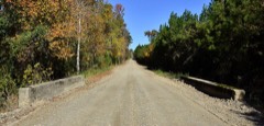 | Dollarway Road | 2.4 miles | 1974 |
| Redfield Commercial Historic District | 2.9 miles | 2023 | |
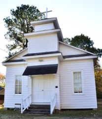 | Lone Star Baptist Church | 3.0 miles | 2005 |
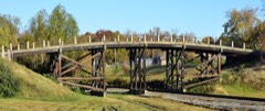 | West James Street Overpass | 3.0 miles | 1995 |
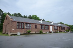 | Redfield School Historic District | 3.2 miles | 2014 |
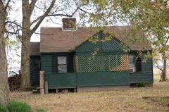 | Plum Bayou Homesteads | 6.9 miles | 1975 |
| National Archives record | The nomination case file for reference 99000822 in Record Group 79. |
| Jefferson County | All 80 listed properties in this county. |