Block
From the record
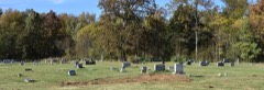
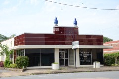
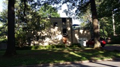
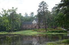
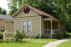
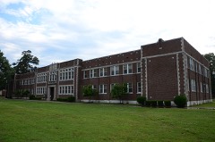
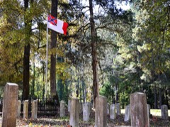
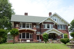
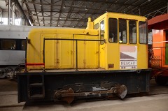
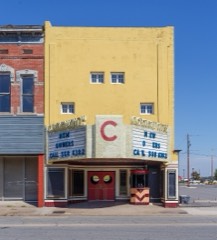
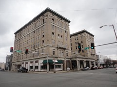
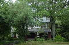
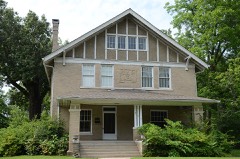
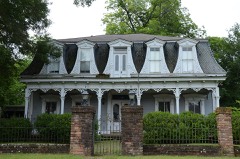
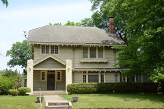
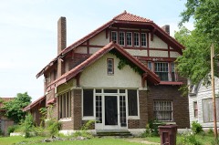
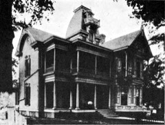
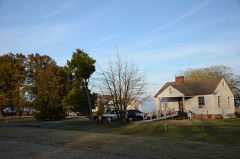
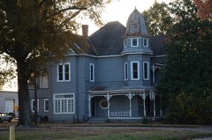
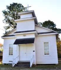
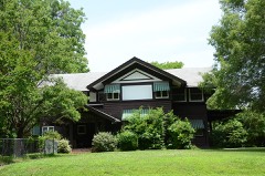
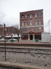
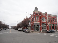
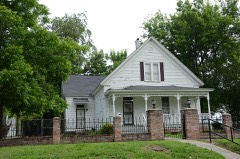
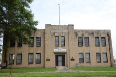
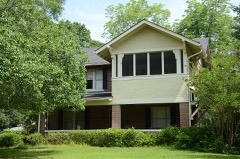
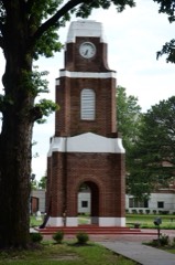
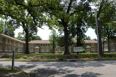
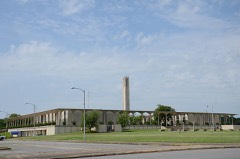
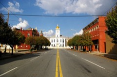
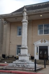
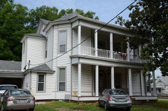
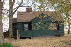
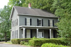
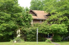
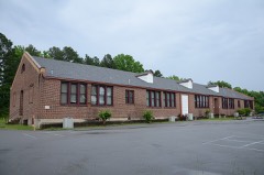
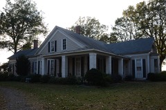
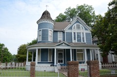
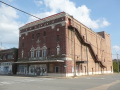
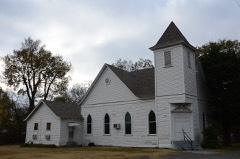
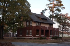
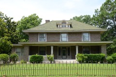
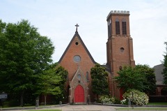
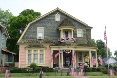
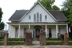
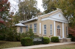
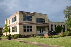
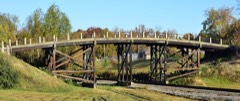
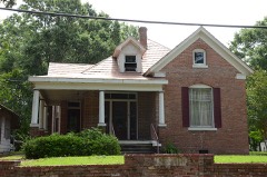
80 National Register listings published here.
Sources: the National Register database, National Park Service
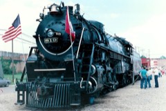
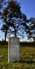
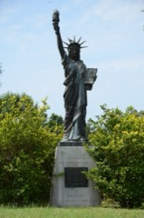
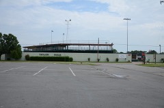
91 topographic sheets cover 80 settlements here, and 80 properties are on the National Register of Historic Places.
80 National Register listings published here.
Sources: the National Register database, National Park Service
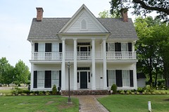
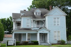
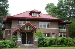
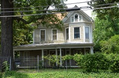
Every property in this county listed on the National Register of Historic Places, with the year it was listed and the federal nomination document.
Every wildfire the federal occurrence database records inside this county: 448 of them, burning about 3,673 acres. 9 started naturally and 89 were recorded as arson. Each settlement page carries the fires within five miles of it.
| Reported cause | Fires |
|---|---|
| Debris and open burning | 189 |
| Missing data/not specified/undetermined | 134 |
| Arson/incendiarism | 89 |
| Equipment and vehicle use | 10 |
| Natural | 9 |
| Misuse of fire by a minor | 7 |
| Railroad operations and maintenance | 7 |
| Smoking | 2 |
| Recreation and ceremony | 1 |
The five largest, by the area the report gives. Three of them were set deliberately.
| Date | Cause | Size | Reported by | Name on the report |
|---|---|---|---|---|
| 19 September 2004 | Arson/incendiarism | 178 acres | Arkansas Forestry Commission | not named |
| 29 March 2006 | Debris and open burning | 151 acres | Arkansas Forestry Commission | not named |
| 12 March 2005 | Arson/incendiarism | 141 acres | Arkansas Forestry Commission | not named |
| 13 June 2018 | Missing data/not specified/undetermined | 137 acres | Arkansas Forestry Commission | not named |
| 10 October 2010 | Equipment and vehicle use | 135 acres | Arkansas Forestry Commission | REDFIELD |
| 4 December 2019 | Missing data/not specified/undetermined | 120 acres | Arkansas Forestry Commission | not named |
| 4 April 2016 | Arson/incendiarism | 96 acres | Arkansas Forestry Commission | not named |
| 13 April 2003 | Debris and open burning | 89 acres | Arkansas Forestry Commission | not named |
Every settlement page carries the fires within five miles of it - see the settlement index below.
The NOAA Storm Events Database holds 666 reports for this county, causing 7 deaths, 37 injuries and about $19,651,780 in recorded property damage. Each settlement page carries the reports that name it.
| Kind of event | Reports |
|---|---|
| Thunderstorm Wind | 322 |
| Hail | 198 |
| Flash Flood | 61 |
| Tornado | 37 |
| Flood | 17 |
| Heavy Rain | 13 |
| Lightning | 10 |
| Funnel Cloud | 8 |
The most serious of them, by death, then injury, then recorded damage. The accounts are quoted exactly as the forecast office filed them.
| When | Event | Place named | Harm | What the report says |
|---|---|---|---|---|
| April 1955 | Tornado (F2) | not stated | 1 killed, 2 hurt, $25,000 | no account filed |
| September 2009 | Heavy Rain | Hardin | 1 killed, 1 hurt, $10,000 | A tree fell on a car that was traveling on Arkansas Highway 104. The car overturned into a water-filled ditch, killing the driver and injuring a passenger. Winds at the time of the accident were light. However, in the 24 hours prior to the accident, approximately 3 inches of rain had fallen, and according to the State Police report, rain was still falling at the time of the accident. It is believed that the heavy rains weakened the tree's roots and added extra weight to the foliage on the tree, causing it to fall. |
| August 1997 | Lightning | Pine Bluff | 1 killed, 1 hurt | Two men were standing near a bulldozer when lightning struck the bulldozer. The lightning travelled through the ground and struck them. One man sustained minor injuries and was later released from the hospital. The second man suffered a heart attack after being struck. He eventually died from his injuries about 2 weeks later. |
| April 2020 | Thunderstorm Wind | White Hall | 1 killed, $30,000 | Numerous trees and power lines were down in the area. One fatality occurred after a tree fell on a residence. |
| June 2017 | Thunderstorm Wind | Hardin | 1 killed | One fatality occurred...when a tree was blown over onto a car. There were other people in the car but none of the others were hurt. |
| July 1988 | Thunderstorm Wind | not stated | 1 killed | no account filed |
| September 1984 | Thunderstorm Wind | not stated | 1 killed | no account filed |
| May 2019 | Tornado (EF1) | Pine Bluff | 9 hurt, $200,000 | Damage was noted to a few apartment buildings, with damage to brick facing and roofs. Trees and utility poles were blown down. |
| January 1999 | Tornado (F1) | Whitehall | 4 hurt, $2,000,000 | no account filed |
| October 2009 | Tornado (EF1) | Brewster | 4 hurt, $400,000 | Soon after the tornado touched down, it damaged a church, where the steeple was toppled and the portico blown down. It then took part of the roof off a house. Next, the tornado traveled into a shopping center. A discount store had several doors blown in, part of the facade blown off, and damage to the roof which resulted in water dripping inside the store.. A car, a small pickup truck, and a tractor-trailer were overturned. Shopping carts and cart corrals were blown around the parking lot. An ice machine at a gas station was blown out into the driveway. A couple of restaurants and a branch bank suffered roof damage. A couple of business signs were blown out. Three people were injured in the business area. The tornado then continued into a residential area. One house was badly damaged when a tree fell into it, and a couple of outbuildings were destroyed. Several homes had shingles torn off and a fence was blown down. Along the path of the tornado, dozens of large trees were blown down. One of these trees fell on a car, injuring a person. |
| April 2001 | Thunderstorm Wind | Samples | 3 hurt | no account filed |
| April 1989 | Thunderstorm Wind | not stated | 3 hurt | no account filed |
| May 1983 | Tornado (F3) | not stated | 2 hurt, $2,500,000 | no account filed |
| November 1970 | Tornado (F2) | not stated | 2 hurt, $25,000 | no account filed |
| April 2011 | Thunderstorm Wind | Pine Bluff | 1 hurt, $125,000 | Trees and limbs were blown down throughout town. One tree fell into a house. Some power poles were broken. An employee of the Arkansas Department of Correction was injured at a corrections facility 2.5 miles north-northwest of Watson Chapel when a pine tree limb fell on him. |
| February 1954 | Tornado (F2) | not stated | 1 hurt, $25,000 | no account filed |
| October 2014 | Thunderstorm Wind | Altheimer | 1 hurt | A tree fell on a man, injuring him. |
| May 2000 | Thunderstorm Wind | Pinebergen | 1 hurt | no account filed |
| June 1998 | Lightning | Whitehall | 1 hurt | no account filed |
| November 1983 | Thunderstorm Wind | not stated | 1 hurt | no account filed |
| May 2015 | Flood | Pine Bluff | $5,000,000 | The Arkansas River at Pine Bluff rose back above flood stage for the 2nd time in May, remaining in flood into June. Many homes were flooded in the Swan Lake area, along with many roads closed due to flooding. There were also water rescues from the Pine Bluff Regional Park and Campground. |
| May 2019 | Flood | Rob Roy | $1,000,000 | Flooding began on the Arkansas River at Pine Bluff on May 26 and continued into June. |
| March 2008 | Flood | Wright | $1,000,000 | Heavy rain caused minor flooding of the Arkansas River at Pine Bluff. This was the 4th highest crest since completion of the McClellan-Kerr Arkansas River Navigation System which extends into Oklahoma. Homes in the Island Harbor Estates subdivision north of Pine Bluff saw water at the top of street signs and mailboxes, but only 2 homes along Holiday and Canal Roads partially flooded. Some winter wheat flooded in Jefferson County. |
| January 2012 | Tornado (EF2) | Sweden | $750,000 | An EF2 tornado began near Sweden. Initially, it severely damaged a large metal building, draped a radio tower over the building, damaged farm machinery and grain trucks, and damaged a gas line. Nearby, several large grain bins were destroyed. Two irrigation pivots were overturned. An old house was crushed by a large tree that fell. The tornado exited Jefferson County west-northwest of Anrep and entered Arkansas County southwest of Hamptons Reservoir. |
| August 2012 | Flash Flood | White Hall | $750,000 | Numerous streets in Pine Bluff flooded. A couple of cars floated down U.S. 63. Some homes were sandbagged, but at least 10 homes had water in them, as did four businesses and three government buildings. Several high water rescues were necessary. Schools in Pine Bluff dismissed early. The University of Arkansas at Pine Bluff cancelled afternoon classes. The county judge declared a disaster due to the flooding. |
| December 2009 | Flood | Redfield | $750,000 | Flash flooding, which developed on the morning of the 24th, became widespread areal flooding later on the 24th and continued into Christmas morning. Many county roads were flooded. Pine Bluff had some flooded streets, especially Hazel St. from 40th Ave. to Interstate 530, and Old Warren Rd. A number of streets in White Hall were flooded. |
| December 2009 | Flash Flood | Redfield | $750,000 | Heavy rain resulted in the development of flash flooding on the morning of the 24th. |
| May 2011 | Flood | Redfield | $500,000 | Some of the camping areas along the Arkansas River were closed due to flooding. |
| March 2008 | Flash Flood | Sulphur Spgs | $500,000 | Approximately 30 to 50 homes were flooded. |
| May 2009 | Flash Flood | Sulphur Spgs | $450,000 | Flooding occurred in the area. In Pine Bluff, eight homes on Hagan Drive as well as an apartment complex on 5th and S. Palm St. had damage due to flooding. Water also entered some homes in Wabbaseka and Altheimer. |
| April 2008 | Flood | Redfield | $300,000 | Minor flooding at the Pine Bluff stream gage on the Arkansas River occurred for three days. The crest in April was one foot higher than the March crest and may have been partially due to the high Mississippi River stages. Damages were primarily to agricultural lands, county roads, and a few houses in Island Harbour Subdivision near Pine Bluff. About four homes were flooded, twice as many as in March. Other property within the levee system, such as hunting and fishing camps, was also flooded. |
| October 2009 | Thunderstorm Wind | Fairfield | $250,000 | A large metal, industrial building suffered considerable damage. |
| December 1978 | Tornado (F1) | not stated | $250,000 | no account filed |
| January 2012 | Tornado (EF1) | Linwood | $175,000 | At a large farming operation, a shed was thrown over the top of a farm shop, damaging the roof of the shop. In addition, an empty 12,000 gallon fuel tank was overturned and rolled out into a flooded farm field. Nearby, the foundation of a concrete block house was damaged. Along U.S. 65, limbs were blown down next to a church. At the Arkansas River levee, an irrigation pivot was overturned and torn apart. |
| December 2012 | Thunderstorm Wind | Eastwood | $125,000 | A carport was torn off a house, another house had a small front porch blown off and some roof damage, and a few other houses had shingles taken off. Falling trees destroyed one car and damaged two others and also crushed a camping trailer. All of the aforementioned damage was near the intersection of Arkansas 365 and 104 in the Samples community. On the grounds of the Pine Bluff Arsenal, a number of trees were blown down or snapped off. |
| September 2021 | Thunderstorm Wind | Leitner | $100,000 | National Weather Service storm survey revealed straight-line microburst winds caused damage near West 13th Avenue, just west of Pine Bluff. Damage consisted of large tree branches broken, small trees uprooted, concrete-supported posts pulled out of the ground, snapped tree trunks, and a large metal roof canopy being ripped off a barn structure. This roof structure then blew into a home, damaging the home and a garage. |
| December 2013 | Tornado (EF0) | Redfield | $100,000 | Numerous trees were uprooted or snapped, with power lines blown down in places. A few homes had roof damage. The corner of one roof was removed, with some damage inside the house. A trampoline and swing set were thrown aloft and wrapped around trees. Several sheds were destroyed. |
| April 2011 | Flood | Redfield | $100,000 | Widespread areal flooding occurred. |
| December 2021 | Thunderstorm Wind | Brewster | $50,000 | Thunderstorm winds damaged the side of a building at 4th Ave. and State St. |
| January 2020 | Thunderstorm Wind | Faith | $50,000 | Several trees were blown down and some were on homes. |
| June 2019 | Lightning | Brewster | $50,000 | Lightning struck a two-family duplex, causing it to catch fire. |
| June 2017 | Lightning | Pine Bluff | $50,000 | A house fire was caused by a lightning strike. |
| May 2013 | Flash Flood | Faith | $50,000 | Very heavy rain fell in the southern part of Jefferson County during the early morning hours of the 17th. Radar showed the swath of heaviest rain from Sulphur Springs to Pinebergen. The 911 center received public reports of rainfall amounts exceeding 5 inches. A CoCoRaHS observer measured 6.62 inches of rain 5.1 miles south-southwest of Pine Bluff and there was a public report of 5.5 inches of rain 4 miles west-southwest of Sulphur Springs. Water entered two homes and a number of roads were flooded, including Old Warren Rd. and Hazel. Ryburn Rd. had to be closed. |
| December 2012 | Flood | White Hall | $50,000 | Street flooding occurred in the Pine Bluff area. |
| September 2012 | Thunderstorm Wind | Pine Bluff | $50,000 | Trees were blown down in Pine Bluff and many other places in Jefferson County. |
| May 2009 | Flood | Warbritton | $50,000 | In a subdivision of more than 40 homes, high stages on the Arkansas River cut off access for most of the month. There were two homes that received water damage. |
| July 2008 | Thunderstorm Wind | White Hall | $50,000 | Minor damage occurred to several residences and other structures. A small tree was knocked down and blocked traffic. A portion of a tree fell onto a roof, knocking off part of a chimney and ripping a hole nearby. Falling trees also damaged some fences. |
| November 1994 | Tornado (F0) | Pine Bluff | $50,000 | A small F0 tornado touched down briefly just southeast of Pine Bluff. One house sustained some roof damage and the front foyer was blown off. A few tree limbs were also blown down. |
| November 1994 | Thunderstorm Wind | Pine Bluff | $50,000 | Several buildings sustained roof damage from thunderstorm winds. |
| November 1993 | Thunderstorm Wind | Moscow | $50,000 | Thunderstorm winds downed some trees and overturned a cotton trailer. |
| December 2013 | Flash Flood | Brewster | $40,000 | Three cars stalled in high water on Hazel St. near Jefferson Regional Medical Center. |
| October 2007 | Thunderstorm Wind | Leitner | $34,000 | Damage occurred at Dollarway High School. Part of the roof was blown off the gym, a large tree fell on a covered walkway and the corner of the library, and two telephone poles were knocked down. |
| June 2021 | Thunderstorm Wind | Sorrells | $30,000 | A portion of a roof was blown off of a house. |
| July 2014 | Thunderstorm Wind | Brewster | $30,000 | Trees and power lines were blown down at several places in Pine Bluff. |
| October 2014 | Thunderstorm Wind | Sherrill | $30,000 | A house had damage to its roof and chimney and a storage building was moved off its foundation. Large trees were blown down. |
| December 2012 | Thunderstorm Wind | Brewster | $30,000 | Half of a tree fell into a house. |
| February 2012 | Thunderstorm Wind | Pine Bluff | $25,000 | Several trees were blown down in Pine Bluff around 5th and Cherry. A few power lines were also down. |
| August 2012 | Flash Flood | Ferda | $25,000 | Areas around Tucker flooded, and flood waters approached Tucker Maximum Security Prison. Water seeped into the newly renovated chapel at the prison. |
| April 2011 | Thunderstorm Wind | Pine Bluff | $25,000 | Trees and power lines were blown down. |
| April 2011 | Thunderstorm Wind | Hardin | $25,000 | Trees and power lines were blown down. A large tree was uprooted and pulled up a natural gas line. |
The Survey's mineral resources record lists 31 workings inside this county. 4 still produce and 27 are closed or unrecorded. Each settlement page carries the workings within five miles of it.
| Commodity | Workings |
|---|---|
| Sand and Gravel, Construction | 30 |
| Vermiculite | 1 |
The least common of them first, because a county's hundredth gravel pit says nothing its first ten did not.
| Where | Site | Commodity | Status | Recorded |
|---|---|---|---|---|
| Port Plant | Vermiculite | Producer | ||
| Cross County Gravel Co | Sand and Gravel, Construction | Past Producer | ||
| Jefferson County Gravel Pit | Sand and Gravel, Construction | Producer | ||
| McKenzie Pit | Sand and Gravel, Construction | Producer | ||
| Pine Bluff Pit | Sand and Gravel, Construction | Past Producer | ||
| Pine Bluff Sand & Gravel Co. | Sand and Gravel, Construction | Past Producer | ||
| Sandhog Dredge | Sand and Gravel, Construction | Producer | ||
| Unk | Sand and Gravel, Construction | Past Producer | ||
| Unk | Sand and Gravel, Construction | Past Producer | ||
| Unk | Sand and Gravel, Construction | Past Producer | ||
| Unk | Sand and Gravel, Construction | Past Producer | ||
| Unk | Sand and Gravel, Construction | Past Producer | ||
| Unk | Sand and Gravel, Construction | Past Producer | ||
| Unk | Sand and Gravel, Construction | Past Producer | ||
| Unk | Sand and Gravel, Construction | Past Producer | ||
| Unk | Sand and Gravel, Construction | Past Producer | ||
| Unk | Sand and Gravel, Construction | Past Producer | ||
| Unk | Sand and Gravel, Construction | Past Producer | ||
| Unk | Sand and Gravel, Construction | Past Producer | ||
| Unk | Sand and Gravel, Construction | Past Producer | ||
| Unk | Sand and Gravel, Construction | Past Producer | ||
| Unk | Sand and Gravel, Construction | Past Producer | ||
| Unk | Sand and Gravel, Construction | Past Producer | ||
| Unk | Sand and Gravel, Construction | Past Producer | ||
| Unk | Sand and Gravel, Construction | Past Producer | ||
| Unk | Sand and Gravel, Construction | Past Producer | ||
| Unk | Sand and Gravel, Construction | Past Producer | ||
| Unk | Sand and Gravel, Construction | Past Producer | ||
| Unk | Sand and Gravel, Construction | Past Producer | ||
| Unk | Sand and Gravel, Construction | Past Producer | ||
| Unk | Sand and Gravel, Construction | Past Producer |
Named settlements recorded in the Geographic Names Information System, each with the topographic sheets covering it. Villages, hamlets and abandoned places alike. Each is shown with the nearest named watercourse or landform and the survey quadrangle it falls on.
Villemont township · 72160 · Reydell quadrangle
15 sheets, 1935 to 1986
No longer a settlement
Washington township · 71602 · On Caney Bayou Fork · White Hall quadrangle
16 sheets, 1932 to 1985
Washington township · 71602 · Hardin quadrangle
14 sheets, 1932 to 1985
No longer a settlement
Old River township · 72004 · Cornerstone quadrangle
16 sheets, 1935 to 1986
No longer a settlement
Vaugine township · 71602 · White Hall quadrangle
16 sheets, 1932 to 1985
No longer a settlement
Washington township · 71602 · On Arnold Creek · White Hall quadrangle
16 sheets, 1932 to 1985
Dunnington township · 72175 · Gethsemane quadrangle
13 sheets, 1935 to 1986
No longer a settlement
Richland township · 71644 · On Jacks Bayou · Grady quadrangle
15 sheets, 1935 to 1986
No longer a settlement
Spring township · 71603 · On Craig Creek · Pine Bluff NW quadrangle
10 sheets, 1955 to 1985
Old River township · 72004 · Near Cooper Island · Cornerstone quadrangle
16 sheets, 1935 to 1986
Jefferson township · 72079 · On Stokes Creek · Redfield quadrangle
12 sheets, 1932 to 1985
Villemont township · 72160 · On Little Bayou Meto · Cades quadrangle
15 sheets, 1935 to 1986
Roberts township · 72073 · Humphrey quadrangle
15 sheets, 1941 to 1986
No longer a settlement
Plum Bayou township · 72004 · On King Bayou · Altheimer quadrangle
14 sheets, 1935 to 1986
Washington township · 71602 · White Hall quadrangle
16 sheets, 1932 to 1985
No longer a settlement
Bogy township · 72004 · On Kings Bayou · Cornerstone quadrangle
16 sheets, 1935 to 1986
No longer a settlement
Plum Bayou township · 72004 · On Old Channel Plum Bayou · Moscow quadrangle
15 sheets, 1935 to 1986
Washington township · 71602 · Near Gum Springs Hill · Hardin quadrangle
14 sheets, 1932 to 1985
Pastoria township · 72152 · On Smiths Bayou · White Hall quadrangle
16 sheets, 1932 to 1985
Vaugine township · 71601 · On Harding Drain · Pine Bluff quadrangle
10 sheets, 1955 to 1985
Whiteville township · 71603 · On Boggy Bayou · Pinebergen quadrangle
16 sheets, 1935 to 1986
Washington township · 71602 · On Gamble Creek · White Hall quadrangle
16 sheets, 1932 to 1985
Bolivar township · 72046 · On Davis Bayou · Wright quadrangle
12 sheets, 1932 to 1985
No longer a settlement
Plum Bayou township · 72004 · Moscow quadrangle
15 sheets, 1935 to 1986
No longer a settlement
Barraque township · 72132 · By Red Bluff · Redfield quadrangle
12 sheets, 1932 to 1985
No longer a settlement
Villemont township · 72133 · On Little Bayou Meto · Reydell quadrangle
15 sheets, 1935 to 1986
Plum Bayou township · 72004 · Near Sheppard Island · Rob Roy quadrangle
13 sheets, 1935 to 1986
Dudley Lake township · 72046 · Sherrill quadrangle
13 sheets, 1935 to 1986
No longer a settlement
Villemont township · 72160 · On Bear Bayou · Reydell quadrangle
15 sheets, 1935 to 1986
No longer a settlement
Vaugine township · 71603 · On Nevins Creek · Pine Bluff quadrangle
10 sheets, 1955 to 1985
Washington township · 71602 · On Caney Bayou Fork · White Hall quadrangle
16 sheets, 1932 to 1985
Vaugine township · 71601 · Near Kelly Island (historical) · Rob Roy quadrangle
13 sheets, 1935 to 1986
The vanished settlements of Jefferson County: the places named above that are no longer on the map.