 Block
Beardsley, Arizona
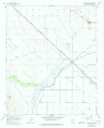
18 topographic sheets cover this place, the earliest surveyed in 1954 and the latest in 1988. It stands in the Wickenburg census division. It lies in ZIP code area 85375. The Survey maps it on the McMicken Dam quadrangle.
Topographic sheets covering this place
9 surveys from 18 printed sheetsMatched by testing this settlement's coordinate against the published boundary of every sheet in the United States Geological Survey's historical collection. Each opens the scanned sheet at the Survey.
- 1954 USGS Phoenix quadrangle1:250000, 5 printings
- 1957 USGS McMicken Dam quadrangle1:24000, 4 printings
- 1957 USGS Phoenix quadrangle1:250000
- 1958 USGS Phoenix quadrangle1:250000
- 1960 USGS Phoenix quadrangle1:250000
- 1969 USGS Phoenix quadrangle1:250000, 2 printings
- 1971 USGS McMicken Dam quadrangle1:24000
- 1971 USGS Phoenix quadrangle1:250000
- 1988 USGS Phoenix North quadrangle1:100000, 2 printings






Fires near this place
409 since 1992Regional context, not property-specific evidence. The federal wildfire occurrence database lists 409 fires within 5 miles of Beardsley between 1992 and 2020, burning about 1,083 acres in total. 1 started naturally. 11 were recorded as arson. Distance is straight-line from the map coordinates, so a fire counted here may appear on a neighbouring settlement's page as well.
| Reported cause | Fires |
|---|---|
| Missing data/not specified/undetermined | 385 |
| Arson/incendiarism | 11 |
| Equipment and vehicle use | 6 |
| Power generation/transmission/distribution | 3 |
| Debris and open burning | 2 |
| Natural | 1 |
| Railroad operations and maintenance | 1 |
The most recent of them, most recent first, with the day each was reported and the service that recorded it.
| Date | Cause | Size | Reported by | Name on the report |
|---|---|---|---|---|
| 8 September 2020 | Missing data/not specified/undetermined | under an acre | Arizona Department of Forestry and Fire Management - State Office | not named |
| 6 September 2013 | Missing data/not specified/undetermined | under an acre | Arizona Department of Forestry and Fire Management - State Office | AZ-133152 |
| 4 September 2011 | Missing data/not specified/undetermined | under an acre | Arizona Department of Forestry and Fire Management - State Office | AZ-111960 |
| 27 September 2011 | Missing data/not specified/undetermined | under an acre | Arizona Department of Forestry and Fire Management - State Office | AZ-111966 |
| 24 September 2015 | Missing data/not specified/undetermined | under an acre | Arizona Department of Forestry and Fire Management - State Office | 155164 |
| 22 September 2020 | Missing data/not specified/undetermined | under an acre | Arizona Department of Forestry and Fire Management - State Office | not named |
| 21 September 2011 | Missing data/not specified/undetermined | under an acre | Arizona Department of Forestry and Fire Management - State Office | AZ-111965 |
| 20 September 2018 | Missing data/not specified/undetermined | under an acre | Surprise Fire Department | 8349687 |
Settlements close enough to share some of these fires:
Mines and quarries near this place
2 within 5 milesRegional context, not property-specific evidence. The federal mineral resources record lists 2 workings within 5 miles of Beardsley: 1 past producer, 1 producer. 1 still produces. What was taken out: Manganese, Sand and Gravel, Construction. Distance is straight-line from the map coordinates, so a quarry counted here may appear on a neighbouring settlement's page as well.
| Where | Site | Commodity | Status | Recorded |
|---|---|---|---|---|
| Maricopa Group | Manganese | Past Producer | 1915 | |
| Sun City Pit | Sand and Gravel, Construction | Producer |
Storms near this place
25 since 2015Regional context, not property-specific evidence. The National Weather Service names Beardsley in 25 storm reports between 2015 and 2025: 12 thunderstorm wind, 8 flash flood, 3 hail, 1 heavy rain. The reports record 1 injury. Each account below is quoted exactly as the forecast office filed it, from the NOAA Storm Events Database, and each date opens the federal record of that event.
| When | Event | Place named | Harm | What the report says |
|---|---|---|---|---|
| October 2022 | Lightning | Beardsley | 1 hurt | A 12 year old girl, who lives in the Sun City West Retirement Community, was struck by lightning while playing outside, causing her heart to stop. Her father was able to successfully resuscitate her. The girl was taken to the hospital afterwards. Timing of the lightning strike was estimated by radar. |
| August 2025 | Thunderstorm Wind | Beardsley | $55,000 | Dozens of trees, approximately 50 trees, downed across a section of Surprise generally between Highway U.S. 60 and Bell Road, with a report of a large tree falling through a brick wall and onto a house near the area between Dysart Road and Bell Road. Wind gusts were estimated between 55 and 60 mph. Timing estimated from radar. No injuries were reported. |
| August 2018 | Thunderstorm Wind | Beardsley | $30,000 | A large cluster of thunderstorms moved steadily north and across the western portion of the greater Phoenix area during the evening hours on August 2nd. Some of the stronger storms generated gusty damaging outflow winds that affected communities such as Sun City West and Waddell. According to a trained weather spotter located about 2 miles southwest of Sun City West, at 1845MST gusty winds estimated to be as high as 70 mph downed about 20 trees with diameters of 3 to 4 inches. Several larger trees with 8 inch diameter trunks were also downed. The downed trees were located along Bell Road between Litchfield and Reems Roads. Between 1845MST and 1930MST, multiple reports of downed trees were received from the public as well as trained spotters; most of the reports were near Bell Road between the Loop 303 and Litchfield road. |
| August 2018 | Flash Flood | Beardsley | $25,000 | Thunderstorms with very heavy rain moved across the far northwest portions of the greater Phoenix area during the evening hours on August 12th; some of the stronger storms produced heavy rain with peak rain rates in excess of 3 inches per hour. The heavy rain led to an episode of flash flooding north of Sun City West and southeast of Wittmann. According to a report from local broadcast media, at 2038MST flash flooding 4 miles northeast of Beardsley resulted in the water rescue of a car stuck in a wash at the intersection of 147th Avenue and Pinnacle Vista Road. The car had multiple occupants; fortunately there were no reports of injuries to any of them. A Flash Flood Warning was in effect at the time of the water rescue and it remained in effect through 2230MST. |
| November 2025 | Flash Flood | Beardsley | $20,000 | Report of a water rescue near at Happy Valley Rd and 187th Ave. Water reportedly up to the level of car headlights. Timing estimated from radar. No injuries reported. |
| July 2021 | Thunderstorm Wind | Beardsley | $20,000 | The City of Surprise emergency manager reported 20 trees down in multiple locations along Sunrise Boulevard between Remington Drive and Mountain View Boulevard. Radar estimated winds were between 40-50 mph at the time, which is consistent with a 48 mph gust measured by a mesonet station, MAMD, at 1.9 miles W of Beardsley. No injuries reported. |
| July 2021 | Thunderstorm Wind | Beardsley | $15,000 | City of Surprise emergency manager reported 15 trees were blown down along Reems Road near Mountain View Boulevard. Radar estimated winds were between 40-50 mph. Timing estimated from radar. No injuries reported. |
| August 2015 | Thunderstorm Wind | Beardsley | $10,000 | Thunderstorms developed over the greater Phoenix metropolitan area during the afternoon hours on August 27th, and due to a combination of elevated instability and wind fields aloft, some of the storms produced strong, gusty and damaging microburst winds. One community that was impacted by the damaging winds was Peoria. According to a report from the public, microburst wind damage was observed about 4 miles northwest of Peoria. Wind gusts estimated to be at least 70 mph tossed a barbeque grill 20 feet; the grill weighed 150 pounds. Additionally, the winds blew down a 30 foot tall tree; the tree had a diameter of 18 inches. The tree fell upon the roof a nearby house. Fortunately there were no injuries reported. |
| July 2022 | Thunderstorm Wind | Beardsley | $5,000 | Multiple 12 diameter tree trunks snapped along 107th Ave just south of Happy Valley Road in Surprise. No injuries were reported. |
| July 2022 | Thunderstorm Wind | Beardsley | $5,000 | Trained spotter reported many uprooted trees with block walls knocked down near the intersection of North 117th Avenue and Avenida Del Sol. Timing estimated from radar. No injuries were reported. |
| August 2017 | Flash Flood | Beardsley | $5,000 | Scattered thunderstorms developed across the northwestern portion of the greater Phoenix area during the morning hours on August 13th and the stronger storms produced locally heavy rains with peak rain rates between one and two inches per hour. The intense rains led to episodes of flash flooding to the northwest of the town of Sun City West. According to a report from the Department of Highways and the city of Surprise, heavy rains from early morning storms forced the closure of Jomax Road west of 163rd Avenue due to flash flooding. The flooding was east of Highway 60 and northwest of the Loop 303 freeway, about 2 miles northwest of Beardsley. |
| August 2017 | Flash Flood | Beardsley | $5,000 | Scattered thunderstorms developed across the greater Phoenix area during the morning hours on August 13th and some of the stronger storms affected the west and northwestern communities such as Surprise and Waddell. The storms generated locally heavy rains with peak rain rates between one and two inches per hour, which was more than sufficient to cause episodes of flash flooding over the highly urbanized surfaces. According to a report from the Department of Highways and the city of Surprise, flash flooding from the earlier morning storms led to the closure of Sarival Road south of Bell Road, approximately 2 miles northwest of Waddell and just west of Surprise. The road was closed as of 0700MST. At the same time, another public report indicated that flash flooding also closed Cotton Lane between Cactus Road and Peoria Avenue, about 2 miles southwest of Waddell and just west of the Loop 303 freeway. A Flash Flood Warning was in effect at the time; it was issued at 0541MST and was in effect through 0845MST. |
| August 2022 | Thunderstorm Wind | Beardsley | $3,000 | Power poles were down near the intersection of Frontier Drive and 151st Avenue. Timing estimated from radar. No injuries were reported. |
| October 2018 | Flash Flood | Beardsley | $2,000 | Widespread moderate to heavy showers developed across the northwest portion of the greater Phoenix metropolitan area during the morning and early afternoon hours on October 13th. Some of the heavy showers impacted communities such as Beardsley and Surprise. Peak rain rates were in excess of one inch per hour, sufficient to cause episodes of flash flooding. According to the City of Surprise Police Department, flash flooding resulted in the closure of Dale Lane where it intersects 163rd Avenue. The flooding was about 5 miles northwest of Beardsley and southeast of Wittmann. A Flash Flood Warning was in effect at the time of the flooding; no reports of accidents or injuries were received. |
| August 2018 | Thunderstorm Wind | Beardsley | $2,000 | Thunderstorms with gusty and damaging outflow winds moved across the northwest portion of the greater Phoenix area during the evening hours on August 9th; some of the stronger storms affected areas to the east of Wittmann and north of Sun City West. At 2030MST a member of the public reported that tree limbs with diameters of between 6 and 8 inches were snapped by gusty winds estimated to be as high as 65 mph. The snapped limbs were located near West Lone Mountain Road and Westland Road in the community of Vistancia and north of the Trilogy Golf Club. |
| June 2024 | Thunderstorm Wind | Beardsley | $1,000 | Tents became airborne and large limbs fell from a tree in the center median of 107th Ave intersecting with Happy Valley Road in Surprise. Wind gusts were estimated at between 40-50 mph based on nearby observing sites. No injuries were reported. |
| September 2025 | Flash Flood | Beardsley | - | Water rescue reported by Phoenix Fire Dispatch Center. No damages or injuries reported. |
| July 2022 | Thunderstorm Wind | Beardsley | - | A Salt River Project Utility Company Mesonet station measured a 64 mph wind gust located south of Happy Valley Road west of Loop 303. |
| August 2022 | Flash Flood | Beardsley | - | The Surprise Emergency Manager said there was significant flash flooding in the Asante Community, with evidence of water over the roads. The Emergency Manager also shared there was significant mud and runoff at a water treatment plant near 29 Palms RV Park. On social media there were several reports of at least minor street flooding around the area as well. Timing of impacts estimated from radar. No reports of damage or injuries from flooding. |
| August 2021 | Flash Flood | Beardsley | - | The City of Surprise closed Jomax Road between 147th Avenue and El Granada Road due to flooding. No damages or injuries were reported. Timing based on radar. |
| March 2020 | Heavy Rain | Beardsley | - | Scattered showers and thunderstorms, some with intense rainfall, developed across the northwest portion of the greater Phoenix area during the early afternoon hours on March 13th. The heavy rain affected communities such as Sun City West and Surprise, and resulted in some local street flooding. According to a trained weather spotter located about 1 mile northwest of the town of Surprise, at 1300MST heavy rain resulted in curb to curb flooding in Sun City West along R H Johnson Boulevard. A local storm runoff canal was running with water almost 2 feet deep at the time. |
| August 2018 | Thunderstorm Wind | Beardsley | - | Thunderstorms with strong gusty outflow winds developed across the northwest portion of the greater Phoenix metropolitan area during the evening hours on August 9th; some of the storms affected areas around Sun City West. At 2114MST an automated Flood Control District weather station west of Sun City West measured a wind gust to 59 mph. The station was located at McMicken Dam near Grand Avenue and the Loop 303 freeway and near the Cimarron Golf Club. |
| October 2018 | Hail | Beardsley | - | Thunderstorms developed to the north of Phoenix during the early morning hours on October 21st, and some of them affected areas between Surprise and New River. The stronger storms produced large hail with diameters up to one inch. At 0420MST, the public reported large hail with a diameter of 0.75 inches. The hail fell about 7 miles northeast of Surprise and near the intersection of Jomax Road and the Lake Pleasant Parkway. About 10 minutes later, the public reported large hail about 10 miles southwest of New River, just southeast of the intersection of Highway 74 and the Lake Pleasant Parkway. In this report the largest stones were 1 inch in diameter. No injuries or damage were reported due to the large hail. |
| August 2018 | Hail | Beardsley | - | Thunderstorms with heavy rain and very large hail developed across the higher terrain locations well to the north of Phoenix during the evening hours on August 12th. At 1845MST a trained spotter located 12 miles northeast of Beardsley, near State Route 74 and just southwest of Lake Pleasant, reported very large hailstones. The spotter indicated that the largest stones reached 1.75 inches in diameter. No damage or injuries were reported due to the unusually large hail. |
| October 2018 | Hail | Beardsley | - | Thunderstorms with large hail developed across the northern portions of the greater Phoenix metropolitan area during the afternoon hours on October 23rd. Some of the stronger storms affected areas north of Sun City West and east of Wittmann. According to reports from the public, at 1650MST large hail fell about 7 miles northeast of Beardsley, near the Blackstone Country Club. The largest stones had a diameter of 1 inch. No damage was reported due to the large hail. |
Nearest settlements
The eight closest, with where each one stands in the county. Distances are straight-line, computed from the Geographic Names Information System coordinates.
| Map | Place | Distance | Sheets |
|---|---|---|---|
| Sun City West | 2.0 miles | 20 | |
| Lizard Acres | 2.4 miles | 20 | |
| Lizard | 2.5 miles | 20 | |
| Surprise | 3.2 miles | 20 | |
| Goldbadge | 4.1 miles | 19 | |
| Waddell | 4.3 miles | 18 | |
| Dysart (historical) | 4.3 miles | 19 | |
| Agua Fria | 5.1 miles | 19 |
Provenance
This settlement is recorded in the Geographic Names Information System as feature 1154. The sheet list is computed by point-in-boundary test against the United States Geological Survey's historical topographic inventory. Both are works of the United States government and carry no copyright under 17 U.S.C. 105.
Wildfire. Short, Karen C. 2022. Spatial wildfire occurrence data for the United States, 1992-2020 [FPA_FOD_20221014]. 6th Edition. Fort Collins, CO: Forest Service Research Data Archive. https://doi.org/10.2737/RDS-2013-0009.6 Collected with United States Government funding and usable without additional permissions or fees.
Mines and quarries. USGS Mineral Resources Data System (MRDS) https://mrdata.usgs.gov/mrds/ A work of the United States government, no copyright under 17 U.S.C. 105.
Storms. NOAA National Centers for Environmental Information, Storm Events Database https://www.ncei.noaa.gov/stormevents/ A work of the United States government, no copyright under 17 U.S.C. 105. Narratives are quoted verbatim from the National Weather Service report and are not edited or summarised.