 Block
Bouse, Arizona
19 topographic sheets cover this place, the earliest surveyed in 1930 and the latest in 1990. It stands in the Parker census division. It lies in ZIP code area 85325. The Survey maps it on the Bouse quadrangle. 707 people lived here at the 2020 count. It stands 948 feet above sea level.
Research this city
Population over time
3 figuresBouse grew from 615 to 707 between 2000 and 2020. These are the recorded population figures Wikidata holds for this place, reached through the Geographic Names Information System number this page is keyed on rather than by name, so they belong to this place and not to another of the same name. Most are census counts, but not all are: an early figure may be a founding or settlement estimate, and an estimate published within five years of a census is left out. The change column is computed, and is left blank where more than 20 years separate a figure from the one before it, because a gap that long is not a change between two counts.
| Year | People | Change |
|---|---|---|
| 2000 | 615 | |
| 2010 | 996 | +381 (+62%) |
| 2020 | 707 | -289 (-29%) |
Topographic sheets covering this place
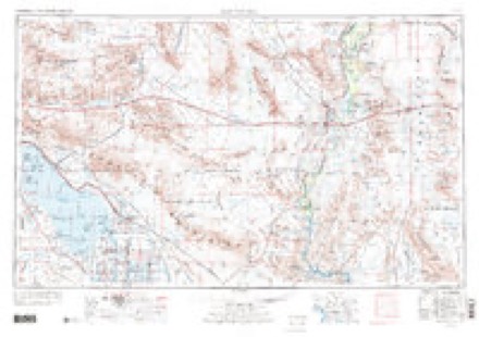
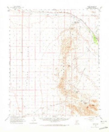
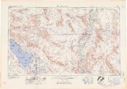
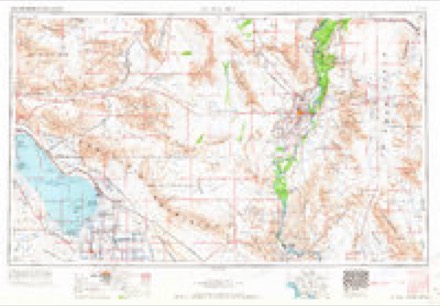
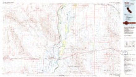
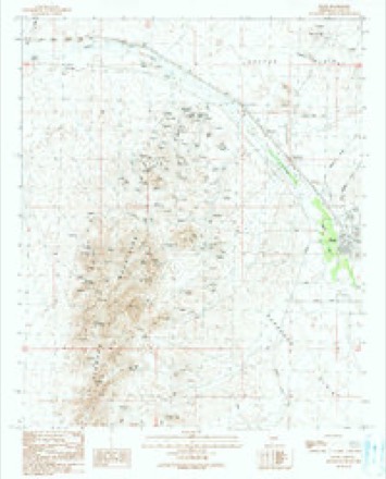
10 surveys from 19 printed sheetsMatched by testing this settlement's coordinate against the published boundary of every sheet in the United States Geological Survey's historical collection. Each opens the scanned sheet at the Survey.
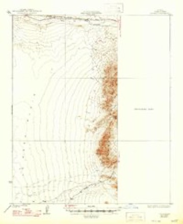
- 1930 USGS Linskey quadrangle1:62500, 2 printings
- 1942 USGS Blythe quadrangle1:250000, 2 printings
- 1954 USGS Salton Sea quadrangle1:250000
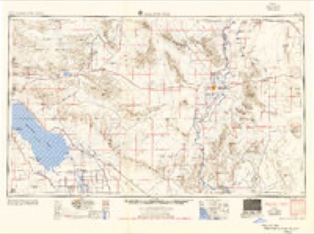
- 1955 USGS Salton Sea quadrangle1:250000, 2 printings
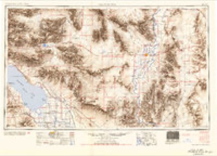
- 1959 USGS Salton Sea quadrangle1:250000, 4 printings
- 1962 USGS Bouse quadrangle1:62500, 2 printings
- 1963 USGS Salton Sea quadrangle1:250000
- 1965 USGS Salton Sea quadrangle1:250000
- 1986 USGS Blythe quadrangle1:100000, 3 printings
- 1990 USGS Bouse quadrangle1:24000
Fires near this place
39 since 1992Regional context, not property-specific evidence. The federal wildfire occurrence database lists 39 fires within 5 miles of Bouse between 1992 and 2020, burning about 681 acres in total. 3 started naturally. 5 were recorded as arson. Distance is straight-line from the map coordinates, so a fire counted here may appear on a neighbouring settlement's page as well.
| Reported cause | Fires |
|---|---|
| Missing data/not specified/undetermined | 19 |
| Arson/incendiarism | 5 |
| Debris and open burning | 4 |
| Natural | 3 |
| Smoking | 2 |
| Misuse of fire by a minor | 2 |
| Fireworks | 2 |
| Equipment and vehicle use | 1 |
| Recreation and ceremony | 1 |
The most recent of them, most recent first, with the day each was reported and the service that recorded it.
| Date | Cause | Size | Reported by | Name on the report |
|---|---|---|---|---|
| 2 September 2006 | Natural | under an acre | Arizona Department of Forestry and Fire Management - State Office | CUNNINGHAM |
| 18 September 2005 | Missing data/not specified/undetermined | 6.0 acres | Arizona Department of Forestry and Fire Management - State Office | WINTERS |
| 9 August 2005 | Natural | under an acre | Arizona Department of Forestry and Fire Management - State Office | ORION |
| 1 August 1992 | Smoking | 125 acres | Colorado River Agency | FORT FIRE |
| 4 July 1992 | Fireworks | under an acre | Colorado River Agency | LOSTLAKE |
| 4 July 1992 | Fireworks | 60 acres | Colorado River Agency | LOSTLAKEII |
| 28 July 1993 | Smoking | 3.0 acres | Arizona Department of Forestry and Fire Management - State Office | not named |
| 22 July 1992 | Missing data/not specified/undetermined | under an acre | Arizona Department of Forestry and Fire Management - State Office | not named |
Settlements close enough to share some of these fires:
Mines and quarries near this place
10 of 65 shownRegional context, not property-specific evidence. The federal mineral resources record lists 65 workings within 5 miles of Bouse: 30 past producers, 27 occurrences, 6 prospects, 2 unknowns. None of them still produces. What was taken out: Barium-Barite, Iron, Fluorine-Fluorite, Manganese. Distance is straight-line from the map coordinates, so a quarry counted here may appear on a neighbouring settlement's page as well.
| Where | Site | Commodity | Status | Recorded |
|---|---|---|---|---|
| Big Boy | Lead, Copper, Gold | Prospect | ||
| Blackbird Deposit | Pumice | Past Producer | ||
| Blue Slate Mine | Copper, Gold, Iron, Silver | Past Producer | ||
| Bouse Area | Tungsten | Past Producer | ||
| Bouse Gold-Copper Prospect | Gold, Copper, Iron | Occurrence | Replacement | |
| Bullion Mine Group | Copper, Barium-Barite, Gold, Iron, Manganese | Past Producer | ||
| Burro Barite No 6 and 8 | Barium-Barite, Fluorine-Fluorite, Manganese, Copper | Occurrence | ||
| Burro Barite Nos. 6 and 8 | Barium-Barite, Manganese, Copper, Fluorine-Fluorite | Occurrence | Barite | |
| Copper Top | Copper, Silver | Past Producer | ||
| Coronation Mine Group | Silver, Gold, Copper, Gypsum-Anhydrite | Past Producer |
Storms near this place
37 since 1995Regional context, not property-specific evidence. The National Weather Service names Bouse in 37 storm reports between 1995 and 2025: 22 flash flood, 10 thunderstorm wind, 2 lightning, 2 flood. The reports record 1 death. Each account below is quoted exactly as the forecast office filed it, from the NOAA Storm Events Database, and each date opens the federal record of that event.
| When | Event | Place named | Harm | What the report says |
|---|---|---|---|---|
| August 2008 | Flash Flood | Bouse | 1 killed, $50,000 | A vehicle with 5 women was swept away as it was caught in raging flood waters along route 72, about a mile and a half southeast of Bouse. One woman died and her body was found about 7 miles away. An RV was also stranded by flood waters in the same wash at the same time. |
| August 2022 | Flash Flood | Bouse | $500,000 | Report from La Paz County Emergency Management of water rushing into houses. Washes in the area were running full. Timing estimated from radar. No injuries were reported. |
| July 2011 | Thunderstorm Wind | Bouse | $100,000 | Isolated high based thunderstorms developed over La Paz county during the late afternoon and evening hours on July 10th. The storms generated gusty microburst winds, estimated to be in excess of 60 knots. According to Cate's Column in the Parker Live Online paper, significant damage occurred in the community of Bouse. Strong winds lifted the roof off of a house and tossed it down a hill. The winds smashed windows, blew out metal garage doors, plucked coolers from rooftops, flattened several carports, and uprooted a number of Mesquite and Palo Verde trees. |
| August 2005 | Thunderstorm Wind | Bouse | $20,000 | Carport awning damaged. |
| September 2023 | Flash Flood | Bouse | $15,000 | A swift water rescue occurred after a single occupied vehicle attempted to drive through a flooded Bouse Wash low water crossing along Rabbit Lane near Stage Coach Road. No injuries were reported. |
| July 2009 | Lightning | Bouse | $12,000 | Lightning took out the power to a large portion of LaPaz County this afternoon. |
| July 2009 | Thunderstorm Wind | Bouse | $10,000 | Telephone lines were reported down. |
| August 2018 | Flash Flood | Bouse | $5,000 | Thunderstorms with locally heavy rain developed across the central portions of La Paz County during the early morning hours on August 16th; some of the stronger storms generated intense rain that affected the community of Bouse as well as motorists on Highway 72. Peak rain rates in excess of one inch per hour led to an episode of early morning flash flooding. According to a sheriff's deputy, at 0231MST several washes were reported to be flowing across Highway 72 from Bouse westward to Highway 95 at the 12 mile junction. A Flash Flood Warning was in effect at the time and it remained in effect through 0400MST. No reports of accidents or injuries were received despite the hazardous driving conditions on Highway 72. |
| October 2018 | Flash Flood | Bouse | $5,000 | A strong Pacific low pressure system moved into western Arizona during the morning hours on October 13th and triggered the development of numerous showers and embedded thunderstorms. Some of the storms produced very heavy rain which impacted portions of La Paz County. The heavy rain even led to an episode of flash flooding near the town of Bouse. According to the Arizona Department of Transportation, at 0933MST flash flooding resulted in water, sediment and debris on State Route 72 from milepost 21 to 24. This was about 6 miles to the northwest of the town of Bouse. No accidents were reported due to the dangerous road conditions. A Flash Flood Warning was in effect at the time of the flooding. |
| August 2016 | Flash Flood | Bouse | $5,000 | Thunderstorms with intense rainfall developed across the west central deserts, including La Paz county, during the afternoon hours on August 10th. Peak rain rates exceeded 2 inches per hour at times and the intense rain led to episodes of flash flooding. As an example of the heavy rain that occurred, a trained weather spotter 1 mile east of Bouse measured 2.05 inches within a 45 minute period ending about 2000MST. At 1931MST, the Arizona Department of Highways reported that Highway 72 was impassable to the southeast of Bouse due to flash flooding. A Flash Flood Warning was issued for the area at 1815MST and it remained in effect through 2218MST. |
| July 2019 | Flash Flood | Bouse | $2,000 | Thunderstorms with very heavy rain developed over central portions of La Paz County during the afternoon hours on July 13th. Some of the stronger storms generated rains in excess of 2 inches which led to an episode of flash flooding near the town of Bouse. According to the La Paz sheriff's office, heavy rain about 3 miles northwest of Bouse resulted in flash flooding along Highway 72, near Yellow Bird Drive. A Flash Flood Warning was issued at 1629MST and was in effect at the time of the flooding. No reports of injuries or accidents were received. |
| August 2025 | Flash Flood | Bouse | - | Washes flowing across roadway along State Route 72 southeast of Bouse. No damages or injuries reported. |
| September 2023 | Flash Flood | Bouse | - | A stream gauge along Bouse Wash at Plomosa Road rose above Action stage around 1415MST, making low water crossings along the wash impassable. The wash remained above Action stage into the morning hours on the 3rd. No damage or injuries were reported. |
| September 2023 | Flood | Bouse | - | A stream gauge located along Bouse Wash at Plomosa Road initially rose above Action stage around 1415MST as a result of flash flooding. The wash crested near moderate flood stage at 2150MST before eventually falling back below Action stage around 0730MST on the 3rd. No damage or injuries were reported. |
| September 2022 | Flash Flood | Bouse | - | A low-water crossing along Highway 72 just northwest of Bouse was impassible due to flooding. No damages or injuries were reported. |
| August 2022 | Flash Flood | Bouse | - | ADOT reported that SR 72 at milepost 30 near Bouse was closed due to flooding. No damage or injuries were reported. Timing was estimated from radar. |
| September 2022 | Flash Flood | Bouse | - | SR-72 at Milepost 25 near Bouse was impassable due to wash flowing over the roadway. Timing estimated from radar. No damages or injuries were reported. |
| June 2022 | Flash Flood | Bouse | - | The Bouse Fire Department reported washes were running along SR-72 near Bouse, resulting in difficult access as well as the closure of several sections of the highway. No damages or injuries were reported. |
| August 2021 | Flash Flood | Bouse | - | The La Paz County Sheriff's Office reported that traffic was at a standstill along Highway 72 north of Bouse due to a wash running across the roadway. No damage or injuries were reported. |
| August 2021 | Flash Flood | Bouse | - | Highway 72 was flooded and impassable near Bouse. Timing adjusted based on radar. No damages or injuries were reported. |
| September 2019 | Flash Flood | Bouse | - | Scattered thunderstorms occurred over portions of La Paz County in southwest Arizona during the afternoon hours on September 26th. Some of the storms generated very heavy rain, with peak rain rates in excess of one inch per hour. The heavy rain led to an episode of flash flooding near the town of Bouse. At 1434MST a La Paz flood gauge with ID number 55611 recorded a water level rise of more than one foot, causing water to flow across the Worley Street low water crossing. This occurred about 1 mile northwest of Bouse. About one hour later a report was received stating that the Bouse Wash in Bouse registered a rise of 2.5 feet. There were no reports of any accidents resulting from the flash flooding. A Flash Flood Warning was issued at 1234MST and was in effect at the time of the flash flooding. |
| August 2015 | Thunderstorm Wind | Bouse | - | Strong thunderstorms developed across central and northwestern La Paz county during the early afternoon hours on August 6th. Some of the stronger storms produced strong and gusty outflow winds; at 1342MST a trained weather spotter located 1 mile south of Bouse measured a wind gust to 62 mph. Shortly thereafter, at 1413MST he measured another gust to 74 mph. He did not report any damage however he mentioned that the strong storms produced one half of an inch of rain within a 30 minute period. |
| July 2015 | Heavy Rain | Bouse | - | Thunderstorms developed during the early afternoon hours across portions of La Paz county, and due to an infusion of tropical moisture from hurricane Dolores, they were able to produce intense rainfall with peak rain rates greater than 2 inches per hour. At about 1400MST, a trained weather spotter 1 mile south of Bouse measured 1 inch of rain within a 17 minute period. Due to the heavy rain, a Small Stream Flood Advisory was issued for central La Paz county; flash flooding was not observed in the area however. A thunderstorm wind gust to 54 mph was also observed. |
| September 2014 | Flash Flood | Bouse | - | Scattered thunderstorms developed across portions of La Paz county during the early afternoon hours on September 8th, and some of them produced locally heavy rain. A trained spotter in Bouse measured 1.72 inches of rain within one hour, ending at about 1330MST. The rain led to flash flooding as Bouse wash began to run flow out of its banks and across highway 72, forcing closure of the highway. According to a Bouse Emergency Manager, at 1442MST highway 72 was closed from Mile Marker 13 to Mile Marker 46 due to the flooding; the closure affected the highway roughly from Bouse southeastward to Vicksburg. Although a Flash Flood Warning was not issued, a Small Stream Flood Advisory was put in effect for the area beginning at 1324MST and continuing through 1530MST. |
| September 2014 | Flash Flood | Bouse | - | Strong thunderstorms continued to develop across portions of La Paz county during the afternoon hours on September 8th; they produced locally heavy rain with peak rain rates between one and two inches per hour. The heavy rains led to flash flooding of washes around Bouse and highway 72. At 1741MST, additional heavy rains occurred that measured one half inch within 30 minutes. The additional heavy rainfall caused the Bouse wash to run heavily. Later in the evening, at 1906MST, the same spotter reported a flash flood; washes in the area were running high and they overflowed local roads. As a result he was unable to reach the road from his house. |
| August 2014 | Flood | Bouse | - | Thunderstorms with locally heavy rain developed across portions of La Paz county during the afternoon hours on August 20th, and they affected the community of Bouse as well as motorists on Highway 72 south of Bouse. The stronger storms produced rain rates in excess of one inch per hour, and storm total rainfall exceeded 3 inches in some locations. The heavy rain led to flash flooding; at 1920MST a trained spotter about 1 mile south of Bouse reported that the Bouse wash was running 3 to 4 feet deep. Highway 72 at mile markers 27 and 28 was inundated and nearly impassable, and Plomosa wash was running heavily. Water was also reported flowing across local roads such as Joshua Drive and Plomosa Road and causing significant problems for motorists. |
| July 2012 | Flash Flood | Bouse | - | Scattered to numerous showers and thunderstorms developed across portions of La Paz county, including the area around Bouse, during the late morning hours and they continued through the afternoon. Due to the very moist and unstable nature of the atmosphere, the storms produced heavy rain which led to episodes of flash flooding. Flash flood warnings were in effect for central La Paz county, including Bouse, beginning at 1238 pm and continued through the afternoon. At 310 pm, a trained weather spotter 1 mile south of Bouse reported that the Bouse wash was running heavily and flooding. |
| October 2012 | Flash Flood | Bouse | - | Isolated thunderstorms developed around Bouse during the late morning hours, and they produced locally heavy rainfall; radar indicated that peak rain rates were in excess of one inch per hour. At 1205 pm, the Arizona Department of Transportation reported water flowing across Highway 72 approximately 2 miles northwest of Bouse. A Flash Flood Warning was not in effect, however a Small Stream Flood Advisory had been issued for Bouse at 1148 am. No accidents or injuries were reported as a result of the flash flooding. |
| August 2005 | Thunderstorm Wind | Bouse | - | Utility power poles and trees blown down. |
| August 2005 | Lightning | Bouse | - | Strong thunderstorms caused lightning to strike an electric power line, resulting in a 3 hour disruption of service to customers. |
| July 2004 | Thunderstorm Wind | Bouse | - | Five power poles downed by winds, small hail and torrential rainfall. Power lines fell onto a semi-tractor trailer parked on road shoulder on state highway 72, trapping the driver for over an hour. |
| November 2004 | Flash Flood | Bouse | - | Heavy rain, up to 2 inches in 2 hours, was reported in Bouse. State highway 72 was closed due to flooding. |
| August 1998 | Thunderstorm Wind | Bouse | - | Power poles down, telephone service knocked out, widespread structural damage, and washes running. |
| September 1998 | Thunderstorm Wind | Bouse | - | Trees blown down, large Palo Verde limbs damaged, and picnic table blown into a trailer. Heavy rains also resulted in washes running resulting in a closure of part of Highway 72 near Bouse. |
| August 1997 | Flash Flood | Bouse | - | Heavy thunderstorm rains produced running water over roads along Highway 72 northwest of Bouse. The flowing water carried rocks, tree stumps, and railroad ties across the roads. |
| August 1997 | Thunderstorm Wind | Bouse | - | Roofs were blown off garages, and tin sheds were blown around. |
| August 1995 | Thunderstorm Wind | Bouse | - | Power lines knocked down; many roofs, windows, and doors blown out. |
Nearest settlements
The eight closest, with where each one stands in the county. Distances are straight-line, computed from the Geographic Names Information System coordinates.
Elsewhere
Matched on this settlement's Geographic Names Information System number rather than its name, so it cannot be a different place of the same name in another state.
| Wikipedia article on Bouse | An encyclopaedic summary. Its text is share-alike, so it is linked here rather than copied. |
| Wikidata item Q895268 | The structured record the population and elevation above come from. Public domain (CC0). |
Provenance
This settlement is recorded in the Geographic Names Information System as feature 1887. The sheet list is computed by point-in-boundary test against the United States Geological Survey's historical topographic inventory. Both are works of the United States government and carry no copyright under 17 U.S.C. 105.
Wildfire. Short, Karen C. 2022. Spatial wildfire occurrence data for the United States, 1992-2020 [FPA_FOD_20221014]. 6th Edition. Fort Collins, CO: Forest Service Research Data Archive. https://doi.org/10.2737/RDS-2013-0009.6 Collected with United States Government funding and usable without additional permissions or fees.
Mines and quarries. USGS Mineral Resources Data System (MRDS) https://mrdata.usgs.gov/mrds/ A work of the United States government, no copyright under 17 U.S.C. 105.
Storms. NOAA National Centers for Environmental Information, Storm Events Database https://www.ncei.noaa.gov/stormevents/ A work of the United States government, no copyright under 17 U.S.C. 105. Narratives are quoted verbatim from the National Weather Service report and are not edited or summarised.