 Block
Cactus, Arizona
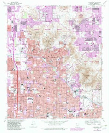
18 topographic sheets cover this place, the earliest surveyed in 1954 and the latest in 1988. It stands in the Phoenix census division. It lies in ZIP code area 85032. It lies near Shadow Mountain. The Survey maps it on the Sunnyslope quadrangle.
Topographic sheets covering this place
9 surveys from 18 printed sheetsMatched by testing this settlement's coordinate against the published boundary of every sheet in the United States Geological Survey's historical collection. Each opens the scanned sheet at the Survey.
- 1954 USGS Phoenix quadrangle1:250000, 5 printings
- 1957 USGS Phoenix quadrangle1:250000
- 1958 USGS Phoenix quadrangle1:250000
- 1960 USGS Phoenix quadrangle1:250000
- 1965 USGS Sunnyslope quadrangle1:24000, 4 printings
- 1969 USGS Phoenix quadrangle1:250000, 2 printings
- 1971 USGS Phoenix quadrangle1:250000
- 1971 USGS Sunnyslope quadrangle1:24000
- 1988 USGS Phoenix North quadrangle1:100000, 2 printings






Fires near this place
1,289 since 1992Regional context, not property-specific evidence. The federal wildfire occurrence database lists 1,289 fires within 5 miles of Cactus between 1992 and 2020, burning about 128 acres in total. 17 started naturally. 25 were recorded as arson. Distance is straight-line from the map coordinates, so a fire counted here may appear on a neighbouring settlement's page as well.
| Reported cause | Fires |
|---|---|
| Missing data/not specified/undetermined | 1235 |
| Arson/incendiarism | 25 |
| Natural | 17 |
| Power generation/transmission/distribution | 12 |
The most recent of them, most recent first, with the day each was reported and the service that recorded it.
| Date | Cause | Size | Reported by | Name on the report |
|---|---|---|---|---|
| 9 September 2012 | Missing data/not specified/undetermined | under an acre | Arizona Department of Forestry and Fire Management - State Office | AZ-122601 |
| 9 September 2010 | Missing data/not specified/undetermined | under an acre | Arizona Department of Forestry and Fire Management - State Office | AZ-101906 |
| 9 September 2010 | Missing data/not specified/undetermined | under an acre | Arizona Department of Forestry and Fire Management - State Office | AZ-101907 |
| 8 September 2018 | Missing data/not specified/undetermined | under an acre | Phoenix Fire Department | 334318 |
| 7 September 2018 | Missing data/not specified/undetermined | under an acre | Phoenix Fire Department | 331822 |
| 7 September 2014 | Missing data/not specified/undetermined | under an acre | Arizona Department of Forestry and Fire Management - State Office | AZ-142070 |
| 7 September 2011 | Missing data/not specified/undetermined | under an acre | Arizona Department of Forestry and Fire Management - State Office | AZ-111664 |
| 7 September 2010 | Missing data/not specified/undetermined | under an acre | Arizona Department of Forestry and Fire Management - State Office | AZ-101900 |
Settlements close enough to share some of these fires:
Mines and quarries near this place
10 of 34 shownRegional context, not property-specific evidence. The federal mineral resources record lists 34 workings within 5 miles of Cactus: 12 unknowns, 11 past producers, 7 occurrences, 3 prospects. 1 still produces. What was taken out: Mercury, Sand and Gravel, Construction, Gold, Copper, Silver. Distance is straight-line from the map coordinates, so a quarry counted here may appear on a neighbouring settlement's page as well.
| Where | Site | Commodity | Status | Recorded |
|---|---|---|---|---|
| Cram's Gold Standard Prospect | Mercury, Silver, Copper, Gold | Past Producer | Vein | |
| Crushed Granite Operation Madison | Stone, Crushed/Broken | Producer | ||
| Marion | Gold, Silver, Bromine | Unknown | ||
| Mercury Group | Mercury, Copper | Past Producer | Cinnabar | |
| Rico Mercury-Pat.#4047 | Mercury, Silver, Copper | Past Producer | 1916 | |
| Seal Rock Group | Kyanite, Mica, Mercury | Occurrence | Cinnabar, Kyanite, Mica | |
| Silica Occurrence | Silica | Occurrence | Quartz | |
| Squaw Peak Area | Kyanite | Past Producer | Metamorphic | |
| Victoria Quicksilver | Mercury, Copper, Gold, Silver | Occurrence | ||
| Kruger and Sultan-Pat.#4355 & 1906 | Gold, Copper, Silver | Unknown |
Storms near this place
20 since 2010Regional context, not property-specific evidence. The National Weather Service names Cactus in 20 storm reports between 2010 and 2025: 8 thunderstorm wind, 6 flash flood, 2 heavy rain, 2 hail. No death or injury is recorded in these reports. Each account below is quoted exactly as the forecast office filed it, from the NOAA Storm Events Database, and each date opens the federal record of that event.
| When | Event | Place named | Harm | What the report says |
|---|---|---|---|---|
| November 2019 | Tornado (EF0) | Cactus | $100,000 | A powerful Pacific upper level low and associated cold front moved east across central and northern portions of the greater Phoenix metropolitan area during the early morning hours on November 29th. Due to elevated levels of wind shear and instability, the front generated several tornadoes in the Phoenix area, including one that tracked to the northeast from eastern Glendale into portions of north Scottsdale. According to a NWS storm survey, the tornado had a path length more than 8 miles and was estimated to be an Ef1 in strength. The tornado began just west of Phoenix Mountain Park and ended near the west side of the Scottsdale TPC Golf Course. There were a number of damage reports associated with the tornado along its path. Many of them were related to downed trees including some with diameters up to 3 feet across. A trained spotter 4 miles west of North Scottsdale reported that some trees fell on vehicles causing damage. Additionally, there were reports of roofs removed and damaged along the path of the tornado. Finally, about 6 miles east of Glendale, Channel 3 TV reported that a very large tree fell on a carport and caused it to collapse upon a car. The fallen tree was just south of Northern Avenue, between 7th and 3rd Avenues. Fortunately there were no reports of any injuries or fatalities. |
| August 2016 | Flash Flood | Cactus | $30,000 | Thunderstorms with very heavy rain developed across the northeastern portion of the greater Phoenix metropolitan area during the morning hours on August 5th; some of the stronger storms produced peak rain rates in excess of 2 inches per hour. Very heavy rain and flash flooding occurred 7 miles southeast of Deer Valley and to the northeast of Phoenix Mountain Park. At 0930MST local broadcast media reported flash flooding which resulted in one car being stuck in flood waters near Cave Creek and Hatcher Roads. One person needed to be rescued from the stranded automobile. A Flash Flood Warning was issued for the area at 0930MST and the warning remained in effect through 1115MST. |
| June 2015 | Thunderstorm Wind | Cactus | $25,000 | Isolated intense thunderstorms developed over portions of the greater Phoenix area during the evening hours on June 29th, and they produced gusty and damaging microburst winds in central Phoenix. According to local broadcast media, at 2218MST numerous large trees ranging from 4 to 6 feet in diameter were blown over by downburst winds estimated to reach as high as 75 mph. The trees were located in the vicinity of Paradise Valley Mall, and some of them fell onto and damaged buildings in the area. No injuries were reported due to the falling trees. |
| September 2025 | Flash Flood | Cactus | $20,000 | Water rescue reported in the vicinity of North 13th Street and East Hatcher Road in Phoenix. No injuries reported. |
| July 2021 | Lightning | Cactus | $10,000 | Lightning struck a house and sparked a fire in in the attic. No one was home at the time of the strike. Fire crews were able to keep the damage at a minimum. Time estimated from radar. No injuries reported. |
| August 2025 | Thunderstorm Wind | Cactus | $5,000 | Several downed trees near 12th Street and Northern Ave in Phoenix. Wind gusts were estimated upwards of 65 mph. No injuries were reported. |
| August 2025 | Thunderstorm Wind | Cactus | $5,000 | Reported downed powerlines in the area of 11th to 14th street near the vicinity of Glendale Avenue in Phoenix. Wind gusts were estimated upwards of 65 mph. No injuries were reported. |
| September 2018 | Thunderstorm Wind | Cactus | $4,000 | Thunderstorms with gusty and damaging outflow winds moved across the northern portions of the greater Phoenix area during the evening hours on September 2nd. One of the stronger storms affected portions of north Phoenix and Deer Valley. According to a report from the public, gusty outflow winds estimated to be near 65 mph in strength blew down a tree about 7 miles southeast of Deer Valley. The tree was blown down and onto a fence at 12th Street and Cave Creek Road. No injuries were reported due to the fallen tree. |
| August 2022 | Thunderstorm Wind | Cactus | $3,000 | Social media pictures showed a large saguaro toppled over and destroying a shed along the area of North 12th Street and East Northern Avenue in Phoenix. Timing estimated from radar. Wind gusts were estimated at 60-70 mph. No injuries were reported. |
| August 2021 | Thunderstorm Wind | Cactus | $2,000 | A social media photo showed a large uprooted tree down on a carport at an apartment complex. No injuries or damaged cars were reported. Timing was estimated using radar. |
| July 2023 | Thunderstorm Wind | Cactus | - | A mesonet station located in the Sunnyslope neighbor of Phoenix measured a 61 mph gust. |
| August 2022 | Flash Flood | Cactus | - | Multiple videos and pictures on social media showed Dreamy Draw Wash flowing across low water crossings near 12th Street and Kaler Drive as well as 14th Street and Desert Park Lane. No damage or injuries were reported. |
| July 2022 | Flash Flood | Cactus | - | A video showed approximately 1-2 ft of water flowing across the road near 12th Street and Hatcher Road. No damage or injuries were reported. |
| July 2021 | Flash Flood | Cactus | - | Hatcher Road was closed due to flooding between 11th Street and 11th Place. Nearby rain gages measured from 0.25 to 1.10 inches. Time estimated from radar and rain gages. No damages or injuries reported. |
| August 2021 | Flash Flood | Cactus | - | Video on social media showed water rapidly flowing across 12th Street near the Torre Blanca community making the street impassable. No damage or injuries were reported. |
| August 2018 | Thunderstorm Wind | Cactus | - | Thunderstorms with very strong outflow winds moved through the central and northern portion of the greater Phoenix metropolitan area during the early evening hours on August 23rd. One of the stronger storms affected portions of north Phoenix. At 1809MST a mesonet weather station labeled DW6996 measured a wind gust to 73 mph. The station was located about 7 miles northwest of Paradise Valley, or just west of the intersection of Highway 51 and Northern Avenue in north Phoenix. No damage was reported in the location of the strong downburst. |
| August 2018 | Hail | Cactus | - | Thunderstorms developed across the northern portion of the greater Phoenix area during the early evening hours on August 23rd; one of the stronger storms affected the communities of Paradise Valley and north Phoenix. At 1816MST, the public reported nickel to quarter sized hailstones falling near the intersection of 17th Street and Mountain View Road, not far to the northwest of the intersection of Highway 51 and Northern Avenue in north Phoenix. The diameter of the largest stones was about one inch. No damage was reported due to the large hail. |
| March 2014 | Heavy Rain | Cactus | - | A vigorous and wet Pacific low pressure system slowly moved into Arizona during the day on March 1st, and as a result scattered showers of moderate to heavy rain fell affecting much of the greater Phoenix metropolitan area. Scattered showers developed in the morning hours and persisted into the afternoon, affecting communities such as Glendale, Scottsdale and Paradise Valley. According to a trained weather spotter 2 miles northeast of North Mountain Park, at 1212MST minor street flooding was observed due to locally heavy rainfall. The spotter measured 0.55 inches of rain which fell in a 30 minute period. Earlier rains which occurred during the late morning hours contributed to the street flooding. At approximately the same time, another trained spotter near Anthem measured nearly one inch of rain with the rainfall beginning during the previous night. |
| August 2010 | Heavy Rain | Cactus | - | A trained spotter in Phoenix measured 1.24 inches of rainfall between 1800MST and 1845MST. The rain fell in the area near 16th Street and Northern. |
| September 2025 | Hail | Cactus | - | no account filed |
Nearest settlements
The eight closest, with where each one stands in the county. Distances are straight-line, computed from the Geographic Names Information System coordinates.
| Map | Place | Distance | Sheets |
|---|---|---|---|
| Stony Mountain Villas | 0.6 miles | 18 | |
| Rancho San Carlos | 0.7 miles | 18 | |
| Shadow Mountain | 0.7 miles | 18 | |
| The Preserve | 1.3 miles | 18 | |
| Lookout Mountain | 1.7 miles | 18 | |
| Mayflower Terrace | 1.9 miles | 18 | |
| Sweetwater Garden | 2.0 miles | 25 | |
| Sunset Hills | 2.0 miles | 18 |
Provenance
This settlement is recorded in the Geographic Names Information System as feature 2344. The sheet list is computed by point-in-boundary test against the United States Geological Survey's historical topographic inventory. Both are works of the United States government and carry no copyright under 17 U.S.C. 105.
Wildfire. Short, Karen C. 2022. Spatial wildfire occurrence data for the United States, 1992-2020 [FPA_FOD_20221014]. 6th Edition. Fort Collins, CO: Forest Service Research Data Archive. https://doi.org/10.2737/RDS-2013-0009.6 Collected with United States Government funding and usable without additional permissions or fees.
Mines and quarries. USGS Mineral Resources Data System (MRDS) https://mrdata.usgs.gov/mrds/ A work of the United States government, no copyright under 17 U.S.C. 105.
Storms. NOAA National Centers for Environmental Information, Storm Events Database https://www.ncei.noaa.gov/stormevents/ A work of the United States government, no copyright under 17 U.S.C. 105. Narratives are quoted verbatim from the National Weather Service report and are not edited or summarised.