 Block
Carefree, Arizona
20 topographic sheets cover this place, the earliest surveyed in 1930 and the latest in 2004. It stands in the Deer Valley census division. It lies in ZIP code area 85377. It lies near Black Mountain. The Survey maps it on the Cave Creek quadrangle. 3,690 people lived here at the 2020 count. It stands 2,382 feet above sea level.
On record in Carefree
Buildings and businesses the archive holds for this place. Each opens its own page, with the source record it came from.
On the National Register 2 records
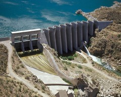 Bartlett Damlisted 2017
- Stoneman Road Military Trail Segmentlisted 2025
Population over time
2 figuresCarefree grew from 3,363 to 3,690 between 2010 and 2020. These are the recorded population figures Wikidata holds for this place, reached through the Geographic Names Information System number this page is keyed on rather than by name, so they belong to this place and not to another of the same name. Most are census counts, but not all are: an early figure may be a founding or settlement estimate, and an estimate published within five years of a census is left out. The change column is computed, and is left blank where more than 20 years separate a figure from the one before it, because a gap that long is not a change between two counts.
| Year | People | Change |
|---|---|---|
| 2010 | 3,363 | |
| 2020 | 3,690 | +327 (+10%) |
Topographic sheets covering this place
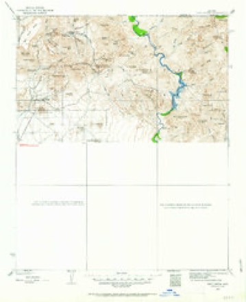
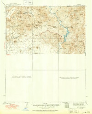
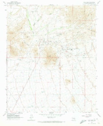
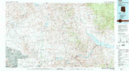
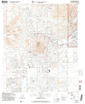
10 surveys from 20 printed sheetsMatched by testing this settlement's coordinate against the published boundary of every sheet in the United States Geological Survey's historical collection. Each opens the scanned sheet at the Survey.
- 1930 USGS Cave Creek quadrangle1:125000, 2 printings
- 1939 USGS Cave Creek quadrangle1:125000, 3 printings
- 1954 USGS Mesa quadrangle1:250000, 4 printings
- 1957 USGS Mesa quadrangle1:250000
- 1958 USGS Mesa quadrangle1:250000
- 1960 USGS Mesa quadrangle1:250000
- 1964 USGS Mesa quadrangle1:250000
- 1965 USGS Cave Creek quadrangle1:24000, 3 printings
- 1994 USGS Theodore Roosevelt Lake quadrangle1:100000, 3 printings
- 2004 USGS Cave Creek quadrangle1:24000





Fires near this place
54 since 1992Regional context, not property-specific evidence. The federal wildfire occurrence database lists 54 fires within 5 miles of Carefree between 1992 and 2020, burning about 3,075 acres in total. 2 started naturally. None was recorded as arson. Distance is straight-line from the map coordinates, so a fire counted here may appear on a neighbouring settlement's page as well.
| Reported cause | Fires |
|---|---|
| Missing data/not specified/undetermined | 51 |
| Natural | 2 |
| Equipment and vehicle use | 1 |
The most recent of them, most recent first, with the day each was reported and the service that recorded it.
| Date | Cause | Size | Reported by | Name on the report |
|---|---|---|---|---|
| 1 September 2020 | Missing data/not specified/undetermined | under an acre | Arizona Department of Forestry and Fire Management - State Office | not named |
| 6 August 2014 | Missing data/not specified/undetermined | under an acre | Arizona Department of Forestry and Fire Management - State Office | AZ-142023 |
| 31 August 2011 | Missing data/not specified/undetermined | under an acre | Arizona Department of Forestry and Fire Management - State Office | AZ-111641 |
| 3 August 2011 | Missing data/not specified/undetermined | under an acre | Arizona Department of Forestry and Fire Management - State Office | AZ-111567 |
| 29 August 2020 | Missing data/not specified/undetermined | under an acre | Arizona Department of Forestry and Fire Management - State Office | not named |
| 17 August 2020 | Missing data/not specified/undetermined | under an acre | Arizona Department of Forestry and Fire Management - State Office | not named |
| 10 August 2020 | Missing data/not specified/undetermined | under an acre | Arizona Department of Forestry and Fire Management - State Office | not named |
| 7 July 2004 | Missing data/not specified/undetermined | 3.0 acres | Arizona Department of Forestry and Fire Management - State Office | LONE |
Settlements close enough to share some of these fires:
Mines and quarries near this place
10 of 29 shownRegional context, not property-specific evidence. The federal mineral resources record lists 29 workings within 5 miles of Carefree: 15 past producers, 9 occurrences, 2 prospects, 2 producers. 2 still produce. What was taken out: Gold, Copper, Silver, Uranium, Sulfur-Pyrite. Distance is straight-line from the map coordinates, so a quarry counted here may appear on a neighbouring settlement's page as well.
| Where | Site | Commodity | Status | Recorded |
|---|---|---|---|---|
| Cave Creek Gold | Silver, Gold | Past Producer | ||
| Copper Kid Nos. 1, 2, and 3 and Copper Kid Amended Claims | Lead, Silver, Copper, Uranium | Occurrence | Galena, Malachite, Uraninite | |
| Copper Top | Gold, Silver, Lead, Copper | Past Producer | ||
| Copper Top Mine | Gold, Copper, Silver, Lead | Past Producer | 1904 | |
| Copper-Kid No.1,2 | Uranium, Copper, Lead, Molybdenum, Silver, Zinc | Prospect | ||
| G.O. John | Copper, Silver, Gold, Lead | Prospect | ||
| Gift Pat.Claim 4503 | Copper, Gold, Silver | Unknown | ||
| Gold Cliff Group | Tungsten, Gold, Silver, Molybdenum, Copper, Fluorine-Fluorite, Beryllium, Niobium (Columbium) | Past Producer | 1910, 1941 | |
| Gold Cliff Pat. 4334 | Tungsten, Gold, Copper, Molybdenum, Fluorine-Fluorite, Sulfur-Pyrite | Past Producer | ||
| Lone Mountain Group | Limestone, General | Past Producer | Sedimentary |
Storms near this place
36 since 1996Regional context, not property-specific evidence. The National Weather Service names Carefree in 36 storm reports between 1996 and 2025: 15 thunderstorm wind, 13 flash flood, 5 hail, 1 heavy rain. The reports record 2 deaths and 3 injuries. Each account below is quoted exactly as the forecast office filed it, from the NOAA Storm Events Database, and each date opens the federal record of that event.
| When | Event | Place named | Harm | What the report says |
|---|---|---|---|---|
| August 2021 | Flash Flood | Carefree | 2 killed, $20,000 | According to local media reports, the Maricopa County Sheriff's Office found two people had perished inside an ATV that was buried in mud and debris downstream in Camp Creek. MCSO was notified and began searching for the missing people around 1600MST on the 18th but did not recover the ATV until 0800MST on the 19th. Media reported that other recreationists were successfully rescued from the area, including a father and daughter who were trapped near Needle Rock Recreation Site and had to be rescued by helicopter. A Camp Creek rain gauge recorded 3.54 inches of rain between 1300MST and 1420MST. The Rackensack Canyon rain gauge measured 3.83 inches of rain between 1250MST and 1430MST. The Maricopa County Flood Control District also reported that Bartlett Dam Road was closed due to swiftly flowing water over the roadway from Camp Creek. |
| July 1999 | Lightning | Carefree | 3 hurt | Three U.S. Forest Service firefighters were stunned or paralyzed for a few minutes as lightning hit the ground near them. They also suffered some burns on the feet and shoulders. |
| August 2021 | Flash Flood | Carefree | $5,000 | Videos on social media showed a low water crossing along Bartlett Dam Road at Camp Creek being impassable as a result of approximately 6-8 inches of flowing water over the road. Additionally, Horseshoe Dam Road between Bartlett Dam Road and Horseshoe Lake was closed by Tonto National Forest due to flood damage. No injuries were reported. |
| June 2018 | Flash Flood | Carefree | $2,000 | Thunderstorms with very heavy rain developed just north of Cave Creek during the mid afternoon hours on June 16th. Radar indicated rainfall totals in the area approaching 2 inches. According to a trained spotter 2 miles north of Cave Creek, at 1615MST washes crossing north Spur Cross Road were running moderately. North Spur Cross Road near Cahava Ranch Road was blocked off. Rainfall accumulation in the area was measured at 1.87 inches within 45 minutes between 1500MST and 1545MST. A Flash Flood Warning was issued at 1526MST and remained in effect until almost 1800MST. |
| June 2025 | Flash Flood | Carefree | $500 | Photos taken along Bartlett Dam Rd show evidence of flash flooding over the road in multiple spots, including at the Camp Creek crossing, with many small boulders, sediment, and other debris left over in the road. No injuries were reported. |
| July 2024 | Flash Flood | Carefree | - | Water over Bartlett Dam Road at Camp Creek. Heavy rain fell on the Wildcat Fire Burn Scar with 1.65 inches of rain recorded in less than one hour at the Camp Creek at Bartlett Dam Road rain gage operated by Maricopa County Flood Control. The County Flood Control notified Maricopa County Department of Transportation to barricade road. No damages nor injuries were reported. |
| July 2024 | Thunderstorm Wind | Carefree | - | A mesonet station located at Horseshoe Dam measured a 59 mph wind gust. |
| August 2022 | Flash Flood | Carefree | - | MCDOT reported Bartlett Dam Road at Cave Creek road was closed due to flooding. No damage or injuries were reported. |
| August 2022 | Thunderstorm Wind | Carefree | - | A mesonet station (SRP19) at Horseshoe Dam measured a 59 mph gust. |
| July 2022 | Thunderstorm Wind | Carefree | - | A mesonet station at Horseshoe Dam measured a wind gust of 58 mph. |
| July 2021 | Thunderstorm Wind | Carefree | - | A SRP mesonet station at Horseshoe Dam measured an 83 mph wind gust. |
| July 2021 | Thunderstorm Wind | Carefree | - | Mesonet station SRP19 at 16.2 miles NE of Carefree measured a 68 mph wind gust. |
| July 2021 | Flash Flood | Carefree | - | U.S. Forest Service reported a 4 foot rise in Camp Creek with flow originating from the Sears burn scar. Time estimated from radar. No damages or injuries were reported. |
| July 2021 | Flash Flood | Carefree | - | A USGS gage along Cave Creek below Cottonwood Creek recorded a rapid rise and exceeded action stage. This gage measured an approximate rise of 5 feet in a 20 minute period and crested at 8.05 feet at 2030MST. No damage or injuries were reported. |
| August 2021 | Thunderstorm Wind | Carefree | - | Mesonet station MAHL at Horseshoe Lake measured a 63 mph wind gust. |
| August 2021 | Flash Flood | Carefree | - | The Cave Creek Ashdale Maricopa County Flood Control District stream gage recorded flow exceeding alarm stage, impacting low water crossings along with properties in the area. At 1513MST, the creek crested at 6.7 feet and 2027 CFS. No damage or injuries were reported. |
| August 2021 | Flash Flood | Carefree | - | A Maricopa County Flood Control District stream gage along Seven Springs Wash exceeded alarm stage, impacting the unbridged Seven Springs Road downstream. At 1418MST, the flow crested at 5.06 feet and 1574 CFS. |
| August 2020 | Thunderstorm Wind | Carefree | - | Thunderstorms with strong gusty outflow winds moved into the far northeast portions of the greater Phoenix area during the late afternoon hours on August 20th. At 1725MST an automated mesonet station at Horseshoe Reservoir measured a wind gust to 59 mph. There were no reports of damage due to the strong gust. The station was located about 16 miles northwest of Sunflower. |
| September 2019 | Flash Flood | Carefree | - | Scattered thunderstorms developed across the central deserts, including areas to the north of Phoenix, during late afternoon and early evening hours on September 26th. A few of the stronger storms produced intense rain with peak rain rates in excess of 2 inches per hour. As an example, at 1902MST the Fig Springs gauge northeast of New River measured 1.06 inches within 30 minutes. The heavy rain resulted in an episode of flash flooding 3 miles east of New River. At 1906MST the Maricopa County Skunk Creek stream gauge reported a rise of 2 feet which exceeded the alarm stage. A Flash Flood Warning was issued for the area only a few minutes prior to the gauge report. Fortunately there were no reports of any accidents in the area due to the flash flooding. |
| June 2018 | Flash Flood | Carefree | - | Thunderstorms with very heavy rain developed just north of Carefree and Cave Creek during the middle of the afternoon on June 16th. Radar indicated that rainfall amounts of up to 2 inches fell in the area, and this led to flash flooding. According to a member of broadcast media, at 1630MST water was flowing swiftly across north Echo Canyon Road, immediately south of the intersection with north Fleming Springs Road. At 1526MST a Flash Flood Warning was issued for the area and it remained in effect until nearly 1800MST. |
| July 2018 | Thunderstorm Wind | Carefree | - | Strong thunderstorms developed across the greater Phoenix metropolitan area as well as higher terrain areas northeast of Phoenix during the afternoon hours on July 9th. The stronger storms generated gusty outflow winds in excess of 60 mph at times. An automated weather station located at Horseshoe Dam measured a wind gust of 63 mph at 1512MST. |
| July 2018 | Thunderstorm Wind | Carefree | - | Strong thunderstorms developed over the higher terrain northeast of Phoenix during the early evening hours on July 28th. Some of the storms affected the area around the Horseshoe Reservoir and they generated strong gusty outflow winds. At 1800MST a mesonet weather station at the Horseshoe Dam measured a gust to 59 mph. The station was labeled as SRP19. |
| August 2018 | Thunderstorm Wind | Carefree | - | Thunderstorms with strong gusty winds developed over the higher terrain northeast of Phoenix during the early evening hours on August 14th. One of the stronger storms affected the area around Horseshoe Lake. At 1820MST an SRP automated mesonet weather station measured a wind gust of 60 mph on the far southern end of the lake. |
| July 2017 | Thunderstorm Wind | Carefree | - | Isolated strong thunderstorms developed during the afternoon across higher terrain locations to the northeast of Phoenix and they were capable of producing very strong outflow winds. According to a mesonet weather station, a wind gust to 68 mph was measured at the Horseshoe Dam located about 16 miles northwest of the town of Sunflower. |
| July 2017 | Thunderstorm Wind | Carefree | - | Strong thunderstorms developed across the higher terrain to the northeast of Phoenix during the evening hours on July 16th, and some of them produced strong gusty outflow winds in excess of 60 mph. According to a mesonet weather station at the Horseshoe Reservoir, at 2105MST a wind gust was measured at 69 mph. This was one of the highest gusts recorded across south-central Arizona during the evening hours. |
| July 2016 | Thunderstorm Wind | Carefree | - | During the late afternoon hours on July 29th, strong thunderstorms developed along the central Arizona mountains; they quickly moved towards the southwest and into the far northern fringes of the greater Phoenix area. One strong storm passed south across Horseshoe Reservoir and it produced a very strong wind gust. As reported by an SRP Mesonet weather sensor located just south of Horseshoe Reservoir, at 1810MST a peak wind gust to 67 mph was recorded. The weather station was about 15 miles to the northwest of the town of Sunflower. |
| July 2009 | Thunderstorm Wind | Carefree | - | Measured winds of 61 mph at Horseshoe Dam. |
| August 2008 | Thunderstorm Wind | Carefree | - | About 20 trees were downed and several homes sustained roof damage due to the strong winds. At Deer Valley airport winds were measured at 51 mph at 10:55 pm MST. |
| August 2006 | Hail | Carefree | - | Large hail reported at Desert Mountain. |
| February 2003 | Hail | Carefree | - | Large hail in Carefree, reported by local TV station. Small hail was also reported by spotters in Phoenix just before 5 pm MST. |
| August 2000 | Funnel Cloud | Carefree | - | Spotter reported funnel cloud 2 miles east of Scottsdale Road. |
| October 1998 | Heavy Rain | Carefree | - | Showers and thunderstorms, some with rainfall rates of an inch per hour moved through the metro Phoenix area. The heaviest rain was reported in Carefree and Cave Creek where 1.10 inches occurred. The greatest storm total was 2.13 inches at Bartlett Dam. Street flooding was reported in many areas. |
| October 1998 | Flash Flood | Carefree | - | Deputies responded to a call about a vehicle trapped in a wash. A second vehicle, with a woman inside, was discovered at 14th Street south of Carefree Highway with rapidly rising water around it. The woman was rescued by the deputies who formed a human chain. The Plymouth Voyager was later washed downstream. |
| February 2005 | Hail | Carefree | - | no account filed |
| March 1996 | Hail | Carefree | - | no account filed |
| March 1996 | Hail | Carefree | - | no account filed |
Nearest settlements
The eight closest, with where each one stands in the county. Distances are straight-line, computed from the Geographic Names Information System coordinates.
| Map | Place | Distance | Sheets |
|---|---|---|---|
| Cave Creek | 1.9 miles | 20 | |
| Carefree Foothills | 2.3 miles | 20 | |
| Dove Valley Ranch | 3.6 miles | 20 | |
| Lone Mountain Ranch | 4.2 miles | 20 | |
| Desert Wind | 4.5 miles | 20 | |
| Dixileta Verde | 4.6 miles | 20 | |
| Sincuidados | 4.7 miles | 20 | |
| Trovia | 5.4 miles | 20 |
Elsewhere
Matched on this settlement's Geographic Names Information System number rather than its name, so it cannot be a different place of the same name in another state.
| Wikipedia article on Carefree | An encyclopaedic summary. Its text is share-alike, so it is linked here rather than copied. |
| Wikidata item Q984260 | The structured record the population and elevation above come from. Public domain (CC0). |
Provenance
This settlement is recorded in the Geographic Names Information System as feature 27283. The sheet list is computed by point-in-boundary test against the United States Geological Survey's historical topographic inventory. Both are works of the United States government and carry no copyright under 17 U.S.C. 105.
Wildfire. Short, Karen C. 2022. Spatial wildfire occurrence data for the United States, 1992-2020 [FPA_FOD_20221014]. 6th Edition. Fort Collins, CO: Forest Service Research Data Archive. https://doi.org/10.2737/RDS-2013-0009.6 Collected with United States Government funding and usable without additional permissions or fees.
Mines and quarries. USGS Mineral Resources Data System (MRDS) https://mrdata.usgs.gov/mrds/ A work of the United States government, no copyright under 17 U.S.C. 105.
Storms. NOAA National Centers for Environmental Information, Storm Events Database https://www.ncei.noaa.gov/stormevents/ A work of the United States government, no copyright under 17 U.S.C. 105. Narratives are quoted verbatim from the National Weather Service report and are not edited or summarised.