 Block
Continental, Arizona
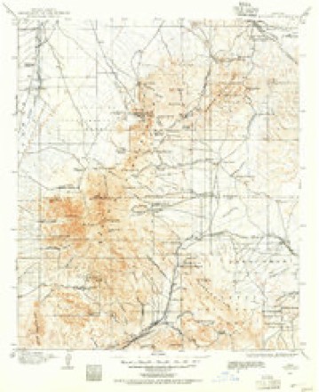
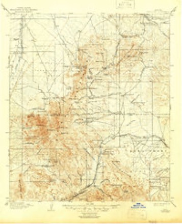
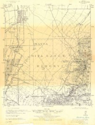
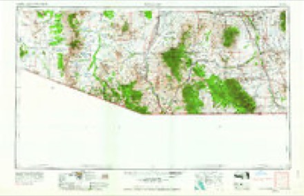
20 topographic sheets cover this place, the earliest surveyed in 1904 and the latest in 2004. It stands in the Tucson census division. It lies in ZIP code area 85614. The Survey maps it on the Green Valley quadrangle. It stands 2,864 feet above sea level.
Topographic sheets covering this place
10 surveys from 20 printed sheetsMatched by testing this settlement's coordinate against the published boundary of every sheet in the United States Geological Survey's historical collection. Each opens the scanned sheet at the Survey.
- 1904 USGS Patagonia quadrangle1:125000
- 1905 USGS Patagonia quadrangle1:125000, 4 printings
- 1926 USGS Helvetia quadrangle1:62500
- 1956 USGS Nogales quadrangle1:250000, 4 printings
- 1958 USGS Nogales quadrangle1:250000
- 1958 USGS Sahuarita quadrangle1:62500, 3 printings
- 1959 USGS Nogales quadrangle1:250000
- 1981 USGS Green Valley quadrangle1:24000
- 1994 USGS Fort Huachuca quadrangle1:100000, 3 printings
- 2004 USGS Green Valley quadrangle1:24000
Fires near this place
98 since 1992Regional context, not property-specific evidence. The federal wildfire occurrence database lists 98 fires within 5 miles of Continental between 1992 and 2020, burning about 283 acres in total. 5 started naturally. None was recorded as arson. Distance is straight-line from the map coordinates, so a fire counted here may appear on a neighbouring settlement's page as well.
| Reported cause | Fires |
|---|---|
| Missing data/not specified/undetermined | 80 |
| Smoking | 6 |
| Natural | 5 |
| Equipment and vehicle use | 3 |
| Railroad operations and maintenance | 1 |
| Debris and open burning | 1 |
| Recreation and ceremony | 1 |
| Misuse of fire by a minor | 1 |
The most recent of them, most recent first, with the day each was reported and the service that recorded it.
| Date | Cause | Size | Reported by | Name on the report |
|---|---|---|---|---|
| 27 September 2020 | Missing data/not specified/undetermined | under an acre | Arizona Department of Forestry and Fire Management - State Office | not named |
| 19 September 2017 | Missing data/not specified/undetermined | under an acre | Green Valley Fire District | not named |
| 16 September 2017 | Missing data/not specified/undetermined | under an acre | Green Valley Fire District | not named |
| 10 September 1999 | Natural | 1.0 acres | Arizona Department of Forestry and Fire Management - State Office | DUVAL |
| 8 August 2020 | Missing data/not specified/undetermined | under an acre | Arizona Department of Forestry and Fire Management - State Office | not named |
| 29 August 2020 | Missing data/not specified/undetermined | under an acre | Arizona Department of Forestry and Fire Management - State Office | not named |
| 29 August 2018 | Missing data/not specified/undetermined | under an acre | Green Valley Fire District | 7628 |
| 26 August 2019 | Missing data/not specified/undetermined | under an acre | Green Valley Fire District | NOT NAMED |
Settlements close enough to share some of these fires:
Mines and quarries near this place
2 within 5 milesRegional context, not property-specific evidence. The federal mineral resources record lists 2 workings within 5 miles of Continental: 1 occurrence, 1 unknown. None of them still produces. What was taken out: Copper, Sand and Gravel, Construction. Distance is straight-line from the map coordinates, so a quarry counted here may appear on a neighbouring settlement's page as well.
Storms near this place
29 since 2007Regional context, not property-specific evidence. The National Weather Service names Continental in 29 storm reports between 2007 and 2024: 10 thunderstorm wind, 8 hail, 5 flash flood, 3 lightning. No death or injury is recorded in these reports. Each account below is quoted exactly as the forecast office filed it, from the NOAA Storm Events Database, and each date opens the federal record of that event.
| When | Event | Place named | Harm | What the report says |
|---|---|---|---|---|
| July 2021 | Thunderstorm Wind | Continental | $100,000 | Thunderstorms winds downed 30 power poles and dozens of trees in Green Valley and Sahuarita. One of the downed trees broke a water main and other blocked streets. Around 10,000 customers were without power into the overnight hours. A CoCoRaHS observer on the southeast side of Green Valley measured a wind gust of 66 mph at 1855MST. |
| July 2022 | Hail | Continental | $50,000 | Ping pong size hail buffeted Green Valley for several minutes. Numerous sky lights were damaged and several houses suffered broken windows. |
| July 2022 | Thunderstorm Wind | Continental | $50,000 | Thunderstorm winds blew down a road sign near the Continental exit of Interstate 19 and 100 trees were downed in Green Valley. |
| July 2013 | Thunderstorm Wind | Continental | $30,000 | Thunderstorm winds downed several trees including three 45-year old eucalyptus trees. Some trees fell onto houses causing minor roof damage and one ruptured a roof-mounted gas line. Another downed tree shattered a patio wall. Several 16 foot garage doors on newer homes were damaged or destroyed because the side of garage was constructed with an opening to a gated patio between the house and attached garage. The fire station at Esperanza Blvd. and La Canada Drive also sustained minor roof damage. |
| July 2009 | Thunderstorm Wind | Continental | $25,000 | Strong thunderstorm downburst winds downed or snapped off 18 power poles in Green Valley. One of the power poles landed on a house. |
| July 2015 | Thunderstorm Wind | Continental | $17,000 | Thunderstorm winds blew over and severely damaged a metal hay barn at a horse rescue which was full of bales. Some of the hay bales suffered water damage. |
| July 2018 | Heavy Rain | Continental | $15,000 | Brief heavy rain from a thunderstorm resulted a single vehicle crash on Interstate 19 in Green Valley. After the driver lost control of the vehicle, it crashed into a tree in the median. All three occupants were taken to the hospital with non-life-threatening injuries. |
| September 2012 | Heavy Rain | Continental | $15,000 | The second heavy rain of the morning overwhelmed a roof drain system on Continental School in Green Valley. Ceiling tiles collapsed from the weight of the rain and carpets were damaged. In addition, a motorist lost control of a vehicle in heavy rain along Interstate 19 near Green Valley. The vehicle left the roadway and crashed into a small tree, injuring the driver. |
| July 2012 | Flash Flood | Continental | $5,000 | Flash flooding closed Desert Ridge Drive in Green Valley as well as Mission Road near Twin Buttes Cemetery. Farther north, a car became stuck in flood waters near Ajo Highway and Sandario Road. In Avra Valley and Picture Rocks, Manville Road was closed between Sanders and Trico Roads due to flooding as well as Twin Peaks Road between Sandario and Sanders Roads. |
| July 2010 | Lightning | Continental | $3,000 | Lightning struck palm tree in the front yard of a home on Abrego Road, which spread to other nearby trees. |
| May 2013 | Dust Devil | Continental | $2,000 | A powerful dust devil removed several dozen roof tiles from two homes in Green Valley. Wind speeds were estimated at 65 mph. A stove vent was also blown off one roof. |
| August 2012 | Thunderstorm Wind | Continental | $2,000 | Thunderstorm winds downed a large tree and damaged a pool canopy at the Green Valley Recreation Club. |
| August 2024 | Flash Flood | Continental | $1,000 | Reports of flash flooding with running water over roadway at the intersection of Sopori Wash and W Arivaca Rd. |
| August 2015 | Thunderstorm Wind | Continental | $1,000 | A pepper tree was uprooted by thunderstorm winds in Green Valley. |
| July 2014 | Lightning | Continental | $1,000 | Lightning struck and burned a pair of palm trees in Green Valley. |
| June 2022 | Thunderstorm Wind | Continental | $500 | Thunderstorm wind gusts to 60 mph downed tree limbs in Green Valley. |
| July 2013 | Thunderstorm Wind | Continental | $500 | Thunderstorms winds downed a tree at Esperanza Estates in Green Valley. |
| July 2012 | Thunderstorm Wind | Continental | $500 | Thunderstorm winds uprooted a tree in Amado. |
| September 2012 | Flash Flood | Continental | $500 | During the morning hours, brief but heavy rain fell on saturated ground, causing washes to quickly fill and flow across roads. Portions of Camino Del Sol and Mission Roads were closed due to flooding in and near Green Valley. |
| July 2017 | Lightning | Continental | $200 | Lightning struck a tree in Green Valley and caught it on fire. |
| September 2022 | Flash Flood | Continental | - | Heavy rain of 3-4 in three hours caused flash flooding and road closures in Green Valley, including Camino Del Sol and Abrego Drive. |
| August 2021 | Flash Flood | Continental | - | Heavy rain of 2 to 3.5 in 90 minutes caused flash flooding of washes and the closure of many roadways in Green Valley. |
| August 2019 | Hail | Continental | - | One inch diameter hail was reported in southern Green Valley. |
| September 2014 | Hail | Continental | - | One inch diameter hail was reported south of Green Valley. |
| September 2011 | Hail | Continental | - | A severe thunderstorm produced a swath of large hail from Green Valley northeastward several miles out of town. |
| July 2007 | Hail | Continental | - | A trained spotter estimated one inch hail near Arivaca Junction. |
| September 2022 | Hail | Continental | - | no account filed |
| September 2022 | Hail | Continental | - | no account filed |
| August 2020 | Hail | Continental | - | no account filed |
Nearest settlements
The eight closest, with where each one stands in the county. Distances are straight-line, computed from the Geographic Names Information System coordinates.
| Map | Place | Distance | Sheets |
|---|---|---|---|
| Green Valley | 1.0 miles | 20 | |
| Green Valley Pueblo Estates | 3.1 miles | 20 | |
| Duval | 5.6 miles | 20 | |
| Twin Buttes | 5.7 miles | 21 | |
| East Sahuarita | 6.7 miles | 20 | |
| Sahuarita Heights | 7.2 miles | 20 | |
| Sahuarita | 7.3 miles | 20 | |
| Arivaca Junction | 9.8 miles | 19 |
Elsewhere
Matched on this settlement's Geographic Names Information System number rather than its name, so it cannot be a different place of the same name in another state.
| Wikipedia article on Continental | An encyclopaedic summary. Its text is share-alike, so it is linked here rather than copied. |
| Wikidata item Q16890635 | The structured record the population and elevation above come from. Public domain (CC0). |
Provenance
This settlement is recorded in the Geographic Names Information System as feature 27862. The sheet list is computed by point-in-boundary test against the United States Geological Survey's historical topographic inventory. Both are works of the United States government and carry no copyright under 17 U.S.C. 105.
Wildfire. Short, Karen C. 2022. Spatial wildfire occurrence data for the United States, 1992-2020 [FPA_FOD_20221014]. 6th Edition. Fort Collins, CO: Forest Service Research Data Archive. https://doi.org/10.2737/RDS-2013-0009.6 Collected with United States Government funding and usable without additional permissions or fees.
Mines and quarries. USGS Mineral Resources Data System (MRDS) https://mrdata.usgs.gov/mrds/ A work of the United States government, no copyright under 17 U.S.C. 105.
Storms. NOAA National Centers for Environmental Information, Storm Events Database https://www.ncei.noaa.gov/stormevents/ A work of the United States government, no copyright under 17 U.S.C. 105. Narratives are quoted verbatim from the National Weather Service report and are not edited or summarised.