 Block
Sahuarita, Arizona
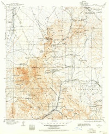
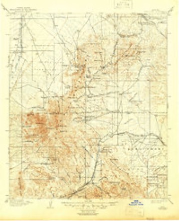
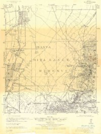
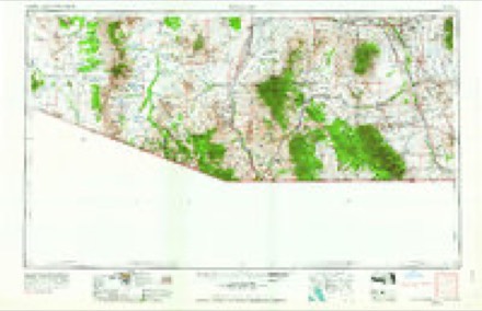
20 topographic sheets cover this place, the earliest surveyed in 1904 and the latest in 1994. It stands in the Tucson census division. It lies in ZIP code area 85629. The Survey maps it on the Sahuarita quadrangle. 34,134 people lived here at the 2020 count. It stands 2,703 feet above sea level.
Population over time
2 figuresSahuarita grew from 25,259 to 34,134 between 2010 and 2020. These are the recorded population figures Wikidata holds for this place, reached through the Geographic Names Information System number this page is keyed on rather than by name, so they belong to this place and not to another of the same name. Most are census counts, but not all are: an early figure may be a founding or settlement estimate, and an estimate published within five years of a census is left out. The change column is computed, and is left blank where more than 20 years separate a figure from the one before it, because a gap that long is not a change between two counts.
| Year | People | Change |
|---|---|---|
| 2010 | 25,259 | |
| 2020 | 34,134 | +8,875 (+35%) |
Topographic sheets covering this place
9 surveys from 20 printed sheetsMatched by testing this settlement's coordinate against the published boundary of every sheet in the United States Geological Survey's historical collection. Each opens the scanned sheet at the Survey.
- 1904 USGS Patagonia quadrangle1:125000
- 1905 USGS Patagonia quadrangle1:125000, 4 printings
- 1926 USGS Helvetia quadrangle1:62500
- 1956 USGS Nogales quadrangle1:250000, 4 printings
- 1958 USGS Nogales quadrangle1:250000
- 1958 USGS Sahuarita quadrangle1:62500, 3 printings
- 1959 USGS Nogales quadrangle1:250000
- 1981 USGS Sahuarita quadrangle1:24000, 2 printings
- 1994 USGS Fort Huachuca quadrangle1:100000, 3 printings
Fires near this place
82 since 1992Regional context, not property-specific evidence. The federal wildfire occurrence database lists 82 fires within 5 miles of Sahuarita between 1992 and 2020, burning about 335 acres in total. 6 started naturally. None was recorded as arson. Distance is straight-line from the map coordinates, so a fire counted here may appear on a neighbouring settlement's page as well.
| Reported cause | Fires |
|---|---|
| Missing data/not specified/undetermined | 63 |
| Equipment and vehicle use | 8 |
| Natural | 6 |
| Railroad operations and maintenance | 1 |
| Misuse of fire by a minor | 1 |
| Debris and open burning | 1 |
| Recreation and ceremony | 1 |
| Smoking | 1 |
The most recent of them, most recent first, with the day each was reported and the service that recorded it.
| Date | Cause | Size | Reported by | Name on the report |
|---|---|---|---|---|
| 27 September 2020 | Missing data/not specified/undetermined | under an acre | Arizona Department of Forestry and Fire Management - State Office | not named |
| 10 September 1999 | Natural | 1.0 acres | Arizona Department of Forestry and Fire Management - State Office | DUVAL |
| 8 August 2020 | Missing data/not specified/undetermined | under an acre | Arizona Department of Forestry and Fire Management - State Office | not named |
| 8 August 2017 | Missing data/not specified/undetermined | under an acre | Arizona Department of Forestry and Fire Management - Southeast District | SAHURITA |
| 13 August 2019 | Missing data/not specified/undetermined | under an acre | Green Valley Fire District | NOT NAMED |
| 9 July 2011 | Equipment and vehicle use | under an acre | Papago Agency | I-19 KM 82 #1 |
| 8 July 2002 | Natural | 2.0 acres | Arizona Department of Forestry and Fire Management - State Office | SAHURITA |
| 3 July 2019 | Natural | under an acre | Green Valley Fire District | NOT NAMED |
Settlements close enough to share some of these fires:
Mines and quarries near this place
5 within 5 milesRegional context, not property-specific evidence. The federal mineral resources record lists 5 workings within 5 miles of Sahuarita: 3 occurrences, 1 producer, 1 past producer. 1 still produces. What was taken out: Geothermal, Copper, Tungsten, Copper, Lead, Zinc. Distance is straight-line from the map coordinates, so a quarry counted here may appear on a neighbouring settlement's page as well.
| Where | Site | Commodity | Status | Recorded |
|---|---|---|---|---|
| Eagle-Picher Mill Tailing Dump | Tungsten, Copper, Lead, Zinc | Past Producer | ||
| Twin Buttes Oxide Plant | Copper | Producer | ||
| Unknown | Geothermal | Occurrence | ||
| Unknown | Geothermal | Occurrence | ||
| Unknown | Geothermal | Occurrence |
Storms near this place
32 since 1997Regional context, not property-specific evidence. The National Weather Service names Sahuarita in 32 storm reports between 1997 and 2025: 14 thunderstorm wind, 9 flash flood, 3 hail, 3 lightning. The reports record 2 deaths and 1 injury. Each account below is quoted exactly as the forecast office filed it, from the NOAA Storm Events Database, and each date opens the federal record of that event.
| When | Event | Place named | Harm | What the report says |
|---|---|---|---|---|
| September 2011 | Flash Flood | Sahuarita | 1 killed, $500,000 | Extremely heavy rainfall across southern Tucson resulted in significant wash and stream flooding downstream from Tucson. Overflowing washes toppled a wall in the Rancho Sahuarita subdivision in Sahuarita resulting in damage to 15 homes and a muddy mess. Water up to one foot was observed in some of the homes. The raging Santa Cruz River also claimed the life of a homeless man that was living under the Grant Road Bridge. Rescuers spotted the man holding onto the bridge pillar, but before they were able to reach him he lost his grip and was swept down the river. His body was found the next day near the Ina Road bridge. |
| August 2018 | Flash Flood | Sahuarita | 1 killed, $15,000 | Up to 1.5 inches of rain in less than 1 hour caused rapid flows on Flato Wash which swept away a vehicle on Old Nogales Highway. The lone driver, who had driven around police barricades, and the vehicle were swept downstream to the west side of main Nogales Highway where the vehicle rested on its top, but remained submerged in flood waters. Rescuers were unable to reach the driver in time to save him. |
| July 2008 | Lightning | Sahuarita | 1 hurt | An 18 year old man was struck by lightning and injured while working on the roof of a house. |
| August 2001 | Thunderstorm Wind | Sahuarita | $200,000 | no account filed |
| July 2022 | Lightning | Sahuarita | $75,000 | Lightning struck at house on Calle del Escribo in Sahuarita causing extensive damage. The owner of the house was treated for 2nd degree burns, which resulted from the fire. |
| June 2015 | Hail | Sahuarita | $50,000 | Quarter to golf ball size hail fell in the Sahuarita area causing damage to vehicles and motor homes. |
| September 2013 | Thunderstorm Wind | Sahuarita | $50,000 | Thunderstorm winds downed nine power poles near Pima Mine Road and Nogales Highway. The downed poles caused 11,000 customers to be without power for several hours and both roadways were closed through the night. A roof was blown off a building at the Sahuarita waste-water treatment plant. In addition, the roof was ripped off a mobile home on East Lumber Street near Old Nogales Highway. Several other mobile homes sustained minor damage in that area and one tree was uprooted. |
| June 2015 | Thunderstorm Wind | Sahuarita | $30,000 | Thunderstorm winds knocked one unoccupied mobile home off its foundation, tore the roof off another and blew windows out of several others in the Sullivan Park neighborhood of East Sahuarita. Several trees were also uprooted. |
| August 2016 | Flash Flood | Sahuarita | $25,000 | Heavy rain caused flash flooding and 3 swift water rescues on the periphery of the Tucson metro area. The first rescue occurred around 830 am LST on Silverbell Rd between Ina Rd and El Camino del Cerro. Around the same time, flood waters 1 to 2 feet deep rushed across Sahuarita Rd near Calle Rinconado. A swift water rescue by the Corona de Tucson FD occurred around 10 am on South Houghton Rd near East Andrada Rd. A third rescue of a woman and her child occurred around 1120 am on South Desert Sunrise Trail near W Snyder Hill Rd. Both Andrada and Pantano High Schools were evacuated and closed early as a precaution due to road closures and a possible sinkhole. Classes resumed the next day. |
| July 2001 | Flash Flood | Sahuarita | $25,000 | no account filed |
| July 2011 | Thunderstorm Wind | Sahuarita | $15,000 | A trained spotter reported an estimated wind gust of 52 knots (60 mph) in northern Sahuarita. Several large trees and a few power poles were downed. The most significant damage was sustained on Pima Mine Road near Interstate 19 where a pole fell onto a moving vehicle. The driver sustained minor injuries and was held overnight for observation. |
| September 1997 | Thunderstorm Wind | Sahuarita | $10,000 | Thunderstorm winds damaged the roof of the high school and trees were uprooted throughout town. |
| July 2011 | Thunderstorm Wind | Sahuarita | $5,000 | Public reported several palo verde trees downed in Sahuarita. |
| September 2011 | Flash Flood | Sahuarita | $5,000 | Heavy rainfall of 2 and 3 inches near and east of Sahuarita caused the closure of several roads including Alvernon, Comsoft, Wilmot and Kolb. Swift water rescues from vehicles were performed near the intersections of Delgado and Davis Roads and Wilmot and Sahuarita Roads. |
| July 2010 | Thunderstorm Wind | Sahuarita | $5,000 | Thunderstorm winds downed several power poles and power lines near the intersection of Pima Mine Road and Nogales Highway. |
| July 2016 | Thunderstorm Wind | Sahuarita | $2,000 | Thunderstorm winds downed power lines in Sahuarita that left 1300 customers without power. |
| July 2024 | Flash Flood | Sahuarita | $1,000 | Road flooding on Sahuarita Road east of Comsoft Drive. |
| August 2018 | Thunderstorm Wind | Sahuarita | $1,000 | Large tree was downed near the intersection of Rancho Sahuarita and Pima Mine Road. A gazebo was also damaged. |
| June 2015 | Lightning | Sahuarita | $1,000 | Lightning struck a house and ignited a small fire on the second story of a Sahuarita home. The lightning also caused a water pipe to burst which subsequently led to ceiling damage. |
| August 2017 | Thunderstorm Wind | Sahuarita | $500 | Several trees were downed across the town of Sahuarita. |
| July 2012 | Thunderstorm Wind | Sahuarita | $500 | Thunderstorm winds blew down a tree in Rancho Sahuarita. |
| August 2010 | Thunderstorm Wind | Sahuarita | $100 | A 6 inch diameter tree was uprooted by microburst winds. |
| September 2025 | Tornado (EFU) | Sahuarita | - | Multiple photos and videos of a landspout tornado spotted near Sahuarita, AZ. The tornado caused no damage or injury. The time and location of the tornado was estimated by radar. The landspout tornado was left unrated due to the remote location and would be difficult to survey. |
| July 2021 | Flash Flood | Sahuarita | - | More than 1 of rain fell on saturated ground causing flash flooding of several roadways from Sahuarita to Corona De Tucson, including Sahuarita Rd. near Wilmot Rd. |
| August 2018 | Flash Flood | Sahuarita | - | Water 8-12 inches deep was running across Sahuarita Road near Kolb Road. |
| September 2017 | Funnel Cloud | Sahuarita | - | A short-lived funnel cloud was observed near the Arizona Motorplex on Los Reales Rd. |
| July 2008 | Hail | Sahuarita | - | A trained spotter reported nickel sized hail in Sahuarita. |
| July 2005 | Tornado (F0) | Sahuarita | - | A tightly formed dust devil was picked up into a rapidly developing updraft of a thunderstorm overhead. The column stretched, narrowed, and strengthened before dissipating about 1.5 minutes after formation. There was no damage and no injuries. |
| August 2017 | Hail | Sahuarita | - | no account filed |
| July 2003 | Thunderstorm Wind | Sahuarita | - | no account filed |
| July 2003 | Thunderstorm Wind | Sahuarita | - | no account filed |
| August 1997 | Flash Flood | Sahuarita | - | no account filed |
Nearest settlements
The eight closest, with where each one stands in the county. Distances are straight-line, computed from the Geographic Names Information System coordinates.
| Map | Place | Distance | Sheets |
|---|---|---|---|
| Sahuarita Heights | 1.7 miles | 20 | |
| East Sahuarita | 1.8 miles | 20 | |
| Duval | 1.8 miles | 20 | |
| Green Valley Pueblo Estates | 4.7 miles | 20 | |
| Twin Buttes | 6.7 miles | 21 | |
| Continental | 7.3 miles | 20 | |
| Green Valley | 7.4 miles | 20 | |
| San Xavier | 7.5 miles | 21 |
Elsewhere
Matched on this settlement's Geographic Names Information System number rather than its name, so it cannot be a different place of the same name in another state.
| Wikipedia article on Sahuarita | An encyclopaedic summary. Its text is share-alike, so it is linked here rather than copied. |
| Wikidata item Q914860 | The structured record the population and elevation above come from. Public domain (CC0). |
Provenance
This settlement is recorded in the Geographic Names Information System as feature 33948. The sheet list is computed by point-in-boundary test against the United States Geological Survey's historical topographic inventory. Both are works of the United States government and carry no copyright under 17 U.S.C. 105.
Wildfire. Short, Karen C. 2022. Spatial wildfire occurrence data for the United States, 1992-2020 [FPA_FOD_20221014]. 6th Edition. Fort Collins, CO: Forest Service Research Data Archive. https://doi.org/10.2737/RDS-2013-0009.6 Collected with United States Government funding and usable without additional permissions or fees.
Mines and quarries. USGS Mineral Resources Data System (MRDS) https://mrdata.usgs.gov/mrds/ A work of the United States government, no copyright under 17 U.S.C. 105.
Storms. NOAA National Centers for Environmental Information, Storm Events Database https://www.ncei.noaa.gov/stormevents/ A work of the United States government, no copyright under 17 U.S.C. 105. Narratives are quoted verbatim from the National Weather Service report and are not edited or summarised.