 Block
Humboldt, Arizona
27 topographic sheets cover this place, the earliest surveyed in 1887 and the latest in 1981. It stands in the Prescott census division. It lies in ZIP code area 86329. It lies near Chaparral Gulch. The Survey maps it on the Humboldt quadrangle.
On record in Humboldt
Buildings and businesses the archive holds for this place. Each opens its own page, with the source record it came from.
On the National Register 1 record
- Woolsey Ranchhouse Ruinslisted 1977
Topographic sheets covering this place
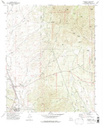
14 surveys from 27 printed sheetsMatched by testing this settlement's coordinate against the published boundary of every sheet in the United States Geological Survey's historical collection. Each opens the scanned sheet at the Survey.
- 1887 USGS Prescott quadrangle1:250000
- 1892 USGS Prescott quadrangle1:250000, 5 printings
- 1905 USGS Jerome quadrangle1:125000, 2 printings
- 1944 USGS Mingus Mountain quadrangle1:62500
- 1944 USGS Mingus Mtn quadrangle1:62500, 3 printings
- 1947 USGS Mingus Mtn quadrangle1:62500
- 1950 USGS Prescott quadrangle1:250000
- 1954 USGS Prescott quadrangle1:250000, 4 printings
- 1958 USGS Prescott quadrangle1:250000
- 1959 USGS Prescott quadrangle1:250000, 2 printings
- 1960 USGS Prescott quadrangle1:250000, 2 printings
- 1965 USGS Prescott quadrangle1:250000
- 1973 USGS Humboldt quadrangle1:24000
- 1981 USGS Prescott quadrangle1:100000, 2 printings
Fires near this place
114 since 1994Regional context, not property-specific evidence. The federal wildfire occurrence database lists 114 fires within 5 miles of Humboldt between 1994 and 2020, burning about 369 acres in total. 2 started naturally. 2 were recorded as arson. Distance is straight-line from the map coordinates, so a fire counted here may appear on a neighbouring settlement's page as well.
| Reported cause | Fires |
|---|---|
| Missing data/not specified/undetermined | 96 |
| Equipment and vehicle use | 4 |
| Debris and open burning | 3 |
| Arson/incendiarism | 2 |
| Natural | 2 |
| Misuse of fire by a minor | 2 |
| Power generation/transmission/distribution | 2 |
| Smoking | 1 |
| Railroad operations and maintenance | 1 |
| Recreation and ceremony | 1 |
The most recent of them, most recent first, with the day each was reported and the service that recorded it.
| Date | Cause | Size | Reported by | Name on the report |
|---|---|---|---|---|
| 8 September 2011 | Missing data/not specified/undetermined | under an acre | Arizona Department of Forestry and Fire Management - State Office | AZ-110331 |
| 8 September 2002 | Equipment and vehicle use | under an acre | Arizona Department of Forestry and Fire Management - State Office | LUZENA |
| 4 September 2019 | Missing data/not specified/undetermined | 1.5 acres | Arizona Department of Forestry and Fire Management - Northwest District | DEWEY |
| 20 September 2019 | Missing data/not specified/undetermined | under an acre | Central Arizona Fire and Medical Authority | NOT NAMED |
| 2 September 2012 | Missing data/not specified/undetermined | under an acre | Arizona Department of Forestry and Fire Management - State Office | AZ-121578 |
| 1 September 2019 | Power generation/transmission/distribution | under an acre | Central Arizona Fire and Medical Authority | NOT NAMED |
| 9 August 2013 | Missing data/not specified/undetermined | under an acre | Arizona Department of Forestry and Fire Management - State Office | AZ-131913 |
| 8 August 2003 | Smoking | under an acre | Phoenix District Office | POLAND |
Settlements close enough to share some of these fires:
Mines and quarries near this place
10 of 89 shownRegional context, not property-specific evidence. The federal mineral resources record lists 89 workings within 5 miles of Humboldt: 31 past producers, 21 prospects, 16 producers, 13 unknowns. 16 still produce. What was taken out: Gold, Copper, Gold, Silver, Silver. Distance is straight-line from the map coordinates, so a quarry counted here may appear on a neighbouring settlement's page as well.
| Where | Site | Commodity | Status | Recorded |
|---|---|---|---|---|
| Arizona National | Silver, Lead, Zinc, Gold, Copper | Past Producer | ||
| Big Bug District | Zinc, Lead, Gold, Copper, Silver | Occurrence | ||
| Butternut Mine | Gold, Copper, Silver, Zinc, Arsenic | Producer | 1902, 1946 | |
| Butternut Property | Copper, Lead, Silver, Zinc, Gold | Past Producer | ||
| California | Gold, Silver, Zinc, Copper, Lead | Past Producer | ||
| Copper Queen Mine | Copper, Silver, Gold, Zinc, Arsenic | Past Producer | 1901, 1967 | |
| Dewey Ranch Clay No. 1 | Clay | Past Producer | Clay | |
| Gladstone-Mccabe Mine | Gold, Silver, Lead, Copper, Iron, Zinc, Silica, Arsenic, Antimony, Sulfur | Producer | 1885 | |
| Henrietta Mine | Gold, Lead, Copper, Silver | Producer | Vein | |
| Hull Property | Copper, Lead, Gold, Silver, Zinc | Past Producer |
Storms near this place
21 since 1996Regional context, not property-specific evidence. The National Weather Service names Humboldt in 21 storm reports between 1996 and 2025: 14 flash flood, 5 hail, 1 lightning, 1 heavy rain. No death or injury is recorded in these reports. Each account below is quoted exactly as the forecast office filed it, from the NOAA Storm Events Database, and each date opens the federal record of that event.
| When | Event | Place named | Harm | What the report says |
|---|---|---|---|---|
| August 1999 | Lightning | Humboldt | $100,000 | Lightning struck a residential home in Humboldt, igniting a roof fire. |
| October 2015 | Hail | Humboldt | $1,000 | Up to two inches of 1/4 inch diameter hail covered the ground at the junction of State Route 69 and 169. Snow plows were called out to clear the hail off of the roads. |
| July 2025 | Flash Flood | Humboldt | - | A USGS stream gauge reported a rise of 5.01 feet on the Agua Fria River near Humboldt. |
| August 2025 | Flash Flood | Humboldt | - | A USGS stream gauge on the Agua Fria River near Humboldt (AFHA3) recorded a rise of 5.91 feet. |
| November 2025 | Flash Flood | Humboldt | - | A USGS stream gauge on the Agua Fria River (AFHA3) near Dewey-Humboldt measured a 3 foot rise. Peak flow was measured at 458 cfs. |
| July 2024 | Flash Flood | Humboldt | - | The USGS stream gauge along the Agua Fria River near Humboldt (AFHA3) reported a 7.86 foot rise starting at around 700 PM, peaking at around 9 PM, and retrning to near normal at around 1 AM. The Agua Fria River gauge near Mayer (AFMA03) began to rise at around 100 AM, rose 2.5 feet by 200 AM, and the dropped to near normal at 1200 PM on the 15th.||There was a Swift water rescue at 835 PM off of Bradshaw Mountain Road in the Quailwood Subdivision (Agua Fria River). Vehicle in the water with two occupants. Report from spotter on social media. |
| August 2022 | Heavy Rain | Humboldt | - | Heavy rain with yard flooding was reported near Dewey-Humboldt. Pea sized hail was also reported. |
| August 2022 | Hail | Humboldt | - | A thunderstorm produced one inch diameter hail, heavy rain, and gusty winds (around 28 MPH). |
| August 2022 | Flash Flood | Humboldt | - | The river gauge on Agua Fria measured a 5 foot rise in 15 minutes (starting at 1215 PM MST). |
| July 2021 | Flash Flood | Humboldt | - | The river gauge on the Agua Fria River near Humboldt measured a 6 foot rise. |
| July 2021 | Flash Flood | Humboldt | - | The Agua Fria river gauge near Dewey-Humboldt measured a 6.5 foot rise around 1800 on July 24. The river gauge near Cordes Junction reported a 6.7 foot rise around 240 AM on July 25.. |
| September 2019 | Flash Flood | Humboldt | - | The Agua Fria river gauge near Humbolt showed a 4 feet rise between 815 and 845 PM. |
| July 2018 | Flash Flood | Humboldt | - | Heavy rain from thunderstorms over the Goodwin Fire scar and the surrounding areas created flash flooding in the Big Bug Creek and the Agua Fria River system all the way down to Lake Pleasant. ||0540 PM FLASH FLOOD MAYER 34.40N 112.23W|07/16/2018 YAVAPAI AZ MESONET || |The Big Bug Creek gauge at Mayer reported at 1.9 foot rise at 540 PM MST. ||The Agua Fria gauge at Humboldt rose from 1.7 feet to 11.7 feet at 545 PM MST. ||The Agua Fria river gauge at Kelton Ranch reported a 4.7 foot rise at 940 PM MST. ||The Agua Fria river gauge near Black Canyon City a 3 foot rise in 10 minutes at 210 AM on July 17. This gauge showed another 3.31 foot rise between 500 AM and 600 AM MST. |
| August 2018 | Flash Flood | Humboldt | - | A swift water rescue was conducted along Prescott Street at the low water crossing of Agua Fria Wash. A motorist tried to cross the flooded roadway. The water was about 12 inches deep. |
| July 2017 | Flash Flood | Humboldt | - | The river gauge on the Agua Fria River at Humbuldt showed a rapid 4 foot rise. This was below the Goodwin Fire scar. |
| July 2017 | Flash Flood | Humboldt | - | The Agua Fria River near Humboldt rose from 1.46 feet to 4.12 feet in about an hour. |
| July 2006 | Hail | Humboldt | - | Quarter sized hail fell in Humbolt with 60 MPH wind and heavy rain. |
| September 2005 | Hail | Humboldt | - | Nickel to quarter sized (7/8 to 1 inch diameter) hail fell in Humbolt for at least 10 minutes. |
| July 2004 | Hail | Humboldt | - | A spotter in Humboldt reported 3/4 inches diameter hail and two inches of rain in 30 minutes. |
| August 2004 | Flash Flood | Humboldt | - | The Agua Fria River was up 6 feet and washed out the Prescott Drive low water crossing in Humboldt. |
| September 1996 | Flash Flood | Humboldt | - | no account filed |
Nearest settlements
The eight closest, with where each one stands in the county. Distances are straight-line, computed from the Geographic Names Information System coordinates.
| Map | Place | Distance | Sheets |
|---|---|---|---|
| Dewey | 2.0 miles | 27 | |
| Dewey-Humboldt | 2.0 miles | 27 | |
| Blue Hills Farms | 3.4 miles | 30 | |
| Poland Junction | 3.8 miles | 33 | |
| Hecla | 6.7 miles | 28 | |
| Mayer | 7.1 miles | 29 | |
| Breezy Pines | 7.5 miles | 33 | |
| Walker | 8.1 miles | 31 |
Provenance
This settlement is recorded in the Geographic Names Information System as feature 30280. The sheet list is computed by point-in-boundary test against the United States Geological Survey's historical topographic inventory. Both are works of the United States government and carry no copyright under 17 U.S.C. 105.
Wildfire. Short, Karen C. 2022. Spatial wildfire occurrence data for the United States, 1992-2020 [FPA_FOD_20221014]. 6th Edition. Fort Collins, CO: Forest Service Research Data Archive. https://doi.org/10.2737/RDS-2013-0009.6 Collected with United States Government funding and usable without additional permissions or fees.
Mines and quarries. USGS Mineral Resources Data System (MRDS) https://mrdata.usgs.gov/mrds/ A work of the United States government, no copyright under 17 U.S.C. 105.
Storms. NOAA National Centers for Environmental Information, Storm Events Database https://www.ncei.noaa.gov/stormevents/ A work of the United States government, no copyright under 17 U.S.C. 105. Narratives are quoted verbatim from the National Weather Service report and are not edited or summarised.