 Block
Punkin Center, Arizona
22 topographic sheets cover this place, the earliest surveyed in 1907 and the latest in 2004. It stands in the Tonto Basin census division. It lies in ZIP code area 85553. It stands on Reno Creek. The Survey maps it on the Tonto Basin quadrangle.
Topographic sheets covering this place
12 surveys from 22 printed sheetsMatched by testing this settlement's coordinate against the published boundary of every sheet in the United States Geological Survey's historical collection. Each opens the scanned sheet at the Survey.
- 1907 USGS Roosevelt quadrangle1:125000, 2 printings
- 1909 USGS Four Peaks quadrangle1:125000
- 1909 USGS Roosevelt quadrangle1:125000
- 1912 USGS Roosevelt quadrangle1:125000, 4 printings
- 1954 USGS Mesa quadrangle1:250000, 4 printings
- 1957 USGS Mesa quadrangle1:250000
- 1958 USGS Mesa quadrangle1:250000
- 1960 USGS Mesa quadrangle1:250000
- 1964 USGS Mesa quadrangle1:250000
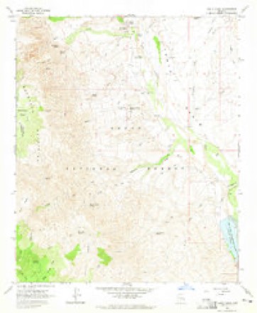
- 1964 USGS Tonto Basin quadrangle1:24000, 2 printings
- 1994 USGS Theodore Roosevelt Lake quadrangle1:100000, 3 printings
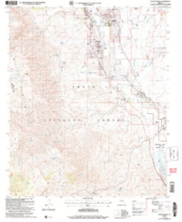
- 2004 USGS Tonto Basin quadrangle1:24000





Fires near this place
113 since 1992Regional context, not property-specific evidence. The federal wildfire occurrence database lists 113 fires within 5 miles of Punkin Center between 1992 and 2020, burning about 4,217 acres in total. 57 started naturally. 2 were recorded as arson. Distance is straight-line from the map coordinates, so a fire counted here may appear on a neighbouring settlement's page as well.
| Reported cause | Fires |
|---|---|
| Natural | 57 |
| Missing data/not specified/undetermined | 34 |
| Equipment and vehicle use | 7 |
| Debris and open burning | 5 |
| Smoking | 3 |
| Arson/incendiarism | 2 |
| Recreation and ceremony | 2 |
| Power generation/transmission/distribution | 1 |
| Railroad operations and maintenance | 1 |
| Misuse of fire by a minor | 1 |
The most recent of them, most recent first, with the day each was reported and the service that recorded it.
| Date | Cause | Size | Reported by | Name on the report |
|---|---|---|---|---|
| 3 September 1994 | Natural | under an acre | Tonto National Forest | not named |
| 29 September 2004 | Missing data/not specified/undetermined | under an acre | Tonto National Forest | BAR X |
| 24 September 2005 | Missing data/not specified/undetermined | 2.0 acres | Tonto National Forest | HAPPY |
| 19 September 2009 | Equipment and vehicle use | under an acre | Tonto National Forest | PUNKIN |
| 18 September 1995 | Natural | under an acre | Tonto National Forest | CRAWFORD |
| 14 September 2017 | Missing data/not specified/undetermined | under an acre | Tonto National Forest | LANN |
| 12 September 2016 | Natural | under an acre | Tonto National Forest | WALNUT |
| 1 September 2017 | Missing data/not specified/undetermined | under an acre | Tonto National Forest | HARDI |
Settlements close enough to share some of these fires:
Mines and quarries near this place
9 within 5 milesRegional context, not property-specific evidence. The federal mineral resources record lists 9 workings within 5 miles of Punkin Center: 3 past producers, 2 prospects, 2 producers, 2 occurrences. 2 still produce. What was taken out: Fluorine-Fluorite, Clay, Zeolites, Sand and Gravel, Construction. Distance is straight-line from the map coordinates, so a quarry counted here may appear on a neighbouring settlement's page as well.
| Where | Site | Commodity | Status | Recorded |
|---|---|---|---|---|
| Gravel Pit | Sand and Gravel, Construction | Past Producer | ||
| Kathy Claims | Uranium | Prospect | ||
| Sun Valley Crushing Co Pit | Stone, Crushed/Broken | Producer | ||
| Tonto Basin Chabazite Deposit | Zeolites | Occurrence | Chabazite | |
| Clay Deposit | Clay | Prospect | ||
| Clay Deposit | Clay | Occurrence | ||
| Packard | Fluorine-Fluorite | Past Producer | 1938 | |
| Packard Mine | Fluorine-Fluorite | Past Producer | 1938 | |
| Tonto Mining & Milling | Fluorine-Fluorite | Producer |
Storms near this place
22 since 1997Regional context, not property-specific evidence. The National Weather Service names Punkin Center in 22 storm reports between 1997 and 2024: 10 flash flood, 7 thunderstorm wind, 3 flood, 1 heavy rain. The reports record 3 deaths. Each account below is quoted exactly as the forecast office filed it, from the NOAA Storm Events Database, and each date opens the federal record of that event.
| When | Event | Place named | Harm | What the report says |
|---|---|---|---|---|
| November 2019 | Flood | Punkin Center | 3 killed, $50,000 | A powerful Pacific low pressure system moving slowly east across Arizona interacted with deep moisture to produce widespread moderate to heavy rain across the higher terrain areas to the north and east of Phoenix during the morning hours on November 29th. Initially the heavy rain led to flash flooding and caused area washes and creeks to flow heavily. Water rose above action stage in Tonto Creek by mid morning, and continued to rise into the afternoon hours. According to local law enforcement, at about 1600MST a large vehicle drove around barriers and attempted to cross flooded Tonto Creek about 3 miles to the southeast of Punkin Center. The vehicle contained at least 2 adults and 7 children. The vehicle was swept away by rapidly flowing flood waters; the 2 adults were rescued along with 4 of the children. However, 3 of the children did not survive. 2 were rescued rather quickly but the third, a 6 year old girl, was not found until at least 2 weeks later after extensive search and rescue efforts. An Areal Flood Warning was in effect at the time the vehicle was swept away. |
| January 2008 | Flash Flood | Punkin Center | $100,000 | Law enforcement reported about 80 people had to be evacuated as flood waters from the Tonto Creek affected portions of Tonto Basin. A spotter in Tonto Basin reported part of a road being washed out. A power outage affected about 2,300 homes and was blamed on flooding when power poles near the creek were taken down. A small dike gave way which resulted in additional flooding of homes and roads. The Red Cross opened a shelter at the Tonto Basin Kiwanis Club and the Tonto Basin School. Gila County declared an emergency due to the flooding. |
| July 2020 | Debris Flow | Punkin Center | $50,000 | Debris flow pushed over State Route 188 and into Roosevelt Lake in Gila county after a radar estimated 1.5-3 inches of rain fell over a portion of the 2020 Bush Fire burn scar. The debris flow was near mile post 253 and led to the closing of a 13 mile stretch of SR-188 in order for heavy equipment to remove roughly 20,000 cubic yards of sediment and boulders and to repair guard railing on one side of the road. It was determined through collaboration between NWS and Arizona Geological Survey (AZGS) that this event was classified as debris flow. For information only, labor costs, fuel costs, and costs to remove the sediment and reopen the road, in addition to the property damage, was estimated around $500,000 for this and the other event location. |
| December 2007 | Flood | Punkin Center | $50,000 | Flood waters in the Tonto Creek caused road closures in the Tonto Basin area. Residents received assistance at the Tonto Basin Fire Department Annex on Elm Street. |
| September 2010 | Flash Flood | Punkin Center | $40,000 | Thunderstorms with very heavy rainfall produced flash flooding in the Tonto Basin as well as the area around Punkin Center. DPS officers reported rock and mudslides along Highway 188 north of Roosevelt Lake, near A-Cross Road and MP-254. ADOT reported a six-foot deep layer of debris that blocked access to roosevelt Lake for most of the day. In addition trained weather spotters reported 3.25 inches of rain and flash flooding in the warned area. |
| July 2008 | Thunderstorm Wind | Punkin Center | $25,000 | Winds knocked a 40 foot motor home on its side and took down power poles and trees in Punkin Center. Winds damaged a 20 foot section of a roof and blew down a TV antenna at Roosevelt Lakes Estates. |
| February 2020 | Flash Flood | Punkin Center | $20,000 | Widespread rain across the high terrain east of Phoenix on Saturday February 22nd led to areal flooding in the Tonto Creek basin north of Lake Roosevelt. Early in the morning on February 23rd, a fresh batch of showers and weak thunderstorms occurred which produced another period of moderate to heavy rain. The additional rain fell in a short period on already saturated ground and led to a rapid rise in the streamflow on Tonto Creek and as a result flash flooding occurred. According to local broadcast media, at 0140MST a motorist needed to be rescued while trying to cross Tonto Creek at the store crossing in Punkin center. The motorist was not injured. While a flash flood warning was not in effect at the time of the rescue, an areal flood warning remained in effect for the area; the warning was issued during the middle of the day on Saturday the 22nd. |
| August 2021 | Flash Flood | Punkin Center | $10,000 | Arizona Department of Transportation closed State Route 188 in both directions due to a mudslide across the highway. Initially the closure was between mile posts 246 and 255, but was updated to between 252 and 255. The mudslide was around mile post 253 and was the same location as a debris flow in July 2020. Runoff may have been enhanced by the 2020 Bush Fire burn area. Photos of the mud slide show roughly 1 to 3 feet of sediment, with burnt tree branches and twigs, across the highway and the guardrail in the southbound lane was destroyed. No injuries or additional damages were reported. |
| September 2019 | Thunderstorm Wind | Punkin Center | $10,000 | Strong thunderstorms developed across the higher terrain northeast of Phoenix during the afternoon hours September 1st. One of the stronger storms generated gusty and damaging outflow winds that affected the community of Punkin Center. According to a trained spotter located about 2 miles northeast of Punkin Center, at 1605MST gusty winds estimated as high as 70 mph ripped off all of the shingles on one side of a home along with the tar paper. Additionally, some mobile homes in the area suffered damage to their roofs and awnings. No injuries were reported due to the high winds. |
| August 2024 | Thunderstorm Wind | Punkin Center | $5,000 | Powerlines down in the Tonto Basin area, affecting approximately 1338 customers. Wind gusts were estimated upwards of 55-60 mph. No injuries were reported. |
| September 2010 | Heavy Rain | Punkin Center | $5,000 | A COOP observer in Punkin Center reported that 3.87 inches of rain fell since 0200 MST. A spotter in Tonto Basin reported washes being filled, with water over the banks by about 6 am MST. |
| July 2003 | Thunderstorm Wind | Punkin Center | $5,000 | Winds damaged part of a boat storage facility, uprooted a large tree, and resulted in a power outage for up to 5 hours. |
| June 2024 | Thunderstorm Wind | Punkin Center | - | A 74 mph wind gust was measured at the Tonto Basin RAWS station. Timing estimated from radar. |
| August 2022 | Flood | Punkin Center | - | A video showed high flow in Tonto Creek made unbridged crossings across the creek impassable. An upstream USGS stream gage along the creek climbed above action stage, peaking at a depth of 5.62 feet at 1915MST. No damage or injuries were reported. |
| October 2021 | Flash Flood | Punkin Center | - | Arizona Department of Transportation reported State Route 188 was closed between mile post 251 and 255 due to a mudslide. Photos show 4 to 6 feet of mud across the highway near mile post 253 that had to be cleared with heavy machinery. Flow originated from a portion of the 2020 Bush fire burn scar. NWS Phoenix in collaboration with Arizona Geological Survey declared the mudslide a hyperconcentrated flow and therefore entered as a flash flood. Timing estimated from radar. No damage or injuries were reported. |
| October 2021 | Thunderstorm Wind | Punkin Center | - | RAWS station TTBA3 in Tonto Basin measured a 61 mph wind gust. |
| July 2021 | Flash Flood | Punkin Center | - | A USGS stream gage along Tonto Creek above Gun Creek recorded a rapid rise, peaking above 6.9 feet, with high flow exceeding action stage. Flash flooding impacted unbridged crossings along Tonto Creek downstream of the gage. The public confirmed the closure of unbridged crossings due to the flooding. Timing was estimated from the gage reaching action stage. No damage or injuries were reported. |
| August 2021 | Flash Flood | Punkin Center | - | Multiple photos and videos show significant flow within the typically dry Reno Creek with flow over Old Highway 188, leading to its closure. Runoff may have been enhanced by the 2020 Bush Fire burn area. Reno Creek would experience another flash flood again in the early afternoon following another round of heavy rain upstream. This kept 188 closed for an extended period. No damages or injuries were reported. |
| August 2021 | Flash Flood | Punkin Center | - | Photos and videos show considerable floodwaters, roughly a few feet deep, rapidly moving down Reno Creek and flowing across Old Highway 188, making it impassable. Runoff may have been enhanced by the 2020 Bush Fire burn area. Reno Creek flooded earlier in the morning as well. No damages or injuries were reported. |
| July 2010 | Thunderstorm Wind | Punkin Center | - | Very strong thunderstorm winds, gusting to 60 mph, downed a number of branches. Locally heavy rain was reported as well, with one half of an inch reported in just 30 minutes. |
| July 2008 | Flash Flood | Punkin Center | - | Washes and low spots flooded after very heavy rains struck the area. |
| October 1997 | Flash Flood | Punkin Center | - | Flooding occurred across Highway 188 south of Punkin Center. A foot of mud debris moved onto the highway. |
Nearest settlements
The eight closest, with where each one stands in the county. Distances are straight-line, computed from the Geographic Names Information System coordinates.
| Map | Place | Distance | Sheets |
|---|---|---|---|
| Rancho Del Escondido | 1.1 miles | 22 | |
| Roosevelt Lake Gardens West | 1.5 miles | 22 | |
| Riverside Acres | 1.9 miles | 22 | |
| Tonto Basin | 3.0 miles | 22 | |
| Roosevelt Lake Gardens East | 4.3 miles | 22 | |
| Jakes Corner | 9.6 miles | 23 | |
| Coffeepot | 13.3 miles | 22 | |
| Gallups | 15.7 miles | 22 |
Provenance
This settlement is recorded in the Geographic Names Information System as feature 33230. The sheet list is computed by point-in-boundary test against the United States Geological Survey's historical topographic inventory. Both are works of the United States government and carry no copyright under 17 U.S.C. 105.
Wildfire. Short, Karen C. 2022. Spatial wildfire occurrence data for the United States, 1992-2020 [FPA_FOD_20221014]. 6th Edition. Fort Collins, CO: Forest Service Research Data Archive. https://doi.org/10.2737/RDS-2013-0009.6 Collected with United States Government funding and usable without additional permissions or fees.
Mines and quarries. USGS Mineral Resources Data System (MRDS) https://mrdata.usgs.gov/mrds/ A work of the United States government, no copyright under 17 U.S.C. 105.
Storms. NOAA National Centers for Environmental Information, Storm Events Database https://www.ncei.noaa.gov/stormevents/ A work of the United States government, no copyright under 17 U.S.C. 105. Narratives are quoted verbatim from the National Weather Service report and are not edited or summarised.