 Block
Sun City, Arizona
19 topographic sheets cover this place, the earliest surveyed in 1954 and the latest in 1988. It stands in the Phoenix census division. It lies in ZIP code area 85351. The Survey maps it on the El Mirage quadrangle. 39,931 people lived here at the 2020 count. It stands 1,142 feet above sea level.
On record in Sun City
Buildings and businesses the archive holds for this place. Each opens its own page, with the source record it came from.
On the National Register 1 record
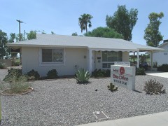 Sun City DEVCO Model No.1listed 2015
Population over time
2 figuresSun City grew from 37,499 to 39,931 between 2010 and 2020. These are the recorded population figures Wikidata holds for this place, reached through the Geographic Names Information System number this page is keyed on rather than by name, so they belong to this place and not to another of the same name. Most are census counts, but not all are: an early figure may be a founding or settlement estimate, and an estimate published within five years of a census is left out. The change column is computed, and is left blank where more than 20 years separate a figure from the one before it, because a gap that long is not a change between two counts.
| Year | People | Change |
|---|---|---|
| 2010 | 37,499 | |
| 2020 | 39,931 | +2,432 (+6%) |
Topographic sheets covering this place
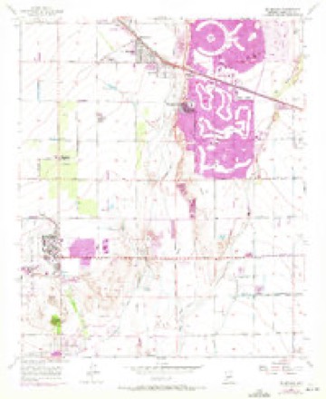
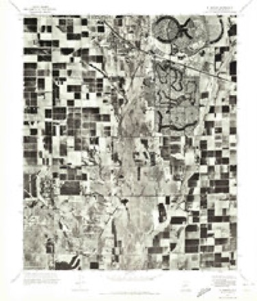
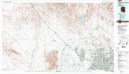
9 surveys from 19 printed sheetsMatched by testing this settlement's coordinate against the published boundary of every sheet in the United States Geological Survey's historical collection. Each opens the scanned sheet at the Survey.
- 1954 USGS Phoenix quadrangle1:250000, 5 printings
- 1957 USGS El Mirage quadrangle1:24000, 5 printings
- 1957 USGS Phoenix quadrangle1:250000
- 1958 USGS Phoenix quadrangle1:250000
- 1960 USGS Phoenix quadrangle1:250000
- 1969 USGS Phoenix quadrangle1:250000, 2 printings
- 1971 USGS El Mirage quadrangle1:24000
- 1971 USGS Phoenix quadrangle1:250000
- 1988 USGS Phoenix North quadrangle1:100000, 2 printings






Fires near this place
663 since 1992Regional context, not property-specific evidence. The federal wildfire occurrence database lists 663 fires within 5 miles of Sun City between 1992 and 2020, burning about 319 acres in total. 6 started naturally. 19 were recorded as arson. Distance is straight-line from the map coordinates, so a fire counted here may appear on a neighbouring settlement's page as well.
| Reported cause | Fires |
|---|---|
| Missing data/not specified/undetermined | 621 |
| Arson/incendiarism | 19 |
| Equipment and vehicle use | 6 |
| Natural | 6 |
| Power generation/transmission/distribution | 5 |
| Misuse of fire by a minor | 2 |
| Smoking | 2 |
| Other causes | 1 |
| Debris and open burning | 1 |
The most recent of them, most recent first, with the day each was reported and the service that recorded it.
| Date | Cause | Size | Reported by | Name on the report |
|---|---|---|---|---|
| 9 September 2011 | Missing data/not specified/undetermined | under an acre | Arizona Department of Forestry and Fire Management - State Office | AZ-110821 |
| 7 September 2015 | Missing data/not specified/undetermined | under an acre | Arizona Department of Forestry and Fire Management - State Office | 154088 |
| 6 September 2019 | Missing data/not specified/undetermined | under an acre | El Mirage Fire Department | NOT NAMED |
| 6 September 2019 | Missing data/not specified/undetermined | under an acre | Sun City Fire Department | NOT NAMED |
| 6 September 2013 | Missing data/not specified/undetermined | under an acre | Arizona Department of Forestry and Fire Management - State Office | AZ-133152 |
| 4 September 2018 | Equipment and vehicle use | under an acre | El Mirage Fire Department | 3065 |
| 30 September 2017 | Missing data/not specified/undetermined | under an acre | Sun City Fire Department | not named |
| 30 September 2012 | Missing data/not specified/undetermined | under an acre | Arizona Department of Forestry and Fire Management - State Office | AZ-121841 |
Settlements close enough to share some of these fires:
Mines and quarries near this place
9 within 5 milesRegional context, not property-specific evidence. The federal mineral resources record lists 9 workings within 5 miles of Sun City: 5 producers, 3 past producers, 1 unknown. 5 still produce. What was taken out: Sand and Gravel, Construction, Halite, Mica, Salt. Distance is straight-line from the map coordinates, so a quarry counted here may appear on a neighbouring settlement's page as well.
| Where | Site | Commodity | Status | Recorded |
|---|---|---|---|---|
| Agua Fria Pit Sun Valley Crushing | Sand and Gravel, Construction, Stone, Crushed/Broken | Past Producer | ||
| Alonzo Elder Muscovite #1 | Mica | Producer | ||
| Southwest Mine & Mill | Salt | Producer | ||
| Unidentified Halite Occurrence | Halite | Past Producer | Halite | |
| Arizona Sand & Rock, Agua Fria Plan | Sand and Gravel, Construction | Producer | ||
| Gravel Pit | Sand and Gravel, Construction | Unknown | ||
| Sand and Gravel Quarry | Sand and Gravel, Construction | Past Producer | Sand and Gravel | |
| Union Rock & Materials, El Mirage | Sand and Gravel, Construction | Producer | ||
| United Metro Pit & Plant #2 Glendal | Sand and Gravel, Construction | Producer |
Storms near this place
33 since 1996Regional context, not property-specific evidence. The National Weather Service names Sun City in 33 storm reports between 1996 and 2025: 17 thunderstorm wind, 4 flash flood, 3 funnel cloud, 3 heavy rain. No death or injury is recorded in these reports. Each account below is quoted exactly as the forecast office filed it, from the NOAA Storm Events Database, and each date opens the federal record of that event.
| When | Event | Place named | Harm | What the report says |
|---|---|---|---|---|
| August 2003 | Lightning | Sun City | $150,000 | Lightning was blamed on a fire which destroyed a house in Sun City West. |
| July 2005 | Thunderstorm Wind | Sun City | $100,000 | Power lines down, trees uprooted, and shingles blown off roofs across a large portion of northwest Phoenix. At least 30 trees were downed by winds at the Palm Ridge Rrecreation Center in Sun City West. One automatic weather station at the White Tank mountains measured the 60 mph gust. |
| July 2021 | Flash Flood | Sun City | $50,000 | Multiple water rescues were reported in Sun City, including 98th Avenue and Granada Drive as well as 99th Avenue and Burns Drive. A flood control channel along the center of 99th Avenue was also reported to be overflowing onto the street. As a result, a Maricopa County Sheriff's Office deputy stopped southbound traffic at Desert Rock Drive due to the depth of the water. No injuries were reported. |
| November 2013 | Thunderstorm Wind | Sun City | $50,000 | Isolated thunderstorms developed across western Maricopa county during the early evening hours on November 4th, and the moved into the greater Phoenix area by 1900 MST. The storms affected communities such as Peoria and Surprise. A few storms generated gusty winds estimated to be in excess of 40 mph. According to local broadcast media, wind gusts blew down several trees which damaged cars at the Arrowhead Honda dealership located near the intersection of the Loop 101 and Bell Road. No injuries were reported. |
| August 2022 | Thunderstorm Wind | Sun City | $40,000 | Several images showed downed power lines and multiple snapped power poles along Cactus Road between 91st Avenue and 83rd Avenue. Most poles were wooden, but there was at least one metal pole that fell down across the road. Timing estimated from radar. No injuries were reported. |
| September 2025 | Flash Flood | Sun City | $20,000 | Water rescue reported near the area of 99th Avenue and Thunderbird Road in Sun City. No injuries reported. |
| January 2021 | Thunderstorm Wind | Sun City | $20,000 | A cold front associated with a strong winter storm moved east across the western portion of the greater Phoenix area during the early afternoon hours on January 25th. A line of strong to severe thunderstorms associated with the front generated some gusty and damaging outflow winds that affected areas around Sun City. According to reports from local broadcast media, at 1336MST gusty winds estimated up to 60 mph ripped the roof off a home and also ripped off roof singles from a few other homes in Sun City; the winds also downed a couple of Palo Verde trees and blew down some fencing. The damage occurred about 1 mile northeast of Youngtown, and along 107th Avenue just to the south of Alabama Avenue. An outdoor COVID-19 vaccination site near Sun City also experienced some minor damage from the strong winds that moved through the area. There were no reports of injuries due to the damaging winds. |
| July 2018 | Thunderstorm Wind | Sun City | $20,000 | Thunderstorms with strong, gusty outflow winds moved across the northern portions of the greater Phoenix metropolitan area during the evening hours on July 30th; some of the stronger storms generated gusty outflow winds estimated to be in excess of 60 mph. Some of the storms impacted the area around the town of Youngtown. According to a report from the public, at 1950MST the American Legion post 2 miles east of Youngtown lost 3 trees; the trees were blown over by outflow winds estimated to be at least 65 mph in strength. The trees fell onto and damaged 2 cars. The post was located near the intersection of Peoria Avenue and 99th Avenue, just west of the New River bank. |
| February 2008 | Lightning | Sun City | $20,000 | Lightning started an attic fire in Sun City and a house fire in Glendale. |
| July 2011 | Thunderstorm Wind | Sun City | $14,000 | Thunderstorms with damaging microburst winds moved through the Sun City area during the early evening hours on July 18th. The strong winds damaged a number of trees at several area golf courses. According to Brian Duthu, Director of golf, five trees, including palms and pines, were lost at Sun City North course. A peak wind gust of 56 mph was measured at the North course. Four trees were lost at the Lakes West golf course. In addition to the wind, locally heavy rain occurred with the storms. 1.65 inches of rain was recorded at the North course, however no significant flooding was reported with the heavy rainfall. |
| August 2022 | Thunderstorm Wind | Sun City | $8,000 | Images showed a destroyed carport with the metal roofing blown into nearby power lines at a mobile home community. Other images showed several large power poles tilted over along 91st Avenue north of Peoria Avenue. Timing estimated from radar. No injuries were reported. |
| July 2018 | Thunderstorm Wind | Sun City | $4,000 | Thunderstorms with gusty and damaging outflow winds moved across the northwest portion of the greater Phoenix metropolitan area during the evening hours on July 30th and some of the stronger storms affected the community of Sun City. According to a trained weather spotter, at 1940MST outflow winds estimated to be as high as 70 mph downed a large tree with a diameter of between 3 and 4 feet. The tree was knocked down at the northeast corner of 108th Drive and Thunderbird Road in Sun City. At the same time, another spotter reported a large tree downed 1 mile south of Sun City, at the intersection of 103rd Avenue and Thunderbird Road. This tree had a diameter between 2 and 3 feet. No injuries were reported. |
| July 2018 | Thunderstorm Wind | Sun City | $2,000 | Thunderstorms developed across the northern portion of the greater Phoenix area, including the town of Deer Valley, during the late afternoon hours on July 9th. The stronger storms generated gusty and damaging outflow winds in excess of 60 mph. According to a trained weather spotter 5 miles west of Deer Valley, gusty winds to near 65 mph downed a large tree. No injuries were reported. The downed tree was located just northeast of the intersection of 67th Avenue and the Loop 101. |
| July 2023 | Thunderstorm Wind | Sun City | $1,000 | Large tree down estimated to be 1.5 feet in diameter at the area of West Lakeview Road and North 93rd Avenue in Peoria. Wind gusts were estimated at 55-60 mph. No injuries were reported. |
| July 2023 | Thunderstorm Wind | Sun City | $1,000 | A large tree was knocked over in Sun City near 108th Ave and Thunderbird Road. Diameter of trunk estimated to be 2-3 ft. Wind gusts were estimated between 55-60 mph. No injuries were reported. |
| August 2020 | Thunderstorm Wind | Sun City | $1,000 | Isolated strong storms moved through northwest Phoenix around midday. Tree damage from thunderstorm downburst wind gusts was reported by a trained spotter driving on Loop-101. Various sized tree limbs were blown over onto parts of the Loop-101 southbound and adjacent business parking lots near Bell road. The spotter also reported a few cars on Loop-101 may have struck the tree debris and that Peoria Police Department was on the scene. No official damages were reported and no injuries were reported. |
| June 2024 | Thunderstorm Wind | Sun City | $500 | A tree branch estimated to be between 1 to 1.5 inches in diameter snapped due to strong winds from outflow boundary near the intersection of 67th Avenue and Loop 101 in Glendale. Gusts were estimated at 40-50 mph based on nearby surface observations. No injuries were reported. |
| July 2011 | Hail | Sun City | $500 | A strong thunderstorm moved across Youngtown during the early evening hours on July 18 and generated gusty winds in excess of 50 mph. A trained weather spotter reported marble sized hail ranging from one half to one inch in diameter. Visibility was lowered to around one mile in blowing dust and some tree branches were damaged. |
| September 2025 | Flash Flood | Sun City | - | John Cabot Road in Sun City was flooded. No damages or injuries reported. |
| September 2025 | Hail | Sun City | - | Photo of estimated quarter-sized hail along Western Desert Hills Drive in Sun Lakes. Location approximated based on radar. No damage or injuries reported. |
| September 2025 | Hail | Sun City | - | Hail measured at 3/4 of an inch in diameter at the intersection of 99th Street and Thunderbird Road in Sun City. No injuries or damage reported. |
| March 2014 | Heavy Rain | Sun City | - | Scattered showers and isolated thunderstorms developed across south central Arizona during the afternoon hours on March 1st as a strong, wet Pacific low pressure system moved across the state. Locally heavy rainfall occurred, affecting the greater Phoenix area including communities such as Youngtown and Peoria. According to a trained weather spotter, heavy rainfall near the Loop 101 and Peoria Avenue caused minor flooding along Peoria Avenue, and traffic was forced to come to a stop. The street flooding occurred at approximately 1550MST. The heavy rain and street flooding also led to the issuance of an Urban and Small Stream Flood Advisory at 1556MST. The advisory was in effect until 1756MST and included west valley communities such as Youngtown, Glendale and Peoria. |
| August 2014 | Heavy Rain | Sun City | - | Scattered thunderstorms developed across the northwest portion of the greater Phoenix metropolitan area during the late afternoon and early evening hours on August 12th, and the stronger storms produced locally heavy rainfall which led to urban flooding. At 1828MST at trained weather spotter 1 mile southeast of Peoria estimated that one half inch of rain fell within 30 minutes. The locally heavy rain also caused local street flooding. At the time, a Flash Flood Warning was in effect. |
| July 2010 | Thunderstorm Wind | Sun City | - | Winds over 70 mph in gusts were reported near the intersection of Jomax and 63rd Avenue. |
| July 2005 | Flash Flood | Sun City | - | Occupants of a stranded vehicle were rescued at 128th Ave and Galaxy. Spotters reported up to 1 inch of rain in just 45 minutes. |
| January 2001 | Lightning | Sun City | - | Lightning struck the roof of a store at 107th and Grand, resulting in a fire that damaged much of the store. |
| September 1999 | Heavy Rain | Sun City | - | About 2 inches of rain fell in about 2 hours. |
| September 1999 | Thunderstorm Wind | Sun City | - | Winds gusted to 81 mph along with 1.9 inches of rain in Sun City West. Portions of two roofs were removed and dozens of trees were blown over at the Grandview Golf Course. |
| August 1999 | Thunderstorm Wind | Sun City | - | Winds took down a few trees at Sun City golf courses. Small hail and heavy rain was also reported in the area. |
| August 1999 | Funnel Cloud | Sun City | - | no account filed |
| July 1996 | Thunderstorm Wind | Sun City | - | no account filed |
| July 1996 | Funnel Cloud | Sun City | - | no account filed |
| September 1996 | Funnel Cloud | Sun City | - | no account filed |
Nearest settlements
The eight closest, with where each one stands in the county. Distances are straight-line, computed from the Geographic Names Information System coordinates.
| Map | Place | Distance | Sheets |
|---|---|---|---|
| Sunset Village | 0.7 miles | 19 | |
| Villa Vista | 1.0 miles | 19 | |
| Casa del Sol Resorts Number One | 1.2 miles | 19 | |
| Peoria Polynesian Village | 1.3 miles | 19 | |
| White Tanks | 1.5 miles | 19 | |
| Youngtown | 1.7 miles | 19 | |
| Peoria Estates | 2.0 miles | 20 | |
| Peoria | 2.2 miles | 20 |
Elsewhere
Matched on this settlement's Geographic Names Information System number rather than its name, so it cannot be a different place of the same name in another state.
| Wikipedia article on Sun City | An encyclopaedic summary. Its text is share-alike, so it is linked here rather than copied. |
| Wikidata item Q1006586 | The structured record the population and elevation above come from. Public domain (CC0). |
Provenance
This settlement is recorded in the Geographic Names Information System as feature 11953. The sheet list is computed by point-in-boundary test against the United States Geological Survey's historical topographic inventory. Both are works of the United States government and carry no copyright under 17 U.S.C. 105.
Wildfire. Short, Karen C. 2022. Spatial wildfire occurrence data for the United States, 1992-2020 [FPA_FOD_20221014]. 6th Edition. Fort Collins, CO: Forest Service Research Data Archive. https://doi.org/10.2737/RDS-2013-0009.6 Collected with United States Government funding and usable without additional permissions or fees.
Mines and quarries. USGS Mineral Resources Data System (MRDS) https://mrdata.usgs.gov/mrds/ A work of the United States government, no copyright under 17 U.S.C. 105.
Storms. NOAA National Centers for Environmental Information, Storm Events Database https://www.ncei.noaa.gov/stormevents/ A work of the United States government, no copyright under 17 U.S.C. 105. Narratives are quoted verbatim from the National Weather Service report and are not edited or summarised.