 Block
From the record
One of 43 National Register listings published here for Gila County · listed in 2000 · category: Building.
Sources: the case file at the National Archives · the National Register database, National Park Service
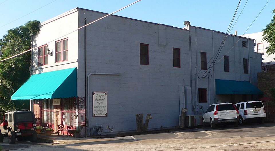
Listed on the National Register of Historic Places in 2000.
One of 43 National Register listings published here for Gila County · listed in 2000 · category: Building.
Sources: the case file at the National Archives · the National Register database, National Park Service
Regional context, not property-specific evidence. The federal wildfire occurrence database lists 109 fires within 5 miles of Soderman Building between 1992 and 2020, burning about 321 acres in total. 43 started naturally. 7 were recorded as arson. Distance is straight-line from the map coordinates, so a fire counted here may appear on a neighbouring settlement's page as well.
| Reported cause | Fires |
|---|---|
| Missing data/not specified/undetermined | 45 |
| Natural | 43 |
| Arson/incendiarism | 7 |
| Equipment and vehicle use | 5 |
| Recreation and ceremony | 3 |
| Debris and open burning | 3 |
| Power generation/transmission/distribution | 3 |
The most recent of them, most recent first, with the day each was reported and the service that recorded it.
| Date | Cause | Size | Reported by | Name on the report |
|---|---|---|---|---|
| 8 September 2017 | Missing data/not specified/undetermined | under an acre | Tri-City Fire District | not named |
| 8 September 1997 | Natural | 155 acres | Tonto National Forest | MUSKHOG |
| 6 September 1995 | Natural | under an acre | Tonto National Forest | BEAUTY |
| 30 September 1994 | Missing data/not specified/undetermined | 1.0 acres | Tonto National Forest | not named |
| 29 September 2018 | Missing data/not specified/undetermined | under an acre | Tri-City Fire District | 2703 |
| 29 September 2018 | Missing data/not specified/undetermined | under an acre | Globe Fire Department | 1433 |
| 25 September 2018 | Equipment and vehicle use | under an acre | Tri-City Fire District | 2663 |
| 23 September 2018 | Missing data/not specified/undetermined | under an acre | Globe Fire Department | 1408 |
Regional context, not property-specific evidence. The federal mineral resources record lists 88 workings within 5 miles of Soderman Building: 32 past producers, 26 producers, 14 prospects, 12 occurrences. 28 still produce. What was taken out: Copper, Gold, Gold, Silver, Manganese. Distance is straight-line from the map coordinates, so a quarry counted here may appear on a neighbouring settlement's page as well.
| Where | Site | Commodity | Status | Recorded |
|---|---|---|---|---|
| Azurite Mine | Clay | Occurrence | ||
| Castle Dome | Fluorine-Fluorite, Barium-Barite, Quartz, Copper | Occurrence | Solution-Cavity Filling | |
| Cedar Tree Deposit | Silver, Copper, Gold, Tungsten | Past Producer | ||
| Cedar Tree Mine | Lead, Copper, Silver, Gold, Zinc | Producer | 1913, 1933 | |
| Copper Cities & Diamond H | Copper, Gold, Zinc, Silver, Molybdenum, Lead, Uranium, Gemstone | Past Producer | 1896 | |
| Cyprus Miami | Copper, Molybdenum, Silver, Gold, Rhodium, Zinc, Lead, PGE | Producer | 1872, 1915 | |
| Day Peaks Area Veins | Molybdenum, Lead, Tungsten, Gold | Occurrence | Vein | |
| Dixon Group | Copper, Asbestos | Past Producer | ||
| Globe-Miami Pit | Sand and Gravel, Construction | Producer | ||
| Hoopes Lime Pit | Limestone, General | Past Producer | Sedimentary |
Regional context, not property-specific evidence. The National Weather Service names Miami, the town this property stands in, in 37 storm reports between 1999 and 2025: 22 flash flood, 7 heavy rain, 5 thunderstorm wind, 3 hail. No death or injury is recorded in these reports. Each account below is quoted exactly as the forecast office filed it, from the NOAA Storm Events Database, and each date opens the federal record of that event.
| When | Event | Place named | Harm | What the report says |
|---|---|---|---|---|
| July 2021 | Flash Flood | Miami | $40,000,000 | After 2.5-3.5 inches of rain fell over the northern portion of the Telegraph burn scar, runoff rapidly collected in Bloody Tanks Wash and flowed downstream through the town of Miami causing catastrophic damage. A rain gage in Russell Gulch to the south measured 2.01 inches of rain between 1316MST and 1414MST with a brief period where rain rates were as high as 8-9 inches per hour with 0.87 inches measured in 10 minutes. At 1438MST Arizona Department of Transportation (ADOT) reported US-60 was closed in both directions at mile post 243 due to water moving over the road. Between 1440MST and 1500MST, a trained spottered reported the flood water was coming out of the banks of the wash at the intersection of Canyon Avenue and US-60 and video showed 6 to 8 feet of flood water in the wash coming up to the base of multiple bridges between Sullivan Street and US-60. Water and mud spilled out of the wash near Cordova Avenue, with flow down Sullivan Street, and entered homes and businesses. ADOT ended up having US-60 closed in both directions between Miami and the town of Superior until 1920MST. According to Gila County Emergency Management and Arizona Department of Emergency and Military Affairs, approximately 600 homes and 10 businesses experienced some form of flood damage. No injuries were reported and the full extent of damage costs are unknown. |
| October 2025 | Flash Flood | Miami | $3,000,000 | U.S. 60 closed from Superior to Globe due to flooding in the Globe/Miami area with sections of the roadway, primarily near Milepost 241, washed away. No injuries reported. |
| September 2025 | Flash Flood | Miami | $100,000 | Floodwaters escaped the banks of Bloody Tanks Wash and came down the streets from the north leading to significant flash flooding in downtown Miami, with lots of mud and rocky debris. Floodwaters entered businesses on Sullivan St. The floodwaters led to the collapse of the front entrance wall of the Wild Horses Saloon on Sullivan St. Timing estimated from radar. No injuries reported. |
| July 2007 | Flash Flood | Miami | $20,000 | Spotter reported 2.75 inches of rain in less than one hour. Sheriffs office reported a swift-water rescue after many streets became flooded during the height of the storm. |
| July 2021 | Flash Flood | Miami | $10,000 | A local bridge along Mackey Camp Road reportedly washed out following a rapid rise in flood waters in Bloody Tanks Wash. Runoff may have been enhanced by the 2021 Telegraph burn scar. Timing based on upstream rain gage and radar. No injuries reported. |
| July 2018 | Thunderstorm Wind | Miami | $10,000 | Afternoon thunderstorms developed in the Globe and Miami area on July 29th, and one of the stronger storms produced gusty and damaging outflow winds that affected Miami and Claypool. According to a trained spotter in the town of Miami, at 1715MST the power was out in town due to nearby power lines that were snapped. at 1720MST a public report was received indicating power lines had been snapped between Claypool and Miami. The wind gusts that snapped the lines were estimated to be upwards of 60 mph. A Severe Thunderstorm Warning was issued for the area at 1707MST and it remained in effect through 1745MST. |
| September 2025 | Flash Flood | Miami | $5,000 | Video showed water raging down Chisholm Avenue in Miami. A couple of large black cylinder items were swept down the road by the floodwaters. Timing estimated from radar. No injuries reported. |
| August 2021 | Flash Flood | Miami | $5,000 | The Arizona Department of Transportation reported that US 60 was closed between Superior and Miami (mileposts 226-243) due to water over the roadway and erosion causing damage to a guardrail and right lane of the highway along Bloody Tanks Wash near milepost 242. No injuries were reported. |
| July 2022 | Thunderstorm Wind | Miami | $1,000 | A large Cypress tree fell onto a building causing some damage. |
| October 2025 | Flash Flood | Miami | - | Video showed very fast flowing water along Repply Avenue in Miami. No damages or injuries reported. |
| October 2025 | Flash Flood | Miami | - | Video shows a torrent of water moving down Latham Boulevard in Miami. No damages or injuries reported. |
| September 2025 | Hail | Miami | - | Quarter-sized hail reported in Miami. No damages or injuries reported. |
| September 2025 | Flash Flood | Miami | - | Video showed Loomis Ave in Miami was a raging river with a foot of water rapidly moving down the street. No damages or injuries reported. |
| September 2025 | Flash Flood | Miami | - | US-60 closed between Mile-marker 243 and Mile-marker 247, from Miami to AZ 188, due to flooding. A photo also showed a flooded Miami Ave in downtown Miami. No damages or injuries reported. |
| September 2025 | Flash Flood | Miami | - | Video from Miami Memorial Library showed several inches of water rapidly moving down Adonis Avenue. Timing estimated from radar. No damages or injuries reported. |
| September 2025 | Flash Flood | Miami | - | US 60 impassable near the Miami area. No damages or injuries reported. |
| September 2025 | Flash Flood | Miami | - | A damage assessment showed evidence of floodwaters escaping Bloody Tanks Wash near the US-60 bridge. Photos showed Reppy Ave just south of US-60 had significant flooding with the road covered curb to burb in a few inches of mud and rocks. No damages or injuries reported. |
| October 2022 | Flash Flood | Miami | - | A video showed flooding occurring from Bloody Tanks. Water was reaching the bottom of a bridge as well as going around it, briefly trapping the person recording the incident. The location of the incident was in the area of Schulze Ranch Road and U.S. 60. Timing estimated from radar. No damages or injuries were reported. |
| July 2022 | Flash Flood | Miami | - | A video posted on social media showed strong flow moving along the Bloody Tanks Wash, resulting a street crossing the wash near Mackey Camp to be completely impassable. No damages or injuries were reported. |
| August 2022 | Flash Flood | Miami | - | Videos showed considerable flow in Bloody Tanks Wash, impacting Schulze Ranch Road. No damage or injuries were reported. |
| July 2022 | Flash Flood | Miami | - | Social media video showed Bloody Tanks Wash in major elevated stage as it was flowing down the city of Miami. No damages or injuries were reported. |
| July 2021 | Flash Flood | Miami | - | A Tonto National Forest service member shared photos from a forest service road near Pinal Peak showing evidence of a flash flood with debris across the road, including boulders/rocks and tree branches strewn across the road. In coordination with the WFO Phoenix Senior Service Hydrologist, it would have taken at least 6 inches of flowing water to move the debris in the photos. There were no reports of damage or injuries. |
| July 2021 | Thunderstorm Wind | Miami | - | A trained weather spotter in Miami, AZ reported that severe thunderstorms knocked down a mature apple tree onto a church parking lot near Sullivan Street and Davis Canyon Road. No injuries were reported. |
| July 2021 | Flash Flood | Miami | - | A trained weather spotter reported that Bloody Tanks Wash was running near bankfull and containing debris. Water levels were reported to still be on the rise. The high flow in the wash was the result of heavy rainfall over the recent Telegraph fire burn scar, leading to enhanced runoff. No damage or injuries were reported. |
| September 2013 | Hail | Miami | - | Early afternoon thunderstorms affected the community of Miami on September 2nd, and they produced large hail. A trained weather spotter reported hail ranging from pea size to quarter size at the intersection of Merritt Street and Franz Avenue. Gusty winds to 50 mph accompanied the thunderstorms, along with minor street flooding. |
| September 2013 | Heavy Rain | Miami | - | Scattered thunderstorms developed during the early afternoon hours on September 2nd and they affected the communities of Globe and Miami. Based on radar and rain gage reports, rainfall rates reached or exceeded 2 inches per hour. At 1430MST a trained weather spotter in Miami reported that nearly 1.5 inches of rain fell within 30 minutes. The heavy rain led to the flooding of low water crossings and streets in the area. An Urban and Small Stream Flood Advisory was issued at 1440MST and it continued until 1630MST. |
| July 2013 | Heavy Rain | Miami | - | Scattered thunderstorms developed and moved across southern Gila county during the afternoon hours on July 25th, and due to the very moist atmospheric conditions, they generated locally heavy rainfall. Rain rates reached to around 2 inches per hour at times and were sufficient to cause local flooding of area streams, washes and roads. A trained weather spotter 4 miles west of Miami measured 0.83 inches of rain in a 20 minute period ending at about 315 pm. Shortly thereafter, a Small Stream Flood Advisory was issued for southern Gila county and it was effective through 530 pm. Other storm spotters in the area reported washes running between Miami and Top of the World, due to the heavy rainfall in the area. |
| July 2013 | Heavy Rain | Miami | - | Scattered thunderstorms developed across southern Gila county during the late afternoon and evening hours on July 20th, and they generated locally heavy rain with rainfall rates in excess of 1 inch per hour. Some of the heavier rain fell in the area around Globe and Miami. According to a trained weather spotter about 4 miles southwest of Miami, 1.61 inches of rain was measured between 530 pm and 6 pm. The heavy rain led to some flooding of area roads and washes; at 605 pm another trained spotter reported that the Miami wash in Miami was running bank to bank. The heavy rain and flooding led to the issuance of a Small Stream Flood Advisory for southern Gila county; it was issued at 545 pm and ran through 745 pm. |
| August 2012 | Heavy Rain | Miami | - | Scattered thunderstorms developed during the afternoon hours across portions of southern Gila County on August 21st, and they affected the communities of Globe and Miami. Due to the very moist and unstable nature of the atmosphere, the storms were able to generate locally heavy rain with rainfall rates in excess of 2 inches per hour. Heavy rain in the Globe/Miami area led to the issuance of a Small Stream Flood Advisory at 418 pm, and the advisory continued until 615 pm. At 605 pm, a trained weather spotter 4 miles west of Miami measured 1.22 inches of rain in a strong thunderstorm. The heavy rain led to flooding of roads and washes in the area around Miami. |
| July 2009 | Heavy Rain | Miami | - | Streets in a small area of Miami were closed early on Thursday morning due to the runoff from heavy rains late Wednesday. |
| July 2009 | Heavy Rain | Miami | - | Streets in a small area of Miami were closed early on Thursday morning due to the runoff from heavy rains late Wednesday. |
| July 2009 | Heavy Rain | Miami | - | Very heavy rain caused landslides on the hills around Globe and Miami. The official observer in Globe had 0.97 inches in less than an hour. |
| April 2004 | Thunderstorm Wind | Miami | - | A strong spring storm moved through central Gila County during the late afternoon with heavy rain, hail, and damaging winds affecting the Globe and Miami areas. The storm ripped the roof off of a business and sent it through power lines and into a roof across the street. This caused damage to two additional businesses. Several homes had shingles blown off their roofs. Trees and power poles were also knocked down. Power was restored to all areas by 7:45 PM. |
| July 2001 | Flash Flood | Miami | - | Thunderstorms with very heavy rains caused a rock slide south of San Carlos, as well as a flash flood in the community of San Carlos between 1907 MST and 1915 MST. Pinal Creek in Miami was reported to be in flash flood at 2025 MST. |
| August 2000 | Flash Flood | Miami | - | Up to 3 inches of rain in one hour resulted in rock and mud slides in parts of town. |
| July 1999 | Thunderstorm Wind | Miami | - | Power lines and power poles down in Miami. |
| May 2007 | Hail | Miami | - | no account filed |
No historic map-sheet match is published for this property yet. That does not mean no map exists. This record needs a coordinate-quality review before it can be joined to a sheet boundary. Browse the county's mapped places while that work is pending.
Other National Register properties close enough to walk or drive between, ordered by distance from this one. Both positions come from the same geocoding pass that matched these properties to their map sheets.
| Photograph | Property | Distance | Listed |
|---|---|---|---|
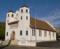 | Our Lady of the Blessed Sacrament Church | 0.1 miles | 2008 |
 | Keystone Avenue Bridge | 0.2 miles | 1989 |
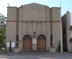 | Miami Community Church | 0.2 miles | 2005 |
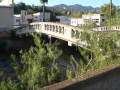 | Inspiration Avenue Bridge | 0.3 miles | 1989 |
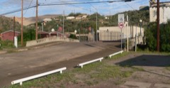 | Cordova Avenue Bridge | 0.3 miles | 1989 |
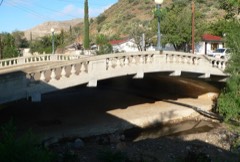 | Reppy Avenue Bridge | 0.4 miles | 1988 |
| National Archives record | The nomination case file for reference 00000465 in Record Group 79. |
| Gila County | All 43 listed properties in this county. |