 Block
From the record
One of 467 National Register listings published here for Maricopa County · listed in 2020 · category: Building.
Sources: the National Register database, National Park Service
Listed on the National Register of Historic Places in 2020.
One of 467 National Register listings published here for Maricopa County · listed in 2020 · category: Building.
Sources: the National Register database, National Park Service
Regional context, not property-specific evidence. The federal wildfire occurrence database lists 816 fires within 5 miles of Peoria Jail House between 1995 and 2020, burning about 94 acres in total. 3 started naturally. 10 were recorded as arson. Distance is straight-line from the map coordinates, so a fire counted here may appear on a neighbouring settlement's page as well.
| Reported cause | Fires |
|---|---|
| Missing data/not specified/undetermined | 791 |
| Arson/incendiarism | 10 |
| Equipment and vehicle use | 4 |
| Smoking | 3 |
| Natural | 3 |
| Misuse of fire by a minor | 2 |
| Debris and open burning | 1 |
| Other causes | 1 |
| Power generation/transmission/distribution | 1 |
The most recent of them, most recent first, with the day each was reported and the service that recorded it.
| Date | Cause | Size | Reported by | Name on the report |
|---|---|---|---|---|
| 9 September 2012 | Missing data/not specified/undetermined | under an acre | Arizona Department of Forestry and Fire Management - State Office | AZ-121835 |
| 9 September 2011 | Missing data/not specified/undetermined | under an acre | Arizona Department of Forestry and Fire Management - State Office | AZ-110821 |
| 8 September 2015 | Missing data/not specified/undetermined | under an acre | Arizona Department of Forestry and Fire Management - State Office | 154089 |
| 8 September 2010 | Missing data/not specified/undetermined | under an acre | Arizona Department of Forestry and Fire Management - State Office | AZ-101205 |
| 7 September 2015 | Missing data/not specified/undetermined | under an acre | Arizona Department of Forestry and Fire Management - State Office | 154088 |
| 7 September 2010 | Missing data/not specified/undetermined | under an acre | Arizona Department of Forestry and Fire Management - State Office | AZ-101204 |
| 6 September 2019 | Missing data/not specified/undetermined | under an acre | El Mirage Fire Department | NOT NAMED |
| 6 September 2019 | Missing data/not specified/undetermined | under an acre | Sun City Fire Department | NOT NAMED |
Regional context, not property-specific evidence. The federal mineral resources record lists 8 workings within 5 miles of Peoria Jail House: 5 producers, 3 past producers. 5 still produce. What was taken out: Sand and Gravel, Construction, Halite, Mica, Salt. Distance is straight-line from the map coordinates, so a quarry counted here may appear on a neighbouring settlement's page as well.
| Where | Site | Commodity | Status | Recorded |
|---|---|---|---|---|
| Agua Fria Pit Sun Valley Crushing | Sand and Gravel, Construction, Stone, Crushed/Broken | Past Producer | ||
| Alonzo Elder Muscovite #1 | Mica | Producer | ||
| Southwest Mine & Mill | Salt | Producer | ||
| Unidentified Halite Occurrence | Halite | Past Producer | Halite | |
| Arizona Sand & Rock, Agua Fria Plan | Sand and Gravel, Construction | Producer | ||
| Sand and Gravel Quarry | Sand and Gravel, Construction | Past Producer | Sand and Gravel | |
| Union Rock & Materials, El Mirage | Sand and Gravel, Construction | Producer | ||
| United Metro Pit & Plant #2 Glendal | Sand and Gravel, Construction | Producer |
Regional context, not property-specific evidence. The National Weather Service names Peoria, the town this property stands in, in 9 storm reports between 1996 and 2010: 5 thunderstorm wind, 1 funnel cloud, 1 heavy rain, 1 lightning. No death or injury is recorded in these reports. Each account below is quoted exactly as the forecast office filed it, from the NOAA Storm Events Database, and each date opens the federal record of that event.
| When | Event | Place named | Harm | What the report says |
|---|---|---|---|---|
| July 2005 | Lightning | Peoria | $500,000 | Lightning caused a fire at a North Peoria home, completely destroying it. |
| July 2010 | Thunderstorm Wind | Peoria | - | A section of the fabric roof at the University of Phoenix Stadium was ripped off due to the powerful winds and heavy rain. Reporters indicated about 1,500 square feet of fabric was damaged. At about the same time, a construction trailer was blown over near 87th Avenue and Glendale. |
| January 2008 | Flash Flood | Peoria | - | Maricopa County Sheriffs office reports multiple road closures along the Cave Creek. Numerous washes were running in the area. |
| March 2004 | Heavy Rain | Peoria | - | Heavy rain accompanied thunderstorms moving eastward across the metropolitan area. Some of the heavier amounts included 2.95 inches in Fountain Hills, and 1.97 inches in Mesa. Firefighters in Surprise performed shallow-water rescues and the Phoenix Fire Department responded to over 130 calls during the storm. Phoenix Sky Harbor airport reported 1.16 inches, along with some flight delays. |
| September 2002 | Funnel Cloud | Peoria | - | Funnel cloud spotted in parts of Peoria, Glendale and north Phoenix.. |
| August 1997 | Thunderstorm Wind | Peoria | - | Clay tiles blown off roof of Target store. |
| August 1996 | Thunderstorm Wind | Peoria | - | no account filed |
| August 1996 | Thunderstorm Wind | Peoria | - | no account filed |
| August 1996 | Thunderstorm Wind | Peoria | - | no account filed |
No historic map-sheet match is published for this property yet. That does not mean no map exists. This record needs a coordinate-quality review before it can be joined to a sheet boundary. Browse the county's mapped places while that work is pending.
Other National Register properties close enough to walk or drive between, ordered by distance from this one. Both positions come from the same geocoding pass that matched these properties to their map sheets.
| Photograph | Property | Distance | Listed |
|---|---|---|---|
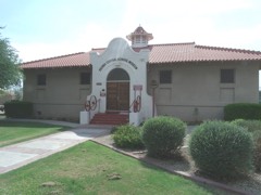 | Central School | under 500 feet | 1982 |
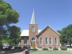 | First Presbyterian Church of Peoria | under 500 feet | 2012 |
 | Peoria High School Old Main | 0.6 miles | 2018 |
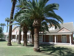 | Sahuaro Ranch | 2.8 miles | 1980 |
| Myrtle Avenue Residential Historic District | 3.4 miles | 2009 | |
| Thunderbird Estates and The McDonald Addition Historic District | 3.5 miles | 2010 |
| National Archives record | The nomination case file for reference 100004993 in Record Group 79. |
| Maricopa County | All 467 listed properties in this county. |