 Block
From the record
One of 76 National Register listings published here for Cochise County · listed in 2011 · category: District.
Sources: the case file at the National Archives · the National Register database, National Park Service
Listed on the National Register of Historic Places in 2011.
One of 76 National Register listings published here for Cochise County · listed in 2011 · category: District.
Sources: the case file at the National Archives · the National Register database, National Park Service
Regional context, not property-specific evidence. The federal wildfire occurrence database lists 88 fires within 5 miles of Benson Historic Barrio between 1992 and 2020, burning about 263 acres in total. 4 started naturally. 2 were recorded as arson. Distance is straight-line from the map coordinates, so a fire counted here may appear on a neighbouring settlement's page as well.
| Reported cause | Fires |
|---|---|
| Missing data/not specified/undetermined | 55 |
| Smoking | 10 |
| Debris and open burning | 6 |
| Equipment and vehicle use | 5 |
| Natural | 4 |
| Railroad operations and maintenance | 3 |
| Arson/incendiarism | 2 |
| Recreation and ceremony | 2 |
| Misuse of fire by a minor | 1 |
The most recent of them, most recent first, with the day each was reported and the service that recorded it.
| Date | Cause | Size | Reported by | Name on the report |
|---|---|---|---|---|
| 4 September 2014 | Equipment and vehicle use | under an acre | Arizona Department of Forestry and Fire Management - State Office | EXIT 306 |
| 29 September 2007 | Missing data/not specified/undetermined | under an acre | Arizona Department of Forestry and Fire Management - State Office | CORNFIELD |
| 27 September 1992 | Smoking | under an acre | Arizona Department of Forestry and Fire Management - State Office | not named |
| 20 September 1992 | Equipment and vehicle use | under an acre | Arizona Department of Forestry and Fire Management - State Office | not named |
| 13 September 1994 | Debris and open burning | under an acre | Arizona Department of Forestry and Fire Management - State Office | not named |
| 9 August 1999 | Missing data/not specified/undetermined | under an acre | Arizona Department of Forestry and Fire Management - State Office | SKYLINE |
| 7 August 2017 | Missing data/not specified/undetermined | under an acre | Mescal-J6 Fire District | not named |
| 29 August 2015 | Missing data/not specified/undetermined | under an acre | Arizona Department of Forestry and Fire Management - State Office | POST |
Regional context, not property-specific evidence. The federal mineral resources record lists 13 workings within 5 miles of Benson Historic Barrio: 7 producers, 4 occurrences, 2 past producers. 7 still produce. What was taken out: Geothermal, Gypsum-Anhydrite, Bentonite, Gypsum-Anhydrite, Sand and Gravel, Construction. Distance is straight-line from the map coordinates, so a quarry counted here may appear on a neighbouring settlement's page as well.
| Where | Site | Commodity | Status | Recorded |
|---|---|---|---|---|
| Industrial Management Corp Pumice | Pumice | Occurrence | ||
| Land | Gypsum-Anhydrite | Occurrence | ||
| Pit No.1 | Sand and Gravel, Construction | Producer | ||
| Pomerene Mill | Tungsten | Past Producer | ||
| Post Ranch Diatomite | Diatomite | Past Producer | ||
| Benson Clay Deposit | Gypsum-Anhydrite, Bentonite | Occurrence | ||
| Benson Deposit | Gypsum-Anhydrite, Bentonite | Occurrence | Bentonite, Gypsum, Selenite | |
| Unknown | Geothermal | Producer | ||
| Unknown | Geothermal | Producer | ||
| Unknown | Geothermal | Producer |
Regional context, not property-specific evidence. The National Weather Service names Benson, the town this property stands in, in 34 storm reports between 1996 and 2025: 15 flash flood, 10 thunderstorm wind, 7 hail, 2 lightning. The reports record 2 deaths. Each account below is quoted exactly as the forecast office filed it, from the NOAA Storm Events Database, and each date opens the federal record of that event.
| When | Event | Place named | Harm | What the report says |
|---|---|---|---|---|
| September 2025 | Flash Flood | Benson | 1 killed, $2,000 | Two individuals attempted to cross a flooded wash and got swept away. Swift water rescues occurred with one person rescued and one fatality. An estimate of 0.75 to 1.0 inches of rainfall according to MRMS. This flash flooding closed Ocotillo Road from 9 PM on the 12th to roughly 6 AM on the 13th of September. |
| June 2015 | Lightning | Benson | 1 killed | Lightning struck and killed a man who was walking along a dirt road. |
| August 2010 | Thunderstorm Wind | Benson | $1,000,000 | The Benson News-Sun and a local city official reported extensive damage to much of the city of Benson from thunderstorm activity. The city official reported numerous mature and young trees uprooted, street signs bent or pulled completely out of the ground, damage to dwellings from uprooted trees, small sheds and car ports were lifted and thrown 50-75 feet, and shingle damage to numerous homes. Also, property fences were knocked over, camper trailers were turned over, and numerous power outages. The newspaper added that one particular insurance provider received 40 claims from residents, mostly related to roof damage. Additional information from the newspaper stated that at least 80 street signs had to be replaced. Extensive damage was also done to the Turquoise Hills Golf Course where numerous large trees were downed and buildings damaged. |
| July 2007 | Flash Flood | Benson | $75,000 | Several homes were flooded in the Comstock neighborhood in Benson due to flash flooding. A swift water rescue also took place at Interstate 10 and the Pomerene Road exit in Benson. |
| August 2019 | Flash Flood | Benson | $50,000 | Around 2 inches of rain in 1 to 2 hours flooded many yards and several homes in the St. David area. Some vehicles became stuck in floodwaters. |
| August 2010 | Lightning | Benson | $50,000 | The Benson News-Sun reported several lightning strikes causing damage and fires in and around Benson. The most extensive lightning damage was done to two motors at the waste water treatment facility. Lightning also damaged numerous transformers. |
| July 1997 | Thunderstorm Wind | Benson | $35,000 | Downburst winds from nearby thunderstorm knocked a mobile home off its foundation completely demolishing it. The winds also blew a cooler off the roof of another trailer, blew over a couple of sheds and torn some of the singles off the roofs of other trailers. |
| August 2010 | Flash Flood | Benson | $30,000 | The Benson News-Sun reported that a man was pulled from a running wash after he attempted to drive through 2 feet of running water on an adjacent street. The force of the water on the street carried his car into the wash and up against a concrete wall. The driver then attempted to get out of the vehicle, but fell 10-15 feet down into the wash underneath his car. Fire crews were able to quickly rescue the driver. He was escorted to the local hospital. City officials also reported numerous washes flooding neighborhood streets. |
| July 2005 | Thunderstorm Wind | Benson | $23,000 | A severe thunderstorms in the Town of Benson produced strong winds (estimated to be 60 mph) and caused several power poles to be downed resulting in widespread power outages throughout the Town of Benson. |
| August 2021 | Flash Flood | Benson | $20,000 | Over an inch of rain in an hour caused flash flooding of roadways in Benson and State Route 80 in St. David. In Benson, one house and the community center were flooded. |
| July 2016 | Flash Flood | Benson | $20,000 | Two inches of rain in less than an hour caused flash flooding in parts of Benson. Benson Middle School was most severely impacted by flood waters. Water was at least ankle deep in an entire wing of the school, damaging rugs and floorboards in ten classrooms. The city of Benson Public Works Building also sustained minor flood damage. |
| July 2006 | Flash Flood | Benson | $20,000 | A county official reported very heavy rainfall which caused west bound Interstate 10 at mile post 300 to be closed due to flooding across the roadway. Additionally, a law enforcement official reported that washes were flowing 2 to 3 feet deep near the Community of Dragoon. Law Enforcement officials also reported that two vehicles were submerged in flood waters on Interstate 10 near milepost 299. |
| July 2002 | Thunderstorm Wind | Benson | $12,000 | no account filed |
| September 2006 | Flash Flood | Benson | $10,000 | Law enforcement reported that a truck was stuck in rising water in the Town of Saint David. A swift water rescue was required to rescue the occupants of the vehicle. Additionally, Sybil Road in the Town of Saint David was flooded. |
| July 2003 | Flash Flood | Benson | $10,000 | no account filed |
| June 2015 | Thunderstorm Wind | Benson | $7,000 | Thunderstorm winds uprooted trees in Lions Park and Apache Park in Benson and ripped a roof off a patio from one residence on Dragoon Street. |
| August 1997 | Thunderstorm Wind | Benson | $3,000 | Thunderstorm winds blew down several power lines. |
| July 2013 | Thunderstorm Wind | Benson | $1,500 | Thunderstorm winds downed a power pole in Benson. |
| July 2025 | Flash Flood | Benson | $1,000 | Slow moving thunderstorms formed over Benson, AZ that produced heavy rainfall that led to flash flooding. Over the 2 hours that rainfall fell, two rainfall gauges reported 1.10-1.25 inches of rainfall. Drivers had to turn around due to flooding over roadways that are impassible with multiple cars pulling over to side of road due to the heavy rainfall. |
| July 2020 | Thunderstorm Wind | Benson | $1,000 | Thunderstorm winds downed a tree at the Benson Visitor Center. The falling tree also damaged a pole-mounted gaslight. |
| August 1998 | Thunderstorm Wind | Benson | $1,000 | no account filed |
| September 2025 | Hail | Benson | - | Photo of 1 inch hail in Benson, AZ. |
| July 2013 | Thunderstorm Wind | Benson | - | Thunderstorm winds downed large tree limbs near Benson. Also, a field of planted rye was mostly flattened. |
| August 2011 | Flash Flood | Benson | - | Heavy rainfall in the Benson area resulted in several overflowing washes and closed neighborhood streets. |
| August 2005 | Hail | Benson | - | Three quarter inch hail was reported by a trained spotter in the Town of Benson. |
| July 2005 | Flash Flood | Benson | - | Law Enforcement reported that there were flooding problems in Benson, mainly road flooding with some roads being impassable. |
| September 2005 | Flash Flood | Benson | - | The Benson Police Department reported numerous streets closed due to flooding including Highway 80 near Valley Park Trailer Park. Residents had to be evacuated from 2 or 3 homes due to flooding. |
| July 2004 | Hail | Benson | - | An NWS employee reported 1.00 inch hail while driving near the Benson area. |
| July 1998 | Flash Flood | Benson | - | Thunderstorms dumping up to 2 inches of rain in 1 hour caused flooding of washes with a weather spotter reporting a 11/2 foot rise in a nearby wash. |
| August 1997 | Flash Flood | Benson | - | Benson police reported flooding in downtown Benson and numerous traffic accidents on Interstate 10 due to zero visibility in heavy rain. |
| September 2011 | Hail | Benson | - | no account filed |
| July 2003 | Hail | Benson | - | no account filed |
| July 2003 | Hail | Benson | - | no account filed |
| July 1996 | Hail | Benson | - | no account filed |
1 paper published in this town, digitised by the Library of Congress and free to read: 1,196 issues, 11,922 pages. Every page is searchable, so a name or a street can be looked for directly in what the town printed about itself at the time.
| Newspaper | Published |
|---|---|
| The Benson Signal | 1915 to 1921 |
No historic map-sheet match is published for this property yet. That does not mean no map exists. This record needs a coordinate-quality review before it can be joined to a sheet boundary. Browse the county's mapped places while that work is pending.
Other National Register properties close enough to walk or drive between, ordered by distance from this one. Both positions come from the same geocoding pass that matched these properties to their map sheets.
| Photograph | Property | Distance | Listed |
|---|---|---|---|
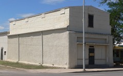 | Hi Wo Company Grocery | under 500 feet | 1994 |
| Max Treu Territorial Meat Company | under 500 feet | 1994 | |
| W. D. Martinez General Merchadise Store | 0.1 miles | 1994 | |
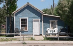 | Benson Railroad Historic District | 0.1 miles | 1994 |
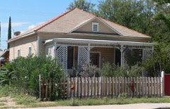 | Redfield-Romine House | 0.3 miles | 1994 |
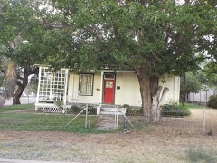 | Smith-Beck House | 0.3 miles | 1994 |
| National Archives record | The nomination case file for reference 11000174 in Record Group 79. |
| Cochise County | All 76 listed properties in this county. |