 Block
From the record
One of 467 National Register listings published here for Maricopa County · listed in 2011 · category: District.
Sources: the National Register database, National Park Service
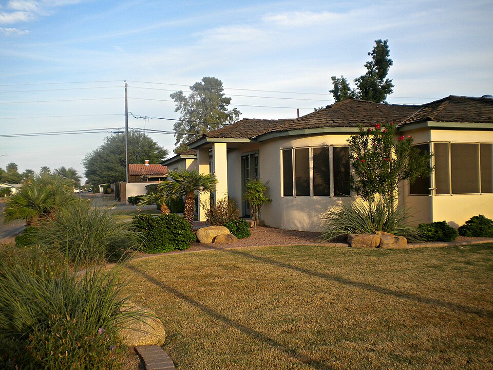
Listed on the National Register of Historic Places in 2011.
One of 467 National Register listings published here for Maricopa County · listed in 2011 · category: District.
Sources: the National Register database, National Park Service
Regional context, not property-specific evidence. The federal wildfire occurrence database lists 691 fires within 5 miles of Silk Stocking Neighborhood Historic District between 1992 and 2020, burning about 1,259 acres in total. 5 started naturally. 8 were recorded as arson. Distance is straight-line from the map coordinates, so a fire counted here may appear on a neighbouring settlement's page as well.
| Reported cause | Fires |
|---|---|
| Missing data/not specified/undetermined | 672 |
| Arson/incendiarism | 8 |
| Natural | 5 |
| Smoking | 2 |
| Equipment and vehicle use | 2 |
| Debris and open burning | 1 |
| Power generation/transmission/distribution | 1 |
The most recent of them, most recent first, with the day each was reported and the service that recorded it.
| Date | Cause | Size | Reported by | Name on the report |
|---|---|---|---|---|
| 9 September 2019 | Missing data/not specified/undetermined | under an acre | Chandler Fire Department | NOT NAMED |
| 9 September 2015 | Missing data/not specified/undetermined | under an acre | Arizona Department of Forestry and Fire Management - State Office | 153942 |
| 8 September 2020 | Missing data/not specified/undetermined | under an acre | Arizona Department of Forestry and Fire Management - State Office | not named |
| 7 September 2018 | Missing data/not specified/undetermined | under an acre | Chandler Fire Department | 332401 |
| 7 September 2018 | Missing data/not specified/undetermined | under an acre | Chandler Fire Department | 333144 |
| 7 September 2018 | Missing data/not specified/undetermined | under an acre | Tempe Fire Department | 1820604 |
| 7 September 2015 | Missing data/not specified/undetermined | under an acre | Arizona Department of Forestry and Fire Management - State Office | 153941 |
| 7 September 2014 | Missing data/not specified/undetermined | under an acre | Arizona Department of Forestry and Fire Management - State Office | AZ-141255 |
Regional context, not property-specific evidence. The federal mineral resources record lists 1 working within 5 miles of Silk Stocking Neighborhood Historic District: 1 producer. All of them still produce. What was taken out: Sand and Gravel, Construction. Distance is straight-line from the map coordinates, so a quarry counted here may appear on a neighbouring settlement's page as well.
| Where | Site | Commodity | Status | Recorded |
|---|---|---|---|---|
| Chandler Ready Mix Plant | Sand and Gravel, Construction | Producer |
Regional context, not property-specific evidence. The National Weather Service names Chandler, the town this property stands in, in 66 storm reports between 1994 and 2025: 42 thunderstorm wind, 7 hail, 7 flash flood, 6 heavy rain. The reports record 4 injuries. Each account below is quoted exactly as the forecast office filed it, from the NOAA Storm Events Database, and each date opens the federal record of that event.
| When | Event | Place named | Harm | What the report says |
|---|---|---|---|---|
| September 1999 | Thunderstorm Wind | Chandler | 2 hurt, $5,000,000 | Winds blew down power poles, trees, and caused considerable damage to homes and businesses in the East Valley. A family in Mesa was trapped inside their vehicle for about an hour after power poles crashed down around them. Power outages affected at least 8,500 customers in the East Valley. The Mesa Regal RV Resort suffered major damage as three trailers were totally destroyed. An airplane was flipped over at Falcon Field with damage to hangar doors. Sky Harbor airport reported numerous flight delays. |
| October 2010 | Hail | West Chandler | 1 hurt, $1,800,000,000 | This storm moved from Firebird Lake, south of Chandler to the north Glendale/south Peoria area. This storm produced widespread golf ball to baseball sized hail along its path. Thousands of roofs and vehicles were damaged by the hail. Locations in northwest Phoenix and Glendale were impacted by this storm as well as the storm shortly after noon, compounding the damage. The football coach at Alhambra High School reported at least one injury when large hail struck the practice field. This palm-size hail is likely the largest hail ever reported in the Phoenix area.|Large hail, estimated to be upwards of 2 inches in diameter, punctured 34 skylights at the main warehouse of St. Mary's Food bank in Phoenix. As a result, water ruined approximately 20 percent of the food inventory, the equivalent of 1.4 million meals. Rain soaked the food, which was stored in cardboard boxes. This information was reported by St. Mary's spokesman Jerry Brown. The damages of 200 thousand dollars covered both the roof damage as well as money to replace the ruined food. |
| August 1997 | Lightning | Chandler | 1 hurt, $50,000 | Lightning struck a house in Chandler slightly injuring a woman. It struck phone lines, power lines, and plumbing in the house igniting a blaze which caused an estimated $50,000 damage to the upstairs bathroom, bedrooms, and attic. The woman was injured while talking on the phone when the lightning travelled along the phone cord and grazed her face and neck. |
| August 2014 | Flood | West Chandler | $2,000,000 | Scattered to numerous thunderstorms produced locally heavy rain across the south central portions of the greater Phoenix metropolitan area during the afternoon and evening hours on August 12th. Peak rainfall rates were well in excess of one inch per hour at times, and storm total rainfall amounts exceeded 3 inches. Some of the hardest hit communities included Laveen, Ahwatukee and South Phoenix. At 1930MST, a trained weather spotter 3 miles northwest of South Mountain Park measured an afternoon storm total rainfall of 3.2 inches. According to the Maricopa County Sheriff's office, heavy rain led to flash flooding and subsequently areal flooding. Numerous roads were flooded and closed, including the intersections of 27th Avenue and Cheyenne Drive, and 45th Avenue and Ivanhoe Street. Many homes in the area, especially those along Dobbins Road between 19th Avenue and 51st Avenue, suffered significant flood damage, as water 1-3 feet filled up their residences. The flooding also produced significant damage to the SRP water system according to SRP spokesman Jeff Lane. The flooding prompted the issuance of an Areal Flood Warning which remained in effect through the early morning hours on August 13th. No injuries were reported due to the flooding. |
| July 2013 | Thunderstorm Wind | West Chandler | $250,000 | Scattered thunderstorms developed in the greater Phoenix area during the late afternoon hours on July 15th, and they affected the community of Ahwatukee. The storms produced gusty and damaging winds estimated to be in excess of 70 mph. According to broadcast media reports and supported by aerial video, 4 homes under construction in a subdivison directly west of Desert View High School between E. Frye Rd. and E. Glenhaven Rd. were destroyed and an additional 6 homes (further along in the construction process had minor damage. A Severe Thunderstorm Warning had been issued for the area starting at 454 pm and continuing until 545 pm. |
| July 2013 | Thunderstorm Wind | West Chandler | $150,000 | Scattered thunderstorms developed in the greater Phoenix area during the late afternoon hours on July 15th, and they affected the community of Ahwatukee. The storms produced gusty and damaging winds estimated to be in excess of 60 mph. According to a trained weather spotter, at 535 pm over 50 trees were blown down in the Lakewood subdivision. Some fallen trees caused other damage to cars and property. The tree diameters were all 12 inches or larger. In addition, there was roof damage noted on a concrete tile roof. A Severe Thunderstorm Warning had been issued for the area starting at 454 pm and continuing until 545 pm. |
| July 2017 | Thunderstorm Wind | West Chandler | $100,000 | Strong thunderstorms developed across the southeast portion of the greater Phoenix area during the late evening hours on July 16th; some of them affected the community of Guadalupe. The storms produced strong, gusty and damaging outflow winds estimated to be in excess of 60 mph. According to local broadcast media, at 2220MST gusty winds uprooted a tree which fell and damaged a parked vehicle at the Arizona Mills Mall, about 1 mile north of Guadalupe. Shortly thereafter, at 2230MST, a very large tree was uprooted and it fell on several cars as well as a parking structure located about 3 miles southwest of Guadalupe. This was also reported by local media. |
| September 2014 | Heavy Rain | West Chandler | $100,000 | Widespread and intense showers and embedded thunderstorms developed across the central portion of the greater Phoenix area during the early morning hours on September 8th, and they affected the community of Ahwatukee. Rainfall rates with the heavier storms exceeded 2 inches per hour at times and led to significant flooding of streams, washes and roads in the area, and the flooding seriously impacted the Mountain Park Community Church located at 24th Street and Pecos Road. A wash that runs behind the church crested during the morning's heavy rainfall and sent water cascading into the church. The water rose above the chairs in the auditorium, actually filling up the entire auditorium. The flooding made for a massive cleanup, and close to 75 volunteers rallied during the afternoon to clean up the mud and debris. |
| July 2005 | Thunderstorm Wind | Chandler | $70,000 | Dozens of trees were blown down, with many cars and homes sustaining damages due to the winds. Most of the damage was in the Springfield Resort Community near Riggs and McQueen roads. |
| July 2013 | Thunderstorm Wind | West Chandler | $50,000 | Scattered strong thunderstorms developed during the late afternoon hours across portions of the greater Phoenix metropolitan area, and they affected communities such as Ahwatukee and Firebird Lake. The storms produced gusty winds estimated to be in excess of 60 mph. According to local broadcast media reports, at 505 pm a semi truck was blown off of Interstate 10 and overturned near 1-10 and Wild Horse Pass Road, approximately 1 mile north of Firebird Lake. No injuries were reported. A Severe Thunderstorm Warning had been issued for the area beginning at 454 pm and continuing until 545 pm. |
| August 2008 | Hail | West Chandler | $50,000 | Many reports of large hail that accompanied several waves of thunderstorms across the city of Phoenix. |
| September 2007 | Thunderstorm Wind | Chandler | $50,000 | A microburst struck a Chandler RV and trailer park, damaging at least one trailer and taking down power lines and uprooting trees. |
| September 1994 | Thunderstorm Wind | Chandler | $50,000 | Severe thunderstorms ripped through the greater Phoenix area with winds in Chandler estimated between 60-65 mph. A weather spotter at 7th St. and Glendale Ave. measured 1.75 inch rain in 50 minutes. Phoenix Sky Harbor Airport, received 1.36 inch. Extensive street flooding was reported around the valley with water three to five feet deep in some underpasses. Numerous trees, both medium and large were blown down. A house caught fire from lightning. A roof and air conditioning unit were blown off a house on 15th Ave., south of Indian School Road. Over 129,000 customers lost power. Seventy power poles were blown down in the Queen Creek area, and another 50 poles near 7th Avenue and Baseline Road. Thunderstorm winds blew out a store front window causing an estimated $6000 damage. A 22-year-old man was killed by lightning while trying to retrieve his vehicle in a parking lot. (O22M) |
| July 2014 | Thunderstorm Wind | West Chandler | $30,000 | Scattered strong thunderstorms affected the southeast portions of the greater Phoenix area, including Chandler, during the late afternoon hours on July 13th. Some of the storms produced gusty and damaging microburst winds estimated to be in excess of 60 mph. At 1705MST, a trained weather spotter located 3 miles to the northwest of the Chandler Fashion Center mall reported downed tree branches and a roof blown off of a house. The damage was close to the intersection of Ray and Kyrene roads. Shortly thereafter, another trained spotter about 1 mile east at the intersection of Ray and McClintock Roads reported that an apartment carport was blown down. Additionally, 3 inch diameter branches were blown off of trees in the area. |
| July 2013 | Thunderstorm Wind | West Chandler | $30,000 | Scattered strong thunderstorms developed during the late afternoon and evening hours and they affected portions of the greater Phoenix area, including the community of Ahwatukee. At 457 pm, a trained weather spotter 1 mile southwest of Ahwatukee reported numerous trees blown down near the intersection of 30th Street and Chandler Boulevard. Winds were estimated to be from 55 to near 60 mph. Pea to marble sized hail accompanied the strong winds. A Severe Thunderstorm Warning was in effect for the area, beginning at 454 pm and continuing until 545 pm. |
| August 2025 | Thunderstorm Wind | West Chandler | $20,000 | Images show multiple large pine trees down at a lavender farm in Chandler. No injuries were reported. Timing estimated from radar. |
| August 2024 | Thunderstorm Wind | West Chandler | $10,000 | Several downed mesquite and palo verde trees along a shopping center located in the area of Ray Road and 48th street in Ahwatukee. Some of the downed palo verde trees struck some vehicles causing minor damage. Wind gusts were estimated upwards of 60-70 mph. No injuries were reported. |
| August 2024 | Thunderstorm Wind | West Chandler | $10,000 | Large tree fell over and took out a light pole in front of an IHOP Restaurant located in the area of Ray Rd and 50th Street in Ahwatukee. Wind gusts were estimated upwards of 60-70 mph. No injuries were reported. |
| October 2015 | Thunderstorm Wind | West Chandler | $10,000 | Scattered thunderstorms developed across the greater Phoenix metropolitan area during the afternoon hours on October 18th and some of them affected the community of Ahwatukee. A few of the stronger storms produced strong gusty winds estimated to be as high as 60 mph. According to a trained weather spotter located 2 miles south of Ahwatukee, gusty winds blew down multiple medium sized trees near the intersection of Pecos Road and 22nd Street. Dime sized hail was also observed. |
| July 2014 | Thunderstorm Wind | Chandler | $10,000 | Scattered thunderstorms affected much of the greater Phoenix area, including the community of Gilbert, during the late afternoon hours on July 13th. The stronger storms produced gusty and damaging microburst winds estimated to be in excess of 60 mph. A trained weather spotter in Gilbert reported trees downed near the intersection of Ray Road and Cooper. Another trained spotter nearby in Gilbert reported trees downed near the intersection of Warner Road and McQueen. |
| August 2025 | Thunderstorm Wind | Chandler | $5,000 | A portion of a cinder block wall was blown down in a residential neighborhood behind a couple of homes. No injuries were reported. Timing estimated from radar. |
| August 2024 | Thunderstorm Wind | West Chandler | $5,000 | Large uprooted tree crashed through a concrete brick wall along Ray Road between 44th and 48th Street in Ahwatukee. Wind gusts were estimated upwards of 60-70 mph. Time estimated from radar. No injuries were reported. |
| August 2024 | Thunderstorm Wind | West Chandler | $5,000 | Multiple large trees downed in the area of 48th street and Warner Road in Ahwatukee. Wind gusts were estimated upwards of 60-70 mph. No injuries were reported. |
| August 2021 | Thunderstorm Wind | West Chandler | $5,000 | Numerous trees down across Ahwatukee with many along Desert Foothills Parkway and Chandler Boulevard over to Ray Road. Many of the trees were palo verdes and several fell into roads and impeded traffic. Winds estimated around 50 to 60 mph. Time based on radar. No injuries were reported. |
| August 2017 | Flash Flood | West Chandler | $5,000 | Scattered thunderstorms developed over portions of the greater Phoenix area, including the southeastern communities, during the late evening hours on August 12th and they persisted into the early morning hours on August 13th. Some of the stronger storms produced locally heavy rainfall which led to an episode of flash flooding in far south Tempe shortly after midnight. Despite rainfall rates typically less than one inch per hour, they were sufficient to cause flooding problems along Interstate 10 near Ray Road. According to local law enforcement, at 0111MST a water rescue was performed near Interstate 10 and Ray Road. No accidents or injuries were reported. A Flash Flood Warning was not in effect, instead a Flood Advisory had been issued at 2238MST the previous day and it was valid through 0145MST on the 13th. |
| May 2009 | Thunderstorm Wind | West Chandler | $5,000 | Winds damaged a small structure at a Tempe car dealership. |
| November 2025 | Hail | West Chandler | $3,000 | Two reports of ping pong to golf ball sized hail along Loop 202 WB between 24th and 40th street in Ahwatukee, with video evidence of hail dents on a vehicle. No injuries reported. |
| September 2023 | Thunderstorm Wind | West Chandler | $3,000 | Downed power poles near the area Maricopa Rd and Highway 347 just west of I-10. Traffic signals were out leading to significant traffic impacts. Wind gusts were estimated at approximately 60 mph. No injuries were reported. |
| October 2018 | Flash Flood | West Chandler | $2,000 | Copious amounts of tropical moisture spread north and into the greater Phoenix area during the morning hours on October 2nd. The moisture was associated with former hurricane Rosa and it led to widespread moderate to heavy showers that affected the town of Chandler. The heavy rain led to episodes of flash flooding. According to the Phoenix police, at 1015MST flash flooding resulted in the closure of Chandler Boulevard and 51st Street, about 4 miles south of the town of Guadalupe. A Flash Flood Warning was issued for the area at 0730MST and was in effect at the time of the flooding. |
| September 1995 | Thunderstorm Wind | Chandler | $1,500 | An 80-foot tree crashed into a mobile home bedroom. Numerous reports of downed trees in the area. |
| August 2020 | Thunderstorm Wind | West Chandler | $1,000 | A trained weather spotter reported two mesquite trees had 5-10 inch diameter limbs snap off. A small gazebo was also lifted from a backyard and displaced onto a fence. This occurred near Ray road and Kyrene road in west Chandler. A severe warned storm was moving through the area at the time. Winds were estimated around 50-55 mph from radar and nearby weather stations. No injuries were reported. |
| July 2016 | Thunderstorm Wind | West Chandler | $1,000 | Scattered thunderstorms moved east across the greater Phoenix metropolitan area during the evening hours on July 1st and some of the stronger storms generated strong and damaging outflow winds. According to a trained weather spotter located 3 miles east of Ahwatukee Foothills, outflow winds estimated to be as high as 65 mph uprooted and Palo Verde tree with a diameter of one foot. |
| March 2013 | Thunderstorm Wind | Chandler | $1,000 | Scattered thunderstorms, associated with a passing cold front, moved across the greater Phoenix metropolitan area during the afternoon hours on March 8th. Some of the storms affected southeast valley communities such as Chandler, and they produced locally strong and gusty outflow winds. According to a trained weather spotter about 1 mile northwest of Tumbleweed Park in Chandler, at 245 pm wind gusts estimated to be at least 60 mph caused a 10 inch diameter Palo Verde tree to be uprooted and knocked down. Another trained spotter 1 mile east of Chandler also reported a 6 inch diameter tree blown down at 245 pm. |
| November 2025 | Flash Flood | West Chandler | - | Video shows inundated concrete wash with rapidly flowing water, making the Tere Street low water crossing in Ahwatukee impassable. Timing estimated from radar. No damages or injuries reported. |
| August 2021 | Thunderstorm Wind | Chandler | - | Videos on social media showed multiple trees down along Pecos Road between McQueen Road and Cooper Road in Chandler. Videos also showed a large tree in this area blocking a roadway requiring a large pickup truck to remove it. No injuries were reported. |
| October 2018 | Flash Flood | West Chandler | - | Widespread moderate to heavy showers developed over the central portion of the greater Phoenix area during the morning hours on October 13th; the showers persisted into the afternoon hours and affected communities such as Ahwatukee and Guadalupe. Peak rain rates were in excess of one inch per hour and resulted in episodes of flash flooding. According to the Phoenix Police Department, flash flooding resulted in the closure of south 48th Street from East Warner Road to East Hoh Way. The flooding was located roughly 3 miles southwest of the town of Guadalupe. A Flash Flood Warning was in effect at the time of the flooding. No accidents were reported due to the flooded roads and the hazardous driving conditions. |
| September 2016 | Heavy Rain | West Chandler | - | Thunderstorms developed across the southeast portions of the greater Phoenix metropolitan area during the afternoon hours on September 1st and some of the storms produced locally heavy rain with peak rainfall rates as high as 2 inches per hour. The heavy rains led to areas of urban street flooding in communities such as Ahwatukee, Chandler and Guadalupe. At 1705MST a trained weather spotter located 3 miles south of Guadalupe estimated that one half inch of rain fell within 22 minutes. The heavy rains flooded the parking lot at Sprouts, which was located at the intersection of Interstate 10 and Ray Road. An Urban and Small Stream Flood Advisory was issued for the area beginning at 1731MST and it remained in effect through 1850MST. |
| September 2014 | Flash Flood | West Chandler | - | Widespread and intense showers...along with embedded thunderstorms...developed across much of the greater Phoenix metropolitan area, including southeastern valley communities such as Chandler and Tempe, during the early morning hours. Rainfall rates were well in excess of 2 inches per hour, briefly reaching to near 6 inches per hour, and the heavy rain led to significant urban as well as flash flooding. At about 0300MST a trained weather spotter reported serious flooding and hydroplaning occurring at the intersection of the Loop 101 northbound and Guadalupe Road in Tempe. Three of the lanes were flooded and impassable. |
| September 2014 | Heavy Rain | West Chandler | - | Widespread showers and thunderstorms developed across the greater Phoenix metropolitan area during the early morning hours on September 8th, and they persisted into the early afternoon hours. Some of the heaviest rainfall fell in the central and southeast portions of the valley, in communities such as Tempe and Chandler. Peak rainfall rates were easily in excess of 2 inches per hour, and briefly spiked as high as 6 inches per hour. Many rain gages measured between 3 and 5 inches during this heavy rainfall event, and the heavy rain led to widespread and significant urban street flooding, as well as episodes of flash flooding. At 1138MST, a trained weather spotter 3 miles northwest of the Chandler Fashion Square Mall measured a storm total rainfall of 6.09 inches. A bit later, at 1349MST, another trained spotter 3 miles southeast of Tempe measured a storm total rainfall of 5.75 inches. The widespread street flooding created very hazardous driving conditions for Phoenix area motorists, especially during the morning rush hour. Many roads across the greater Phoenix area were either restricted or closed for several hours or more. |
| September 2014 | Heavy Rain | West Chandler | - | Widespread showers and embedded thunderstorms developed across the central portion of the greater Phoenix metropolitan area during the early morning hours, and they produced intense rainfall with peak rainfall rates well in excess of 2 inches per hour. The heavy rain continued into the middle of the morning before tapering off and resulted in significant urban street flooding, affecting motorists across the greater Phoenix area. At 0724MST a public report was received indicating that 4.39 inches of rain was measured 2 miles southwest of Ahwatukee. At about the same time, a trained spotter 3 miles southeast of Tempe measured 4.82 inches of rain since the rain began in the early morning. Finally, at 0633MST, another trained spotter 3 miles southwest of the Fiesta Mall in Mesa measured 4.08 inches of rain. The widespread street flooding caused many roads to become closed or restricted and created hazardous driving conditions during the morning rush hour across the greater Phoenix area. |
| July 2013 | Thunderstorm Wind | West Chandler | - | Scattered thunderstorms, some with strong gusty winds, developed during the late afternoon hours across portions of the greater Phoenix area and they affected the community of Ahwatukee. At 454 pm, a trained weather spotter 1 mile southwest of Ahwatukee estimated a wind gust to 60 mph. The strong winds caused a number of trees to be blown down in the area. Small hail up to one quarter inch in diameter accompanied the gusty winds. |
| March 2013 | Hail | West Chandler | - | Scattered thunderstorms, some with moderate hail, moved across the greater Phoenix area during the middle of the afternoon on March 8th. Communities such as Ahwatukee and Guadalupe recorded hail approaching one inch in diameter. According to a National Weather Service employee, at 243 pm hail measured at three quarters of an inch in diameter fell near 38th street and Ray Road in Ahwatukee. Additionally, a trained weather spotter 1 mile east of Guadalupe reported nickel hail at the intersection of Kyrene and Guadalupe roads at 235 pm. |
| September 2013 | Flash Flood | West Chandler | - | Southerly flow imported copious amounts of tropical moisture into south central Arizona during the morning hours on September 9th, and as a result widespread showers developed across the greater Phoenix metropolitan area. Areas of moderate to heavy rain developed; isolated embedded thunderstorms further enhanced the rainfall totals. Flood Control District gages and radar data indicated that rainfall rates up to two inches per hour had occurred during the late morning and this led to flash flooding in the community of Ahwatukee. At about 1200MST, a local broadcast media report indicated that water was flowing over the road near the intersection of 48th Street and Warner Road in Ahwatukee. As a result, the road was closed. A Flash Flood Warning was issued for the central portions of the greater Phoenix area at 1133MST and it continued through 1300MST. Although the heavy rains did let up, additional rainfall occurred into the afternoon hours and led to the issuance of an Urban and Small Stream Flood Advisory at 1300MST; the advisory continued until 1500MST. |
| July 2012 | Thunderstorm Wind | West Chandler | - | Scattered thunderstorms developed to the southeast of the greater Phoenix area during the afternoon hours on July 21st. The storms produced strong and gusty outflow winds which moved northwest and into the Phoenix metropolitan area during the late afternoon. The winds, which were in excess of 50 mph at times, generated dense blowing dust and dust storm conditions. At 511 pm, a trained weather spotter 2 miles southwest of Firebird Lake, or in far southwest Chandler, measured a wind gust to 63 mph. At the time, a dust storm was in progress with zero visibility in dense blowing dust. |
| August 2010 | Thunderstorm Wind | West Chandler | - | A trained spotter near South Mountain Park reported that multiple large tree limbs, at least 7 inches in diameter, were blown down by strong thunderstorm winds estimated to be in excess of 50 kt. |
| October 2010 | Heavy Rain | Chandler | - | A trained weather spotter reported very heavy rainfall associated with strong thunderstorms. 0.44 inches of rain fell in just 10 minutes. Other spotters in central Phoenix and across the greater Phoenix area reported thunderstorms with heavy rain; rainfall rates exceeded one inch per hour and in one instance heavy rain caused visibility to lower to one quarter mile. Over a seven hour period, almost 2 inches of rain fell near Baseline Road and Mesa Drive in Mesa. The heavy rain led to significant urban street flooding and prompted the issuance of an urban small stream flood advisory. |
| August 2008 | Heavy Rain | Chandler | - | About 1.1 inches fell in just 30 minutes at Chandler and McQueen. Some streets were flooded. |
| May 2008 | Thunderstorm Wind | Chandler | - | Strong and gusty winds uprooted trees in Eastern Chandler. Dense blowing dust with low visibility was reported at Gateway airport. |
| July 2007 | Thunderstorm Wind | Chandler | - | Very strong winds kicked up widespread areas of dense blowing dust. Spotters reported less than 1/4 mile visibility.| |
| July 2005 | Thunderstorm Wind | Chandler | - | Tree down. |
| September 2005 | Hail | Chandler | - | Near Lindsay and Riggs roads. |
| March 2003 | Thunderstorm Wind | Chandler | - | Thunderstorms developed south and west of Sun Lakes and moved rapidly northeast across Chandler. Brief heavy rain accompanied these storms. |
| August 2002 | Thunderstorm Wind | Chandler | - | Microburst winds struck a large area in the East Valley, taking down power poles and uprooting trees.Homes, businesses and cars were damaged. Power lines fell on top of an SRP construction trailer and the resulting fire destroyed the trailer. Power lines were downed in Gilbert, trapping a few people at the Islands Elementary school. |
| August 2001 | Thunderstorm Wind | Chandler | - | Severe thunderstorm wind gusts blew down electric power poles between southern Chandler and southeast Mesa. |
| August 1999 | Flood | Chandler | - | Rainfall exceeded one inch per half hour in parts of the east valley, resulting in street flooding. |
| February 1998 | Funnel Cloud | Chandler | - | There were several reports of a funnel cloud in an area between Chandler Blvd. and Queen Creek Rd. near Interstate 10. |
| August 1997 | Thunderstorm Wind | Chandler | - | Power lines were blown down across Interstate 10 near the Chandler Boulevard exit. |
| October 1997 | Hail | Chandler | - | Dime-sized hail was reported by an NWS employee at Arizona Avenue and Pecos Road. |
| September 1995 | Thunderstorm Wind | Chandler | - | Power poles were knocked over near Williams Gateway Airport. |
| September 1995 | Thunderstorm Wind | Chandler | - | An automated weather station recorded an 82 mph thunderstorm gust. |
No historic map-sheet match is published for this property yet. That does not mean no map exists. This record needs a coordinate-quality review before it can be joined to a sheet boundary. Browse the county's mapped places while that work is pending.
Other National Register properties close enough to walk or drive between, ordered by distance from this one. Both positions come from the same geocoding pass that matched these properties to their map sheets.
| Photograph | Property | Distance | Listed |
|---|---|---|---|
 | Chandler High School | 0.2 miles | 2007 |
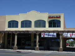 | Suhwaro Hotel | 0.4 miles | 1994 |
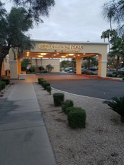 | San Marcos Hotel | 0.4 miles | 1982 |
 | Chandler Commercial Historic District | 0.5 miles | 2000 |
| Tucson, Cornelia and Gila Bend Railroad Caboose No. 15 | 2.7 miles | ||
 | Railroad Steam Wrecking Crane and Tool Car | 2.7 miles | 2007 |
| National Archives record | The nomination case file for reference 11000567 in Record Group 79. |
| Maricopa County | All 467 listed properties in this county. |