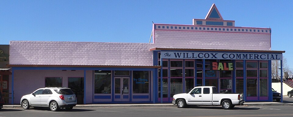
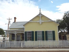
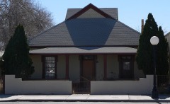
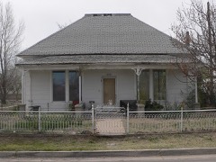
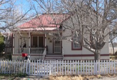
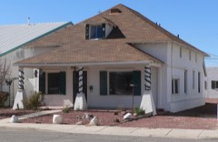
Listed on the National Register of Historic Places in 1983.
From the record
“Norton and Company Store is an historic structure in Willcox, Arizona, United States. Built circa 1880, it was added to the National Register of Historic Places in 1983.”
Wikipedia article John H. Norton and Company Store, CC BY-SA 4.0.
One of 76 National Register listings published here for Cochise County · listed in 1983 · category: Building.
National Register reference number.83002987- the number the National Park Service assigned this property when it was listed, and the key its nomination file is catalogued under at the National Archives.
Fires near this property
146 since 1992
Regional context, not property-specific
evidence. The
federal wildfire occurrence database
lists 146 fires within 5 miles of Norton, John H., and Company Store
between 1992 and 2020, burning about 807 acres in total. 5 started naturally. 3 were recorded as arson.
Distance is straight-line from the map coordinates, so a fire counted
here may appear on a neighbouring settlement's page as well.
Reported cause
Fires
Missing data/not specified/undetermined
92
Smoking
17
Debris and open burning
13
Equipment and vehicle use
10
Natural
5
Arson/incendiarism
3
Recreation and ceremony
2
Railroad operations and maintenance
2
Misuse of fire by a minor
2
The most recent of
them, most recent first, with the day each was reported and the service
that recorded it.
Date
Cause
Size
Reported by
Name on the report
6 September 1992
Equipment and vehicle use
under an acre
Arizona Department of Forestry and Fire Management - State Office
not named
30 September 2001
Missing data/not specified/undetermined
under an acre
Arizona Department of Forestry and Fire Management - State Office
RURAL
30 September 1993
Smoking
4.0 acres
Arizona Department of Forestry and Fire Management - State Office
not named
30 September 1993
Smoking
under an acre
Arizona Department of Forestry and Fire Management - State Office
not named
20 September 2010
Equipment and vehicle use
under an acre
Willcox Volunteer Fire Department
OLD STEWART
11 September 2019
Missing data/not specified/undetermined
under an acre
Arizona Department of Forestry and Fire Management - Southeast District
GOLD
7 August 1995
Smoking
under an acre
Arizona Department of Forestry and Fire Management - State Office
not named
20 August 2020
Missing data/not specified/undetermined
under an acre
Arizona Department of Forestry and Fire Management - State Office
Regional context, not property-specific
evidence. The federal mineral resources record lists
26 workings within 5 miles of Norton, John H., and Company Store: 20 producers, 3 occurrences, 2 prospects, 1 unknown.
20 still produce. What was taken out: Geothermal, Sand and Gravel, Construction, Gypsum-Anhydrite, Copper. Distance is straight-line from the
map coordinates, so a quarry counted here may appear on a neighbouring
settlement's page as well.
Regional context, not property-specific
evidence. The National Weather Service names
Willcox, the town this property stands in, in 37 storm reports between 1995 and 2024: 13 thunderstorm wind, 12 flash flood, 9 hail, 1 lightning.
The reports record 3 deaths and 7 injuries. Each account below is quoted exactly as the forecast office
filed it, from the NOAA Storm Events Database, and each date
opens the federal record of that event.
Heavy rainfall near the Town of Cascabel and along Cascabel Road caused several locations of the road to be flooded and impassable. At 19:40 MST (7:40 pm MST) a 1997 Ford flatbed pick-up truck, driving on Cascabel Road near the town of Cascabel (at mile post 23), en route to the Town of St. David encountered flood waters that were deep and moving rapidly across the street. The vehicle become stuck in the flood water and the two passengers in the vehicle were swept out of the truck and downstream. Both passengers perished.
A tornado touched down near Cox and Hamilton Rd, and moved northeast for approximately 1.7 miles causing extensive damage. One mobile home was lifted and moved off its foundation. Five people inside, including three children sustained minor injuries. The roof of another mobile home was ripped off and power poles were snapped. Two other homes were damaged along with a large machine shed-type storage building and several trees were snapped in half or uprooted. The damage survey concluded that peak wind speeds from the tornado were between 90 and 100 mph.
Straight-line wind damage occurred in and around Willcox. Damage to multiple structures along with multiple downed power poles. Many trees were downed as well. A fifth wheel trailer was tipped over with two occupants inside. Both suffered non-life-threatening injuries.
Video on social media showing accumulating hail with largest hail 1.5 inch in diameter. Video also showed damage to car windshield and dents in hood and roof of car.
A microburst over downtown Willcox caused damage along Haskell Street. A tin roof was blown off one building while part of a roof was peeled off another. Several trees were downed including a large tree in Railroad Park.
A strong thunderstorm in the area brought heavy rain and hail. The hail covered the ground up to two inches deep. Hail remained on the ground six hours after the storm had ended. Some minor roof damage occurred as a result of the wind. Two large tractor-semitrailers were blown off of Interstate 10 in the Willcox area.
Thunderstorm winds downed four towers of a center pivot which was full of water at the time to tip over. The storm then blew the wood and metal roof off a commercial produce building for an apple orchard, with multiple pieces found up to three fields away. Four power poles, several trees and a tent were also blown over.
Heavy rains fell across the Frye Fire burn scar and caused flash flooding in Ash Creek. An 8 pipeline leading to Cluff Pond 3 was washed away and several private outbuildings were damaged.
A thunderstorm outflow wind gust estimated at 60 mph destroyed a horse barn on the Diamond P Ranch on Brookerson Road, 17 miles north of Willcox. The 10-stall horse barn was completely destroyed by the wind gust. Two racehorses that were not in the barn were killed, when debris from the barn landed on them.
Local law enforcement reported that Whitewater School Road was flooded with a vehicle stuck in the wash. Additionally, Central Highway and Davis Road were also flooded.
A strong thunderstorm caused power lines to be downed in the Town of Kansas Settlement and small trees to be downed northeast of the Town of Sunsites. The strong winds were measured to be 60 mph (52 knots) by a trained spotter in the area and were estimated to be near 70 mph (61 knots) by another trained spotter.
A trained spotter reported one inch (1.00 inch) hail in the Town of Elfrida. A member of the public reported 0.88 inch hail, associated with the same severe thunderstorm almost 20 minutes later.
A trained weather spotter near the City of Willcox reported water flowing over Highway 191 to the northwest of the Town of Sunsites and over Kansas Settlement Road.
Chiricahua National Mounument was closed for 2 days following the flooding with camping prohibited for the next 30 days. Cleanup of debris washed through the area took several days.
A strong thunderstorm in the area brought heavy rain and hail. The hail covered the ground up to two inches deep. Hail remained on the ground six hours after the storm had ended. Some minor roof damage occurred as a result of the wind. Two large tractor-semitrailers were blown off of Interstate 10 in the Willcox area.
2 papers published in this town,
digitised by the Library of Congress and free to read: 956 issues,
6,717 pages. Every page is searchable, so a name or a street can be
looked for directly in what the town printed about itself at the time.
No historic map-sheet match is published
for this property yet. That does not mean no map exists. This record needs
a coordinate-quality review before it can be joined to a sheet boundary.
Browse the county's mapped places while that work is
pending.
Listed places nearby
6 within 8 miles
Other National Register properties close
enough to walk or drive between, ordered by distance from this one. Both
positions come from the same geocoding pass that matched these properties
to their map sheets.
Listing record. National Park Service National Register of Historic Places, listed-properties dataset, current to 2026-05-22.
Map join. Address geocoded through the United States Census geocoder, then tested against the published boundary of every sheet in the USGS Historical Topographic Map Collection.
How this page is made. Listing fields come from federal records; map-sheet coverage is a labelled coordinate-to-boundary calculation, not a source-field claim.
Wildfire. Short, Karen C. 2022. Spatial wildfire occurrence data for the United States, 1992-2020 [FPA_FOD_20221014]. 6th Edition. Fort Collins, CO: Forest Service Research Data Archive. https://doi.org/10.2737/RDS-2013-0009.6 Collected with United States Government funding and usable without additional permissions or fees.
Mines and quarries. USGS Mineral Resources Data System (MRDS) https://mrdata.usgs.gov/mrds/ A work of the United States government, no copyright under 17 U.S.C. 105.
Storms. NOAA National Centers for Environmental Information, Storm Events Database https://www.ncei.noaa.gov/stormevents/ A work of the United States government, no copyright under 17 U.S.C. 105. Narratives are quoted verbatim from the National Weather Service report and are not edited or summarised.
 Block