 Block
From the record
One of 467 National Register listings published here for Maricopa County · listed in 1984 · category: Building.
Sources: the case file at the National Archives · the National Register database, National Park Service
Listed on the National Register of Historic Places in 1984.
One of 467 National Register listings published here for Maricopa County · listed in 1984 · category: Building.
Sources: the case file at the National Archives · the National Register database, National Park Service
Regional context, not property-specific evidence. The federal wildfire occurrence database lists 1,650 fires within 5 miles of Hugh Laird House between 1995 and 2020, burning about 187 acres in total. 11 started naturally. 23 were recorded as arson. Distance is straight-line from the map coordinates, so a fire counted here may appear on a neighbouring settlement's page as well.
| Reported cause | Fires |
|---|---|
| Missing data/not specified/undetermined | 1604 |
| Arson/incendiarism | 23 |
| Natural | 11 |
| Equipment and vehicle use | 4 |
| Power generation/transmission/distribution | 3 |
| Recreation and ceremony | 2 |
| Debris and open burning | 2 |
| Misuse of fire by a minor | 1 |
The most recent of them, most recent first, with the day each was reported and the service that recorded it.
| Date | Cause | Size | Reported by | Name on the report |
|---|---|---|---|---|
| 9 September 2015 | Missing data/not specified/undetermined | under an acre | Arizona Department of Forestry and Fire Management - State Office | 155223 |
| 8 September 2018 | Missing data/not specified/undetermined | under an acre | Phoenix Fire Department | 334484 |
| 8 September 2018 | Missing data/not specified/undetermined | under an acre | Phoenix Fire Department | 333916 |
| 8 September 2013 | Missing data/not specified/undetermined | under an acre | Arizona Department of Forestry and Fire Management - State Office | AZ-133139 |
| 7 September 2019 | Missing data/not specified/undetermined | under an acre | Phoenix Fire Department | NOT NAMED |
| 7 September 2018 | Missing data/not specified/undetermined | under an acre | Tempe Fire Department | 1820633 |
| 7 September 2015 | Missing data/not specified/undetermined | under an acre | Arizona Department of Forestry and Fire Management - State Office | 154830 |
| 7 September 2014 | Missing data/not specified/undetermined | under an acre | Arizona Department of Forestry and Fire Management - State Office | AZ-142071 |
Regional context, not property-specific evidence. The federal mineral resources record lists 11 workings within 5 miles of Hugh Laird House: 6 producers, 3 past producers, 1 prospect, 1 unknown. 6 still produce. What was taken out: Sand and Gravel, Construction, Copper, Tungsten, Flagstone, Slate, Dimension. Distance is straight-line from the map coordinates, so a quarry counted here may appear on a neighbouring settlement's page as well.
| Where | Site | Commodity | Status | Recorded |
|---|---|---|---|---|
| Gabitzsch-Owens | Tungsten, Copper | Prospect | ||
| Mesa Sand & Gravel Pit | Sand and Gravel, Construction, Stone, Crushed/Broken | Producer | ||
| Scottsdale Plant | Flagstone, Slate, Dimension | Producer | ||
| Giacoma Claims | Copper | Unknown | ||
| Arizona S&R Plant #3 | Sand and Gravel, Construction | Producer | ||
| Hayden Road Pit | Sand and Gravel, Construction | Past Producer | ||
| Nesbitt Pit & Plant | Sand and Gravel, Construction | Producer | ||
| Sand and Gravel Quarry | Sand and Gravel, Construction | Past Producer | Sand and Gravel | |
| Tri-City Gravel Pit | Sand and Gravel, Construction | Producer | ||
| United Metro Plant #6 | Sand and Gravel, Construction | Producer |
Regional context, not property-specific evidence. The National Weather Service names Tempe, the town this property stands in, in 47 storm reports between 1994 and 2025: 32 thunderstorm wind, 6 hail, 4 heavy rain, 2 funnel cloud. The reports record 3 injuries. Each account below is quoted exactly as the forecast office filed it, from the NOAA Storm Events Database, and each date opens the federal record of that event.
| When | Event | Place named | Harm | What the report says |
|---|---|---|---|---|
| August 2014 | Thunderstorm Wind | Tempe | 2 hurt, $25,000 | Thunderstorms developed across portions of the greater Phoenix metropolitan area during the late afternoon and early evening hours on August 3rd, and some of them affected the community of Tempe. The stronger storms produced gusty and damaging winds, with peak gusts estimated to be at least 60 mph. According to a local broadcast media report, thunderstorm winds blew down several trees at the Apache Station apartments, located about 2 miles southeast of the Tempe Marketplace. The falling trees resulted in two injuries; one man's finger was broken as a tree fell, and another woman was injured when a tree was blown into the pool at the apartment complex. Additionally, the media reported that strong thunderstorm winds blew off half of the roof at an animal hospital near the Apache Station apartment complex. |
| August 2008 | Thunderstorm Wind | Tempe | 1 hurt, $4,000,000 | In Tempe, an 18 year-old man was injured by a falling tree. Winds on the ASU campus were measured at 69 mph and severely damaged the indoor football practice facility. |
| August 2015 | Thunderstorm Wind | Tempe | $400,000 | Strong thunderstorms developed across portions of the greater Phoenix metropolitan area, including the community of Tempe, during the evening hours on August 31st. Due to a favorable combination of elevated moisture, instability, and wind fields aloft, the stronger storms produced gusty and damaging microburst winds which were estimated to reach as high as 75 mph at times. The microburst winds produced significant damage across the northern portion of Tempe. According to an article in the Arizona Republic, very strong winds ripped off part of the roof at the Integrity Charter School in Tempe. City spokeswoman Melissa Quillard reported that the Tempe Center for the Arts sustained roof damage and about one half of the trees around the center were damaged. Finally, it was reported that the pedestrian and bicycle bridge across Tempe Town Lake was significantly damaged by the microburst winds. Repairs to the bridge were estimated at one quarter of a million dollars; the bridge was closed and will remain closed until futher notice. No injuries were reported as a result of the damaging winds. |
| June 2006 | Thunderstorm Wind | Tempe | $300,000 | Winds associated with thunderstorms uprooted trees and brought down power lines to parts of the Phoenix metropolitan area. About 6,000 SRP customers were without power in the Gilbert area. Dense blowing dust also resulted in very low visibility, delaying flights at Sky Harbor airport. |
| August 2013 | Thunderstorm Wind | Tempe | $50,000 | Scattered afternoon thunderstorms moved across the southeast portions of the greater Phoenix area on August 26th, and they impacted the community of Tempe. Thunderstorm outflow winds estimated to be at least 60 mph downed a large tree at an apartment complex located at the intersection of Kyrene and Elliot roads in Tempe. The tree landed on top of 3 adjacent parked cars and caved in the roofs of each car. The report was received via local broadcast media. |
| July 2008 | Lightning | Tempe | $50,000 | Lightning was blamed in starting a fire in the attic of a Tempe home. Tempe Fire responded to two other weather related fires. |
| August 2014 | Thunderstorm Wind | Tempe | $40,000 | Thunderstorms developed across portions of the greater Phoenix area during the evening hours on August 3rd, and some of the stronger storms affected the community of Tempe. The storms produced damaging microburst winds that were estimated to reach 70 mph at times. Several reports of damage were received from the public, mostly in the area about 2 miles to the east of Tempe. The damage reports all occurred at approximately 1815MST. According to public reports, a two foot in diameter tree was uprooted, and when it fell it damaged a stone wall. Additionally, two large trees were blown down, causing damage to a cinder block wall and a swimming pool. Many other large trees in the area were also blown down. Finally, another public report indicated that a power pole was snapped in east central Tempe at the intersection of South River Drive and Southern Avenue. This location was on Southern Avenue between McClintock Drive and the Loop 101. |
| August 2020 | Thunderstorm Wind | Tempe | $30,000 | Strong thunderstorms developed on outflow boundaries over central and southeast portions of the greater Phoenix area during the evening hours on August 20th. Some of the stronger storms impacted the communities of Tempe and Ahwatukee Foothills. According to a report from local broadcast media, at 1959MST gusty outflow winds estimated to be at least 60 mph in strength blew down a very large tree onto an apartment complex in Tempe. The damage occurred just northwest of the intersection of Rural Road and the Superstition Freeway. The downed tree had a diameter of over one foot. Just a few minutes prior to that, a trained spotter located 4 miles east of the Ahwatukee Foothills reported multiple trees blown down and the largest tree had a diameter of greater than six inches. There were no reports of injuries at the apartment complex or due to the falling trees. |
| August 2015 | Thunderstorm Wind | Tempe | $30,000 | Scattered strong thunderstorms moved across the central portion of the greater Phoenix metropolitan area during the evening hours on August 31st, and they affected the community of Tempe. Some of the stronger storms produced gusty and damaging outflow winds in excess of 60 mph; the winds blew down numerous trees. According to a trained weather spotter 2 miles northwest of the Tempe Marketplace in north Tempe, damaging winds estimated to be as high as 70 mph blew down numerous large trees along Scottsdale Road south of east McKellips Road. At the same time, a report from the public indicated numerous large trees down near 68th Street and McKellips. Additionally, at 1950MST another public report indicated that strong winds downed a streetlight pole on College Avenue just north of Curry Road, near the Arizona State University campus. |
| August 2018 | Thunderstorm Wind | Tempe | $20,000 | Thunderstorms with strong gusty outflow winds moved through the southeast portion of the greater Phoenix area during the early evening hours on August 12th. One of the stronger storms moved across the community of Tempe. According to a member of the public located about 1 mile west of Tempe, at 1822MST gusty winds estimated to be as high as 70 mph downed a large eucalyptus tree; the tree was knocked over and onto an apartment building near the intersection of Mill Avenue and Southern Avenue. No injuries were reported due to the downed tree. |
| July 2009 | Thunderstorm Wind | Tempe | $20,000 | Strong winds damaged roof tiles near McClintock Drive, and a spotter at Warner and Kyrene reported 1/2 inch of rain in 15 minutes. |
| August 2015 | Thunderstorm Wind | Tempe | $15,000 | Scattered thunderstorms moved across the southeast portion of the greater Phoenix metropolitan area during the evening hours on August 31st, and some of the stronger storms generated gusty and damaging outflow winds. Some of the winds damaged trees in the area around the Arizona State University campus in north Tempe. At 2030MT, a member of the public reported that gusty winds downed trees and blew shingles off of roofs near the intersection of Mill Avenue and Broadway Road in north Tempe. The winds were estimated to be in excess of 60 mph. About 30 minutes earlier, the public reported that gusty winds downed trees along University Avenue between Priest Drive and the Loop 202, about 2 miles west of the college campus. |
| October 2025 | Heavy Rain | Tempe | $10,000 | Tiles of roof collapsed due to water infiltration inside the Sky High Smoke Shop located in a shopping center off of Southern and Mill Avenues in Tempe. No injuries reported. |
| September 2025 | Thunderstorm Wind | Tempe | $10,000 | Large dead tree fell, damaging a cinderblock wall, a couple of motorcycles, and bringing down a power line in the area of University Drive and McClintock Drive in Tempe. Wind gusts were estimated at 55-60 mph. Timing estimated from radar. No injuries reported. |
| September 2025 | Flash Flood | Tempe | $10,000 | Image shows a car stranded in a flooded roadway along a neighborhood located in the area of Southern Avenue and Loop 101. No injuries reported. |
| September 2013 | Flash Flood | Tempe | $10,000 | Southerly flow imported copious amounts of tropical moisture into south central Arizona during the morning hours on September 9th, and as a result widespread showers developed across the eastern portions of the greater Phoenix metropolitan area. Areas of moderate to heavy rain developed; isolated embedded thunderstorms further enhanced the rainfall totals. Flood Control District gages and radar data indicated that rainfall rates up to 2 inches per hour had occurred during the late morning and this led to flash flooding across portions of Mesa and Chandler. According to the Arizona Department of Highways, at about 1200MST there was flash flooding near the interchange of the Superstition Freeway, or US 60, and the Loop 101. This intersection was about 2 miles southwest of the Fiesta Mall. A Flash Flood Warning was in effect for the area at the time and it ran through 1300MST. Although the heavy rains had tapered by early afternoon, additional rains occurred into the afternoon hours and another Urban and Small Stream Flood Advisory was issued which ran from 1300MST to 1500MST. |
| August 2025 | Thunderstorm Wind | Tempe | $7,000 | An image showed a large tree down on a utility van near Elna Rae Street and Hardy Drive. No injuries were reported. |
| July 2022 | Thunderstorm Wind | Tempe | $5,000 | Social media image showed a brick fence blown over near the intersection of East Southern Avenue and Loop 101 in Tempe. No injuries were reported. |
| September 2008 | Thunderstorm Wind | Tempe | $5,000 | A trained spotter reported a wind gust of 60 mph along with pea sized hail at McClintock and Guadalupe. |
| August 2018 | Thunderstorm Wind | Tempe | $3,000 | Thunderstorms with strong and gusty outflow winds developed across the central portion of the greater Phoenix area, including the community of Tempe, during the evening hours on August 8th. Some of the stronger wind gusts were sufficient to cause damage over portions of north Tempe. According to a trained weather spotter near the Shalimar Golf Course, at 1958MST gusty winds estimated to be at least 75 mph in strength snapped a flagpole in half. The damage occurred at 1924 East Wesleyan Drive in Tempe. A few minutes earlier, at 1955MST, a trained spotter located 1 mile east of Arizona State University reported a large branch downed onto the light rail near the intersection of Apache Boulevard and McClintock Road. The winds that downed the branch were estimated to be around 60 mph. |
| June 2015 | Thunderstorm Wind | Tempe | $3,000 | Isolated thunderstorms developed across the greater Phoenix metropolitan area during the late afternoon and evening hours on June 27th, and some of them affected the town of Tempe. The stronger storms produced gusty and damaging outflow winds estimated to be at least 65 mph in strength. According to a trained weather spotter about 2 miles east of central Tempe, at 1845MST a tree was blown down on Apache Boulevard between McClintock and Rural Roads. About 15 minutes later, strong winds blew down some large tree branches at least 2 inches in diameter in Scottsdale, at the intersection of Thomas and 67th Place. |
| August 2014 | Thunderstorm Wind | Tempe | $3,000 | Scattered thunderstorms affected the greater Phoenix metropolitan area during the late afternoon and evening hours on August 12th, and some of them affected the community of Tempe. In addition to heavy rain, the stronger storms produced gusty and damaging microburst winds. A National Weather Service employee reported that thunderstorms winds, estimated to be at least 60 mph, downed a 25 foot tall tree at the intersection of Rural Road and Broadway Road in north Tempe. The tree had a diameter of approximately one and a half feet. No injuries were reported due to the fallen tree. |
| July 2018 | Thunderstorm Wind | Tempe | $2,000 | Strong thunderstorms developed over central portions of the greater Phoenix area, including the community of Tempe, during the afternoon hours on July 9th. Some of the storms generated gusty outflow winds in excess of 50 mph. According to a public report, at about 1600MST outflow winds estimated to be 60 mph in strength blew down a large tree near the intersection of University Avenue and McClintock Road, about 1 mile northeast of Arizona State University. No injuries resulted from the falling tree. |
| July 2009 | Thunderstorm Wind | Tempe | $2,000 | Four inch tree limbs were blown down near Elliot and Rural. |
| September 2025 | Thunderstorm Wind | Tempe | $1,000 | Tree uprooted near the intersection of East University Ave and South College Avenue on the campus of Arizona State University in Tempe. No injuries reported. |
| November 2025 | Hail | Tempe | - | Photo of estimated nickel-sized diameter hail in the area of East Broadway Road and South McClintock Drive in Tempe. No damages or injuries reported. |
| November 2025 | Hail | Tempe | - | Photos of accumulated hail with sizes up to 0.75 in diameter in the area of South Country Club Way and East Balboa Drive in Tempe. No damages or injuries reported. |
| September 2025 | Hail | Tempe | - | Social media image of hail around 1 inch in diameter in the vicinity of the Loop-101/US-60 interchange in Tempe. No damage or injuries reported. |
| July 2018 | Heavy Rain | Tempe | - | Isolated to scattered thunderstorms developed over central and eastern portions of the greater Phoenix area, including the community of Tempe, during the late afternoon and evening hours on July 10th. The stronger storms produced intense rainfall with peak rain rates approaching 2 inches per hour. At 1715MST a trained spotter in Tempe reported heavy rain; one half inch fell within a 15 minute period just southwest of the intersection of Rural Road and Southern Avenue. Minor street flooding was also reported. At 1724MST, another spotter about one block west reported street flooding; there was sufficient accumulation of water to flow up over the curbs and onto the sidewalk on the east side of Mill Avenue. Additionally, at 1800MST a public report was received about street flooding just east of Rural Road between Baseline Road and Guadalupe Road; water was flowing over the curbs in a fashion similar to the other reports. An Urban and Small Stream Flood Advisory was issued for the area at 1718MST and it remained in effect through 1845MST. |
| July 2010 | Heavy Rain | Tempe | - | Heavy downpours of .75 inch in a half hour were reporte at Baseline and McClintock. Water was reported to be axle deep on the roadway. Parking lots were flooded in Tempe. |
| September 2007 | Heavy Rain | Tempe | - | Locally heavy rain was reported to be a factor in the series of vehicle accidents on US 60. The most serious wreck was a 27-car pileup in the westbound lanes between Rural and McClintock Drive. |
| July 2006 | Thunderstorm Wind | Tempe | - | Trees uprooted near downtown Tempe. |
| August 2006 | Thunderstorm Wind | Tempe | - | Numerous trees downed by strong winds. |
| January 2001 | Funnel Cloud | Tempe | - | Spotters reported the short-lived funnel cloud over the Ahwatukee-Chandler area. |
| October 1998 | Thunderstorm Wind | Tempe | - | A cluster of thunderstorms, with at least one rotating supercell, produced winds that uprooted trees, blew down power poles, and damaged at least one large wall at a construction site in Chandler. |
| August 1998 | Thunderstorm Wind | Tempe | - | Large tree limbs downed by winds near Broadway and Rural. Numerous streets in Tempe flooded. |
| October 1998 | Hail | Tempe | - | Large hail reported in Mesa and Tempe. |
| July 1997 | Thunderstorm Wind | Tempe | - | A weather service employee near Broadway Road and Rural Road reported shingles ripped off his home. His neighbour reported a eucalyptus tree was sheared off at the top. |
| August 1997 | Funnel Cloud | Tempe | - | A rain-wrapped funnel cloud was sighted about 5 to 7 miles south of the intersection of Hardy Drive at University Drive. |
| August 1997 | Thunderstorm Wind | Tempe | - | Several more power lines blown down in Tempe. |
| August 1997 | Thunderstorm Wind | Tempe | - | Power lines blown down. |
| August 1995 | Thunderstorm Wind | Tempe | - | Power lines were knocked down due to thunderstorm winds. |
| September 1994 | Hail | Tempe | - | Severe thunderstorms rolled into the greater Phoenix area dumping 0.75 inch rain in 30 minutes in Sun City; 1.50 inch in one hour at Lake Pleasant; 1.12 inch rain in one hour at 27th Avenue and Bell Road; 1.65 inch rain in one hour was reported in Litchfield Park resulting in major street flooding. Lightning strikes started fires in three homes in Litchfield Park, but damage was minor. A storm chase team at 32nd Street and Greenway measured wind gusts to 69 mph at 1734 MST. An estimated 13,000 homes were without power. |
| September 1994 | Thunderstorm Wind | Tempe | - | Thunderstorm winds downed a half dozen power poles, uprooted large trees, and tore shingles off a roof. |
| March 1994 | Thunderstorm Wind | Tempe | - | Road signs in a construction site on Interstate 10 were blown down. |
| July 1994 | Thunderstorm Wind | Tempe | - | A cluster of severe thunderstorms moved west across the Phoenix metropolitan area between 7 and 8 pm. The thunderstorms toppled and uprooted large trees, blew shingles off roofs, and downed power lines. Lightning also struck a manufacturing plant, and the resulting fire destroyed the building and its contents. |
| September 2003 | Hail | Tempe | - | no account filed |
No historic map-sheet match is published for this property yet. That does not mean no map exists. This record needs a coordinate-quality review before it can be joined to a sheet boundary. Browse the county's mapped places while that work is pending.
Other National Register properties close enough to walk or drive between, ordered by distance from this one. Both positions come from the same geocoding pass that matched these properties to their map sheets.
| Photograph | Property | Distance | Listed |
|---|---|---|---|
 | W. A. Moeur House | under 500 feet | 1984 |
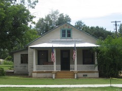 | Hiatt House | 0.1 miles | 1984 |
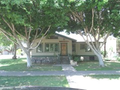 | Byron Redden House | 0.1 miles | 1984 |
| B. H. Scudder Rental House | 0.2 miles | 1984 | |
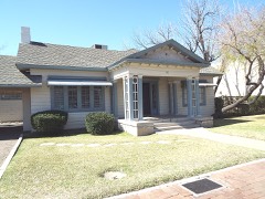 | C. P. Mullen House | 0.2 miles | 1984 |
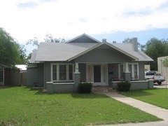 | Elliott House | 0.2 miles | 1984 |
| National Archives record | The nomination case file for reference 84000726 in Record Group 79. |
| Maricopa County | All 467 listed properties in this county. |