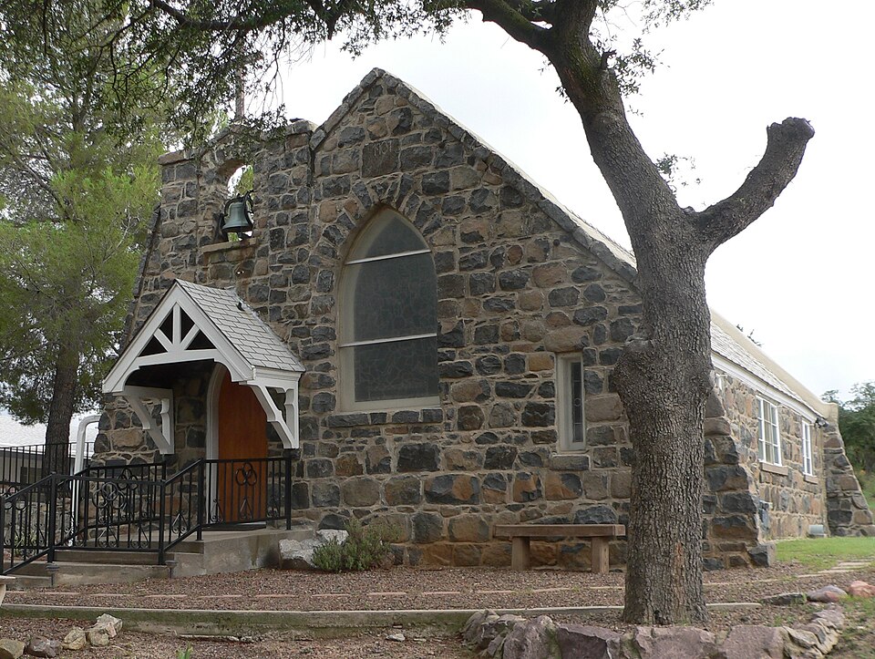
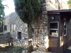
National Register reference number.84000768- the number the National Park Service assigned this property when it was listed, and the key its nomination file is catalogued under at the National Archives.
Fires near this property
80 since 1992
Regional context, not property-specific
evidence. The
federal wildfire occurrence database
lists 80 fires within 5 miles of All Saint's Church
between 1992 and 2020, burning about 3,389 acres in total. 17 started naturally. 5 were recorded as arson.
Distance is straight-line from the map coordinates, so a fire counted
here may appear on a neighbouring settlement's page as well.
Reported cause
Fires
Missing data/not specified/undetermined
37
Natural
17
Debris and open burning
9
Smoking
5
Arson/incendiarism
5
Equipment and vehicle use
4
Misuse of fire by a minor
3
The most recent of
them, most recent first, with the day each was reported and the service
that recorded it.
Date
Cause
Size
Reported by
Name on the report
8 September 2002
Arson/incendiarism
under an acre
Arizona Department of Forestry and Fire Management - State Office
FALCON
3 September 2017
Missing data/not specified/undetermined
under an acre
Oracle Volunteer Fire District
not named
3 September 1996
Smoking
under an acre
Arizona Department of Forestry and Fire Management - State Office
not named
12 September 2016
Natural
under an acre
Coronado National Forest
COD RANCH
9 August 1995
Missing data/not specified/undetermined
1.0 acres
Arizona Department of Forestry and Fire Management - State Office
not named
5 August 1993
Natural
10 acres
Coronado National Forest
JINKS
4 August 2001
Natural
under an acre
Arizona Department of Forestry and Fire Management - State Office
Regional context, not property-specific
evidence. The federal mineral resources record lists
46 workings within 5 miles of All Saint's Church: 24 past producers, 9 prospects, 8 occurrences, 4 producers.
4 still produce. What was taken out: Gold, Tungsten, Copper, Lead, Silver. Distance is straight-line from the
map coordinates, so a quarry counted here may appear on a neighbouring
settlement's page as well.
Regional context, not property-specific
evidence. The National Weather Service names
Oracle, the town this property stands in, in 32 storm reports between 1993 and 2022: 10 hail, 9 thunderstorm wind, 9 flash flood, 2 lightning.
The reports record 1 death. Each account below is quoted exactly as the forecast office
filed it, from the NOAA Storm Events Database, and each date
opens the federal record of that event.
Around 1.50 to 1.75 inches of rain fell in 30 minutes, with isolated reports of 1.90 inches. The Bonito Wash flooded several homes in the Campo Bonito area. Along the Canada del Oro Wash, the Rancho Solano gauge recorded a 9 foot rise of water. Several houses sustained flood damage. To compound the problem of the fast rising water, two culverts at a bridge downstream became blocked.
Thunderstorms moving into Oracle resulted in trees and power lines downed across a roadway. The most extensive damage was a roof blown off of a home located on Bonito Drive in Oracle.
Numerous streets flooded in Oracle, along with a swift water rescue. The gage at Oracle Ridge recorded 0.94 inches in 30 minutes. Over 40 homes were evacuated in the Catalina area along the Canada del Oro Wash.
Heavy rain caused ponding of water along Highway 79 north of Park Link Drive, and caused Durham Wash and other small washes to flow across the highway, making it impassable for 2 hours. Farther south, heavy rain also occurred near I-10 along the Pinal/Pima county line. Flash flooding occurred at Pinal Air Park, where flood waters entered several buildings. Runoff flooded small washes near Red Rock and washed out Sasco Road at the Santa Cruz River.
Thunderstorms produced torrential rainfall on the north side of the Catalina Mountains, producing flash flooding. Rainfall estimates were locally as high as six inches in portions of southeast Pinal County, specifically near Camp Bonito. Law enforcement barricaded Mt. Lemmon and Peppersauce Roads due to flash flooding. A trained spotter measured 2.40 inches of rain 4 miles southeast of Oracle.
Several homes near Golder Ranch Road were impacted when water in Canada del Oro wash rose 2 to 6 feet. A gauge near Oracle Ridge reported 1.10 inches of rain.
This short-lived tornado over a remote area was observed by a tornado chaser. It touched down and lifted up several times, with lots of desert debris in the funnel.
No historic map-sheet match is published
for this property yet. That does not mean no map exists. This record needs
a coordinate-quality review before it can be joined to a sheet boundary.
Browse the county's mapped places while that work is
pending.
Listed places nearby
6 within 8 miles
Other National Register properties close
enough to walk or drive between, ordered by distance from this one. Both
positions come from the same geocoding pass that matched these properties
to their map sheets.
Listing record. National Park Service National Register of Historic Places, listed-properties dataset, current to 2026-05-22.
Map join. Address geocoded through the United States Census geocoder, then tested against the published boundary of every sheet in the USGS Historical Topographic Map Collection.
How this page is made. Listing fields come from federal records; map-sheet coverage is a labelled coordinate-to-boundary calculation, not a source-field claim.
Wildfire. Short, Karen C. 2022. Spatial wildfire occurrence data for the United States, 1992-2020 [FPA_FOD_20221014]. 6th Edition. Fort Collins, CO: Forest Service Research Data Archive. https://doi.org/10.2737/RDS-2013-0009.6 Collected with United States Government funding and usable without additional permissions or fees.
Mines and quarries. USGS Mineral Resources Data System (MRDS) https://mrdata.usgs.gov/mrds/ A work of the United States government, no copyright under 17 U.S.C. 105.
Storms. NOAA National Centers for Environmental Information, Storm Events Database https://www.ncei.noaa.gov/stormevents/ A work of the United States government, no copyright under 17 U.S.C. 105. Narratives are quoted verbatim from the National Weather Service report and are not edited or summarised.
 Block