 Block
From the record
One of 100 National Register listings published here for Pinal County · listed in 1986 · category: Building.
Sources: the case file at the National Archives · the National Register database, National Park Service
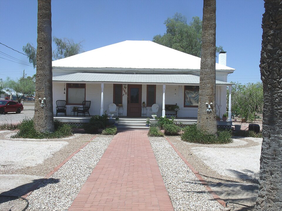
Listed on the National Register of Historic Places in 1986.
One of 100 National Register listings published here for Pinal County · listed in 1986 · category: Building.
Sources: the case file at the National Archives · the National Register database, National Park Service
Regional context, not property-specific evidence. The federal wildfire occurrence database lists 107 fires within 5 miles of W. Y. Price House between 1992 and 2020, burning about 797 acres in total. None started naturally. 8 were recorded as arson. Distance is straight-line from the map coordinates, so a fire counted here may appear on a neighbouring settlement's page as well.
| Reported cause | Fires |
|---|---|
| Missing data/not specified/undetermined | 62 |
| Debris and open burning | 13 |
| Smoking | 11 |
| Arson/incendiarism | 8 |
| Equipment and vehicle use | 6 |
| Railroad operations and maintenance | 4 |
| Firearms and explosives use | 2 |
| Power generation/transmission/distribution | 1 |
The most recent of them, most recent first, with the day each was reported and the service that recorded it.
| Date | Cause | Size | Reported by | Name on the report |
|---|---|---|---|---|
| 23 September 1992 | Arson/incendiarism | 120 acres | Arizona Department of Forestry and Fire Management - State Office | not named |
| 20 September 1993 | Debris and open burning | under an acre | Arizona Department of Forestry and Fire Management - State Office | not named |
| 18 September 1993 | Arson/incendiarism | under an acre | Arizona Department of Forestry and Fire Management - State Office | not named |
| 12 September 1995 | Smoking | under an acre | Arizona Department of Forestry and Fire Management - State Office | not named |
| 11 September 2018 | Missing data/not specified/undetermined | under an acre | Arizona Department of Forestry and Fire Management - Southeast District | DIFFEN |
| 6 August 1996 | Missing data/not specified/undetermined | under an acre | Arizona Department of Forestry and Fire Management - State Office | not named |
| 6 August 1995 | Smoking | under an acre | Arizona Department of Forestry and Fire Management - State Office | not named |
| 4 August 1995 | Smoking | 2.0 acres | Arizona Department of Forestry and Fire Management - State Office | not named |
Regional context, not property-specific evidence. The federal mineral resources record lists 16 workings within 5 miles of W. Y. Price House: 12 past producers, 2 occurrences, 2 prospects. None of them still produces. What was taken out: Sand and Gravel, Construction, Iron, Copper Sulfide, Copper Oxide, Molybdenum. Distance is straight-line from the map coordinates, so a quarry counted here may appear on a neighbouring settlement's page as well.
| Where | Site | Commodity | Status | Recorded |
|---|---|---|---|---|
| Florence | Copper Sulfide, Copper Oxide, Molybdenum | Prospect | 1969 | |
| Oro Negro Mining Co Properties | Iron | Prospect | ||
| Gravel Pit | Sand and Gravel, Construction | Occurrence | Gravel | |
| Gravel Pit | Sand and Gravel, Construction | Occurrence | Gravel | |
| Gravel Pit | Sand and Gravel, Construction | Past Producer | ||
| Gravel Pit | Sand and Gravel, Construction | Past Producer | ||
| Gravel Pit | Sand and Gravel, Construction | Past Producer | ||
| Gravel Pit | Sand and Gravel, Construction | Past Producer | ||
| Gravel Pit | Sand and Gravel, Construction | Past Producer | ||
| Gravel Pit | Sand and Gravel, Construction | Past Producer |
Regional context, not property-specific evidence. The National Weather Service names Florence, the town this property stands in, in 39 storm reports between 1996 and 2025: 20 thunderstorm wind, 11 flash flood, 3 hail, 2 heavy rain. No death or injury is recorded in these reports. Each account below is quoted exactly as the forecast office filed it, from the NOAA Storm Events Database, and each date opens the federal record of that event.
| When | Event | Place named | Harm | What the report says |
|---|---|---|---|---|
| September 2004 | Flash Flood | Florence | $2,000,000 | Local areas of heavy rainfall developed within a tropical-like environment across much of south-central Arizona. Locally windy conditions preceded the showers and thunderstorms during the late afternoon hours. A rather narrow band of heavy rain developed over mainly rural areas of northern Pinal County, which resulted in flooded homes and roads. Three to 5 inches of rain was reported in a 70 minute period in one northern portion of Pinal County, according to the county emergency manager. The worst damage occurred in the community of Queen Valley, where the sewage treatment plant had an initial damage estimate of $1.5 million. Gov. Napolitano declared an emergency and designated $200,000 to help repair roads and the sewage treatment plant. Several water rescues were made, and cars were washed out of carports. Flood waters carried various types of debris, and a propane tank was found in a tree. |
| July 2018 | Thunderstorm Wind | Florence | $250,000 | Strong thunderstorms developed over the higher terrain of eastern Arizona during the afternoon hours on July 30th and some of the stronger storms produced gusty damaging microburst winds that impacted the community of Florence. According to aerial survey footage taken by local broadcast media, multiple mobile homes were destroyed about 1 mile northeast of the town of Florence. The damaged homes were just southeast of the intersection of Butte Avenue and the Pinal Parkway. The damage occurred at roughly 1830MST. According to radar imagery, a downburst wind pattern affected the homes, with peak wind gusts estimated to be at least 75 mph in strength. At about the same time the Pinal County Office of Emergency Management reported that strong wind gusts downed a Mesquite tree in Florence, near the Highway 79 and Butte Avenue intersection. The diameter of the downed tree was 21 inches. The tree was blown over and landed on a car; the car was destroyed in the process. No injuries were reported due to the strong wind damage. |
| August 2015 | Thunderstorm Wind | Florence | $50,000 | Strong thunderstorms developed to the southeast of the greater Phoenix metropolitan area during the late afternoon hours on August 29th, affecting locations in the vicinity of Florence. Due to a combination of elevated moisture, instability and winds aloft, the stronger storms generated damaging microburst winds estimated to be in excess of 70 mph. According to a report from the public, at 1800MST a microburst hit to the northwest of Florence, about 5 miles north of the community of Valley Farms. The strong winds blew off roof boards and tiles from numerous homes and snapped and uprooted dozens of trees in the area. Board debris from the damage could also be found in some yards in the town of Florence. |
| September 2011 | Thunderstorm Wind | Florence | $30,000 | Thunderstorms with damaging microburst winds moved across the Florence area during the evening hours on September 10th. A trained weather spotter in northeast Florence reported roof damage to several carports. Winds were estimated to be in excess of 50 knots. |
| July 2009 | Lightning | Florence | $30,000 | A house at Third and Phoenix streets in Florence was struck by lightning, setting the house on fire. |
| June 2006 | Thunderstorm Wind | Florence | $30,000 | Power poles and lines down near Johnson Ranch. |
| September 1999 | Thunderstorm Wind | Florence | $30,000 | Windows blown out of the guard towers, and roof torn off at the nearby prison. Nearby Sacaton, on the Gila River Indian Community, had 13 homes damaged by the storm. Minor and major roof damages, coolers damaged, windows broken, carport damage, trailer sidings and trailer damages. |
| August 2022 | Thunderstorm Wind | Florence | $25,000 | There were numerous reports of wind damage in Anthem at Merrill Ranch, including 35 plus trees uprooted, snapped, or with branches down. There were also reports of roof tiles blown off and a Gazebo that was lifted from one yard to another. No injuries were reported. |
| September 2025 | Flash Flood | Florence | $20,000 | Video showed considerable flow along Hunt Highway in Florence with a vehicle stuck in the floodwaters. Timing estimated from radar. No injuries reported. |
| July 2013 | Thunderstorm Wind | Florence | $10,000 | Strong thunderstorms developed during the early afternoon hours across portions of north central Pinal county on July 12th. The storms produced gusty and damaging winds estimated to be in excess of 60 mph, which affected communities such as San Tan Valley and Florence. At 1230 pm, a trained weather spotter 2 miles north of Florence reported that a large tree had been blown over in Florence Gardens. In addition, an awning had been blown off of a house in the same area. A Severe Thunderstorm Warning had been issued for the area beginning at 1224 pm and continuing through 115 pm. |
| July 2007 | Thunderstorm Wind | Florence | $10,000 | Winds as high as 70 mph damaged at least one power pole. |
| August 2024 | Thunderstorm Wind | Florence | $5,000 | Downed powerlines reported on SR-287, between Main St and Valley Farms Rd in Florence, leading to a closure of the highway. No injuries were reported. |
| July 2018 | Flash Flood | Florence | $5,000 | Thunderstorms developed over the higher terrain of eastern Arizona during the afternoon hours on July 30th and the stronger storms generated intense rainfall with peak rain rates approaching 2 inches per hour. The heavy rain resulted in a few episodes of evening flash flooding and one of them affected the town of Florence. At 1800MST, the Pinal County Office of Emergency Management reported flash flooding along Main Street which resulted in water that flowed into their offices. No injuries were reported. A Flash Flood Warning was not in effect at the time of the flooding. |
| June 2008 | Dust Devil | Florence | $5,000 | Minor damage to homes resulted when a dust devil moved through this community. |
| July 2008 | Thunderstorm Wind | Florence | $2,000 | Winds snapped a power pole at Central and Butte Avenues. |
| October 2010 | Thunderstorm Wind | Florence | $1,000 | A trained spotter in the town of Florence reported that a large Palo Verde tree was blown down by a strong thunderstorm wind gust, estimated to be at least 50 mph. |
| September 2025 | Thunderstorm Wind | Florence | $500 | Minor wind damage reported at the corner of North Dogwood Road and Jakes Lane in Florence. A few broken windows. Report of a gustnado on the leading edge of the storm. No injuries reported. |
| August 2010 | Thunderstorm Wind | Florence | $100 | Thunderstorm winds downed tree limbs. |
| September 2025 | Flash Flood | Florence | - | Video showed about 6-12 inches of water flowing along Main Street in Florence. No damages or injuries reported. |
| September 2025 | Hail | Florence | - | Ping pong sized hail reported in Florence. No damages or injuries reported. |
| July 2021 | Flash Flood | Florence | - | More than 1 inch of rain in less than 1 hour caused flash flooding in Cactus Forest and the closure of Quail Ridge Way near Diffin Rd. |
| July 2021 | Flash Flood | Florence | - | County Public Works reported Price Road east of SR 79 in the Florence area was closed due to flooding. No injuries were reported. |
| July 2018 | Heavy Rain | Florence | - | Thunderstorms developed to the southeast of the greater Phoenix area during the afternoon hours on July 9th and affected portions of northern Pinal County including the area around the community of Florence. Some of the stronger storms produced locally heavy rainfall which led to some street flooding near Florence. According to a trained weather spotter 5 miles northwest of Florence, at about 1600MST street flooding was reported in the Merrill Ranch development; some of the water was flowing over curbs in the complex. No flash flooding was reported however. |
| October 2018 | Hail | Florence | - | Thunderstorms with large hail developed to the southeast of Phoenix during the late afternoon hours on October 21st. Some of the stronger storms affected the community of Florence. According to a trained weather spotter 1 mile north of Florence, quarter sized hailstones fell at 1640MST, near the intersection of Highway 79 and East Diversion Dam Road. No damage was reported with the large hail. |
| October 2018 | Hail | Florence | - | Thunderstorms with large hail developed to the southeast of Phoenix during the late afternoon and evening hours on October 21st. According to a trained weather spotter located 5 miles northwest of Florence, large hail was reported at 1652MST near Anthem Community Park and just northeast of the intersection of Attaway Road and the Hunt Highway. The diameter of the largest stones was about 1 inch. No damage was reported as a result of the large hail. |
| August 2010 | Heavy Rain | Florence | - | Thunderstorms in the Florence area produced locally heavy rainfall, with rainfall rates in excess of 1.5 inches per hour. At 2115MST the Pinal County sheriff reported running washes with water water covering highway 79 near Florence. In addition, flooding was reported along the Hunt highway. |
| July 2008 | Flash Flood | Florence | - | Nearly two inches of rain caused streets in Florence to become flooded. |
| July 2007 | Flash Flood | Florence | - | Radar indicated over 2 inches of rain fell in parts of Pinal County. Many roads flooded. |
| August 2006 | Flash Flood | Florence | - | Several roads flooded in the town of Cactus Forest, and widespread street flooding in Eloy. |
| July 2004 | Thunderstorm Wind | Florence | - | Brief heavy rain and dense blowing dust accompanied the thunderstorms across parts of northern Pinal County. |
| September 2004 | Thunderstorm Wind | Florence | - | Trees uprooted on the east side of Florence, power poles blown down in Apache Junction. |
| August 2002 | Thunderstorm Wind | Florence | - | Measured winds of 57 mph at the Magma Dam automatic station. |
| August 2001 | Flood | Florence | - | Many streets and roads flooded during the early morning hours after rainfalls of one to two inches covered the area. |
| July 1999 | Flash Flood | Florence | - | Very heavy rainfall, up to 2.25 per hour hit this area. Widespread damage due to high water in many areas of Northwest Pinal County. |
| July 1997 | Thunderstorm Wind | Florence | - | Strong winds knocked down fifteen power line poles on Arizona 287 between Florence and Coolidge. |
| August 1997 | Thunderstorm Wind | Florence | - | Spotter reported numerous trees were blown down, roofs damaged, and power poles downed. Some streets had to be closed due to live wires down across the roads. A tin roof completely lifted off an adobe home and was dumped into yard. The spotter observed sheet metal flying past his window during the storm. |
| August 1997 | Flash Flood | Florence | - | Sand bags were used on Main Street due to one to two feet of water flowing across the road. Weather spotter recorded 2.5 inches of rain from the storm. |
| August 1996 | Thunderstorm Wind | Florence | - | no account filed |
| August 1996 | Thunderstorm Wind | Florence | - | no account filed |
1 paper published in this town, digitised by the Library of Congress and free to read: 962 issues, 3,842 pages. Every page is searchable, so a name or a street can be looked for directly in what the town printed about itself at the time.
| Newspaper | Published |
|---|---|
| The Florence Tribune | 1892 to 1901 |
No historic map-sheet match is published for this property yet. That does not mean no map exists. This record needs a coordinate-quality review before it can be joined to a sheet boundary. Browse the county's mapped places while that work is pending.
Other National Register properties close enough to walk or drive between, ordered by distance from this one. Both positions come from the same geocoding pass that matched these properties to their map sheets.
| Photograph | Property | Distance | Listed |
|---|---|---|---|
 | C. D. Henry House | under 500 feet | 1986 |
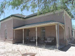 | Harvey-Niemeyer House | 0.1 miles | 1986 |
| Dr. George M. and Esther A. Brockway House | 0.1 miles | 2004 | |
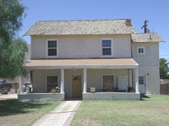 | Truman-Randall House | 0.2 miles | 1987 |
| Encarnacion Avenenti House | 0.2 miles | 1987 | |
 | First Presbyterian Church of Florence | 0.3 miles | 1994 |
| National Archives record | The nomination case file for reference 86002632 in Record Group 79. |
| Pinal County | All 100 listed properties in this county. |