 Block
From the record
One of 100 National Register listings published here for Pinal County · listed in 1988 · category: Structure.
Sources: the case file at the National Archives · the National Register database, National Park Service
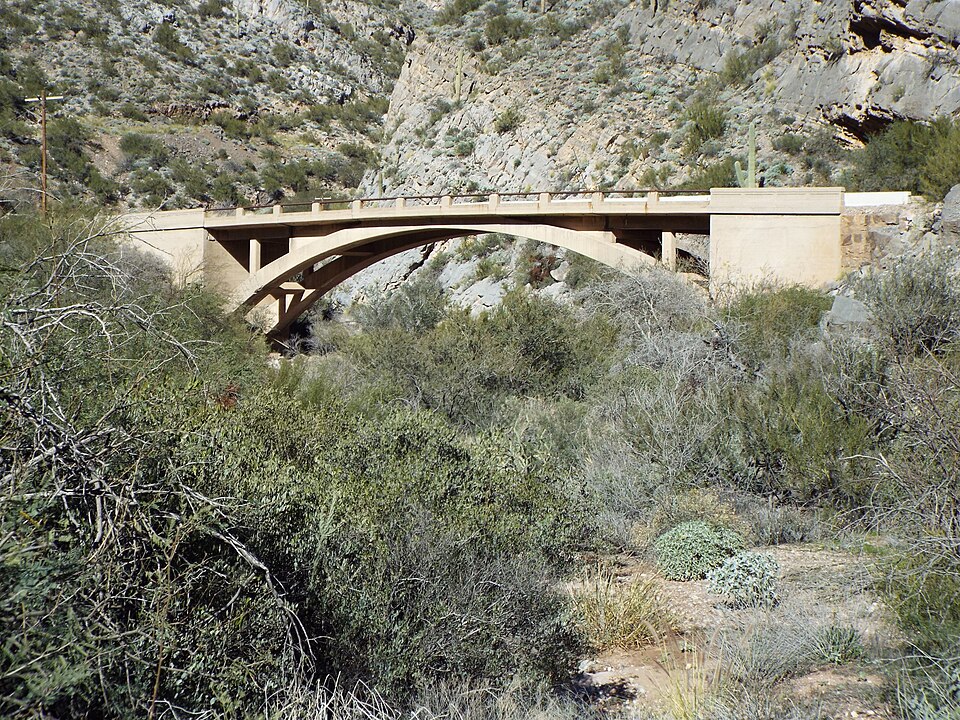
Listed on the National Register of Historic Places in 1988.
One of 100 National Register listings published here for Pinal County · listed in 1988 · category: Structure.
Sources: the case file at the National Archives · the National Register database, National Park Service
Regional context, not property-specific evidence. The federal wildfire occurrence database lists 177 fires within 5 miles of Queen Creek Bridge between 1992 and 2020, burning about 15,065 acres in total. 29 started naturally. 13 were recorded as arson. Distance is straight-line from the map coordinates, so a fire counted here may appear on a neighbouring settlement's page as well.
| Reported cause | Fires |
|---|---|
| Missing data/not specified/undetermined | 76 |
| Natural | 29 |
| Equipment and vehicle use | 25 |
| Recreation and ceremony | 15 |
| Arson/incendiarism | 13 |
| Debris and open burning | 8 |
| Smoking | 5 |
| Misuse of fire by a minor | 2 |
| Railroad operations and maintenance | 1 |
| Other causes | 1 |
| Fireworks | 1 |
| Power generation/transmission/distribution | 1 |
The most recent of them, most recent first, with the day each was reported and the service that recorded it.
| Date | Cause | Size | Reported by | Name on the report |
|---|---|---|---|---|
| 5 September 2007 | Recreation and ceremony | under an acre | Tonto National Forest | TV RANCH |
| 30 September 2019 | Missing data/not specified/undetermined | under an acre | Superior Fire Department | NOT NAMED |
| 30 September 2019 | Missing data/not specified/undetermined | under an acre | Queen Valley Fire District | NOT NAMED |
| 22 September 2009 | Missing data/not specified/undetermined | under an acre | Arizona Department of Forestry and Fire Management - State Office | PICKETPOST |
| 19 September 1992 | Recreation and ceremony | 2.0 acres | Tonto National Forest | not named |
| 18 September 1993 | Arson/incendiarism | 4.0 acres | Tonto National Forest | not named |
| 8 August 2012 | Natural | under an acre | Tonto National Forest | PICKETT |
| 8 August 2006 | Equipment and vehicle use | under an acre | Tonto National Forest | BURNT |
Regional context, not property-specific evidence. The federal mineral resources record lists 71 workings within 5 miles of Queen Creek Bridge: 31 past producers, 18 producers, 12 prospects, 8 occurrences. 19 still produce. What was taken out: Perlite, Copper, Manganese, Gold, Silver. Distance is straight-line from the map coordinates, so a quarry counted here may appear on a neighbouring settlement's page as well.
| Where | Site | Commodity | Status | Recorded |
|---|---|---|---|---|
| Apache | Copper, Silver, Lead, Gold | Past Producer | ||
| Apache Tears Mine | Gemstone | Producer | ||
| Belmont Copper Property | Silver, Copper, Gold, Molybdenum, Vanadium, Lead, Manganese | Past Producer | ||
| Belmont Mine | Copper, Silver, Lead, Zinc, Gold, Manganese, Vanadium | Producer | 1899, 1926, 1945 | |
| Black Eagle | Copper, Lead, Silver, Gold, Zinc | Past Producer | ||
| Blue Bird | Copper, Gold, Stone | Prospect | ||
| Daggs Group | Iron, Lead, Molybdenum, Vanadium | Past Producer | ||
| Dougan Claims | Copper, Iron | Prospect | ||
| Grand Pacific | Copper, Iron, Manganese | Past Producer | ||
| Grand Pacific Mine | Copper, Silver, Gold, Manganese | Producer | 1900, 1916, 1955 |
Regional context, not property-specific evidence. The National Weather Service names Superior, the town this property stands in, in 21 storm reports between 1997 and 2024: 7 flash flood, 6 hail, 4 thunderstorm wind, 4 heavy rain. No death or injury is recorded in these reports. Each account below is quoted exactly as the forecast office filed it, from the NOAA Storm Events Database, and each date opens the federal record of that event.
| When | Event | Place named | Harm | What the report says |
|---|---|---|---|---|
| August 2007 | Thunderstorm Wind | Superior | $50,000 | Thunderstorm winds blew out windows at the Superior administration building, and damaged a nearby truck window. Trees were downed by strong winds. |
| August 2018 | Flash Flood | Superior | $20,000 | Thunderstorms with very heavy rain developed across high terrain areas to the east of Phoenix during the evening hours on August 23rd; some of the stronger storms produced peak rain rates in excess of 3 inches per hour which resulted in flash flooding near the town of Superior. As an example of the heavy rain in the area, a trained spotter in Apache Junction reported 1.2 inches of rain within 20 minutes at 2030MST. At 1920MST, a trained spotter reported that as he drove through the town of Superior, there was debris and boulders flowing across the roads due to flash flooding in the area. A bit later, at 2005MST, the Arizona Department of Highways reported that boulders and debris were blocking portions of Highway 60 about 2 miles to the northeast of Superior. A Flash Flood Warning was issued for the area at 1907MST and it remained in effect through 2015MST. Fortunately there were no accidents reported due to the debris flowing across the roads. |
| August 2024 | Hail | Superior | - | Penny sized hail reported along Highway 60 at Top of the World. No damages nor injuries were reported. |
| August 2021 | Flash Flood | Superior | - | Arizona Department of Transportation reported that US-60 was closed in both directions between Superior and Top-Of-The-World, specifically between mileposts 227 and 235, due to rocks on the roadway following heavy rainfall in the area. The highway was reopened around 0030MST on the 14th. No damages or injuries were reported. |
| July 2017 | Heavy Rain | Superior | - | Thunderstorms with very heavy rain developed across the higher terrain areas well to the east of Phoenix during the late afternoon and evening hours on July 21st and some of the stronger storms affected the community of Superior. At 1900MST a trained spotter located 1 mile northeast of Superior measured 0.74 inches of rain within a 45 minute period. Heavy rain such as reported by the spotter resulted in the issuance of a Flood Advisory for the area around Superior; the advisory was first issued at 1727MST and continued through 2030MST. The flooding resulted in very hazardous driving conditions for motorists in the area, especially since some of the advisory took place at night. |
| July 2017 | Heavy Rain | Superior | - | Scattered thunderstorms developed across the far eastern portion of the greater Phoenix area, including higher terrain locations of far northeast Maricopa County, during the afternoon hours on July 22nd. Locally heavy rain was observed in some locales, including the community of Superior. At 1615MST a trained spotter 1 mile northeast of Superior measured 0.74 inches of rain within a 20 minute period. Locally heavy rain such as this necessitated the issuance of a Small Stream Flood Advisory for areas near to and to the north of Superior. The advisory was issued at 1552MST and ran through 1745MST. |
| July 2015 | Heavy Rain | Superior | - | Thunderstorms developed across the central deserts during the evening hours on July 29th and they produced locally heavy rainfall in the community of Superior. At about 1900MST, a trained weather spotter 1 mile northeast of Superior measured 0.75 inches of rainfall, most of which fell within a 30 minute period. The heavy rain led to the issuance of a Small Stream Flood Advisory for portions of the central deserts including northern Pinal County. No flash flooding was observed. |
| July 2014 | Heavy Rain | Superior | - | Thunderstorms with heavy rain developed in the area around Superior during the early afternoon hours on July 15th. The storms were slow moving, and produced rainfall rates in excess of one inch per hour, which led to local flooding of streams, washes and area roads. A Small Stream Flood Advisory was issued for Superior, starting at 1313MST and continuing until 1615MST. At 1325MST a trained weather spotter 1 mile northeast of Superior measured 0.94 inches of rain which fell in less than one hour. Shortly thereafter, the spotter reported that water was 6 inches deep across the main street in Superior, and Queen Creek was flowing with water about 6 inches deep. At 1342MST, a second trained spotter in Superior reported street flooding in Superior and on Highway 60 just east of Superior. Flow continued in Queen Creek through the late afternoon hours, and the depth of flowing water exceeded 12 inches by 1645MST. |
| May 2007 | Hail | Superior | - | Spotter reported large hail. |
| August 2007 | Flash Flood | Superior | - | Rapid rise in water levels in washes. Rocks and debris reported on highway 60 near Superior. |
| July 2007 | Flash Flood | Superior | - | Rock slides were reported on SR 60 between the Queen Creek tunnel and Devils Canyon. |
| December 2004 | Flash Flood | Superior | - | Heavy rainfall caused flash flooding in Superior in the vicinity of the crossroads of Queen Creek road and Stone Avenue. |
| August 2001 | Thunderstorm Wind | Superior | - | Severe thunderstorm wind gusts blew down trees in town. |
| September 1999 | Hail | Superior | - | Large hail was reported throughout the area along with heavy rain. One spotter about 7 miles east of Superior, at Top of the World, reported 1.10 inch in just 25 minutes. |
| July 1999 | Flash Flood | Superior | - | Rainfall of 2.26 inches reported at Boyce Thompson arboretum near Superior. Silver King wash flooded. Pea size hail also reported. Highway 60 briefly closed at MP 232 due to rock slide. Water covered route 60 near Queen Valley. |
| August 1998 | Hail | Superior | - | Large hail and very heavy rain damaged part of a roof of a home. |
| August 1997 | Thunderstorm Wind | Superior | - | Part of a trailer roof was blown off. Signs along a road were blown down. |
| February 2005 | Flash Flood | Superior | - | no account filed |
| August 2004 | Hail | Superior | - | no account filed |
| August 2002 | Hail | Superior | - | no account filed |
| September 1998 | Thunderstorm Wind | Superior | - | no account filed |
No historic map-sheet match is published for this property yet. That does not mean no map exists. This record needs a coordinate-quality review before it can be joined to a sheet boundary. Browse the county's mapped places while that work is pending.
Other National Register properties close enough to walk or drive between, ordered by distance from this one. Both positions come from the same geocoding pass that matched these properties to their map sheets.
| Photograph | Property | Distance | Listed |
|---|---|---|---|
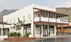 | Magma Hotel | 0.5 miles | 1994 |
| Devil's Canyon Bridge | 3.9 miles | 1988 | |
 | Boyce Thompson Southwestern Arboretum | 4.3 miles | 1976 |
| National Archives record | The nomination case file for reference 88001679 in Record Group 79. |
| Pinal County | All 100 listed properties in this county. |