 Block
From the record
One of 140 National Register listings published here for Coconino County · listed in 1992 · category: Site.
Sources: the case file at the National Archives · the National Register database, National Park Service
Listed on the National Register of Historic Places in 1992.
One of 140 National Register listings published here for Coconino County · listed in 1992 · category: Site.
Sources: the case file at the National Archives · the National Register database, National Park Service
Regional context, not property-specific evidence. The federal wildfire occurrence database lists 261 fires within 5 miles of Summit Mountain Lookout Tree between 1992 and 2020, burning about 9,491 acres in total. 164 started naturally. None was recorded as arson. Distance is straight-line from the map coordinates, so a fire counted here may appear on a neighbouring settlement's page as well.
| Reported cause | Fires |
|---|---|
| Natural | 164 |
| Recreation and ceremony | 61 |
| Missing data/not specified/undetermined | 16 |
| Smoking | 8 |
| Debris and open burning | 7 |
| Equipment and vehicle use | 4 |
| Misuse of fire by a minor | 1 |
The most recent of them, most recent first, with the day each was reported and the service that recorded it.
| Date | Cause | Size | Reported by | Name on the report |
|---|---|---|---|---|
| 8 September 2001 | Recreation and ceremony | under an acre | Kaibab National Forest | DEADHORSE |
| 7 September 2009 | Recreation and ceremony | under an acre | Kaibab National Forest | COLEMAN |
| 7 September 2008 | Recreation and ceremony | under an acre | Kaibab National Forest | MEADOW |
| 6 September 2015 | Natural | under an acre | Kaibab National Forest | ELK |
| 5 September 2017 | Natural | under an acre | Kaibab National Forest | TRAP |
| 5 September 2010 | Recreation and ceremony | under an acre | Kaibab National Forest | MORGAN |
| 4 September 2018 | Equipment and vehicle use | under an acre | Kaibab National Forest | DOGTOWN |
| 4 September 2003 | Natural | under an acre | Kaibab National Forest | ROSILDA |
Regional context, not property-specific evidence. The federal mineral resources record lists 6 workings within 5 miles of Summit Mountain Lookout Tree: 5 unknowns, 1 producer. 1 still produces. What was taken out: Pumice, Sand and Gravel, Construction. Distance is straight-line from the map coordinates, so a quarry counted here may appear on a neighbouring settlement's page as well.
| Where | Site | Commodity | Status | Recorded |
|---|---|---|---|---|
| Gravel Pit | Sand and Gravel, Construction | Unknown | ||
| Pit #8088 | Sand and Gravel, Construction | Producer | ||
| Cinder Pit | Pumice | Unknown | ||
| Cinder Pit | Pumice | Unknown | ||
| Cinder Pit | Pumice | Unknown | ||
| Cinder Pit | Pumice | Unknown |
Regional context, not property-specific evidence. The National Weather Service names Williams, the town this property stands in, in 24 storm reports between 1996 and 2024: 7 heavy rain, 5 flood, 5 hail, 2 wildfire. The reports record 1 injury. Each account below is quoted exactly as the forecast office filed it, from the NOAA Storm Events Database, and each date opens the federal record of that event.
| When | Event | Place named | Harm | What the report says |
|---|---|---|---|---|
| August 1996 | Flood | Williams | 1 hurt, $1,000 | no account filed |
| July 2024 | Hail | Williams | - | A thunderstorm produced enough hail to cover the ground in Williams. Most of the hail was 1/4 to 7/8 inch in diamter (pea to nickel sized). There was one report of 1 inch diameter hail (quarter sized). |
| July 2024 | Dust Devil | Williams | - | As people were trying to set up a hot air balloon, a dust devil created winds estimated to be between 40-50 mph. This caused the balloon to detach from its anchor point, sending it into nearby buildings. Three bystanders were injured, including an 8-year-old girl with a broken thumb and rope burns, a 15-year-old who sustained neck and back injuries, and an adult woman who was cut. The balloon also caused damage to two parked cars, knocked down a light pole, and damaged electrical equipment in a nearby building. |
| July 2021 | Flash Flood | Williams | - | Lewis Street in Williams was flooded. |
| July 2017 | Heavy Rain | Williams | - | A thunderstorm over Williams produce 1.37 inches of rain in 40 minutes, very gusty winds, and lots of lightning. Moderate street flooding was observed in the neighborhood southwest of Downtown. |
| June 2016 | Heavy Rain | Williams | - | Heavy rain and hail up to 1/2 inch in diameter caused local flooding in and around Williams. |
| September 2016 | Funnel Cloud | Williams | - | A funnel cloud was seen about two miles south-southwest of Williams. |
| August 2015 | Heavy Rain | Williams | - | Over half an inch (0.55 inches) fell in Williams in less than 15 minutes. Mud and debris were flowing down 10th Street in Williams. |
| September 2014 | Heavy Rain | Williams | - | A trained spotter in Williams reported 0.95 inches of rain in just 45 minutes. |
| July 2012 | Heavy Rain | Williams | - | Trained spotters reported 1.17 and 1.70 inches of rain in Williams. |
| July 2010 | Heavy Rain | Williams | - | A thunderstorm produced 2.45 inches of rain in just 45 minutes. |
| August 2008 | Hail | Williams | - | Quarter sized (1 inch diameter) hail fell for about 10 minutes with heavy rain in Williams. |
| July 2007 | Flash Flood | Williams | - | Heavy rain from thunderstorms caused flooding in the Williams area. Two feet of water covered Country Club Road at the railroad underpass. |
| August 2007 | Flood | Williams | - | Several streets were closed in Williams due to water in streets from heavy rain. |
| July 2006 | Hail | Williams | - | 3/4 inch diameter hail was reported 3 miles east of Williams. |
| August 2004 | Hail | Williams | - | One inch diameter hail was reported 5 miles north of Williams. |
| August 2003 | Heavy Rain | Williams | - | Williams Police Department reported 2.30 inches of rain in just under 40 minutes. This caused extensive street flooding. Some streets had enough water to trap small cars. Several streets were barricaded. |
| September 2002 | Funnel Cloud | Williams | - | An off duty NWS employee reported a funnel cloud four miles east of Williams. |
| May 2000 | Wildfire | Williams | - | The Pumpkin fire started on May 24, 2000 and had burned 9500 acres by the end of May. The fire was started by lightning on the afternoon of May 24, 2000. The fire was burning in the wilderness area of Kendrick Peak and was 40 percent contained by May 31, 2000. |
| July 2002 | Flood | Williams | - | no account filed |
| August 2001 | Hail | Williams | - | no account filed |
| August 2001 | Flood | Williams | - | no account filed |
| June 2000 | Wildfire | Williams | - | no account filed |
| August 2000 | Flood | Williams | - | no account filed |
1 paper published in this town, digitised by the Library of Congress and free to read: 1,089 issues, 5,720 pages. Every page is searchable, so a name or a street can be looked for directly in what the town printed about itself at the time.
| Newspaper | Published |
|---|---|
| The Williams News | 1891 to 1989 |
No historic map-sheet match is published for this property yet. That does not mean no map exists. This record needs a coordinate-quality review before it can be joined to a sheet boundary. Browse the county's mapped places while that work is pending.
Other National Register properties close enough to walk or drive between, ordered by distance from this one. Both positions come from the same geocoding pass that matched these properties to their map sheets.
| Photograph | Property | Distance | Listed |
|---|---|---|---|
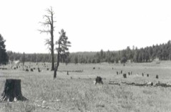 | Barney Flat Historic Railroad Logging Landscape | 2.0 miles | 1995 |
| National Archives record | The nomination case file for reference 91001948 in Record Group 79. |
| Coconino County | All 140 listed properties in this county. |