BlockBefore
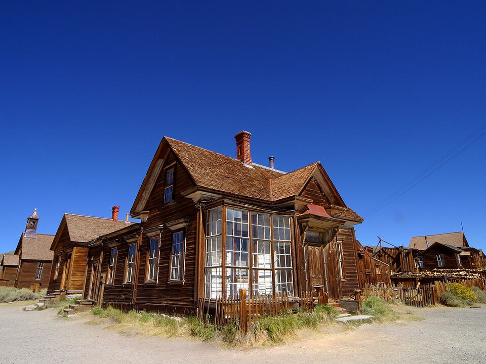
Photograph of Bodie
Photograph by PDPhoto.org, Public domain. Via Wikimedia Commons.

Wheaton and Hollis Hotel

A National Historic Landmark. Built in 1876. Listed on the National Register of Historic Places in 1966. 11 historic topographic surveys show this location, the earliest from 1909.

From the record

“Bodie is a ghost town in the Bodie Hills east of the Sierra Nevada mountain range in Mono County, California, United States. It is about 75 miles (121 km) southeast of Lake Tahoe, and 12 mi (19 km) east-southeast of Bridgeport, at an elevation of 8,379 feet (2,554 m).”

Wikipedia article Bodie, California, CC BY-SA 4.0.

One of 11 National Register listings published here for Mono County · listed in 1966 · category: Building · built in 1876 · a National Historic Landmark.

Sources: the Wikipedia article · the National Register database, National Park Service · the Wikipedia article
The listing

  • National Historic Landmark. The highest federal designation, held by about 2,600 places in the country against roughly 100,000 Register listings.
  • What is counted as historic. The nomination lists 19 buildingss, 15 sitess as contributing to the listing.
  • Still standing. The Park Service records this property as extant.
  • Address. 7 mi. S of Bridgeport on U.S. 395, then 12 mi. E on secondary rd., Bridgeport, 93517
  • When was it listed? October 1966
  • Category. building
  • Census division. North Mono
  • When was it built? 1876
  • National Register reference number. 66000213 - assigned by the National Park Service when the property was listed.

Then and now

1909 to 1998

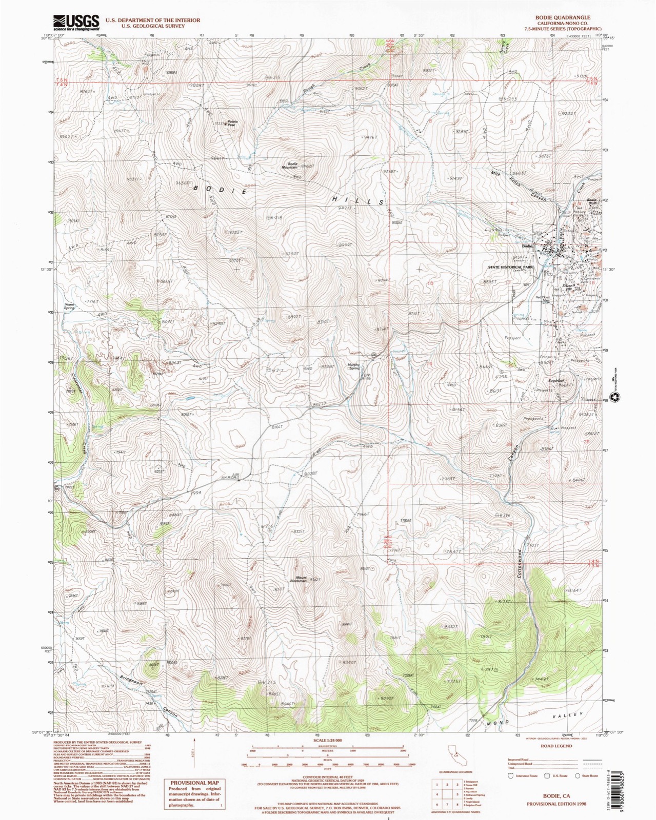
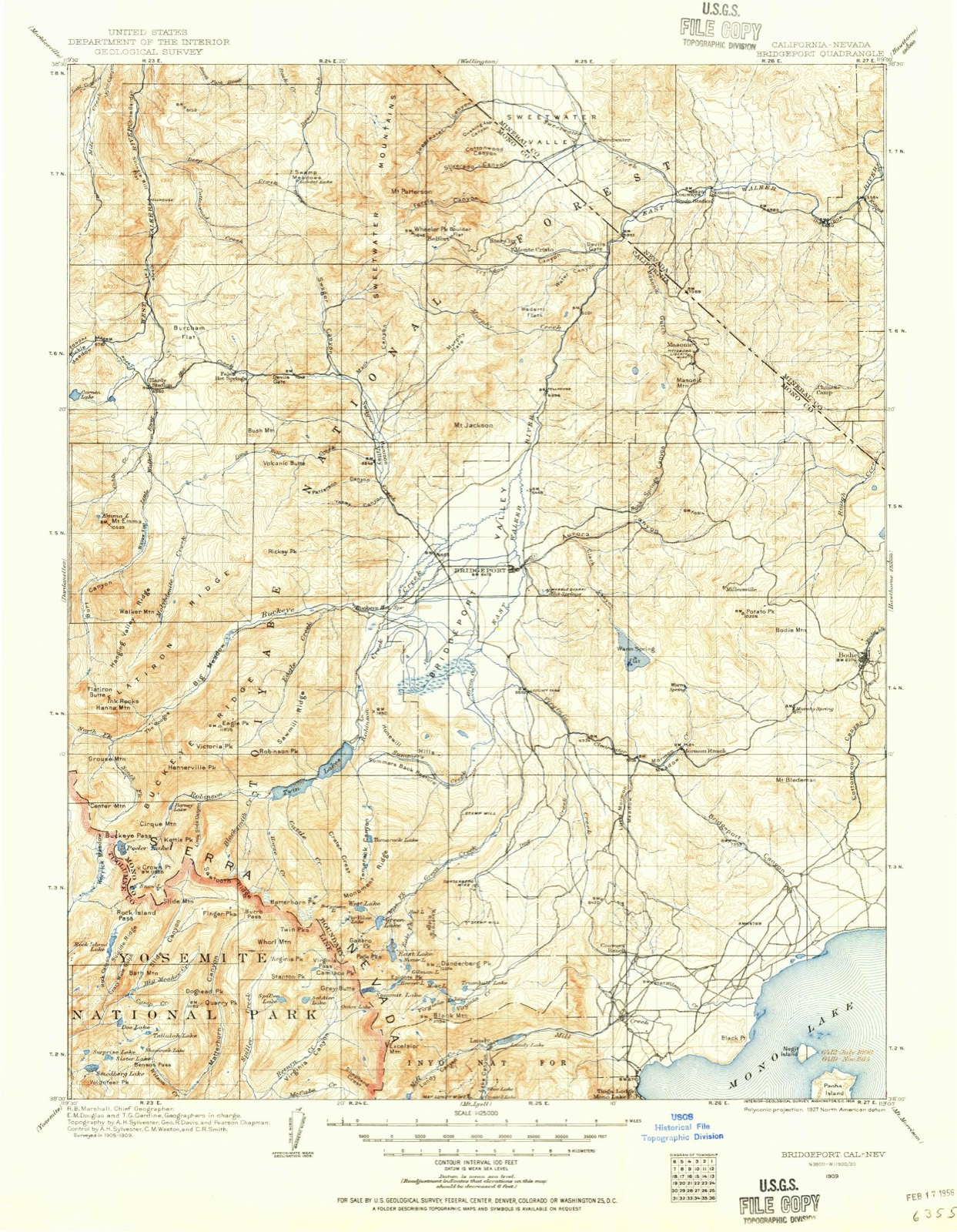
The ground this property stands on, surveyed 89 years apart. Drag the handle to wipe between them. Both sheets are United States Geological Survey originals; neither has been altered.

Topographic sheet covering Wheaton and Hollis Hotel, surveyed 1998
Topographic sheet covering Wheaton and Hollis Hotel, surveyed 1909

Fires near this property

10 since 1996

Regional context, not property-specific evidence. The federal wildfire occurrence database lists 10 fires within 5 miles of Wheaton and Hollis Hotel between 1996 and 2020, burning about 379 acres in total. 10 started naturally. None was recorded as arson. Distance is straight-line from the map coordinates, so a fire counted here may appear on a neighbouring settlement's page as well.

Reported cause Fires
Natural10

The most recent of them, most recent first, with the day each was reported and the service that recorded it.

DateCause SizeReported by Name on the report
24 August 1996Natural3.0 acresCentral California DistrictWARMSPRING
15 August 2004Naturalunder an acreCentral California DistrictROSA
1 August 2015Naturalunder an acreCentral California DistrictJUNIPER
2 July 2001Naturalunder an acreHumboldt-Toiyabe National ForestDRY
18 July 2014Natural93 acresCentral California DistrictBODIE
18 July 2009Natural2.0 acresCentral California DistrictBODIE II
5 June 2009Naturalunder an acreCentral California DistrictBODIE
26 June 2020Natural280 acresBishop Field OfficeAURORA

Every fire recorded in Mono County

Mines and quarries near this property

10 of 26 shown

Regional context, not property-specific evidence. The federal mineral resources record lists 26 workings within 5 miles of Wheaton and Hollis Hotel: 14 past producers, 7 occurrences, 4 unknowns, 1 producer. 1 still produces. What was taken out: Gold, Gold, Silver, Silver, Uranium. Distance is straight-line from the map coordinates, so a quarry counted here may appear on a neighbouring settlement's page as well.

Where SiteCommodity StatusRecorded
Bodie MineGold, Silver, MercuryPast Producer1859
MonoGold, Copper, SilverPast Producer
Mono ShaftGold, Silver, CopperPast ProducerGold
Tailings PondTungsten, SilverUnknown
RelichUraniumOccurrence
Relich ClaimUraniumOccurrence
Arco PlacerGold, SilverUnknown
JohnsonGold, SilverUnknown
Southern Cons.Gold, SilverPast ProducerGold
Southern Consolidated MineGold, SilverPast Producer

Every working recorded in Mono County

Storms near this property

11 since 2004

Regional context, not property-specific evidence. The National Weather Service names Bridgeport, the town this property stands in, in 11 storm reports between 2004 and 2023: 5 heavy rain, 3 flood, 2 hail, 1 thunderstorm wind. No death or injury is recorded in these reports. Each account below is quoted exactly as the forecast office filed it, from the NOAA Storm Events Database, and each date opens the federal record of that event.

WhenEvent Place namedHarm What the report says
June 2011FloodBridgeport$1,000California Land Management indicated that the Twin Lakes Campground (30 campsites) was completely shut down due to snowmelt flooding. No damage to campground property noted just the loss of income from the closed campsites.
March 2023FloodBridgeport-The public reported that State Route 182 has been closed from the town of Bridgeport to the Nevada state line in Mono County due to reports of flooding. There was no estimated time of reopening.
May 2023FloodBridgeport-CHP reported a fallen tree and flooding of the southbound lane of US-395 near Green Lakes Road intersection, with Green Creek overflowing out of its banks.
August 2022Heavy RainBridgeport-Mesonet station EW3821 located in Bridgeport, CA reported 0.81 inches total rainfall between 5:45 and 8:15 pm.
December 2021Heavy RainBridgeport-COCORAHS station (CA-MN-5), AWOS, and mesonet sites reported heavy rain ranging from 0.72 at Benton, CA (BETC1), to 1.16 from AWOS located at USMC MWTC Bridgeport, and 2.47 at the mesonet site (CRVC1) located 1.0 mi SSW of Crestview, CA.
March 2019Heavy RainBridgeport-CO-OP observer in Bridgeport reported 0.60 inches of rainfall in a 24 hour period from 1 March 0920PST to 2 March 0920PST. Observer elevation 6470 feet MSL.
July 2014HailBridgeport-Hail reported by Mono County Sheriff's department.
July 2013HailBridgeport-Reports from the Mono County sheriff and the California Highway Patrol indicated hail between 0.75 and 1 inch in diameter. Hail covered highway 182 in Bridgeport to 4 inches in depth.
October 2009Heavy RainBridgeport-Over 2 inches of rainfall caused damage to the Mono County Jail in Bridgeport. The roof was being repaired and was not sufficiently protected from the unusually heavy rain. Additional heavy rainfall amounts include: Crestview RAWS with 4.36, Benton RAWS with 2.86, and Mammoth Lakes Airport with 2.09.
July 2005Thunderstorm WindBridgeport-A 54 kt (62 mph) wind gust reported at the Bridgeport RAWS sensor.
August 2004Heavy RainBridgeport-A total of 0.80 inches of rainfall (0.69 inches in one hour) was recorded at a RAWS sensor 3 miles WNW of Bridgeport.

Every storm recorded in Mono County

Maps showing this location

11 surveys

United States Geological Survey topographic sheets whose coverage includes this point. Matched by taking the coordinate the National Park Service records for this property, then testing that coordinate against the published boundary of every sheet.

Sources for this property

National Archives recordThe nomination case file for reference 66000213 in Record Group 79.
Wikipedia articleCommunity-written account of this property, licensed CC BY-SA.
Mono CountyAll 11 listed properties in this county.

Provenance

  • Listing record. National Park Service National Register of Historic Places, listed-properties dataset, current to 2026-05-22.
  • Map join. Address geocoded through the United States Census geocoder, then tested against the published boundary of every sheet in the USGS Historical Topographic Map Collection.
  • How this page is made. Listing fields come from federal records; map-sheet coverage is a labelled coordinate-to-boundary calculation, not a source-field claim.
  • Wildfire. Short, Karen C. 2022. Spatial wildfire occurrence data for the United States, 1992-2020 [FPA_FOD_20221014]. 6th Edition. Fort Collins, CO: Forest Service Research Data Archive. https://doi.org/10.2737/RDS-2013-0009.6 Collected with United States Government funding and usable without additional permissions or fees.
  • Mines and quarries. USGS Mineral Resources Data System (MRDS) https://mrdata.usgs.gov/mrds/ A work of the United States government, no copyright under 17 U.S.C. 105.
  • Storms. NOAA National Centers for Environmental Information, Storm Events Database https://www.ncei.noaa.gov/stormevents/ A work of the United States government, no copyright under 17 U.S.C. 105. Narratives are quoted verbatim from the National Weather Service report and are not edited or summarised.