 Block
From the record
18 National Register listings published here.
Sources: the National Register database, National Park Service
141 topographic sheets cover 70 settlements here, and 18 properties are on the National Register of Historic Places.
18 National Register listings published here.
Sources: the National Register database, National Park Service
Every property in this county listed on the National Register of Historic Places, with the year it was listed and the federal nomination document.
| Photograph | Property | Type | Listed | Reference |
|---|---|---|---|---|
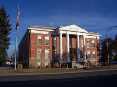 | Adams County Courthouse | building | 2006 | 06000916 |
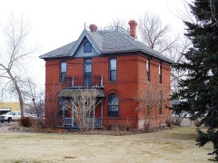 | Bowles House | building | 1988 | 88002308 |
| Brighton High School | building | 1998 | 97001665 | |
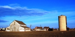 | Bromley Farm-Koizuma Hishinuma Farm | district | 2007 | 07000811 |
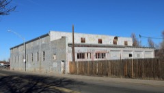 | Colorado Sanitary Canning Factory | building | 2016 | 16000073 |
| Deza Estates | district | 2023 | 100009565 | |
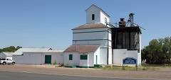 | Eastlake Farmers Co-Operative Elevator Company | structure | 2010 | 10000259 |
| Engelbrecht Farm | district | 2014 | 14000170 | |
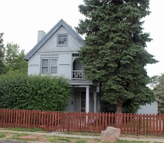 | Granville Fuller House | building | 2012 | 12000242 |
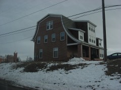 | William J. Gregory House | building | 1996 | 96000166 |
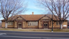 | Harris Park School | building | 1990 | 90000868 |
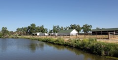 | Metzger Farm | district | 2013 | 13000077 |
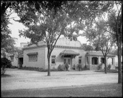 | Riverside Cemetery | district | 1994 | 94001253 |
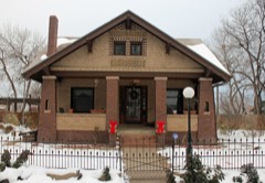 | M.J. Lavina Robidoux House | building | 2011 | 11000655 |
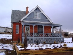 | Thede Farmhouse | building | 1998 | 98000024 |
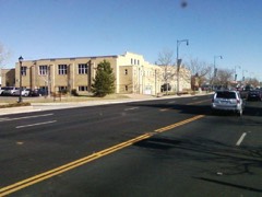 | Union High School | building | 2000 | 99001665 |
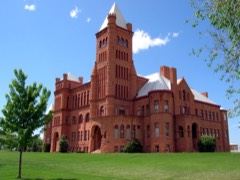 | Westminster University | building | 1979 | 79000572 |
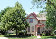 | Blanche A. Wilson House | building | 1996 | 96001278 |
Every wildfire the federal occurrence database records inside this county: 2,221 of them, burning about 10,166 acres. 42 started naturally and 62 were recorded as arson. Each settlement page carries the fires within five miles of it.
| Reported cause | Fires |
|---|---|
| Missing data/not specified/undetermined | 1782 |
| Smoking | 88 |
| Equipment and vehicle use | 68 |
| Arson/incendiarism | 62 |
| Debris and open burning | 56 |
| Recreation and ceremony | 52 |
| Natural | 42 |
| Fireworks | 40 |
| Misuse of fire by a minor | 16 |
| Power generation/transmission/distribution | 9 |
| Railroad operations and maintenance | 6 |
The five largest, by the area the report gives. One of them was set deliberately.
| Date | Cause | Size | Reported by | Name on the report |
|---|---|---|---|---|
| 19 August 2020 | Missing data/not specified/undetermined | 4,200 acres | Adams County Office | SHAMROCK |
| 19 August 2020 | Missing data/not specified/undetermined | 2,000 acres | Adams County Office | DETER-WINTERS |
| 22 August 2011 | Missing data/not specified/undetermined | 1,000 acres | Colorado State Forest Service-State Headquarters | BYERS |
| 7 July 1995 | Equipment and vehicle use | 443 acres | Rocky Mountain Arsenal National Wildlife Refuge | SEC23-95 |
| 22 July 2020 | Missing data/not specified/undetermined | 400 acres | Adams County Office | CALHOUN |
| 6 March 2017 | Missing data/not specified/undetermined | 290 acres | Aurora Fire Department | UNKNOWN |
| 23 March 2018 | Arson/incendiarism | 270 acres | Greater Brighton Fire Protection District | UNKNOWN |
| 8 August 2016 | Debris and open burning | 134 acres | Rocky Mountain Arsenal National Wildlife Refuge | RATTLESNAKE HILL |
Every settlement page carries the fires within five miles of it - see the settlement index below.
The NOAA Storm Events Database holds 862 reports for this county, causing 3 deaths, 62 injuries and about $469,895,270 in recorded property damage. Each settlement page carries the reports that name it.
| Kind of event | Reports |
|---|---|
| Hail | 489 |
| Tornado | 192 |
| Thunderstorm Wind | 135 |
| Flash Flood | 21 |
| Lightning | 19 |
| Flood | 5 |
| Dust Devil | 1 |
The most serious of them, by death, then injury, then recorded damage. The accounts are quoted exactly as the forecast office filed them.
| When | Event | Place named | Harm | What the report says |
|---|---|---|---|---|
| June 2006 | Lightning | Westminster | 1 killed | A man on a motorcycle was struck by lightning and killed. The motorcyclist was struck on U.S. Highway 36 between Church Ranch Blvd. and Sheridan Blvd. After the man was struck, he crashed into the center median. The lightning left a crater in the highway that was approximately 18 inches long, 8 inches wide and 4 inches deep. |
| May 2001 | Lightning | Westminster | 1 killed | A 19-yr old man was killed by lightning as he was walking along the shoulder of U.S. Highway 36 during a thunderstorm. |
| August 2000 | Flash Flood | West Central Portion | 1 killed | no account filed |
| June 1981 | Tornado (F2) | not stated | 42 hurt, $25,000,000 | no account filed |
| May 1994 | Thunderstorm Wind | Commerce City | 6 hurt | no account filed |
| June 2001 | Hail | Watkins | 5 hurt, $49,000,000 | Large hail, damaging winds and very heavy rain pummeled a mobile home park in Watkins. In the park, 52 mobile homes, 14 recreational vehicles, 3 homes and a commercial building were damaged. Siding was riddled with holes and windows were broken. Vehicles sustained extensive body damage and the car windows were shattered. A handful of people were treated for minor cuts and bruises. Strong winds also flipped a tractor trailer along Interstate 70 near Watkins. At least 30 private planes at Front Range Airport were totalled. The radome protecting the National Weather Service doppler radar, which was tracking the storm, also sustained damage. The storm caused power outages which affected about 1,200 residents. Excluding the damage done at Denver International Airport, damage estimates totalled $49 million, making it the costliest storm in the last 3 years, and 10th costliest since 1984. |
| July 2011 | Hail | Watkins | 2 hurt, $164,800,000 | no account filed |
| September 1989 | Thunderstorm Wind | not stated | 2 hurt | no account filed |
| August 1977 | Tornado (F1) | not stated | 1 hurt, $250,000 | no account filed |
| August 1997 | Lightning | Aurora | 1 hurt, $1,000 | A man received minor injuries when he was struck by lightning while talking on the telephone. |
| May 2010 | Lightning | Commerce City | 1 hurt | A child was struck in the leg by lightning while watching television. |
| May 2002 | Thunderstorm Wind | Strasburg | 1 hurt | A very strong dry microburst swept a woman up into swirl of dirt and carried her approximately 150 feet. The woman was in an open field, corraling a yearling horse, when the incident occurred. Fortunately, she received only minor injuries. |
| September 2011 | Lightning | Brighton | 1 hurt | no account filed |
| May 1996 | Hail | Thornton | $120,000,000 | no account filed |
| May 2010 | Hail | Barr Lake | $70,000,000 | no account filed |
| June 1999 | Hail | Aurora | $35,000,000 | no account filed |
| September 2013 | Flood | Barr Lake | $2,140,000 | Heavy rain, ranging from 4 to 10 inches through the entire storm event, caused widespread flooding along the entire drainage system of the South Platte River. Flooding and flash flooding inpacted Riverdale Golf Course and the Regional Park. The gulch that ran through those two areas caused flooding and erosion in several places including the newly created reservoirs between the Regional Park and 120th Avenue.|The Regional Park shop was also flooded as well as the Riverdale Golf Shop. All combined, the countys estimated damage at the Park alone, not including the golf course, was about $637,000. Parts of Colorado Boulevard between CO7 and 168th Avenue were closed due to significant damage to the road surface and foundation.|Additional damage also occurred at retention ponds, parks and trails. The cost to roads and bridges was approximately $400,000 for repairs. Approximately 755 households were impacted by flooding. |
| May 2023 | Flood | Northglenn | $1,000,000 | Dozens of roads in Adams County were hit by flooding and were closed due to damage. Authorities believe the damage and impact to the county was severe. The following streets were closed due to flooding: 26th Ave. between Yulle Road and Wolf Creek Road, 64th Ave. between Piggott Road and Wolf Creek Road, Piggott Road from 80th Ave. to 88th Ave., Old Victory Road from US 36 to SH 79, 72nd Ave. from Bradbury-Krebs Road to Xmore Road, Road 15 from Bradbury-Krebs Road to Xmore Road, 26th Ave. from Strasburg Road to Comanche Drive, 26th Ave. from Piggott Road to Yulle Road, 48th Ave. from Strasburg Road to Piggott Road, 112th Ave. from Headlight Road to Nordbye Road, 112th Ave. from Behrens Road to Horrogate Road, 72nd Ave. from Converse Road to SH 79, 80th Ave. from Schumaker Road to SH 79, Cameron Drive from Guy Court to OBrien, Converse Road from 128th Ave. to 144th Ave., Converse Road, from 88th Ave. to 112th Ave., East 112th Ave. from SH 79 to Converse Road, 104th Ave. at Manilla Road and at Tumbleweed Court, 64th Ave. from Converse Road to Schumaker Road, Converse Road from 88th Ave. to 64th Ave., 72nd Ave. at Converse Road and SH 79, 80th Ave. from SH 79 to Schumaker Road, 112th Ave. from Himalaya Road to Picadilly. All Adams County trails were also closed, which included the South Platte River Trail.|. |
| August 1999 | Flash Flood | West Portion | $500,000 | no account filed |
| May 1990 | Tornado (F1) | not stated | $250,000 | no account filed |
| June 1988 | Tornado (F2) | not stated | $250,000 | no account filed |
| May 1978 | Tornado (F2) | not stated | $250,000 | no account filed |
| May 1976 | Tornado (F2) | not stated | $250,000 | no account filed |
| June 1967 | Tornado (F0) | not stated | $250,000 | no account filed |
| July 1996 | Tornado (F2) | Strasburg | $220,000 | no account filed |
| July 2001 | Lightning | Thornton | $200,000 | Lightning struck the roof of a home. Most of the damage was confined to the attic. |
| July 2018 | Tornado (EF1) | Strasburg | $100,000 | A tornado touched down a tossed a cattle feeder one quarter of a mile. In addition, some farm equipment was knocked over and the windows of a home were blown out. |
| July 1997 | Lightning | Watkins | $75,000 | Lightning sparked a fire causing extensive damage to a home. |
| May 2000 | Thunderstorm Wind | Watkins | $70,000 | A strong microburst wind to 92 mph (80 kts) flipped one small plane on its back and blew at DC-3 loose from its moorings and into a grassy field at Front Range Airport. |
| June 2023 | Flash Flood | Denver Front Range A | $50,000 | Highway 36 was closed due to flooding between Watkins and Schumaker Road. At least 6 vehicles were stranded with reports of roads washed out and active water rescues in progress. |
| August 2010 | Lightning | Westminster | $30,000 | Lightning struck a residence and sparked a fire. The fire migrated in the space between the first and second floor. |
| August 2009 | Lightning | Bennett | $25,000 | Lightning ignited two oil tanks near Bennett. It took 18,000 gallons of water and foam to put out the fires. |
| June 2009 | Tornado (EF0) | Northglenn | $25,000 | A small tornado touched and caused minor damage. Several trees were downed in an open field. The tornado also damaged a metal fence and minor roof damage to a nearby residence. |
| May 1959 | Tornado (F2) | not stated | $25,000 | no account filed |
| August 2010 | Lightning | Westminster | $20,000 | Lightning sparked a fire at a townhome. The fire caused damage to the exterior roof and severe damage to the trusses in the attic. |
| July 1997 | Flood | Westminster | $20,000 | Heavy rain caused flooding to occur in the Rancho Pecos apartment building. Several residents had to be evacuated from their apartments. |
| August 2008 | Lightning | Brighton | $20,000 | no account filed |
| May 2015 | Tornado (EF1) | Strasburg | $15,000 | A tornado touched down briefly and extensively damaged a storage shed. |
| July 2001 | Lightning | Thornton | $15,000 | Lightning struck another home in Thornton. Most of the damage was confined to the attic. |
| May 2014 | Flash Flood | Bennett | $10,000 | A line of stationary thunderstorms produced flash flooding near Bennett. Over one foot of water was observed rushing over the junction of US 36 and Kiowa-Bennett Road. |
| March 2016 | Dust Devil | Thornton | $5,000 | A gustnado knocked down a power pole and destroyed a small storage shed. |
| May 2010 | Lightning | Commerce City | $5,000 | A lightning strike killed a buffalo at the Rocky Mountain Arsenal Refuge. |
| September 1993 | Thunderstorm Wind | Brighton | $5,000 | no account filed |
| June 1988 | Tornado (F1) | not stated | $2,500 | no account filed |
| July 1987 | Tornado (F2) | not stated | $2,500 | no account filed |
| May 1984 | Tornado (F1) | not stated | $2,500 | no account filed |
| June 1982 | Tornado (F3) | not stated | $2,500 | no account filed |
| May 1967 | Tornado (F1) | not stated | $2,500 | no account filed |
| July 1954 | Tornado (F1) | not stated | $2,500 | no account filed |
| July 2025 | Thunderstorm Wind | Westminster | $1,000 | Report via social media. Measured a 50 mph gust using a handheld anemometer. A few trees down along with numerous 1-3 inch diameter branches. |
| July 1994 | Tornado (F0) | Byers to | $500 | Spotters reported a tornado 10 miles east northeast of Byers (31 miles east of Denver). The tornado traveled in open country to 6 miles east of Byers before dissipating. The tornado downed several power poles northeast of Byers. Spotters estimated the tornado to be 0.5 mile wide at its biggest point, and could have caused up to F4 type damage. |
| May 1994 | Thunderstorm Wind | Westminster | $500 | no account filed |
| September 1993 | Thunderstorm Wind | Denver | $500 | no account filed |
| September 1993 | Hail | Shamrock | $500 | no account filed |
| September 1993 | Thunderstorm Wind | Shamrock | $500 | no account filed |
| July 1955 | Tornado | not stated | $250 | no account filed |
| April 1954 | Tornado | not stated | $250 | no account filed |
| June 1983 | Tornado (F1) | not stated | $30 | no account filed |
| June 1982 | Tornado (F1) | not stated | $30 | no account filed |
| June 1982 | Tornado (F1) | not stated | $30 | no account filed |
The Survey's mineral resources record lists 157 workings inside this county. 33 still produce and 124 are closed or unrecorded. Each settlement page carries the workings within five miles of it.
| Commodity | Workings |
|---|---|
| Sand and Gravel, Construction | 145 |
| Clay | 10 |
| Gold | 4 |
| Gold, Silver | 1 |
| Gold, Silver, Sand and Gravel, Construction | 1 |
| Sand and Gravel, Construction, Silver | 1 |
The least common of them first, because a county's hundredth gravel pit says nothing its first ten did not.
| Where | Site | Commodity | Status | Recorded |
|---|---|---|---|---|
| Adams North Pit | Sand and Gravel, Construction, Gold, Silver | Past Producer | 1956 | |
| Unknown | Gold, Silver, Sand and Gravel, Construction | Producer | Placer | |
| Unknown | Gold, Sand and Gravel, Construction, Silver | Occurrence | ||
| Cooley Gravel Co. Pits | Sand and Gravel, Construction, Gold | Past Producer | 1951, 1964 | |
| Gordon Pit | Sand and Gravel, Construction, Gold | Past Producer | Gold, Sand and Gravel | |
| Thornton Pit | Sand and Gravel, Construction, Gold | Producer | 1980 | |
| Unknown | Clay | Occurrence | ||
| Unknown | Clay | Occurrence | ||
| Unknown | Clay | Occurrence | ||
| Unknown | Clay | Occurrence | ||
| Unknown | Clay | Occurrence | ||
| Unknown | Clay | Producer | ||
| Unknown | Clay | Producer | ||
| Unknown | Clay | Producer | ||
| Unknown | Clay | Producer | ||
| Unknown | Clay | Producer | ||
| Adams Aggregate Inc Pit | Sand and Gravel, Construction | Unknown | ||
| Adams Aggregate Inc Pit | Sand and Gravel, Construction | Unknown | ||
| Adams County Pit | Sand and Gravel, Construction | Past Producer | ||
| Adams County Pit | Sand and Gravel, Construction | Past Producer | ||
| Adams County Pit | Sand and Gravel, Construction | Unknown | ||
| Albert Frei & Sons Sand and Gr Pit | Sand and Gravel, Construction | Unknown | ||
| Asphalt Paving Co Pit | Sand and Gravel, Construction | Past Producer | ||
| Asphalt Paving Co Pit | Sand and Gravel, Construction | Past Producer | ||
| Baker | Sand and Gravel, Construction | Past Producer | ||
| Brannan Sand and Gravel Co Pit | Sand and Gravel, Construction | Unknown | ||
| Brannan Sand and Gravel Co Pit | Sand and Gravel, Construction | Past Producer | ||
| Brannan Sand and Gravel Co Pit | Sand and Gravel, Construction | Past Producer | ||
| Brannan Sand and Gravel Co Pit | Sand and Gravel, Construction | Past Producer | ||
| Brannan Sand and Gravel Co Pit | Sand and Gravel, Construction | Past Producer | ||
| Brannan Sand and Gravel Co Pit | Sand and Gravel, Construction | Past Producer | ||
| Brannan Sand and Gravel Co Pit | Sand and Gravel, Construction | Past Producer | ||
| Brannan Sand and Gravel Co Pit | Sand and Gravel, Construction | Past Producer | ||
| Brannan Sand and Gravel Co Pit | Sand and Gravel, Construction | Past Producer | ||
| Brannan Sand and Gravel Co Pit | Sand and Gravel, Construction | Past Producer | ||
| Brannan Sand and Gravel Pit | Sand and Gravel, Construction | Past Producer | ||
| Brannan Sand and Gravel Pit | Sand and Gravel, Construction | Unknown | ||
| C & H Construction Co Pit | Sand and Gravel, Construction | Past Producer | ||
| Colorado Consolidated Rock Pit | Sand and Gravel, Construction | Producer | ||
| Colorado Consolidated Rock Pit | Sand and Gravel, Construction | Producer | ||
| Colorado Highway Dept Pit | Sand and Gravel, Construction | Past Producer | ||
| Colorado-Wyoming Improvement Co Pi | Sand and Gravel, Construction | Unknown | ||
| Colorado-Wyoming Improvement Co Pi | Sand and Gravel, Construction | Unknown | ||
| Colorado-Wyoming Improvement Co Pi | Sand and Gravel, Construction | Unknown | ||
| Colorado-Wyoming Improvment Co Pit | Sand and Gravel, Construction | Past Producer | ||
| Consolidated Plant | Sand and Gravel, Construction | Producer | ||
| Consolidated Rock Pit | Sand and Gravel, Construction | Producer | ||
| Cooley Gravel Co Pit | Sand and Gravel, Construction | Past Producer | ||
| Cooley Gravel Co Pit | Sand and Gravel, Construction | Past Producer | ||
| Cooley Gravel Co Pit | Sand and Gravel, Construction | Past Producer | ||
| Cooley Gravel Co Pit | Sand and Gravel, Construction | Unknown | ||
| Cooley Gravel Co Pit | Sand and Gravel, Construction | Unknown | ||
| Cooley Gravel Co Pit | Sand and Gravel, Construction | Past Producer | ||
| Department of Wildlife Pit | Sand and Gravel, Construction | Past Producer | ||
| Fast Construction Co Pit | Sand and Gravel, Construction | Unknown | ||
| Fast Construction Pit | Sand and Gravel, Construction | Unknown | ||
| Gravel Pit | Sand and Gravel, Construction | Producer | ||
| Gravel Pit | Sand and Gravel, Construction | Past Producer | ||
| Gravel Pit | Sand and Gravel, Construction | Unknown | ||
| Gravel Pit | Sand and Gravel, Construction | Past Producer | ||
| Gravel Pit | Sand and Gravel, Construction | Past Producer | ||
| Gravel Pit | Sand and Gravel, Construction | Producer | ||
| Gravel Pit | Sand and Gravel, Construction | Past Producer | ||
| Gravel Pit | Sand and Gravel, Construction | Producer | ||
| Gravel Pit | Sand and Gravel, Construction | Producer | ||
| Gravel Pit | Sand and Gravel, Construction | Past Producer | ||
| Gravel Pit | Sand and Gravel, Construction | Past Producer | ||
| Gravel Pit | Sand and Gravel, Construction | Producer | ||
| Gravel Pit | Sand and Gravel, Construction | Past Producer | ||
| Gravel Pit | Sand and Gravel, Construction | Past Producer | ||
| Gravel Pit | Sand and Gravel, Construction | Past Producer | ||
| Gravel Pit | Sand and Gravel, Construction | Past Producer | ||
| Gravel Pit | Sand and Gravel, Construction | Past Producer | ||
| Gravel Pit | Sand and Gravel, Construction | Past Producer | ||
| Gravel Pit | Sand and Gravel, Construction | Past Producer | ||
| Gravel Pit | Sand and Gravel, Construction | Unknown | ||
| Gravel Pit | Sand and Gravel, Construction | Past Producer | ||
| Gravel Pit | Sand and Gravel, Construction | Past Producer | ||
| Gravel Pit | Sand and Gravel, Construction | Unknown | ||
| Gravel Pit | Sand and Gravel, Construction | Past Producer | ||
| Gravel Pit | Sand and Gravel, Construction | Producer | ||
| Gravel Pit | Sand and Gravel, Construction | Past Producer | ||
| Gravel Pit | Sand and Gravel, Construction | Unknown | ||
| Gravel Pit | Sand and Gravel, Construction | Past Producer | ||
| Gravel Pit | Sand and Gravel, Construction | Producer | ||
| Gravel Pit | Sand and Gravel, Construction | Producer | ||
| Gravel Pit | Sand and Gravel, Construction | Past Producer | ||
| Gravel Pit | Sand and Gravel, Construction | Past Producer | ||
| Gravel Pit | Sand and Gravel, Construction | Unknown | ||
| Gravel Pit | Sand and Gravel, Construction | Producer | ||
| Gravel Pit | Sand and Gravel, Construction | Producer | ||
| Gravel Pit | Sand and Gravel, Construction | Past Producer | ||
| Gravel Pit | Sand and Gravel, Construction | Past Producer | ||
| Gravel Pit | Sand and Gravel, Construction | Producer | ||
| Gravel Pit | Sand and Gravel, Construction | Past Producer | ||
| Gravel Pit | Sand and Gravel, Construction | Past Producer | ||
| Gravel Pit | Sand and Gravel, Construction | Producer | ||
| Gravel Pit | Sand and Gravel, Construction | Producer | ||
| Gravel Pit | Sand and Gravel, Construction | Past Producer | ||
| Gravel Pit | Sand and Gravel, Construction | Past Producer | ||
| H W Siddle Inc Pit | Sand and Gravel, Construction | Unknown | ||
| Henderson S&G Pit | Sand and Gravel, Construction | Past Producer | ||
| Houston Construction Pit | Sand and Gravel, Construction | Unknown | ||
| Industrial Development Investrs Pi | Sand and Gravel, Construction | Unknown | ||
| Jones Fine Sand Co Pit | Sand and Gravel, Construction | Producer | ||
| Kilgore-Atchinson I | Sand and Gravel, Construction | Unknown | ||
| Kilgore-Atchinson Ii | Sand and Gravel, Construction | Unknown | ||
| Mobile Pre-Mix Concrete Inc Pit | Sand and Gravel, Construction | Unknown | ||
| Mobile Pre-Mix Concrete Inc Pit | Sand and Gravel, Construction | Unknown | ||
| Mobile Pre-Mix Concrete Inc Pit | Sand and Gravel, Construction | Unknown | ||
| Northwestern Engineering Co Pit | Sand and Gravel, Construction | Past Producer | ||
| Parkdale | Sand and Gravel, Construction | Past Producer | ||
| Peter Kiewit Sons Pit | Sand and Gravel, Construction | Past Producer | ||
| Pink Greenhouses Pit | Sand and Gravel, Construction | Unknown | ||
| Platte Valley Sand & Gravel Pit | Sand and Gravel, Construction | Producer | ||
| Sterling | Sand and Gravel, Construction | Past Producer | ||
| Suburban Sand and Gravel Co Pit | Sand and Gravel, Construction | Unknown | ||
| Suburban Sand and Gravel Co Pit | Sand and Gravel, Construction | Unknown | ||
| Suburban Sand and Gravel Co Pit | Sand and Gravel, Construction | Unknown | ||
| Superior Sand and Gravel Co Pit | Sand and Gravel, Construction | Producer | ||
| Tee Pee Construction Co Pit | Sand and Gravel, Construction | Producer | ||
| Unknown | Sand and Gravel, Construction | Producer | Gravel | |
| Unknown | Sand and Gravel, Construction | Occurrence | Gravel | |
| Unknown | Sand and Gravel, Construction | Occurrence | Gravel | |
| Unknown | Sand and Gravel, Construction | Occurrence | Gravel | |
| Unknown | Sand and Gravel, Construction | Occurrence | Gravel | |
| Unknown | Sand and Gravel, Construction | Occurrence | Gravel | |
| Unknown | Sand and Gravel, Construction | Occurrence | Gravel | |
| Unknown | Sand and Gravel, Construction | Occurrence | Gravel | |
| Unknown | Sand and Gravel, Construction | Occurrence | Gravel | |
| Unknown | Sand and Gravel, Construction | Occurrence | Gravel | |
| Unknown | Sand and Gravel, Construction | Occurrence | Gravel | |
| Unknown | Sand and Gravel, Construction | Occurrence | Gravel | |
| Unknown | Sand and Gravel, Construction | Occurrence | Gravel | |
| Unknown | Sand and Gravel, Construction | Occurrence | Gravel | |
| Unknown | Sand and Gravel, Construction | Occurrence | Gravel | |
| Unknown | Sand and Gravel, Construction | Occurrence | Gravel | |
| Unknown | Sand and Gravel, Construction | Occurrence | Gravel | |
| Unknown | Sand and Gravel, Construction | Occurrence | Gravel | |
| Unknown | Sand and Gravel, Construction | Occurrence | Gravel | |
| Unknown | Sand and Gravel, Construction | Producer | Gravel | |
| Unnamed Gravel Pit | Sand and Gravel, Construction | Occurrence | Gravel | |
| Western Paving Co & Houston Con Pi | Sand and Gravel, Construction | Past Producer | ||
| Western Paving Co Pit | Sand and Gravel, Construction | Past Producer | ||
| Western Paving Co Pit | Sand and Gravel, Construction | Past Producer | ||
| Western Paving Co Pit | Sand and Gravel, Construction | Past Producer | ||
| Western Paving Co Pit | Sand and Gravel, Construction | Past Producer | ||
| Western Paving Co Pit | Sand and Gravel, Construction | Past Producer | ||
| Western Paving Co Pit | Sand and Gravel, Construction | Past Producer | ||
| Western Paving Co Pit | Sand and Gravel, Construction | Producer | ||
| Western Paving Co Pit | Sand and Gravel, Construction | Unknown | ||
| Western Paving Co Pit | Sand and Gravel, Construction | Past Producer | ||
| Western Paving Co Pit | Sand and Gravel, Construction | Producer | ||
| Western Paving Co Pit | Sand and Gravel, Construction | Past Producer | ||
| Western Paving Co Pit | Sand and Gravel, Construction | Producer | ||
| Western Paving Co Pit | Sand and Gravel, Construction | Past Producer | ||
| Western Paving Pit | Sand and Gravel, Construction | Past Producer |
Named settlements recorded in the Geographic Names Information System, each with the topographic sheets covering it. Villages, hamlets and abandoned places alike. Each is shown with the nearest named watercourse or landform and the survey quadrangle it falls on.
Commerce City census division · 80022 · On Clear Creek · Commerce City quadrangle
28 sheets, 1890 to 1981
West Adams census division · 80221 · On Little Dry Creek · Arvada quadrangle
24 sheets, 1899 to 1983
North Aurora census division · 80010 · On Toll Gate Creek · Fitzsimons quadrangle
26 sheets, 1890 to 1981
Brighton census division · 80601 · On Third Creek · Brighton quadrangle
24 sheets, 1890 to 1981
East Adams census division · 80103 · Near Cabin Gulch · Peoria quadrangle
15 sheets, 1953 to 1981
Commerce City census division · 80022 · On Sand Creek · Commerce City quadrangle
28 sheets, 1890 to 1981
West Adams census division · 80260 · Commerce City quadrangle
28 sheets, 1890 to 1981
North Aurora census division · 80011 · Fitzsimons quadrangle
26 sheets, 1890 to 1981
North Aurora census division · 80010 · On Toll Gate Creek · Fitzsimons quadrangle
26 sheets, 1890 to 1981
Brighton census division · 80640 · Near Branther Gulch · Brighton quadrangle
24 sheets, 1890 to 1981
North Aurora census division · 80011 · On Toll Gate Creek · Fitzsimons quadrangle
26 sheets, 1890 to 1981
North Aurora census division · 80011 · On Toll Gate Creek · Fitzsimons quadrangle
26 sheets, 1890 to 1981
North Aurora census division · 80011 · On Toll Gate Creek · Fitzsimons quadrangle
26 sheets, 1890 to 1981
West Adams census division · 80260 · Arvada quadrangle
24 sheets, 1899 to 1983
East Adams census division · 80136 · Living Springs quadrangle
15 sheets, 1951 to 1981
North Aurora census division · 80010 · On Toll Gate Creek · Montbello quadrangle
25 sheets, 1890 to 1981
Commerce City census division · 80216 · On Sand Creek · Commerce City quadrangle
28 sheets, 1890 to 1981
West Adams census division · 80260 · Lafayette quadrangle
20 sheets, 1899 to 1983
North Aurora census division · 80010 · On Toll Gate Creek · Montbello quadrangle
25 sheets, 1890 to 1981
West Adams census division · 80030 · On Little Dry Creek · Arvada quadrangle
24 sheets, 1899 to 1983
Brighton census division · 80602 · On Todd Creek · Brighton quadrangle
24 sheets, 1890 to 1981
West Adams census division · 80221 · On Little Dry Creek · Arvada quadrangle
24 sheets, 1899 to 1983
West Adams census division · 80216 · On Little Dry Creek · Commerce City quadrangle
28 sheets, 1890 to 1981
West Adams census division · 80229 · On Clear Creek · Commerce City quadrangle
28 sheets, 1890 to 1981
West Adams census division · 80221 · On Little Dry Creek · Arvada quadrangle
24 sheets, 1899 to 1983