 Block
From the record
One of 18 National Register listings published here for Adams County · listed in 2023 · category: District.
Sources: the National Register database, National Park Service
Listed on the National Register of Historic Places in 2023.
One of 18 National Register listings published here for Adams County · listed in 2023 · category: District.
Sources: the National Register database, National Park Service
Regional context, not property-specific evidence. The federal wildfire occurrence database lists 900 fires within 5 miles of Deza Estates between 1992 and 2020, burning about 158 acres in total. 4 started naturally. 37 were recorded as arson. Distance is straight-line from the map coordinates, so a fire counted here may appear on a neighbouring settlement's page as well.
| Reported cause | Fires |
|---|---|
| Missing data/not specified/undetermined | 751 |
| Arson/incendiarism | 37 |
| Smoking | 31 |
| Fireworks | 20 |
| Recreation and ceremony | 19 |
| Equipment and vehicle use | 12 |
| Misuse of fire by a minor | 11 |
| Debris and open burning | 10 |
| Power generation/transmission/distribution | 4 |
| Natural | 4 |
| Railroad operations and maintenance | 1 |
The most recent of them, most recent first, with the day each was reported and the service that recorded it.
| Date | Cause | Size | Reported by | Name on the report |
|---|---|---|---|---|
| 9 September 2019 | Missing data/not specified/undetermined | under an acre | Colorado State Forest Service-State Headquarters | N/A |
| 9 September 2011 | Missing data/not specified/undetermined | under an acre | Colorado State Forest Service-State Headquarters | WESTMINSTER |
| 9 September 2010 | Missing data/not specified/undetermined | under an acre | Colorado State Forest Service-State Headquarters | not named |
| 8 September 2018 | Missing data/not specified/undetermined | under an acre | Thornton Fire Department | UNKNOWN |
| 7 September 2020 | Missing data/not specified/undetermined | under an acre | North Metro Fire Rescue District | N/A |
| 7 September 2020 | Missing data/not specified/undetermined | under an acre | North Metro Fire Rescue District | N/A |
| 7 September 2015 | Missing data/not specified/undetermined | under an acre | North Metro Fire Rescue District | UNKNOWN |
| 7 September 2013 | Equipment and vehicle use | under an acre | Thornton Fire Department | UNKNOWN |
Regional context, not property-specific evidence. The federal mineral resources record lists 71 workings within 5 miles of Deza Estates: 43 past producers, 18 unknowns, 7 occurrences, 3 producers. 3 still produce. What was taken out: Sand and Gravel, Construction, Gold, Gold, Silver, Gold, Silver, Sand and Gravel, Construction. Distance is straight-line from the map coordinates, so a quarry counted here may appear on a neighbouring settlement's page as well.
| Where | Site | Commodity | Status | Recorded |
|---|---|---|---|---|
| Adams North Pit | Sand and Gravel, Construction, Gold, Silver | Past Producer | 1956 | |
| Unknown | Gold, Silver, Sand and Gravel, Construction | Producer | Placer | |
| Unknown | Gold, Sand and Gravel, Construction, Silver | Occurrence | ||
| Cooley Gravel Co. Pits | Sand and Gravel, Construction, Gold | Past Producer | 1951, 1964 | |
| Gordon Pit | Sand and Gravel, Construction, Gold | Past Producer | Gold, Sand and Gravel | |
| Thornton Pit | Sand and Gravel, Construction, Gold | Producer | 1980 | |
| Adams County Pit | Sand and Gravel, Construction | Past Producer | ||
| Adams County Pit | Sand and Gravel, Construction | Past Producer | ||
| Albert Frei & Sons Sand and Gr Pit | Sand and Gravel, Construction | Unknown | ||
| Brannan Sand and Gravel Co Pit | Sand and Gravel, Construction | Past Producer |
Regional context, not property-specific evidence. The National Weather Service names Northglenn, the town this property stands in, in 44 storm reports between 2004 and 2025: 35 hail, 7 thunderstorm wind, 1 tornado, 1 flood. No death or injury is recorded in these reports. Each account below is quoted exactly as the forecast office filed it, from the NOAA Storm Events Database, and each date opens the federal record of that event.
| When | Event | Place named | Harm | What the report says |
|---|---|---|---|---|
| May 2023 | Flood | Northglenn | $1,000,000 | Dozens of roads in Adams County were hit by flooding and were closed due to damage. Authorities believe the damage and impact to the county was severe. The following streets were closed due to flooding: 26th Ave. between Yulle Road and Wolf Creek Road, 64th Ave. between Piggott Road and Wolf Creek Road, Piggott Road from 80th Ave. to 88th Ave., Old Victory Road from US 36 to SH 79, 72nd Ave. from Bradbury-Krebs Road to Xmore Road, Road 15 from Bradbury-Krebs Road to Xmore Road, 26th Ave. from Strasburg Road to Comanche Drive, 26th Ave. from Piggott Road to Yulle Road, 48th Ave. from Strasburg Road to Piggott Road, 112th Ave. from Headlight Road to Nordbye Road, 112th Ave. from Behrens Road to Horrogate Road, 72nd Ave. from Converse Road to SH 79, 80th Ave. from Schumaker Road to SH 79, Cameron Drive from Guy Court to OBrien, Converse Road from 128th Ave. to 144th Ave., Converse Road, from 88th Ave. to 112th Ave., East 112th Ave. from SH 79 to Converse Road, 104th Ave. at Manilla Road and at Tumbleweed Court, 64th Ave. from Converse Road to Schumaker Road, Converse Road from 88th Ave. to 64th Ave., 72nd Ave. at Converse Road and SH 79, 80th Ave. from SH 79 to Schumaker Road, 112th Ave. from Himalaya Road to Picadilly. All Adams County trails were also closed, which included the South Platte River Trail.|. |
| June 2009 | Tornado (EF0) | Northglenn | $25,000 | A small tornado touched and caused minor damage. Several trees were downed in an open field. The tornado also damaged a metal fence and minor roof damage to a nearby residence. |
| June 2025 | Hail | Northglenn | - | Report from mping. |
| June 2025 | Thunderstorm Wind | Northglenn | - | A 8 to 10 inch diameter tree downed. |
| May 2024 | Hail | Northglenn | - | Minor damage to siding, roofs, and trees. |
| May 2024 | Hail | Northglenn | - | The report was via mping. |
| May 2024 | Hail | Northglenn | - | The report was via mping. |
| May 2024 | Hail | Northglenn | - | The report was via mping. |
| May 2024 | Hail | Northglenn | - | The report was via mping. |
| May 2024 | Hail | Northglenn | - | Location was near 120th and Colorado. Minot tree damage and minor car damage. |
| July 2024 | Hail | Northglenn | - | The report was from mping. |
| June 2020 | Thunderstorm Wind | Northglenn | - | Intense thunderstorm winds overturned greenhouses and a gazebo. |
| June 2020 | Thunderstorm Wind | Northglenn | - | Intense thunderstorm winds snapped tree limbs up to three inches in diameter. |
| July 2013 | Thunderstorm Wind | Northglenn | - | An intense thunderstorm wind downed a tree. |
| June 2025 | Hail | Northglenn | - | no account filed |
| May 2024 | Hail | Northglenn | - | no account filed |
| May 2024 | Hail | Northglenn | - | no account filed |
| August 2023 | Hail | Northglenn | - | no account filed |
| August 2023 | Hail | Northglenn | - | no account filed |
| August 2021 | Hail | Northglenn | - | no account filed |
| August 2021 | Hail | Northglenn | - | no account filed |
| June 2020 | Thunderstorm Wind | Northglenn | - | no account filed |
| June 2018 | Hail | Northglenn | - | no account filed |
| June 2018 | Hail | Northglenn | - | no account filed |
| June 2018 | Hail | Northglenn | - | no account filed |
| May 2016 | Hail | Northglenn | - | no account filed |
| May 2016 | Hail | Northglenn | - | no account filed |
| May 2014 | Hail | Northglenn | - | no account filed |
| May 2014 | Hail | Northglenn | - | no account filed |
| August 2013 | Thunderstorm Wind | Northglenn | - | no account filed |
| May 2011 | Hail | Northglenn | - | no account filed |
| May 2011 | Hail | Northglenn | - | no account filed |
| July 2011 | Thunderstorm Wind | Northglenn | - | no account filed |
| July 2011 | Hail | Northglenn | - | no account filed |
| July 2011 | Hail | Northglenn | - | no account filed |
| May 2010 | Hail | Northglenn | - | no account filed |
| June 2010 | Hail | Northglenn | - | no account filed |
| June 2010 | Hail | Northglenn | - | no account filed |
| June 2009 | Hail | Northglenn | - | no account filed |
| June 2009 | Hail | Northglenn | - | no account filed |
| July 2007 | Hail | Northglenn | - | no account filed |
| April 2005 | Hail | Northglenn | - | no account filed |
| June 2005 | Hail | Northglenn | - | no account filed |
| August 2004 | Hail | Northglenn | - | no account filed |
No historic map-sheet match is published for this property yet. That does not mean no map exists. This record needs a coordinate-quality review before it can be joined to a sheet boundary. Browse the county's mapped places while that work is pending.
Other National Register properties close enough to walk or drive between, ordered by distance from this one. Both positions come from the same geocoding pass that matched these properties to their map sheets.
| Photograph | Property | Distance | Listed |
|---|---|---|---|
 | Westminster University | 2.6 miles | 1979 |
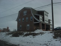 | William J. Gregory House | 2.8 miles | 1996 |
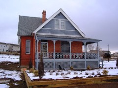 | Thede Farmhouse | 2.8 miles | 1998 |
 | Metzger Farm | 3.3 miles | 2013 |
 | Union High School | 3.8 miles | 2000 |
 | Harris Park School | 3.8 miles | 1990 |
| National Archives record | The nomination case file for reference 100009565 in Record Group 79. |
| Adams County | All 18 listed properties in this county. |