 Block
From the record
16 National Register listings published here.
Sources: the National Register database, National Park Service
87 topographic sheets cover 29 settlements here, and 16 properties are on the National Register of Historic Places.
16 National Register listings published here.
Sources: the National Register database, National Park Service
Every property in this county listed on the National Register of Historic Places, with the year it was listed and the federal nomination document.
| Photograph | Property | Type | Listed | Reference |
|---|---|---|---|---|
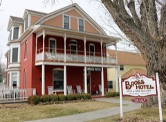 | Bross Hotel | building | 2015 | 15000780 |
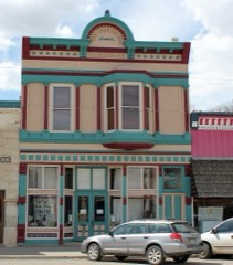 | Curtis Hardware Store | building | 1989 | 89001746 |
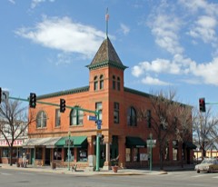 | Delta County Bank Building | building | 1993 | 93000577 |
| Delta Municipal Light & Power Plant | building | 2024 | 100010079 | |
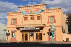 | Egyptian Theater | building | 1993 | 93000575 |
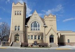 | First Methodist Episcopal Church of Delta | building | 1991 | 91000069 |
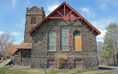 | First Presbyterian Church of Eckert | building | 2006 | 05001507 |
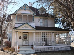 | Garnethurst | building | 1995 | 95001245 |
| Hotchkiss Homestead | district | 2011 | 11000900 | |
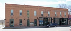 | Hotchkiss Hotel | building | 1984 | 84000802 |
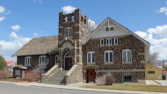 | Hotchkiss Methodist Episcopal Church | building | 2009 | 09000853 |
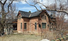 | Mathews House | building | 2004 | 04001110 |
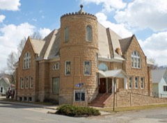 | Paonia First Christian Church | building | 2011 | 11000218 |
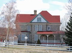 | Stolte House | building | 1997 | 97001280 |
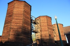 | Surface Creek Livestock Company Silos | structure | 2000 | 00000367 |
 | US Post Office and Federal Building-Delta Main | building | 1986 | 86000173 |
Every wildfire the federal occurrence database records inside this county: 987 of them, burning about 11,210 acres. 363 started naturally and 5 were recorded as arson. Each settlement page carries the fires within five miles of it.
| Reported cause | Fires |
|---|---|
| Missing data/not specified/undetermined | 449 |
| Natural | 363 |
| Recreation and ceremony | 88 |
| Debris and open burning | 36 |
| Smoking | 23 |
| Equipment and vehicle use | 15 |
| Arson/incendiarism | 5 |
| Power generation/transmission/distribution | 4 |
| Fireworks | 2 |
| Railroad operations and maintenance | 1 |
| Misuse of fire by a minor | 1 |
The five largest, by the area the report gives. None of them was recorded as arson.
| Date | Cause | Size | Reported by | Name on the report |
|---|---|---|---|---|
| 4 July 1994 | Natural | 3,848 acres | Southwest District, Montrose | WAKE |
| 3 July 2004 | Natural | 2,806 acres | Southwest District, Montrose | MCGRUDER |
| 2 July 1999 | Natural | 515 acres | Southwest District, Montrose | FRUITLAND |
| 14 June 2016 | Natural | 500 acres | Denver County | UNKNOWN |
| 18 June 1996 | Debris and open burning | 313 acres | Southwest District, Montrose | DOC MESA |
| 11 June 1996 | Natural | 312 acres | Southwest District, Montrose | WELLS |
| 4 July 1994 | Natural | 306 acres | Southwest District, Montrose | MISSOURI |
| 8 July 2004 | Missing data/not specified/undetermined | 301 acres | Southwest District, Montrose | DTX1 SMTN |
Every settlement page carries the fires within five miles of it - see the settlement index below.
The NOAA Storm Events Database holds 71 reports for this county, causing no deaths, no injuries and about $6,293,000 in recorded property damage. Each settlement page carries the reports that name it.
| Kind of event | Reports |
|---|---|
| Thunderstorm Wind | 21 |
| Flash Flood | 9 |
| Funnel Cloud | 9 |
| Flood | 9 |
| Heavy Rain | 8 |
| Hail | 7 |
| Tornado | 3 |
| Lightning | 3 |
| Dust Devil | 1 |
| Debris Flow | 1 |
The most serious of them, by death, then injury, then recorded damage. The accounts are quoted exactly as the forecast office filed them.
| When | Event | Place named | Harm | What the report says |
|---|---|---|---|---|
| May 2023 | Debris Flow | Paonia | $2,000,000 | Excessive spring runoff and debris backing up in culverts led to a large sinkhole developing on Highway 133 north of Paonia and south of Somerset, Colorado between mile markers 14 and 19. This resulted in the closure of the highway to allow emergency repairs to be made. The sinking soils were first noticed on April 29, 2023 with the eventual collapse of the highway occurring on May 2, 2023. |
| August 2010 | Thunderstorm Wind | Lazear | $2,000,000 | A strong eastward-moving thunderstorm cell collapsed over central Delta County and produced damaging winds across portions of eastern Delta County. Measured wind speeds included 79 mph at a location 4 miles northwest of Hotchkiss and 90 mph at a location just under 3 miles southeast of Hotchkiss. The damage pach extended from about 5 miles west-northwest of Hotchkiss to about 7 miles east of Hotchkiss. The width of the damage patch extended from about 2 miles north of Hotchkiss to about just north of Crawford. Numerous trees were downed, with some trees more than 2 feet in diameter where they were snapped off. Many houses and other personal property were damaged, including the historic brick Hotchkiss Barn. An airplane was torn from its moorings and flipped over at the Paonia Airport. Power was out in many locations, though it was restored at most locations by the afternoon on the following day. |
| May 1998 | Flash Flood | Hotchkiss | $1,400,000 | no account filed |
| May 1993 | Thunderstorm Wind | Delta | $500,000 | Strong thunderstorm winds destroyed a mobile home in Peach Valley, east of Delta. No one was injured. Time estimated. |
| July 2013 | Flash Flood | Roubideau | $150,000 | A Union Pacific train trestle was washed away, including the super and sub-structure. Portions of a dirt road between Highway 50 and the train tracks in Dominguez Canyon were washed out. The flow of rapidly moving water through this area was estimated to be up to 10 feet deep and 30 yards wide. |
| June 1994 | Thunderstorm Wind | Eckert | $50,000 | no account filed |
| July 2006 | Flash Flood | Delta | $40,000 | no account filed |
| October 2001 | Lightning | Delta | $28,000 | no account filed |
| September 2002 | Flash Flood | Delta | $25,000 | no account filed |
| September 2002 | Tornado (F1) | Delta | $25,000 | no account filed |
| May 2001 | Thunderstorm Wind | Delta | $20,000 | no account filed |
| May 2023 | Flood | Bowie | $10,000 | Snowmelt produced a washout on National Forest System Road (NFSR) #704-Condemn-It park road located at mile post 1.5 south of West Muddy Guard Station in the Paonia Ranger District. The road was not passable and remained closed. |
| May 2015 | Heavy Rain | Cedaredge | $10,000 | A blocked culvert and increased water flow due to recent rainfall near the confluence of Cow Creek and Leroux Creek caused a portion of County Road 3100 to wash out with localized flooding near Leroux Creek. |
| May 2023 | Flood | Paonia Arpt | $5,000 | Emergency management reported flooding along portions of the North Fork of the Gunnison River near Hotchkiss, mainly in the form of significant erosion of banks along the river. A few cars from a junkyard that was located right against the river bank were taken by the water. |
| August 2003 | Flash Flood | Cedaredge | $5,000 | no account filed |
| August 2003 | Lightning | Cedaredge | $5,000 | no account filed |
| July 2010 | Thunderstorm Wind | Lazear | $3,000 | Three large cottonwood trees were blown down, a roof of a hayshed was torn off and blown 200 to 300 feet from the shed, and power lines were downed along highway 92 near the intersection with County Road 3050. |
| May 2005 | Dust Devil | Hotchkiss | $3,000 | no account filed |
| August 2000 | Lightning | Delta | $3,000 | no account filed |
| May 2023 | Flood | Cedaredge | $2,500 | Flooding on Surface Creek led to the closure of a recreational trail along the river, near Cedaredge, as the trail was washed out. |
| May 2023 | Flood | Paonia | $2,500 | Accelerated snowmelt from a near-record snowpack due to above normal temperatures produced high and fast flow on the North Fork of the Gunnison River near Paonia, Colorado. This led to a power pole that was near the river to be washed out, resulting in a power outage for almost 700 people between Paonia and Hotchkiss. |
| July 2021 | Flood | Delta Arpt | $2,000 | Heavy rain produced minor street flooding in downtown Delta. |
| March 2001 | Flood | Delta | $2,000 | no account filed |
| April 2023 | Flood | Paonia Arpt | $1,000 | Rapid snowmelt resulted in flooding across Bell Creek Road outside Paonia as Bell Creek overran its banks. |
| July 2001 | Thunderstorm Wind | Cedaredge | $1,000 | no account filed |
| August 2023 | Thunderstorm Wind | Orchard City | - | Wind gusts estimated to be 70 mph downed power lines and knocked over some trees 1 mile west-southwest of Eckert. |
| July 2021 | Thunderstorm Wind | Hotchkiss | - | A peak wind gust of 63 MPH was measured by the automated Mesonet weather station 3 miles north-northwest of Hotchkiss. |
| July 2020 | Thunderstorm Wind | Delta Arpt | - | A peak wind gust of 59 mph was measured by the automated weather station at the Blake Field Airport in Delta. |
| June 2020 | Thunderstorm Wind | Grand Mesa | - | Wind gusts estimated to be in the 70 to 75 mph range uprooted some very large trees and caused damage to cabins and vehicles. |
| June 2020 | Thunderstorm Wind | Roubideau | - | A peak wind gust of 62 mph was measured by an automated weather station 12 miles southeast of Whitewater. |
| June 2020 | Thunderstorm Wind | Roubideau | - | A peak wind gust of 63 mph was measured by an automated weather station 12 miles southeast of Whitewater. |
| July 2019 | Flash Flood | Delta Arpt | - | Water flowed across Colorado Highway 92 east of Delta which brought traffic to a standstill. Rain rates exceeded one inch per hour with a Cooperative Observer 3 miles east of Delta measuring 1.20 inches in an hour. |
| October 2018 | Thunderstorm Wind | Hotchkiss | - | An automated weather station three miles north-northwest of Hotchkiss recorded a peak wind gust of 70 MPH. |
| July 2017 | Heavy Rain | Cedaredge | - | A total of 1.25 inches of rain was measured within 90 minutes. |
| September 2014 | Tornado (EF0) | Roubideau | - | A tornado touched down over open country and was observed and reported by a person familiar with tornadoes. |
| July 2014 | Flash Flood | Hotchkiss | - | Thunderstorms brought an area of heavy rainfall from Hotchkiss to areas north of Cedaredge. Flash flooding impacted portions of Hotchkiss and closed a portion of Highway 65 north of Cedaredge which deposited a large amount of debris onto the road. |
| July 2013 | Flash Flood | Roubideau | - | Highway 50 was closed in both directions at mile markers 52-58 due to flash flooding. Fast moving water flowed up to two feet deep in places across the four lanes of the highway. |
| July 2012 | Heavy Rain | Crawford | - | Over 0.75 inches of rain fell within an hour from a thunderstorm that moved between Paonia and Crawford Reservoir. |
| August 2011 | Funnel Cloud | Delta Arpt | - | A funnel cloud was observed by several people near the Adobe Hills north of Delta. |
| July 2011 | Flash Flood | Delta Arpt | - | Flash flood waters and debris crossed over Highway 50, leaving over a foot deep of mud and other debris on the road after the waters receded. Highway 50 was closed until CDOT crews were able to clear the road of debris. |
| July 2010 | Thunderstorm Wind | Lazear | - | Strong winds snapped off several large tree branches in the area. |
| July 2009 | Funnel Cloud | Crawford | - | A large funnel cloud formed just south of Crawford and was photographed by a person about 10 miles away in Hotchkiss. |
| June 2009 | Heavy Rain | Delta | - | Heavy rainfall caused street flooding in the southern part of the town of Delta, including the area around 12th and Main Street. |
| October 2006 | Thunderstorm Wind | Paonia Arpt | - | This wind gust was measured by the Jay RAWS at the 6200 foot level. |
| July 1994 | Tornado (F0) | Paonia | - | A spotter reported a small tornado touched down in an open field northeast of Paonia (27 miles northeast of Montrose). No damage or injuries was reported. |
| June 1994 | Hail | Eckert | - | Marble-size hail caused considerable damage to peach and apple orchards near Eckert (38 miles southeast of Grand Junction). |
| August 1993 | Hail | Paonia | - | Marble-size hail caused major damage to the fruit and vegetable crops in the Paonia area (27 miles northeast of Montrose). |
| August 2008 | Thunderstorm Wind | Lazear | - | no account filed |
| July 2006 | Heavy Rain | Crawford | - | no account filed |
| August 2006 | Heavy Rain | Delta | - | no account filed |
| May 2005 | Funnel Cloud | Hotchkiss | - | no account filed |
| June 2005 | Thunderstorm Wind | Delta | - | no account filed |
| August 2003 | Funnel Cloud | Delta | - | no account filed |
| August 2003 | Funnel Cloud | Delta | - | no account filed |
| August 2003 | Hail | Crawford | - | no account filed |
| July 2003 | Funnel Cloud | Paonia | - | no account filed |
| September 2002 | Funnel Cloud | Delta | - | no account filed |
| September 2002 | Thunderstorm Wind | Hotchkiss | - | no account filed |
| August 2001 | Flood | Delta | - | no account filed |
| August 2001 | Hail | Delta | - | no account filed |
The Survey's mineral resources record lists 75 workings inside this county. 7 still produce and 68 are closed or unrecorded. Each settlement page carries the workings within five miles of it.
| Commodity | Workings |
|---|---|
| Sand and Gravel, Construction | 55 |
| Sulfur | 4 |
| Gypsum-Anhydrite | 4 |
| Molybdenum | 3 |
| Gold | 2 |
| Iron | 2 |
| Aluminum | 2 |
| Clay | 2 |
| Manganese | 1 |
| Fire Clay (Refractory), Stone, Dimension | 1 |
| Coal | 1 |
| Aluminum, Gypsum-Anhydrite | 1 |
| Gold, Silver | 1 |
The least common of them first, because a county's hundredth gravel pit says nothing its first ten did not.
| Where | Site | Commodity | Status | Recorded |
|---|---|---|---|---|
| Burdick Mine | Coal, Aluminum, Gypsum-Anhydrite | Past Producer | ||
| Delta Limonite Deposit | Iron, Manganese | Past Producer | 1890 | |
| Molly Group | Molybdenum, Gold, Silver | Unknown | ||
| Unknown | Fire Clay (Refractory), Stone, Dimension | Occurrence | Sedimentary | |
| Davis and Spaulding Property | Aluminum | Unknown | ||
| Gravel Pit | Clay | Past Producer | ||
| Iron Cap Mine | Iron | Past Producer | ||
| Shale Pit | Clay | Past Producer | ||
| Unnamed Placers | Gold | Past Producer | Placer | |
| Unnamed Placers | Gold | Past Producer | 1874 | |
| Various | Sand and Gravel, Construction, Aluminum | Unknown | ||
| Molly Group | Molybdenum | Occurrence | Molybdenite | |
| Morelock Mine | Molybdenum | Unknown | ||
| Atlas Mining Co Mine | Sulfur | Past Producer | ||
| Canyon and Tract Group | Gypsum-Anhydrite | Past Producer | ||
| Chipeta Mill | Gypsum-Anhydrite | Past Producer | ||
| Doty Mine | Gypsum-Anhydrite | Past Producer | ||
| Gunnison Forks | Sulfur | Producer | ||
| Gunnison Forks | Sulfur | Past Producer | ||
| Thomas | Sulfur | Producer | ||
| Unknown | Gypsum-Anhydrite | Occurrence | Sedimentary | |
| Delta County Pit | Sand and Gravel, Construction | Producer | ||
| Delta Sand & Gravel | Sand and Gravel, Construction | Past Producer | ||
| Delta Sand and Gravel Pit | Sand and Gravel, Construction | Producer | ||
| Gravel Pit | Sand and Gravel, Construction | Past Producer | ||
| Gravel Pit | Sand and Gravel, Construction | Unknown | ||
| Gravel Pit | Sand and Gravel, Construction | Past Producer | ||
| Gravel Pit | Sand and Gravel, Construction | Past Producer | ||
| Gravel Pit | Sand and Gravel, Construction | Past Producer | ||
| Gravel Pit | Sand and Gravel, Construction | Past Producer | ||
| Gravel Pit | Sand and Gravel, Construction | Unknown | ||
| Gravel Pit | Sand and Gravel, Construction | Past Producer | ||
| Gravel Pit | Sand and Gravel, Construction | Past Producer | ||
| Gravel Pit | Sand and Gravel, Construction | Unknown | ||
| Gravel Pit | Sand and Gravel, Construction | Past Producer | ||
| Gravel Pit | Sand and Gravel, Construction | Unknown | ||
| Gravel Pit | Sand and Gravel, Construction | Past Producer | ||
| Gravel Pit | Sand and Gravel, Construction | Past Producer | ||
| Gravel Pit | Sand and Gravel, Construction | Past Producer | ||
| Gravel Pit | Sand and Gravel, Construction | Past Producer | ||
| Gravel Pit | Sand and Gravel, Construction | Unknown | ||
| Gravel Pit | Sand and Gravel, Construction | Past Producer | ||
| Gravel Pit | Sand and Gravel, Construction | Past Producer | ||
| Gravel Pit | Sand and Gravel, Construction | Past Producer | ||
| Gravel Pit | Sand and Gravel, Construction | Unknown | ||
| Gravel Pit | Sand and Gravel, Construction | Unknown | ||
| Gravel Pit | Sand and Gravel, Construction | Past Producer | ||
| Gravel Pit | Sand and Gravel, Construction | Unknown | ||
| Gravel Pit | Sand and Gravel, Construction | Past Producer | ||
| Gravel Pit | Sand and Gravel, Construction | Past Producer | ||
| Gravel Pit | Sand and Gravel, Construction | Unknown | ||
| Gravel Pit | Sand and Gravel, Construction | Past Producer | ||
| Gravel Pit | Sand and Gravel, Construction | Unknown | ||
| Gravel Pit | Sand and Gravel, Construction | Past Producer | ||
| Gravel Pit | Sand and Gravel, Construction | Unknown | ||
| Gravel Pit | Sand and Gravel, Construction | Past Producer | ||
| Hallenbeck Pit and Plant | Sand and Gravel, Construction | Producer | ||
| Lambert Pit | Sand and Gravel, Construction | Producer | ||
| North Fork Pit | Sand and Gravel, Construction | Producer | ||
| Sand and Gravel Pit | Sand and Gravel, Construction | Unknown | ||
| Unknown | Sand and Gravel, Construction | Occurrence | Gravel | |
| Unknown | Sand and Gravel, Construction | Occurrence | Gravel | |
| Unknown | Sand and Gravel, Construction | Occurrence | Sand and Gravel | |
| Unknown | Sand and Gravel, Construction | Occurrence | Gravel | |
| Unknown | Sand and Gravel, Construction | Occurrence | Sand and Gravel | |
| Unknown | Sand and Gravel, Construction | Occurrence | Gravel | |
| Unknown | Sand and Gravel, Construction | Occurrence | Gravel | |
| Unknown | Sand and Gravel, Construction | Occurrence | Gravel | |
| Unknown | Sand and Gravel, Construction | Occurrence | Sand and Gravel | |
| Unknown | Sand and Gravel, Construction | Occurrence | Sand and Gravel | |
| Unknown | Sand and Gravel, Construction | Occurrence | Gravel | |
| Unknown | Sand and Gravel, Construction | Occurrence | Gravel | |
| Unknown | Sand and Gravel, Construction | Occurrence | Gravel | |
| Unknown | Sand and Gravel, Construction | Occurrence | Gravel | |
| Unknown | Sand and Gravel, Construction | Occurrence | Gravel |
Named settlements recorded in the Geographic Names Information System, each with the topographic sheets covering it. Villages, hamlets and abandoned places alike. Each is shown with the nearest named watercourse or landform and the survey quadrangle it falls on.
Cedaredge census division · 81410 · On Alfalfa Run · Orchard City quadrangle
14 sheets, 1956 to 1983
Cedaredge census division · 81413 · On Williams Creek · Cedaredge quadrangle
14 sheets, 1956 to 1983
Delta census division · 81416 · Near Beaver Gulch · Dominguez quadrangle
15 sheets, 1956 to 1980
Paonia census division · 81428 · On Reynolds Creek · Hotchkiss quadrangle
13 sheets, 1956 to 1983
Cedaredge census division · 81413 · On Williams Creek · Cedaredge quadrangle
14 sheets, 1956 to 1983
Cedaredge census division · 81410 · On Surface Creek · Orchard City quadrangle
14 sheets, 1956 to 1983
Hotchkiss census division · 81415 · Near Youngs Peak · Crawford quadrangle
14 sheets, 1956 to 2001
Delta census division · 81416 · On Uncompahgre River · Delta quadrangle
16 sheets, 1956 to 1980
Delta census division · 81416 · On Wells Gulch · Dominguez quadrangle
15 sheets, 1956 to 1980
Cedaredge census division · 81418 · Near Happy Hollow Gulch · Orchard City quadrangle
14 sheets, 1956 to 1983
Delta census division · 81416 · On Escalante Creek · Dominguez quadrangle
15 sheets, 1956 to 1980
Hotchkiss census division · 81419 · Near Short Draw · Hotchkiss quadrangle
13 sheets, 1956 to 1983
Delta census division · 81416 · On Escalante Creek · Dominguez quadrangle
15 sheets, 1956 to 1980
Paonia census division · 81428 · On Hubbard Creek · Bowie quadrangle
16 sheets, 1956 to 2001
Delta census division · 81416 · Near Tatum Gulch · Good Point quadrangle
17 sheets, 1956 to 1980
Hotchkiss census division · 81419 · Near Alum Gulch · Lazear quadrangle
17 sheets, 1955 to 1983
Delta census division · 81416 · On Uncompahgre River · North Delta quadrangle
16 sheets, 1956 to 1980
Cedaredge census division · 81418 · Near Happy Hollow Gulch · Orchard City quadrangle
14 sheets, 1956 to 1983
Paonia census division · 81428 · On Minnesota Creek · Paonia quadrangle
15 sheets, 1956 to 2001
Delta census division · 81416 · Near Beaver Gulch · Dominguez quadrangle
15 sheets, 1956 to 1980
Hotchkiss census division · 81419 · Near Allen Gulch · Lazear quadrangle
17 sheets, 1955 to 1983
Delta census division · 81416 · On Tongue Creek · North Delta quadrangle
16 sheets, 1956 to 1980
Delta census division · 81416 · On Cedar Run · Orchard City quadrangle
14 sheets, 1956 to 1983