 Block
From the record
One of 16 National Register listings published here for Delta County · listed in 2004 · category: Building.
Sources: the case file at the National Archives · the National Register database, National Park Service
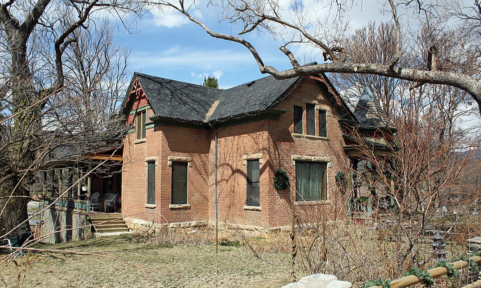
Listed on the National Register of Historic Places in 2004.
One of 16 National Register listings published here for Delta County · listed in 2004 · category: Building.
Sources: the case file at the National Archives · the National Register database, National Park Service
Regional context, not property-specific evidence. The federal wildfire occurrence database lists 139 fires within 5 miles of Mathews House between 1992 and 2020, burning about 4,276 acres in total. 105 started naturally. None was recorded as arson. Distance is straight-line from the map coordinates, so a fire counted here may appear on a neighbouring settlement's page as well.
| Reported cause | Fires |
|---|---|
| Natural | 105 |
| Missing data/not specified/undetermined | 21 |
| Debris and open burning | 6 |
| Smoking | 3 |
| Recreation and ceremony | 2 |
| Power generation/transmission/distribution | 1 |
| Equipment and vehicle use | 1 |
The most recent of them, most recent first, with the day each was reported and the service that recorded it.
| Date | Cause | Size | Reported by | Name on the report |
|---|---|---|---|---|
| 26 September 1992 | Natural | 2.0 acres | Southwest District, Montrose | JAY |
| 20 September 2009 | Natural | under an acre | Southwest District, Montrose | RED TOP PEAK |
| 16 September 2009 | Natural | under an acre | Southwest District, Montrose | SOUTH JUMBO |
| 14 September 1997 | Natural | under an acre | Southwest District, Montrose | TERROR |
| 13 September 2001 | Natural | under an acre | Southwest District, Montrose | JUMBO |
| 13 September 1997 | Natural | under an acre | Southwest District, Montrose | GARVINMESA |
| 13 September 1993 | Natural | under an acre | Southwest District, Montrose | WAKEFIELD |
| 12 September 1993 | Natural | under an acre | Southwest District, Montrose | LOVE |
Regional context, not property-specific evidence. The federal mineral resources record lists 5 workings within 5 miles of Mathews House: 2 occurrences, 2 past producers, 1 unknown. None of them still produces. What was taken out: Sand and Gravel, Construction. Distance is straight-line from the map coordinates, so a quarry counted here may appear on a neighbouring settlement's page as well.
| Where | Site | Commodity | Status | Recorded |
|---|---|---|---|---|
| Delta Sand & Gravel | Sand and Gravel, Construction | Past Producer | ||
| Gravel Pit | Sand and Gravel, Construction | Past Producer | ||
| Sand and Gravel Pit | Sand and Gravel, Construction | Unknown | ||
| Unknown | Sand and Gravel, Construction | Occurrence | Gravel | |
| Unknown | Sand and Gravel, Construction | Occurrence | Gravel |
Regional context, not property-specific evidence. The National Weather Service names Paonia, the town this property stands in, in 5 storm reports between 1993 and 2023: 1 hail, 1 tornado, 1 funnel cloud, 1 flood. No death or injury is recorded in these reports. Each account below is quoted exactly as the forecast office filed it, from the NOAA Storm Events Database, and each date opens the federal record of that event.
| When | Event | Place named | Harm | What the report says |
|---|---|---|---|---|
| May 2023 | Debris Flow | Paonia | $2,000,000 | Excessive spring runoff and debris backing up in culverts led to a large sinkhole developing on Highway 133 north of Paonia and south of Somerset, Colorado between mile markers 14 and 19. This resulted in the closure of the highway to allow emergency repairs to be made. The sinking soils were first noticed on April 29, 2023 with the eventual collapse of the highway occurring on May 2, 2023. |
| May 2023 | Flood | Paonia | $2,500 | Accelerated snowmelt from a near-record snowpack due to above normal temperatures produced high and fast flow on the North Fork of the Gunnison River near Paonia, Colorado. This led to a power pole that was near the river to be washed out, resulting in a power outage for almost 700 people between Paonia and Hotchkiss. |
| July 1994 | Tornado (F0) | Paonia | - | A spotter reported a small tornado touched down in an open field northeast of Paonia (27 miles northeast of Montrose). No damage or injuries was reported. |
| August 1993 | Hail | Paonia | - | Marble-size hail caused major damage to the fruit and vegetable crops in the Paonia area (27 miles northeast of Montrose). |
| July 2003 | Funnel Cloud | Paonia | - | no account filed |
No historic map-sheet match is published for this property yet. That does not mean no map exists. This record needs a coordinate-quality review before it can be joined to a sheet boundary. Browse the county's mapped places while that work is pending.
Other National Register properties close enough to walk or drive between, ordered by distance from this one. Both positions come from the same geocoding pass that matched these properties to their map sheets.
| Photograph | Property | Distance | Listed |
|---|---|---|---|
 | Curtis Hardware Store | 0.3 miles | 1989 |
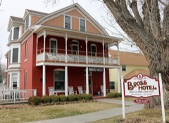 | Bross Hotel | 0.4 miles | 2015 |
 | Paonia First Christian Church | 0.5 miles | 2011 |
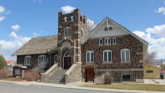 | Hotchkiss Methodist Episcopal Church | 7.7 miles | 2009 |
 | Hotchkiss Hotel | 7.8 miles | 1984 |
| National Archives record | The nomination case file for reference 04001110 in Record Group 79. |
| Delta County | All 16 listed properties in this county. |