Block
From the record
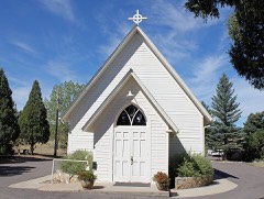
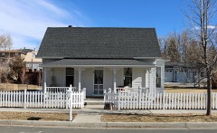
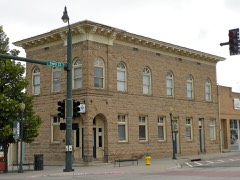
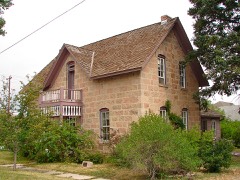
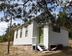
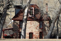
24 National Register listings published here.
Sources: the National Register database, National Park Service
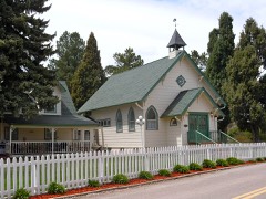
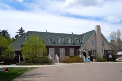
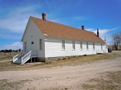
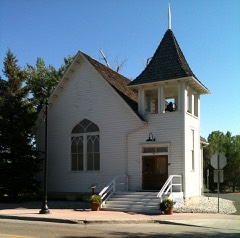
178 topographic sheets cover 72 settlements here, and 24 properties are on the National Register of Historic Places.
24 National Register listings published here.
Sources: the National Register database, National Park Service
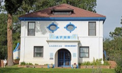
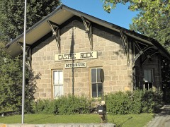
Every property in this county listed on the National Register of Historic Places, with the year it was listed and the federal nomination document.
Every wildfire the federal occurrence database records inside this county: 2,103 of them, burning about 11,517 acres. 443 started naturally and 67 were recorded as arson. Each settlement page carries the fires within five miles of it.
| Reported cause | Fires |
|---|---|
| Missing data/not specified/undetermined | 1156 |
| Natural | 443 |
| Recreation and ceremony | 127 |
| Equipment and vehicle use | 116 |
| Smoking | 74 |
| Arson/incendiarism | 67 |
| Fireworks | 31 |
| Misuse of fire by a minor | 30 |
| Debris and open burning | 29 |
| Other causes | 12 |
| Firearms and explosives use | 10 |
| Railroad operations and maintenance | 5 |
| Power generation/transmission/distribution | 3 |
The five largest, by the area the report gives. None of them was recorded as arson.
| Date | Cause | Size | Reported by | Name on the report |
|---|---|---|---|---|
| 22 May 2002 | Natural | 4,085 acres | Pike and San Isabel National Forest | SCHOONOVER |
| 24 March 2011 | Missing data/not specified/undetermined | 1,600 acres | Douglas County | BURNING TREE |
| 24 March 2011 | Missing data/not specified/undetermined | 1,200 acres | Colorado State Forest Service-State Headquarters | FRANKTOWN |
| 29 October 2003 | Missing data/not specified/undetermined | 1,050 acres | Colorado State Forest Service-State Headquarters | CHEROKEE RANCH |
| 17 May 1998 | Recreation and ceremony | 600 acres | Pike and San Isabel National Forest | BIG TURKEY |
| 29 June 2020 | Missing data/not specified/undetermined | 500 acres | Douglas County | CHATRIDGE 2 |
| 29 May 2020 | Missing data/not specified/undetermined | 225 acres | Aurora Fire Department | N/A |
| 28 October 2016 | Equipment and vehicle use | 205 acres | South Metro Fire Rescue | UNKNOWN |
Every settlement page carries the fires within five miles of it - see the settlement index below.
The NOAA Storm Events Database holds 623 reports for this county, causing 2 deaths, 19 injuries and about $20,354,840 in recorded property damage. Each settlement page carries the reports that name it.
| Kind of event | Reports |
|---|---|
| Hail | 428 |
| Tornado | 64 |
| Thunderstorm Wind | 55 |
| Flash Flood | 41 |
| Lightning | 26 |
| Heavy Rain | 4 |
| Flood | 4 |
| Funnel Cloud | 1 |
The most serious of them, by death, then injury, then recorded damage. The accounts are quoted exactly as the forecast office filed them.
| When | Event | Place named | Harm | What the report says |
|---|---|---|---|---|
| July 1997 | Thunderstorm Wind | Parker | 1 killed, 2 hurt | One construction worker was killed, two others injured, when a strong wind gust caused the scaffolding they were standing on to collapse. |
| May 2017 | Lightning | Sedalia | 1 killed, 1 hurt, $5,000 | A woman and her horse were killed after they were struck by lightning. A 15-year-old girl also sustained serious injuries and was treated for electrocution. |
| June 1965 | Tornado (F1) | not stated | 4 hurt, $2,500 | no account filed |
| June 1999 | Hail | Franktown | 3 hurt, $3,000,000 | Large hail, up to golfball size and accumulating several inches deep, caused a large section of a corrugated metal roof of a greenhouse complex to collapse. About a third of the roof covering the 30,000 square foot building collapsed. Thirty five workers were trapped in the debris, 3 people were treated for minor injuries. Hail piled up 1-2 feet deep blocked the roadways, slowing down emergency vehicles. Damage to the building was estimated to be around $3.0 million. |
| May 1961 | Tornado (F2) | not stated | 2 hurt, $25,000 | no account filed |
| August 2004 | Lightning | Castle Rock | 2 hurt | Two men were shocked when lightning hit the ground nearby, as they were golfing the eighth green at Castle Pines. The two golfers suffered only minor injuries. |
| July 2006 | Lightning | Castle Rock | 1 hurt | Lightning struck a teenager as he was mowing his lawn and listening to an iPod. The teen suffered burns to his hands and feet, and had blood running from his ear when he was found. The victim's eardrums were ruptured and his hearing was damaged. |
| June 2004 | Lightning | Castle Rock | 1 hurt | Lightning struck a power pole in Castle Rock igniting a small fire and injuring a 12-yr old girl standing nearby. The girl received minor injuries from the electrical shock. Lightning also sparked a small brush fire. The fire was quickly extinguished without incident. |
| May 2001 | Lightning | Castle Rock | 1 hurt | A construction worker received minor injuries when he took an indirect lightning strike. |
| June 1997 | Lightning | Castle Rock | 1 hurt | Lightning struck a security guard at the Castle Pines Golf Course. He received minor injuries. |
| September 1996 | Lightning | Franktown | 1 hurt | no account filed |
| July 2006 | Flash Flood | Southwest Portion | $13,300,000 | Up to 3 inches of heavy rain in the Hayman burn area caused destructive flash flooding along West Creek, between Deckers and Westcreek. Horse Creek, which drains into West Creek, swelled from a normally small creek, into a raging torrent, 25 to 30 feet deep and 300 feet wide. The wall of water damaged or destroyed approximately 30 sections of a 5-mile stretch of State Highway 67, which parallels West Creek. Several homes were extensively damaged or destroyed. In all 86 homes had no access to the highway, resulting in a 125-mile detour for residents of the West Creek subdivision. The sheriff's office used reverse 911 to warn residents to evacuate the area surrounding the subdivision. Campsites near Deckers were also evacuated. No injuries were reported, but several people had to be rescued, due to extensive damage to the access roads and bridges in the area. Reconstruction was estimated to be $13.3 million. |
| August 2000 | Lightning | Sedalia | $2,000,000 | Lightning sparked a blaze which gutted a 10-unit apartment building in Highlands Ranch. Twenty-eight people were left homeless. |
| July 1990 | Tornado (F1) | not stated | $250,000 | no account filed |
| July 1985 | Tornado (F2) | not stated | $250,000 | no account filed |
| July 1973 | Tornado (F0) | not stated | $250,000 | no account filed |
| May 2009 | Lightning | Sedalia | $200,000 | no account filed |
| July 2006 | Lightning | Castle Rock | $125,000 | Lightning struck a residence causing extensive damage to the roof as well as the side of the home. |
| July 2011 | Lightning | Acequia | $100,000 | Lightning triggered a fire that causes extensive damage to a home. |
| August 2002 | Tornado (F0) | Parker | $100,000 | The first tornado, associated with a multi-vortex storm, touched down briefly near E-470 and South Jordan Road. Some fences were damaged and a few trees were blow down. A few of the homes also sustained minor roof damage. |
| July 2000 | Lightning | Castle Rock | $100,000 | Lightning struck a home is Castle Rock causing extensive damage. The majority of the damage was confined to the roof, attic and second floor. |
| August 2007 | Lightning | Parker | $100,000 | no account filed |
| August 2013 | Flash Flood | Castle Rock | $50,000 | Flash flooding occurred along Interstate 25, south of Castle Rock. |
| June 2012 | Flash Flood | Parker | $50,000 | Several roads were washed out from The Pinery to 3 miles west of The Pinery. |
| July 2009 | Flash Flood | Westcreek | $50,000 | Heavy rain, mud and debris came down onto State Highway 67, about 5 miles south of Deckers, completely closing the highway. Due to the amount of debris, the creek was rerouted onto the highway, damaging the road. Storm totals up to 1.75 inches were reported. Several motorists were reportedly stranded in the area and had to be rescued. |
| July 1994 | Tornado (F1) | Parker | $50,000 | A small, short-lived tornado caused damage to a house under construction in Parker (16 miles south southeast of Denver). |
| June 1996 | Lightning | Parker | $30,000 | no account filed |
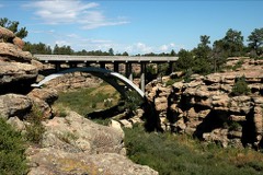
| May 2023 | Flood | Castlewood Canyon State Park | $25,000 | Several trails in Castlewood Canyon State Park were closed as they were underwater and impassable. |
| July 2011 | Flash Flood | Westcreek | $25,000 | Heavy rain produced flash flooding in the Hayman burn scar. |
| July 1985 | Tornado (F1) | not stated | $25,000 | no account filed |
| August 1953 | Tornado (F0) | not stated | $25,000 | no account filed |
| June 2024 | Flash Flood | Parker | $20,000 | South Metro Fire reported cars are being swamped due to rising waters. |
| August 1997 | Lightning | Castle Rock | $20,000 | Lightning struck a home sparking a fire. |
| June 2015 | Flash Flood | Louviers | $15,000 | Flash flooding reported in and around Sedalia. |
| June 2015 | Flood | Louviers | $15,000 | Flooding occurred along Plum Creek and its tributaries. Four trails in Castle Rock were closed due to flooding. Plum Creek remained above flood stage for approximately 2.5 hours, with moderate flooding along and east of the creek. |
| June 2015 | Flood | Roxborough Park | $15,000 | River flooding forced the closure of twenty campgrounds. State Highway 67 near Deckers and Spruce Wood were restricted to local traffic only. |
| July 2014 | Flash Flood | Acequia | $15,000 | Heavy rain, up to 3 inches in one hour, forced mud and debris to slide across US 85 near Airport Road. In addition, Moore and Titan Roads were closed as floodwaters, 6 to 8 inches in depth, crossed the roadways. |
| June 2012 | Lightning | Parker | $15,000 | Lightning struck a home and damaged the attic. |
| August 2005 | Lightning | Castle Rock | $15,000 | Lightning struck an unoccupied home in Parker. The fire caused damage to the roof, attic and second floor bedroom. |
| July 2004 | Thunderstorm Wind | Parker | $15,000 | Strong thunderstorm winds downed a 65-ft blue spruce in Parker. The tree landed onto a home, damaging the roof of the residence. Dozens of holes poked into the shingles and gutters were damaged. |
| July 2014 | Lightning | Castle Rock | $10,000 | Lightning struck a home and sparked a small fire in the attic. |
| August 2008 | Flash Flood | Westcreek | $10,000 | Flash flooding occurred near the town of Westcreek. Private drives to residences in the Trail Creek subdivision were washed out. |
| August 2008 | Flash Flood | Westcreek | $10,000 | The road in the YMCA Camp Shady Brook was washed out and bridges were damaged. Flood damage was observed at the YMCA Camp. Excessive sediment washed back into the pond, at the top of the camp, as Fourmile Creek flooded. In the camp, the gullies carved by the floodwaters were 6 feet wide by 5 feet deep. |
| August 2008 | Lightning | Castle Rock | $10,000 | no account filed |
| August 2008 | Lightning | Castle Rock | $10,000 | no account filed |
| June 2009 | Heavy Rain | Castle Rock | $5,000 | Heavy rain caused significant trail damage in Castlewood Canyon. A couple of wooden walkways over the creek were also washed out. |
| June 1987 | Tornado (F1) | not stated | $2,500 | no account filed |
| May 1978 | Tornado (F0) | not stated | $2,500 | no account filed |
| August 1978 | Tornado (F1) | not stated | $2,500 | no account filed |
| July 1978 | Tornado (F0) | not stated | $2,500 | no account filed |
| August 2008 | Tornado (EF1) | Westcreek | $2,000 | A landspout tornado developed and caused extensive tree damage. One man was injured when he tried to escape the falling trees in his ATV. One of the trees fell on him and broke two vertebrae in his back. |
| May 2017 | Lightning | Highlands Ranch | $1,000 | A nearby lightning strike slightly injured a woman while she was watching a youth |baseball game. |
| July 2007 | Flash Flood | Westcreek | $1,000 | no account filed |
| July 2007 | Flash Flood | Westcreek | $1,000 | no account filed |
| August 2007 | Flash Flood | Westcreek | $1,000 | no account filed |
| September 1993 | Thunderstorm Wind | Castle Rock | $500 | Thunderstorm winds blew over power lines which caused a power outage in Castle Rock. |
| July 1979 | Tornado (F0) | not stated | $250 | no account filed |
| July 1979 | Tornado (F0) | not stated | $250 | no account filed |
| June 1954 | Tornado (F1) | not stated | $250 | no account filed |
| June 1983 | Tornado (F0) | not stated | $30 | no account filed |
The Survey's mineral resources record lists 207 workings inside this county. 82 still produce and 125 are closed or unrecorded. Each settlement page carries the workings within five miles of it.
| Commodity | Workings |
|---|---|
| Stone, Crushed/Broken | 45 |
| Feldspar | 37 |
| Stone | 27 |
| Clay | 23 |
| Sand and Gravel, Construction | 17 |
| REE | 7 |
| Gold | 5 |
| Fire Clay (Refractory) | 5 |
| Gemstone | 4 |
| Mica | 4 |
| Feldspar, Quartz | 4 |
| Fluorine-Fluorite | 4 |
| Quartz | 4 |
| Gold, Silver | 3 |
The least common of them first, because a county's hundredth gravel pit says nothing its first ten did not.
| Where | Site | Commodity | Status | Recorded |
|---|---|---|---|---|
| California Quarry | Feldspar, REE, Niobium (Columbium) | Past Producer | Microcline, Pyrochlore | |
| Colorado Mineral Society | Magnesite, Talc-Soapstone | Unknown | 1883 | |
| Cramer Quarry | Feldspar, REE, Thorium, Uranium | Past Producer | 1942, 1951 | |
| Denver Quarry | Feldspar, Beryllium | Past Producer | 1949 | |
| Devils Head Pegmatite District | Feldspar, Quartz, Gemstone, Beryllium, REE, Tin, Niobium (Columbium), Thorium | Producer | 1930, 1970 | |
| Devils Head Prospect | Gemstone, Tin, Feldspar | Past Producer | Surface | |
| Fern Cr. | Quartz, Mica, Fluorine-Fluorite, Feldspar | Producer | Biotite, Fluorite, Quartz | |
| Helmer Bros. Quarry | Limestone, General | Producer | Limestone | |
| Helmer Lime Quarry | Clay, Stone, Crushed/Broken | Past Producer | ||
| Higginson Pit | Granite | Past Producer | ||
| Jenny Lode | Gold, Copper, Silver | Occurrence | ||
| Little Anna | Feldspar, Quartz, Mica | Producer | Biotite, Quartz | |
| Little Eddy Quarry | Feldspar, REE, Thorium | Past Producer | 1948 | |
| Lone Pine Feldspar Quarry | Feldspar, Niobium (Columbium), Thorium, REE | Past Producer | Microcline | |
| Lone Pine Pegmatite | Niobium (Columbium), Thorium | Occurrence | Pyrochlore, Thorite | |
| Oregon No.1,2&3 and Little Patsy | REE, Uranium | Unknown | ||
| Roxborough Park | Stone, Crushed/Broken, Magnesite, Stone | Past Producer | ||
| Rusty Pick | Feldspar, Mica, Fluorine-Fluorite | Occurrence | Biotite, Feldspar | |
| Skeleton No. 2 Quarry | Quartz, Feldspar, REE | Past Producer | 1972 | |
| Three Muskateers | REE, Mica, Feldspar, Fluorine-Fluorite, Quartz | Producer | Biotite, Fluorite, Monazite, Quartz | |
| Three Musketeers | Feldspar, Fluorine-Fluorite, Potassium, Quartz | Past Producer | ||
| Unknown | Mica, Feldspar | Occurrence | Feldspar, Mica | |
| Unknown | Stone, Dimension | Producer | Tuff | |
| Unnamed Copper Prospect | Copper, Uranium, Nickel, Cobalt | Occurrence | Vein | |
| Unnamed Molybdenum Occurrence | Molybdenum | Occurrence | Molybdenite | |
| Waterton Sand & Clay Co. | Fire Clay (Refractory), Sand and Gravel, Construction | Occurrence | Sand | |
| Watson Park Quarry | Feldspar, REE, Gemstone | Past Producer | 1947, 1948 | |
| Churchill | Silica | Past Producer | ||
| Lost Dutchman Quarry | Feldspar, Thorium, REE | Past Producer | 1953 | |
| M Y M | Gypsum-Anhydrite | Past Producer | ||
| Perry Park | Gypsum-Anhydrite | Past Producer | ||
| Princeton Group | Feldspar, Thorium, REE | Past Producer | 1960 | |
| Saddle Rock Ranch | Silica, Quartz | Past Producer | ||
| Unnamed Gold Occurrence | Silver, Gold | Occurrence | Placer | |
| Unnamed Gold Occurrence | Silver, Gold | Occurrence | Placer | |
| Devils Head Copper | Copper | Past Producer | ||
| Happy Canyon Creek Gold Occurrence | Gold, Silver | Occurrence | Placer | |
| Kaminski Prospect | Uranium | Occurrence | Euxenite | |
| Leonard Mine | Manganese | Occurrence | Psilomelane | |
| Leonard Mine | Manganese | Unknown | 1952 | |
| Penley No. 1 Lease | Uranium | Unknown | ||
| Penley No.1 Lease | Uranium | Occurrence | Carnotite | |
| R E Coulter | Manganese | Past Producer | ||
| Unnamed Copper Prospect | Copper | Occurrence | Vein | |
| Unnamed Gold Occurrence | Gold, Silver | Occurrence | Placer | |
| Unnamed Gold Occurrence | Gold, Silver | Occurrence | Placer | |
| Baldwin | Feldspar, Quartz | Producer | Quartz | |
| C & S | Fluorine-Fluorite | Past Producer | ||
| Devils Head | Gemstone | Occurrence | Amazonstone, Topaz | |
| Devils Head Topaz | Gemstone | Past Producer | ||
| Glen Spielman | Quartz | Past Producer | ||
| Little Eagle | Feldspar, Quartz | Occurrence | Quartz | |
| Little Eagle | Feldspar, Quartz | Past Producer | ||
| Pine Creek | Fluorine-Fluorite | Past Producer | ||
| Rusty Pick | Quartz | Past Producer | ||
| Skeleton #2 | Quartz, Feldspar | Past Producer | ||
| Unknown | Mica | Occurrence | Mica | |
| Unknown | Mica | Occurrence | Mica | |
| Unknown | Mica | Past Producer | ||
| Unknown | Mica | Past Producer | ||
| Unknown | Fluorine-Fluorite | Past Producer | ||
| Unknown | Fluorine-Fluorite | Past Producer | ||
| Andre-Horse Creek Placer | Gold | Occurrence | Placer | |
| Helmer Bros. | Fire Clay (Refractory) | Occurrence | ||
| Hillside | Fire Clay (Refractory) | Occurrence | ||
| Johnson, Scott, & Brickyard | Fire Clay (Refractory) | Occurrence | ||
| Newlin Gulch Gold Occurrence | Gold | Occurrence | Placer | |
| Newlin Gulch Placer | Gold | Occurrence | 1895 | |
| Russellville Gulch Placer | Gold | Past Producer | 1858 | |
| The Hogback Clay Mine | Fire Clay (Refractory) | Occurrence | ||
| Ware | Fire Clay (Refractory) | Occurrence | ||
| Cramer No. 2 Quarry | Feldspar, REE | Past Producer | Microcline | |
| Louviers Plant | REE | Producer | ||
| Miller Lode | Feldspar, REE | Past Producer | Microcline | |
| Molycorp Inc Louviers Plant | REE | Producer | ||
| Spielman Quarry | Feldspar, REE | Past Producer | 1947 | |
| Three Musketeers Feldspar Lode | Feldspar, REE | Past Producer | 1938, 1943 | |
| Deer Creek Pit | Sand and Gravel, Construction | Producer | ||
| Ditmar | Sand and Gravel, Construction, Stone | Past Producer | ||
| Franktown | Sand and Gravel, Construction, Stone, Crushed/Broken | Past Producer | ||
| Haas Pit | Sand and Gravel, Construction | Past Producer | ||
| Larkspur Pit | Sand and Gravel, Construction | Producer | ||
| Titan | Sand and Gravel, Construction | Producer | ||
| Titan Pit | Sand and Gravel, Construction | Producer | ||
| Titan Plant | Sand and Gravel, Construction | Unknown | ||
| Unknown | Sand and Gravel, Construction | Occurrence | Gravel | |
| Unknown | Sand and Gravel, Construction | Occurrence | Gravel | |
| Unknown | Sand and Gravel, Construction | Occurrence | Gravel | |
| Unknown | Sand and Gravel, Construction | Occurrence | Sedimentary | |
| Unknown | Sand and Gravel, Construction | Occurrence | Sedimentary | |
| Unknown | Sand and Gravel, Construction | Occurrence | Gravel | |
| Unknown | Sand and Gravel, Construction | Occurrence | Gravel | |
| Walker Pit | Sand and Gravel, Construction | Producer | ||
| Whisenhunt Gravel Pit | Sand and Gravel, Construction | Unknown | ||
| Claypit | Clay | Producer | ||
| Claypit | Clay | Producer | ||
| Claypit | Clay | Producer | ||
| Claypit | Clay | Producer | ||
| Claypit | Clay | Producer | ||
| Claypit | Clay | Producer | ||
| Claypit | Clay | Producer | ||
| Claypit | Clay | Producer | ||
| Claypit | Clay | Producer | ||
| Claypit | Clay | Producer | ||
| Claypit | Clay | Producer | ||
| Claypit | Clay | Producer | ||
| Diamond Clay Mine | Clay | Past Producer | ||
| Duke Pit | Clay | Producer | ||
| Hillside Mine | Clay | Past Producer | ||
| Hogback #2 #3 #4 | Clay | Producer | ||
| Larkspur | Clay | Past Producer | ||
| Madis | Clay | Past Producer | ||
| Unknown | Clay | Occurrence | Clay | |
| Unknown | Clay | Occurrence | Clay | |
| Ute Mine | Clay | Producer | ||
| Waterton Sand & Clay | Clay, Stone, Crushed/Broken | Past Producer | ||
| Wildcat | Clay | Past Producer | ||
| Castle Rock | Stone | Past Producer | ||
| Little Joe | Stone, Feldspar | Past Producer | ||
| Quarry | Stone | Producer | ||
| Quarry | Stone | Producer | ||
| Quarry | Stone | Producer | ||
| Quarry | Stone | Producer | ||
| Quarry | Stone | Producer | ||
| Quarry | Stone | Producer | ||
| Quarry | Stone | Producer | ||
| Quarry | Stone | Producer | ||
| Quarry | Stone | Producer | ||
| Quarry | Stone | Past Producer | ||
| Quarry | Stone | Producer | ||
| Quarry | Stone | Producer | ||
| Quarry | Stone | Producer | ||
| Quarry | Stone | Producer | ||
| Quarry | Stone | Producer | ||
| Quarry | Stone | Producer | ||
| Quarry | Stone | Producer | ||
| Quarry | Stone | Producer | ||
| Quarry | Stone | Producer | ||
| Quarry | Stone | Producer | ||
| Quarry | Stone | Producer | ||
| Quarry | Stone | Producer | ||
| Quarry | Stone | Producer | ||
| Sedalia | Stone | Producer | ||
| Baldwin Mine | Feldspar | Occurrence | Microcline | |
| Baldwin Pegmatite | Feldspar | Past Producer | ||
| California Lode | Feldspar | Past Producer | ||
| Cramer #2 Pegmatite | Feldspar | Past Producer | ||
| Cramer Pegmatite | Feldspar | Past Producer | ||
| Denver Pegmatite | Feldspar | Past Producer | ||
| Devils Head | Feldspar | Past Producer | ||
| Fern Creek | Feldspar | Past Producer | ||
| Little Anna | Feldspar | Past Producer | ||
| Little Eddy | Feldspar | Past Producer | ||
| Little Joe | Feldspar | Past Producer | ||
| Lone Pine | Feldspar | Past Producer | ||
| Lost Dutchman | Feldspar | Past Producer | ||
| Miller Lode #1 | Feldspar | Past Producer | ||
| Newlin Gulch | Feldspar | Past Producer | ||
| Princeton A N H K | Feldspar | Past Producer | ||
| Spielman | Feldspar | Past Producer | ||
| Unknown | Feldspar | Occurrence | Feldspar | |
| Unknown | Feldspar | Occurrence | Feldspar | |
| Unknown | Feldspar | Past Producer | ||
| Unknown | Feldspar | Past Producer | ||
| Watson Park | Feldspar | Past Producer | ||
| Adams Aggregates Inc | Stone, Crushed/Broken | Past Producer | ||
| Gravel Pit | Stone, Crushed/Broken | Producer | ||
| Gravel Pit | Stone, Crushed/Broken | Producer | ||
| Gravel Pit | Stone, Crushed/Broken | Producer | ||
| Gravel Pit | Stone, Crushed/Broken | Producer | ||
| Gravel Pit | Stone, Crushed/Broken | Producer | ||
| Gravel Pit | Stone, Crushed/Broken | Producer | ||
| Gravel Pit | Stone, Crushed/Broken | Producer | ||
| Gravel Pit | Stone, Crushed/Broken | Producer | ||
| Gravel Pit | Stone, Crushed/Broken | Producer | ||
| Gravel Pit | Stone, Crushed/Broken | Unknown | ||
| Gravel Pit | Stone, Crushed/Broken | Producer | ||
| Gravel Pit | Stone, Crushed/Broken | Unknown | ||
| Gravel Pit | Stone, Crushed/Broken | Producer | ||
| Gravel Pit | Stone, Crushed/Broken | Producer | ||
| Gravel Pit | Stone, Crushed/Broken | Producer | ||
| Gravel Pit | Stone, Crushed/Broken | Unknown | ||
| Gravel Pit | Stone, Crushed/Broken | Producer | ||
| Gravel Pit | Stone, Crushed/Broken | Producer | ||
| Gravel Pit | Stone, Crushed/Broken | Unknown | ||
| Gravel Pit | Stone, Crushed/Broken | Producer | ||
| Gravel Pit | Stone, Crushed/Broken | Unknown | ||
| Gravel Pit | Stone, Crushed/Broken | Producer | ||
| Gravel Pit | Stone, Crushed/Broken | Producer | ||
| Gravel Pit | Stone, Crushed/Broken | Unknown | ||
| Gravel Pit | Stone, Crushed/Broken | Producer | ||
| Gravel Pit | Stone, Crushed/Broken | Producer | ||
| Gravel Pit | Stone, Crushed/Broken | Producer | ||
| Gravel Pit | Stone, Crushed/Broken | Producer | ||
| Gravel Pit | Stone, Crushed/Broken | Producer | ||
| Gravel Pit | Stone, Crushed/Broken | Producer | ||
| Gravel Pit | Stone, Crushed/Broken | Producer | ||
| Kassler Quarry | Stone, Crushed/Broken | Producer | ||
| Pre-Mix Sand & Gravel Inc | Stone, Crushed/Broken | Past Producer | ||
| Sand Pit | Stone, Crushed/Broken | Producer | ||
| Sand Pit | Stone, Crushed/Broken | Producer | ||
| Sandpit | Stone, Crushed/Broken | Producer | ||
| Slocum | Stone, Crushed/Broken | Past Producer | ||
| Unknown | Stone, Crushed/Broken | Occurrence | Sedimentary | |
| Unknown | Stone, Crushed/Broken | Occurrence | Sedimentary | |
| Unknown | Stone, Crushed/Broken | Occurrence | Sedimentary | |
| Unknown | Stone, Crushed/Broken | Producer |
Named settlements recorded in the Geographic Names Information System, each with the topographic sheets covering it. Villages, hamlets and abandoned places alike. Each is shown with the nearest named watercourse or landform and the survey quadrangle it falls on.
Sedalia census division · 80125 · Near Sterling Gulch · Littleton quadrangle
21 sheets, 1899 to 1983
Sedalia census division · 80124 · On Cook Creek · Highlands Ranch quadrangle
26 sheets, 1890 to 1981
Parker census division · 80134 · Near Moonshine Gulch · Ponderosa Park quadrangle
30 sheets, 1894 to 1983
Sedalia census division · 80125 · Near Marcy Gulch · Littleton quadrangle
21 sheets, 1899 to 1983
Parker census division · 80116 · On Willow Creek · Ponderosa Park quadrangle
30 sheets, 1894 to 1983
Sedalia census division · 80124 · On Cook Creek · Highlands Ranch quadrangle
26 sheets, 1890 to 1981
Sedalia census division · 80108 · By Wildcat Point · Sedalia quadrangle
26 sheets, 1894 to 1983
Sedalia census division · 80108 · Near Haskins Gulch · Sedalia quadrangle
26 sheets, 1894 to 1983
Castle Rock census division · 80104 · Near Sellers Gulch · Castle Rock South quadrangle
28 sheets, 1894 to 1983
Parker census division · 80116 · On Willow Creek · Castle Rock North quadrangle
28 sheets, 1894 to 1983
Parker census division · 80134 · Near Oak Gulch · Parker quadrangle
24 sheets, 1890 to 1981
Parker census division · 80134 · Near Newlin Gulch · Parker quadrangle
24 sheets, 1890 to 1981
Parker census division · 80134 · On Happy Canyon Creek · Parker quadrangle
24 sheets, 1890 to 1981
Parker census division · 80104 · Castle Rock North quadrangle
28 sheets, 1894 to 1983
Parker census division · 80116 · On Willow Creek · Castle Rock North quadrangle
28 sheets, 1894 to 1983
Sedalia census division · 80130 · On Cook Creek · Highlands Ranch quadrangle
26 sheets, 1890 to 1981
Parker census division · 80134 · Near Badger Gulch · Parker quadrangle
24 sheets, 1890 to 1981
Castle Rock census division · 80118 · Near Rattlesnake Butte · Greenland quadrangle
23 sheets, 1894 to 1983
Parker census division · 80108 · Castle Rock North quadrangle
28 sheets, 1894 to 1983
Sedalia census division · 80124 · On Cook Creek · Highlands Ranch quadrangle
26 sheets, 1890 to 1981
Sedalia census division · 80126 · Highlands Ranch quadrangle
26 sheets, 1890 to 1981
Sedalia census division · 80135 · On Indian Creek · Sedalia quadrangle
26 sheets, 1894 to 1983
Castle Rock census division · 80118 · On Carpenter Creek · Larkspur quadrangle
27 sheets, 1894 to 1994
Sedalia census division · 80131 · On Indian Creek · Kassler quadrangle
33 sheets, 1893 to 1994
Parker census division · 80134 · Near Badger Gulch · Parker quadrangle
24 sheets, 1890 to 1981
Castle Rock census division · 80109 · Dawson Butte quadrangle
28 sheets, 1894 to 1994
Sedalia census division · 80135 · Near Bear Mountain · Devils Head quadrangle
29 sheets, 1893 to 1994
Sedalia census division · 80135 · On Pine Creek · Deckers quadrangle
32 sheets, 1893 to 1994
Castle Rock census division · 80109 · Near Haskins Gulch · Sedalia quadrangle
26 sheets, 1894 to 1983
Sedalia census division · 80124 · On Cook Creek · Highlands Ranch quadrangle
26 sheets, 1890 to 1981
Parker census division · 80138 · Near Tallman Gulch · Parker quadrangle
24 sheets, 1890 to 1981
Castle Rock census division · 80118 · On Perry Park · Dawson Butte quadrangle
28 sheets, 1894 to 1994
Sedalia census division · 80135 · Near Thomas Hill · Kassler quadrangle
33 sheets, 1893 to 1994
Parker census division · 80138 · Near Tallman Gulch · Piney Creek quadrangle
24 sheets, 1890 to 1981
Parker census division · 80134 · Near Lemon Gulch · Castle Rock North quadrangle
28 sheets, 1894 to 1983
Sedalia census division · 80125 · On Little Willow Creek · Kassler quadrangle
33 sheets, 1893 to 1994
Sedalia census division · 80125 · On Little Willow Creek · Kassler quadrangle
33 sheets, 1893 to 1994
Parker census division · 80138 · Near Tallman Gulch · Piney Creek quadrangle
24 sheets, 1890 to 1981
Sedalia census division · 80135 · On Jarre Creek · Sedalia quadrangle
26 sheets, 1894 to 1983
Castle Rock census division · 80135 · On South Garber Creek · Devils Head quadrangle
29 sheets, 1893 to 1994
Parker census division · 80134 · Near Badger Gulch · Parker quadrangle
24 sheets, 1890 to 1981
Parker census division · 80108 · Castle Rock North quadrangle
28 sheets, 1894 to 1983
Castle Rock census division · 80118 · On Spruce Mountain · Larkspur quadrangle
27 sheets, 1894 to 1994
Sedalia census division · 80135 · Near Nighthawk Hill · Devils Head quadrangle
29 sheets, 1893 to 1994
Sedalia census division · 80125 · Near Sterling Gulch · Littleton quadrangle
21 sheets, 1899 to 1983
Parker census division · 80134 · Near Newlin Gulch · Parker quadrangle
24 sheets, 1890 to 1981
Castle Rock census division · 80109 · Near Glade Gulch · Dawson Butte quadrangle
28 sheets, 1894 to 1994
Sedalia census division · 80135 · On Pine Creek · Deckers quadrangle
32 sheets, 1893 to 1994
Parker census division · 80116 · Near Reed Hollow · Ponderosa Park quadrangle
30 sheets, 1894 to 1983
Parker census division · 80112 · Near Badger Gulch · Parker quadrangle
24 sheets, 1890 to 1981
Sedalia census division · 80135 · Near Shrewsbury Gulch · Westcreek quadrangle
25 sheets, 1893 to 1994