 Block
From the record
11 National Register listings published here.
Sources: the National Register database, National Park Service
154 topographic sheets cover 38 settlements here, and 11 properties are on the National Register of Historic Places.
11 National Register listings published here.
Sources: the National Register database, National Park Service
Every property in this county listed on the National Register of Historic Places, with the year it was listed and the federal nomination document.
| Photograph | Property | Type | Listed | Reference |
|---|---|---|---|---|
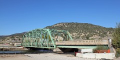 | Dotsero Bridge | structure | 2002 | 02001155 |
| Eagle River Bridge | structure | 2002 | 02001156 | |
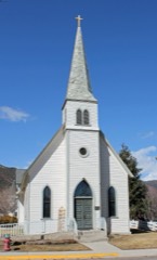 | First Evangelical Lutheran Church | building | 1993 | 93000576 |
| Glassier Farmstead | district | 2023 | 100009260 | |
| Notch Mountain Shelter | building | 2015 | 15000059 | |
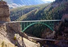 | Red Cliff Bridge | structure | 1985 | 85000204 |
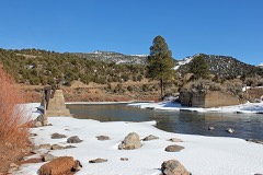 | State Bridge | structure | 1985 | 85001401 |
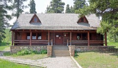 | Tigiwon Community House | building | 2015 | 15000060 |
| Upper Brush Creek School | building | 2015 | 15000126 | |
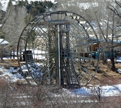 | Waterwheel | site | 1977 | 77000372 |
| Woods Lake Resort | district | 1988 | 88001226 |
Every wildfire the federal occurrence database records inside this county: 1,440 of them, burning about 9,259 acres. 646 started naturally and 13 were recorded as arson. Each settlement page carries the fires within five miles of it.
| Reported cause | Fires |
|---|---|
| Natural | 646 |
| Recreation and ceremony | 352 |
| Missing data/not specified/undetermined | 315 |
| Debris and open burning | 39 |
| Smoking | 19 |
| Power generation/transmission/distribution | 15 |
| Equipment and vehicle use | 15 |
| Arson/incendiarism | 13 |
| Misuse of fire by a minor | 10 |
| Railroad operations and maintenance | 8 |
| Fireworks | 4 |
| Other causes | 2 |
| Firearms and explosives use | 2 |
The five largest, by the area the report gives. None of them was recorded as arson.
| Date | Cause | Size | Reported by | Name on the report |
|---|---|---|---|---|
| 31 July 2002 | Missing data/not specified/undetermined | 2,400 acres | Northwest District, Grand Junction | GARCO 4 |
| 18 July 2010 | Missing data/not specified/undetermined | 1,452 acres | Colorado State Forest Service-State Headquarters | not named |
| 11 July 2003 | Misuse of fire by a minor | 1,232 acres | Northwest District, Grand Junction | DOTSERO CR |
| 2 July 2017 | Natural | 974 acres | White River National Forest | GUTZLER |
| 9 June 2018 | Firearms and explosives use | 455 acres | Northwest District, Grand Junction | BOCCO |
| 16 October 2016 | Missing data/not specified/undetermined | 400 acres | Denver County | UNKNOWN |
| 15 October 2016 | Recreation and ceremony | 360 acres | White River National Forest | FREEMAN |
| 9 May 2004 | Missing data/not specified/undetermined | 200 acres | Colorado State Forest Service-State Headquarters | not named |
Every settlement page carries the fires within five miles of it - see the settlement index below.
The NOAA Storm Events Database holds 104 reports for this county, causing 4 deaths, no injuries and about $1,776,500 in recorded property damage. Each settlement page carries the reports that name it.
| Kind of event | Reports |
|---|---|
| Thunderstorm Wind | 41 |
| Flash Flood | 22 |
| Debris Flow | 11 |
| Flood | 10 |
| Heavy Rain | 9 |
| Funnel Cloud | 5 |
| Tornado | 2 |
| Hail | 2 |
| Wildfire | 1 |
| Lightning | 1 |
The most serious of them, by death, then injury, then recorded damage. The accounts are quoted exactly as the forecast office filed them.
| When | Event | Place named | Harm | What the report says |
|---|---|---|---|---|
| June 2023 | Flood | Sweetwater | 1 killed | Three river rafters using inflatable canoes got caught up in swift water flows which were elevated due to recent warm weather and accelerated snowmelt. One rafter got separated from the group and was discovered downstream. CPR efforts were not successful and rafter passed away. |
| June 2023 | Flood | Burns | 1 killed | A family rafting on the Colorado River became separated when their boat capsized due the fast and high flows as a result of recent snowmelt. First responders were able to locate all of the victims, but one minor was unresponsive to CPR. |
| June 2020 | Flood | (Ege)Eagle | 1 killed | A young boy who was playing in the playground area of the Eagle Villas Apartments accidentally drowned in the nearby Eagle River. He was missing for almost a month before his body was recovered in the Eagle River east of Dotsero on July 3rd. |
| June 2019 | Flood | Avon | 1 killed | A raft carrying five young men down the Eagle River flipped when it hit a tall wave and a hole on the other side of the river near Eagle-Vail. As a result, all five passengers were thrown into the raging river. Four managed to scramble up the bank to safety while one was swept away and eventually passed away. |
| July 2021 | Debris Flow | Avon | $500,000 | Nottingham Road west of Buck Creek Road in Avon was closed for several hours after multiple mudslides occurred as a result of heavy rains. |
| August 2008 | Lightning | Vail | $500,000 | Lightning struck a home in Vail Valley and ignited a fire within the floor structure and the ceiling cavity. The fire burned through five structural floor joists. The lightning also blew apart a section of the stone chimney and sent pieces flying up to 20 feet away. |
| July 1999 | Flash Flood | Gypsum | $350,000 | no account filed |
| July 2006 | Flash Flood | Basalt | $200,000 | no account filed |
| August 2021 | Flash Flood | Pando | $100,000 | The White River National Forest reported Homestake Road was closed just past the turn-out to Gold Park Campground. The road washed out due to flash flooding where it crossed French Creek. The road remained closed before reopening the day afternoon. |
| July 1998 | Flash Flood | Basalt | $40,000 | no account filed |
| April 1974 | Tornado (F1) | not stated | $25,000 | no account filed |
| April 2012 | Thunderstorm Wind | Dotsero | $12,000 | Severe thunderstorm outflow winds destroyed a barn when a well secured roof was blown off. |
| August 2019 | Debris Flow | Basalt | $10,000 | Numerous mudslides occurred 1 to 3 miles east of Basalt along Frying Pan Road as well as in the northwest side of town along Cedar and Pinion Drives in the Lake Christine Fire burn scar. The mud and debris closed several neighborhood roads with water flows estimated at 6 feet above normally dry channels, creeks, and washes. Drainage culverts were overwhelmed by mud and rocks flowing off the burn scar with 1 to 3 feet of ash-filled mud covering lawns and surrounding a few homes. Portions of Frying Pan Road were closed and, while the mud and debris flows that occurred were not associated with the Lake Christine Fire burn scar itself, the steep terrain and heavy rainfall still resulted in several vehicles being trapped by the flows. United States Geological Survey (USGS) rain gauges recorded about 1.60 inches of rain fell over the area in less than 2 hours. |
| July 2011 | Flash Flood | Vail | $10,000 | A flash flood came down from the north in Middle Creek, flowed through culverts under I-70, and into a developed area of Vail on its way to Gore Creek. The normally 3 foot wide placid Middle Creek was a roaring force of water 12 feet wide and over 6 feet deep. The interior of the Vail Public Library sustained water 2 inches deep on the carpeting, and the basements of nearby lodges and condos were also flooded. A layer of mud and other debris covered parking areas, including the Dobson Ice Arena's parking lot. City crews worked vigorously with heavy equipment to divert the flood waters away from other locations in Vail. |
| June 2010 | Flash Flood | Vail | $10,000 | A burst of rainfall during the peak snowmelt period apparently caused a debris dam to break near the headwaters of Gore Creek. Gore Creek suddenly rose about 3 feet and stayed within the channel except in a few areas where it spread out and approached the entry of some condominiums. Additionally, trees up to 1.5 feet in diameter came down Gore Creek and jammed up at the bridges and culverts causing additional flooding, mostly to lawns and landscaping. A blocked culvert resulted in water flowing up to about a foot deep over Highway 24. |
| July 2011 | Flash Flood | Gypsum | $5,000 | Flash flooding occurred along a 5 mile stretch along and near Gypsum Creek Road, with flood waters up to 8 feet deep across one side road. Roads were washed out in places. |
| August 2007 | Flash Flood | Basalt | $5,000 | Torrential rainfall over the Seven Castles formation of cliffs and gullies funneled down the Seven Castles Creek drainage and spilled into the Fryingpan River. The flood of water, rocks, and mud caused the course of the river channel to shift south. The debris field from the flood was about 1/4 mile wide and caused Eagle County road crews to scurry to the scene to clear up the debris covering the road. Debris ranged from knee-deep to waist-high. A temporary construction bridge and a section of Old Stage Road were washed out. |
| July 2007 | Flash Flood | Eagle | $2,000 | Water and mud came down a drainage from the north and flowed across all lanes of Interstate 70 and continued across Highway 6. The flow of water and mud covered a 175 yard stretch of Interstate 70 and Highway 6 and was up to 4 feet deep when it struck the interstate. Two cars on Interstate 70 were stuck in 1.5 feet deep mud which was up to 3 feet deep in the west-bound lanes. The west-bound lanes of the interstate were closed for about 6 hours, while HIghway 6 and the east-bound lanes of the interstate were closed for a shorter period of time. |
| July 2007 | Flash Flood | Eagle | $2,000 | Heavy rainfall in the Sylvan Lake State Park area resulted in a flash flood. The flood came down from the east and was filled with debris that flowed up to 8 feet in depth down a normally dry drainage called Sneeve Gulch. Unofficial rainfall measurements of just over 2 inches came from the State Park Service. The flash flood widened the gulch from about 10 feet to 30 feet. The flash flood crossed USFS Road 400 and a Park Service tributary road. When the flash flood struck the main road, the culverts were immediately clogged with debris and the flow of water and debris went across the road, causing errosion to the road and depositing several feet of debris on the road. An 8 foot high berm adjacent to the Park Service tributary road was 10 feet in length prior to the flash flood. After the flood the berm was 70 feet in length. The debris within the flash flood included trees up to 2 feet in diameter and boulders up to 4 feet in diameter. About 80 people were trapped at the Sylvan Lake State Park campground that night. The flash flood came close to a couple of State Park structures. Otherwise, there was no significant property damage except to the USFS Road 400 where the culverts needed to be replaced. |
| July 2003 | Flash Flood | Dotsero | $2,000 | no account filed |
| May 2000 | Thunderstorm Wind | Avon | $2,000 | no account filed |
| July 2007 | Flash Flood | Wolcott | $1,000 | Heavy rain producing thunderstorms caused water and debris to flow down a canyon north of Interstate 70 and onto the interstate near mile marker 154. The flow was about 40 feet wide and 2 feet deep across the westbound lanes of the interstate. The flow contained a considerable amount of rocks, mud, and other debris that was deposited onto the road. The westbound lanes were closed for about 1 hour. |
| August 1998 | Flash Flood | Eagle | $500 | no account filed |
| August 2024 | Debris Flow | Wolcott | - | Colorado Department of Transportation reported a mudslide on Interstate 70 at mile marker 159, between the towns of Wolcott and Edwards, necessitating a brief closure to clear the road. |
| August 2024 | Debris Flow | (Ege)Eagle | - | Part of the same storm that led to a mudslide on Interstate 70. This mudslide impacted the Brush Creek Road area south of Eagle, CO. Road and bridge crews were dispatched to clear this area. |
| August 2024 | Debris Flow | Edwards | - | Part of the same storms that led to a mudslide on Interstate 70. Mudslides were reported along Squaw Creek Drive in Cordillera, south of Edwards. Road and bridge crews were dispatched to clean up the debris. |
| August 2024 | Debris Flow | Redcliff | - | Heavy rain from a slow moving storm over the Vail Pass area of Interstate 70 resulted in a small mud or rock slide early in the afternoon of August 5th. This slide was spotted via Colorado Department of Transportation webcams, and did result in a brief closure of one lane of Interstate 70 for cleanup. |
| May 2024 | Thunderstorm Wind | Dowd | - | A peak wind gust of 64 MPH was measured by the automated weather station at Dowd Junction, 1 mile north of Dowd. |
| May 2024 | Thunderstorm Wind | Gypsum | - | A peak wind gust of 68 MPH was measured by the automated weather station at the Eagle County Regional Airport. A tree was knocked down in Gypsum around the same time that these thunderstorm wind gusts occurred. |
| August 2023 | Debris Flow | (Ege)Eagle | - | A mudslide occurred up Sneve Gulch at Sylvan Lake as a result of heavy rain from thunderstorms. |
| August 2023 | Flood | Wolcott | - | Some standing water accumulated on a portion of I-70 as a result of heavy rain from thunderstorms. Radar estimated over an inch of rain fell in 40 minutes. |
| August 2023 | Debris Flow | El Jebel | - | Strong thunderstorms sat over the Lake Christine Burn Scar with rain rates exceeding 1 inch per hour at times. As a result of heavy rain over the burn scar, there were reports of minor flooding in some townhomes. Additionally, the pedestrian underpass next to Whole Foods was filled with around 5.5 feet of water. |
| February 2022 | Flash Flood | Snowmass | - | The USGS gage along the Roaring Fork River near Emma, Colorado showed indications of an ice jam release. |
| August 2021 | Thunderstorm Wind | Dowd | - | A peak wind gust of 58 MPH was measured by the automated Mesonet weather station 1 mile north of Dowd. |
| July 2020 | Thunderstorm Wind | Gypsum | - | A peak wind gust of 60 mph was measured by the automated weather station at the Eagle County Regional Airport. |
| June 2020 | Thunderstorm Wind | Gypsum | - | A peak wind gust of 61 mph was measured by the automated weather station at the Eagle County Regional Airport. |
| April 2019 | Thunderstorm Wind | Basalt | - | Colorado Department of Transportation (CDOT) road sensors recorded wind gusts of 73 mph from outflow associated with a collapsing thunderstorm. |
| January 2019 | Flash Flood | Basalt | - | The Roaring Fork Conservancy District reported an Ice Jam that was breaking up along the Fryingpan River with large debris and chunks of ice flow downstream. The river peaked around midday on January 3rd and again on January 4th. |
| September 2019 | Thunderstorm Wind | Gypsum | - | The automated weather station at the Eagle County Regional Airport measured a peak wind gust of 61 mph as a line of showers and thunderstorms moved across the area. The severe winds resulted in 645 power outages across Eagle County. |
| June 2018 | Debris Flow | Avon | - | Heavy rainfall caused a mud to flow across the westbound lane of Interstate 70 at the Avon Exit 167. That portion of I-70 was closed for about 50 minutes until the debris was removed. Radar estimated storm total rainfall was up to 0.50 of an inch in less than an hour. |
| July 2018 | Heavy Rain | El Jebel | - | An IRAWS station measured 0.24 inches of rain and small hail between 11:03 and 11:18 PM MST. The Incident Meteorologist on the Lake Christine fire reported that flowing water up to 6 inches deep ran across a U.S. Forest Service road and a small amount of debris flowed down drainages as a result of heavy rain. |
| July 2018 | Flash Flood | El Jebel | - | Minor debris flows were reported across the western portion of the Lake Christine fire burn scar with debris flowing toward Spring Park Reservoir. Crews reported standing water depth of 2 to 3 inches in some areas. The El Jebel RAWS site reported 0.34 inches of rain fell in approximately 30 minutes between 3:45 and 4:18 PM MST. |
| July 2018 | Thunderstorm Wind | Gypsum | - | The automated weather station at the Eagle County Regional Airport measured a peak wind gust of 59 mph from a strong thunderstorm. |
| July 2018 | Flash Flood | El Jebel | - | The Incident Meteorologist on the Lake Christine fire reported that flowing water up to 6 inches deep ran across a U.S. Forest Service road and a small amount of debris flowed down drainages as a result of heavy rainfall. An IRAWS station in the area measured 0.24 of an inch of rain and small hail within 15 minutes. |
| July 2018 | Heavy Rain | El Jebel | - | The El Jebel RAWS station measured 0.34 of an inch of rain which fell in approximately 30 minutes. Minor debris flows were reported across the western portion of the Lake Christine Wildfire burn scar with debris flowing toward Spring Park Reservoir. Fire fighting crews reported standing water depth of 2 to 3 inches in some areas. |
| July 2016 | Debris Flow | Avon | - | A debris flow of rocks and mud came down onto Nottingham Road in Avon. |
| June 2015 | Flash Flood | (Ege)Eagle | - | Heavy rainfall from an intense thunderstorm produced a flash flood which deposited mud and other debris up to four feet deep onto East Brush Creek Road. The road was closed for several hours until road crews cleared the debris. |
| July 2014 | Flash Flood | Wolcott | - | Interstate 70 was closed in both directions due to debris that was deposited on the roadway from flash flood waters. |
| September 2013 | Debris Flow | Avon | - | A mudslide at mile marker 154 closed Highway 6 for several hours in both directions. |
| July 2013 | Funnel Cloud | Basalt | - | A brief rope funnel appeared below a thunderstorm for about a couple of minutes in Basalt. |
| July 2012 | Thunderstorm Wind | Avon | - | A severe thunderstorm wind gust was reported by a trained spotter near Avon. |
| July 2011 | Heavy Rain | Basalt | - | A rainfall of total of 1.48 inches was measured within 60 minutes at the Crown RAWS weather station. |
| June 2011 | Flood | Dotsero | - | The Colorado River experienced elevated flows due to snow melt runoff from June 5th to the end of the month. Flood advisories or warnings were in effect through most of this time, with a few brief exceptions when the river fell just below bankfull. The main area of concern was from the confluence with the Eagle River near Dotsero to the County line just above Glenwood Canyon. Water quickly rose on the evening of June 6th when flood warnings were issued and remained in place through June 10th. Highway 6 at Dotsero was closed due to the high water levels reaching the bottom of the bridge. The river continued to reach or exceed bankfull conditions through the end of the month, except the period of June 19th through the 24th when cooler weather reduced the heavy runoff. Lowland flooding was reported through the month and some sandbagging of residential areas were required from near Gypsum to Dotsero. |
| June 2011 | Thunderstorm Wind | Gypsum | - | Thunderstorm wind gust to 60 mph reported in the town of Gypsum. |
| June 2011 | Thunderstorm Wind | Gypsum | - | Severe outflow winds were reported at the Eagle County Airport as winds gusted up to 69 mph. |
| June 2011 | Thunderstorm Wind | Gypsum | - | Thunderstorm outflow winds of up to 60 mph were reported along with pea sized hail accumulating several inches deep. |
| June 2011 | Thunderstorm Wind | (Ege)Eagle | - | A large cottonwood tree was blown down at Sylvan Lake State Park by strong thunderstorm wind gusts. |
| June 2011 | Thunderstorm Wind | Wolcott | - | Wind gusts to 61 mph were reported near Wolcott with very heavy rainfall runoff occurring along with pea sized hail. |
| July 2010 | Heavy Rain | Wolcott | - | Heavy rain from thunderstorms caused a mudslide along I-70 just west of Wolcott. One westbound lane of the interstate were closed for an hour and a half. |
| July 2009 | Funnel Cloud | (Ege)Eagle | - | A funnel cloud was observed and photographed by people in the Eagle area. |
The Survey's mineral resources record lists 152 workings inside this county. 39 still produce and 113 are closed or unrecorded. Each settlement page carries the workings within five miles of it.
| Commodity | Workings |
|---|---|
| Stone, Crushed/Broken | 20 |
| Gold | 19 |
| Gypsum-Anhydrite | 17 |
| Manganese | 17 |
| Sand and Gravel, Construction | 14 |
| Uranium | 12 |
| Silver | 8 |
| Lead | 8 |
| Copper | 7 |
| Stone, Dimension | 5 |
| Pumice | 4 |
| Zinc | 3 |
| Stone | 3 |
| Molybdenum | 2 |
The least common of them first, because a county's hundredth gravel pit says nothing its first ten did not.
| Where | Site | Commodity | Status | Recorded |
|---|---|---|---|---|
| Blue-Bell, Lady Bell and Adjoinin | Copper, Silver | Past Producer | ||
| Burns & Mccoy | Gold, Copper, Lead, Silver, Zinc | Past Producer | ||
| Eagle | Iron, Silver, Gold | Occurrence | Limonite, Pyrite, Pyrrhotite, Siderite, Turgite | |
| Eagle | Arsenic | Occurrence | ||
| Eagle | Zinc, Copper, Lead | Producer | Bornite, Chalcanthite, Chalcocite, Chalcopyrite, Covellite, Lead, Tetrahedrite | |
| Eagle #2 | Aluminum | Occurrence | ||
| Eagle Mine | Zinc, Silver, Copper, Lead, Gold, Manganese | Past Producer | 1879 | |
| Gilman (Red Cliff) District | Lead, Gold, Zinc, Silver, Copper, Manganese, Iron | Past Producer | Anglesite, Chalcopyrite, Cerargyrite, Cerussite, Galena, Hemimorphite, Sphalerite, Tetrahedrite, Psilomelane, Pyrolusite, Smithsonite | |
| Glengarry Mine | Lead, Copper, Zinc | Past Producer | ||
| Iron Mask | Gold, Silver, Zinc, Manganese, Lead | Producer | Replacement | |
| Lady Bell, Eagled | Gold, Uranium, Vanadium, Silver | Producer | ||
| Liberty | Lead, Zinc, Silver | Occurrence | ||
| Little Spring | Uranium, Vanadium | Past Producer | ||
| Newman Mine | Lead, Gold, Silver, Zinc | Past Producer | ||
| Tip Top Mine | Lead, Zinc, Copper | Past Producer | ||
| Tip Top Mining Co | Copper, Lead, Zinc, Silver, Gold | Producer | Vein | |
| Unknown | Volcanic Materials | Occurrence | Ash | |
| Unknown | Kyanite | Occurrence | Sillimanite | |
| Unknown | Zinc, Lead, Silver, Gold | Occurrence | Vein | |
| Unknown | Gold, Silver, Lead | Occurrence | Vein | |
| Unknown | Pumice, Perlite | Occurrence | Pumice | |
| Unknown | Gold, Silver | Producer | Placer | |
| Unknown | Gypsum-Anhydrite, Anthracite | Past Producer | ||
| Unknown | Magnesite, Stone | Past Producer | ||
| Wildflower Group | Silver, Gold, Lead, Copper | Occurrence | Galena, Tetrahedrite | |
| Arrowhead Claims | Uranium, Vanadium | Past Producer | ||
| Cross City | Molybdenum | Occurrence | Molybdenite | |
| Horse Mountain Uranium Mines | Uranium, Vanadium | Past Producer | 1915 | |
| Ohio Tunnel | Gold, Lead, Silver | Past Producer | 1913 | |
| Popovich | Molybdenum | Occurrence | Molybdenite | |
| Unknown | Lead, Silver | Occurrence | Lead, Silver | |
| Gilman | Zinc | Producer | Replacement | |
| Golden Wedge | Lead, Zinc | Past Producer | ||
| Morning | Lead, Zinc | Past Producer | ||
| Quarry | Stone | Producer | ||
| Quarry | Stone | Producer | ||
| Dotsero Quarry | Pumice | Producer | ||
| Homestake Creek | Pumice | Past Producer | ||
| Mount Sanders | Pumice | Past Producer | ||
| Unknown | Pumice | Past Producer | ||
| Dotsero Crater | Stone, Dimension | Occurrence | Scoria | |
| Mount Saunders | Stone, Dimension | Occurrence | Scoria | |
| Unknown | Stone, Dimension | Occurrence | Scoria | |
| Unknown | Stone, Dimension | Occurrence | Scoria | |
| Unknown | Stone, Dimension | Occurrence | Scoria | |
| Coyote | Copper | Occurrence | Chrysocolla, Malachite | |
| Coyote Claims | Copper | Past Producer | ||
| Ground Hog Mine | Copper | Past Producer | ||
| Lady Bell Mine | Silver, Copper | Past Producer | 1913 | |
| North Dakota Mine Kleckner & Mack | Silver, Copper | Past Producer | 1913 | |
| Rio Grande & Copper Queen | Copper | Occurrence | Chalcocite, Chalcopyrite, Malachite | |
| Rio Grande & Copper Queen | Copper | Past Producer | ||
| Brush Creek | Silver | Past Producer | ||
| Discovery Tunnel | Gold, Silver | Past Producer | ||
| El Capitan Mine | Silver, Gold | Past Producer | ||
| Fulford | Lead, Silver | Past Producer | ||
| Iron Dyke | Lead | Past Producer | ||
| Unknown | Silver | Occurrence | Silver | |
| Unknown | Lead | Occurrence | Anglesite, Galena | |
| Unknown | Silver | Producer | Vein | |
| Arrowhead | Uranium | Producer | ||
| Arrowhead | Uranium | Occurrence | Carnotite | |
| Arrowhead #1 | Uranium | Unknown | 1955 | |
| Horse Mountain | Uranium | Occurrence | ||
| Little Spring | Uranium | Producer | ||
| Little Spring Et Al Claims | Uranium | Occurrence | Torbernite, Uraninite, Uranophane | |
| Lucky Strike #1 | Uranium | Past Producer | ||
| Rock Hat Claim | Uranium | Unknown | ||
| Tipton Ranch | Uranium | Occurrence | ||
| Tipton Ranch | Uranium | Unknown | ||
| Vail Pass | Uranium | Past Producer | ||
| B & B Edwards Pit | Sand and Gravel, Construction | Producer | ||
| Unknown | Sand and Gravel, Construction | Occurrence | Sand and Gravel | |
| Unknown | Sand and Gravel, Construction | Occurrence | Gravel | |
| Unknown | Sand and Gravel, Construction | Occurrence | Sand and Gravel | |
| Unknown | Sand and Gravel, Construction | Occurrence | Sedimentary | |
| Unknown | Sand and Gravel, Construction | Producer | Gravel | |
| Unknown | Sand and Gravel, Construction | Occurrence | Sand and Gravel | |
| Unknown | Sand and Gravel, Construction | Producer | Sand and Gravel | |
| Unknown | Sand and Gravel, Construction | Occurrence | Sand and Gravel | |
| Unknown | Sand and Gravel, Construction | Occurrence | Sand and Gravel | |
| Unknown | Sand and Gravel, Construction | Occurrence | Sand and Gravel | |
| Unknown | Sand and Gravel, Construction | Occurrence | Sand and Gravel | |
| Unknown | Sand and Gravel, Construction | Occurrence | Sand and Gravel | |
| Unknown | Sand and Gravel, Construction | Occurrence | Sand and Gravel | |
| At Last | Manganese | Past Producer | ||
| Avon | Gypsum-Anhydrite | Past Producer | ||
| Ben Butler | Manganese | Past Producer | ||
| Blowout Hill | Gypsum-Anhydrite | Past Producer | ||
| Deep Creek | Gypsum-Anhydrite | Past Producer | ||
| Foster Combination Mine | Manganese | Past Producer | ||
| Gypsum | Gypsum-Anhydrite | Past Producer | ||
| Hornsilver Mine | Manganese | Past Producer | ||
| Johnson Mine | Manganese | Past Producer | ||
| Liberty Mine | Manganese | Past Producer | ||
| Ovee-Silurian Mine | Manganese | Past Producer | ||
| Pine Martin Mine | Manganese | Past Producer | ||
| Reudi | Gypsum-Anhydrite | Past Producer | ||
| Unknown | Gypsum-Anhydrite | Occurrence | Sedimentary | |
| Unknown | Gypsum-Anhydrite | Occurrence | Sedimentary | |
| Unknown | Gypsum-Anhydrite | Occurrence | Sedimentary | |
| Unknown | Gypsum-Anhydrite | Occurrence | Sedimentary | |
| Unknown | Gypsum-Anhydrite | Occurrence | Sedimentary | |
| Unknown | Gypsum-Anhydrite | Occurrence | Sedimentary | |
| Unknown | Gypsum-Anhydrite | Occurrence | Sedimentary | |
| Unknown | Gypsum-Anhydrite | Producer | Sedimentary | |
| Unknown | Gypsum-Anhydrite | Producer | Sedimentary | |
| Unknown | Manganese | Past Producer | ||
| Unknown | Manganese | Past Producer | ||
| Unknown | Gypsum-Anhydrite | Past Producer | ||
| Unknown | Manganese | Past Producer | ||
| Unknown | Gypsum-Anhydrite | Past Producer | ||
| Unknown | Manganese | Past Producer | ||
| Unknown | Manganese | Past Producer | ||
| Unknown | Manganese | Past Producer | ||
| Unknown | Manganese | Past Producer | ||
| Unknown | Manganese | Past Producer | ||
| Burns & Mccoy | Gold | Producer | Placer | |
| Eagle River | Gold | Occurrence | Placer | |
| Eagle River | Gold | Occurrence | Placer | |
| El Capitan | Gold | Producer | Gold | |
| Lake Cr. | Gold | Occurrence | Placer | |
| Polar Star Mine | Gold | Past Producer | ||
| Treasure Vault | Gold | Past Producer | ||
| Unknown | Gold | Occurrence | Gold | |
| Unknown | Gold | Occurrence | Gold | |
| Unknown | Gold | Occurrence | Gold | |
| Unknown | Gold | Occurrence | Gold | |
| Unknown | Gold | Occurrence | Placer | |
| Unknown | Gold | Producer | Placer | |
| Ute Park, High Line, Blue Jay | Gold | Occurrence | Placer | |
| Vesuvius, Lava | Gold | Occurrence | Placer | |
| Avon Pit-Porto-Mix | Stone, Crushed/Broken | Producer | ||
| Edwards | Stone, Crushed/Broken | Producer | ||
| Gravel Pit | Stone, Crushed/Broken | Producer | ||
| Gravel Pit | Stone, Crushed/Broken | Producer | ||
| Gravel Pit | Stone, Crushed/Broken | Producer | ||
| Gravel Pit | Stone, Crushed/Broken | Producer | ||
| Gravel Pit | Stone, Crushed/Broken | Producer | ||
| Gravel Pit | Stone, Crushed/Broken | Producer | ||
| Gravel Pit | Stone, Crushed/Broken | Producer | ||
| Gravel Pit | Stone, Crushed/Broken | Producer | ||
| Gravel Pit | Stone, Crushed/Broken | Producer | ||
| Gravel Pit | Stone, Crushed/Broken | Producer | ||
| Gravel Pit | Stone, Crushed/Broken | Producer | ||
| Gravel Pit | Stone, Crushed/Broken | Producer | ||
| Gravel Pit | Stone, Crushed/Broken | Producer | ||
| Gravel Pit | Stone, Crushed/Broken | Producer | ||
| Gravel Pits | Stone, Crushed/Broken | Producer | ||
| Homeward Bound | Stone, Crushed/Broken | Past Producer | ||
| New Jersey Zinc Pit | Stone, Crushed/Broken | Producer | ||
| Peach Blow | Stone, Crushed/Broken | Producer | Sedimentary |
Named settlements recorded in the Geographic Names Information System, each with the topographic sheets covering it. Villages, hamlets and abandoned places alike. Each is shown with the nearest named watercourse or landform and the survey quadrangle it falls on.
Minturn-Red Cliff census division · 81632 · On McCoy Creek · Edwards quadrangle
16 sheets, 1957 to 1980
Minturn-Red Cliff census division · 81645 · Near Bishop Gulch · Minturn quadrangle
21 sheets, 1934 to 1980
No longer a settlement
Minturn-Red Cliff census division · 81620 · On Beaver Creek · Edwards quadrangle
16 sheets, 1957 to 1980
Minturn-Red Cliff census division · 81620 · Near Bachelor Gulch · Grouse Mountain quadrangle
13 sheets, 1957 to 1980
Basalt census division · 81621 · On Fryingpan River · Basalt quadrangle
14 sheets, 1957 to 1982
Minturn-Red Cliff census division · 81620 · Grouse Mountain quadrangle
13 sheets, 1957 to 1980
Minturn-Red Cliff census division · 81649 · On Peterson Creek · Minturn quadrangle
21 sheets, 1934 to 1980
Minturn-Red Cliff census division · 81657 · On Bighorn Creek · Vail East quadrangle
21 sheets, 1934 to 1980
Eagle-Gypsum census division · 80423 · Near Cabin Gulch · State Bridge quadrangle
12 sheets, 1957 to 1980
Eagle-Gypsum census division · 80426 · Near Fargo Gulch · Burns South quadrangle
12 sheets, 1957 to 1980
Eagle-Gypsum census division · 81632 · Near Dry Gulch · Wolcott quadrangle
14 sheets, 1957 to 1980
Eagle-Gypsum census division · 80423 · On Yarmony Creek · McCoy quadrangle
11 sheets, 1957 to 1980
Eagle-Gypsum census division · 80426 · Near Blue Hill · Blue Hill quadrangle
10 sheets, 1957 to 1980
Eagle-Gypsum census division · 80426 · Near Fargo Gulch · Burns South quadrangle
12 sheets, 1957 to 1980
Eagle-Gypsum census division · 81637 · On Eagle River · Dotsero quadrangle
19 sheets, 1927 to 1981
Minturn-Red Cliff census division · 81657 · On Gore Creek · Minturn quadrangle
21 sheets, 1934 to 1980
Eagle-Gypsum census division · 81631 · On Eby Creek · Eagle quadrangle
12 sheets, 1957 to 1980
Minturn-Red Cliff census division · 81657 · Near Ptarmigan Point · Minturn quadrangle
21 sheets, 1934 to 1980
Minturn-Red Cliff census division · 81632 · On Berry Creek · Edwards quadrangle
16 sheets, 1957 to 1980
Eagle-Gypsum census division · 81631 · Near White Quail Gulch · Fulford quadrangle
12 sheets, 1957 to 1980
Minturn-Red Cliff census division · 81649 · On Rock Creek · Minturn quadrangle
21 sheets, 1934 to 1980
Eagle-Gypsum census division · 81637 · On Gypsum Creek · Gypsum quadrangle
13 sheets, 1957 to 1980
Minturn-Red Cliff census division · 81645 · Near Whitney Peak · Mount of the Holy Cross quadrangle
32 sheets, 1889 to 1983
No longer a settlement
Eagle-Gypsum census division · 80463 · On Yarmony Creek · McCoy quadrangle
11 sheets, 1957 to 1980
Minturn-Red Cliff census division · 81657 · Near Ptarmigan Point · Red Cliff quadrangle
21 sheets, 1934 to 1980
Minturn-Red Cliff census division · 81645 · On Martin Creek · Minturn quadrangle
21 sheets, 1934 to 1980
Minturn-Red Cliff census division · 81649 · Near Piney Gulch · Pando quadrangle
33 sheets, 1889 to 1983
Minturn-Red Cliff census division · 81649 · Near McAllister Gulch · Pando quadrangle
33 sheets, 1889 to 1983
Minturn-Red Cliff census division · 81649 · On Willow Creek · Red Cliff quadrangle
21 sheets, 1934 to 1980
Basalt census division · 81621 · On Smith Creek · Ruedi Reservoir quadrangle
19 sheets, 1909 to 1983
No longer a settlement
Eagle-Gypsum census division · 80423 · Sheephorn Mountain quadrangle
19 sheets, 1933 to 1980
Eagle-Gypsum census division · 80423 · On Goodson Creek · State Bridge quadrangle
12 sheets, 1957 to 1980
Minturn-Red Cliff census division · 81657 · On Spraddle Creek · Vail East quadrangle
21 sheets, 1934 to 1980
Minturn-Red Cliff census division · 81657 · On Buffehr Creek · Vail West quadrangle
19 sheets, 1934 to 1980
Eagle-Gypsum census division · 81655 · On Alkali Creek · Wolcott quadrangle
14 sheets, 1957 to 1980
The vanished settlements of Eagle County: the places named above that are no longer on the map.