 Block
From the record
10 National Register listings published here.
Sources: the National Register database, National Park Service
88 topographic sheets cover 25 settlements here, and 10 properties are on the National Register of Historic Places.
10 National Register listings published here.
Sources: the National Register database, National Park Service
Every property in this county listed on the National Register of Historic Places, with the year it was listed and the federal nomination document.
| Photograph | Property | Type | Listed | Reference |
|---|---|---|---|---|
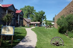 | Francisco Plaza | building | 1986 | 86002950 |
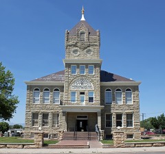 | Huerfano County Courthouse and Jail | building | 1973 | 73000476 |
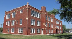 | Huerfano County High School | building | 2005 | 05001200 |
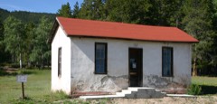 | La Veta Pass Narrow Gauge Railroad Depot | building | 1980 | 80000902 |
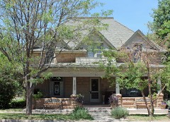 | Lamme Hospital | building | 1993 | 93001376 |
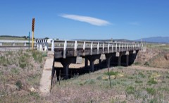 | Maitland Arroyo Bridge | structure | 2002 | 02001134 |
| Oxford Hotel | building | 2024 | 100011000 | |
| Smith, Edwin L. Building | building | 2020 | 100005435 | |
| Veta Pass | district | 2011 | 11000607 | |
| Walsenburg Mercantile | building | 2025 | 100011507 |
Every wildfire the federal occurrence database records inside this county: 294 of them, burning about 18,677 acres. 76 started naturally and 41 were recorded as arson. Each settlement page carries the fires within five miles of it.
| Reported cause | Fires |
|---|---|
| Missing data/not specified/undetermined | 124 |
| Natural | 76 |
| Arson/incendiarism | 41 |
| Smoking | 18 |
| Recreation and ceremony | 12 |
| Equipment and vehicle use | 10 |
| Debris and open burning | 9 |
| Power generation/transmission/distribution | 3 |
| Misuse of fire by a minor | 1 |
The five largest, by the area the report gives. None of them was recorded as arson.
| Date | Cause | Size | Reported by | Name on the report |
|---|---|---|---|---|
| 19 June 2013 | Natural | 13,572 acres | Royal Gorge Field Office | EAST PEAK |
| 15 December 2016 | Missing data/not specified/undetermined | 2,000 acres | Huerfano County | 48 |
| 1 June 2011 | Missing data/not specified/undetermined | 1,600 acres | Colorado State Forest Service-State Headquarters | WALSENBURG |
| 15 October 2015 | Missing data/not specified/undetermined | 270 acres | Huerfano County | HIGHWAY 160 MM 291 |
| 3 June 2019 | Natural | 230 acres | Pike and San Isabel National Forest | REVEILLE |
| 5 June 2020 | Natural | 144 acres | Royal Gorge Field Office | WILSON CROSSING |
| 28 February 2018 | Equipment and vehicle use | 117 acres | Huerfano County Fire Protection District | UNKNOWN |
| 15 July 2011 | Missing data/not specified/undetermined | 100 acres | Colorado State Forest Service-State Headquarters | WALSENBURG |
Every settlement page carries the fires within five miles of it - see the settlement index below.
The NOAA Storm Events Database holds 193 reports for this county, causing no deaths, 7 injuries and about $605,500 in recorded property damage. Each settlement page carries the reports that name it.
| Kind of event | Reports |
|---|---|
| Hail | 92 |
| Flash Flood | 61 |
| Heavy Rain | 16 |
| Tornado | 8 |
| Thunderstorm Wind | 7 |
| Lightning | 3 |
| Debris Flow | 3 |
| Funnel Cloud | 2 |
| Flood | 1 |
The most serious of them, by death, then injury, then recorded damage. The accounts are quoted exactly as the forecast office filed them.
| When | Event | Place named | Harm | What the report says |
|---|---|---|---|---|
| July 1999 | Lightning | Cuchara | 3 hurt | Three people were injured by a lightning flash approximately 100 yards west of the summit of West Spanish Peak. A 44-year old male experienced a direct hit, while his 41-year old male companion felt the side flash and was thrown against some rocks, suffering a skull fracture. A 7-year old boy also experienced the side flash and was thrown down and suffered facial cuts. |
| July 1978 | Tornado (F2) | not stated | 2 hurt, $25,000 | no account filed |
| July 2006 | Lightning | Cuchara | 2 hurt | no account filed |
| May 1993 | Tornado (F1) | not stated | $500,000 | A tornado developed two miles southwest of the town of La Veta and moved north to two miles west of La Veta before dissipating. The tornado touched down periodically along its track. Two barns were destroyed and at least 20 pine and cottonwood trees (up to 100 feet tall) were uprooted. Downed trees had to be removed from several roads. Estimates placed damages at $100,000. There were no deaths or injuries. |
| June 2000 | Lightning | La Veta | $40,000 | A summer house was totally destroyed by a lightning started fire. |
| June 2007 | Hail | Walsenburg | $30,000 | Very large hail damaged vehicles, broke windows, and destroyed roofs on structures in a mostly rural area. |
| September 2019 | Flash Flood | Red Wing | $5,000 | Huerfano County Emergency Manager reports Pass Creek Road has been washed out due to flash flooding from the Spring burn scar. |
| July 2014 | Flash Flood | La Veta | $3,000 | no account filed |
| July 1958 | Tornado (F0) | not stated | $2,500 | no account filed |
| June 2025 | Hail | Delcarbon | - | Hail up to 1 inches in diameter fell in Huerfano County from severe thunderstorms. |
| June 2025 | Hail | Delcarbon | - | Hail up to 1.5 inches in diameter fell in Huerfano County from severe thunderstorms. |
| July 2025 | Debris Flow | Cuchara | - | EM reported flow over CO-12 in addition to debris flow. Debris caused some overflow in roadside ditches. County Rd 420 and Indian Creek also experienced similar conditions at this time, but no sperate reports. |
| July 2025 | Thunderstorm Wind | Walsenburg | - | AWOS station K4V1 4 N Walsenburg. The station measured a 58 mph wind gust. |
| July 2024 | Thunderstorm Wind | Delcarbon | - | Mesonet station co029 025s066 at apache city recorded 63 mph wind gust. |
| September 2024 | Thunderstorm Wind | Delcarbon | - | There was a 56 knot wind gust reported at location. |
| June 2024 | Flash Flood | La Veta | - | Heavy rainfall led to some water over short stretches of Hwy 160, county roads, ditches, and other low-lying areas. No other notable impacts reported. Radar-estimated rainfall of 1.5-2.0 inches occurred over impacted areas within warning area. |
| June 2024 | Thunderstorm Wind | La Veta | - | Public source (via mPing) reported wind damage with 1 inch tree limbs broken and shingles blown off. |
| June 2023 | Hail | La Veta | - | Public reported. |
| June 2023 | Heavy Rain | La Veta | - | There was 1.6 inches of rain reported. |
| August 2022 | Heavy Rain | Walsenburg | - | Spotter reported 1.75 inches of rain. |
| August 2022 | Flash Flood | Walsenburg | - | Roadway flooding. |
| July 2022 | Flash Flood | Cuchara | - | County Highway 12 closed at mile marker 13 for water over the road. |
| July 2022 | Heavy Rain | La Veta | - | Heavy rainfall of 1.53 inches. |
| July 2022 | Heavy Rain | La Veta | - | Heavy rainfall of 1.82 inches measured at Harrison Bridge near Cucharas, in one hour. |
| July 2021 | Flash Flood | (Vtp)La Veta Pass | - | Flooding occurred at Indian Creek and Road 421. Eight inches of water was noted, but with no damage. |
| July 2021 | Flash Flood | (Vtp)La Veta Pass | - | Debris and mudflow were noted into Middle Creek and along county roads 440 and 442. |
| July 2021 | Flash Flood | Cuchara | - | Highway 12 was closed at Big Branch Creek for water and debris over the road. |
| July 2021 | Flash Flood | Cuchara | - | Flash flooding occurred over Highway 12, with the road closed. |
| July 2021 | Flash Flood | La Veta | - | Road 421 was overtopped for hundreds of yards. |
| July 2021 | Flash Flood | (Vtp)La Veta Pass | - | Water overtopped County road 442. |
| August 2021 | Heavy Rain | La Veta | - | Heavy rainfall of 3.70 inches. |
| August 2021 | Heavy Rain | Delcarbon | - | Heavy rainfall of 3.49 inches. |
| July 2021 | Heavy Rain | Red Wing | - | Heavy rainfall of 1.00 inches, on the Spring Burn scar. |
| July 2021 | Heavy Rain | La Veta | - | Heavy rainfall of 3.45 inches. |
| August 2021 | Flash Flood | Cuchara | - | Emergency management reported that Highway 12 was overtopped with water. |
| May 2021 | Heavy Rain | La Veta | - | Heavy rain of 1.70 inches, La Veta. |
| May 2021 | Heavy Rain | Delcarbon | - | Heavy rain of 2.97 inches, 6 miles south Rye. |
| May 2021 | Heavy Rain | La Veta | - | Heavy rain of 2.54 inches, 5 miles north northeast Spanish Peaks. |
| May 2021 | Heavy Rain | Farisita | - | Heavy rain of 2.97 inches, 4 miles south Farisita. |
| May 2020 | Heavy Rain | La Veta | - | One-hour total. |
| August 2020 | Debris Flow | (Vtp)La Veta Pass | - | Heavy rain and flash flooding on Spring burn scar. |
| August 2020 | Heavy Rain | La Veta | - | Heavy rainfall of 1.9 inches. |
| August 2020 | Flash Flood | (Vtp)La Veta Pass | - | Massive flash flood coming down Indian creek. Video shows several new channels, rushing water several feet deep with an expanse nearly 100 feet wide. CR 421 completely inundated. |
| August 2020 | Flash Flood | La Veta | - | Rushing water across CR 421 along Indian creek, about a foot deep. Road is impassable. |
| August 2020 | Flash Flood | Cuchara | - | Highway 12 was over topped and a car became stranded in flood waters. |
| August 2020 | Debris Flow | La Veta | - | Mud slide across Highway 12 has closed the road down from mm 13-14, per CSP Pueblo. |
| August 2020 | Flash Flood | Cuchara | - | Highway 12 was temporarily closed for a flash flood and minor debris flow off of the Spring burn scar. |
| July 2020 | Flash Flood | Cuchara | - | Flash flooding over toppled Hwy 12 at mile marker 14.5. Hwy 12 saw approx. 3 inches of mud with 3 inches of water on the road over a distance of approximately 90 feet. |
| July 2020 | Flash Flood | (Vtp)La Veta Pass | - | Twelve inches of water was over the roadway. |
| July 2020 | Flash Flood | Red Wing | - | Road was closed due to 3 feet of rock and debris covering the road. |
| July 2020 | Flash Flood | (Vtp)La Veta Pass | - | Water over county road 421. |
| June 2019 | Flash Flood | (Vtp)La Veta Pass | - | Huerfano County Emergency Manager reported water flowing over CR 442 just west of CR 441 making the road impassable. |
| July 2019 | Flash Flood | (Vtp)La Veta Pass | - | Sheriffs deputy reported 3-4 feet of water over Huerfano County road 443. |
| July 2019 | Flash Flood | (Vtp)La Veta Pass | - | Flash flooding and debris-mud flows, from Indian Creek, across portions of CR 421 in and just north of Sulphur Springs was reported. |
| August 2019 | Flash Flood | Red Wing | - | Huerfano County EM reported CR 572 has become impassable due to flash flooding and debris flow. |
| August 2019 | Flash Flood | (Vtp)La Veta Pass | - | Huerfano County EM reported a flash flood and rock slide closing CR 572. |
| August 2019 | Flash Flood | (Vtp)La Veta Pass | - | Huerfano County EM reported 2 to 4 feet of water running across roadway at least 500 feet wide. |
| August 2019 | Hail | Delcarbon | - | Nickel sized hail reported. |
| July 2019 | Flash Flood | (Vtp)La Veta Pass | - | South Abeyta Creek was reported to be about 2 feet over its banks. |
| July 2019 | Flash Flood | (Vtp)La Veta Pass | - | Huerfano County EM reported Middle Creek is out of its banks. |
The Survey's mineral resources record lists 98 workings inside this county. 2 still produce and 96 are closed or unrecorded. Each settlement page carries the workings within five miles of it.
| Commodity | Workings |
|---|---|
| Sand and Gravel, Construction | 47 |
| Uranium, Vanadium | 8 |
| Copper | 7 |
| Uranium | 5 |
| Gold | 5 |
| Silver | 5 |
| Tellurium | 4 |
| Vanadium, Uranium | 4 |
| Vanadium | 3 |
| Gold, Silver | 3 |
| Tungsten | 3 |
| Copper, Uranium | 2 |
| Copper, Silver | 2 |
| Clay | 2 |
The least common of them first, because a county's hundredth gravel pit says nothing its first ten did not.
| Where | Site | Commodity | Status | Recorded |
|---|---|---|---|---|
| Blanca District | Copper, Zinc, Lead, Silver, Molybdenum, Tungsten, Gold, Antimony | Past Producer | hydrothermal veins | |
| Bullseye Mine | Gold, Lead, Silver, Copper, Antimony | Past Producer | Vein | |
| Butte Valley, Alamo #1 | Coal, Sand and Gravel, Construction | Past Producer | Sedimentary | |
| Coronado Group | Silver, Gold, Copper, Tellurium | Past Producer | Vein | |
| Dallas Dottie Prospect | Uranium, Vanadium, Copper | Occurrence | Carnotite | |
| Deadwood Mining Co. Claims | Gold, Copper, Lead, Silver | Prospect | Vein | |
| Grayback North District | Lead, Silver, Iron, Zinc, Gold | Past Producer | 1875 | |
| La Veta District | Zinc, Silver, Copper, Lead, Gold | Past Producer | 1908, 1935 | |
| La Veta District | Gold, Silver, Lead, Copper | Past Producer | ||
| Lone Pine, Ojo | Copper, Vanadium, Uranium | Occurrence | Coal | |
| McMillan Group | Gold, Silver, Tellurium, Copper, Bismuth | Occurrence | Vein | |
| Mcguire Lode | Uranium, Copper, Vanadium | Prospect | Carnotite, Malachite, Calciovolborthite | |
| Mosca Pass Prospect | Molybdenum | Occurrence | Vein | |
| Stumbling Stud Mine | Vanadium, Uranium, Zirconium, Fluorine-Fluorite, Thorium | Past Producer | Coffinite | |
| Unknown | Limestone, General | Occurrence | Limestone | |
| Unknown | Sand and Gravel, Construction, Coal | Occurrence | Sedimentary | |
| Unnamed Prospect | Silver, Gold, Lead, Copper | Prospect | Chalcopyrite, Galena, Sphalerite, Tetrahedrite | |
| Unnamed Prospects | Silver, Copper, Gold, Lead | Prospect | Chalcopyrite, Galena, Sphalerite, Tetrahedrite | |
| Unnamed Prospects | Silver, Gold, Copper, Lead | Prospect | Chalcopyrite, Galena, Sphalerite, Tetrahedrite | |
| Washout Claim | Uranium, Copper | Prospect | Copper, Cuprite | |
| Chamblin | Clay | Past Producer | Clay | |
| Dividend adit | Silver, Gold, Tungsten, Tellurium | Prospect | ||
| Hawkins adit | Silver, Gold, Tungsten, Tellurium | Prospect | ||
| Independent Claim | Copper, Uranium | Prospect | ||
| Malachite Mine | Copper, Silver | Occurrence | Chalcopyrite | |
| Parks Lode Claim | Copper, Uranium, Vanadium | Prospect | Tyuyamunite, Azurite, Malachite | |
| Tom Branch Prospects | Copper, Silver, Vanadium | Occurrence | ||
| Unknown | Clay | Occurrence | Clay | |
| Butler Claims | Gold, Silver | Occurrence | Vein | |
| Courthouse vein system | Gold, Silver, Tungsten, Tellurium | Past Producer | Chalcopyrite, Galena, Gold, Hessite, Jalpaite, Melonite, Pearceite, Polybasite, Pyrite, Scheelite, Sphalerite, Sylvanite, Tetrahedrite, Wolframite | |
| Unnamed Vanadium Occurrence | Vanadium | Prospect | Vein | |
| Anal No. 1 Mine | Vanadium, Uranium | Past Producer | 1955 | |
| City Slicker Mine | Vanadium, Uranium | Past Producer | Carnotite | |
| Hall Property | Vanadium, Uranium, Copper | Occurrence | Carnotite, Malachite | |
| Bell Air Claims | Uranium, Vanadium, Silver, Copper | Prospect | Coffinite | |
| Black Jack No. 2 Claim | Uranium | Prospect | ||
| Deiz Ranch Occurrence | Uranium | Occurrence | ||
| Grayback South Placer District | Gold | Past Producer | 1875 | |
| Isabell Group | Uranium | Prospect | Pitchblende | |
| Little Joe Claims | Silver | Prospect | Hematite | |
| Spanish Peaks Uranium Occurrence | Uranium | Occurrence | ||
| Unnamed Gold Occurrence | Gold | Occurrence | ||
| Wayatoya Creek Placer | Gold | Past Producer | Placer | |
| Maes Creek Prospects | Copper | Occurrence | Vein | |
| Mcintire Property | Uranium, Vanadium, Copper | Prospect | ||
| Santa Rosa Claim | Uranium, Vanadium, Copper | Past Producer | Autunite, Azurite, Malachite | |
| Gardner area | Uranium, Vanadium | Prospect | ||
| Huerfano Park uranium prospect | Uranium, Vanadium | Prospect | ||
| Muleshoe Uranium Deposit | Uranium, Vanadium | Past Producer | ||
| South Apache Creek Prospects | Uranium, Vanadium | Prospect | ||
| Whitecliff 1-6 Claims | Uranium, Vanadium | Prospect | ||
| Borrow Pit | Sand and Gravel, Construction | Past Producer | ||
| Goemmer | Sand and Gravel, Construction | Past Producer | ||
| Huerfano Granite Quarry | Sand and Gravel, Construction | Past Producer | ||
| Kirkpatrick Pit | Sand and Gravel, Construction | Producer | ||
| Unknown | Sand and Gravel, Construction | Occurrence | Sand and Gravel | |
| Unknown | Sand and Gravel, Construction | Occurrence | Gravel | |
| Unknown | Sand and Gravel, Construction | Occurrence | Sand and Gravel | |
| Unknown | Sand and Gravel, Construction | Occurrence | Sand and Gravel | |
| Unknown | Sand and Gravel, Construction | Occurrence | Sand and Gravel | |
| Unknown | Sand and Gravel, Construction | Occurrence | Sand and Gravel | |
| Unknown | Sand and Gravel, Construction | Occurrence | Sand and Gravel | |
| Unknown | Sand and Gravel, Construction | Occurrence | Gravel | |
| Unknown | Sand and Gravel, Construction | Past Producer | Gravel | |
| Unknown | Sand and Gravel, Construction | Occurrence | Sand and Gravel | |
| Unknown | Sand and Gravel, Construction | Occurrence | Sand and Gravel | |
| Unknown | Sand and Gravel, Construction | Occurrence | Sand and Gravel | |
| Unknown | Sand and Gravel, Construction | Occurrence | Sand and Gravel | |
| Unknown | Sand and Gravel, Construction | Occurrence | Gravel | |
| Unknown | Sand and Gravel, Construction | Past Producer | ||
| Unknown | Sand and Gravel, Construction | Past Producer | ||
| Unknown | Sand and Gravel, Construction | Past Producer | ||
| Unknown | Sand and Gravel, Construction | Past Producer | ||
| Unknown | Sand and Gravel, Construction | Past Producer | ||
| Unknown | Sand and Gravel, Construction | Past Producer | ||
| Unknown | Sand and Gravel, Construction | Past Producer | ||
| Unknown | Sand and Gravel, Construction | Past Producer | ||
| Unknown | Sand and Gravel, Construction | Past Producer | ||
| Unknown | Sand and Gravel, Construction | Past Producer | ||
| Unknown | Sand and Gravel, Construction | Past Producer | ||
| Unknown | Sand and Gravel, Construction | Past Producer | ||
| Unknown | Sand and Gravel, Construction | Past Producer | ||
| Unknown | Sand and Gravel, Construction | Past Producer | ||
| Unknown | Sand and Gravel, Construction | Past Producer | ||
| Unknown | Sand and Gravel, Construction | Past Producer | ||
| Unknown | Sand and Gravel, Construction | Past Producer | ||
| Unknown | Sand and Gravel, Construction | Past Producer | ||
| Unknown | Sand and Gravel, Construction | Past Producer | ||
| Unknown | Sand and Gravel, Construction | Past Producer | ||
| Unknown | Sand and Gravel, Construction | Past Producer | ||
| Unknown | Sand and Gravel, Construction | Past Producer | ||
| Unknown | Sand and Gravel, Construction | Past Producer | ||
| Unknown | Sand and Gravel, Construction | Past Producer | ||
| Unknown | Sand and Gravel, Construction | Past Producer | ||
| Unknown | Sand and Gravel, Construction | Past Producer | ||
| Unknown | Sand and Gravel, Construction | Past Producer | ||
| Unknown | Sand and Gravel, Construction | Past Producer | ||
| Walsenburg Pit | Sand and Gravel, Construction | Producer |
Named settlements recorded in the Geographic Names Information System, each with the topographic sheets covering it. Villages, hamlets and abandoned places alike. Each is shown with the nearest named watercourse or landform and the survey quadrangle it falls on.
Walsenburg census division · 81089 · On South Oak Creek · Farisita quadrangle
17 sheets, 1889 to 1988
Gardner census division · 81040 · Near Watkins Gulch · Devils Gulch quadrangle
19 sheets, 1889 to 1994
Gardner census division · 81040 · On Martin Creek · Red Wing quadrangle
18 sheets, 1889 to 2001
La Veta census division · 81055 · Near Cross Mountain · La Veta Pass quadrangle
21 sheets, 1889 to 1988
La Veta census division · 81055 · On Dodgeton Creek · Cuchara quadrangle
15 sheets, 1954 to 1994
Walsenburg census division · 81089 · On Walsen Arroyo · Maria Reservoir quadrangle
16 sheets, 1891 to 1988
Gardner census division · 81040 · On Oak Creek · Farisita quadrangle
17 sheets, 1889 to 1988
Gardner census division · 81040 · On Muddy Creek · Gardner quadrangle
15 sheets, 1889 to 1988
La Veta census division · 81055 · On Middle Creek · La Veta quadrangle
18 sheets, 1889 to 1988
Walsenburg census division · 81069 · On Apache Creek · Lascar quadrangle
15 sheets, 1891 to 1988
Walsenburg census division · 81089 · Near Pryor Canyon · Pryor quadrangle
17 sheets, 1891 to 1988
La Veta census division · 81055 · Near Dump Mountain · La Veta Pass quadrangle
21 sheets, 1889 to 1988
La Veta census division · 81055 · Near Cross Mountain · La Veta quadrangle
18 sheets, 1889 to 1988
Walsenburg census division · 81089 · Near Walsen Crag · Walsenburg North quadrangle
15 sheets, 1891 to 1988
Walsenburg census division · 81089 · In Pryor Canyon · Pryor quadrangle
17 sheets, 1891 to 1988
Gardner census division · 81040 · Near Point of Rocks · Red Wing quadrangle
18 sheets, 1889 to 2001
Walsenburg census division · 81089 · Near Fourmile Canyon · Aguilar quadrangle
22 sheets, 1891 to 1988
Walsenburg census division · 81089 · On Bear Creek · Walsenburg South quadrangle
18 sheets, 1891 to 1988