Block
From the record
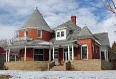
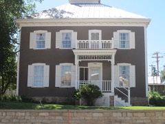
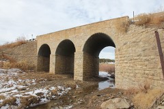
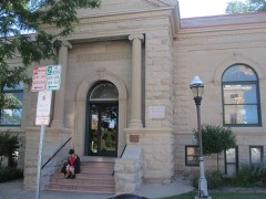
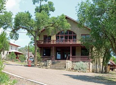
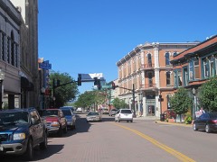
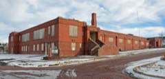
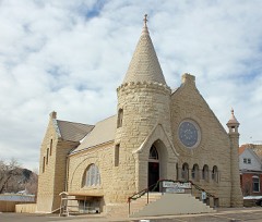
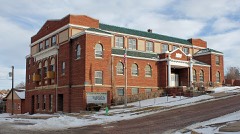
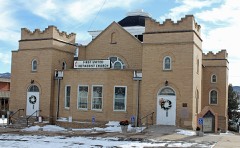
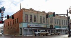
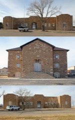
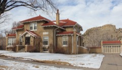
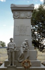
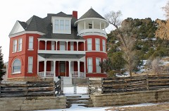
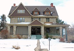
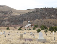
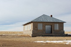
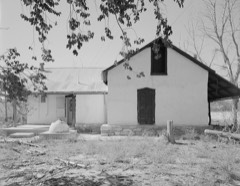
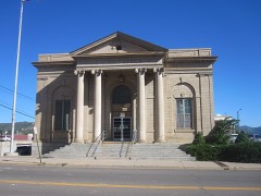
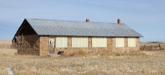
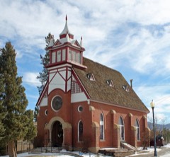
26 National Register listings published here, 1 of them a National Historic Landmark.
Sources: the National Register database, National Park Service
147 topographic sheets cover 59 settlements here, and 26 properties are on the National Register of Historic Places.
26 National Register listings published here, 1 of them a National Historic Landmark.
Sources: the National Register database, National Park Service
Every property in this county listed on the National Register of Historic Places, with the year it was listed and the federal nomination document.
Every wildfire the federal occurrence database records inside this county: 542 of them, burning about 226,904 acres. 171 started naturally and 30 were recorded as arson. Each settlement page carries the fires within five miles of it.
| Reported cause | Fires |
|---|---|
| Missing data/not specified/undetermined | 270 |
| Natural | 171 |
| Arson/incendiarism | 30 |
| Equipment and vehicle use | 22 |
| Recreation and ceremony | 16 |
| Debris and open burning | 12 |
| Smoking | 10 |
| Misuse of fire by a minor | 6 |
| Power generation/transmission/distribution | 3 |
| Fireworks | 1 |
| Railroad operations and maintenance | 1 |
The five largest, by the area the report gives. None of them was recorded as arson.
| Date | Cause | Size | Reported by | Name on the report |
|---|---|---|---|---|
| 9 June 2008 | Natural | 45,814 acres | Pike and San Isabel National Forest | BRIDGER |
| 5 June 2011 | Natural | 35,583 acres | Fort Carson Army Base | BEAR SPRINGS |
| 2 June 2002 | Natural | 33,000 acres | Pueblo Interagency Dispatch Center | TRINIDAD COMPLEX |
| 7 June 2011 | Natural | 13,312 acres | Las Animas County | SHELL COMPLEX |
| 20 May 2020 | Natural | 11,828 acres | Las Animas County | CHERRY CANYON |
| 1 April 1996 | Recreation and ceremony | 9,523 acres | Pike and San Isabel National Forest | CANYON |
| 7 June 2011 | Natural | 9,089 acres | Pike and San Isabel National Forest | CALLIE MARIE |
| 15 May 2002 | Natural | 8,000 acres | Royal Gorge Field Office | FURNISH |
Every settlement page carries the fires within five miles of it - see the settlement index below.
The NOAA Storm Events Database holds 437 reports for this county, causing no deaths, 4 injuries and about $409,560 in recorded property damage. Each settlement page carries the reports that name it.
| Kind of event | Reports |
|---|---|
| Hail | 317 |
| Thunderstorm Wind | 40 |
| Tornado | 38 |
| Heavy Rain | 19 |
| Flash Flood | 15 |
| Funnel Cloud | 6 |
| Flood | 1 |
| Wildfire | 1 |
The most serious of them, by death, then injury, then recorded damage. The accounts are quoted exactly as the forecast office filed them.
| When | Event | Place named | Harm | What the report says |
|---|---|---|---|---|
| June 1994 | Thunderstorm Wind | Trinidad | 3 hurt, $500 | Thunderstorm winds blew over a tent of a fireworks display in Trinidad and scattered the fireworks. Three people were slightly injured when the tent fell onto them. |
| June 2014 | Tornado (EF1) | Trinidad | 1 hurt, $5,000 | A large tornado occurred over mostly open country damaging some fencing, toppling trees, and damaging one outbuilding. One person was injured. |
| June 1991 | Tornado (F0) | not stated | $250,000 | no account filed |
| June 2002 | Wildfire | Trinidad | $50,000 | no account filed |
| June 1998 | Tornado (F1) | Ville Green | $30,000 | no account filed |
| July 2010 | Flash Flood | Stonewall | $20,000 | Several roads north of Highway 12 sustained severe erosion due to deep, fast-flowing water. |
| July 2010 | Flash Flood | Weston | $20,000 | Several roads north of Highway 12 sustained severe erosion due to deep, fast-flowing water. |
| May 2009 | Flash Flood | Hoehne | $10,000 | I-25 frontage road and County Road 42 flooded. |
| August 2010 | Hail | Stonewall | $10,000 | no account filed |
| May 2001 | Tornado (F0) | Hoehne | $5,000 | A brief touch down occurred, damaging a garage. |
| June 2014 | Tornado (EF1) | (Tad)Trinidad Arpt | $3,000 | A second tornado crossed US Highway 160 and damaged some fencing and snapped a power pole. |
| June 1965 | Tornado (F1) | not stated | $2,500 | no account filed |
| May 1965 | Tornado (F1) | not stated | $2,500 | no account filed |
| October 1997 | Thunderstorm Wind | Kim | $1,000 | A severe thunderstorm quickly developed along a line of thunderstorms moving east through southeast Colorado. The high winds seems to be shortlived and a couple of trampolines were damaged and destroyed. No damage to structures was reported. |
| June 1983 | Tornado (F1) | not stated | $30 | no account filed |
| June 1983 | Tornado (F1) | not stated | $30 | no account filed |
| May 2025 | Thunderstorm Wind | (Tad)Trinidad Arpt | - | The awos station ktad at Trinidad Airport reported a 61 mph wind gust. |
| June 2025 | Hail | Ville Green | - | Hail up to 1.5 inches in diameter fell in north central Las Animas County from a supercell thunderstorm. |
| June 2025 | Tornado (EFU) | Ville Green | - | A tornado was observed about 12.5 miles northwest of Kim, Colorado. No damage reported. Via radar observation and spotter report, it was on the ground for 4 to 5 minutes. |
| June 2025 | Hail | Kim | - | Hail up to 2 inches in diameter fell in Las Animas County from a supercell thunderstorm. |
| June 2025 | Hail | Kim | - | Hail up to 2 inches in diameter fell in Las Animas County from a supercell thunderstorm. |
| June 2025 | Hail | Kim | - | Hail up to 2 inches in diameter fell in Las Animas County from a supercell thunderstorm. |
| June 2025 | Hail | Kim | - | Hail up to 3 inches in diameter fell in Las Animas County from a supercell thunderstorm. |
| June 2025 | Hail | Hoehne | - | Hail up to 1.25 inches in diameter fell in Las Animas County from severe thunderstorms. |
| June 2025 | Thunderstorm Wind | (Tad)Trinidad Arpt | - | Ktad asos reported a 69 mph wind gusts from strong to severe storms. |
| June 2025 | Hail | Hoehne | - | Hail up to 2 inches in diameter fell in Las Animas County from severe thunderstorms. |
| June 2025 | Hail | Trinidad | - | Hail up to 2 inches in diameter fell in Las Animas County from severe thunderstorms. |
| August 2025 | Hail | Boncarbo | - | Hail measured to 1 inches fell in western Las Animas County. |
| August 2025 | Hail | Boncarbo | - | Hail measured to 1 inches fell in western Las Animas County. |
| August 2025 | Hail | Trinidad | - | Hail measured to 1.5 inches fell in western Las Animas County. |
| August 2025 | Hail | Kim | - | Hail measured to 3 inches fell in eastern Las Animas County. |
| August 2025 | Hail | Kim | - | Hail measured to 3 inches fell in eastern Las Animas County. |
| August 2025 | Hail | Kim | - | Hail measured to 3.25 inches fell in eastern Las Animas County. |
| August 2025 | Hail | Kim | - | Hail measured to 2 inches fell in eastern Las Animas County. |
| September 2025 | Hail | Branson | - | Hail up to 1 inches was measured in western Las Animas County. |
| September 2025 | Hail | Branson | - | Hail up to 1.25 inches was measured in western Las Animas County. |
| September 2025 | Hail | Trinidad | - | Hail up to 1 inches was measured in western Las Animas County. |
| September 2025 | Hail | Trinidad | - | Hail up to 1.5 inches was measured in western Las Animas County. |
| September 2025 | Hail | Branson | - | Hail up to 1.5 inches was measured in western Las Animas County. |
| May 2024 | Thunderstorm Wind | (Tad)Trinidad Arpt | - | The AWOS station of the Trinidad Airport (KTAD) reported a wind gust of 51 kts. |
| October 2024 | Hail | Branson | - | Hailstones were fused together, some the size of a golf ball. |
| August 2024 | Hail | Kim | - | A COOP Observer reported hail of .88 inches in diameter. |
| July 2023 | Tornado (EFU) | Kim | - | Brief tornado reported by a storm chaser 15 miles northeast of Kim. |
| August 2023 | Hail | Kim | - | Via social media. |
| July 2023 | Hail | Trinidad | - | Reported from MPing. |
| July 2023 | Hail | Trinidad | - | Reported from MPing. |
| July 2023 | Hail | Trinidad | - | Reported from MPing. |
| July 2023 | Hail | Trinidad | - | Reported from MPing. |
| July 2023 | Hail | Trinidad | - | Reported form MPing. |
| June 2023 | Hail | Model | - | Public reported. |
| June 2023 | Hail | Aguilar | - | Trained spotter reported. |
| June 2023 | Hail | (Tad)Trinidad Arpt | - | Trained spotter reported. |
| June 2023 | Hail | Tobe | - | Reported by storm chasers. |
| June 2023 | Heavy Rain | Weston | - | There was 1.57 inches of rain reported. |
| June 2023 | Heavy Rain | Weston | - | There was 1.61 inches of rain recorded. |
| June 2023 | Tornado (EFU) | Model | - | There were two videos supporting the tornado touching on the ground briefly. |
| June 2023 | Tornado (EF0) | Thatcher | - | Delayed report of a weak tornado that was briefly on the ground. Reported via picture on social media. |
| July 2022 | Hail | Aguilar | - | Report of golf ball size hail in Gulnare. Also, one inch of hail accumulation reported. |
| July 2022 | Hail | Boncarbo | - | Trained spotter measured one inch hail just southeast of Boncarbo. |
| July 2022 | Hail | Trinidad | - | Report of a mix of quarter to golf ball size hail in the northern part of Trinidad, just east of Interstate 25. |
The Survey's mineral resources record lists 91 workings inside this county. 18 still produce and 73 are closed or unrecorded. Each settlement page carries the workings within five miles of it.
| Commodity | Workings |
|---|---|
| Stone, Crushed/Broken | 41 |
| Sand and Gravel, Construction | 13 |
| Clay | 12 |
| Fire Clay (Refractory) | 8 |
| Uranium | 7 |
| Gold | 4 |
| Copper, Lead, Silver | 3 |
| Gypsum-Anhydrite | 3 |
| Copper | 2 |
| Gold, Silver, Lead | 1 |
| Limestone, General | 1 |
| Limestone, Dimension | 1 |
The least common of them first, because a county's hundredth gravel pit says nothing its first ten did not.
| Where | Site | Commodity | Status | Recorded |
|---|---|---|---|---|
| Little Mattie Lode | Gold, Silver, Lead, Copper | Prospect | Chalcopyrite, Galena, Sphalerite, Tetrahedrite | |
| Unk | Limestone, Dimension | Past Producer | ||
| Unknown | Limestone, General | Producer | ||
| Mike's Mine | Uranium, Copper | Occurrence | Surface | |
| Chacuaco Creek | Gypsum-Anhydrite | Producer | ||
| Johnny Branch | Gypsum-Anhydrite | Producer | ||
| Monitor Lode | Gold, Copper, Lead, Silver | Prospect | Chalcopyrite, Galena, Sphalerite, Tetrahedrite | |
| Spanish Gold Mine Lode | Gold, Copper, Lead, Silver | Prospect | Chalcopyrite, Galena, Sphalerite, Tetrahedrite | |
| Uncle Sam Lode | Gold, Copper, Lead, Silver | Prospect | Chalcopyrite, Galena, Sphalerite, Tetrahedrite | |
| Unk | Gypsum-Anhydrite | Past Producer | ||
| Unnamed Placer | Gold | Past Producer | Placer | |
| Airborne Anomaly | Uranium | Occurrence | ||
| Booster Claim No. 1 | Uranium | Occurrence | ||
| Dave Welsh Claim | Uranium | Occurrence | Surface | |
| Fan Dyke No. 1 | Uranium | Prospect | Carnotite | |
| Unnamed Uranium Occurrence | Uranium | Occurrence | ||
| Virginia No. 14 Mine | Uranium | Past Producer | Carnotite, Tyuyamunite | |
| Unknown | Fire Clay (Refractory) | Occurrence | ||
| Unknown | Fire Clay (Refractory) | Occurrence | ||
| Unknown | Fire Clay (Refractory) | Occurrence | ||
| Unknown | Fire Clay (Refractory) | Occurrence | ||
| Unknown | Fire Clay (Refractory) | Occurrence | ||
| Unknown | Fire Clay (Refractory) | Occurrence | ||
| Unknown | Fire Clay (Refractory) | Occurrence | ||
| Unknown | Fire Clay (Refractory) | Occurrence | ||
| Claypit | Clay | Past Producer | ||
| Claypit | Clay | Past Producer | ||
| Col-Tex Co | Clay | Past Producer | ||
| Jolly Pit | Clay | Producer | ||
| New Mary Mine | Clay | Producer | ||
| Santa Fe Pit | Clay | Producer | ||
| Summit Brick Plant | Clay | Producer | ||
| Thatcher Clay Mine | Clay | Past Producer | ||
| Trinidad Mine | Clay | Producer | ||
| Trinidad Operation | Clay | Producer | ||
| Unk | Clay | Past Producer | ||
| Welte Pit | Clay | Past Producer | ||
| Unknown | Sand and Gravel, Construction | Occurrence | ||
| Unknown | Sand and Gravel, Construction | Occurrence | ||
| Unknown | Sand and Gravel, Construction | Occurrence | ||
| Unknown | Sand and Gravel, Construction | Occurrence | ||
| Unknown | Sand and Gravel, Construction | Occurrence | ||
| Unknown | Sand and Gravel, Construction | Occurrence | ||
| Unknown | Sand and Gravel, Construction | Occurrence | ||
| Unknown | Sand and Gravel, Construction | Occurrence | ||
| Unknown | Sand and Gravel, Construction | Occurrence | ||
| Unknown | Sand and Gravel, Construction | Occurrence | ||
| Unknown | Sand and Gravel, Construction | Occurrence | ||
| Unknown | Sand and Gravel, Construction | Occurrence | ||
| Unknown | Sand and Gravel, Construction | Occurrence | ||
| Gravel Pit | Stone, Crushed/Broken | Past Producer | ||
| Gravel Pit | Stone, Crushed/Broken | Past Producer | ||
| Gravel Pit | Stone, Crushed/Broken | Past Producer | ||
| Gravel Pit | Stone, Crushed/Broken | Past Producer | ||
| Gravel Pit | Stone, Crushed/Broken | Past Producer | ||
| Gravel Pit | Stone, Crushed/Broken | Past Producer | ||
| Gravel Pit | Stone, Crushed/Broken | Past Producer | ||
| Gravel Pit | Stone, Crushed/Broken | Producer | ||
| Gravel Pit | Stone, Crushed/Broken | Past Producer | ||
| Gravel Pit | Stone, Crushed/Broken | Past Producer | ||
| Gravel Pit | Stone, Crushed/Broken | Past Producer | ||
| Gravel Pit | Stone, Crushed/Broken | Past Producer | ||
| Gravel Pit | Stone, Crushed/Broken | Past Producer | ||
| Gravel Pit | Stone, Crushed/Broken | Past Producer | ||
| Gravel Pit | Stone, Crushed/Broken | Producer | ||
| Gravel Pit | Stone, Crushed/Broken | Past Producer | ||
| Gravel Pit | Stone, Crushed/Broken | Past Producer | ||
| Gravel Pit | Stone, Crushed/Broken | Past Producer | ||
| Gravel Pit | Stone, Crushed/Broken | Past Producer | ||
| Gravel Pit | Stone, Crushed/Broken | Producer | ||
| Gravel Pit | Stone, Crushed/Broken | Past Producer | ||
| Gravel Pit | Stone, Crushed/Broken | Past Producer | ||
| Gravel Pit | Stone, Crushed/Broken | Past Producer | ||
| Gravel Pit | Stone, Crushed/Broken | Past Producer | ||
| Gravel Pit | Stone, Crushed/Broken | Past Producer | ||
| Gravel Pit | Stone, Crushed/Broken | Past Producer | ||
| Gravel Pit | Stone, Crushed/Broken | Producer | ||
| Gravel Pit | Stone, Crushed/Broken | Past Producer | ||
| Gravel Pit | Stone, Crushed/Broken | Producer | ||
| Gravel Pit | Stone, Crushed/Broken | Past Producer | ||
| Gravel Pit | Stone, Crushed/Broken | Past Producer | ||
| Gravel Pit | Stone, Crushed/Broken | Producer | ||
| Gravel Pit | Stone, Crushed/Broken | Producer | ||
| Gravel Pit | Stone, Crushed/Broken | Past Producer | ||
| Gravel Pits | Stone, Crushed/Broken | Past Producer | ||
| Gravel Pits | Stone, Crushed/Broken | Past Producer | ||
| Gravel Pits | Stone, Crushed/Broken | Past Producer | ||
| Gravel Pits | Stone, Crushed/Broken | Past Producer | ||
| Gravel Pits | Stone, Crushed/Broken | Producer | ||
| Gravel Pits | Stone, Crushed/Broken | Past Producer | ||
| Leone Sand and Gravel | Stone, Crushed/Broken | Producer |
Named settlements recorded in the Geographic Names Information System, each with the topographic sheets covering it. Villages, hamlets and abandoned places alike. Each is shown with the nearest named watercourse or landform and the survey quadrangle it falls on.
Aguilar census division · 81020 · Near Gonzales Canyon · Aguilar quadrangle
22 sheets, 1891 to 1988
Trinidad census division · 81081 · On Ocaña Creek · Barela quadrangle
17 sheets, 1892 to 1988
Trinidad census division · 81082 · On Duran Arroyo · Trinidad East quadrangle
18 sheets, 1892 to 1988
Weston census division · 81024 · Near Toisan Canyon · Madrid quadrangle
21 sheets, 1891 to 1988
Trinidad census division · 81082 · Near Cottonwood Canyon · Trinidad West quadrangle
24 sheets, 1891 to 1988
Weston census division · 81091 · On South Fork Purgatoire River · Weston quadrangle
21 sheets, 1891 to 1988
Aguilar census division · 81082 · Near Canyon Bonito · Delagua quadrangle
21 sheets, 1891 to 1988
No longer a settlement
Trinidad census division · 81082 · On Gray Creek · Trinidad East quadrangle
18 sheets, 1892 to 1988
Trinidad census division · 81082 · Near China Canyon · Trinidad East quadrangle
18 sheets, 1892 to 1988
Trinidad census division · 81082 · Near Number Seven Canyon · Ludlow quadrangle
19 sheets, 1891 to 1988
No longer a settlement
Aguilar census division · 81020 · Near Frio Canyon · Gulnare quadrangle
22 sheets, 1891 to 1988
Model census division · 81059 · On Big Arroyo · Thatcher quadrangle
16 sheets, 1891 to 1993
Trinidad census division · 81082 · Near Colorado Canyon · Trinidad West quadrangle
24 sheets, 1891 to 1988
Aguilar census division · 81082 · Near Berwind Canyon · Ludlow quadrangle
19 sheets, 1891 to 1988
Weston census division · 81082 · In Madrid Canyon · Madrid quadrangle
21 sheets, 1891 to 1988
No longer a settlement
Weston census division · 81091 · Near Cow Canyon · Weston quadrangle
21 sheets, 1891 to 1988
Weston census division · 81091 · Near Hayrack Mountain · Stonewall quadrangle
11 sheets, 1954 to 1994
Weston census division · 81091 · Near Parras Canyon · Vigil quadrangle
21 sheets, 1891 to 1988
Model census division · 81082 · On Frijole Creek · Patterson Crossing quadrangle
15 sheets, 1892 to 1988
Trinidad census division · 81082 · Near Carpios Canyon · Trinidad West quadrangle
24 sheets, 1891 to 1988
No longer a settlement
Weston census division · 81082 · Near Pentitente Canyon · Madrid quadrangle
21 sheets, 1891 to 1988
No longer a settlement
Trinidad census division · 81082 · Near Carpios Canyon · Trinidad West quadrangle
24 sheets, 1891 to 1988
No longer a settlement
Trinidad census division · 81081 · Near Loma Mujer · Fishers Peak quadrangle
16 sheets, 1892 to 1988
Weston census division · 81082 · In Sarcillo Canyon · Weston quadrangle
21 sheets, 1891 to 1988
Weston census division · 81082 · Near Pentitente Canyon · Weston quadrangle
21 sheets, 1891 to 1988
Weston census division · 81082 · Near Smith Canyon · Valdez quadrangle
23 sheets, 1891 to 1988
Trinidad census division · 81082 · Near Levsa Canyon · Trinidad West quadrangle
24 sheets, 1891 to 1988
No longer a settlement
Trinidad census division · 81082 · Near Levsa Canyon · Trinidad West quadrangle
24 sheets, 1891 to 1988
No longer a settlement
Weston census division · 81091 · Near Romain Canyon · Stonewall quadrangle
11 sheets, 1954 to 1994
Weston census division · 81091 · Near Deadman Canyon · Stonewall quadrangle
11 sheets, 1954 to 1994
Weston census division · 81082 · Near Burro Canyon · Madrid quadrangle
21 sheets, 1891 to 1988
Weston census division · 81091 · Near Bonito Canyon · Torres quadrangle
12 sheets, 1954 to 1988
Branson census division · 81081 · On Salazar Arroyo · Trinchera quadrangle
15 sheets, 1892 to 1988
Trinidad census division · 81082 · Near Picketwire Valley · Trinidad West quadrangle
24 sheets, 1891 to 1988
Weston census division · 81082 · In Valdez Canyon · Valdez quadrangle
23 sheets, 1891 to 1988
Trinidad census division · 81082 · Near Prairie Canyon · Delagua quadrangle
21 sheets, 1891 to 1988
Weston census division · 81091 · Near Lorencito Canyon · Little Pine Canyon quadrangle
20 sheets, 1891 to 1988
Weston census division · 81091 · On North Fork Purgatoire River · Vigil quadrangle
21 sheets, 1891 to 1988
Trinidad census division · 81082 · Near Long Canyon · Trinidad West quadrangle
24 sheets, 1891 to 1988
No longer a settlement
Branson census division · 81027 · Near Piñon Ridge · Trementina Canyon quadrangle
16 sheets, 1891 to 1982
Weston census division · 81091 · Near Santistevan Canyon · Vigil quadrangle
21 sheets, 1891 to 1988
The vanished settlements of Las Animas County: the places named above that are no longer on the map.