 Block
Lamar, Colorado
19 topographic sheets cover this place, the earliest surveyed in 1892 and the latest in 1988. It stands in the Lamar census division. It lies in ZIP code area 81052. The Survey maps it on the Lamar East quadrangle. 7,687 people lived here at the 2020 count. It stands 3,625 feet above sea level.
Research this city
On record in Lamar
Buildings and businesses the archive holds for this place. Each opens its own page, with the source record it came from.
On the National Register 7 records
 Atchison, Topeka and Santa Fe Railway Passenger Depotlisted 2019
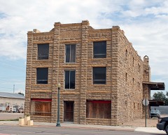 Davies Hotellisted 1978
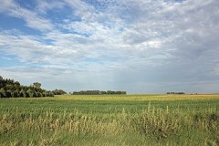 Paulsen Farmlisted 1999
 Prowers County Buildinglisted 1981
 US Post Office-Lamar Mainlisted 1986
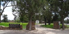 Willow Creek Parklisted 2007
- Prowers Country Welfare Housinglisted 2009
Population over time
2 figuresLamar fell from 7,804 to 7,687 between 2010 and 2020. These are the recorded population figures Wikidata holds for this place, reached through the Geographic Names Information System number this page is keyed on rather than by name, so they belong to this place and not to another of the same name. Most are census counts, but not all are: an early figure may be a founding or settlement estimate, and an estimate published within five years of a census is left out. The change column is computed, and is left blank where more than 20 years separate a figure from the one before it, because a gap that long is not a change between two counts.
| Year | People | Change |
|---|---|---|
| 2010 | 7,804 | |
| 2020 | 7,687 | -117 (-1%) |
Topographic sheets covering this place
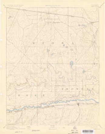
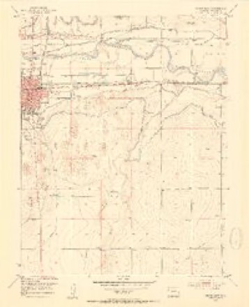
6 surveys from 19 printed sheetsMatched by testing this settlement's coordinate against the published boundary of every sheet in the United States Geological Survey's historical collection. Each opens the scanned sheet at the Survey.
- 1892 USGS Lamar quadrangle1:125000, 7 printings
- 1953 USGS Lamar East quadrangle1:24000, 5 printings
- 1954 USGS Lamar quadrangle1:250000, 3 printings
- 1958 USGS Lamar quadrangle1:250000, 2 printings
- 1984 USGS Lamar quadrangle1:100000
- 1988 USGS Lamar quadrangle1:100000
Fires near this place
214 since 1994Regional context, not property-specific evidence. The federal wildfire occurrence database lists 214 fires within 5 miles of Lamar between 1994 and 2020, burning about 13,182 acres in total. 5 started naturally. 7 were recorded as arson. Distance is straight-line from the map coordinates, so a fire counted here may appear on a neighbouring settlement's page as well.
| Reported cause | Fires |
|---|---|
| Missing data/not specified/undetermined | 162 |
| Recreation and ceremony | 28 |
| Arson/incendiarism | 7 |
| Equipment and vehicle use | 6 |
| Natural | 5 |
| Debris and open burning | 3 |
| Smoking | 2 |
| Misuse of fire by a minor | 1 |
The most recent of them, most recent first, with the day each was reported and the service that recorded it.
| Date | Cause | Size | Reported by | Name on the report |
|---|---|---|---|---|
| 9 September 2005 | Missing data/not specified/undetermined | under an acre | Colorado State Forest Service-State Headquarters | not named |
| 5 September 2005 | Missing data/not specified/undetermined | under an acre | Colorado State Forest Service-State Headquarters | not named |
| 4 September 1995 | Recreation and ceremony | under an acre | Prowers County | not named |
| 27 September 2005 | Missing data/not specified/undetermined | 300 acres | Colorado State Forest Service-State Headquarters | not named |
| 27 September 2005 | Missing data/not specified/undetermined | 100 acres | Colorado State Forest Service-State Headquarters | not named |
| 27 September 1995 | Missing data/not specified/undetermined | under an acre | Prowers County | not named |
| 21 September 2005 | Missing data/not specified/undetermined | under an acre | Colorado State Forest Service-State Headquarters | not named |
| 17 September 1995 | Recreation and ceremony | 200 acres | Prowers County | not named |
Settlements close enough to share some of these fires:
Mines and quarries near this place
10 of 13 shownRegional context, not property-specific evidence. The federal mineral resources record lists 13 workings within 5 miles of Lamar: 10 past producers, 2 producers, 1 occurrence. 2 still produce. What was taken out: Sand and Gravel, Construction, Stone. Distance is straight-line from the map coordinates, so a quarry counted here may appear on a neighbouring settlement's page as well.
| Where | Site | Commodity | Status | Recorded |
|---|---|---|---|---|
| Prowers Granite Qy | Stone | Producer | ||
| Lamar Valley Concrete Pit & Plant | Sand and Gravel, Construction | Producer | ||
| Unk | Sand and Gravel, Construction | Past Producer | ||
| Unk | Sand and Gravel, Construction | Past Producer | ||
| Unk | Sand and Gravel, Construction | Past Producer | ||
| Unk | Sand and Gravel, Construction | Past Producer | ||
| Unk | Sand and Gravel, Construction | Past Producer | ||
| Unk | Sand and Gravel, Construction | Past Producer | ||
| Unk | Sand and Gravel, Construction | Past Producer | ||
| Unk | Sand and Gravel, Construction | Past Producer |
Storms near this place
60 of 200 shownRegional context, not property-specific evidence. The National Weather Service names Lamar in 200 storm reports between 1994 and 2024: 106 hail, 37 thunderstorm wind, 24 tornado, 17 flash flood. The reports record 1 death and 10 injuries. Each account below is quoted exactly as the forecast office filed it, from the NOAA Storm Events Database, and each date opens the federal record of that event.
| When | Event | Place named | Harm | What the report says |
|---|---|---|---|---|
| September 1998 | Lightning | Lamar | 1 killed, 3 hurt | no account filed |
| April 2012 | Tornado (EF2) | Lamar | 7 hurt, $500,000 | This long-track tornado began southeast of Lamar and damaged an electrical substation along county road EE. A power outage in the Lamar area lasted for over 12 hours. Two communication towers were downed...and four dwellings were destroyed. |
| May 2001 | Hail | Lamar | $5,000,000 | The thunderstorms that spawned seven tornadoes west of Lamar, brought giant hail between golf ball and baseball size to Lamar. |
| May 2010 | Hail | Lamar | $250,000 | Damaging large hail occurred in Lamar for around 15 minutes. |
| May 2001 | Tornado (F3) | Lamar | $150,000 | Thunderstorms spawned six brief tornadoes and an F3 tornado within a three mile radius of the Lamar Municipal Airport between 1049 MST and 1231 MST just west of Lamar. The F3 tornado, which showed supercellular characteristics, completely destroyed a modular home and five vehicles in its vicinity, and damaged two other homes nearby. Eleven power poles were destroyed as well. |
| May 2003 | Thunderstorm Wind | Lamar | $50,000 | An intense rear flank downdraft caused heavy damage to several ranch buildings. Part of the wall, and the roof of a large building were destroyed. Smaller, less substantial structures were a total loss. |
| August 2002 | Flash Flood | Lamar | $50,000 | Heavy rain from severe thunderstorms caused flash flooding from the Willow Creek drainage basin in Lamar southward. A rental store sustained heavy flood damage between 7:30 p.m. and 8:00 p.m., as water was up to three feet deep on the property. A local golf course was closed because bridges and crossings over the creek were washed out. The greens suffered hail damage. Mud was deep in many streets on the south and east sides of Lamar in the Willow Creek drainage. Parts of highway 287, south of Lamar, were closed due to high water. |
| June 2012 | Thunderstorm Wind | Lamar | $30,000 | High winds caused numerous downed power poles...a collapsed awning at a gas station...and other scattered damage throughout the city. |
| June 2007 | Flash Flood | Lamar | $20,000 | An area of strong to severe thunderstorms produced very heavy rain in and around Lamar. Many streets were covered by at least 6 inches of water. |
| June 1996 | Thunderstorm Wind | Lamar | $15,000 | no account filed |
| July 2011 | Thunderstorm Wind | Lamar | $10,000 | An unanchored mobile home flipped at CR13 between Highway 50 and Highway 96. |
| July 2010 | Tornado (EF0) | Lamar | $10,000 | A brief tornado brought down a 200-foot tall radio tower on the KLMR property. |
| July 2015 | Thunderstorm Wind | Lamar | $5,000 | Damage to tree limbs and power poles occurred across Lamar. |
| August 2015 | Thunderstorm Wind | Lamar | $5,000 | A few power lines were downed around Lamar. |
| June 2006 | Hail | Lamar | $5,000 | no account filed |
| July 2011 | Thunderstorm Wind | Lamar | $2,000 | A few telephone poles sustained damage. |
| August 2024 | Thunderstorm Wind | Lamar | - | A trained spotter reported thunderstorm wind damage, with large trees and fence posts downed in willow creek park in Lamar. |
| May 2024 | Hail | Lamar | - | A public source via mPing, reported hail of 1 inch in diameter. |
| May 2024 | Hail | Lamar | - | A public source via mPing, reported hail of 1.75 inches in diameter. |
| May 2024 | Hail | Lamar | - | A public source via mPing, reported hail of 1.25 inches in diameter. |
| May 2024 | Hail | Lamar | - | A public source via mPing, reported hail of 1.75 inches in diameter. |
| May 2024 | Hail | Lamar | - | Picture of hail on social media from a storm chaser, was approximately twice the size of a quarter, and therefore was estimated to be around 2 inches in diameter. |
| September 2024 | Thunderstorm Wind | Lamar | - | There was a 54 knot wind gust reported at location. |
| July 2023 | Flash Flood | Lamar | - | Significant street flooding in Lamar with Highway 287 almost impassable at this location. |
| July 2022 | Thunderstorm Wind | Lamar | - | Large tree reported down in the downtown area. |
| July 2022 | Thunderstorm Wind | Lamar | - | Numerous trees blown down across town. Roof damage to Lamar radio station from estimated 75 mph winds, believed to be from a microburst. Widespread structural damage reported around town. |
| July 2022 | Thunderstorm Wind | Lamar | - | Estimated winds. |
| July 2022 | Thunderstorm Wind | Lamar | - | Estimated winds. |
| June 2022 | Flash Flood | Lamar | - | Widespread flooded roads and other minor flooding from earlier thunderstorm activity. |
| June 2022 | Flash Flood | Lamar | - | Main street flooded with 1 to 2 feet of water. |
| June 2022 | Tornado (EFU) | Lamar | - | Off duty NWS employee reported tornado touchdown. |
| June 2022 | Heavy Rain | Lamar | - | Fell over the previous 24 hours. |
| May 2021 | Thunderstorm Wind | Lamar | - | Power poles are down. |
| July 2021 | Heavy Rain | Lamar | - | Heavy rainfall of 1.00 inches. |
| May 2021 | Thunderstorm Wind | Lamar | - | Numerous large trees are down in Lamar. |
| March 2021 | Heavy Rain | Lamar | - | Heavy rain of 1.61 inches. |
| August 2021 | Heavy Rain | Lamar | - | Heavy rainfall of 1.22 inches. |
| July 2021 | Flash Flood | Lamar | - | Flooding in the 600 block of Main street in Lamar. |
| July 2021 | Funnel Cloud | Lamar | - | Saw what appeared to be a funnel cloud with no view of the base, from about 15 miles southwest of the location. |
| August 2021 | Flash Flood | Lamar | - | Flooding at the intersection of Main street and Olive street. Water was deep enough to require traffic redirection from law enforcement. |
| May 2021 | Hail | Lamar | - | Six miles southeast Lamar. |
| May 2021 | Heavy Rain | Lamar | - | Heavy rain of 1.66 inches. |
| June 2020 | Hail | Lamar | - | Public report of 1 inch hail. |
| May 2019 | Tornado (EFU) | Lamar | - | NWS Pueblo employee spotted a brief tornado near Lamar, CO. The tornado stayed in open fields producing no visible damage. A storm survey was not conducted without any damage indicators to properly assess a EF rating. |
| August 2019 | Hail | Lamar | - | Nickel size hail reported. |
| August 2019 | Hail | Lamar | - | One inch hail reported. |
| September 2019 | Thunderstorm Wind | Lamar | - | Several 5 inch tree limbs broken off. |
| July 2018 | Flash Flood | Lamar | - | A strong thunderstorm accumulated 12-18 inches of standing water over Main Street in Lamar, Colorado. The road was closed down. |
| July 2017 | Thunderstorm Wind | Lamar | - | A few trees were snapped off and uprooted. |
| July 2015 | Flash Flood | Lamar | - | Street flooding to a depth of greater than six inches was reported across Lamar. |
| May 2015 | Flash Flood | Lamar | - | Severe storms produced heavy rain and large hail which flooded roadways southeast of Lamar. |
| July 2014 | Flood | Lamar | - | The Arkansas River at Lamar went above flood stage, causing minor agricultural flooding. |
| July 2014 | Flood | Lamar | - | The Arkansas River at Lamar briefly went above flood stage causing minor agricultural flooding. |
| July 2014 | Flash Flood | Lamar | - | Heavy rain caused flash flooding of county roads and US Highway 50 east of Lamar. |
| July 2014 | Tornado (EF0) | Lamar | - | A brief landspout tornado occurred across open country and caused no damage. |
| May 2011 | Tornado (EF0) | Lamar | - | A landspout tornado occurred in a field and caused no damage. |
| July 2011 | Thunderstorm Wind | Lamar | - | A small barn was damaged. |
| August 2011 | Thunderstorm Wind | Lamar | - | A storm generated severe winds at the Lamar Airport. |
| May 2007 | Thunderstorm Wind | Lamar | - | Two trees, 30-foot tall with 9-inch diameter trunks, were uprooted. |
| May 2007 | Tornado (EF0) | Lamar | - | A brief tornado was spotted. There was no known damage. |
Nearest settlements
The eight closest, with where each one stands in the county. Distances are straight-line, computed from the Geographic Names Information System coordinates.
Elsewhere
Matched on this settlement's Geographic Names Information System number rather than its name, so it cannot be a different place of the same name in another state.
| Wikipedia article on Lamar | An encyclopaedic summary. Its text is share-alike, so it is linked here rather than copied. |
| Wikidata item Q994475 | The structured record the population and elevation above come from. Public domain (CC0). |
Provenance
This settlement is recorded in the Geographic Names Information System as feature 203835. The sheet list is computed by point-in-boundary test against the United States Geological Survey's historical topographic inventory. Both are works of the United States government and carry no copyright under 17 U.S.C. 105.
Wildfire. Short, Karen C. 2022. Spatial wildfire occurrence data for the United States, 1992-2020 [FPA_FOD_20221014]. 6th Edition. Fort Collins, CO: Forest Service Research Data Archive. https://doi.org/10.2737/RDS-2013-0009.6 Collected with United States Government funding and usable without additional permissions or fees.
Mines and quarries. USGS Mineral Resources Data System (MRDS) https://mrdata.usgs.gov/mrds/ A work of the United States government, no copyright under 17 U.S.C. 105.
Storms. NOAA National Centers for Environmental Information, Storm Events Database https://www.ncei.noaa.gov/stormevents/ A work of the United States government, no copyright under 17 U.S.C. 105. Narratives are quoted verbatim from the National Weather Service report and are not edited or summarised.