 Block
Loveland, Colorado
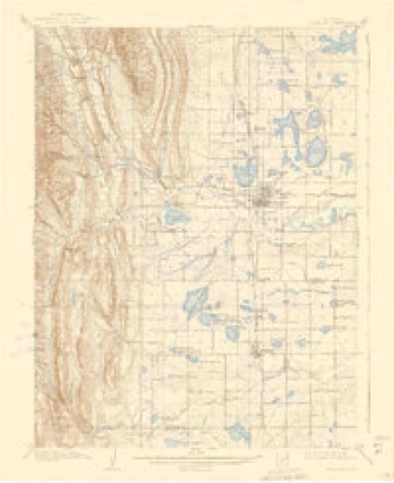
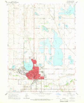
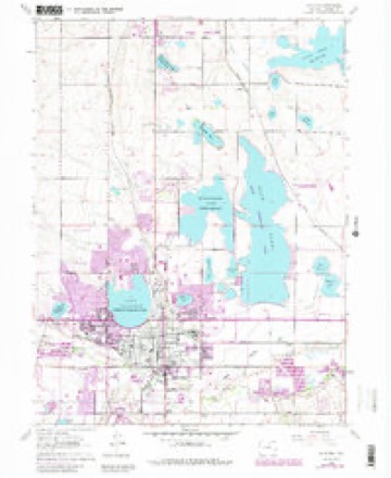
28 topographic sheets cover this place, the earliest surveyed in 1906 and the latest in 1984. It stands in the Loveland census division. It lies in ZIP code area 80537. It lies near Ryan Gulch. The Survey maps it on the Loveland quadrangle. 76,378 people lived here at the 2020 count. It stands 4,984 feet above sea level.
Research this city
On record in Loveland
Buildings and businesses the archive holds for this place. Each opens its own page, with the source record it came from.
On the National Register 12 of 17 shown
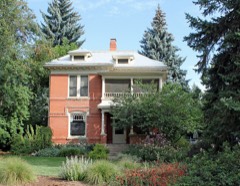 A.S. Benson Houselisted 2004
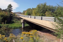 Big Thompson River Bridge IIIlisted 2002
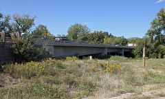 Big Thompson River Bridge IVlisted 2002
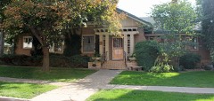 Maude Stanfield Harter Borland Houselisted 2004
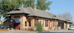 Colorado and Southern Railway Depotlisted 1982
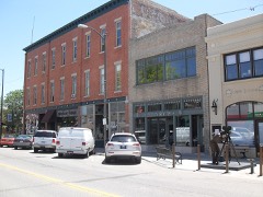 Downtown Loveland Historic Districtlisted 2015
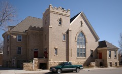 First United Presbyterian Churchlisted 2004
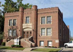 Loveland State Amorylisted 2001
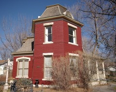 William H. McCreery Houselisted 2001
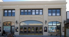 Rialto Theaterlisted 1988
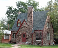 Henry K. and Mary E. Shaffer Houselisted 2007
- Chasteen's Grovelisted 1978
Population over time
2 figuresLoveland grew from 66,859 to 76,378 between 2010 and 2020. These are the recorded population figures Wikidata holds for this place, reached through the Geographic Names Information System number this page is keyed on rather than by name, so they belong to this place and not to another of the same name. Most are census counts, but not all are: an early figure may be a founding or settlement estimate, and an estimate published within five years of a census is left out. The change column is computed, and is left blank where more than 20 years separate a figure from the one before it, because a gap that long is not a change between two counts.
| Year | People | Change |
|---|---|---|
| 2010 | 66,859 | |
| 2020 | 76,378 | +9,519 (+14%) |
Topographic sheets covering this place
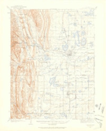
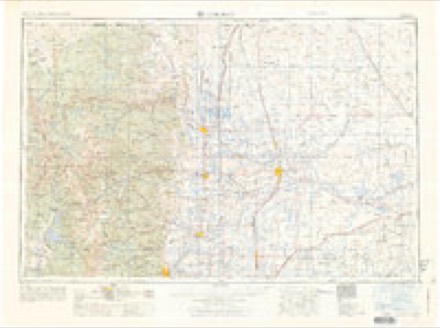
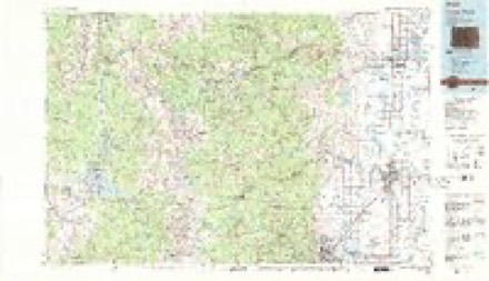
11 surveys from 28 printed sheetsMatched by testing this settlement's coordinate against the published boundary of every sheet in the United States Geological Survey's historical collection. Each opens the scanned sheet at the Survey.
- 1906 USGS Loveland quadrangle1:62500, 5 printings
- 1908 USGS Loveland quadrangle1:62500, 7 printings
- 1954 USGS Greeley quadrangle1:250000, 3 printings
- 1957 USGS Greeley quadrangle1:250000
- 1958 USGS Greeley quadrangle1:250000
- 1960 USGS Loveland quadrangle1:24000
- 1961 USGS Greeley quadrangle1:250000
- 1962 USGS Loveland quadrangle1:24000, 4 printings
- 1964 USGS Greeley quadrangle1:250000
- 1965 USGS Greeley quadrangle1:250000
- 1984 USGS Estes Park quadrangle1:100000, 3 printings
Fires near this place
347 since 2011Regional context, not property-specific evidence. The federal wildfire occurrence database lists 347 fires within 5 miles of Loveland between 2011 and 2020, burning about 98 acres in total. 1 started naturally. 2 were recorded as arson. Distance is straight-line from the map coordinates, so a fire counted here may appear on a neighbouring settlement's page as well.
| Reported cause | Fires |
|---|---|
| Missing data/not specified/undetermined | 297 |
| Smoking | 15 |
| Equipment and vehicle use | 9 |
| Recreation and ceremony | 8 |
| Misuse of fire by a minor | 5 |
| Fireworks | 4 |
| Railroad operations and maintenance | 3 |
| Arson/incendiarism | 2 |
| Debris and open burning | 2 |
| Natural | 1 |
| Other causes | 1 |
The most recent of them, most recent first, with the day each was reported and the service that recorded it.
| Date | Cause | Size | Reported by | Name on the report |
|---|---|---|---|---|
| 6 September 2011 | Missing data/not specified/undetermined | under an acre | Colorado State Forest Service-State Headquarters | LOVELAND |
| 5 September 2018 | Missing data/not specified/undetermined | under an acre | Loveland Fire & Rescue Department | UNKNOWN |
| 4 September 2011 | Missing data/not specified/undetermined | 1.0 acres | Colorado State Forest Service-State Headquarters | LOVELAND |
| 25 September 2018 | Natural | under an acre | Loveland Fire & Rescue Department | UNKNOWN |
| 24 September 2018 | Missing data/not specified/undetermined | under an acre | Loveland Fire & Rescue Department | UNKNOWN |
| 23 September 2018 | Missing data/not specified/undetermined | under an acre | Loveland Fire & Rescue Department | UNKNOWN |
| 22 September 2018 | Missing data/not specified/undetermined | under an acre | Loveland Fire & Rescue Department | UNKNOWN |
| 21 September 2018 | Missing data/not specified/undetermined | under an acre | Loveland Fire & Rescue Department | UNKNOWN |
Settlements close enough to share some of these fires:
Mines and quarries near this place
10 of 30 shownRegional context, not property-specific evidence. The federal mineral resources record lists 30 workings within 5 miles of Loveland: 12 producers, 10 past producers, 7 occurrences, 1 plant. 13 still produce. What was taken out: Sand and Gravel, Construction, Gypsum-Anhydrite, Stone, Fire Clay (Refractory). Distance is straight-line from the map coordinates, so a quarry counted here may appear on a neighbouring settlement's page as well.
| Where | Site | Commodity | Status | Recorded |
|---|---|---|---|---|
| (Facility) Loveland Sugar Refinery Quarry | Calcium | Plant | ||
| Mineral Concentrates | Beryllium | Past Producer | ||
| Mountain State Mill | Gold | Past Producer | ||
| Unknown | Clay | Producer | ||
| Boyd Lake | Stone, Crushed/Broken | Past Producer | ||
| Loveland Gravel Pit | Stone, Crushed/Broken | Producer | ||
| Unknown | Fire Clay (Refractory) | Occurrence | ||
| Unknown | Fire Clay (Refractory) | Occurrence | ||
| Loveland | Stone | Producer | ||
| Loveland Quarry | Gypsum-Anhydrite | Producer |
Storms near this place
60 of 78 shownRegional context, not property-specific evidence. The National Weather Service names Loveland in 78 storm reports between 1993 and 2024: 55 hail, 9 thunderstorm wind, 9 lightning, 3 flash flood. The reports record 4 deaths and 20 injuries. Each account below is quoted exactly as the forecast office filed it, from the NOAA Storm Events Database, and each date opens the federal record of that event.
| When | Event | Place named | Harm | What the report says |
|---|---|---|---|---|
| July 2005 | Thunderstorm Wind | Loveland | 2 killed, 4 hurt | Strong thunderstorm winds occurred at Boyd Lake. Two women drowned when the boat they were in capsized. Four others that were in the boat had to be hospitalized, one was in intensive care. |
| May 2003 | Lightning | Loveland | 1 killed, 1 hurt | Lightning struck and killed one man, and injured another, while they were fishing along the shore of Boyd Lake. |
| August 2001 | Lightning | Loveland | 1 killed | A 43-year old man was killed by lightning as he stood under a tree. |
| July 2005 | Lightning | Loveland | 9 hurt | Lightning struck near a beach area at Boyd Lake. Nine people were injured, five were treated at the park and four other were hospitalized. |
| August 2001 | Thunderstorm Wind | Loveland | 2 hurt | High winds flipped an empty semi-truck on its side, smashing the cab into a guard rail. |
| July 1996 | Lightning | Loveland | 2 hurt | no account filed |
| May 1994 | Thunderstorm Wind | Loveland | 1 hurt, $500 | Thunderstorm winds gusting to 60 mph (52 knots) buffeted portions of Southeast Larimer County. Winds toppled a tent at an outdoor music concert in Loveland (12 miles south southeast of Fort Collins), injuring eight people and causing damage to musical instruments. A truck driver was injured on Interstate 25, five miles east of Loveland when his semi truck was overturned by gusty winds. |
| August 2023 | Hail | Loveland | 1 hurt | no account filed |
| July 2010 | Lightning | Loveland | $100,000 | Lightning sparked a fire to a home in west Loveland, causing extensive damage to the roof, attic and garage. |
| May 2014 | Flash Flood | Loveland | $15,000 | Thunderstorms with locally heavy rain, produced flash flooding in west Loveland. One to two feet of standing water was observed over major intersections. Wilson Ave and 43rd St was closed, as well as Cascade Ave and US 34. |
| June 2015 | Flash Flood | Loveland | $10,000 | Heavy rain produced flash flooding in Loveland. The Fountain of Loveland, a local wedding and event venue had its outdoor marriage area flooded due to heavy rain. The business owner observed the area fill up to 5 ft of water in less than 15 minutes. Minor flooding occurred at the Sam's Club along Eisenhower Blvd. |
| July 1994 | Hail | Loveland | $5,000 | Hail up to golf ball-size broke windows of several homes and vehicles in Loveland (12 miles south southeast of Fort Collins). |
| June 1997 | Lightning | Loveland | $4,000 | Lightning struck a home in Loveland sometime during the afternoon. A meter box was blown up setting the garage on fire. |
| June 1994 | Thunderstorm Wind | Loveland | $500 | Thunderstorm winds, estimated at 80 mph, overturned a trailer south of Loveland (12 miles south southeast of Fort Collins). |
| June 2005 | Flash Flood | Loveland | - | Heavy rain caused flash flooding in the vicinity of Loveland. Flooding was reported at the Exit 11/2 along Interstate 25. Floodwaters also inundated parts of State Highways 60 and 287. |
| July 2005 | Lightning | Loveland | - | Lightning caused a fire at an apartment complex in Loveland. The complex was destroyed, leaving 20 people homeless. |
| July 2004 | Heavy Rain | Loveland | - | Heavy rain and flooding problems in parts of Loveland. Several storm drains became inundated which caused street flooding of some low lying intersections. One intersection had accumulated up to 3 feet of standing water, stranding a family in a minivan. The Colorado State Patrol managed to tow the vehicle to higher ground. |
| May 1998 | Lightning | Loveland | - | Lightning damaged a utility pole in Big Thompson Canyon. As a result, 300 residents in Loveland were without electrical service for several hours. |
| August 1998 | Thunderstorm Wind | Loveland | - | Strong thunderstorm winds caused minor damage to several homes under construction in the Emerald Glen subdivision in northwest Loveland. Two power lines were also downed, knocking out service to 900 residents for a short time. |
| July 1994 | Thunderstorm Wind | Loveland | - | Thunderstorm winds overturned a boat on Horsetooth Bay (6 miles west of Fort Collins). Two people were aboard, no one was injured. |
| July 2024 | Hail | Loveland | - | no account filed |
| July 2024 | Hail | Loveland | - | no account filed |
| August 2023 | Hail | Loveland | - | no account filed |
| June 2020 | Hail | Loveland | - | no account filed |
| July 2019 | Hail | Loveland | - | no account filed |
| July 2019 | Hail | Loveland | - | no account filed |
| July 2019 | Hail | Loveland | - | no account filed |
| July 2019 | Hail | Loveland | - | no account filed |
| July 2018 | Hail | Loveland | - | no account filed |
| July 2018 | Hail | Loveland | - | no account filed |
| June 2015 | Hail | Loveland | - | no account filed |
| June 2015 | Hail | Loveland | - | no account filed |
| June 2015 | Hail | Loveland | - | no account filed |
| June 2015 | Hail | Loveland | - | no account filed |
| June 2015 | Hail | Loveland | - | no account filed |
| May 2014 | Hail | Loveland | - | no account filed |
| June 2014 | Hail | Loveland | - | no account filed |
| June 2013 | Hail | Loveland | - | no account filed |
| June 2013 | Hail | Loveland | - | no account filed |
| July 2011 | Hail | Loveland | - | no account filed |
| July 2011 | Hail | Loveland | - | no account filed |
| July 2011 | Hail | Loveland | - | no account filed |
| July 2011 | Hail | Loveland | - | no account filed |
| June 2011 | Hail | Loveland | - | no account filed |
| June 2010 | Hail | Loveland | - | no account filed |
| June 2010 | Hail | Loveland | - | no account filed |
| June 2010 | Hail | Loveland | - | no account filed |
| July 2009 | Hail | Loveland | - | no account filed |
| August 2009 | Hail | Loveland | - | no account filed |
| May 2008 | Hail | Loveland | - | no account filed |
| May 2008 | Hail | Loveland | - | no account filed |
| May 2008 | Hail | Loveland | - | no account filed |
| May 2008 | Hail | Loveland | - | no account filed |
| July 2007 | Hail | Loveland | - | no account filed |
| June 2005 | Thunderstorm Wind | Loveland | - | no account filed |
| June 2005 | Thunderstorm Wind | Loveland | - | no account filed |
| June 2005 | Hail | Loveland | - | no account filed |
| June 2005 | Hail | Loveland | - | no account filed |
| May 2004 | Hail | Loveland | - | no account filed |
| May 2004 | Hail | Loveland | - | no account filed |
Nearest settlements
The eight closest, with where each one stands in the county. Distances are straight-line, computed from the Geographic Names Information System coordinates.
| Map | Place | Distance | Sheets |
|---|---|---|---|
| Browns Corner | 1.1 miles | 28 | |
| Kings Corner | 1.3 miles | 28 | |
| Campion | 3.3 miles | 32 | |
| Redmond | 5.9 miles | 28 | |
| Berthoud | 6.2 miles | 32 | |
| Berts Corner | 6.4 miles | 32 | |
| Kelim | 6.6 miles | 21 | |
| Trilby Corner | 6.7 miles | 28 |
Elsewhere
Matched on this settlement's Geographic Names Information System number rather than its name, so it cannot be a different place of the same name in another state.
| Wikipedia article on Loveland | An encyclopaedic summary. Its text is share-alike, so it is linked here rather than copied. |
| Wikidata item Q876195 | The structured record the population and elevation above come from. Public domain (CC0). |
Provenance
This settlement is recorded in the Geographic Names Information System as feature 177720. The sheet list is computed by point-in-boundary test against the United States Geological Survey's historical topographic inventory. Both are works of the United States government and carry no copyright under 17 U.S.C. 105.
Wildfire. Short, Karen C. 2022. Spatial wildfire occurrence data for the United States, 1992-2020 [FPA_FOD_20221014]. 6th Edition. Fort Collins, CO: Forest Service Research Data Archive. https://doi.org/10.2737/RDS-2013-0009.6 Collected with United States Government funding and usable without additional permissions or fees.
Mines and quarries. USGS Mineral Resources Data System (MRDS) https://mrdata.usgs.gov/mrds/ A work of the United States government, no copyright under 17 U.S.C. 105.
Storms. NOAA National Centers for Environmental Information, Storm Events Database https://www.ncei.noaa.gov/stormevents/ A work of the United States government, no copyright under 17 U.S.C. 105. Narratives are quoted verbatim from the National Weather Service report and are not edited or summarised.