 Block
From the record
One of 26 National Register listings published here for Routt County · listed in 2004 · category: Building.
Sources: the case file at the National Archives · the National Register database, National Park Service
Listed on the National Register of Historic Places in 2004.
One of 26 National Register listings published here for Routt County · listed in 2004 · category: Building.
Sources: the case file at the National Archives · the National Register database, National Park Service
Regional context, not property-specific evidence. The federal wildfire occurrence database lists 12 fires within 5 miles of Summit Creek Ranger Station between 1994 and 2019, burning about 3 acres in total. 5 started naturally. None was recorded as arson. Distance is straight-line from the map coordinates, so a fire counted here may appear on a neighbouring settlement's page as well.
| Reported cause | Fires |
|---|---|
| Natural | 5 |
| Recreation and ceremony | 3 |
| Missing data/not specified/undetermined | 2 |
| Equipment and vehicle use | 1 |
| Smoking | 1 |
The most recent of them, most recent first, with the day each was reported and the service that recorded it.
| Date | Cause | Size | Reported by | Name on the report |
|---|---|---|---|---|
| 5 September 2011 | Recreation and ceremony | under an acre | Medicine Bow-Routt National Forests, Thunder Basin National Grassland | NIPPLE |
| 7 August 2018 | Natural | under an acre | Medicine Bow-Routt National Forests, Thunder Basin National Grassland | TWIN MOUNTAIN |
| 6 August 2000 | Natural | 1.5 acres | Medicine Bow-Routt National Forests, Thunder Basin National Grassland | LITTLE SNAKE |
| 5 August 2000 | Recreation and ceremony | under an acre | Medicine Bow-Routt National Forests, Thunder Basin National Grassland | 486 |
| 3 August 1994 | Recreation and ceremony | under an acre | Medicine Bow-Routt National Forests, Thunder Basin National Grassland | not named |
| 27 August 2011 | Natural | under an acre | Medicine Bow-Routt National Forests, Thunder Basin National Grassland | WILLOW LAKE |
| 24 August 2018 | Missing data/not specified/undetermined | under an acre | North Routt Fire Protection District | UNKNOWN |
| 11 August 2003 | Natural | under an acre | Medicine Bow-Routt National Forests, Thunder Basin National Grassland | LOPEZ |
Regional context, not property-specific evidence. The federal mineral resources record lists 45 workings within 5 miles of Summit Creek Ranger Station: 34 occurrences, 9 past producers, 1 producer, 1 prospect. 1 still produces. What was taken out: Gold, Silver, Zinc, Copper, Gold, Lead, Silver. Distance is straight-line from the map coordinates, so a quarry counted here may appear on a neighbouring settlement's page as well.
| Where | Site | Commodity | Status | Recorded |
|---|---|---|---|---|
| 7d Tunnel | Zinc, Gold, Lead, Silver, Copper | Occurrence | ||
| Campbell Tunnel and Shaft | Copper, Gold, Molybdenum, Silver | Occurrence | ||
| Hahns Peak District | Gold, Silver, Lead, Zinc, Copper, Molybdenum | Prospect | Galena, Pyrite, Sphalerite, Tetrahedrite | |
| Royal Flush Mine | Gold, Copper, Lead, Silver | Past Producer | ||
| Success | Uranium | Occurrence | ||
| Tom Thumb Mine | Silver, Lead, Gold | Past Producer | ||
| Unknown | Zinc, Silver, Copper, Lead, Gold | Occurrence | ||
| Beryl Mountain | Zinc, Copper, Gold, Lead, Silver | Occurrence | ||
| Oro Cache | Zinc, Copper, Gold, Lead, Silver | Occurrence | ||
| Price Tunnel | Zinc, Copper, Gold, Lead, Silver | Past Producer |
Regional context, not property-specific evidence. The National Weather Service names Columbine, the town this property stands in, in 3 storm reports between 2000 and 2011: 2 flood, 1 thunderstorm wind. No death or injury is recorded in these reports. Each account below is quoted exactly as the forecast office filed it, from the NOAA Storm Events Database, and each date opens the federal record of that event.
| When | Event | Place named | Harm | What the report says |
|---|---|---|---|---|
| May 2008 | Flood | Columbine | $15,000 | Snowmelt runoff caused some streams and creeks to exceed bankfull. Culverts were overwhelmed in areas and portions of roads were damaged. In some cases, minor flooding and road damage occurred due to snowmelt water that cascaded off slopes above roads. Water 6 to 8 inches deep flowed across some roads. The force of the water caused a section of road between the Elk River Guest Ranch and Vista Verde Guest Ranch to slough off. The damaged road section was about 20 feet wide and plunged 12 to 14 feet down. |
| June 2011 | Flood | Columbine | - | Rapid snow melt from a record snow pack over the Northern Colorado mountains allowed many waterways across Routt County to experience increased flows through the entire month of June. Areal flood advisories and warnings were in place to cover numerous small creeks and rivers that met or exceeded bankfull conditions. Flood advisories and warnings were also issued for site specific portions of the Elk River through the the month with the highest flows during the first half of the month and a second peak during the last few days of the month which continued into July. Preliminary data form the USGS shows historical volume and peak flow records were surpassed on this river near Milner. Significant low land flooding was reported across Routt County with some businesses and residences requiring sand bags to keep out flood waters. In rural areas, equipment and animals had to be evacuated by the encroaching water. Many local roads were also impacted with 6 to 12 inches of water being reported over the roadways. |
| June 2000 | Thunderstorm Wind | Columbine | - | no account filed |
No historic map-sheet match is published for this property yet. That does not mean no map exists. This record needs a coordinate-quality review before it can be joined to a sheet boundary. Browse the county's mapped places while that work is pending.
Other National Register properties close enough to walk or drive between, ordered by distance from this one. Both positions come from the same geocoding pass that matched these properties to their map sheets.
| Photograph | Property | Distance | Listed |
|---|---|---|---|
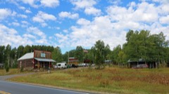 | Columbine | 1.8 miles | 2007 |
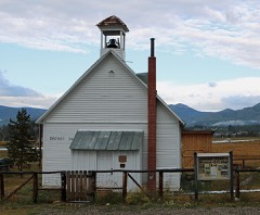 | Hahns Peak Schoolhouse | 5.3 miles | 1974 |
| National Archives record | The nomination case file for reference 04000735 in Record Group 79. |
| Routt County | All 26 listed properties in this county. |