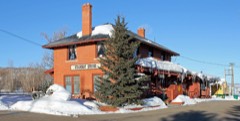
Block
From the record
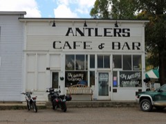
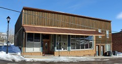
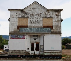
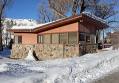
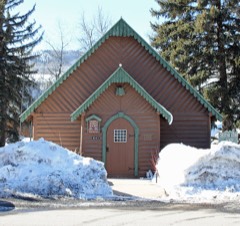
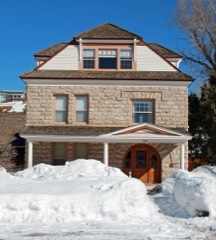
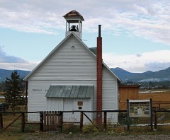
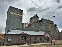
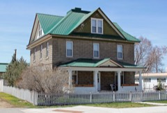
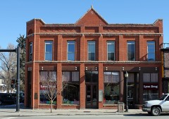
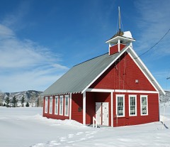
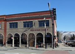
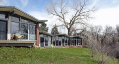
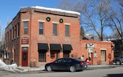
26 National Register listings published here.
Sources: the National Register database, National Park Service
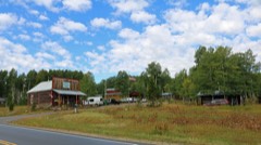
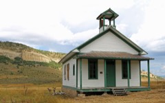
111 topographic sheets cover 24 settlements here, and 26 properties are on the National Register of Historic Places.
26 National Register listings published here.
Sources: the National Register database, National Park Service
Every property in this county listed on the National Register of Historic Places, with the year it was listed and the federal nomination document.
Every wildfire the federal occurrence database records inside this county: 452 of them, burning about 92,862 acres. 251 started naturally and 5 were recorded as arson. Each settlement page carries the fires within five miles of it.
| Reported cause | Fires |
|---|---|
| Natural | 251 |
| Missing data/not specified/undetermined | 73 |
| Recreation and ceremony | 70 |
| Smoking | 18 |
| Debris and open burning | 14 |
| Equipment and vehicle use | 13 |
| Misuse of fire by a minor | 6 |
| Arson/incendiarism | 5 |
| Power generation/transmission/distribution | 1 |
| Fireworks | 1 |
The five largest, by the area the report gives. None of them was recorded as arson.
| Date | Cause | Size | Reported by | Name on the report |
|---|---|---|---|---|
| 6 September 2020 | Natural | 20,517 acres | Medicine Bow-Routt National Forests, Thunder Basin National Grassland | MIDDLE FORK |
| 19 July 2018 | Natural | 20,120 acres | Medicine Bow-Routt National Forests, Thunder Basin National Grassland | SILVER CREEK |
| 12 July 2002 | Natural | 16,852 acres | Medicine Bow-Routt National Forests, Thunder Basin National Grassland | HINMAN |
| 12 August 2002 | Natural | 14,403 acres | Medicine Bow-Routt National Forests, Thunder Basin National Grassland | BURN RIDGE |
| 14 July 2002 | Natural | 4,400 acres | Medicine Bow-Routt National Forests, Thunder Basin National Grassland | GREEN CREEK |
| 4 September 2017 | Natural | 4,222 acres | Northwest District, Craig | DEEP CREEK |
| 19 August 2017 | Natural | 2,940 acres | Medicine Bow-Routt National Forests, Thunder Basin National Grassland | BIG RED |
| 8 July 2001 | Natural | 1,270 acres | Medicine Bow-Routt National Forests, Thunder Basin National Grassland | MAD CREEK |
Every settlement page carries the fires within five miles of it - see the settlement index below.
The NOAA Storm Events Database holds 103 reports for this county, causing no deaths, no injuries and about $303,000 in recorded property damage. Each settlement page carries the reports that name it.
| Kind of event | Reports |
|---|---|
| Thunderstorm Wind | 27 |
| Wildfire | 21 |
| Hail | 19 |
| Flood | 16 |
| Heavy Rain | 10 |
| Tornado | 3 |
| Lightning | 2 |
| Debris Flow | 2 |
| Funnel Cloud | 2 |
| Flash Flood | 1 |
The most serious of them, by death, then injury, then recorded damage. The accounts are quoted exactly as the forecast office filed them.
| When | Event | Place named | Harm | What the report says |
|---|---|---|---|---|
| August 2011 | Hail | Oak Creek | $50,000 | Hail up to the size of golf balls was reported in Oak Creek. |
| September 1997 | Hail | Hayden | $50,000 | no account filed |
| July 2004 | Thunderstorm Wind | Steamboat Spgs | $45,000 | no account filed |
| September 2004 | Thunderstorm Wind | Steamboat Spgs | $40,000 | no account filed |
| June 2009 | Lightning | Yampa | $30,000 | Lightning struck the South Routt Elementary School and started the building on fire. The fire and related damage were confined to the gymnasium. |
| May 2008 | Flood | Columbine | $15,000 | Snowmelt runoff caused some streams and creeks to exceed bankfull. Culverts were overwhelmed in areas and portions of roads were damaged. In some cases, minor flooding and road damage occurred due to snowmelt water that cascaded off slopes above roads. Water 6 to 8 inches deep flowed across some roads. The force of the water caused a section of road between the Elk River Guest Ranch and Vista Verde Guest Ranch to slough off. The damaged road section was about 20 feet wide and plunged 12 to 14 feet down. |
| July 2003 | Thunderstorm Wind | Steamboat Spgs | $15,000 | no account filed |
| April 2006 | Flood | Hayden | $10,000 | no account filed |
| July 2003 | Lightning | Steamboat Spgs | $10,000 | no account filed |
| June 2024 | Thunderstorm Wind | (Hdn)Hayden Arpt | $5,000 | A severe thunderstorm moved through the Hayden area on the evening of the 21st, bringing multiple severe threats including strong to severe winds. The peak gust recorded at KHDN AWOS at Hayden-Yampa Valley Airport was only 48 mph, but there were multiple reports of damage in Hayden proper. This included downed trees and limbs. Reports from local Law Enforcement indicated a tree down, blocking Maple Street. Another downed tree was reported to have crushed a parked car. |
| May 2006 | Flood | Milner | $5,000 | no account filed |
| June 2005 | Hail | Oak Creek | $5,000 | no account filed |
| July 2005 | Heavy Rain | Oak Creek | $5,000 | no account filed |
| June 2003 | Thunderstorm Wind | Steamboat Spgs | $5,000 | no account filed |
| September 1997 | Thunderstorm Wind | Hayden Arpt | $5,000 | no account filed |
| May 1980 | Tornado (F1) | not stated | $2,500 | no account filed |
| May 2023 | Flood | Hitchens | $2,000 | Warm temperatures increased snowmelt and caused flooding on Routt County Road 44 between Highway 40 and Routt County Road 42. The road was closed for an extended period of time. |
| April 2023 | Flood | Hayden | $1,000 | Rapid snowmelt resulted in Dry Creek, which runs underneath Highway 40, coming out of its banks. As a result, Highway 40 was closed and shut down in both directions from Craig to Steamboat Springs due to safety concerns. Schools in Hayden were closed. Flood waters did not recede for several days. |
| April 2023 | Flood | Hayden | $1,000 | Rapid snowmelt resulted in Dry Creek, which runs underneath S Popular Street, coming out of its banks. As a result, S Popular Street near Harvest Drive was closed due to flooding. Flood waters did not recede for several days. |
| June 2016 | Thunderstorm Wind | Steamboat Spgs | $1,000 | Widespread tree damage occurred in Steamboat Springs. One to two foot healthy trees snapped due to winds. |
| April 2024 | Flood | Steamboat Spgs | $500 | Reports from the City of Steamboat Springs on facebook informed followers that the Yampa River Core Trail would be closed periodically due to snowmelt flooding as river levels fluctuated. River levels during this period ranged from 3.5 ft to 4.5 ft, before dropping below 3 ft again. |
| May 2024 | Flood | (Sbs)Steamboat Spgs | - | Social media reports began in late April of nuisance flooding along the Yampa Core Trail, and by the end of the month of May the Grand Junction Service hydrologist visited the area and was able to confirm the flooding was ongoing. River levels increased above the roughly 3.5 foot threshold for this trail flooding on the 14th, and remained above this through the end of the month. Peak river height of roughly 5.25 feet occurred on the 21st before gradually decreasing. A secondary, smaller peak of 4.75 feet occurred on the 29th, likely enhanced by precipitation in the area. |
| May 2023 | Debris Flow | Clark | - | A large mudslide occurred as a result of rapid snowmelt on County Road 129 south of Clark near Fetcher Ranch. |
| May 2023 | Flood | Clark | - | Seedhouse Road in Routt County northeast of Clark was closed between mile markers 3 and 5 as a result of flooding. |
| August 2023 | Funnel Cloud | Yampa | - | A funnel cloud was spotted by several people near Yampa. |
| August 2023 | Flood | Steamboat Spgs | - | Minor flooding occurred in portions of Steamboat Springs as a result of heavy rain from thunderstorms. A CoCoRaHS observer located 1 mile north-northwest of town measured 1.18 inches of rain in 30 minutes. |
| June 2020 | Thunderstorm Wind | Hayden | - | Wind gusts estimated to be in the 70 to 75 mph range uprooted or snapped some trees and blew the roof off of a house. |
| April 2019 | Thunderstorm Wind | (Hdn)Hayden Arpt | - | The automated weather station at the Yampa Valley Airport (KHDN) measured a peak wind gust of 59 mph from outflow winds associated with a strong thunderstorm. |
| June 2018 | Tornado (EF0) | Clark | - | A relatively high-elevation tornado in the Routt National Forest was observed by numerous individuals in Routt County. The rotational winds reached the ground initially near the 8900 foot level. Although the rotational winds were on the ground for no more than a couple of minutes, the associated condensation funnel existed for about 10 minutes. A debris cloud which indicated wind rotation on the ground was observed by some eyewitnesses who photographed the tornado. |
| May 2017 | Debris Flow | Tow Creek | - | A debris flow consisting of dirt and boulders up to 20 feet in diameter came down onto Highway 40 and blocked the road for several hours. |
| July 2017 | Funnel Cloud | Sidney | - | A funnel cloud was photographed just west of Rabbit Ears Pass by a person who was traveling on Highway 40. |
| June 2016 | Thunderstorm Wind | Hayden | - | Hayden ASOS reported 59 mph wind gust. |
| July 2014 | Hail | (Sbs)Steamboat Spgs | - | Quarter size hail was measured 1.5 miles north of the Strawberry Park Elementary school on County Road 36. |
| July 2014 | Hail | (Sbs)Steamboat Spgs | - | Wind blown hail stripped a lot of leaves off trees and accumulated to a depth of two inches. The largest hail stones were the sized of ping pong balls. |
| July 2013 | Heavy Rain | Steamboat Spgs | - | Nearly an inch of rain fell in approximately 30 minutes. |
| July 2013 | Heavy Rain | (Sbs)Steamboat Spgs | - | A rainfall total of 1.53 inches fell within 40 minutes. |
| July 2012 | Heavy Rain | Steamboat Spgs | - | Rainfall for the first 30 minutes measured 1.30 inches, with 1.51 inches reported for the duration of the event. Only minor flooding was reported. |
| July 2012 | Heavy Rain | Steamboat Spgs | - | Rainfall in excess of one and a third inches was reported within about a 30 minute period. Only minor flooding was reported. |
| April 2012 | Thunderstorm Wind | (Hdn)Hayden Arpt | - | Outflow thunderstorm winds gusted to 58 mph at the Yampa Valley Regional Airport. |
| June 2011 | Flood | Columbine | - | Rapid snow melt from a record snow pack over the Northern Colorado mountains allowed many waterways across Routt County to experience increased flows through the entire month of June. Areal flood advisories and warnings were in place to cover numerous small creeks and rivers that met or exceeded bankfull conditions. Flood advisories and warnings were also issued for site specific portions of the Elk River through the the month with the highest flows during the first half of the month and a second peak during the last few days of the month which continued into July. Preliminary data form the USGS shows historical volume and peak flow records were surpassed on this river near Milner. Significant low land flooding was reported across Routt County with some businesses and residences requiring sand bags to keep out flood waters. In rural areas, equipment and animals had to be evacuated by the encroaching water. Many local roads were also impacted with 6 to 12 inches of water being reported over the roadways. |
| July 2011 | Flood | (Sbs)Steamboat Spgs | - | The Elk River dropped below flood stage near Milner on July 1st and the warning was replaced with an areal flood advisoriy to cover this river and other small creeks and streams in northern Routt County. This advisory remained in place through July 10th as the river fluctuated near the flood stage through this time, then began a slow decline through the rest of the month. The river inundated farm and ranch land and the flood waters also encroached on a few residences. Several local and rural roadways were also under water through the first week of July. |
| June 2010 | Hail | Hayden | - | Hail up to 3/4 of an inch in diameter was reported in Hayden. Hail covered the ground for a couple of hours. |
| June 2010 | Heavy Rain | Hitchens | - | Showers and thunderstorms produced over one inch of rain across portions of Routt County, which lead to some minor flooding along the Elk River near Milner. |
| July 2010 | Hail | Hayden | - | Penny sized hail, heavy rainfall and gusty winds were reported near Hayden. The electrical power was temporarily off in the area due to the storm. |
| August 2010 | Hail | Hahns Peak | - | Penny sized hail and brief heavy rain fell at Steamboat Lake State Park. |
| August 2009 | Hail | Clark | - | Hail up to 1.25 inches in diameter pummeled a forested area southeast of Steamboat Lake. |
| May 2008 | Flood | Hitchens | - | The Elk River near Milner exceeded flood stage and water inundated low lying pasture and farm land adjacent to the river. The river also ran above bankfull above Clark. Reports from the Routt County emergency manager indicated some dirt roads had been covered with water. |
| May 2008 | Flood | Steamboat Ii | - | The Elk River near Milner exceeded flood stage and inundated low lying areas adjacent to the river, mainly consisting of pasture and farm land. Flooding continued into the following month. Please see the June 2008 Storm Data publication for a continuation on this event. |
| June 2008 | Flood | Steamboat Ii | - | This event began the last day of May and continued into June. The Elk River near Milner exceeded flood stage inundating low lying areas adjacent to the river, mainly pasture and farm land. |
| July 2007 | Heavy Rain | Hahns Peak | - | Forty minutes of moderate rainfall resulted in some large pools of water in low lying areas within the Hahns Peak community. |
| July 2007 | Heavy Rain | Oak Creek | - | A thunderstorm produced .90 inches of rain in 45 minutes in downtown Oak Creek. |
| April 1997 | Thunderstorm Wind | Steamboat Spgs | - | Several microbursts struck a snow-covered meadow about a mile south of Steamboat Springs, near the western border of Steamboat Ski Area. Huge plumes of snow shot hundreds of feet upward in a swirling motion. Some nearby mature Blue Spruce and Douglas Fir trees were damaged. |
| June 1995 | Tornado (F0) | Steamboat Springs | - | A short lived, but rare tornado downed a tree. |
| July 2014 | Hail | Steamboat Spgs | - | no account filed |
| July 2008 | Hail | Steamboat Spgs | - | no account filed |
| May 2006 | Hail | Steamboat Spgs | - | no account filed |
| April 2005 | Thunderstorm Wind | Steamboat Spgs | - | no account filed |
| June 2005 | Thunderstorm Wind | Steamboat Spgs | - | no account filed |
| July 2005 | Hail | Oak Creek | - | no account filed |
| May 2004 | Thunderstorm Wind | Hayden | - | no account filed |
The Survey's mineral resources record lists 157 workings inside this county. 8 still produce and 149 are closed or unrecorded. Each settlement page carries the workings within five miles of it.
| Commodity | Workings |
|---|---|
| Gold | 50 |
| Sand and Gravel, Construction | 44 |
| Silver | 26 |
| Copper | 14 |
| Uranium | 10 |
| Zinc | 10 |
| Copper, Gold, Lead, Silver | 5 |
| Lead, Zinc | 4 |
| Lead | 3 |
| Mica | 2 |
| Clay | 2 |
| REE | 2 |
| Copper, Molybdenum | 2 |
| Stone, Dimension | 2 |
The least common of them first, because a county's hundredth gravel pit says nothing its first ten did not.
| Where | Site | Commodity | Status | Recorded |
|---|---|---|---|---|
| 7d Tunnel | Zinc, Gold, Lead, Silver, Copper | Occurrence | ||
| Ace High Claims | Copper, Vanadium, Uranium | Occurrence | 1955 | |
| Copper King | Copper, Lead, Silver, Gold | Past Producer | 1900, 1910 | |
| Dennis D Claims | Uranium, Rhenium | Occurrence | Euxenite | |
| Elkhorn | Silver, Copper, Gold, Lead, Zinc | Past Producer | ||
| Farwell Mtn. | Molybdenum, Copper, Gold, Silver | Occurrence | Chalcopyrite, Molybdenite | |
| Floyd Peak Adit | Copper, Gold, Silver | Occurrence | ||
| Greenville Shaft | Lead, Zinc, Silver, Gold, Copper | Prospect | ||
| Hahns Peak District | Gold, Silver, Lead, Zinc, Copper, Molybdenum | Prospect | Galena, Pyrite, Sphalerite, Tetrahedrite | |
| King Solomon Creek | Lead, Zinc, Silver, Copper, Bismuth, Gold | Occurrence | ||
| Mccoy Pit & Quarry | Pumice | Past Producer | ||
| Royal Flush Mine | Gold, Copper, Lead, Silver | Past Producer | ||
| Slavonia Mine | Mica, Zinc, Lead, Beryllium | Past Producer | ||
| Sunset Claims | Copper, Gold | Occurrence | Copper, Gold | |
| Three Forks | Silver, Copper, Gold, Lead | Occurrence | ||
| Tom Thumb Mine | Silver, Lead, Gold | Past Producer | ||
| Unknown | Stone, Crushed/Broken | Occurrence | Sedimentary | |
| Unknown | Limestone, General | Occurrence | Limestone | |
| Unknown | Zinc, Silver, Copper, Lead, Gold | Occurrence | ||
| Unknown Quarry | Stone | Past Producer | ||
| Unnamed | Uranium, Thorium | Occurrence | ||
| Campbell Tunnel and Shaft | Copper, Gold, Molybdenum, Silver | Occurrence | ||
| Colo. Mining Co. | Copper, Molybdenum | Occurrence | ||
| Copper Spur | Copper, Gold, Lead, Silver | Prospect | ||
| Emancipation Group | Copper, Molybdenum | Past Producer | ||
| Farwell Mine | Copper, Molybdenum | Past Producer | ||
| Farwell Mountain Northwest | Copper, Gold, Lead, Silver | Occurrence | ||
| King Lode Claims | Mica | Occurrence | Mica | |
| Routt Hot Springs | Geothermal | Unknown | ||
| Soda Creek | Uranium, REE | Occurrence | ||
| Steamboat Springs | Geothermal | Unknown | ||
| Temple Prospect | REE | Occurrence | Monazite | |
| Unknown | Clay | Occurrence | ||
| Unknown | Stone, Dimension | Occurrence | Scoria | |
| Unknown | Clay | Occurrence | Clay | |
| Unknown | Stone, Dimension | Occurrence | Scoria | |
| Unknown | Copper, Gold, Molybdenum, Silver | Occurrence | ||
| Unknown | Zinc, Copper, Lead | Occurrence | ||
| Zinc Mountain | Zinc, Copper, Lead | Occurrence | ||
| Unknown | Lead, Zinc | Past Producer | ||
| Unknown | Silver, Lead, Zinc | Occurrence | ||
| Unknown | Silver, Lead, Zinc | Occurrence | ||
| Unknown | Silver, Lead, Zinc | Occurrence | ||
| Whiskey Park | Silver, Lead, Zinc | Occurrence | ||
| Beryl Mountain | Zinc, Copper, Gold, Lead, Silver | Occurrence | ||
| Greenville Mine | Zinc, Copper, Gold, Lead, Silver | Past Producer | ||
| Lower Slavonia | Zinc, Copper, Gold, Lead, Silver | Occurrence | ||
| Oro Cache | Zinc, Copper, Gold, Lead, Silver | Occurrence | ||
| Price Tunnel | Zinc, Copper, Gold, Lead, Silver | Past Producer | ||
| Dennis D. Claims | Uranium | Occurrence | ||
| Fair-U | Uranium | Occurrence | ||
| Fair-U No. 1,2 | Uranium | Occurrence | ||
| South Fork Soda Creek | Uranium | Occurrence | ||
| Success | Uranium | Occurrence | ||
| Unknown | Uranium | Occurrence | ||
| Unknown | Uranium | Occurrence | ||
| Unknown | Uranium | Occurrence | ||
| Buffalo Pass | Copper, Gold | Occurrence | ||
| Buffalo Pass Road | Copper, Gold | Occurrence | ||
| Cole Mine | Copper | Producer | ||
| Copper Ridge | Copper, Gold | Occurrence | ||
| Slate Creek | Copper, Gold | Occurrence | ||
| Elkhorn Mine | Silver | Occurrence | Silver | |
| Hahns Peak Central area | Gold, Silver | Occurrence | ||
| Hahns Peak NE area | Gold, Silver | Occurrence | ||
| Hahns Peak NW area | Gold, Silver | Occurrence | ||
| Iron Mountain | Silver, Gold | Occurrence | ||
| King Solomon Creek | Silver, Gold | Occurrence | ||
| Little Snake | Silver, Gold | Occurrence | ||
| Master Key | Silver | Occurrence | Silver | |
| Master Key Mine | Silver, Gold | Past Producer | ||
| Middle Fork Lode | Silver, Gold | Occurrence | ||
| Minnie D. | Silver | Producer | Gold, Lead, Silver | |
| Minnie D. | Silver, Gold | Past Producer | ||
| Royal Flush Mine | Silver | Occurrence | Silver | |
| Southern Cross Mine | Silver | Occurrence | ||
| Tom Thumb | Silver | Occurrence | Gold, Lead, Silver | |
| Twin Mountain | Silver, Gold | Occurrence | ||
| Unknown | Silver | Occurrence | Silver | |
| Unknown | Silver, Gold | Occurrence | ||
| Unknown | Silver, Gold | Occurrence | ||
| Bear River Sand & Gravel | Sand and Gravel, Construction | Past Producer | ||
| Hayden #1 | Sand and Gravel, Construction | Past Producer | ||
| Hogue Pit & Plant | Sand and Gravel, Construction | Producer | ||
| Thompson Pit | Sand and Gravel, Construction | Producer | ||
| Unknown | Sand and Gravel, Construction | Occurrence | Gravel | |
| Unknown | Sand and Gravel, Construction | Occurrence | Sedimentary | |
| Unknown | Sand and Gravel, Construction | Occurrence | Gravel | |
| Unknown | Sand and Gravel, Construction | Occurrence | Gravel | |
| Unknown | Sand and Gravel, Construction | Occurrence | Gravel | |
| Unknown | Sand and Gravel, Construction | Occurrence | Gravel | |
| Unknown Borrow Pit | Sand and Gravel, Construction | Past Producer | ||
| Unknown Borrow Pit | Sand and Gravel, Construction | Past Producer | ||
| Unknown Gravel Pit | Sand and Gravel, Construction | Past Producer | ||
| Unknown Gravel Pit | Sand and Gravel, Construction | Past Producer | ||
| Unknown Gravel Pit | Sand and Gravel, Construction | Past Producer | ||
| Unknown Gravel Pit | Sand and Gravel, Construction | Past Producer | ||
| Unknown Gravel Pit | Sand and Gravel, Construction | Past Producer | ||
| Unknown Gravel Pit | Sand and Gravel, Construction | Past Producer | ||
| Unknown Gravel Pit | Sand and Gravel, Construction | Past Producer | ||
| Unknown Gravel Pit | Sand and Gravel, Construction | Producer | ||
| Unknown Gravel Pit | Sand and Gravel, Construction | Past Producer | ||
| Unknown Gravel Pit | Sand and Gravel, Construction | Past Producer | ||
| Unknown Gravel Pit | Sand and Gravel, Construction | Producer | ||
| Unknown Gravel Pit | Sand and Gravel, Construction | Past Producer | ||
| Unknown Gravel Pit | Sand and Gravel, Construction | Past Producer | ||
| Unknown Gravel Pit | Sand and Gravel, Construction | Past Producer | ||
| Unknown Gravel Pit | Sand and Gravel, Construction | Past Producer | ||
| Unknown Gravel Pit | Sand and Gravel, Construction | Past Producer | ||
| Unknown Gravel Pit | Sand and Gravel, Construction | Past Producer | ||
| Unknown Gravel Pit | Sand and Gravel, Construction | Past Producer | ||
| Unknown Gravel Pit | Sand and Gravel, Construction | Past Producer | ||
| Unknown Gravel Pit | Sand and Gravel, Construction | Past Producer | ||
| Unknown Gravel Pit | Sand and Gravel, Construction | Past Producer | ||
| Unknown Gravel Pit | Sand and Gravel, Construction | Past Producer | ||
| Unknown Gravel Pit | Sand and Gravel, Construction | Producer | ||
| Unknown Gravel Pit | Sand and Gravel, Construction | Past Producer | ||
| Unknown Gravel Pit | Sand and Gravel, Construction | Past Producer | ||
| Unknown Gravel Pit | Sand and Gravel, Construction | Past Producer | ||
| Unknown Gravel Pit | Sand and Gravel, Construction | Past Producer | ||
| Unknown Gravel Pit | Sand and Gravel, Construction | Past Producer | ||
| Unknown Gravel Pit | Sand and Gravel, Construction | Past Producer | ||
| Unknown Gravel Pit | Sand and Gravel, Construction | Past Producer | ||
| Unknown Gravel Pit | Sand and Gravel, Construction | Past Producer | ||
| Unknown Gravel Pit | Sand and Gravel, Construction | Producer | ||
| Acme Placer | Gold | Occurrence | Placer | |
| Acme Placer | Gold | Past Producer | ||
| Barnum, Hornet, Lamm Placers | Gold | Occurrence | Placer | |
| Bell Placer | Gold | Occurrence | Placer | |
| Blackburn, El Capitan, Ben Harrison Placers | Gold | Occurrence | Placer | |
| Blue Jay | Gold | Occurrence | Placer | |
| Blue Jay Mine | Gold | Past Producer | ||
| Cap Smith Hill | Gold | Occurrence | ||
| Columbine Placer | Gold | Occurrence | Placer | |
| Concord, Belmont, Nettie Marrin Placers | Gold | Occurrence | Placer | |
| Gate, Jgb, Grover Clevland, Ben Harrison, El Capitan Placers | Gold | Occurrence | Placer | |
| Gold Bond, Keystone Placers | Gold | Occurrence | Placer | |
| Hornet | Gold | Occurrence | Placer | |
| Iron Springs Mine | Gold | Past Producer | ||
| Keystone, Marrin Placers | Gold | Occurrence | Gold | |
| Little Mountain | Gold | Occurrence | ||
| Poverty Bar | Gold | Occurrence | Placer | |
| Southern Cross Tunnel | Gold | Occurrence | ||
| Twin Mountain Placers | Gold | Occurrence | Placer | |
| Unknown | Gold | Occurrence | ||
| Unknown | Gold | Occurrence | Placer | |
| Unknown | Gold | Occurrence | Placer | |
| Unknown | Gold | Occurrence | Gold | |
| Unknown | Gold | Occurrence | Gold | |
| Unknown | Gold | Occurrence | Placer | |
| Unknown | Gold | Occurrence | Placer | |
| Unknown | Gold | Occurrence | Gold | |
| Unknown | Gold | Occurrence | ||
| Unknown | Gold | Occurrence | ||
| Unknown | Gold | Occurrence | ||
| Unknown Placer | Gold | Past Producer | ||
| Ways Gulch Placer | Gold | Occurrence | Placer |
Named settlements recorded in the Geographic Names Information System, each with the topographic sheets covering it. Villages, hamlets and abandoned places alike. Each is shown with the nearest named watercourse or landform and the survey quadrangle it falls on.
Hayden census division · 81653 · On Cantling Creek · Cottonwood Rim quadrangle
17 sheets, 1932 to 1988
Hayden census division · 80487 · Near Coal View Gulch · Milner quadrangle
19 sheets, 1924 to 1979
No longer a settlement
Steamboat Springs census division · 80428 · Near Cottonwood Gulch · Clark quadrangle
20 sheets, 1911 to 2000
Steamboat Springs census division · 80428 · Near Trilby Flats · Hahns Peak quadrangle
20 sheets, 1911 to 2000
Hayden census division · 81639 · Near Williams Park · Dunckley quadrangle
20 sheets, 1924 to 2000
Hayden census division · 81639 · Near Bull Gulch · Quaker Mountain quadrangle
21 sheets, 1923 to 2000
Steamboat Springs census division · 80428 · Near Cottonwood Gulch · Clark quadrangle
20 sheets, 1911 to 2000
Hayden census division · 81639 · Near Coal Bank Gulch · Hayden quadrangle
17 sheets, 1916 to 1979
Steamboat Springs census division · 80487 · On Mad Creek · Mad Creek quadrangle
18 sheets, 1911 to 2000
Hayden census division · 80487 · On Cheney Creek · Milner quadrangle
19 sheets, 1924 to 1979
Steamboat Springs census division · 80487 · Near Little Cheney Gulch · Milner quadrangle
19 sheets, 1924 to 1979
Hayden census division · 80487 · On Grassy Creek · Mount Harris quadrangle
17 sheets, 1924 to 1979
Steamboat Springs census division · 80487 · Near Rattlesnake Butte · Mad Creek quadrangle
18 sheets, 1911 to 2000
Hayden census division · 81639 · Near Berry Gulch · Pagoda quadrangle
19 sheets, 1916 to 2000
Oak Creek census division · 80469 · On Whipple Creek · Yampa quadrangle
13 sheets, 1954 to 2000
Steamboat Springs census division · 80487 · On Mica Creek · Mount Zirkel quadrangle
23 sheets, 1911 to 2000
Steamboat Springs census division · 80487 · On Slate Creek · Mad Creek quadrangle
18 sheets, 1911 to 2000
Steamboat Springs census division · 80487 · On Butcherknife Creek · Steamboat Springs quadrangle
12 sheets, 1954 to 1980
Yampa census division · 80479 · On Newcomer Creek · Toponas quadrangle
14 sheets, 1954 to 2000
The vanished settlements of Routt County: the places named above that are no longer on the map.