 Block
From the record
One of 38 National Register listings published here for Pitkin County · listed in 2022 · category: District.
Sources: the National Register database, National Park Service
Listed on the National Register of Historic Places in 2022.
One of 38 National Register listings published here for Pitkin County · listed in 2022 · category: District.
Sources: the National Register database, National Park Service
Regional context, not property-specific evidence. The federal wildfire occurrence database lists 37 fires within 5 miles of Soldner Home and Studio between 1994 and 2020, burning about 8 acres in total. 6 started naturally. None was recorded as arson. Distance is straight-line from the map coordinates, so a fire counted here may appear on a neighbouring settlement's page as well.
| Reported cause | Fires |
|---|---|
| Missing data/not specified/undetermined | 26 |
| Natural | 6 |
| Recreation and ceremony | 2 |
| Equipment and vehicle use | 2 |
| Misuse of fire by a minor | 1 |
The most recent of them, most recent first, with the day each was reported and the service that recorded it.
| Date | Cause | Size | Reported by | Name on the report |
|---|---|---|---|---|
| 6 September 1995 | Natural | under an acre | White River National Forest | STEEP BEAVER |
| 26 September 2016 | Recreation and ceremony | under an acre | White River National Forest | CONGO |
| 2 September 2011 | Missing data/not specified/undetermined | under an acre | Colorado State Forest Service-State Headquarters | ASPEN |
| 15 August 2001 | Equipment and vehicle use | under an acre | White River National Forest | SNOWMASS INCIDENT |
| 11 August 2016 | Natural | under an acre | White River National Forest | HUNTER CREEK VALLEY |
| 4 July 2011 | Missing data/not specified/undetermined | under an acre | Colorado State Forest Service-State Headquarters | ASPEN |
| 21 July 2000 | Natural | under an acre | White River National Forest | DAISY |
| 17 July 2002 | Natural | under an acre | White River National Forest | BUTTERMILK |
Regional context, not property-specific evidence. The federal mineral resources record lists 141 workings within 5 miles of Soldner Home and Studio: 133 past producers, 6 producers, 2 occurrences. 6 still produce. What was taken out: Silver, Lead, Silver, Lead, Zinc, Zinc. Distance is straight-line from the map coordinates, so a quarry counted here may appear on a neighbouring settlement's page as well.
| Where | Site | Commodity | Status | Recorded |
|---|---|---|---|---|
| A M T & D Co Tunnel | Silver, Lead, Calcium | Past Producer | ||
| A-J Tunnel | Lead, Calcium, Silver, Stone | Past Producer | ||
| Argentum-Juanita Incline | Silver, Clay, Calcium | Past Producer | ||
| Aspen | Silver, Lead, Gold, Zinc, Platinum | Past Producer | Galena | |
| Aspen | Silver, Calcium, Lead, Stone | Past Producer | ||
| Aspen District | Silver, Lead, Zinc, Copper, Gold, Manganese, Cadmium, Uranium, Arsenic, Antimony, Platinum | Past Producer | 1879, 1882, 1968 | |
| Bushwacker Shaft | Silver, Lead, Clay, Calcium | Past Producer | ||
| Compromise Mg Co | Silver, Calcium, Clay | Past Producer | ||
| Della's | Silver, Calcium, Clay, Lead | Past Producer | ||
| Dubuque Tunnel | Copper, Lead | Occurrence | Vein |
Regional context, not property-specific evidence. The National Weather Service names Aspen, the town this property stands in, in 12 storm reports between 1997 and 2023: 4 lightning, 4 flash flood, 2 debris flow, 1 thunderstorm wind. The reports record 1 death and 3 injuries. Each account below is quoted exactly as the forecast office filed it, from the NOAA Storm Events Database, and each date opens the federal record of that event.
| When | Event | Place named | Harm | What the report says |
|---|---|---|---|---|
| July 1997 | Lightning | Aspen | 1 killed | no account filed |
| July 2008 | Lightning | Aspen | 2 hurt | A family of five from Idaho were all struck by lightning while hiking on the American Lake Trail, about 9.5 miles south of Aspen. A 15-year-old girl was revived after being administered CPR. A 17-year-old boy was burned on the soles of his feet. The other three family members did not receive any significant injuries. |
| July 2000 | Lightning | Aspen | 1 hurt | no account filed |
| July 2023 | Debris Flow | Aspen | $5,000 | Debris of mud and rock fell across portions of the Rio Grande Trail outside of Aspen as a result of heavy rain from thunderstorms. |
| August 2021 | Debris Flow | Aspen | $5,000 | Pitkin County Sheriff reported the closure of Independence Pass along Colorado Highway 82 between mile markers 47 and 72 due to mudslides. |
| July 2007 | Flash Flood | Aspen | $5,000 | Heavy rain caused water and debris to flow down a normally dry drainage running through the Maroon Creek Day Use Area provided by the USFS. The water and debris average depth was 5 feet with a width of 30 feet. The flash flood hit the Maroon Creek Road and a trailhead parking lot where it spread out about 100 feet wide, clogging culverts and burying the road and day-use area under 1 to 2 feet of debris. Improved trails were destroyed and tons of debris had to be removed from the road and day-use area. Additionally, hailstones up to 1/2 inch diameter accompanied the heavy rain. There were people camping nearby in tents when the event occurred. |
| July 2006 | Lightning | Aspen | $2,000 | no account filed |
| July 2007 | Heavy Rain | Aspen | - | Minor flooding and rockslides occurred on Highway 82 just east of Aspen. |
| June 2005 | Thunderstorm Wind | Aspen | - | no account filed |
| August 2001 | Flash Flood | Aspen | - | no account filed |
| July 1998 | Flash Flood | Aspen | - | no account filed |
| July 1998 | Flash Flood | Aspen | - | no account filed |
No historic map-sheet match is published for this property yet. That does not mean no map exists. This record needs a coordinate-quality review before it can be joined to a sheet boundary. Browse the county's mapped places while that work is pending.
Other National Register properties close enough to walk or drive between, ordered by distance from this one. Both positions come from the same geocoding pass that matched these properties to their map sheets.
| Photograph | Property | Distance | Listed |
|---|---|---|---|
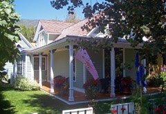 | Samuel I. Hallett House | 1.4 miles | 1987 |
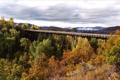 | Maroon Creek Bridge | 1.5 miles | 1985 |
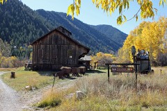 | Holden Mining and Smelting Co. | 1.6 miles | 1990 |
| Berger Cabin | 1.6 miles | 2025 | |
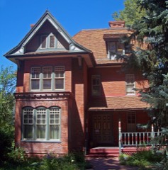 | Wheeler-Stallard House | 1.8 miles | 1975 |
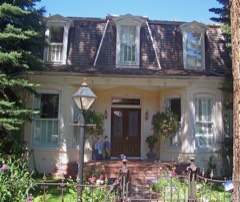 | Henry Webber House-Pioneer Park | 1.9 miles | 1987 |
| National Archives record | The nomination case file for reference 100006799 in Record Group 79. |
| Pitkin County | All 38 listed properties in this county. |