 Block
From the record
38 National Register listings published here.
Sources: the National Register database, National Park Service
75 topographic sheets cover 17 settlements here, and 38 properties are on the National Register of Historic Places.
38 National Register listings published here.
Sources: the National Register database, National Park Service
Every property in this county listed on the National Register of Historic Places, with the year it was listed and the federal nomination document.
| Photograph | Property | Type | Listed | Reference |
|---|---|---|---|---|
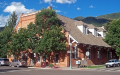 | Armory Hall, Fraternal Hall | building | 1975 | 75000529 |
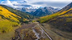 | Ashcroft, Colorado | site | 1975 | 75000533 |
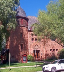 | Aspen Community Church | building | 1975 | 75000530 |
| Berger Cabin | building | 2025 | 100011303 | |
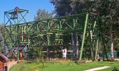 | Boat Tow | object | 1990 | 90000866 |
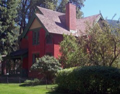 | Bowles-Cooley House | building | 1987 | 87000188 |
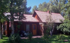 | Matthew Callahan Log Cabin | building | 1987 | 87000150 |
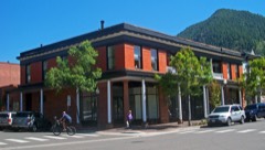 | Collins Block-Aspen Lumber and Supply | building | 1987 | 87000191 |
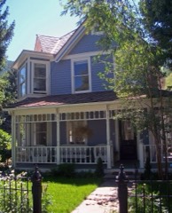 | Dixon-Markle House | building | 1987 | 87000165 |
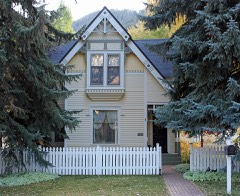 | D. E. Frantz House | building | 1987 | 87000152 |
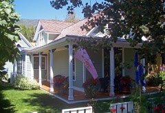 | Samuel I. Hallett House | building | 1987 | 87000155 |
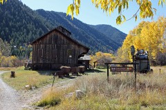 | Holden Mining and Smelting Co. | district | 1990 | 90000867 |
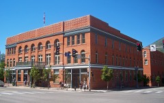 | Hotel Jerome | building | 1986 | 86000459 |
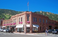 | Hyman-Brand Building | building | 1985 | 85000085 |
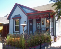 | Thomas Hynes House | building | 1987 | 87000157 |
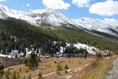 | Independence and Independence Mill Site | district | 1973 | 73000484 |
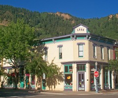 | La Fave Block | building | 1987 | 87000193 |
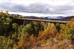 | Maroon Creek Bridge | structure | 1985 | 85000222 |
 | New Brick-The Brick Saloon | building | 1987 | 87000185 |
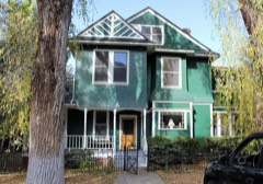 | Newberry House | building | 1987 | 87000158 |
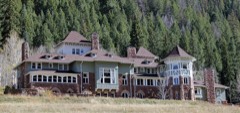 | Osgood Castle | building | 1971 | 71000216 |
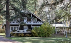 | Osgood Gamekeeper's Lodge | building | 1989 | 89000933 |
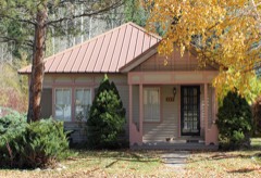 | Osgood-Kuhnhausen House | building | 1983 | 83001327 |
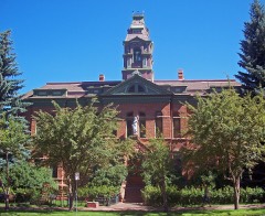 | Pitkin County Courthouse | building | 1975 | 75000531 |
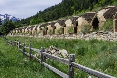 | Redstone Coke Oven Historic District | district | 1990 | 89002385 |
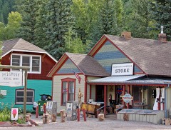 | Redstone Historic District | district | 1989 | 89000934 |
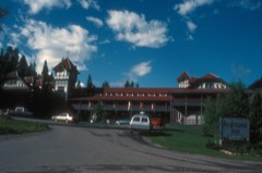 | Redstone Inn | building | 1980 | 80000920 |
 | Riede's City Bakery | building | 1987 | 87000182 |
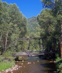 | Sheely Bridge | structure | 1985 | 85000223 |
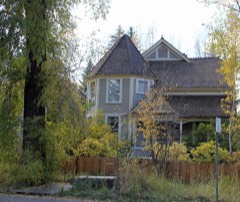 | Shilling-Lamb House | building | 1987 | 87000163 |
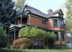 | Smith-Elisha House | building | 1989 | 87002121 |
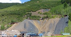 | Smuggler Mine | site | 1987 | 87000194 |
| Soldner Home and Studio | district | 2022 | 100006799 | |
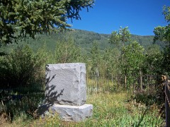 | Ute Cemetery | site | 2002 | 02000291 |
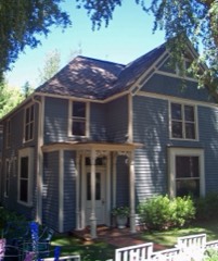 | Davis Waite House | building | 1987 | 87000160 |
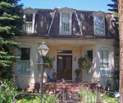 | Henry Webber House-Pioneer Park | building | 1987 | 87000189 |
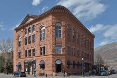 | Wheeler Opera House | building | 1972 | 72000276 |
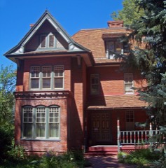 | Wheeler-Stallard House | building | 1975 | 75000532 |
Every wildfire the federal occurrence database records inside this county: 220 of them, burning about 4,244 acres. 99 started naturally and 1 was recorded as arson. Each settlement page carries the fires within five miles of it.
| Reported cause | Fires |
|---|---|
| Natural | 99 |
| Missing data/not specified/undetermined | 70 |
| Recreation and ceremony | 32 |
| Power generation/transmission/distribution | 10 |
| Debris and open burning | 3 |
| Equipment and vehicle use | 2 |
| Misuse of fire by a minor | 1 |
| Fireworks | 1 |
| Smoking | 1 |
| Arson/incendiarism | 1 |
The five largest, by the area the report gives. None of them was recorded as arson.
| Date | Cause | Size | Reported by | Name on the report |
|---|---|---|---|---|
| 3 July 2018 | Missing data/not specified/undetermined | 3,070 acres | Denver County | LAKE CHRISTINE FIRE |
| 21 October 2019 | Natural | 720 acres | White River National Forest | GRANITE LAKE |
| 5 September 2002 | Natural | 171 acres | White River National Forest | THOMPSON CREEK |
| 30 October 2003 | Power generation/transmission/distribution | 48 acres | Northwest District, Grand Junction | PITKINCO 2 |
| 2 October 2011 | Natural | 37 acres | Northwest District, Grand Junction | WINGO |
| 3 August 1992 | Natural | 35 acres | White River National Forest | not named |
| 16 July 2005 | Natural | 31 acres | White River National Forest | FRYING PAN WFU |
| 5 April 2002 | Missing data/not specified/undetermined | 30 acres | Northwest District, Grand Junction | PITKIN ASSIST 1 |
Every settlement page carries the fires within five miles of it - see the settlement index below.
The NOAA Storm Events Database holds 79 reports for this county, causing 2 deaths, 3 injuries and about $1,177,000 in recorded property damage. Each settlement page carries the reports that name it.
| Kind of event | Reports |
|---|---|
| Flash Flood | 25 |
| Debris Flow | 25 |
| Thunderstorm Wind | 9 |
| Heavy Rain | 6 |
| Hail | 5 |
| Lightning | 4 |
| Flood | 4 |
| Tornado | 1 |
The most serious of them, by death, then injury, then recorded damage. The accounts are quoted exactly as the forecast office filed them.
| When | Event | Place named | Harm | What the report says |
|---|---|---|---|---|
| May 2023 | Flood | Snowmass | 1 killed | The Roaring Fork River ran high and fast as a result of accelerated snowmelt. Rescuers were unable to resuscitate a person they recovered from the river near the Lazy Glen subdivision after strong, runoff-fueled currents carried the victim downstream roughly 1 1/2 to 2 miles. It did not appear the person had been in a water vessel like a boat or raft. The incident had the makings of someone falling into the river from its banks, but that wasnt a certainty. Age and gender of victim is unknown. |
| July 1997 | Lightning | Aspen | 1 killed | no account filed |
| July 2008 | Lightning | Aspen | 2 hurt | A family of five from Idaho were all struck by lightning while hiking on the American Lake Trail, about 9.5 miles south of Aspen. A 15-year-old girl was revived after being administered CPR. A 17-year-old boy was burned on the soles of his feet. The other three family members did not receive any significant injuries. |
| July 2000 | Lightning | Aspen | 1 hurt | no account filed |
| July 2021 | Debris Flow | Redstone | $500,000 | Several mudslides occurred along Colorado Highway 133 near Redstone as a result of heavy rains. Debris depth was 7 to 8 feet with one slide and 3 to 4 feet deep with another. As a result, motorists were stranded until cleanup operations were complete. |
| July 2021 | Debris Flow | Redstone | $300,000 | Heavy rains resulted in a debris flow of mud, branches and rocks across Avalanche Creek Road. The road remained closed and impassable overnight before reopening the next morning. |
| July 1999 | Flash Flood | Redstone | $150,000 | no account filed |
| July 2021 | Debris Flow | Redstone | $50,000 | Mudslides occurred on Colorado Highway 133 at Redstone Boulevard, 9 miles north of McClure Pass near mile marker 55. The highway was closed in both directions for almost twelve hours due to cleanup operations. |
| July 2006 | Flash Flood | Snowmass | $40,000 | no account filed |
| July 1999 | Flash Flood | Redstone | $30,000 | no account filed |
| July 2021 | Debris Flow | Redstone | $25,000 | A debris flow of mud, rocks and trees occurred along Colorado Highway 133 north of Redstone as a result of heavy rains. The road was closed for several hours due to cleanup operations. |
| June 1975 | Tornado (F2) | not stated | $25,000 | no account filed |
| June 2011 | Flood | Snowmass | $10,000 | Area creeks across Pitkin County responded to rapid snowmelt and ran at elevated levels through much of June. Areas adjacent to the Crystal river were impacted through the middle part of the month when flood advisories were in effect for near bankfull conditions. The river also briefly spiked above flood stage on June 6th near Redstone. Low land flooding was reported along the Crystal river with water and debris reaching the bottom of several bridges between Restone and Carbondale. |
| July 2021 | Debris Flow | Redstone | $7,500 | Mudslides occurred as a result of heavy rains along Colorado Highway 133 near Redstone and Swiss Village. The highway was closed for a couple of hours due to cleanup operations. |
| June 2023 | Flood | (Ase)Aspen Arpt | $5,000 | Accelerated snowmelt resulted in the development of a sinkhole on the edge of Brush Creek Road immediately downhill of Lower Kearns Road in Snowmass Village. The road was closed for a short while before being reopened a day or so later. |
| July 2023 | Debris Flow | Aspen | $5,000 | Debris of mud and rock fell across portions of the Rio Grande Trail outside of Aspen as a result of heavy rain from thunderstorms. |
| August 2021 | Debris Flow | Aspen | $5,000 | Pitkin County Sheriff reported the closure of Independence Pass along Colorado Highway 82 between mile markers 47 and 72 due to mudslides. |
| July 2007 | Flash Flood | Aspen | $5,000 | Heavy rain caused water and debris to flow down a normally dry drainage running through the Maroon Creek Day Use Area provided by the USFS. The water and debris average depth was 5 feet with a width of 30 feet. The flash flood hit the Maroon Creek Road and a trailhead parking lot where it spread out about 100 feet wide, clogging culverts and burying the road and day-use area under 1 to 2 feet of debris. Improved trails were destroyed and tons of debris had to be removed from the road and day-use area. Additionally, hailstones up to 1/2 inch diameter accompanied the heavy rain. There were people camping nearby in tents when the event occurred. |
| July 2008 | Heavy Rain | Woody Creek | $3,000 | Heavy rain resulted in minor flooding of two homes along Lower River Road near mile marker 27. |
| September 1997 | Flash Flood | Snowmass | $3,000 | no account filed |
| July 2022 | Debris Flow | Redstone | $2,000 | A mudslide occurred on Colorado Highway 133 near Redstone at mile marker 57 as a result of heavy rain from thunderstorms. |
| August 2017 | Heavy Rain | Snowmass | $2,000 | A series of strong thunderstorms produced torrential rainfall in the Elk Run subdivision which resulted in water that flowed into several homes. A home on Red Tail Court took the brunt of water flowing off the hillside and had two feet of water in the lower level. Some of the streets in Elk Run were coated with as much as 6 inches of mud. Radar estimated 1 to 1.5 inches of rain fell throughout the day. |
| July 2007 | Flash Flood | Redstone | $2,000 | Heavy rain producing thunderstorms caused flash flooding across a forest service road between Highway 133 and the Avalanche Creek Campground. About 3 feet of debris was deposited on the road in the wake of the flash flood. Dozens of campers were stranded in the campground until the next day. |
| July 2006 | Lightning | Aspen | $2,000 | no account filed |
| September 1997 | Flash Flood | Redstone | $2,000 | no account filed |
| May 2023 | Flood | Snowmass | $1,000 | Warm temperatures increased snowmelt and caused flooding on the lower Prince Creek trails, which ran along Prince Creek. High water submerged bridges and led to damage on the trails. |
| August 2022 | Debris Flow | Redstone | $1,000 | A mudslide occurred on Colorado Highway 133 near Redstone due to heavy rain which resulted in both lanes of traffic being closed due to cleanup operations. |
| May 2023 | Debris Flow | (Ase)Aspen Arpt | $500 | Warm temperatures increased snowmelt and caused a debris flow on unsettled slopes on the Rio Grande Trail in Snowmass Canyon. The trail ran along the Roaring Fork River. |
| July 2022 | Debris Flow | Woody Creek | $500 | A minor debris flow occurred on the Jaffee Connector Trail between Jaffee Park and the Rio Grande Trail in Pitkin County as a result of heavy rain from thunderstorms. |
| July 2022 | Debris Flow | Snowmass | $500 | A debris flow several inches thick of mud and rocks occurred on portions of the Rio Grande Trail in Pitkin County as a result of heavy rain from thunderstorms. |
| May 2025 | Thunderstorm Wind | Snowmass | - | The Colorado Department of Transportation mesonet site 082w023 Basalt-Holland Hills recorded a wind gust to 75 mph at 1:58 PM MDT. This gust was associated with ongoing afternoon thunderstorms over the adjacent higher terrain. No reports of injuries, damages, or fatalities were received. |
| July 2025 | Debris Flow | Redstone | - | A mudslide occurred on Highway 133 due to heavy rainfall from a thunderstorm at mile marker 59.5. Radar estimated that 0.7 to 1.4 inches of rain fell within the drainage above Highway 133. The mudslide was reported at 1530 MST. |
| August 2025 | Debris Flow | Redstone | - | Two rock/mud slides were reported on Highway 133, about 10 miles south of Carbondale, between mile-markers 60 and 63. The road was reported as passable but with mud and debris on the road as of approximately 10:20 AM MDT. Reports from the Colorado Department of Transportation. Road was not closed, but did require clean-up. No reports of injuries or fatalities were received. |
| August 2025 | Debris Flow | Snowmass | - | As of approximately 10:10 AM MDT, two rock slides were reported to have occurred on Highway 82 in Snowmass Canyon. No road closures were reported, and no damages occurred. Road did have to be cleared. No injuries or fatalities were reported. |
| October 2025 | Debris Flow | Woody Creek | - | Heavy rain caused mud and rockslides on Frying Pan Road in Pitkin County. Road closed at 511 MST and was reopened by 623 MST. |
| October 2025 | Debris Flow | Redstone | - | Radar indicated heavy rain between 0300 and 0400 MST. This heavy rain caused multiple mudslides to occur around 0400 MST between Carbondale and Redstone along Highway 133 centered around mile marker 55.7. Another one occurred at mile marker 53 within this similar timeframe. One vehicle was stuck in the mudslide but not buried. No indication of how deep or wide the slide was but clean up took longer than usual due to the stuck vehicle. Road reopened in both directions at 0917 MST. |
| August 2024 | Debris Flow | Redstone | - | Multiple mudslides were reported by local law enforcement near Redstone, CO. These mudslides followed the Crystal River valley, along State Highway 133 near mile marker 53. This is roughly 1 mile north of Redstone. Slow storm motion, steep terrain, and heavy rain all combined in an area known to be susceptible to debris flows and mudslides. Highway 133 was closed for several hours for cleanup. |
| July 2024 | Debris Flow | Redstone | - | Heavy rain rates from a thunderstorm resulted in mudslides across Highway 133 about 4 miles north of Redstone, resulting in a closure of the highway. |
| July 2024 | Debris Flow | Redstone | - | A strong thunderstorm produced heavy rainfall rates resulting in a large mudslide at Avalanche Ranch along Highway 133. There were other mudslides along Highway 133 between Redstone Blvd and Red Dog Rd about 4 miles north of Redstone. These mudslides resulted in Highway 133 being closed in both directions from mile markers 53 to 57. |
| February 2022 | Flash Flood | Snowmass | - | Law Enforcement in Pitkin County reported an Ice Jam that was breaking up along the Roaring Fork River with large debris and chunks of ice flow downstream. |
| January 2022 | Flash Flood | Snowmass | - | Emergency Manager in Pitkin County reported an Ice Jam that was breaking up along the Roaring Fork River with large debris and chunks of ice flow downstream. |
| March 2022 | Flash Flood | Snowmass | - | The Roaring Fork Conservancy in Pitkin County reported an Ice Jam that was breaking up along the Roaring Fork River with large debris and chunks of ice flow downstream. |
| July 2021 | Debris Flow | (Ase)Aspen Arpt | - | A rockslide occurred as a result of heavy rain along Colorado Highway 82 at Shane Bluffs (mile marker 36). |
| July 2021 | Debris Flow | Redstone | - | A mudslide resulted in the closure of Colorado Highway 133 just north of Redstone at mile marker 55. The road opened to one lane later that morning before crews finished cleanup operations. |
| December 2021 | Flash Flood | Snowmass | - | Emergency Manager in Pitkin County reported an Ice Jam that was breaking up along the Roaring Fork River with large debris and chunks of ice flow downstream. |
| June 2020 | Thunderstorm Wind | Snowmass | - | Wind gusts estimated to be in the 60 to 65 mph range knocked over a large tree which blocked traffic in both directions on Emma Road near Mile Marker 3 on Colorado Highway 82. |
| January 2019 | Flash Flood | Snowmass | - | Emergency Manager in Pitkin County reported an Ice Jam that was breaking up along the Roaring Fork River with large debris and chunks of ice flow downstream. River gauges along the Roaring Fork River showed sudden rises from less than 1 foot to 1.5 feet and CFS increases from 7.33 CFS to near 45 CFS around midday on January 3rd and again on January 4th. |
| July 2019 | Flash Flood | Snowmass | - | Thunderstorms produced heavy rain south of Carbondale which resulted in some minor flash flooding along the Prince Creek Trail System. Radar estimated rainfall rates of 0.25 to 0.50 inches per hour. |
| August 2019 | Debris Flow | Redstone | - | Showers and thunderstorms produced heavy rain which led to a mudslide along County Road 3 near Marble. The road was closed in both directions as a result. |
| July 2017 | Debris Flow | (Ase)Aspen Arpt | - | Several rockslides occurred after showers and storms produced heavy rain, which blocked eastbound lanes on portions of Colorado Highway 82. Radar estimated 0.50 to 0.70 inches of rain fell earlier in the afternoon. The Aspen-Pitkin County Airport ASOS measured 0.93 of an inch of rain in the early evening. |
| July 2016 | Debris Flow | Redstone | - | Heavy rainfall from showers and thunderstorms led to rising waters which resulted in a mudslide at the confluence of the middle and lower Thompson Creek just outside of Carbondale. |
| July 2014 | Flash Flood | Redstone | - | Numerous mud slides up to a foot deep were reported north of Redstone due to heavy rainfall and runoff. Southbound lanes of Highway 133 were blocked for several hours as road crews removed the debris. |
| July 2014 | Flash Flood | Redstone | - | Highway 133 was closed for about 30 minutes due to flash flooding which deposited a large amount of debris onto the road at various locations between Redstone and McClure Pass. |
| July 2012 | Flash Flood | Redstone | - | Heavy rainfall resulted in a flash flood across a section of Highway 133 about six miles south of Carbondale. The flash flood deposited mud and debris up to three feet deep on the highway. Highway 133 was closed for nearly three hours due to this event. |
| July 2012 | Thunderstorm Wind | Redstone | - | Severe thunderstorm wind gusts downed a tree at Avalanche Road near Redstone, blocking both lanes of Highway 133. |
| July 2011 | Heavy Rain | Snowmass | - | Ranfall of 0.70 of an inch fell within 60 minutes and resulted in minor flooding. |
| July 2011 | Flash Flood | (Ase)Aspen Arpt | - | Flash floods deposited mud and other debris up to 2 feet deep on a quarter mile section of the much used Rio Grande Trail. Additionally, the Stein Trail which leads to the Aspen Airport Business Center was also was hit with flood waters that left a significant amount of mud and debris on the road. The Aspen-Pitkin County Airport also incurred flowing water up to a half foot deep across the facility. |
| July 2009 | Flash Flood | Redstone | - | Heavy rainfall resulted in a flash flood with a large amount of mud that flowed across Highway 133. When the flooding stopped, it left a deposit of mud on the Highway up to 4 feet deep. The highway was opened to traffic within two hours after the flash flooding ended. |
| July 2007 | Heavy Rain | Redstone | - | Heavy rain washed rocks and debris out of bar ditches and onto Highway 133 in multiple locations along a three mile stretch of the road near McClure Pass. |
| July 2007 | Heavy Rain | Aspen | - | Minor flooding and rockslides occurred on Highway 82 just east of Aspen. |
The Survey's mineral resources record lists 252 workings inside this county. 21 still produce and 231 are closed or unrecorded. Each settlement page carries the workings within five miles of it.
| Commodity | Workings |
|---|---|
| Silver | 111 |
| Lead | 109 |
| Silver, Lead, Zinc | 16 |
| Stone, Crushed/Broken | 15 |
| Zinc | 14 |
| Copper | 13 |
| Silver, Zinc | 13 |
| Manganese | 12 |
| Silver, Lead | 12 |
| Gold | 10 |
| Iron | 8 |
| Calcium | 7 |
| Lead, Zinc | 6 |
| Lead, Zinc, Silver | 4 |
The least common of them first, because a county's hundredth gravel pit says nothing its first ten did not.
| Where | Site | Commodity | Status | Recorded |
|---|---|---|---|---|
| A M T & D Co Tunnel | Silver, Lead, Calcium | Past Producer | ||
| A-J Tunnel | Lead, Calcium, Silver, Stone | Past Producer | ||
| Argentum-Juanita Incline | Silver, Clay, Calcium | Past Producer | ||
| Aspen | Silver, Lead, Gold, Zinc, Platinum | Past Producer | Galena | |
| Aspen | Silver, Calcium, Lead, Stone | Past Producer | ||
| Aspen Contact Mine | Zinc, Silver, Lead | Past Producer | 1892 | |
| Aspen District | Silver, Lead, Zinc, Copper, Gold, Manganese, Cadmium, Uranium, Arsenic, Antimony, Platinum | Past Producer | 1879, 1882, 1968 | |
| Bushwacker Shaft | Silver, Lead, Clay, Calcium | Past Producer | ||
| Compromise Mg Co | Silver, Calcium, Clay | Past Producer | ||
| Della's | Silver, Calcium, Clay, Lead | Past Producer | ||
| Dubuque Tunnel | Copper, Lead | Occurrence | Vein | |
| Fryingpan Group | Uranium, Vanadium | Past Producer | ||
| Galena Bell & Lincoln Pride | Gold, Silver, Granite, Stone, Dimension | Past Producer | ||
| Greenhorn | Molybdenum, Copper, Lead, Zinc | Occurrence | Molybdenite | |
| Homestead | Lead, Feldspar, Manganese, Silver | Past Producer | ||
| Hope Mine | Lead, Calcium, Gold, Zinc | Past Producer | ||
| Lenado Exploration | Silver, Zinc, Lead | Producer | ||
| Lincoln Gulch | Silver, Lead, Gold, Molybdenum | Past Producer | ||
| M & J Claim | Silver, Lead, Copper | Occurrence | Argentite, Galena, Stromeyerite | |
| Millinee | Lead, Clay, Silver | Past Producer | ||
| Mollie Gibson | Lead, Silver, Calcium, Clay | Past Producer | ||
| Mystic Eagle Quarry | Gypsum-Anhydrite, Alabaster, Marble, Dimension | Producer | ||
| Percy Lasalle M & Power Co | Silver, Lead, Stone, Crushed/Broken, Calcium | Past Producer | ||
| Pitkin Iron Mine | Iron, Silver, Titanium, Metal, Manganese, Copper | Producer | 1882, 1960 | |
| Porphyry Bell | Calcium, Feldspar | Past Producer | ||
| Puzzler Lode | Iron, Magnesite | Past Producer | ||
| Ruby | Silver, Gold, Zinc | Past Producer | ||
| Ruby Mine | Copper, Zinc, Lead, Silver, Manganese | Past Producer | 1897 | |
| Smuggler Mine | Silver, Lead, Zinc, Copper, Manganese, Cadmium, Antimony, Uranium | Past Producer | 1881, 1882, 1948 | |
| Snowmass | Lead, Copper, Zinc | Past Producer | ||
| Snowmass Creek Mine | Copper, Silver, Molybdenum, Iron, Zinc | Past Producer | Pyrite | |
| Sphalerite Mine | Zinc, Lead, Copper | Occurrence | Vein | |
| Spring Butte Mine | Lead, Gypsum-Anhydrite | Past Producer | 1926 | |
| Tower Durant Tunnel and Dump | Gold, Silver, Uranium, Zinc | Unknown | ||
| Unknown | Peat | Occurrence | ||
| Alta Argent | Copper, Clay | Past Producer | ||
| Conundrum Hot Springs | Geothermal | Unknown | ||
| Durant Mine | Lead, Zinc, Silver, Limestone, General, Gold | Past Producer | Argentite, Limestone, Smithsonite, Sphalerite | |
| Frying Pan Claims | Uranium | Occurrence | Torbernite | |
| Frying Pan Claims | Uranium | Past Producer | Vein | |
| Penny Hot Springs | Geothermal | Unknown | 1885 | |
| Tom Gilmore | Calcium, Clay | Past Producer | ||
| Unknown | Limestone, General | Producer | Sedimentary | |
| Unknown | Oil Sands | Occurrence | ||
| Unknown | Oil Sands | Occurrence | ||
| Independence District | Gold, Silver, Copper, Lead | Producer | 1879, 1951 | |
| Independence Mine | Gold, Silver, Copper | Past Producer | 1879 | |
| Martha Washington | Lead, Calcium, Clay, Silver | Past Producer | ||
| Mayflower | Lead, Calcium, Clay, Silver | Past Producer | ||
| Midnight Mine | Silver, Lead, Zinc, Copper, Gold | Past Producer | 1951 | |
| Mineral Farm | Lead, Calcium, Clay, Silver | Past Producer | ||
| Montezuma Mine | Silver, Zinc, Lead, Copper, Gold | Past Producer | 1881, 1960 | |
| Mt. Hope Mine | Gold, Silver, Copper | Past Producer | 1879 | |
| Pride of Aspen | Lead, Calcium, Silver | Past Producer | ||
| Sam Houston | Lead, Calcium, Silver | Past Producer | ||
| San Jacinto | Lead, Calcium, Silver | Past Producer | ||
| Unknown | Sand and Gravel, Construction | Producer | Sedimentary | |
| Unknown | Sand and Gravel, Construction | Producer | ||
| Woody Creek Pit | Sand and Gravel, Construction | Past Producer | ||
| Argentum-Juniata Mine | Silver, Zinc, Lead | Past Producer | 1885 | |
| Aspen Contact Tunnel | Silver, Calcium, Lead | Past Producer | ||
| Aspen Mine | Silver, Zinc, Lead | Past Producer | 1884 | |
| Aspen Wince | Silver, Calcium, Lead | Past Producer | ||
| D P Rohlphing Co | Silver, Calcium, Lead | Past Producer | ||
| Good Thunder Shaft | Silver, Calcium, Lead | Past Producer | ||
| Highland Tunnel | Silver, Zinc, Lead, Copper | Past Producer | 1932, 1940 | |
| Hope Mine | Lead, Silver, Zinc, Copper | Past Producer | 1936 | |
| Last Dollar Mine | Lead, Silver, Zinc | Past Producer | 1884 | |
| Lenado | Lead, Zinc, Silver | Producer | Chalcopyrite | |
| Mary B. Mine | Lead, Silver, Zinc | Past Producer | ||
| Mollie Gibson Mine | Lead, Zinc, Silver, Copper, Manganese | Past Producer | Underground | |
| Park Tunnel | Lead, Silver, Zinc, Manganese | Past Producer | 1929 | |
| Princess Louise Shaft | Lead, Zinc, Silver | Past Producer | ||
| Borealis | Silver, Lead, Zinc | Past Producer | ||
| Little Annie | Silver, Lead, Zinc | Past Producer | ||
| Montezuma Mine | Silver, Lead, Zinc | Past Producer | 1881, 1897 | |
| Munn Tunnel | Copper, Lead, Zinc | Past Producer | ||
| Statesman Tunnel | Silver, Lead, Zinc | Past Producer | ||
| Sumggler | Silver, Lead, Zinc | Past Producer | ||
| Baystate | Lead, Calcium | Past Producer | ||
| Bonney-Bell Tunnel | Silver, Calcium | Past Producer | ||
| Lime Gulch & Hurricane | Silver, Calcium | Past Producer | ||
| Meredith | Calcium | Past Producer | ||
| Single Jack Group | Calcium, Lead | Past Producer | ||
| Cooper Creek | Iron | Past Producer | ||
| Cooper Fork Deposit | Iron | Occurrence | ||
| Cooper Fork Quarry | Iron | Occurrence | ||
| Iron Hills Properties | Iron | Past Producer | ||
| Pitkin Iron Mine | Iron | Past Producer | 1961 | |
| Unknown | Lead, Iron | Past Producer | ||
| Alpine Mine | Gold | Past Producer | ||
| Ashcroft | Gold, Silver, Lead, Zinc | Occurrence | ||
| Continental Placer | Gold | Occurrence | Placer | |
| Gold Hill Tunnel | Gold | Past Producer | ||
| Independence | Gold, Silver | Past Producer | ||
| Late Acquisition Mine | Silver, Lead, Zinc, Gold | Past Producer | 1881 | |
| Roaring Fork | Gold, Silver | Past Producer | ||
| Unknown | Gold | Occurrence | ||
| Aspen Mining and Smelting Co. Mine | Silver, Lead, Zinc | Past Producer | 1881, 1930 | |
| Best Friend Mine | Silver, Lead, Zinc, Manganese | Past Producer | 1885 | |
| Big Buck | Manganese | Past Producer | ||
| Big Buck Mine | Manganese | Occurrence | Vein | |
| Bionaz Group | Manganese | Past Producer | Vein | |
| Bionaz Group | Manganese | Past Producer | ||
| Camp Bird Mine | Silver, Lead, Zinc | Past Producer | 1882 | |
| Celeste Mine | Silver, Lead, Zinc | Past Producer | 1885 | |
| Eclipse Mine | Silver, Lead | Past Producer | ||
| Iowa Chief Mine | Silver, Lead | Past Producer | 1882 | |
| Justice Mine | Silver, Lead, Zinc | Past Producer | 1886 | |
| Little Annie Mine | Silver, Lead, Zinc | Past Producer | 1882 | |
| Mt Ranger Group | Copper, Silver, Lead | Past Producer | ||
| Panco Manganese Deposit | Manganese | Occurrence | Braunite | |
| Panco Manganese Deposit | Manganese | Occurrence | ||
| Panco Manganese Deposits | Manganese | Past Producer | ||
| Pride of Aspen Mine | Silver, Lead, Zinc | Past Producer | 1892, 1919 | |
| Puzzler Lode | Manganese | Occurrence | Psilomelane, Pyrolusite | |
| Schiller Mine | Silver, Lead, Zinc | Past Producer | 1884 | |
| Ainer | Lead, Silver, Zinc | Past Producer | ||
| Avalanche | Copper | Past Producer | ||
| Bushwhacker Mine | Silver, Lead, Zinc, Copper | Past Producer | Sphalerite | |
| Copperopolis Mine | Copper | Past Producer | ||
| Cowenhoven Tunnel | Lead, Silver, Zinc | Past Producer | ||
| Della S. Mine | Silver, Lead, Zinc, Copper | Past Producer | Sphalerite | |
| Gem Mine | Lead, Silver, Zinc | Past Producer | ||
| Highland Tunnel | Lead, Silver, Zinc | Past Producer | ||
| Hurricane Mine | Lead, Silver, Zinc | Past Producer | ||
| Little Percy Mine | Silver, Lead, Zinc, Copper | Past Producer | 1884 | |
| Mcdonalds | Lead, Silver, Zinc | Past Producer | ||
| Midnight | Lead, Silver, Zinc | Past Producer | ||
| Midnight Tunnel | Lead, Silver, Zinc | Past Producer | ||
| Park Regent Mine | Silver, Lead, Zinc, Copper | Past Producer | 1885 | |
| Smuggler Mine | Lead, Silver, Zinc | Past Producer | ||
| Tam O Shanter | Lead, Silver, Zinc | Past Producer | ||
| Unknown | Lead, Silver, Zinc | Past Producer | ||
| Unknown | Lead, Silver, Zinc | Past Producer | ||
| Unknown | Lead, Silver, Zinc | Past Producer | ||
| Ground Hog Group | Lead, Zinc | Past Producer | ||
| Varney Tunnel | Lead, Zinc | Past Producer | ||
| Benedict Pit | Stone, Crushed/Broken | Producer | ||
| Concentrating Plant & Mill Area | Stone, Crushed/Broken | Past Producer | ||
| Gravel Pit | Stone, Crushed/Broken | Producer | ||
| Gravel Pit | Stone, Crushed/Broken | Producer | ||
| Gravel Pit | Stone, Crushed/Broken | Producer | ||
| Gravel Pit | Stone, Crushed/Broken | Producer | ||
| Gravel Pit | Stone, Crushed/Broken | Producer | ||
| Gravel Pit | Stone, Crushed/Broken | Producer | ||
| Gravel Pit | Stone, Crushed/Broken | Producer | ||
| Hemann-Woody Creek | Stone, Crushed/Broken | Producer | ||
| Iowa Chief | Silver, Stone, Crushed/Broken | Past Producer | ||
| Iowa Shaft | Silver, Stone, Crushed/Broken | Past Producer | ||
| Jaffee Pit | Stone, Crushed/Broken | Producer | ||
| Oriental Gravel Pit | Stone, Crushed/Broken | Producer | ||
| T-C Aggregates | Stone, Crushed/Broken | Producer | ||
| Aspen Mining and Drainage Tunnel | Silver, Lead, Zinc | Past Producer | Sphalerite | |
| Bonnybel Mine | Silver, Lead, Zinc | Past Producer | 1880, 1900, 1925 | |
| Leadville Mine | Silver, Lead, Zinc | Past Producer | 1890 | |
| Midnight Mine | Silver, Lead, Zinc | Producer | ||
| Newman Tunnel | Silver, Lead, Zinc | Past Producer | 1881, 1926 | |
| Tilly Shaft | Silver, Lead, Zinc | Past Producer | 1890 | |
| Unnamed Prospects | Silver, Lead, Zinc | Occurrence | Sphalerite | |
| A M & S Group | Silver, Lead | Past Producer | ||
| Arkansas Tun | Silver, Lead | Past Producer | ||
| Baltic | Lead, Silver | Past Producer | ||
| Best Friend | Silver, Lead | Past Producer | ||
| Bi-Metallic Tunnel | Silver, Lead | Past Producer | ||
| Birmingham | Silver, Lead | Past Producer | ||
| Broadway Shaft | Silver, Lead | Past Producer | ||
| Brownlime Tun | Silver, Lead | Past Producer | ||
| Camp Bird | Silver, Lead | Past Producer | ||
| Carter&Morman Tunnels | Lead, Silver | Prospect | ||
| Champion Shaft | Silver, Lead | Past Producer | ||
| Clark Tunnel | Silver, Lead | Past Producer | ||
| Conomara Shaft New | Lead, Silver | Past Producer | ||
| Cunningham Tunnel | Lead, Silver | Prospect | ||
| Deep Shaft | Silver, Lead | Past Producer | ||
| Durgen Tunnel | Silver, Lead | Past Producer | ||
| Eclipse Mine | Silver, Lead | Past Producer | ||
| Edison Incline | Silver, Lead | Past Producer | ||
| Emma Shaft | Lead, Silver | Past Producer | ||
| Enterprise | Silver, Lead | Past Producer | ||
| Franklin | Silver, Lead | Past Producer | ||
| Galena | Lead | Past Producer | ||
| Golcanda | Lead, Silver | Past Producer | ||
| Great Western | Lead, Silver | Past Producer | ||
| Harkins Tunnel | Silver, Lead | Past Producer | ||
| Harrisburg | Lead, Silver | Past Producer | ||
| Holden | Lead, Silver | Past Producer | ||
| Homestake | Lead, Silver | Past Producer | ||
| Hope Mining M&L Co | Lead, Silver | Past Producer | ||
| Igneous Tunnel | Silver, Lead | Past Producer | ||
| Independence No 1 | Lead, Silver | Past Producer | ||
| Jenny Lind | Silver, Lead | Past Producer | ||
| Johnson Tun | Silver, Lead | Past Producer | ||
| Larson | Lead, Silver | Past Producer | ||
| Late Acquisition Shaft | Silver, Lead | Past Producer | ||
| Leadville Tunnel | Lead, Silver | Past Producer | ||
| Little Cloud Tunnel | Silver, Lead | Past Producer | ||
| Little May | Lead, Silver | Past Producer | ||
| Little Nell Shaft | Lead, Silver | Past Producer | ||
| Mayflower Tunnel | Silver, Lead | Past Producer | ||
| Middle Tunnel | Silver, Lead | Past Producer | ||
| Mines At Aspen | Lead, Silver | Past Producer | ||
| New York Tun | Lead, Silver | Past Producer | ||
| Newman | Lead | Past Producer | ||
| Old Shaft | Lead, Silver | Past Producer | ||
| Park Regent | Lead, Silver | Past Producer | ||
| Pelland | Silver, Lead | Past Producer | ||
| Pioneer Tunnel | Silver, Lead | Past Producer | ||
| Porphyry Mountain Mines Co | Lead, Silver | Past Producer | ||
| Pride of Aspen | Silver, Lead | Past Producer | ||
| Pride of the Hills | Silver, Lead | Past Producer | ||
| Prorphyry | Silver, Lead | Past Producer | ||
| Red Spruce | Silver, Lead | Past Producer | ||
| Robert Emmet | Lead, Silver | Past Producer | ||
| Ruby | Lead | Past Producer | ||
| Saint Joe | Silver, Lead | Past Producer | ||
| Saint Paul Shaft | Silver, Lead | Past Producer | ||
| Schillar Shaft | Lead, Silver | Past Producer | ||
| South Tunnel | Lead | Past Producer | ||
| Spar #2 | Lead | Past Producer | ||
| Spar Consolidated | Lead, Silver | Past Producer | ||
| Spar Disc | Lead | Past Producer | ||
| Stillwell Shaft | Lead, Silver | Past Producer | ||
| Teaser | Lead, Silver | Past Producer | ||
| Traynor | Silver, Lead | Past Producer | ||
| Unknown | Lead, Silver | Past Producer | ||
| Unknown | Lead, Silver | Past Producer | ||
| Unknown | Lead, Silver | Past Producer | ||
| Unknown | Silver, Lead | Past Producer | ||
| Unknown | Lead, Silver | Past Producer | ||
| Unknown | Lead, Silver | Past Producer | ||
| Unknown | Silver, Lead | Past Producer | ||
| Vallejo | Lead, Silver | Past Producer | ||
| Veteran | Lead, Silver | Past Producer | ||
| Visine | Silver, Lead | Past Producer | ||
| Yankee Tunnel | Silver, Lead | Past Producer | ||
| Young Shaft | Silver, Lead | Past Producer | ||
| Broadway Tunnel | Silver | Past Producer | ||
| Denver Shaft | Silver | Past Producer | ||
| Free Silver | Silver | Past Producer | ||
| Great Western | Silver | Occurrence | ||
| Lasalle | Silver | Past Producer | ||
| Last Dollar | Silver | Past Producer | ||
| Lease | Silver | Past Producer | ||
| Mary B Tunnel | Silver | Past Producer | ||
| North Tunnel | Silver | Past Producer | ||
| Old Pioneer Tun | Silver | Past Producer | ||
| Oriental | Silver | Past Producer | ||
| Percy | Silver | Past Producer | ||
| Sec of Aspen Mining Belt | Silver | Past Producer | ||
| Silver Bell | Silver | Past Producer | ||
| Silver Star | Silver | Past Producer |
Named settlements recorded in the Geographic Names Information System, each with the topographic sheets covering it. Villages, hamlets and abandoned places alike. Each is shown with the nearest named watercourse or landform and the survey quadrangle it falls on.
Aspen census division · 81612 · On Express Creek · Hayden Peak quadrangle
27 sheets, 1893 to 1983
Aspen census division · 81642 · On North Fork Fryingpan River · Meredith quadrangle
18 sheets, 1909 to 1983
Snowmass Village census division · 81621 · On West Sopris Creek · Basalt quadrangle
14 sheets, 1957 to 1982
Aspen census division · 81611 · On Independence Creek · Independence Pass quadrangle
20 sheets, 1909 to 1994
No longer a settlement
Aspen census division · 81621 · On Miller Creek · Meredith quadrangle
18 sheets, 1909 to 1983
Snowmass Village census division · 81623 · Near Bears Gulch · Placita quadrangle
13 sheets, 1957 to 1982
Snowmass Village census division · 81623 · On East Creek · Redstone quadrangle
16 sheets, 1957 to 1982
Aspen census division · 81611 · On Galena Creek · Independence Pass quadrangle
20 sheets, 1909 to 1994
No longer a settlement
Snowmass Village census division · 81654 · On Snowmass Creek · Woody Creek quadrangle
19 sheets, 1909 to 1983
Snowmass Village census division · 81615 · On West Fork Brush Creek · Highland Peak quadrangle
25 sheets, 1893 to 1983
Aspen census division · 81642 · Near Bessie Park · Meredith quadrangle
18 sheets, 1909 to 1983
Snowmass Village census division · 81654 · Near Bionaz Gulch · Basalt quadrangle
14 sheets, 1957 to 1982
Aspen census division · 81656 · On Little Woody Creek · Woody Creek quadrangle
19 sheets, 1909 to 1983
The vanished settlements of Pitkin County: the places named above that are no longer on the map.