 Block
From the record
One of 21 National Register listings published here for Montezuma County · listed in 2024 · category: Building.
Sources: the National Register database, National Park Service
Listed on the National Register of Historic Places in 2024.
One of 21 National Register listings published here for Montezuma County · listed in 2024 · category: Building.
Sources: the National Register database, National Park Service
Regional context, not property-specific evidence. The federal wildfire occurrence database lists 117 fires within 5 miles of Exon & Rush Meat Market and Mercantile between 1992 and 2020, burning about 532 acres in total. 38 started naturally. None was recorded as arson. Distance is straight-line from the map coordinates, so a fire counted here may appear on a neighbouring settlement's page as well.
| Reported cause | Fires |
|---|---|
| Recreation and ceremony | 46 |
| Natural | 38 |
| Missing data/not specified/undetermined | 17 |
| Equipment and vehicle use | 8 |
| Debris and open burning | 4 |
| Fireworks | 1 |
| Power generation/transmission/distribution | 1 |
| Smoking | 1 |
| Misuse of fire by a minor | 1 |
The most recent of them, most recent first, with the day each was reported and the service that recorded it.
| Date | Cause | Size | Reported by | Name on the report |
|---|---|---|---|---|
| 5 September 2006 | Natural | under an acre | Tres Rios Field Office | LIGHTNER |
| 3 September 2004 | Natural | under an acre | Mesa Verde National Park | JOHNY CASH |
| 29 September 2005 | Natural | under an acre | San Juan National Forest | RACCOON |
| 27 September 2009 | Recreation and ceremony | under an acre | San Juan National Forest | HUMAN |
| 5 August 2012 | Recreation and ceremony | under an acre | San Juan National Forest | HIGHSCHOOL |
| 30 August 2015 | Recreation and ceremony | under an acre | San Juan National Forest | 527 |
| 26 August 2008 | Natural | under an acre | San Juan National Forest | OMEGA |
| 23 August 2013 | Natural | under an acre | Tres Rios Field Office | KIVA |
Regional context, not property-specific evidence. The federal mineral resources record lists 19 workings within 5 miles of Exon & Rush Meat Market and Mercantile: 8 unknowns, 5 occurrences, 3 prospects, 2 past producers. 1 still produces. What was taken out: Sand and Gravel, Construction, Clay, Fire Clay (Refractory), Uranium. Distance is straight-line from the map coordinates, so a quarry counted here may appear on a neighbouring settlement's page as well.
| Where | Site | Commodity | Status | Recorded |
|---|---|---|---|---|
| Canon 7 | Uranium, Vanadium | Past Producer | ||
| Dolores Mine | Coal, Gold, Silver | Past Producer | ||
| Unknown | Fire Clay (Refractory) | Occurrence | ||
| Unknown | Fire Clay (Refractory) | Occurrence | ||
| Unk | Clay | Prospect | ||
| Unk | Clay | Prospect | ||
| Unknown | Clay | Unknown | ||
| Gravel Pits | Sand and Gravel, Construction | Producer | ||
| Unk | Sand and Gravel, Construction | Prospect | ||
| Unk | Sand and Gravel, Construction | Unknown |
Regional context, not property-specific evidence. The National Weather Service names Dolores, the town this property stands in, in 11 storm reports between 1997 and 2023: 4 wildfire, 2 thunderstorm wind, 2 hail, 1 funnel cloud. No death or injury is recorded in these reports. Each account below is quoted exactly as the forecast office filed it, from the NOAA Storm Events Database, and each date opens the federal record of that event.
| When | Event | Place named | Harm | What the report says |
|---|---|---|---|---|
| April 2023 | Flood | Dolores | $50,000 | Rapid snowmelt from the Dolores River led to various drainages breaching their banks. This resulted in flooded downtown residential buildings in the town of Dolores. The water also flooded streets, some yards, and school playgrounds. Flood waters did not recede for several days. |
| July 1997 | Thunderstorm Wind | Dolores | $20,000 | no account filed |
| June 2020 | Hail | Dolores | - | A severe thunderstorm produced large hail measured to be the size of quarters west-northwest of Dolores. |
| July 2018 | Heavy Rain | Dolores | - | Heavy rain from thunderstorms produced minor flooding across Colorado Highway 184 and 27.8 road. Nearby CoCoRaHS rainfall reports ranged from 0.70 to 0.90 of an inch. |
| May 2015 | Funnel Cloud | Dolores | - | A persistent funnel cloud was seen just northeast of Cortez and traveled northeast about four miles before it dissipated over the Summit Ridge area. The funnel clouds was photographed and reported by many people. |
| May 2015 | Thunderstorm Wind | Dolores | - | An intense thunderstorm produced strong outflow winds which destroyed a farm shed at a location between Mancos and Cortez. |
| October 2010 | Hail | Dolores | - | Hail the size of ping pong balls pelted the area near the Anasazi Heritage Center. |
| August 2001 | Wildfire | Dolores | - | no account filed |
| October 2001 | Wildfire | Dolores | - | no account filed |
| July 2001 | Wildfire | Dolores | - | no account filed |
| July 1998 | Wildfire | Dolores | - | no account filed |
No historic map-sheet match is published for this property yet. That does not mean no map exists. This record needs a coordinate-quality review before it can be joined to a sheet boundary. Browse the county's mapped places while that work is pending.
Other National Register properties close enough to walk or drive between, ordered by distance from this one. Both positions come from the same geocoding pass that matched these properties to their map sheets.
| Photograph | Property | Distance | Listed |
|---|---|---|---|
 | Southern Hotel | 0.3 miles | 1989 |
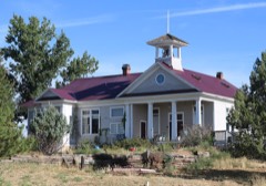 | Lebanon School | 4.9 miles | 1996 |
| Haynie Site | 6.4 miles | 2017 |
| National Archives record | The nomination case file for reference 100009564 in Record Group 79. |
| Montezuma County | All 21 listed properties in this county. |