Block
From the record
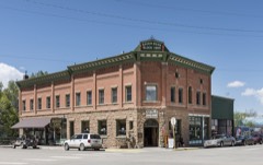
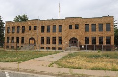
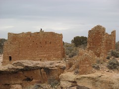
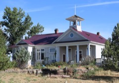
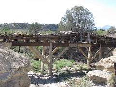
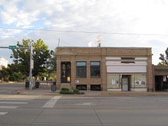
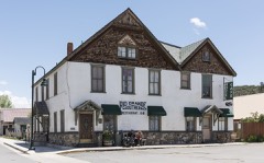
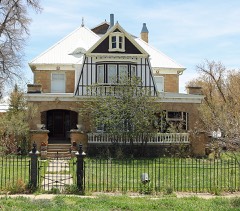
21 National Register listings published here, 2 of them National Historic Landmarks.
Sources: the National Register database, National Park Service
72 topographic sheets cover 19 settlements here, and 21 properties are on the National Register of Historic Places.
21 National Register listings published here, 2 of them National Historic Landmarks.
Sources: the National Register database, National Park Service
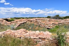
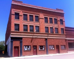
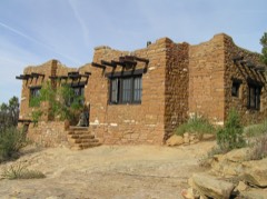
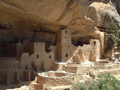
Every property in this county listed on the National Register of Historic Places, with the year it was listed and the federal nomination document.
Every wildfire the federal occurrence database records inside this county: 3,617 of them, burning about 73,219 acres. 2,497 started naturally and 63 were recorded as arson. Each settlement page carries the fires within five miles of it.
| Reported cause | Fires |
|---|---|
| Natural | 2497 |
| Missing data/not specified/undetermined | 359 |
| Smoking | 164 |
| Debris and open burning | 155 |
| Recreation and ceremony | 148 |
| Fireworks | 141 |
| Arson/incendiarism | 63 |
| Equipment and vehicle use | 46 |
| Misuse of fire by a minor | 36 |
| Power generation/transmission/distribution | 6 |
| Other causes | 2 |
The five largest, by the area the report gives. One of them was set deliberately.
| Date | Cause | Size | Reported by | Name on the report |
|---|---|---|---|---|
| 20 July 2000 | Natural | 23,220 acres | Mesa Verde National Park | BIRCHER |
| 22 June 2012 | Arson/incendiarism | 10,133 acres | Tres Rios Field Office | WEBER |
| 18 August 1996 | Natural | 4,781 acres | Mesa Verde National Park | CHAPIN 5 |
| 8 June 2018 | Missing data/not specified/undetermined | 4,593 acres | San Juan National Forest | BURRO |
| 2 August 2000 | Natural | 3,888 acres | Ute Mountain Ute Agency | PONY |
| 14 June 2020 | Natural | 2,905 acres | Tres Rios Field Office | EAST CANYON |
| 15 July 2003 | Natural | 2,744 acres | Mesa Verde National Park | MOCCASIN |
| 29 July 2002 | Natural | 2,601 acres | Mesa Verde National Park | LONG MESA |
Every settlement page carries the fires within five miles of it - see the settlement index below.
The NOAA Storm Events Database holds 140 reports for this county, causing no deaths, 7 injuries and about $2,555,350 in recorded property damage. Each settlement page carries the reports that name it.
| Kind of event | Reports |
|---|---|
| Thunderstorm Wind | 30 |
| Hail | 24 |
| Heavy Rain | 22 |
| Wildfire | 17 |
| Lightning | 13 |
| Flood | 11 |
| Flash Flood | 11 |
| Funnel Cloud | 4 |
| Debris Flow | 4 |
| Tornado | 3 |
| Dust Devil | 1 |
The most serious of them, by death, then injury, then recorded damage. The accounts are quoted exactly as the forecast office filed them.
| When | Event | Place named | Harm | What the report says |
|---|---|---|---|---|
| August 2000 | Thunderstorm Wind | Mancos | 4 hurt, $50,000 | no account filed |
| August 2001 | Lightning | Cortez | 3 hurt | no account filed |
| August 2003 | Hail | Cortez | $1,000,000 | no account filed |
| August 2002 | Wildfire | Cortez | $300,000 | no account filed |
| September 2005 | Flash Flood | Lewis | $250,000 | no account filed |
| July 1997 | Lightning | Cortez | $150,000 | no account filed |
| June 1996 | Heavy Rain | Cortez | $100,000 | no account filed |
| October 2013 | Thunderstorm Wind | Arriola | $75,000 | Strong outflow winds from a thunderstorm combined with winds associated with a nearby cold front to produce extensive damage on several farms within about a two-mile radius of the location with the heaviest damage. At the location with the strongest estimated winds, a metal barn was destroyed and a wind turbine that was rated to withstand winds to 95 mph had the blades ripped off and the flange bolt assembly ripped apart. Shingles were ripped off houses and outbuildings and unsecured objects such as lawn chairs became airborne missiles. Ripening hay in many fields was leveled and pinto bean plants in other fields were ripped to shreds and flattened. |
| July 1997 | Lightning | Cortez | $60,000 | no account filed |
| April 2023 | Flood | Dolores | $50,000 | Rapid snowmelt from the Dolores River led to various drainages breaching their banks. This resulted in flooded downtown residential buildings in the town of Dolores. The water also flooded streets, some yards, and school playgrounds. Flood waters did not recede for several days. |
| July 2018 | Heavy Rain | Cortez | $50,000 | Thunderstorms moved over the area and produced 1.55 inches of rain within an hour and a half. Street flooding occurred as the storm drains were not able to handle the volume of rainfall. Water backed up into an area next to the flooded roads and flowed into the ground level floors of an apartment building. Water also pooled up to about a foot deep in a large vacant field. |
| August 1996 | Wildfire | Mesa Verde Natl Park | $50,000 | no account filed |
| July 2000 | Wildfire | Mesa Verde Natl Park | $40,000 | no account filed |
| June 2006 | Flash Flood | Cortez | $30,000 | no account filed |
| September 2005 | Heavy Rain | Towaoc | $30,000 | no account filed |
| July 2002 | Wildfire | Cortez | $30,000 | no account filed |
| July 2002 | Hail | Stoner | $25,000 | no account filed |
| April 1985 | Tornado (F2) | not stated | $25,000 | no account filed |
| September 1970 | Tornado (F1) | not stated | $25,000 | no account filed |
| October 2006 | Thunderstorm Wind | Cortez | $20,000 | Large trees were blown down in Cortez. One tree landed on a truck on Market Street. A 50 foot spruce tree about 2.5 feet in diameter was snapped off about 15 feet above the ground. Also, a 75 foot section of the roof on the Ace Hardware store on North Broadway was peeled back.| |
| September 2005 | Lightning | Cortez | $20,000 | no account filed |
| September 2003 | Flash Flood | Cortez | $20,000 | no account filed |
| February 2003 | Thunderstorm Wind | Cortez | $20,000 | no account filed |
| July 1997 | Thunderstorm Wind | Dolores | $20,000 | no account filed |
| September 2003 | Hail | Yellow Jacket | $12,000 | no account filed |
| August 2024 | Debris Flow | Mancos | $10,000 | Heavy rainfall to the northeast of Mesa Verde National Park fell on the afternoon of August 25th, with estimated rainfall rates in excess of 2 inches per hour for around 10 minutes. That puts the rainfall total along County Road 41, in this area, at 0.25-0.35 inches. The debris flow resulted in the closure of the road and damage to the road in at least 2 locations. |
| August 2023 | Flood | Cortez | $10,000 | The emergency manager reported that heavy rain from thunderstorms led to minor flooding across portions of Cortez, including some basements in homes along Highway 491 and Veterans Park. |
| June 2022 | Hail | Mesa Verde Natl Park | $10,000 | Hail measured to be the size of quarters accumulated on the road in Mesa Verde National Park. The accumulation was estimated to be 6 inches deep. The hail dimpled at least two vehicles. |
| May 2017 | Lightning | Cortez | $10,000 | Morning thunderstorms produced frequent lightning which ignited numerous tree fires and blasted a tree which fell across electrical lines. Lightning also sparked a structure fire on South Madison Street in Cortez. |
| August 2006 | Flash Flood | Cortez | $10,000 | no account filed |
| September 2003 | Flash Flood | Cortez | $10,000 | no account filed |
| June 1999 | Thunderstorm Wind | Cortez | $8,000 | no account filed |
| September 2002 | Thunderstorm Wind | Cortez | $7,000 | no account filed |
| July 1997 | Thunderstorm Wind | Mancos | $5,000 | no account filed |
| July 2005 | Lightning | Cortez | $4,000 | no account filed |
| September 2002 | Flash Flood | Lewis | $4,000 | no account filed |
| May 2004 | Dust Devil | Cortez | $3,000 | no account filed |
| August 2013 | Lightning | Cortez | $2,000 | A power pole was struck by lightning and started on fire. |
| July 2013 | Lightning | Mesa Verde Natl Park | $2,000 | A lightning strike in Mesa Verde National Park caused a wildfire that was quickly contained. Other fires were also started by lightning in Montezuma County, including a wildfire on Sleeping Ute Mountain. |
| July 2005 | Thunderstorm Wind | Mancos | $2,000 | no account filed |
| September 2005 | Hail | Towaoc | $2,000 | no account filed |
| July 1998 | Lightning | Cortez | $2,000 | no account filed |
| August 2010 | Lightning | Mancos | $1,000 | Electricity was lost to around 234 consumers when a pole was ignited by a lightning strike that occurred on the western edge of Mancos. |
| July 2022 | Debris Flow | Pleasant View | $500 | Heavy rain from thunderstorms resulted in mud and debris on Road BB near Pleasant View, between roads 12 and 13. |
| October 1998 | Lightning | Cortez | $500 | no account filed |
| August 2022 | Flood | (Cez)Cortez Arpt | $250 | Localized flooding occurred at County Road 23.6 as a result of heavy rain from thunderstorms. |
| August 2022 | Flood | Cortez | $100 | Localized flooding occurred at the intersection of 1st Street and South Maple Street as a result of heavy rain from thunderstorms. |
| September 2025 | Thunderstorm Wind | (Cez)Cortez Arpt | - | At approximately 5:47PM MDT the KCEZ ASOS at Cortez-Montezuma County Airport recorded a wind gust to 60 mph, with other nearby gusts recording 45-55 mph. There was a thunderstorm nearby at the time, marking this as a thunderstorm wind gust. No reports of damages, injuries, or fatalities were received in association with this event. |
| August 2024 | Debris Flow | (Cez)Cortez Arpt | - | Emergency manager for Montezuma County reported a large boulder loosened from multiple consecutive days of heavy rain having fallen onto Road G, near the intersection of Road 21, about 2.5 miles from Cortez-Montezuma County Airport. This large boulder necessitated heavy machinery to clean up, but did not impact traffic on the road, despite partially blocking the west-bound lane. |
| June 2024 | Thunderstorm Wind | (Cez)Cortez Arpt | - | With the increased monsoonal moisture at midlevels, scattered showers and thunderstorms built on the higher terrain near Cortez. Dry surface levels acted to enhance outflow winds as storms moved overhead. These storms eventually moved over Cortez, they produced gusts to 58 mph at the KCEZ ASOS at Cortez-Montezuma Airport in Cortez. Gusts to 58 mph were recorded twice, once at 1:02 PM MDT and again at 1:09 PM MDT. |
| September 2024 | Debris Flow | Towaoc | - | Heavy Rainfall just east, northeast of Towaoc resulted in debris flows across Highline ditch/canal. Debris flow with mud and large boulders were noted near mile marker 29 on Highway 491 (between 21 Rd and B Rd). |
| March 2023 | Flood | Lewis | - | Rapid snowmelt and rain caused flooding and the closure of Colorado Highway 184 near its intersection with U.S. Highway 491. Heavy rain and rapid snowmelt overwhelmed a culvert which failed, contributing to the backup of the culvert and subsequent flooding. |
| August 2023 | Flood | Cortez | - | The emergency manager reported several inches of rain running through the streets of Cortez as a result of heavy rain from thunderstorms. The Cooperative Observer measured 0.55 inches of rain in 35 minutes. |
| August 2023 | Thunderstorm Wind | (Cez)Cortez Arpt | - | A peak wind gust of 62 MPH was measured by the automated weather station at the Cortez Municipal Airport. |
| August 2023 | Flood | Cortez | - | The emergency manager reported flooding at the intersection of 25 and L Roads northeast of downtown Cortez as a result of heavy rain from thunderstorms. |
| June 2022 | Thunderstorm Wind | Mesa Verde Natl Park | - | Wind gusts around 60 mph were estimated by the Cooperative Observer in Mesa Verde National Park. |
| March 2022 | Thunderstorm Wind | (Cez)Cortez Arpt | - | A peak wind gust of 58 MPH was measured by the automated weather station at the Cortez Municipal Airport. |
| May 2021 | Hail | Stoner | - | A severe thunderstorm produced large hail measured to be the size of quarters southeast of Stoner. |
| August 2021 | Thunderstorm Wind | (Cez)Cortez Arpt | - | A peak wind gust of 71 MPH was measured by the automated weather station at the Cortez Municipal Airport. |
| June 2020 | Hail | Dolores | - | A severe thunderstorm produced large hail measured to be the size of quarters west-northwest of Dolores. |
The Survey's mineral resources record lists 150 workings inside this county. 10 still produce and 140 are closed or unrecorded. Each settlement page carries the workings within five miles of it.
| Commodity | Workings |
|---|---|
| Gold | 57 |
| Sand and Gravel, Construction | 43 |
| Uranium | 15 |
| Vanadium | 13 |
| Silver | 11 |
| Copper | 10 |
| Gold, Silver | 6 |
| Iron | 5 |
| Uranium, Vanadium | 5 |
| Clay | 4 |
| Silver, Gold | 2 |
| Manganese | 2 |
| Fire Clay (Refractory) | 2 |
| Lead, Silver | 2 |
The least common of them first, because a county's hundredth gravel pit says nothing its first ten did not.
| Where | Site | Commodity | Status | Recorded |
|---|---|---|---|---|
| Battle Rock Mine | Copper, Silver, Gold | Occurrence | Vein | |
| Bell Hamilton Mine | Silver, Copper | Prospect | 1882, 1932 | |
| Dolores Mine | Coal, Gold, Silver | Past Producer | ||
| Euclid Mine | Gold, Silver, Lead, Tellurium, Zinc, Antimony, Arsenic | Occurrence | 1912 | |
| Florence W. Mine | Gold, Silver, Copper, Lead, Antimony | Past Producer | 1914, 1958 | |
| Gold Dollar | Gold, Lead, Copper, Silver | Past Producer | ||
| Karla Kay Mine | Uranium, Vanadium, Manganese | Past Producer | Stratiform | |
| Mancos River Black Sand Deposit | Uranium, Thorium, Zirconium, Titanium, Metal, Iron, REE | Occurrence | 1912 | |
| Mcelmo Creek Area | Carbon Dioxide, Natural Gas, Petroleum (Oil), Uranium, Vanadium, Copper, Silver, Manganese, Gold | Producer | Carnotite, Chalcopyrite | |
| Mesa Verde Quarry | Stone, Crushed/Broken | Producer | ||
| Red Arrow Mine and Mill | Silver, Gold, Copper, Antimony, Tellurium, Zinc, Lead | Past Producer | 1933, 2013 | |
| Shiprock Group | Titanium, Zirconium, Iron, Thorium | Prospect | ||
| Thunder Mine | Lead, Zinc | Occurrence | Galena, Pyrite, Sphalerite | |
| Unk | Vanadium, Coal | Prospect | ||
| Unknown | Gold, Copper, PGE | Past Producer | ||
| Charlene Prospect | Silver, Gold | Past Producer | Vein | |
| Cliff House Group | Uranium, Vanadium, Copper, Manganese | Occurrence | ||
| Idaho & May Day Group | Gold, Lead, Silver | Past Producer | ||
| Thunder | Gold, Lead, Silver | Past Producer | ||
| Unknown | Fire Clay (Refractory) | Occurrence | ||
| Unknown | Fire Clay (Refractory) | Occurrence | ||
| Ute Creek Dike Prospects | Copper, Manganese | Occurrence | Vein | |
| Little Maude | Clay | Unknown | ||
| Unk | Clay | Prospect | ||
| Unk | Clay | Prospect | ||
| Unknown | Clay | Unknown | ||
| Cb Claims | Uranium, Vanadium | Past Producer | Stratiform | |
| Coffin's Prospect | Uranium, Vanadium, Copper | Occurrence | 1913 | |
| Roberta Jean Mine | Uranium, Vanadium | Past Producer | Stratiform | |
| Rush Basin Bog Iron | Iron | Past Producer | ||
| Rush Basin Bog Limonite Deposit | Iron, Gold | Occurrence | ||
| Unk | Iron | Prospect | ||
| Unk | Iron | Prospect | ||
| Billings | Gold, Silver | Occurrence | Gold | |
| Bluebell Claims | Gold, Silver | Occurrence | ||
| Century Mine | Gold, Silver | Past Producer | 1882, 1896 | |
| Kentucky Mine | Gold, Silver, Copper | Past Producer | 1900, 1910 | |
| Battle Rock | Copper | Past Producer | ||
| Brown Bear Mine | Copper | Prospect | 1882 | |
| Dixie Queen Mine | Copper | Past Producer | 1905 | |
| Little Maude Mine | Copper | Occurrence | Vein | |
| Missouri Girl Mine | Copper | Past Producer | 1909 | |
| Barr-Menefee | Gold, Silver | Past Producer | ||
| Billings | Gold, Silver | Prospect | ||
| Champion Mill | Gold, Silver | Past Producer | ||
| Echo Basin | Gold, Silver | Past Producer | ||
| Gold Run Tunnel | Gold, Silver | Past Producer | ||
| Kentucky | Gold, Silver | Past Producer | ||
| Peerless | Gold, Silver | Past Producer | ||
| Red Arrow Extension | Gold, Silver | Past Producer | ||
| Rowena Tunnel | Gold, Silver | Past Producer | ||
| Timberline | Gold, Silver | Past Producer | ||
| Unk | Gold, Silver | Prospect | ||
| Blue Eagle | Uranium, Vanadium | Prospect | ||
| Buckeye | Uranium, Vanadium | Past Producer | ||
| Canon 7 | Uranium, Vanadium | Past Producer | ||
| Cliff House | Uranium, Vanadium | Prospect | ||
| Cliff House #2 | Uranium, Vanadium | Prospect | ||
| Cliff House #4 | Uranium, Vanadium | Prospect | ||
| Coffin's Prospect | Vanadium, Uranium | Prospect | ||
| Cross No. 1 | Uranium, Vanadium | Past Producer | ||
| Karla Kay | Uranium, Vanadium | Past Producer | ||
| Le-Ru Mines | Uranium, Vanadium | Past Producer | ||
| Roberta Jean | Uranium, Vanadium | Past Producer | ||
| Three States | Uranium, Vanadium | Prospect | ||
| Yellow Lizzard | Uranium, Vanadium | Prospect | ||
| Cliff House Group | Uranium | Prospect | ||
| Three States Natural Gas Company Prospect | Uranium | Occurrence | Carnotite | |
| Gravel Pit | Sand and Gravel, Construction | Producer | ||
| Gravel Pit | Sand and Gravel, Construction | Producer | ||
| Gravel Pit | Sand and Gravel, Construction | Producer | ||
| Gravel Pits | Sand and Gravel, Construction | Producer | ||
| Gravel Pits | Sand and Gravel, Construction | Producer | ||
| Towaoc Pit | Sand and Gravel, Construction | Producer | ||
| Unk | Sand and Gravel, Construction | Prospect | ||
| Unk | Sand and Gravel, Construction | Prospect | ||
| Unk | Sand and Gravel, Construction | Prospect | ||
| Unk | Sand and Gravel, Construction | Unknown | ||
| Unk | Sand and Gravel, Construction | Producer | ||
| Unk | Sand and Gravel, Construction | Prospect | ||
| Unk | Sand and Gravel, Construction | Prospect | ||
| Unk | Sand and Gravel, Construction | Prospect | ||
| Unk | Sand and Gravel, Construction | Producer | ||
| Unk | Sand and Gravel, Construction | Prospect | ||
| Unk | Sand and Gravel, Construction | Prospect | ||
| Unk | Sand and Gravel, Construction | Prospect | ||
| Unk | Sand and Gravel, Construction | Prospect | ||
| Unk | Sand and Gravel, Construction | Unknown | ||
| Unknown | Sand and Gravel, Construction | Occurrence | Gravel | |
| Unknown | Sand and Gravel, Construction | Occurrence | Gravel | |
| Unknown | Sand and Gravel, Construction | Occurrence | Gravel | |
| Unknown | Sand and Gravel, Construction | Occurrence | Gravel | |
| Unknown | Sand and Gravel, Construction | Occurrence | Gravel | |
| Unknown | Sand and Gravel, Construction | Occurrence | Gravel | |
| Unknown | Sand and Gravel, Construction | Occurrence | Gravel | |
| Unknown | Sand and Gravel, Construction | Occurrence | Gravel | |
| Unknown | Sand and Gravel, Construction | Occurrence | Gravel | |
| Unknown | Sand and Gravel, Construction | Occurrence | Gravel | |
| Unknown | Sand and Gravel, Construction | Occurrence | Gravel | |
| Unknown | Sand and Gravel, Construction | Occurrence | Gravel | |
| Unknown | Sand and Gravel, Construction | Occurrence | Gravel | |
| Unknown | Sand and Gravel, Construction | Occurrence | Gravel | |
| Unknown | Sand and Gravel, Construction | Occurrence | ||
| Unknown | Sand and Gravel, Construction | Occurrence | Gravel | |
| Unknown | Sand and Gravel, Construction | Occurrence | Gravel | |
| Unknown | Sand and Gravel, Construction | Unknown | ||
| Unknown | Sand and Gravel, Construction | Unknown | ||
| Unknown | Sand and Gravel, Construction | Unknown | ||
| Unknown | Sand and Gravel, Construction | Unknown | ||
| Unknown | Sand and Gravel, Construction | Unknown | ||
| Unknown | Sand and Gravel, Construction | Unknown | ||
| Bed Rock Placer | Gold | Past Producer | ||
| Belle Placer | Gold | Past Producer | ||
| Black Hawk No. 1 | Gold | Past Producer | ||
| Dolores River Placer | Gold | Past Producer | ||
| Doyle | Gold | Past Producer | ||
| East Mancos Properties | Gold | Past Producer | ||
| East Mancos River Placers | Gold | Past Producer | 1885 | |
| East Mancos River Placers | Gold | Past Producer | ||
| East Mancos River Placers | Gold | Past Producer | ||
| East Mancos River Placers | Gold | Past Producer | ||
| Fall Creek | Gold | Past Producer | ||
| Georgia Girl | Gold | Past Producer | ||
| Golconda Placer | Gold | Past Producer | ||
| Golconda, Hesperus, Senate? | Gold | Past Producer | ||
| Gold Rim Prospect | Gold | Prospect | ||
| Goldorada Claims | Gold | Prospect | ||
| Kebler, Golconda | Gold | Past Producer | ||
| Kiabab | Gold | Prospect | ||
| Kimball | Gold | Past Producer | ||
| Lady Stafford | Gold | Past Producer | ||
| Mancos Canyon Gold, Inc. | Gold | Past Producer | ||
| Mancos Claims | Gold | Prospect | ||
| Mancos Consolidated Gold Mines | Gold | Past Producer | ||
| Mancos View | Gold | Past Producer | ||
| Peerless Mine | Gold | Occurrence | 1890 | |
| Rush Basin | Gold | Past Producer | ||
| Silver Falls | Gold | Past Producer | ||
| Stafford Claims | Gold | Prospect | ||
| Tula May | Gold | Past Producer | ||
| Unk | Gold | Prospect | ||
| Unk | Gold | Prospect | ||
| Unk | Gold | Prospect | ||
| Unk | Gold | Prospect | ||
| Unk | Gold | Prospect | ||
| Unk | Gold | Prospect | ||
| Unk | Gold | Prospect | ||
| Vulcan Placer | Gold | Past Producer | ||
| West Mancos River Placers | Gold | Past Producer | Placer | |
| West Mancos River Placers | Gold | Past Producer |
Named settlements recorded in the Geographic Names Information System, each with the topographic sheets covering it. Villages, hamlets and abandoned places alike. Each is shown with the nearest named watercourse or landform and the survey quadrangle it falls on.
Cortez census division · 81321 · Near Leavell Draw · Arriola quadrangle
12 sheets, 1956 to 1994
Mancos census division · 81334 · Wetherill Mesa quadrangle
12 sheets, 1956 to 1982
No longer a settlement
Cortez census division · 81321 · Near Hartman Draw · Cortez quadrangle
11 sheets, 1956 to 1982
Dolores census division · 81323 · Near Lost Canyon · Dolores West quadrangle
10 sheets, 1956 to 1982
Mancos census division · 81330 · By Echo Cliff · Wetherill Mesa quadrangle
12 sheets, 1956 to 1982
No longer a settlement
Mancos census division · 81328 · On Deer Lick Creek · Rampart Hills quadrangle
17 sheets, 1895 to 1982
Cortez census division · 81327 · Near Brumley Draw · Arriola quadrangle
12 sheets, 1956 to 1994
Mancos census division · 81328 · Near Rock Canyon · Millwood quadrangle
13 sheets, 1956 to 1982
Pleasant View census division · 81331 · Pleasant View quadrangle
11 sheets, 1956 to 1994
Mancos census division · 81328 · Near Beef Pasture · Rampart Hills quadrangle
17 sheets, 1895 to 1982
Dolores census division · 81323 · Near Italian Canyon · Dolores East quadrangle
10 sheets, 1956 to 1982
Mancos census division · 81330 · By Sun Point · Moccasin Mesa quadrangle
25 sheets, 1912 to 1982
No longer a settlement
Mancos census division · 81328 · By Flint Rock Point · Mancos quadrangle
11 sheets, 1956 to 1982
Pleasant View census division · 81335 · Yellow Jacket quadrangle
12 sheets, 1956 to 1982
The vanished settlements of Montezuma County: the places named above that are no longer on the map.