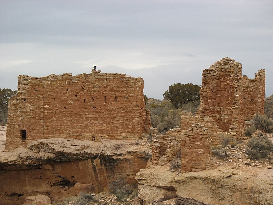
Built in 1923. Listed on the National Register of Historic Places in 1966.
From the record
“Hovenweep National Monument is located on land in southwestern Colorado and southeastern Utah, between Cortez, Colorado and Blanding, Utah on the Cajon Mesa of the Great Sage Plain. Shallow tributaries run through the wide and deep canyons into the San Juan River.”
Wikipedia article Hovenweep National Monument, CC BY-SA 4.0.
One of 21 National Register listings published here for Montezuma County · listed in 1966 · category: District · built in 1923.
National Register reference number.66000250- the number the National Park Service assigned this property when it was listed, and the key its nomination file is catalogued under at the National Archives.
Fires near this property
20 since 1996
Regional context, not property-specific
evidence. The
federal wildfire occurrence database
lists 20 fires within 5 miles of Hovenweep National Monument
between 1996 and 2018, burning about 533 acres in total. 20 started naturally. None was recorded as arson.
Distance is straight-line from the map coordinates, so a fire counted
here may appear on a neighbouring settlement's page as well.
Reported cause
Fires
Natural
20
The most recent of
them, most recent first, with the day each was reported and the service
that recorded it.
Regional context, not property-specific
evidence. The National Weather Service names
Cortez, the town this property stands in, in 59 storm reports between 1996 and 2023: 10 thunderstorm wind, 9 lightning, 9 wildfire, 8 heavy rain.
The reports record 3 injuries. Each account below is quoted exactly as the forecast office
filed it, from the NOAA Storm Events Database, and each date
opens the federal record of that event.
Thunderstorms moved over the area and produced 1.55 inches of rain within an hour and a half. Street flooding occurred as the storm drains were not able to handle the volume of rainfall. Water backed up into an area next to the flooded roads and flowed into the ground level floors of an apartment building. Water also pooled up to about a foot deep in a large vacant field.
Large trees were blown down in Cortez. One tree landed on a truck on Market Street. A 50 foot spruce tree about 2.5 feet in diameter was snapped off about 15 feet above the ground. Also, a 75 foot section of the roof on the Ace Hardware store on North Broadway was peeled back.|
The emergency manager reported that heavy rain from thunderstorms led to minor flooding across portions of Cortez, including some basements in homes along Highway 491 and Veterans Park.
Morning thunderstorms produced frequent lightning which ignited numerous tree fires and blasted a tree which fell across electrical lines. Lightning also sparked a structure fire on South Madison Street in Cortez.
The emergency manager reported several inches of rain running through the streets of Cortez as a result of heavy rain from thunderstorms. The Cooperative Observer measured 0.55 inches of rain in 35 minutes.
The emergency manager reported flooding at the intersection of 25 and L Roads northeast of downtown Cortez as a result of heavy rain from thunderstorms.
Thunderstorms moving over the area produced 1.55 inches of rain in an hour and a half. Minor street and building flooding occurred with the first floor of a low lying apartment receiving some water.
A car was washed 15 feet off Highway 160 into a ditch by flash flood waters. Mud and debris was also reported at mile marker 29 at the intersection with County Road 21.
Thunderstorms produced rainfall of 1.20 inches in Cortez between 1325 and 1410 MST. The heavy rain caused street flooding in Cortez. The water was up to three feet deep on 5th Street.
No historic map-sheet match is published
for this property yet. That does not mean no map exists. This record needs
a coordinate-quality review before it can be joined to a sheet boundary.
Browse the county's mapped places while that work is
pending.
Listing record. National Park Service National Register of Historic Places, listed-properties dataset, current to 2026-05-22.
Map join. Address geocoded through the United States Census geocoder, then tested against the published boundary of every sheet in the USGS Historical Topographic Map Collection.
How this page is made. Listing fields come from federal records; map-sheet coverage is a labelled coordinate-to-boundary calculation, not a source-field claim.
Wildfire. Short, Karen C. 2022. Spatial wildfire occurrence data for the United States, 1992-2020 [FPA_FOD_20221014]. 6th Edition. Fort Collins, CO: Forest Service Research Data Archive. https://doi.org/10.2737/RDS-2013-0009.6 Collected with United States Government funding and usable without additional permissions or fees.
Storms. NOAA National Centers for Environmental Information, Storm Events Database https://www.ncei.noaa.gov/stormevents/ A work of the United States government, no copyright under 17 U.S.C. 105. Narratives are quoted verbatim from the National Weather Service report and are not edited or summarised.
 Block