 Block
From the record
One of 20 National Register listings published here for Garfield County · listed in 1980 · category: Site.
Sources: the case file at the National Archives · the National Register database, National Park Service
Listed on the National Register of Historic Places in 1980.
One of 20 National Register listings published here for Garfield County · listed in 1980 · category: Site.
Sources: the case file at the National Archives · the National Register database, National Park Service
Regional context, not property-specific evidence. The federal wildfire occurrence database lists 190 fires within 5 miles of Havemeyer-Willcox Canal Pumphouse and Forebay between 1992 and 2020, burning about 1,534 acres in total. 153 started naturally. None was recorded as arson. Distance is straight-line from the map coordinates, so a fire counted here may appear on a neighbouring settlement's page as well.
| Reported cause | Fires |
|---|---|
| Natural | 153 |
| Missing data/not specified/undetermined | 28 |
| Equipment and vehicle use | 5 |
| Debris and open burning | 2 |
| Railroad operations and maintenance | 2 |
The most recent of them, most recent first, with the day each was reported and the service that recorded it.
| Date | Cause | Size | Reported by | Name on the report |
|---|---|---|---|---|
| 8 September 2019 | Natural | under an acre | Northwest District, Grand Junction | SHALE MINE |
| 8 September 2009 | Natural | 2.0 acres | Northwest District, Grand Junction | GFX ASSIST 498 |
| 6 September 2001 | Natural | under an acre | Northwest District, Grand Junction | OAK |
| 5 September 2016 | Missing data/not specified/undetermined | 19 acres | Northwest District, Grand Junction | MEDIAN |
| 5 September 2013 | Natural | under an acre | Northwest District, Grand Junction | 246 |
| 4 September 2004 | Natural | under an acre | Northwest District, Grand Junction | PORCUPINE |
| 4 September 1996 | Natural | under an acre | Northwest District, Grand Junction | LONGRIDGE |
| 4 September 1993 | Natural | under an acre | Northwest District, Grand Junction | ANVIL PTII |
Regional context, not property-specific evidence. The federal mineral resources record lists 1 working within 5 miles of Havemeyer-Willcox Canal Pumphouse and Forebay: 1 occurrence. None of them still produces. What was taken out: Sand and Gravel, Construction. Distance is straight-line from the map coordinates, so a quarry counted here may appear on a neighbouring settlement's page as well.
| Where | Site | Commodity | Status | Recorded |
|---|---|---|---|---|
| Unknown | Sand and Gravel, Construction | Occurrence | Sand and Gravel |
Regional context, not property-specific evidence. The National Weather Service names Rifle, the town this property stands in, in 32 storm reports between 1997 and 2023: 9 flash flood, 6 heavy rain, 5 flood, 4 thunderstorm wind. The reports record 2 deaths. Each account below is quoted exactly as the forecast office filed it, from the NOAA Storm Events Database, and each date opens the federal record of that event.
| When | Event | Place named | Harm | What the report says |
|---|---|---|---|---|
| July 2003 | Lightning | Rifle | 2 killed | no account filed |
| July 2002 | Flash Flood | Rifle | $158,000 | no account filed |
| August 2002 | Flash Flood | Rifle | $100,000 | no account filed |
| August 1997 | Flash Flood | Rifle | $80,000 | no account filed |
| July 2005 | Flash Flood | Rifle | $10,000 | no account filed |
| August 2023 | Flood | Rifle | $5,000 | Heavy rain from thunderstorms flooded a basement at the intersection of 5th Street and Ute Avenue in Rifle. |
| July 2021 | Flash Flood | Rifle | $5,000 | Heavy rain resulted in urban flash flooding south-southwest of Rifle. A trained weather spotter reported gutters overflowing and flooding on roadways. |
| August 1999 | Flash Flood | Rifle | $5,000 | no account filed |
| August 2003 | Lightning | Rifle | $3,000 | no account filed |
| August 2023 | Flood | Rifle | - | Heavy rain from thunderstorms led to 6 inches of water flowing over 12th Street and Park Avenue in Rifle. |
| July 2017 | Debris Flow | Rifle | - | Colorado Highway 325 was closed in both directions north of Rifle after heavy rainfall resulted in a mudslide. Law enforcement personnel estimated a foot of mud was across the road. |
| July 2017 | Heavy Rain | Rifle | - | Water runoff from heavy rain flowed across portions of County Roads 233 and 252 near Rifle Creek. Radar estimated rainfall near those locations ranged from about an inch to an inch and a half. |
| August 2017 | Debris Flow | Rifle | - | Colorado Highway 325 was closed in both directions in Rifle Gap between mile markers 6 and 8 due to a mudslide and flooding as a result of heavy rains. The Highway reopened 4 hours later. |
| August 2017 | Heavy Rain | Rifle | - | Flooding from Government Creek was reported to be impacting a residence near mile marker 8 along Colorado Highway 13 as a result of heavy rains. |
| September 2014 | Flash Flood | Rifle | - | A section of Colorado Highway 325 was closed due flash flooding which deposited a significant amount of mud and debris onto the roadway. |
| June 2010 | Hail | Rifle | - | Hail up to 1.0 inch in diameter was reported in Rifle. |
| August 2010 | Heavy Rain | Rifle | - | Heavy rainfall caused mud and rocks to slide across Highway 13, blocking the Highway north of Rifle between mile markers 7 and 10. |
| August 2008 | Flash Flood | Rifle | - | A six foot wall of water roared down Government Creek which normally runs no deeper than a trickle in August. |
| July 2010 | Thunderstorm Wind | Rifle | - | no account filed |
| July 2006 | Heavy Rain | Rifle | - | no account filed |
| August 2003 | Hail | Rifle | - | no account filed |
| July 2003 | Heavy Rain | Rifle | - | no account filed |
| September 2002 | Thunderstorm Wind | Rifle | - | no account filed |
| May 2002 | Thunderstorm Wind | Rifle | - | no account filed |
| July 2002 | Flood | Rifle | - | no account filed |
| August 2001 | Flood | Rifle | - | no account filed |
| September 2001 | Hail | Rifle | - | no account filed |
| August 2001 | Flood | Rifle | - | no account filed |
| May 2000 | Thunderstorm Wind | Rifle | - | no account filed |
| July 1998 | Wildfire | Rifle | - | no account filed |
| September 1998 | Heavy Rain | Rifle | - | no account filed |
| September 1997 | Flash Flood | Rifle | - | no account filed |
No historic map-sheet match is published for this property yet. That does not mean no map exists. This record needs a coordinate-quality review before it can be joined to a sheet boundary. Browse the county's mapped places while that work is pending.
Other National Register properties close enough to walk or drive between, ordered by distance from this one. Both positions come from the same geocoding pass that matched these properties to their map sheets.
| Photograph | Property | Distance | Listed |
|---|---|---|---|
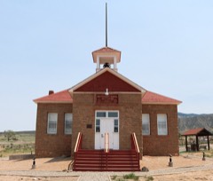 | Battlement Mesa Schoolhouse | 7.4 miles | 1983 |
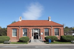 | US Post Office-Rifle Main | 7.5 miles | 1986 |
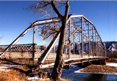 | Rifle Bridge | 7.6 miles | 1985 |
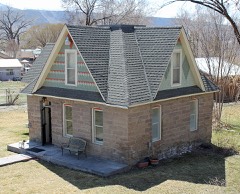 | Wasson-McKay Place | 7.9 miles | 2010 |
| National Archives record | The nomination case file for reference 80000900 in Record Group 79. |
| Garfield County | All 20 listed properties in this county. |