 Block
From the record
20 National Register listings published here.
Sources: the National Register database, National Park Service
107 topographic sheets cover 23 settlements here, and 20 properties are on the National Register of Historic Places.
20 National Register listings published here.
Sources: the National Register database, National Park Service
Every property in this county listed on the National Register of Historic Places, with the year it was listed and the federal nomination document.
| Photograph | Property | Type | Listed | Reference |
|---|---|---|---|---|
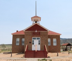 | Battlement Mesa Schoolhouse | building | 1983 | 83001295 |
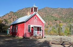 | Canyon (Canon) Creek School, District No. 32 | building | 2004 | 03001360 |
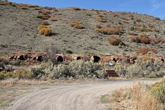 | Cardiff Coke Ovens | structure | 1996 | 96001331 |
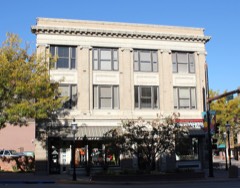 | Citizens National Bank Building | building | 1999 | 99000824 |
| Earnest Ranch | building | 1998 | 98000292 | |
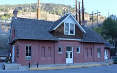 | Glenwood Springs Hydroelectric Plant | building | 1998 | 98001244 |
| Havemeyer-Willcox Canal Pumphouse and Forebay | site | 1980 | 80000900 | |
| Holland-Thompson Property | district | 2013 | 13000524 | |
 | Hotel Colorado | building | 1977 | 77000376 |
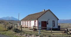 | Missouri Heights School | building | 1999 | 99001145 |
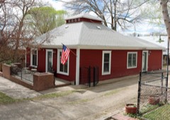 | John Herbert Nunns House | building | 2013 | 13000871 |
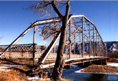 | Rifle Bridge | structure | 1985 | 85000213 |
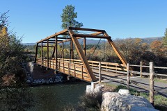 | Satank Bridge | structure | 1985 | 85000211 |
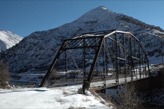 | South Canon Bridge | structure | 1985 | 85000212 |
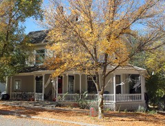 | Starr Manor | building | 1986 | 86001350 |
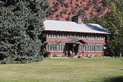 | Sumers Lodge | building | 1997 | 97000593 |
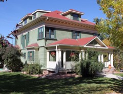 | Edward T. Taylor House | building | 1986 | 86002807 |
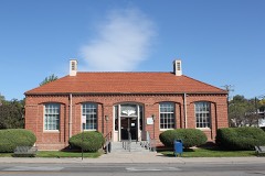 | US Post Office-Rifle Main | building | 1986 | 86000186 |
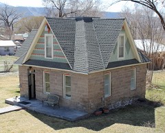 | Wasson-McKay Place | building | 2010 | 10000536 |
 | Western Hotel | building | 2016 | 16000074 |
Every wildfire the federal occurrence database records inside this county: 2,488 of them, burning about 120,007 acres. 1,724 started naturally and 9 were recorded as arson. Each settlement page carries the fires within five miles of it.
| Reported cause | Fires |
|---|---|
| Natural | 1724 |
| Missing data/not specified/undetermined | 515 |
| Recreation and ceremony | 112 |
| Debris and open burning | 47 |
| Equipment and vehicle use | 36 |
| Smoking | 22 |
| Arson/incendiarism | 9 |
| Railroad operations and maintenance | 6 |
| Power generation/transmission/distribution | 5 |
| Misuse of fire by a minor | 5 |
| Firearms and explosives use | 4 |
| Fireworks | 2 |
| Other causes | 1 |
The five largest, by the area the report gives. None of them was recorded as arson.
| Date | Cause | Size | Reported by | Name on the report |
|---|---|---|---|---|
| 10 August 2020 | Missing data/not specified/undetermined | 32,431 acres | White River National Forest | GRIZZLY CREEK |
| 19 July 2002 | Natural | 17,056 acres | White River National Forest | BIG FISH |
| 22 June 2002 | Natural | 13,493 acres | White River National Forest | SPRING CREEK |
| 8 June 2002 | Missing data/not specified/undetermined | 12,209 acres | White River National Forest | COAL SEAM |
| 23 July 1996 | Natural | 5,580 acres | Northwest District, Grand Junction | HATCHET |
| 8 July 2003 | Missing data/not specified/undetermined | 5,292 acres | Northwest District, Grand Junction | GARCO 5 |
| 29 June 1997 | Natural | 4,600 acres | Northwest District, Grand Junction | SEWEMUP |
| 28 July 2018 | Natural | 2,703 acres | White River National Forest | CACHE CREEK |
Every settlement page carries the fires within five miles of it - see the settlement index below.
The NOAA Storm Events Database holds 229 reports for this county, causing 5 deaths, 1 injury and about $162,768,600 in recorded property damage. Each settlement page carries the reports that name it.
| Kind of event | Reports |
|---|---|
| Thunderstorm Wind | 64 |
| Flash Flood | 42 |
| Heavy Rain | 35 |
| Debris Flow | 34 |
| Hail | 20 |
| Wildfire | 15 |
| Flood | 14 |
| Lightning | 4 |
| Funnel Cloud | 1 |
The most serious of them, by death, then injury, then recorded damage. The accounts are quoted exactly as the forecast office filed them.
| When | Event | Place named | Harm | What the report says |
|---|---|---|---|---|
| July 2003 | Lightning | Rifle | 2 killed | no account filed |
| July 1997 | Flash Flood | Silt | 1 killed, $150,000 | no account filed |
| May 2023 | Flood | Glenwood Spgs | 1 killed | The Colorado River in Glenwood Canyon ran high and fast as a result of accelerated snowmelt. While rafting in Glenwood Canyon, two rafters fell into the river while navigating a rapid and eddy. Both men were pulled from the water and brought back to shore. The rafting party began CPR on the two individuals - one rafter responded, but the other one did not. |
| June 1996 | Thunderstorm Wind | New Castle | 1 killed | no account filed |
| March 1998 | Heavy Rain | Glenwood Spgs | 1 hurt, $20,000 | no account filed |
| July 2021 | Debris Flow | Shoshone | $125,000,000 | Major flash flooding and debris flows occurred throughout Glenwood Canyon from the Grizzly Creek Fire burn scar as a result of significant rainfall from showers and thunderstorms. Multiple mudslides were reported by the Colorado Department of Transportation (CDOT). Numerous vehicles were trapped between slides for several hours. Rainfall rates in excess of 4 inches/hour were estimated with storms. Remote gauges recorded between 1 and 2 inches in less than an hour along the south and east sides of the burn scar. CDOT reported damage to the structure of Interstate 70 which remained closed for over two weeks due to cleanup operations and surveys. |
| July 2021 | Debris Flow | Shoshone | $25,000,000 | Multiple debris flows occurred along Interstate 70 within the Grizzly Creek Fire burn scar between mile marker 123 and Hanging Lake Tunnel. Colorado Department of Transportation (CDOT) described the damage from the new flows as extreme. The new debris piles were around 17 feet tall over the roadway and house-sized boulders fell as well. Hanging Lake trail received considerable damage. At least seven bridges were either destroyed, washed downstream or otherwise severely damaged. National Forest officials say it will be at least late-season 2022 before the trail can be reopened. |
| July 2002 | Wildfire | Glenwood Spgs | $3,500,000 | no account filed |
| July 2021 | Debris Flow | Shoshone | $2,500,000 | Heavy rain formed over the Grizzly Creek burn scar near Glenwood Springs, CO which caused a major mudslide across the Colorado River near MM 124 of Interstate 70. According to CDOT, the material in the river resulted in some damming of the river. Additionally, a smaller mudslide occurred at MM 129 at the same time and flowed across I-70 with an unknown depth. I-70 was closed for an extended period due to cleanup operations. |
| June 2011 | Flood | Carbondale Arpt | $1,750,000 | The Colorado River experienced elevated flows due to snow melt runoff from June 5th to the end of the month. Flood advisories or warnings were in effect through most of this time, with only brief periods when the river fell just below bankfull. Much of the area along the Colorado River from near the entrance to Glenwood Canyon to Rifle in Garfield County was impacted by the high flows in June. In Glenwood Canyon the water rose to within a few inches of the railroad line, inundated equipment near the river at Bair Ranch and closed the rest area along I-70 adjacent to the ranch. Portions of a recreational bike path along the river bank were under 4 to 5 feet of water and several sections were destroyed or washed downstream and cost 1.5 million dollars to repair. Low land flooding was common as the river spread hundreds of yards past the bank in several areas. Water moved into the rest area at Rifle and forced a daylong closure. During peak rises, water also inundated rail bridges leading into Rifle and flooded a Frisbee golf course in Rifle. Other flooding along the Beaver and Rifle Creek waterways caused road damage and travel inconveniences. High flows along Elk Creek caused enough bank erosion to wash away a cabin along the stream on June 13th. |
| August 2002 | Wildfire | Carbondale | $1,200,000 | no account filed |
| July 2002 | Wildfire | Carbondale | $1,000,000 | no account filed |
| September 2002 | Wildfire | Glenwood Spgs | $500,000 | no account filed |
| August 2002 | Wildfire | Glenwood Spgs | $500,000 | no account filed |
| July 2021 | Debris Flow | Allen | $250,000 | At least three debris flows of mud, trees and rocks occurred across the eastern portion of the Grizzly Creek Fire burn area near Bair Ranch. Radar estimated 0.30 to 0.50 inches of rain fell in 20 minutes over the affected area. I-70 was closed in both directions for 24 hours due to cleanup operations. |
| July 2002 | Flash Flood | Rifle | $158,000 | no account filed |
| June 2021 | Debris Flow | Glenwood Spgs | $150,000 | Several debris flows occurred as a result of heavy rain over the western portion of the Grizzly Creek Fire burn scar. One debris flow covered both lanes on Interstate 70 and was approximately 80 feet wide and about 5 feet deep. It also ran all the way down to the Colorado River. Radar estimated 0.40 to 0.60 inches of rain fell in 36 minutes. I-70 was closed in both directions for 12 to 24 hours due to cleanup operations. |
| June 2021 | Debris Flow | Glenwood Spgs | $100,000 | A debris flow occurred as a result of heavy rain over the western portion of the Grizzly Creek Fire burn scar. The debris flow was about 60 to 70 feet wide over the westbound lanes of Interstate 70 and approximately 5 feet deep. A slide at the bottom of the drainage ranged from 6.5 to nearly 8 feet deep. Radar estimated 0.30 to 0.40 inches of rain fell in 20 to 30 minutes. I-70 westbound was closed for several hours due to cleanup operations. |
| July 2021 | Debris Flow | Allen | $100,000 | Several debris flows occurred as a result of heavy rain over the eastern portion of the Grizzly Creek Fire burn scar. The debris covered both sides of Interstate 70 and ran all the way down to the Colorado River. Hourly rain rates exceeded 0.50 inches/hour. I-70 was closed in both directions for several hours due to cleanup operations. |
| July 2021 | Debris Flow | Allen | $100,000 | Two minor debris flows occurred across the southern portion of the Grizzly Creek Fire burn area. One to three inches of very slick mud ran across Interstate 70 at mile marker 128 off Cinnamon Creek from the south side of Glenwood Canyon. Mud also ran underneath the railroad tracks north of I-70 in this section. Radar estimated 0.20 to 0.50 inches of rain fell across the area. I-70 was closed in both directions for several hours due to cleanup operations. |
| July 2021 | Debris Flow | Douglas Pass | $100,000 | Ten feet of water flowed on County Road 205 within the Pine Gulch Fire burn scar. |
| August 2002 | Flash Flood | Rifle | $100,000 | no account filed |
| August 2001 | Flash Flood | New Castle | $100,000 | no account filed |
| August 1997 | Flash Flood | Rifle | $80,000 | no account filed |
| June 2004 | Lightning | Carbondale | $60,000 | no account filed |
| May 2023 | Debris Flow | Glenwood Spgs | $50,000 | Saturated soils from excessive runoff of melting snow lead to numerous mud and debris flows near Glenwood Springs, CO and the near the Hanging Lake Trail in Glenwood Canyon. The mud trapped a train traveling through the west side of Glenwood Springs with no injuries reported. Access to the Hanging Lake Trail was cutoff with roadway closures. Mud also slid off of Red Mountain south of Glenwood Springs, prompting the additional closures of some roadways and a private bridge was washed out. |
| August 2002 | Flash Flood | Glenwood Spgs | $50,000 | no account filed |
| July 1998 | Lightning | Parachute | $50,000 | no account filed |
| August 2013 | Flash Flood | Battlement Mesa | $25,000 | Flash flooding closed Interstate 70 and adjacent roads near Parachute for more than two hours. An access road that runs parallel and north of I-70 was heavily damaged. |
| September 2002 | Flash Flood | Glenwood Spgs | $25,000 | no account filed |
| August 2023 | Debris Flow | Pagosa Spgs Arpt | $20,000 | The trail system above Glenwood Meadows in Glenwood Springs (located between the community center and Roaring Fork Transportation Authority facility) suffered damage due to debris flows from heavy rain. |
| July 2021 | Hail | Allen | $15,000 | Ping pong ball sized hail fell 18 miles east of Buford in Garfield County. The hail dented vehicles and broke the skylights on several campers at the Trappers Lake Campground. |
| August 2023 | Debris Flow | Glenwood Spgs | $10,000 | A debris flow of mud and rocks occurred as a result of heavy rain over portions of the Grizzly Creek Fire burn scar. The debris flow took place near mile marker 120.6. The No Name Creek rain gauge reported 1.86 inches of rain fell in 50 minutes. |
| September 2013 | Flash Flood | Douglas Pass | $10,000 | Oil field workers reported a wall of water that washed out the road in several places in the Whiskey Creek area. Several people were stranded. |
| July 2007 | Flash Flood | Glenwood Spgs | $10,000 | Heavy rain over a wildfire burn area resulted in flash flooding and debris flows which began on higher terrain to the east of County Road 137. Water and debris flowed out of 3 separate drainages and ran across County Road 137. One flow was 4 feet deep across the road, while the other two flows were 1 to 2 feet deep where they crossed the road. Total debris deposits spread out over a 1.5 mile section of the road. Several vehicles got stuck trying to drive through it. One house became completely surrounded by debris, and a garage was filled with mud and rock, covering an ATV completely and up to the wheel wells of a pickup. |
| July 2005 | Flash Flood | Rifle | $10,000 | no account filed |
| June 1996 | Thunderstorm Wind | New Castle | $10,000 | no account filed |
| August 2023 | Flood | Rifle | $5,000 | Heavy rain from thunderstorms flooded a basement at the intersection of 5th Street and Ute Avenue in Rifle. |
| July 2022 | Debris Flow | Grand Vly | $5,000 | A debris flow of mud and small to medium-sized rocks occurred on Highway 6 on the west side of Parachute as a result of heavy rain from thunderstorms. The road was closed for a couple of hours due to cleanup operations. |
| July 2021 | Flash Flood | Rifle | $5,000 | Heavy rain resulted in urban flash flooding south-southwest of Rifle. A trained weather spotter reported gutters overflowing and flooding on roadways. |
| July 2019 | Flood | Silt | $5,000 | The northbound lane of Colorado State Highway 325 was closed for an extended period of time about 2 miles north of Rifle Gap Reservoir between Rifle Gap and Rifle Falls State Park due to a partial collapse of the roadway. The collapse was the result of excessive runoff from snow melt and the accumulation of underground water. |
| October 2018 | Thunderstorm Wind | (1v1)Rifle Arpt | $5,000 | A line of strong thunderstorms produced damaging winds in the Rifle area, including the Rifle Garfield County Airport where the strongest winds were measured. A single engine Cessna aircraft incurred damage as it was tipped sideways onto a wing and also tipped onto its nose. |
| July 2014 | Flash Flood | Douglas Pass | $5,000 | Thunderstorms with very heavy rainfall moved slowly over the Tavaputs Plateau near Baxter Pass. Flood waters made many areas of Colorado Road 202 impassable, especially where branches of West Salt Creek traverse the roadway. A bridge embankment was damaged from the flood waters. |
| July 2007 | Flash Flood | New Castle | $5,000 | Heavy rain over a wildfire burn area resulted in flash flooding and debris flows. Large amounts of debris, including partially burned trees, cut trees, mud and boulders were carried down drainages to the west of County Road 137. The debris spread out across Highway 6 to a depth of about 2 feet over a span of 40 to 50 feet. Debris was also deposited across railroad tracks along the Vulcan Ditch which was totally clogged with debris. The flow then spread out across Interstate 70 and covered a 300 yard stretch of both the east and west bound lanes. The interstate was closed for about 1 hour. |
| August 1999 | Flash Flood | Rifle | $5,000 | no account filed |
| August 1999 | Flash Flood | Glenwood Spgs | $4,000 | no account filed |
| July 2019 | Debris Flow | Glenwood Spgs | $3,000 | Showers and thunderstorms produced heavy rain across portions of Interstate 70 northeast of Glenwood Springs. This led to a significant mudslide with debris exceeding 2 feet deep that closed both eastbound and westbound traffic for an extended period. Numerous cars were stranded. |
| August 2003 | Lightning | Rifle | $3,000 | no account filed |
| August 2023 | Debris Flow | Allen | $2,500 | The Colorado Department of Transportation reported 4 separate mudslides occurred along portions of I-70 within the Grizzly Creek Fire burn scar as a result of heavy rain from thunderstorms. The slides took place east of Hanging Lake Tunnel and 30 cars were trapped in between the flows. The largest slide took place near the westbound exit ramp of Bear Ranch and was roughly 50 feet long and covered one lane. The radar estimated precipitation totals of 0.65 to 0.85 inches north of the interstate with 1.80 inches measured at the East Fork Dead Horse automated gauge. The road remained closed until early on the morning of the 27th. |
| August 2023 | Debris Flow | Allen | $2,000 | Heavy rain from thunderstorms over the Grizzly Creek Fire burn scar resulted in the ponding of water along portions of I-70 with a mud and debris slide reported near mile marker 120.6 I-70 was closed in both directions from 1800 on the evening of the 24th to 0000 on the 25th. |
| July 2007 | Flash Flood | New Castle | $2,000 | Torrential rain producing thunderstorms caused water and mud to inundate an irrigation canal and then flow across Interstate 70. Spotter and public reports indicated between 2.5 and 3 inches of rainfall occurred over a period ranging from 15 to 30 minutes. |
| September 2003 | Heavy Rain | Carbondale | $2,000 | no account filed |
| September 1997 | Flash Flood | Parachute | $2,000 | no account filed |
| July 2016 | Flash Flood | Grand Vly | $1,000 | Heavy rainfall quickly eroded part of Conn Creek Road, County Road 213, at mile marker 2. Two miles up the road, several vehicles got stuck and remained there until county road and bridge workers could get to the scene to assist with extraction. |
| May 2008 | Flood | Allen | $1,000 | Portions of a recreational bike and walking path adjacent to the Colorado River through Glenwood Canyon were flooded. Water was within a few inches of railroad tracks in the area. |
| August 2003 | Flash Flood | Glenwood Spgs | $1,000 | no account filed |
| May 2023 | Flood | Allen | $500 | Increased snowmelt along the Colorado River led to the closure of Hanging Lake Trail near Glenwood Springs. Water flowed directly down parts of the trail, forcing the closure for approximately a week or so. |
| August 2022 | Debris Flow | De Beque | $500 | A mudslide occurred along Interstate 70 at mile marker 66 near De Beque. |
| May 2006 | Thunderstorm Wind | Carbondale | $500 | no account filed |
| October 1997 | Thunderstorm Wind | New Castle | $500 | no account filed |
The Survey's mineral resources record lists 84 workings inside this county. 12 still produce and 72 are closed or unrecorded. Each settlement page carries the workings within five miles of it.
| Commodity | Workings |
|---|---|
| Sand and Gravel, Construction | 29 |
| Uranium, Vanadium | 8 |
| Gypsum-Anhydrite | 7 |
| Clay | 6 |
| Lead | 6 |
| Manganese | 3 |
| Vanadium | 3 |
| Limestone, Dimension | 3 |
| Uranium | 3 |
| Zinc | 3 |
| Lead, Silver, Zinc | 2 |
| Gold | 2 |
| Silver | 2 |
| Lead, Zinc | 2 |
The least common of them first, because a county's hundredth gravel pit says nothing its first ten did not.
| Where | Site | Commodity | Status | Recorded |
|---|---|---|---|---|
| Carbonate District | Lead, Silver, Zinc, Copper | Past Producer | 1879, 1945 | |
| Dade Prospect | Silver, Lead, Copper, Zinc, Gold | Occurrence | 1940 | |
| Elk Van Tunnel and Uv Claims | Vanadium, Uranium | Past Producer | Carnotite, Tyuyamunite | |
| Garfield Mine | Vanadium, Lead, Selenium, Chromium, Uranium | Past Producer | 1929 | |
| Grandview | Zinc, Lead, Silver, Limestone, General | Past Producer | 1925, 1927 | |
| Gray Eagle Mine | Gold, Silver, Zinc, Lead | Past Producer | ||
| Lily Mine | Lead, Silver, Zinc | Past Producer | ||
| Rifle Mine | Uranium, Vanadium, Lead, Selenium, Chromium | Past Producer | 1909, 1922 | |
| Sunshine Lode Mine | Zinc, Lead, Silver, Gold, Copper, Manganese | Past Producer | 1925, 1927, 1951 | |
| Sunshine Mine | Lead, Silver, Zinc, Copper, Gold | Past Producer | ||
| Unknown | Limestone, General | Producer | Limestone | |
| Unknown | Dolomite, Limestone, General | Occurrence | Dolomite, Limestone | |
| Unknown | Zeolites | Occurrence | Analcime | |
| Unknown | Kaolin | Occurrence | ||
| Unknown | Helium | Occurrence | Helium | |
| Unnamed Gold Occurrence | Gold, Silver | Occurrence | Gold, Silver | |
| Dade | Lead, Silver | Past Producer | 1940 | |
| Dotsero Warm Srpings | Geothermal | Unknown | ||
| Glenwood Springs | Geothermal | Unknown | ||
| Gray Eagle Mine | Gold, Silver | Past Producer | 1909, 1941 | |
| Lily Mine | Lead, Silver, Zinc | Occurrence | ||
| Parker | Lead, Zinc | Occurrence | Galena, Sphalerite | |
| Sunshine Mine Grandview | Lead, Zinc | Producer | Galena, Marcasite, Sphalerite | |
| Garfield Mine | Vanadium, Uranium | Past Producer | 1929 | |
| Glenwood Lime Quarry | Limestone, Dimension | Producer | ||
| Marblehead Quarry | Limestone, Dimension | Past Producer | ||
| Midcontinent Limestone | Limestone, Dimension | Producer | ||
| Parker Mine | Lead, Zinc | Past Producer | ||
| Revelation Group | Uranium | Unknown | ||
| Rifle Mill | Vanadium, Uranium | Producer | ||
| Strong Mine | Lead, Zinc | Past Producer | ||
| Unknown | Vanadium | Occurrence | ||
| Unnamed Manganese Occurrence | Manganese | Occurrence | ||
| Unnamed Manganese Occurrence | Manganese | Occurrence | Pyrolusite | |
| Big Three | Lead | Past Producer | ||
| New Castle | Clay | Producer | ||
| Unknown | Clay | Occurrence | Sedimentary | |
| Unknown | Clay | Occurrence | Clay | |
| Unknown | Clay | Occurrence | Clay | |
| Unknown | Clay | Occurrence | Clay | |
| Unknown | Clay | Producer | ||
| Deep Creek | Gypsum-Anhydrite | Past Producer | ||
| East Canyon Creek | Gypsum-Anhydrite | Producer | ||
| M. Folley Claim | Gypsum-Anhydrite | Occurrence | Sedimentary | |
| Unknown | Gypsum-Anhydrite | Occurrence | Sedimentary | |
| Unknown | Gypsum-Anhydrite | Occurrence | Sedimentary | |
| Unknown | Gypsum-Anhydrite | Producer | ||
| Unknown Gravel Pit | Gypsum-Anhydrite | Unknown | ||
| Elk Van Tunnel and Uv Claims | Uranium, Vanadium | Prospect | 1940 | |
| End of Trail Mine | Uranium, Vanadium | Past Producer | Carnotite, Tyuyamunite | |
| End of Trail No. 2 | Uranium, Vanadium | Occurrence | Carnotite | |
| End of Trail No. 2 | Uranium, Vanadium | Past Producer | 1942 | |
| Lotti B Mine | Uranium, Vanadium | Past Producer | Carnotite, Tyuyamunite | |
| Rifle Mine | Uranium, Vanadium | Past Producer | 1909, 1924 | |
| Uv-Elk Van | Uranium, Vanadium | Occurrence | Carnotite | |
| Chambers Pit | Sand and Gravel, Construction | Producer | ||
| Jammeron Pit | Sand and Gravel, Construction | Producer | ||
| Rifle Pit | Sand and Gravel, Construction | Producer | ||
| Unknown | Sand and Gravel, Construction | Occurrence | Sand and Gravel | |
| Unknown | Sand and Gravel, Construction | Occurrence | Sedimentary | |
| Unknown | Sand and Gravel, Construction | Occurrence | Sand and Gravel | |
| Unknown | Sand and Gravel, Construction | Occurrence | Sand and Gravel | |
| Unknown | Sand and Gravel, Construction | Occurrence | Sand and Gravel | |
| Unknown | Sand and Gravel, Construction | Occurrence | Sand and Gravel | |
| Unknown | Sand and Gravel, Construction | Occurrence | Sand and Gravel | |
| Unknown | Sand and Gravel, Construction | Occurrence | Gravel | |
| Unknown | Sand and Gravel, Construction | Occurrence | Sand and Gravel | |
| Unknown | Sand and Gravel, Construction | Occurrence | Sand and Gravel | |
| Unknown | Sand and Gravel, Construction | Occurrence | Sand and Gravel | |
| Unknown | Sand and Gravel, Construction | Occurrence | Sand and Gravel | |
| Unknown | Sand and Gravel, Construction | Occurrence | Sand and Gravel | |
| Unknown | Sand and Gravel, Construction | Occurrence | Sand and Gravel | |
| Unknown Gravel Pit | Sand and Gravel, Construction | Past Producer | ||
| Unknown Gravel Pit | Sand and Gravel, Construction | Unknown | ||
| Unknown Gravel Pit | Sand and Gravel, Construction | Past Producer | ||
| Unknown Gravel Pit | Sand and Gravel, Construction | Unknown | ||
| Unknown Gravel Pit | Sand and Gravel, Construction | Past Producer | ||
| Unknown Gravel Pit | Sand and Gravel, Construction | Unknown | ||
| Unknown Gravel Pit | Sand and Gravel, Construction | Unknown | ||
| Unknown Gravel Pit | Sand and Gravel, Construction | Unknown | ||
| Unknown Gravel Pit | Sand and Gravel, Construction | Unknown | ||
| Unknown Gravel Pit | Sand and Gravel, Construction | Past Producer | ||
| Unknown Gravel Pit | Sand and Gravel, Construction | Past Producer | ||
| Unknown Gravel Pit | Sand and Gravel, Construction | Past Producer |
Named settlements recorded in the Geographic Names Information System, each with the topographic sheets covering it. Villages, hamlets and abandoned places alike. Each is shown with the nearest named watercourse or landform and the survey quadrangle it falls on.
Rifle census division · 81650 · Near Sharrard Park · Anvil Points quadrangle
23 sheets, 1906 to 1981
West Garfield census division · 81630 · Near Railroad Canyon · Baxter Pass quadrangle
12 sheets, 1956 to 1981
West Garfield census division · 81635 · Near Stone Quarry Gulch · Parachute quadrangle
16 sheets, 1929 to 1981
Glenwood Springs census division · 81601 · Carbonate quadrangle
19 sheets, 1927 to 1981
No longer a settlement
Glenwood Springs census division · 81623 · Near White Hill · Carbondale quadrangle
16 sheets, 1957 to 1982
West Garfield census division · 81630 · Near South Canyon · Carbonera quadrangle
13 sheets, 1956 to 1981
Glenwood Springs census division · 81601 · Near Red Canyon · Glenwood Springs quadrangle
22 sheets, 1927 to 1981
Glenwood Springs census division · 81601 · On Cattle Creek · Cattle Creek quadrangle
15 sheets, 1957 to 1982
Glenwood Springs census division · 81601 · On Canyon Creek · Storm King Mountain quadrangle
20 sheets, 1927 to 1981
Glenwood Springs census division · 81601 · On Oasis Creek · Glenwood Springs quadrangle
22 sheets, 1927 to 1981
Glenwood Springs census division · 81601 · Near Glenwood Canyon · Glenwood Springs quadrangle
22 sheets, 1927 to 1981
Glenwood Springs census division · 81623 · On Crystal River · Carbondale quadrangle
16 sheets, 1957 to 1982
New Castle census division · 81647 · On Alkali Creek · New Castle quadrangle
20 sheets, 1906 to 1981
Glenwood Springs census division · 81601 · On No Name Creek · Glenwood Springs quadrangle
22 sheets, 1927 to 1981
West Garfield census division · 81635 · Near Hayes Gulch · Parachute quadrangle
16 sheets, 1929 to 1981
Rifle census division · 81650 · Near Balzac Gulch · Rulison quadrangle
13 sheets, 1957 to 1982
Glenwood Springs census division · 81623 · On Edgerton Creek · Carbondale quadrangle
16 sheets, 1957 to 1982
New Castle census division · 81652 · On Dry Hollow Creek · Silt quadrangle
20 sheets, 1906 to 1981
West Garfield census division · 81635 · On Wallace Creek · Parachute quadrangle
16 sheets, 1929 to 1981
The vanished settlements of Garfield County: the places named above that are no longer on the map.