 Block
From the record
One of 19 National Register listings published here for Otero County · listed in 1980 · category: District.
Sources: the case file at the National Archives · the National Register database, National Park Service
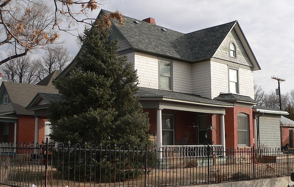
Listed on the National Register of Historic Places in 1980.
One of 19 National Register listings published here for Otero County · listed in 1980 · category: District.
Sources: the case file at the National Archives · the National Register database, National Park Service
Regional context, not property-specific evidence. The federal wildfire occurrence database lists 214 fires within 5 miles of San Juan Avenue Historic District between 2003 and 2019, burning about 179 acres in total. 3 started naturally. None was recorded as arson. Distance is straight-line from the map coordinates, so a fire counted here may appear on a neighbouring settlement's page as well.
| Reported cause | Fires |
|---|---|
| Missing data/not specified/undetermined | 172 |
| Smoking | 20 |
| Equipment and vehicle use | 8 |
| Debris and open burning | 6 |
| Fireworks | 4 |
| Natural | 3 |
| Misuse of fire by a minor | 1 |
The most recent of them, most recent first, with the day each was reported and the service that recorded it.
| Date | Cause | Size | Reported by | Name on the report |
|---|---|---|---|---|
| 6 September 2017 | Smoking | under an acre | La Junta Rural Fire Protection District | UNKNOWN |
| 6 September 2015 | Missing data/not specified/undetermined | under an acre | La Junta Rural Fire Protection District | UNKNOWN |
| 17 September 2015 | Missing data/not specified/undetermined | under an acre | La Junta Rural Fire Protection District | UNKNOWN |
| 17 September 2015 | Missing data/not specified/undetermined | under an acre | La Junta Rural Fire Protection District | UNKNOWN |
| 13 September 2015 | Missing data/not specified/undetermined | under an acre | La Junta Rural Fire Protection District | UNKNOWN |
| 1 September 2011 | Missing data/not specified/undetermined | 1.0 acres | Colorado State Forest Service-State Headquarters | LA JUNTA |
| 8 August 2015 | Missing data/not specified/undetermined | under an acre | La Junta Rural Fire Protection District | UNKNOWN |
| 8 August 2005 | Missing data/not specified/undetermined | under an acre | Colorado State Forest Service-State Headquarters | not named |
Regional context, not property-specific evidence. The federal mineral resources record lists 31 workings within 5 miles of San Juan Avenue Historic District: 17 unknowns, 7 occurrences, 6 past producers, 1 producer. 1 still produces. What was taken out: Sand and Gravel, Construction, Gypsum-Anhydrite, Stone, Crushed/Broken, Fire Clay (Refractory). Distance is straight-line from the map coordinates, so a quarry counted here may appear on a neighbouring settlement's page as well.
| Where | Site | Commodity | Status | Recorded |
|---|---|---|---|---|
| Alabaster Processing Plant | Gypsum-Anhydrite | Past Producer | ||
| La Junta Shale | Stone, Crushed/Broken | Past Producer | ||
| Unk | Clay | Unknown | ||
| Unknown | Fire Clay (Refractory) | Producer | Sedimentary | |
| La Junta Gravel Pit | Sand and Gravel, Construction | Unknown | ||
| Unk | Sand and Gravel, Construction | Unknown | ||
| Unk | Sand and Gravel, Construction | Unknown | ||
| Unk | Sand and Gravel, Construction | Unknown | ||
| Unk | Sand and Gravel, Construction | Unknown | ||
| Unk | Sand and Gravel, Construction | Unknown |
Regional context, not property-specific evidence. The National Weather Service names La Junta, the town this property stands in, in 115 storm reports between 1993 and 2024: 49 hail, 30 thunderstorm wind, 15 flash flood, 9 flood. No death or injury is recorded in these reports. Each account below is quoted exactly as the forecast office filed it, from the NOAA Storm Events Database, and each date opens the federal record of that event.
| When | Event | Place named | Harm | What the report says |
|---|---|---|---|---|
| June 2007 | Thunderstorm Wind | La Junta | $80,000 | An intense thunderstorm wind gust occurred on County Road R, hitting a ranch. Major damage occurred to a 50-foot long shed, which damaged a truck inside. Debris from the shed was thrown several hundred feet to the east. Other farm equipment sustained damage as well. Several corrals were destroyed. |
| October 1997 | Tornado (F1) | La Junta | $75,000 | Another supercell thunderstorm brought large hail and a tornado to southeast Otero county. The storm and accompanying tornado moved out of open country southwest of the Higbee Valley and struck several ranches just north of the Purgatoire River on Road 804. At about 8:45 p.m. the tornado struck three ranches about 3 miles southwest of Higbee. Some barns were destroyed, and roofs were ripped off others. Horse trailers, windmills, feed troughs, hay feeders, water tanks, grain storage bins were destroyed. Many large cottonwood trees were broken off or uprooted. The tornado ripped through the northwest side of Higbee, and one horse perished from injuries due to flying debris there. The tornado then moved northeast through open ranch country for another 5 miles, with the only known damage being two downed power poles. |
| May 1998 | Tornado (F1) | La Junta | $50,000 | A narrow tornado and 80 to 100 mph straight-line winds downed power lines... damaged several grain bins and storage silos...uprooted large trees...shattered some windows...and partially ripped off some roofs in the rural Star Valley area west of La Junta. A large 40x100 foot machine shop was destroyed. Several small sheds were also destroyed. Power was not restored to some parts of the area until the following afternoon. |
| October 1997 | Hail | La Junta | $50,000 | no account filed |
| June 2013 | Thunderstorm Wind | North La Junta | $30,000 | Severe storm wind gusts caused gas station sign and overhang damage. In addition, trees snapped and uprooted in the City of La Junta while airport hangers were damaged at the La Junta airport. |
| May 1998 | Thunderstorm Wind | La Junta | $25,000 | Damaging straight-line winds moved through mainly northern La Junta. Hardest hit was the Fair View Cemetery, on the northwest side of town, where about 25 large trees were damaged or uprooted. Spotty roof and sign damage occurred on the north side of La Junta. |
| June 2002 | Thunderstorm Wind | La Junta | $20,000 | no account filed |
| August 2007 | Lightning | La Junta | $10,000 | Lightning strikes causes small fires in a few buildings. |
| October 1997 | Hail | La Junta | $10,000 | no account filed |
| July 2001 | Lightning | La Junta | $3,000 | A lightning strike burned up a transformer and caused 4 wells to stop working for 2 days in the La Junta area. |
| September 1993 | Thunderstorm Wind | La Junta | $500 | Severe thunderstorms rumbled across portions of Eastern Colorado. Golfball hail damaged cars north of Limon, while wind- driven marble-size hail broke windows southeast of Shamrock (26 miles south of Fort Morgan). Thunderstorm winds blew over an overhead sign onto the intersection of Interstate 70 and Interstate 25 in Denver, causing considerable damage to 4 vehicles. The winds also caused a police car to be blown off the road northeast of Denver. Thunderstorm winds gusting to 66 mph (57 knots) damaged the siding of a residence southeast of Brighton. In Arriba (18 miles east of Limon), one-inch diameter hail broke windows, damaged vehicles and destroyed crops, while thunderstorm winds knocked a shed onto a camper. Thunderstorm winds blew over a camper and a semi north of Lamar, and knocked down power lines in La Junta, causing a brief power outage. |
| April 1993 | Thunderstorm Wind | La Junta | $500 | Thunderstorm winds blew down several fences in La Junta. |
| May 2024 | Hail | La Junta | - | Trained spotter reported mostly pea size hail, with quarter size mixed in. |
| May 2023 | Hail | North La Junta | - | Reported from a trained spotter. |
| July 2023 | Flood | La Junta | - | Reports of major flooding along Highway 50 and Highway 350 near La Junta. Multiple cars stuck in 3 feet of water. |
| August 2022 | Flash Flood | La Junta | - | Underpass flooded and impassable. |
| August 2022 | Thunderstorm Wind | La Junta | - | Blown down power poll. |
| August 2022 | Thunderstorm Wind | La Junta | - | Blown down power pole. |
| July 2022 | Flash Flood | La Junta | - | Spotter reports Highway 50 is closed in La Junta due to flash flooding under railroad underpass. |
| September 2021 | Thunderstorm Wind | La Junta | - | Downed tree branches were reported across La Junta. |
| July 2021 | Flash Flood | La Junta | - | Multiple underpasses were flooded in La Junta. |
| May 2021 | Flash Flood | La Junta | - | High water flowing across State Highway 109, with car stranded. |
| May 2021 | Flood | North La Junta | - | Homes on Bradish Avenue flooded. Arroyos draining into Arkansas River have caused river levels to rise above flood levels. |
| July 2020 | Flash Flood | La Junta | - | Heavy rainfall produced 2.5 to 3 feet of water, flooding Highway 50 and closing the road at the railroad overpass. |
| July 2020 | Flash Flood | La Junta | - | Potter Dr. underpass flooded. |
| July 2019 | Heavy Rain | La Junta | - | Nearly one inch of rain fell within an hour. |
| June 2018 | Tornado (EF0) | La Junta | - | A delayed review and report of a landspout south of La Junta 4 miles south of La Junta, Colorado. No damage was noted with this landspout . Pictures were sent to a local broadcast meteorologist and was virtually undetectable via radar. There was a Tornado Watch for this event, the watch number was #191. |
| July 2018 | Flash Flood | La Junta | - | Heavy rain caused US Highway 50 to close in La Junta due to flash flooding, according to the State Patrol. |
| May 2015 | Tornado (EF0) | La Junta | - | A short-lived tornado occurred over open country and caused no damage. |
| July 2014 | Flood | La Junta | - | The Arkansas River at La Junta went just above flood stage, causing minor agricultural flooding. |
| July 2014 | Flood | La Junta | - | The Arkansas River at La Junta went above flood stage, causing minor agricultural flooding. |
| July 2014 | Flash Flood | North La Junta | - | Numerous roads and low lying areas experienced flash flooding central Otero County, including the La Junta and Swink areas, and arroyo watersheds in the south-cental portions of the county. Highways 109 and 50 were closed for several hours. |
| July 2014 | Flood | La Junta | - | The Arkansas River at La Junta briefly went above flood stage causing minor agricultural flooding. |
| July 2014 | Flood | La Junta | - | The Arkansas River at La Junta briefly went above flood stage causing minor agricultural flooding. |
| September 2013 | Flood | La Junta | - | The Arkansas River went above flood stage in the La Junta area, flooding some roads near the river. |
| September 2012 | Funnel Cloud | La Junta | - | The funnel was more than half way to the ground. |
| July 2011 | Thunderstorm Wind | La Junta | - | No known damage. |
| July 2006 | Flash Flood | La Junta | - | Rainfall amounts of 2 to 3 inches in one hour's time fell on already saturated ground in Pueblo County as well as several other counties in southeast Colorado. Numerous creeks, arroyos and low water crossings flooded with fast flowing water and debris. The heavy rain also caused flooding of roads in Pueblo West and over portions of I-25, prompting numerous water rescues. As the heavy rains continued eastward, flooding problems then spread east across portions of Crowley, Otero and Bent Counties, leaving behind additional closed roads, including US Highway 50 in La Junta, Highway 194 near Las Animas and numerous county roads around Ordway. |
| August 2004 | Flash Flood | La Junta | - | Slow moving thunderstorms caused heavy rain which brought flash flooding to highway 194. |
| August 2004 | Flash Flood | La Junta | - | Slow moving thunderstorms produced very heavy rain and flash flooding on highways 94 and 50. |
| August 2004 | Flash Flood | La Junta | - | Very heavy rain from a slow moving thunderstorm resulted in water over 6 inches deep to flow over highway 50 on the Bent-Otero County line. |
| June 1995 | Tornado (F0) | La Junta | - | Tornado in open country with no known damage. |
| April 1993 | Hail | La Junta | - | Marble-size hail covered the ground at a depth of 1 inch, 5 miles south of La Junta. |
| July 2023 | Hail | La Junta | - | no account filed |
| July 2022 | Thunderstorm Wind | La Junta | - | no account filed |
| July 2022 | Thunderstorm Wind | La Junta | - | no account filed |
| May 2021 | Thunderstorm Wind | La Junta | - | no account filed |
| May 2021 | Hail | La Junta | - | no account filed |
| June 2017 | Hail | La Junta | - | no account filed |
| August 2017 | Hail | La Junta | - | no account filed |
| August 2017 | Hail | La Junta | - | no account filed |
| August 2017 | Hail | La Junta | - | no account filed |
| June 2016 | Hail | North La Junta | - | no account filed |
| June 2016 | Thunderstorm Wind | La Junta | - | no account filed |
| August 2015 | Hail | North La Junta | - | no account filed |
| May 2015 | Hail | La Junta | - | no account filed |
| May 2015 | Flash Flood | La Junta | - | no account filed |
| August 2015 | Hail | La Junta | - | no account filed |
| July 2014 | Flood | La Junta | - | no account filed |
| September 2012 | Hail | La Junta | - | no account filed |
No historic map-sheet match is published for this property yet. That does not mean no map exists. This record needs a coordinate-quality review before it can be joined to a sheet boundary. Browse the county's mapped places while that work is pending.
Other National Register properties close enough to walk or drive between, ordered by distance from this one. Both positions come from the same geocoding pass that matched these properties to their map sheets.
| Photograph | Property | Distance | Listed |
|---|---|---|---|
| United Methodist Church of La Junta | under 500 feet | 2025 | |
 | Dr. Frank Finney House | 0.1 miles | 1984 |
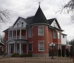 | Eugene Rourke House | 0.2 miles | 1983 |
 | U.S. Post Office | 0.2 miles | 1976 |
 | Lincoln School | 0.2 miles | 1978 |
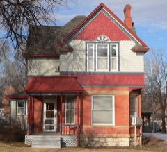 | Wilson A. Hart House | 0.3 miles | 1979 |
| National Archives record | The nomination case file for reference 80000918 in Record Group 79. |
| Otero County | All 19 listed properties in this county. |