 Block
From the record
19 National Register listings published here, 1 of them a National Historic Landmark.
Sources: the National Register database, National Park Service
92 topographic sheets cover 29 settlements here, and 19 properties are on the National Register of Historic Places.
19 National Register listings published here, 1 of them a National Historic Landmark.
Sources: the National Register database, National Park Service
Every property in this county listed on the National Register of Historic Places, with the year it was listed and the federal nomination document.
| Photograph | Property | Type | Listed | Reference |
|---|---|---|---|---|
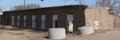 | Adobe Stables, Arkansas Valley Fairgrounds | building | 2007 | 07001305 |
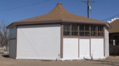 | Art Building | building | 1996 | 96001027 |
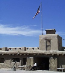 | Bent's Old Fort National Historic Site | district | 1966 | 66000254 |
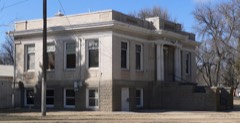 | Carnegie Public Library | building | 1995 | 95001247 |
 | Dr. Frank Finney House | building | 1984 | 84000877 |
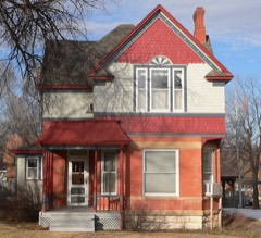 | Wilson A. Hart House | building | 1979 | 79000617 |
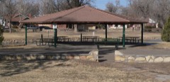 | La Junta City Park | district | 2007 | 07000343 |
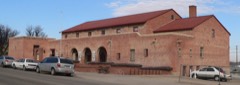 | Lincoln School | building | 1978 | 78000874 |
| Manzanola United Methodist Church (MUMC) | building | 2024 | 100011069 | |
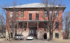 | North La Junta School | building | 1992 | 92000809 |
 | Rocky Ford Post Office | building | 2008 | 07001394 |
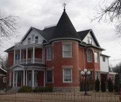 | Eugene Rourke House | building | 1983 | 83001326 |
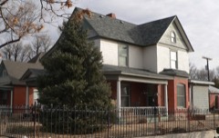 | San Juan Avenue Historic District | district | 1980 | 80000918 |
 | Santa Fe Railway Manzanola Depot | building | 2004 | 04000363 |
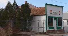 | Daniel Sciumbato Grocery Store | building | 1984 | 84000878 |
| Swink School | building | 2025 | 100011578 | |
 | U.S. Post Office | building | 1976 | 76000565 |
| United Methodist Church of La Junta | building | 2025 | 100011789 | |
| Valley View-Hillcrest Cemetery | site | 2024 | 100010592 |
Every wildfire the federal occurrence database records inside this county: 757 of them, burning about 15,986 acres. 38 started naturally and 3 were recorded as arson. Each settlement page carries the fires within five miles of it.
| Reported cause | Fires |
|---|---|
| Missing data/not specified/undetermined | 543 |
| Debris and open burning | 46 |
| Equipment and vehicle use | 42 |
| Smoking | 41 |
| Natural | 38 |
| Recreation and ceremony | 29 |
| Fireworks | 7 |
| Railroad operations and maintenance | 4 |
| Arson/incendiarism | 3 |
| Misuse of fire by a minor | 2 |
| Other causes | 1 |
| Power generation/transmission/distribution | 1 |
The five largest, by the area the report gives. None of them was recorded as arson.
| Date | Cause | Size | Reported by | Name on the report |
|---|---|---|---|---|
| 14 December 2003 | Missing data/not specified/undetermined | 2,500 acres | Colorado State Forest Service-State Headquarters | not named |
| 19 February 2011 | Equipment and vehicle use | 2,042 acres | Pike and San Isabel National Forest | SIERRA VISTA |
| 3 June 2011 | Missing data/not specified/undetermined | 2,000 acres | Colorado State Forest Service-State Headquarters | LA JUNTA |
| 23 March 2002 | Debris and open burning | 1,725 acres | Bents Old Fort National Historic Site | SANTA FE |
| 11 April 2020 | Missing data/not specified/undetermined | 1,500 acres | Otero County | BENT FORT |
| 14 April 2008 | Debris and open burning | 1,227 acres | Pike and San Isabel National Forest | SNAKEWEED |
| 24 July 2011 | Natural | 1,044 acres | Pike and San Isabel National Forest | WITHERS CANYON |
| 24 November 2018 | Missing data/not specified/undetermined | 505 acres | Otero County | TIMBER |
Every settlement page carries the fires within five miles of it - see the settlement index below.
The NOAA Storm Events Database holds 445 reports for this county, causing 4 deaths, no injuries and about $554,750 in recorded property damage. Each settlement page carries the reports that name it.
| Kind of event | Reports |
|---|---|
| Hail | 219 |
| Thunderstorm Wind | 137 |
| Tornado | 30 |
| Flash Flood | 27 |
| Flood | 12 |
| Heavy Rain | 11 |
| Lightning | 5 |
| Funnel Cloud | 4 |
The most serious of them, by death, then injury, then recorded damage. The accounts are quoted exactly as the forecast office filed them.
| When | Event | Place named | Harm | What the report says |
|---|---|---|---|---|
| June 2016 | Thunderstorm Wind | (Lhx)La Junta Arpt | 1 killed, $10,000 | A microburst flipped over a 30-foot trailer home and killed the male occupant. |
| June 2024 | Flood | (Lhx)La Junta Arpt | 1 killed | Sustained high flow releases from Pueblo Reservoir led to brief periods of minor flooding along the Arkansas River in La Junta (LXHC2) from June 12-13 and again on June 15. The LXHC2 stream gauge reported the first crest of 11.36 ft on June 12 and a second crest of 11.32 ft on June 15. One fatality was reported for the June 15 event. |
| September 2005 | Lightning | Rocky Ford | 1 killed | A 36-year old man was struck and killed by lightning while work outside on a farm. |
| September 1996 | Lightning | Swink | 1 killed | no account filed |
| June 2007 | Thunderstorm Wind | La Junta | $80,000 | An intense thunderstorm wind gust occurred on County Road R, hitting a ranch. Major damage occurred to a 50-foot long shed, which damaged a truck inside. Debris from the shed was thrown several hundred feet to the east. Other farm equipment sustained damage as well. Several corrals were destroyed. |
| October 1997 | Tornado (F1) | La Junta | $75,000 | Another supercell thunderstorm brought large hail and a tornado to southeast Otero county. The storm and accompanying tornado moved out of open country southwest of the Higbee Valley and struck several ranches just north of the Purgatoire River on Road 804. At about 8:45 p.m. the tornado struck three ranches about 3 miles southwest of Higbee. Some barns were destroyed, and roofs were ripped off others. Horse trailers, windmills, feed troughs, hay feeders, water tanks, grain storage bins were destroyed. Many large cottonwood trees were broken off or uprooted. The tornado ripped through the northwest side of Higbee, and one horse perished from injuries due to flying debris there. The tornado then moved northeast through open ranch country for another 5 miles, with the only known damage being two downed power poles. |
| June 2007 | Flash Flood | Fowler | $50,000 | A complex of strong to severe thunderstorms produced very heavy rain which flooded low areas and basements from Fowler to Rocky Ford. |
| May 1998 | Tornado (F1) | La Junta | $50,000 | A narrow tornado and 80 to 100 mph straight-line winds downed power lines... damaged several grain bins and storage silos...uprooted large trees...shattered some windows...and partially ripped off some roofs in the rural Star Valley area west of La Junta. A large 40x100 foot machine shop was destroyed. Several small sheds were also destroyed. Power was not restored to some parts of the area until the following afternoon. |
| August 2003 | Thunderstorm Wind | Rocky Ford | $50,000 | no account filed |
| October 1997 | Hail | La Junta | $50,000 | no account filed |
| June 2013 | Thunderstorm Wind | North La Junta | $30,000 | Severe storm wind gusts caused gas station sign and overhang damage. In addition, trees snapped and uprooted in the City of La Junta while airport hangers were damaged at the La Junta airport. |
| May 1998 | Thunderstorm Wind | La Junta Arpt | $25,000 | Damaging winds moved through the industrial park and airport complex north of La Junta. Several windows were blown out of the municipal golf course clubhouse. A partially erected building in the complex was destroyed. The roof of a restroom facility was blown off. Several trees were uprooted. A trailer just south of the complex was blown on its side. |
| May 1998 | Thunderstorm Wind | La Junta | $25,000 | Damaging straight-line winds moved through mainly northern La Junta. Hardest hit was the Fair View Cemetery, on the northwest side of town, where about 25 large trees were damaged or uprooted. Spotty roof and sign damage occurred on the north side of La Junta. |
| October 1953 | Tornado | not stated | $25,000 | no account filed |
| June 2002 | Thunderstorm Wind | La Junta | $20,000 | no account filed |
| August 2007 | Lightning | La Junta | $10,000 | Lightning strikes causes small fires in a few buildings. |
| September 2001 | Hail | Swink | $10,000 | Severe thunderstorms produced hail up to baseball size in northern Otero County. At Holbrook Reservoir golf ball to baseball size hail killed over 1600 birds. The dead birds include: 1479 pelicans...over 100 acelots...about 50 gulls...24 ducks...and a couple dozen other waterfowl. A few homes in the area also had their windows broken by the large hail. |
| October 1997 | Hail | La Junta | $10,000 | no account filed |
| July 2014 | Thunderstorm Wind | Fowler | $8,000 | A hay barn was severely damaged on County Road 1. |
| July 2011 | Thunderstorm Wind | Timpas | $5,000 | A severe storm produced damaging winds. Large tree limbs were brought down. Decking was damaged. The roof to a cattle barn was lofted several hundred feet and ended up in the High Line Canal. |
| August 2004 | Lightning | Rocky Ford | $4,000 | A lightning strike caused a haystack to catch fire. |
| July 2014 | Thunderstorm Wind | Fowler | $3,000 | Power poles and lines were taken down on County Road 3 south of Fowler. |
| July 2001 | Lightning | La Junta | $3,000 | A lightning strike burned up a transformer and caused 4 wells to stop working for 2 days in the La Junta area. |
| June 1983 | Tornado (F1) | not stated | $2,500 | no account filed |
| July 1966 | Tornado (F1) | not stated | $2,500 | no account filed |
| June 1962 | Tornado (F1) | not stated | $2,500 | no account filed |
| October 1953 | Tornado (F2) | not stated | $2,500 | no account filed |
| September 1993 | Thunderstorm Wind | La Junta | $500 | Severe thunderstorms rumbled across portions of Eastern Colorado. Golfball hail damaged cars north of Limon, while wind- driven marble-size hail broke windows southeast of Shamrock (26 miles south of Fort Morgan). Thunderstorm winds blew over an overhead sign onto the intersection of Interstate 70 and Interstate 25 in Denver, causing considerable damage to 4 vehicles. The winds also caused a police car to be blown off the road northeast of Denver. Thunderstorm winds gusting to 66 mph (57 knots) damaged the siding of a residence southeast of Brighton. In Arriba (18 miles east of Limon), one-inch diameter hail broke windows, damaged vehicles and destroyed crops, while thunderstorm winds knocked a shed onto a camper. Thunderstorm winds blew over a camper and a semi north of Lamar, and knocked down power lines in La Junta, causing a brief power outage. |
| April 1993 | Thunderstorm Wind | La Junta | $500 | Thunderstorm winds blew down several fences in La Junta. |
| May 1962 | Tornado (F1) | not stated | $250 | no account filed |
| May 1957 | Tornado | not stated | $250 | no account filed |
| August 1953 | Tornado | not stated | $250 | no account filed |
| May 2024 | Thunderstorm Wind | (Lhx)La Junta Arpt | - | Measured via the ASOS station (KLHX) airport. |
| May 2024 | Thunderstorm Wind | (Lhx)La Junta Arpt | - | La Junta airport. |
| May 2024 | Hail | La Junta | - | Trained spotter reported mostly pea size hail, with quarter size mixed in. |
| July 2024 | Hail | Cheraw | - | One inch measured hail was reported. |
| July 2024 | Thunderstorm Wind | Fowler | - | Mesonet station fw4234 at Fowler reported 67mph wind gust. |
| July 2024 | Thunderstorm Wind | Manzanola | - | Four transmission power poles along US50 just west of Manzanola blown down. Numerous trees down in Otero county. Time based on radar. |
| July 2024 | Flood | (Lhx)La Junta Arpt | - | Locally heavy rainfall (radar QPE estimated 1-2 inches) resulted in a quick rise and brief period of minor flooding along the Arkansas River in La Junta (LXHC2). The river crested just above Minor Flood Stage at 11.20 ft. at 6:15am MDT. |
| July 2024 | Flash Flood | Manzanola | - | Right lane of Hwy 50 flooded with one car stalled. |
| July 2024 | Flash Flood | Rocky Ford | - | Flooded intersection at Highway 50 and Steen Ave, in La Junta, began at 8:55pm MDT. Road closed due to high water. |
| October 2024 | Thunderstorm Wind | (Lhx)La Junta Arpt | - | Surface observations from KLHX. |
| June 2024 | Thunderstorm Wind | (Lhx)La Junta Arpt | - | ASOS at the La Junta Airport reported wind gusts from a severe thunderstorm, which measured 63 kts. |
| June 2024 | Thunderstorm Wind | Cheraw | - | A trained spotter reported an 8 inch live tree limb blown off. Another dead tree was also blown down. 3/4 inch hail also occurred. |
| May 2023 | Hail | North La Junta | - | Reported from a trained spotter. |
| May 2023 | Thunderstorm Wind | (Lhx)La Junta Arpt | - | Reported by La Junta surface observations. |
| July 2023 | Flash Flood | Timpas | - | Highway 350 closed between mile marker 47 and 48 due to road damage and flooding. |
| July 2023 | Flood | La Junta | - | Reports of major flooding along Highway 50 and Highway 350 near La Junta. Multiple cars stuck in 3 feet of water. |
| June 2023 | Heavy Rain | Higbee | - | There was 0.98 inches that fell within an hour. |
| June 2023 | Flash Flood | Higbee | - | Water in creek is over the road and bridge. Local estimates are that the creek is running at least 10 feet higher than normal. |
| August 2022 | Flash Flood | La Junta | - | Underpass flooded and impassable. |
| August 2022 | Flash Flood | Swink | - | Flooding over Highway 50 in spots between Reynolds Ave and CR 24. |
| August 2022 | Thunderstorm Wind | La Junta | - | Blown down power poll. |
| August 2022 | Thunderstorm Wind | Rocky Ford | - | Two power poles blow over. |
| August 2022 | Thunderstorm Wind | La Junta | - | Blown down power pole. |
| July 2022 | Flash Flood | La Junta | - | Spotter reports Highway 50 is closed in La Junta due to flash flooding under railroad underpass. |
| July 2022 | Tornado (EF0) | (Lhx)La Junta Arpt | - | Pictures from Otero county sheriffs office show minor structural damage to a residence north of Highway 50 and south of the Arkansas river, northeast of casa. Winds are estimated at 80 mph. The tornado continued to track towards the Otero and Bent county line before lifting. |
| July 2022 | Thunderstorm Wind | Rocky Ford | - | Otero county sheriffs office reported numerous trees down across the county. |
| July 2022 | Heavy Rain | Swink | - | Heavy rainfall of 2.22 inches. |
| July 2022 | Heavy Rain | Rocky Ford | - | Heavy rainfall of 2.50 inches. |
The Survey's mineral resources record lists 81 workings inside this county. 4 still produce and 77 are closed or unrecorded. Each settlement page carries the workings within five miles of it.
| Commodity | Workings |
|---|---|
| Sand and Gravel, Construction | 62 |
| Clay | 7 |
| Fire Clay (Refractory) | 5 |
| Stone | 4 |
| Stone, Dimension | 1 |
| Gypsum-Anhydrite | 1 |
| Stone, Crushed/Broken | 1 |
The least common of them first, because a county's hundredth gravel pit says nothing its first ten did not.
| Where | Site | Commodity | Status | Recorded |
|---|---|---|---|---|
| Alabaster Processing Plant | Gypsum-Anhydrite | Past Producer | ||
| La Junta Shale | Stone, Crushed/Broken | Past Producer | ||
| Unknown | Stone, Dimension | Occurrence | ||
| Unk | Stone | Unknown | ||
| Unk | Stone | Unknown | ||
| Unk | Stone | Unknown | ||
| Unknown | Stone | Occurrence | ||
| Unknown | Fire Clay (Refractory) | Occurrence | Sedimentary | |
| Unknown | Fire Clay (Refractory) | Occurrence | Sedimentary | |
| Unknown | Fire Clay (Refractory) | Occurrence | Sedimentary | |
| Unknown | Fire Clay (Refractory) | Producer | Sedimentary | |
| Unknown | Fire Clay (Refractory) | Producer | Sedimentary | |
| Unk | Clay | Unknown | ||
| Unk | Clay | Unknown | ||
| Unk | Clay | Unknown | ||
| Unk | Clay | Unknown | ||
| Unk | Clay | Unknown | ||
| Unk | Clay | Unknown | ||
| Unknown | Clay | Occurrence | Sedimentary | |
| Hancock Pit | Sand and Gravel, Construction | Producer | ||
| Korinek Trout Farm Pit | Sand and Gravel, Construction | Unknown | ||
| La Junta Gravel Pit | Sand and Gravel, Construction | Unknown | ||
| Unk | Sand and Gravel, Construction | Unknown | ||
| Unk | Sand and Gravel, Construction | Unknown | ||
| Unk | Sand and Gravel, Construction | Past Producer | ||
| Unk | Sand and Gravel, Construction | Past Producer | ||
| Unk | Sand and Gravel, Construction | Past Producer | ||
| Unk | Sand and Gravel, Construction | Unknown | ||
| Unk | Sand and Gravel, Construction | Unknown | ||
| Unk | Sand and Gravel, Construction | Unknown | ||
| Unk | Sand and Gravel, Construction | Unknown | ||
| Unk | Sand and Gravel, Construction | Unknown | ||
| Unk | Sand and Gravel, Construction | Unknown | ||
| Unk | Sand and Gravel, Construction | Unknown | ||
| Unk | Sand and Gravel, Construction | Unknown | ||
| Unk | Sand and Gravel, Construction | Unknown | ||
| Unk | Sand and Gravel, Construction | Unknown | ||
| Unk | Sand and Gravel, Construction | Unknown | ||
| Unk | Sand and Gravel, Construction | Unknown | ||
| Unk | Sand and Gravel, Construction | Unknown | ||
| Unk | Sand and Gravel, Construction | Unknown | ||
| Unk | Sand and Gravel, Construction | Unknown | ||
| Unk | Sand and Gravel, Construction | Past Producer | ||
| Unk | Sand and Gravel, Construction | Unknown | ||
| Unk | Sand and Gravel, Construction | Unknown | ||
| Unk | Sand and Gravel, Construction | Unknown | ||
| Unk | Sand and Gravel, Construction | Unknown | ||
| Unk | Sand and Gravel, Construction | Unknown | ||
| Unk | Sand and Gravel, Construction | Unknown | ||
| Unk | Sand and Gravel, Construction | Unknown | ||
| Unk | Sand and Gravel, Construction | Unknown | ||
| Unk | Sand and Gravel, Construction | Unknown | ||
| Unk | Sand and Gravel, Construction | Unknown | ||
| Unk | Sand and Gravel, Construction | Unknown | ||
| Unk | Sand and Gravel, Construction | Unknown | ||
| Unk | Sand and Gravel, Construction | Past Producer | ||
| Unk | Sand and Gravel, Construction | Past Producer | ||
| Unk | Sand and Gravel, Construction | Unknown | ||
| Unk | Sand and Gravel, Construction | Unknown | ||
| Unk | Sand and Gravel, Construction | Unknown | ||
| Unk | Sand and Gravel, Construction | Unknown | ||
| Unk | Sand and Gravel, Construction | Unknown | ||
| Unk | Sand and Gravel, Construction | Unknown | ||
| Unk | Sand and Gravel, Construction | Unknown | ||
| Unknown | Sand and Gravel, Construction | Occurrence | Gravel | |
| Unknown | Sand and Gravel, Construction | Occurrence | Gravel | |
| Unknown | Sand and Gravel, Construction | Occurrence | Gravel | |
| Unknown | Sand and Gravel, Construction | Occurrence | Gravel | |
| Unknown | Sand and Gravel, Construction | Occurrence | ||
| Unknown | Sand and Gravel, Construction | Occurrence | Gravel | |
| Unknown | Sand and Gravel, Construction | Occurrence | ||
| Unknown | Sand and Gravel, Construction | Occurrence | Gravel | |
| Unknown | Sand and Gravel, Construction | Occurrence | Gravel | |
| Unknown | Sand and Gravel, Construction | Occurrence | Gravel | |
| Unknown | Sand and Gravel, Construction | Occurrence | Gravel | |
| Unknown | Sand and Gravel, Construction | Occurrence | Gravel | |
| Unknown | Sand and Gravel, Construction | Occurrence | Gravel | |
| Unknown | Sand and Gravel, Construction | Occurrence | ||
| Unknown | Sand and Gravel, Construction | Occurrence | ||
| Unknown | Sand and Gravel, Construction | Occurrence | ||
| Valco Concrete Div No. 1 | Sand and Gravel, Construction | Producer |
Named settlements recorded in the Geographic Names Information System, each with the topographic sheets covering it. Villages, hamlets and abandoned places alike. Each is shown with the nearest named watercourse or landform and the survey quadrangle it falls on.
Timpas census division · 81059 · On Hoe Ranch Arroyo · Timpas quadrangle
17 sheets, 1891 to 1996
Timpas census division · 81050 · On Benton Arroyo · Hawley quadrangle
18 sheets, 1891 to 1996
Timpas census division · 81050 · On Thompson Arroyo · Hadley quadrangle
15 sheets, 1891 to 1981
Timpas census division · 81050 · On Robinson Arroyo · Hadley quadrangle
15 sheets, 1891 to 1981
La Junta census division · 81050 · On Anderson Arroyo · La Junta quadrangle
18 sheets, 1891 to 1996
Cheraw census division · 81050 · On Anderson Arroyo · La Junta quadrangle
18 sheets, 1891 to 1996
Manzanola census division · 81058 · Near Smith Hollow · Manzanola quadrangle
14 sheets, 1891 to 1981
Timpas census division · 81059 · On Bear Springs Arroyo · Bloom quadrangle
18 sheets, 1891 to 1996
Cheraw census division · 81050 · On King Arroyo · La Junta quadrangle
18 sheets, 1891 to 1996
Cheraw census division · 81050 · On Vandiver Arroyo · Hadley quadrangle
15 sheets, 1891 to 1981
No longer a settlement
La Junta census division · 81077 · On Timpas Creek · Rocky Ford quadrangle
14 sheets, 1891 to 1981
Manzanola census division · 81067 · Near Patterson Hollow · Manzanola quadrangle
14 sheets, 1891 to 1981
The vanished settlements of Otero County: the places named above that are no longer on the map.