 Block
From the record
One of 10 National Register listings published here for Custer County · listed in 1993 · category: Building.
Sources: the case file at the National Archives · the National Register database, National Park Service
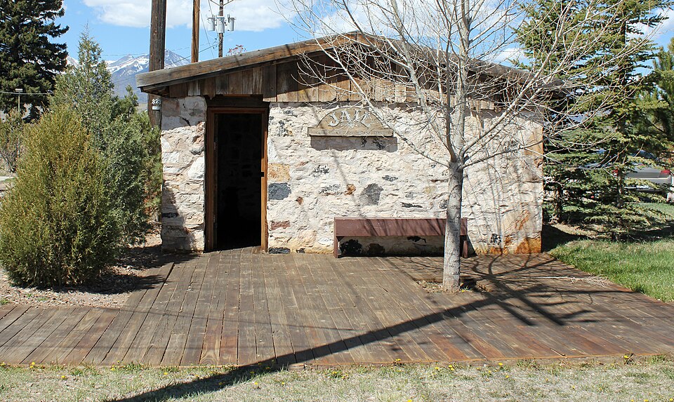
Listed on the National Register of Historic Places in 1993.
One of 10 National Register listings published here for Custer County · listed in 1993 · category: Building.
Sources: the case file at the National Archives · the National Register database, National Park Service
Regional context, not property-specific evidence. The federal wildfire occurrence database lists 41 fires within 5 miles of Westcliffe Jail between 1992 and 2020, burning about 192 acres in total. 9 started naturally. None was recorded as arson. Distance is straight-line from the map coordinates, so a fire counted here may appear on a neighbouring settlement's page as well.
| Reported cause | Fires |
|---|---|
| Missing data/not specified/undetermined | 24 |
| Natural | 9 |
| Recreation and ceremony | 3 |
| Smoking | 2 |
| Misuse of fire by a minor | 1 |
| Equipment and vehicle use | 1 |
| Debris and open burning | 1 |
The most recent of them, most recent first, with the day each was reported and the service that recorded it.
| Date | Cause | Size | Reported by | Name on the report |
|---|---|---|---|---|
| 8 September 2010 | Missing data/not specified/undetermined | under an acre | Colorado State Forest Service-State Headquarters | not named |
| 28 September 2010 | Natural | under an acre | Colorado State Forest Service-State Headquarters | not named |
| 19 September 2010 | Natural | under an acre | Colorado State Forest Service-State Headquarters | not named |
| 15 September 2010 | Natural | under an acre | Colorado State Forest Service-State Headquarters | not named |
| 6 August 2007 | Natural | under an acre | Pike and San Isabel National Forest | MILLBALL |
| 31 August 2018 | Natural | 1.0 acres | Wet Mountain Fire Protection District | UNKNOWN |
| 29 August 2016 | Missing data/not specified/undetermined | under an acre | Wet Mountain Fire Protection District | UNKNOWN |
| 15 August 2010 | Natural | under an acre | Colorado State Forest Service-State Headquarters | not named |
Regional context, not property-specific evidence. The federal mineral resources record lists 54 workings within 5 miles of Westcliffe Jail: 30 past producers, 10 prospects, 7 producers, 7 occurrences. 7 still produce. What was taken out: Silver, Manganese, Perlite, Sand and Gravel, Construction. Distance is straight-line from the map coordinates, so a quarry counted here may appear on a neighbouring settlement's page as well.
| Where | Site | Commodity | Status | Recorded |
|---|---|---|---|---|
| Bull Domingo Mine | Lead, Silver, Zinc, Gold, Uranium | Past Producer | 1879, 1880, 1914 | |
| Dakota Maid Prospect | Silver, Gold, Lead | Prospect | Galena, Pyrite, Tetrahedrite | |
| Defender Mine | Silver, Lead, Zinc, Gold | Past Producer | 1882 | |
| Defender Mine | Lead, Silver, Zinc | Past Producer | ||
| Dolly Varden | Zinc, Silver, Lead | Prospect | vein | |
| Geyser Mine | Lead, Silver, Gold, Copper, Zinc | Past Producer | 1878, 1880, 1911 | |
| Herman Passiflora Mine | Silver, Lead, Gold, Iron, Copper | Past Producer | 1895 | |
| Immortal Mine | Silver, Iron, Lead, Copper | Past Producer | 1882 | |
| Jit Prospect | Zinc, Lead, Manganese | Prospect | Chalcopyrite, Galena | |
| Kate Mine | Silver, Copper, Lead, Iron | Past Producer | 1885 |
Regional context, not property-specific evidence. The National Weather Service names Westcliffe, the town this property stands in, in 53 storm reports between 1993 and 2024: 34 hail, 6 flash flood, 5 funnel cloud, 3 tornado. The reports record 1 death and 1 injury. Each account below is quoted exactly as the forecast office filed it, from the NOAA Storm Events Database, and each date opens the federal record of that event.
| When | Event | Place named | Harm | What the report says |
|---|---|---|---|---|
| August 2011 | Lightning | Westcliffe | 1 killed, 1 hurt | no account filed |
| April 2002 | Wildfire | Westcliffe | $100,000 | no account filed |
| May 2002 | Wildfire | Westcliffe | $100,000 | no account filed |
| July 2003 | Flash Flood | Westcliffe | $20,000 | no account filed |
| August 1993 | Hail | Westcliffe | $500 | Severe thunderstorms rolled through portions of Chaffee and Custer Counties. Hail up to walnut-size damaged windows in Johnson Village (21 miles northwest of Salida) and Westcliffe. |
| May 2024 | Funnel Cloud | Westcliffe | - | Cold air funnel, documented by video moving over Eureka Mountain and Spread Eagle Peak. |
| July 2021 | Flash Flood | Westcliffe | - | Hermit road from Highway 69 to 96 was closed due to flooding in several locations. |
| July 2021 | Flash Flood | Westcliffe | - | Flooding of intersection near 3rd and Edwards avenue. |
| July 2021 | Heavy Rain | Westcliffe | - | Heavy rainfall of 1.92 inches. |
| July 2019 | Funnel Cloud | Westcliffe | - | Spotter reported a funnel cloud near Lake DeWeese. |
| July 2019 | Tornado (EF0) | Westcliffe | - | A tornado touched down near William Avenue in |Westcliffe, CO on the evening of July 22, 2019, traveling in|a southeast to northwest direction. A continuous path of damage |was seen for one-third of a mile before lifting as it crossed |Vista Dr. No further visible damage was seen beyond this point |but witnesses said the tornado touched down again before |nearing Wolf Street and then lifted for a final time. |Much of the damage included canopies, carports, RVs, and gazebos.|No primary residence damage was seen outside of a few missing |shingles, peeled up metal roofing, and a few blown in windows by |flying debris. One carport awning was lifted off the ground nearly|100 feet and then carried nearly 100 yards before it was dropped |onto a nearby roof. No injuries were reported. |
| July 2019 | Flash Flood | Westcliffe | - | Heavy rain closed roadway. |
| May 2012 | Funnel Cloud | Westcliffe | - | A significant funnel cloud occurred south of Westcliffe and extended around 1/2 way to the ground. |
| July 2011 | Flash Flood | Westcliffe | - | Deep water and debris was noted over Highway 69. |
| June 2007 | Tornado (EF0) | Westcliffe | - | A brief tornado occurred over open country of the Wet Mountain Valley. There was no known damage. |
| June 1997 | Tornado (F0) | Westcliffe | - | A tornado briefly occurred in an open field southeast of Westcliffe. There was no known damage. |
| October 2023 | Thunderstorm Wind | Westcliffe | - | no account filed |
| May 2021 | Hail | Westcliffe | - | no account filed |
| July 2018 | Hail | Westcliffe | - | no account filed |
| May 2016 | Hail | Westcliffe | - | no account filed |
| July 2014 | Hail | Westcliffe | - | no account filed |
| May 2012 | Hail | Westcliffe | - | no account filed |
| June 2008 | Hail | Westcliffe | - | no account filed |
| August 2008 | Hail | Westcliffe | - | no account filed |
| August 2008 | Hail | Westcliffe | - | no account filed |
| August 2008 | Hail | Westcliffe | - | no account filed |
| August 2008 | Hail | Westcliffe | - | no account filed |
| June 2007 | Hail | Westcliffe | - | no account filed |
| July 2007 | Hail | Westcliffe | - | no account filed |
| July 2007 | Hail | Westcliffe | - | no account filed |
| May 2006 | Hail | Westcliffe | - | no account filed |
| September 2005 | Hail | Westcliffe | - | no account filed |
| June 2004 | Hail | Westcliffe | - | no account filed |
| June 2004 | Hail | Westcliffe | - | no account filed |
| June 2004 | Hail | Westcliffe | - | no account filed |
| August 2004 | Hail | Westcliffe | - | no account filed |
| August 2004 | Hail | Westcliffe | - | no account filed |
| July 2004 | Hail | Westcliffe | - | no account filed |
| July 2004 | Hail | Westcliffe | - | no account filed |
| October 2004 | Hail | Westcliffe | - | no account filed |
| June 2003 | Hail | Westcliffe | - | no account filed |
| June 2003 | Hail | Westcliffe | - | no account filed |
| July 2002 | Hail | Westcliffe | - | no account filed |
| July 2001 | Hail | Westcliffe | - | no account filed |
| May 1999 | Funnel Cloud | Westcliffe | - | no account filed |
| July 1998 | Hail | Westcliffe | - | no account filed |
| July 1998 | Flash Flood | Westcliffe | - | no account filed |
| July 1998 | Hail | Westcliffe | - | no account filed |
| July 1998 | Hail | Westcliffe | - | no account filed |
| August 1998 | Hail | Westcliffe | - | no account filed |
| June 1997 | Funnel Cloud | Westcliffe | - | no account filed |
| June 1996 | Hail | Westcliffe | - | no account filed |
| July 1996 | Hail | Westcliffe | - | no account filed |
No historic map-sheet match is published for this property yet. That does not mean no map exists. This record needs a coordinate-quality review before it can be joined to a sheet boundary. Browse the county's mapped places while that work is pending.
Other National Register properties close enough to walk or drive between, ordered by distance from this one. Both positions come from the same geocoding pass that matched these properties to their map sheets.
| Photograph | Property | Distance | Listed |
|---|---|---|---|
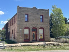 | National Hotel-Wolff Building | 0.2 miles | 1987 |
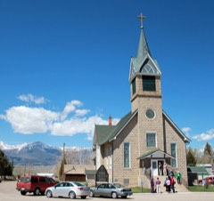 | Hope Lutheran Church | 0.3 miles | 1978 |
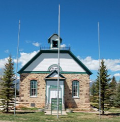 | Westcliff School | 0.3 miles | 1989 |
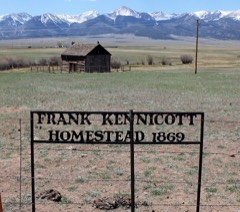 | Kennicott Cabin | 3.9 miles | 1997 |
| Willows School | 4.2 miles | 1993 | |
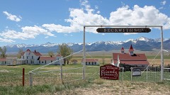 | Beckwith Ranch | 4.8 miles | 1998 |
| National Archives record | The nomination case file for reference 92001846 in Record Group 79. |
| Custer County | All 10 listed properties in this county. |