 Block
Burlington, Connecticut
30 topographic sheets cover this place, the earliest surveyed in 1892 and the latest in 1994. It stands in Burlington town. It lies in ZIP code area 06013. It lies near Two Buck Ring. The Survey maps it on the Collinsville quadrangle.
On record in Burlington
Buildings and businesses the archive holds for this place. Each opens its own page, with the source record it came from.
On the National Register 5 records
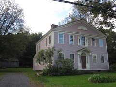 Brown Tavernlisted 1972
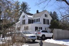 Hart's Corner Historic Districtlisted 1987
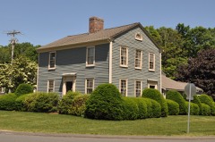 Treadwell Houselisted 1982
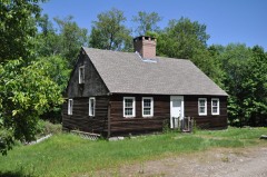 John Wiard Houselisted 1982
- Hitchcock-Schwarzmann Milllisted 1977
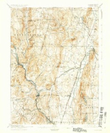
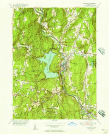
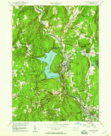
Topographic sheets covering this place
11 surveys from 30 printed sheetsMatched by testing this settlement's coordinate against the published boundary of every sheet in the United States Geological Survey's historical collection. Each opens the scanned sheet at the Survey.
- 1892 USGS Granby quadrangle1:62500, 8 printings
- 1906 USGS Farmington quadrangle1:125000, 2 printings
- 1947 USGS Hartford quadrangle1:250000, 2 printings
- 1948 USGS Hartford quadrangle1:250000, 2 printings
- 1951 USGS Collinsville quadrangle1:31680, 2 printings
- 1956 USGS Collinsville quadrangle1:24000, 5 printings
- 1961 USGS Hartford quadrangle1:250000
- 1962 USGS Hartford quadrangle1:250000, 3 printings
- 1965 USGS Hartford quadrangle1:250000, 2 printings
- 1986 USGS Hartford quadrangle1:100000
- 1994 USGS Hartford quadrangle1:100000, 2 printings








In the county-history sources
831 words on this townshipThe Memorial History of Hartford County, Connecticut, 1633-1884;, published 1886 names this settlement in its chapter on Burlington Town. These are the passages that mention it, exactly as the scans read.
West Britain from its small and sparse population furnished several soldiers for the country in the War of the Revolution. After its incorporation as Burlington the town furnished many in the War of 1812 ; and though the pensioners of those wars who belonged to the town have passed, with their honorable scars upon them, to " the undiscovered country," they are held in respectful remembrance by all who knew them. In the late Civil War the town furnished its full quota of soldiers, many of whom will return no more.
Passage source: The Memorial History of Hartford County, Connecticut, 1633-1884;, published 1886.
Simeon Hart, for many years principal of the celebrated Farmington Academy, was a native of Burlington, and received his commonschool education there. He graduated at Yale College in the class of 1823, and soon after became principal of the academy above referred to, to which he gave much celebrity, and in the management of which he gained for himself high reputation as a teacher. His useful life closed at Farmington, where for the most part it had been spent, and where his students have erected a fitting monument to his memory.
Passage source: The Memorial History of Hartford County, Connecticut, 1633-1884;, published 1886.
Machine-read from a century-old scan, so expect the errors a machine makes: misspelled names, dropped words, stray characters.
Fires near this place
139 since 1992Regional context, not property-specific evidence. The federal wildfire occurrence database lists 139 fires within 5 miles of Burlington between 1992 and 2020, burning about 398 acres in total. None started naturally. 13 were recorded as arson. Distance is straight-line from the map coordinates, so a fire counted here may appear on a neighbouring settlement's page as well.
| Reported cause | Fires |
|---|---|
| Missing data/not specified/undetermined | 98 |
| Debris and open burning | 15 |
| Arson/incendiarism | 13 |
| Recreation and ceremony | 8 |
| Misuse of fire by a minor | 3 |
| Equipment and vehicle use | 1 |
| Smoking | 1 |
The most recent of them, most recent first, with the day each was reported and the service that recorded it.
| Date | Cause | Size | Reported by | Name on the report |
|---|---|---|---|---|
| 19 September 2020 | Recreation and ceremony | under an acre | Connecticut Division of Forestry | 124 LAIR ROAD |
| 13 September 2008 | Missing data/not specified/undetermined | under an acre | Connecticut Division of Forestry | not named |
| 1 September 2020 | Missing data/not specified/undetermined | under an acre | Connecticut Division of Forestry | LITCHFIELD TPKE |
| 9 August 2001 | Missing data/not specified/undetermined | 1.0 acres | Connecticut Division of Forestry | not named |
| 17 August 2008 | Missing data/not specified/undetermined | under an acre | Connecticut Division of Forestry | not named |
| 14 August 2005 | Missing data/not specified/undetermined | under an acre | Connecticut Division of Forestry | not named |
| 5 July 2009 | Missing data/not specified/undetermined | under an acre | Connecticut Division of Forestry | not named |
| 4 July 2008 | Missing data/not specified/undetermined | under an acre | Connecticut Division of Forestry | not named |
Settlements close enough to share some of these fires:
Mines and quarries near this place
10 of 16 shownRegional context, not property-specific evidence. The federal mineral resources record lists 16 workings within 5 miles of Burlington: 13 past producers, 1 plant, 1 occurrence, 1 producer. 2 still produce. What was taken out: Sand and Gravel, Construction, Copper, Stone, Dimension, Molybdenum, Silver, Copper, Sulfur. Distance is straight-line from the map coordinates, so a quarry counted here may appear on a neighbouring settlement's page as well.
| Where | Site | Commodity | Status | Recorded |
|---|---|---|---|---|
| Bristol Copper Mine | Molybdenum, Silver, Copper, Sulfur | Past Producer | 1795, 1836 | |
| Lead Mine | Lead | Past Producer | ||
| Soapstone Mine | Talc-Soapstone | Past Producer | ||
| Unnamed Magnetite Occurrence | Iron | Occurrence | Magnetite | |
| Bristol Mine | Copper | Past Producer | ||
| Dorvel Metallurgical/Harwinton, Ct. | Copper | Plant | ||
| Millstone Quarry | Stone, Dimension | Past Producer | ||
| Quarry | Stone, Dimension | Past Producer | ||
| Bradford Estate | Sand and Gravel, Construction | Past Producer | ||
| Burlington Pit | Sand and Gravel, Construction | Past Producer |
Storms near this place
30 since 1994Regional context, not property-specific evidence. The National Weather Service names Burlington in 30 storm reports between 1994 and 2025: 14 thunderstorm wind, 10 hail, 2 heavy rain, 2 flood. The reports record 1 injury. Each account below is quoted exactly as the forecast office filed it, from the NOAA Storm Events Database, and each date opens the federal record of that event.
| When | Event | Place named | Harm | What the report says |
|---|---|---|---|---|
| February 1996 | Lightning | Burlington | 1 hurt | no account filed |
| June 2009 | Thunderstorm Wind | Burlington | $50,000 | Trees, up to 18 inches in diameter, on Route 4 were downed by thunderstorm winds. |
| June 2009 | Thunderstorm Wind | Burlington | $50,000 | Trees on the George Washington Turnpike were downed by thunderstorm winds. |
| August 2009 | Thunderstorm Wind | Burlington | $15,000 | Trees and wires on Lyons Road, Upson Street, and Blaine Lane were downed by thunderstorm winds. |
| July 1997 | Thunderstorm Wind | Burlington | $10,000 | no account filed |
| February 2016 | Thunderstorm Wind | Burlington | $5,000 | A tree and wires on the George Washington Turnpike were downed by thunderstorm winds. |
| June 2008 | Thunderstorm Wind | Burlington | $5,000 | Trees were downed by thunderstorm winds onto utility lines. |
| September 2005 | Hail | Burlington | $5,000 | no account filed |
| May 2002 | Hail | Burlington | $4,000 | no account filed |
| July 2010 | Thunderstorm Wind | Burlington | $3,000 | A tree on West Chippens Hill Road was downed by thunderstorm winds. |
| June 2025 | Thunderstorm Wind | Burlington | $2,000 | In Burlington there were multiple trees and wires down. |
| June 2024 | Thunderstorm Wind | Burlington | $2,000 | In Burlington, there were trees down on powerlines on Spielman Hwy. |
| August 2002 | Thunderstorm Wind | Burlington | $2,000 | no account filed |
| June 2021 | Thunderstorm Wind | Burlington | $500 | In Burlington, a spotter reported the top of a mature oak tree snapped off. Street unknown. |
| September 2011 | Flood | Burlington | - | Scoville Street, West Chippens Hill Road, and the George Washington Turnpike were flooded with one foot of water. In addition, Bunnell Brook at Burlington experienced minor flooding. |
| June 2009 | Hail | Burlington | - | Hail one to two inches in diameter fell in Burlington. |
| December 2008 | Flood | Burlington | - | Roack Road in Burlington was closed due to flooding. |
| September 1999 | Flash Flood | Burlington | - | Burlington Brook |
| May 1994 | Hail | Burlington | - | Large trees and wires were blown down and large hail was reported. A house was reported on fire. In Simsbury, hail was reported to be covering the ground in one part of town. |
| May 1994 | Thunderstorm Wind | Burlington | - | Large trees and wires were blown down and large hail was reported. A house was reported on fire. In Simsbury, hail was reported to be covering the ground in one part of town. |
| August 2011 | Hail | Burlington | - | no account filed |
| July 2010 | Hail | Burlington | - | no account filed |
| July 2008 | Hail | Burlington | - | no account filed |
| August 2008 | Hail | Burlington | - | no account filed |
| April 2006 | Heavy Rain | Burlington | - | no account filed |
| June 2000 | Heavy Rain | Burlington | - | no account filed |
| July 1997 | Hail | Burlington | - | no account filed |
| July 1996 | Thunderstorm Wind | Burlington | - | no account filed |
| July 1996 | Thunderstorm Wind | Burlington | - | no account filed |
| July 1995 | Hail | Burlington | - | no account filed |
Nearest settlements
The eight closest, with where each one stands in the county. Distances are straight-line, computed from the Geographic Names Information System coordinates.
| Map | Place | Distance | Sheets |
|---|---|---|---|
| Lamson Corner | 1.9 miles | 34 | |
| Whigville | 2.8 miles | 34 | |
| Huckleberry Hills Trails | 3.8 miles | 30 | |
| Collinsville | 3.8 miles | 30 | |
| Lovely Street | 3.9 miles | 30 | |
| Unionville | 4.2 miles | 30 | |
| West District | 4.5 miles | 34 | |
| Cherry Park | 5.0 miles | 30 |
Provenance
This settlement is recorded in the Geographic Names Information System as feature 212428. The sheet list is computed by point-in-boundary test against the United States Geological Survey's historical topographic inventory. Both are works of the United States government and carry no copyright under 17 U.S.C. 105.
Wildfire. Short, Karen C. 2022. Spatial wildfire occurrence data for the United States, 1992-2020 [FPA_FOD_20221014]. 6th Edition. Fort Collins, CO: Forest Service Research Data Archive. https://doi.org/10.2737/RDS-2013-0009.6 Collected with United States Government funding and usable without additional permissions or fees.
Mines and quarries. USGS Mineral Resources Data System (MRDS) https://mrdata.usgs.gov/mrds/ A work of the United States government, no copyright under 17 U.S.C. 105.
Storms. NOAA National Centers for Environmental Information, Storm Events Database https://www.ncei.noaa.gov/stormevents/ A work of the United States government, no copyright under 17 U.S.C. 105. Narratives are quoted verbatim from the National Weather Service report and are not edited or summarised.