 Block
Fairfield, Connecticut
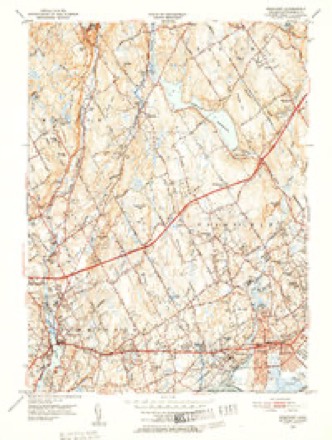
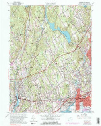
36 topographic sheets cover this place, the earliest surveyed in 1892 and the latest in 1986. It stands in Fairfield town. It lies in ZIP code area 06824. It lies near Sasco Hill. The Survey maps it on the Westport quadrangle.
On record in Fairfield
Buildings and businesses the archive holds for this place. Each opens its own page, with the source record it came from.
On the National Register 12 records
 Birdcraft SanctuaryNational Historic Landmark · listed 1982
 Jonathan Sturges HouseNational Historic Landmark · listed 1984
 Bronson Windmilllisted 1971
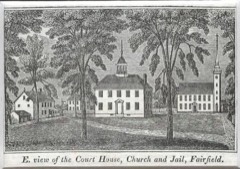 Fairfield Historic Districtlisted 1971
 Fairfield Railroad Stationslisted 1989
 Greenfield Hill Grange #133listed 2008
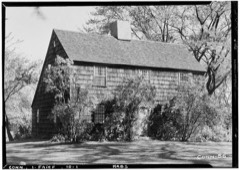 David Ogden Houselisted 1979
 John Osborne Houselisted 1987
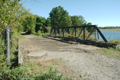 Pine Creek Park Bridgelisted 1992
 Restmorelisted 2009
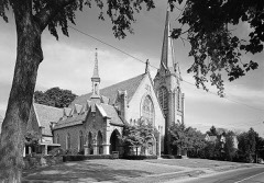 Southport Historic Districtlisted 1971
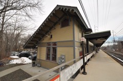 Southport Railroad Stationslisted 1989
Topographic sheets covering this place
11 surveys from 36 printed sheetsMatched by testing this settlement's coordinate against the published boundary of every sheet in the United States Geological Survey's historical collection. Each opens the scanned sheet at the Survey.
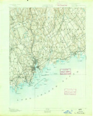
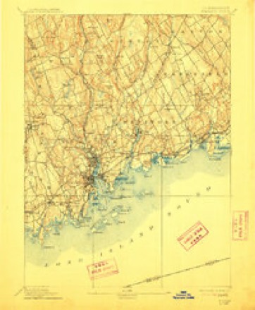
- 1892 USGS Norwalk quadrangle1:62500
- 1893 USGS Norwalk quadrangle1:62500, 12 printings
- 1947 USGS Hartford quadrangle1:250000, 2 printings
- 1948 USGS Hartford quadrangle1:250000, 2 printings
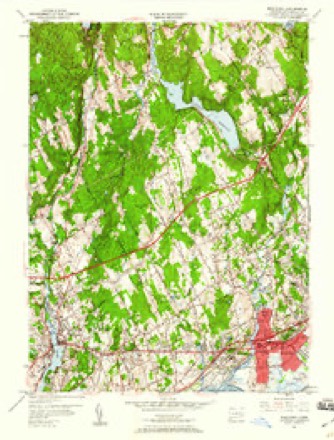
- 1951 USGS Westport quadrangle1:24000, 2 printings
- 1951 USGS Westport quadrangle1:31680, 3 printings
- 1960 USGS Westport quadrangle1:24000, 5 printings
- 1961 USGS Hartford quadrangle1:250000
- 1962 USGS Hartford quadrangle1:250000, 3 printings
- 1965 USGS Hartford quadrangle1:250000, 2 printings
- 1986 USGS Bridgeport quadrangle1:100000, 3 printings






In the county-history sources
6,612 words on this townshipHistory of Fairfield County, Connecticut, published 1881 names this settlement in its chapter on Fairfield Town. These are the passages that mention it, exactly as the scans read.
The town of Fairfield is located in the southern part of the county, and is bounded as follows : On the north by Kaston and Weston ; on the east by Bridgeport ; on the south by Long Island Sound ; on the west by Westport and "Weston. The surface of the town is undulating, and the soil is very fertile and generally free from stone.
Passage source: History of Fairfield County, Connecticut, published 1881.
To the renowned IndiauTfighter, John Mason, and the intrepid and talented Roger Ludlow and the soldiers who accompanied them on the expedition against the warlike Pequots, is due the honor of having discovered this section. These were the first white men Avho set foot upon the soil of Fairfield.
Passage source: History of Fairfield County, Connecticut, published 1881.
The Pequots, after the disa.strous conflagration at Mistiek, fled westward and secreted themselves in a swamp near the present village of Southport, in this town, where they awaited the certain attack of the | English. And they had not long to wait. Mivson | and Ludlow had resolved to utterly exterminate this , tribe, whose ferocity at that time stood without a par- ' ullel in the history of Indian nations. With that dc- I termination which knows no failure, the little band ; of soldiers followed hard upon the retreating form of the red brother. Their location in the dismal, miry swamp was in some respects an advantageous one. It served as a sort of ambush, and tlie miry nature of the place rendered it ahnost imj^wsible for the Kngli-sh to a]>proach. In this dismal place were secreted about eighty Pequot warriors, with their women and children and about two hundred other Indians, including the Fairfield Indians. The Hon. Gideon H. Hollister says, - haste to retreat, only sunk deeper in tho miro. Tho Indians, made hohl by this adventnre, pressed hard upon them, and would havo carried off their 8eal|>s had it not been for tho timely aid of some other Kngli(«hmen who wadod into the swamp, sword iu hand, drove l>ack the IVr|uot8, and drew their disabled frionda from tho mud that bad threatened to swallow them up.
Passage source: History of Fairfield County, Connecticut, published 1881.
Machine-read from a century-old scan, so expect the errors a machine makes: misspelled names, dropped words, stray characters.
Read the whole chapter on Fairfield Town - it names this place 10 more 10 times.
Fires near this place
54 since 2005Regional context, not property-specific evidence. The federal wildfire occurrence database lists 54 fires within 5 miles of Fairfield between 2005 and 2020, burning about 17 acres in total. None started naturally. None was recorded as arson. Distance is straight-line from the map coordinates, so a fire counted here may appear on a neighbouring settlement's page as well.
| Reported cause | Fires |
|---|---|
| Missing data/not specified/undetermined | 34 |
| Smoking | 10 |
| Debris and open burning | 7 |
| Railroad operations and maintenance | 2 |
| Recreation and ceremony | 1 |
The most recent of them, most recent first, with the day each was reported and the service that recorded it.
| Date | Cause | Size | Reported by | Name on the report |
|---|---|---|---|---|
| 8 September 2007 | Smoking | under an acre | Connecticut Division of Forestry | not named |
| 6 September 2007 | Missing data/not specified/undetermined | under an acre | Connecticut Division of Forestry | not named |
| 3 September 2017 | Missing data/not specified/undetermined | 3.8 acres | Connecticut Division of Forestry | 191 MAIN ST S (RT 133 |
| 24 September 2007 | Smoking | under an acre | Connecticut Division of Forestry | not named |
| 5 August 2007 | Missing data/not specified/undetermined | under an acre | Connecticut Division of Forestry | not named |
| 29 August 2016 | Missing data/not specified/undetermined | under an acre | Connecticut Division of Forestry | 10 BARNUM DYKE BRIDGEPORT |
| 2 July 2007 | Missing data/not specified/undetermined | under an acre | Connecticut Division of Forestry | not named |
| 17 July 2016 | Smoking | under an acre | Connecticut Division of Forestry | 1700 POST ROAD EAST |
Settlements close enough to share some of these fires:
Mines and quarries near this place
7 within 5 milesRegional context, not property-specific evidence. The federal mineral resources record lists 7 workings within 5 miles of Fairfield: 6 past producers, 1 plant. 1 still produces. What was taken out: Stone, Crushed/Broken, Stone, Dimension, Granite, Silver. Distance is straight-line from the map coordinates, so a quarry counted here may appear on a neighbouring settlement's page as well.
| Where | Site | Commodity | Status | Recorded |
|---|---|---|---|---|
| Handy & Harmon Refin/Fairfield, Ct. | Silver | Plant | ||
| Basalt Rock Quarry No. El-003 | Stone, Crushed/Broken | Past Producer | Diabase | |
| Burr's Quarry | Granite | Past Producer | ||
| County Jail Granite Gneiss Rock Quarry | Stone, Crushed/Broken | Past Producer | Unknown | |
| County Jail Quarry | Granite | Past Producer | ||
| Granitic Gneiss Rock Quarry No. El-007 | Stone, Dimension | Past Producer | Gneiss | |
| Traprock Quarry | Stone, Dimension | Past Producer |
Storms near this place
31 since 1993Regional context, not property-specific evidence. The National Weather Service names Fairfield in 31 storm reports between 1993 and 2024: 19 thunderstorm wind, 5 flash flood, 4 hail, 2 lightning. The reports record 3 deaths and 1 injury. Each account below is quoted exactly as the forecast office filed it, from the NOAA Storm Events Database, and each date opens the federal record of that event.
| When | Event | Place named | Harm | What the report says |
|---|---|---|---|---|
| June 2019 | Thunderstorm Wind | Fairfield | 1 killed, $6,000 | Fallen tree into a car resulted in a fatality and another person having to be extracted from the car on Sturges Road in the Mill Plain section of Fairfield. |
| May 2018 | Thunderstorm Wind | New Fairfield | 1 killed, $5,000 | Tree fell on a car on Brush Hill Road, killing one person inside. |
| May 2002 | High Wind | Fairfield | 1 killed | no account filed |
| June 2006 | Lightning | New Fairfield | 1 hurt | Man struck by lightning. Taken to hospital. He was treated for minor injuries and released. |
| June 2011 | Thunderstorm Wind | New Fairfield | $20,000 | Approximately 20 to 30 trees were reported down throughout New Fairfield. |
| June 2010 | Lightning | Fairfield | $6,000 | A lightning strike struck Stratfield Elementary School in Farifield. The lightning strike knocked out a 10-by-3-foot chunck of the chimney. |
| May 2018 | Thunderstorm Wind | New Fairfield | $5,000 | Numerous trees down near the intersection of Route 37 and Route 39. Also nickel sized hail reported. |
| July 2009 | Thunderstorm Wind | Fairfield | $4,000 | Multiple trees and wires were reported down throughout the town. |
| September 2023 | Thunderstorm Wind | New Fairfield | $3,000 | Limbs and wires down in New Fairfield CT. |
| June 2009 | Thunderstorm Wind | Fairfield | $2,000 | Trees and power lines were reported down in Fairfield. |
| August 2024 | Thunderstorm Wind | Fairfield | $1,000 | Tree in roadway on I-95 southbound between exits 22 and 21. Right lane closed. |
| September 2014 | Thunderstorm Wind | Fairfield | - | High winds downed numerous trees in Fairfield. |
| September 2014 | Thunderstorm Wind | Fairfield | - | High winds downed trees and wires that closed multiple roads throughout the town of Fairfield. |
| August 2009 | Flash Flood | New Fairfield | - | In Fairfield, Saw Mill Rd. was closed near Rt. 39 due to flooding. |
| August 2008 | Flash Flood | Fairfield | - | Fairfield police rescued the occupants of five vehicles that became stuck in high water. |
| September 2008 | Flash Flood | Fairfield | - | North Benson Road in Fairfield was closed due to flooding. Iranistan Ave. in the area of State St., Fairfield Ave., and Railroad Ave. were inundated with flood waters. About 25 areas in Bridgeport were flooded and 10 water rescues were performed by local emergency personnel. |
| June 2007 | Thunderstorm Wind | New Fairfield | - | Downed trees and power lines. |
| June 2006 | Thunderstorm Wind | New Fairfield | - | Trees and power lines downed over much of Northern Fairfield County. |
| July 2005 | Thunderstorm Wind | New Fairfield | - | Trees down. |
| June 2005 | Flash Flood | Fairfield | - | Flash flooding of streets, neighborhoods, and creeks in Fairfield and Monroe. |
| July 2005 | Thunderstorm Wind | New Fairfield | - | Trees down in New Fairfield. The storms continued to move southeastward and subsequently downed trees in Bridgeport at 6:25 PM EDT. |
| August 2004 | Flash Flood | Fairfield | - | Significant street flooding occurred. |
| August 2002 | Thunderstorm Wind | New Fairfield | - | A local newspaper reported numerous trees down in New Fairfield, 8 trees down in Brookfield, 21 city streets in Danbury affected by downed trees and power lines; and 10 trees down along with power lines in Redding. |
| August 1993 | Thunderstorm Wind | New Fairfield | - | Police report several trees down. |
| July 2014 | Hail | New Fairfield | - | no account filed |
| May 2005 | Thunderstorm Wind | Fairfield | - | no account filed |
| May 2005 | Hail | Fairfield | - | no account filed |
| May 2005 | Hail | Fairfield | - | no account filed |
| May 2005 | Hail | Fairfield | - | no account filed |
| October 2003 | Thunderstorm Wind | New Fairfield | - | no account filed |
| July 1997 | Thunderstorm Wind | New Fairfield | - | no account filed |
Nearest settlements
The eight closest, with where each one stands in the county. Distances are straight-line, computed from the Geographic Names Information System coordinates.
| Map | Place | Distance | Sheets |
|---|---|---|---|
| Southport | 1.1 miles | 36 | |
| Little Danbury (historical) | 1.3 miles | 31 | |
| Little Danbury | 1.4 miles | 31 | |
| Grover Hill | 1.9 miles | 31 | |
| Schoonhoven Park | 1.9 miles | 31 | |
| Black Rock | 2.4 miles | 31 | |
| Tunxis Hill | 2.7 miles | 31 | |
| Greenfield Hill | 2.9 miles | 36 |
Provenance
This settlement is recorded in the Geographic Names Information System as feature 206996. The sheet list is computed by point-in-boundary test against the United States Geological Survey's historical topographic inventory. Both are works of the United States government and carry no copyright under 17 U.S.C. 105.
Wildfire. Short, Karen C. 2022. Spatial wildfire occurrence data for the United States, 1992-2020 [FPA_FOD_20221014]. 6th Edition. Fort Collins, CO: Forest Service Research Data Archive. https://doi.org/10.2737/RDS-2013-0009.6 Collected with United States Government funding and usable without additional permissions or fees.
Mines and quarries. USGS Mineral Resources Data System (MRDS) https://mrdata.usgs.gov/mrds/ A work of the United States government, no copyright under 17 U.S.C. 105.
Storms. NOAA National Centers for Environmental Information, Storm Events Database https://www.ncei.noaa.gov/stormevents/ A work of the United States government, no copyright under 17 U.S.C. 105. Narratives are quoted verbatim from the National Weather Service report and are not edited or summarised.