 Block
Farmington, Connecticut
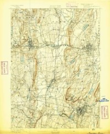
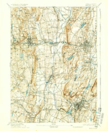
38 topographic sheets cover this place, the earliest surveyed in 1892 and the latest in 1994. It stands in Farmington town. It lies in ZIP code area 06032. It stands on Pequabuck River. The Survey maps it on the New Britain quadrangle.
On record in Farmington
Buildings and businesses the archive holds for this place. Each opens its own page, with the source record it came from.
On the National Register 10 records
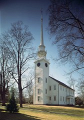 First Church of ChristNational Historic Landmark · listed 1975
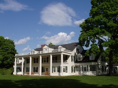 Hill-Stead MuseumNational Historic Landmark · listed 1991
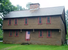 Stanley-Whitman HouseNational Historic Landmark · listed 1966
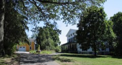 Austin F. Williams Carriagehouse and HouseNational Historic Landmark · listed 1998
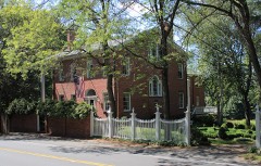 Gen. George Cowles Houselisted 1982
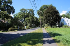 Farmington Historic Districtlisted 1972
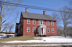 Gridley-Parsons-Staples Homesteadlisted 1981
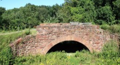 Pequabuck Bridgelisted 1984
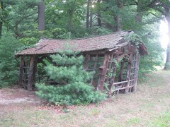 Shade Swamp Shelterlisted 1986
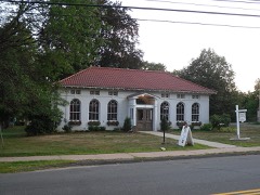 West End Librarylisted 2000
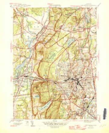
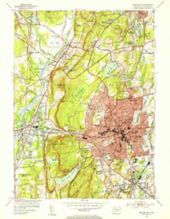
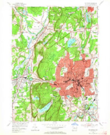
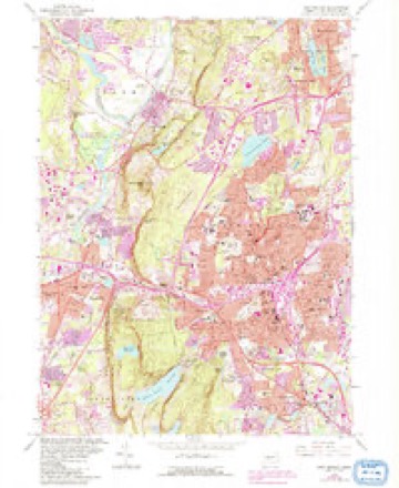
Topographic sheets covering this place
14 surveys from 38 printed sheetsMatched by testing this settlement's coordinate against the published boundary of every sheet in the United States Geological Survey's historical collection. Each opens the scanned sheet at the Survey.
- 1892 USGS Meriden quadrangle1:62500
- 1893 USGS Meriden quadrangle1:62500, 10 printings
- 1906 USGS Farmington quadrangle1:125000, 2 printings
- 1946 USGS New Britain quadrangle1:31680, 2 printings
- 1947 USGS Hartford quadrangle1:250000, 2 printings
- 1948 USGS Hartford quadrangle1:250000, 2 printings
- 1953 USGS New Britain quadrangle1:31680, 2 printings
- 1953 USGS New Britain quadrangle1:24000, 2 printings
- 1961 USGS Hartford quadrangle1:250000
- 1962 USGS Hartford quadrangle1:250000, 3 printings
- 1965 USGS Hartford quadrangle1:250000, 2 printings
- 1966 USGS New Britain quadrangle1:24000, 6 printings
- 1986 USGS Hartford quadrangle1:100000
- 1994 USGS Hartford quadrangle1:100000, 2 printings








In the county-history sources
15,168 words on this townshipThe Memorial History of Hartford County, Connecticut, 1633-1884;, published 1886 names this settlement in its chapter on Farmington Town. These are the passages that mention it, exactly as the scans read.
Notwithstanding all these precautions, the early settlers of this town were occasionally moved to fear and alarm. In 1612 the General Court took measures in reference to a hostile gathering and plot of the Indians about Tunxis. In 1657 the house of John Hart Avas destroyed by fire, and his family consumed, with yi yr c was near the centre of the village, that of Mr. Scott on the border of " the great plains." Both these acts were ascribed to Meshupano, as principal, and his accessories. For firing the house the Farmington Indians paid each year a heavy tribute for seven years, " eighty f addome of wampum, well strung and merchantable." The year after, complaint was made of the bullets shot into the town from the garrison of the natives, and also of their entertainment of strange Indians, and they were ordered to find another garrison. In 1662 we find them quarrelling with the Podunks of Windsor. From 1640 to 1720, eighty years, this town had fronted an almost unbroken forest which extended from the wooded horizon which we see from the village street, westward to the Housatonic and northwestward to Lake George. This was the hunting-ground of the Tunxis tribe and the marauding-ground of the dreaded Mohawk, who might appear either as the foe of his timid subject, or perchance as his ally for the destruction of the whites. For the first sixty years there was a numerous and not always friendly tribe in a garrison and village almost within musket-shot of the church.^ In 1675 Simsbury, then Massaco, a frontier settlement to the north, was deserted by its inhabitants - some forty families - and totally burned. So complete was the desolation, that the returning settlers found it difficult to discover the places where their effects had been secreted. The church erected in 1708 was provided with " guard seats," as they were called, where some ten to twenty men could be on the lookout near the doors against a sudden assault. The space for these seats was relinquished in 1726 for the erection of pews for eight families, with the provision that the pews should be surrendered should there be subsequent occasion to mount a guard. Later than this, on some occasion of alarm increased by the presence of strange Indians, the men of the Tunxis tribe were required to present themselves daily at the house of Deacon Lee, and pass in review before his daughter, whom they both admired and feared. Deacon Lee lived a little distance northward from the centre on the west
Passage source: The Memorial History of Hartford County, Connecticut, 1633-1884;, published 1886.
In 1840, by order of the School Society of Farmington, a monumental block of red sandstone was erected to the memory of these Indians. It stands in the new burying-ground on the edge of the river. The spot is one of sad historical interest, as the following inscription on one side of the monument explains : -
Passage source: The Memorial History of Hartford County, Connecticut, 1633-1884;, published 1886.
The church was organized in 1652, or, as the record has it, " Upon the 13th of October Mr. Roger Newton, Stephen Hart, Thomas Judd, John Bronson, John Cole, Thomas Thomson, and Robert Porter joined in Church Covenant in Farmington." Of this church Roger Newton was the first pastor. Stephen Hart had been a member of the original church of Thomas Hooker. It is added, " About one month after myself [John Steele,
Passage source: The Memorial History of Hartford County, Connecticut, 1633-1884;, published 1886.
Machine-read from a century-old scan, so expect the errors a machine makes: misspelled names, dropped words, stray characters.
Read the whole chapter on Farmington Town - it names this place 18 more 18 times.
Fires near this place
35 since 1993Regional context, not property-specific evidence. The federal wildfire occurrence database lists 35 fires within 5 miles of Farmington between 1993 and 2016, burning about 22 acres in total. None started naturally. 4 were recorded as arson. Distance is straight-line from the map coordinates, so a fire counted here may appear on a neighbouring settlement's page as well.
| Reported cause | Fires |
|---|---|
| Missing data/not specified/undetermined | 24 |
| Misuse of fire by a minor | 5 |
| Arson/incendiarism | 4 |
| Debris and open burning | 1 |
| Recreation and ceremony | 1 |
The most recent of them, most recent first, with the day each was reported and the service that recorded it.
| Date | Cause | Size | Reported by | Name on the report |
|---|---|---|---|---|
| 16 August 1993 | Recreation and ceremony | 1.0 acres | Connecticut Division of Forestry | not named |
| 12 August 1999 | Arson/incendiarism | under an acre | Connecticut Division of Forestry | not named |
| 26 June 1999 | Missing data/not specified/undetermined | under an acre | Connecticut Division of Forestry | not named |
| 1 June 1999 | Arson/incendiarism | under an acre | Connecticut Division of Forestry | not named |
| 7 May 2001 | Misuse of fire by a minor | under an acre | Connecticut Division of Forestry | not named |
| 17 May 2000 | Missing data/not specified/undetermined | under an acre | Connecticut Division of Forestry | not named |
| 1 May 1999 | Missing data/not specified/undetermined | under an acre | Connecticut Division of Forestry | not named |
| 8 April 2000 | Missing data/not specified/undetermined | under an acre | Connecticut Division of Forestry | not named |
Settlements close enough to share some of these fires:
Mines and quarries near this place
10 of 35 shownRegional context, not property-specific evidence. The federal mineral resources record lists 35 workings within 5 miles of Farmington: 23 past producers, 9 producers, 1 unknown, 1 occurrence. 10 still produce. What was taken out: Stone, Crushed/Broken, Stone, Dimension, Sand and Gravel, Construction, Flagstone. Distance is straight-line from the map coordinates, so a quarry counted here may appear on a neighbouring settlement's page as well.
| Where | Site | Commodity | Status | Recorded |
|---|---|---|---|---|
| Aiudi Stone Pit and Quarry | Stone | Producer | ||
| Basalt Rock Quarry and Barite Occurrence No. Dj-026 | Stone, Crushed/Broken, Barium-Barite | Producer | Basalt, Prehnite, Quartz | |
| Bristol Copper Mine | Molybdenum, Silver, Copper, Sulfur | Past Producer | 1795, 1836 | |
| Bristol Mine | Copper | Past Producer | ||
| Sphalerite Vein Quartz Occurrence No. Dj-023 | Zinc, Sulfur | Occurrence | Calcite, Prehnite, Quartz, Sphalerite | |
| Brownstone Quarry | Flagstone | Past Producer | ||
| Brownstone Quarry | Flagstone | Past Producer | ||
| Sandstone Quarry #Di-012 | Flagstone | Past Producer | ||
| Brickyard Pit | Sand and Gravel, Construction | Producer | ||
| Plainville Pit | Sand and Gravel, Construction | Past Producer | Sedimentary |
Storms near this place
15 since 1995Regional context, not property-specific evidence. The National Weather Service names Farmington in 15 storm reports between 1995 and 2024: 11 thunderstorm wind, 3 hail, 1 lightning. The reports record 1 injury. Each account below is quoted exactly as the forecast office filed it, from the NOAA Storm Events Database, and each date opens the federal record of that event.
| When | Event | Place named | Harm | What the report says |
|---|---|---|---|---|
| July 2002 | Thunderstorm Wind | Farmington | 1 hurt, $20,000 | no account filed |
| June 2009 | Thunderstorm Wind | Farmington | $250,000 | Fifty to one hundred trees across Farmington were downed by thunderstorm winds. Multiple roads were closed because of downed trees in the area of Route 4. One of these trees fell onto a car. |
| July 2016 | Thunderstorm Wind | Farmington | $5,000 | A tree on New Britain Avenue was downed by thunderstorm winds. |
| July 2018 | Thunderstorm Wind | Farmington | $3,000 | At 2:05 PM EST, a thunderstorm crossing Farmington Connecticut brought a tree and wires down on Colton Street, and a tree was brought down on Reservoir Road. |
| June 2008 | Thunderstorm Wind | Farmington | $2,000 | Trees were downed by thunderstorm winds. |
| July 2023 | Thunderstorm Wind | Farmington | $1,000 | In Farmington, wires were down on Rt. 4 and New Britain Ave. |
| July 2020 | Lightning | Farmington | $1,000 | In Farmington, lightning struck a pole on Main Street, bringing down the pole and wires. |
| May 2010 | Thunderstorm Wind | Farmington | $1,000 | A tree on River Road was downed by thunderstorm winds. |
| August 2024 | Hail | Farmington | - | In Farmington, 1 inch hail fail. |
| June 2006 | Hail | Farmington | - | no account filed |
| August 1999 | Thunderstorm Wind | Farmington | - | no account filed |
| June 1997 | Thunderstorm Wind | Farmington | - | no account filed |
| May 1997 | Hail | Farmington | - | no account filed |
| May 1996 | Thunderstorm Wind | Farmington | - | no account filed |
| July 1995 | Thunderstorm Wind | Farmington | - | no account filed |
Nearest settlements
The eight closest, with where each one stands in the county. Distances are straight-line, computed from the Geographic Names Information System coordinates.
| Map | Place | Distance | Sheets |
|---|---|---|---|
| Farmington Station | 1.6 miles | 38 | |
| River Glen | 2.4 miles | 38 | |
| Pinnacle Heights Housing | 2.5 miles | 38 | |
| Corbin Heights Housing | 2.6 miles | 38 | |
| Bensted Corner | 2.7 miles | 34 | |
| Oakland Gardens | 2.7 miles | 38 | |
| East Farmington Heights | 3.1 miles | 38 | |
| West District | 3.3 miles | 34 |
Provenance
This settlement is recorded in the Geographic Names Information System as feature 207036. The sheet list is computed by point-in-boundary test against the United States Geological Survey's historical topographic inventory. Both are works of the United States government and carry no copyright under 17 U.S.C. 105.
Wildfire. Short, Karen C. 2022. Spatial wildfire occurrence data for the United States, 1992-2020 [FPA_FOD_20221014]. 6th Edition. Fort Collins, CO: Forest Service Research Data Archive. https://doi.org/10.2737/RDS-2013-0009.6 Collected with United States Government funding and usable without additional permissions or fees.
Mines and quarries. USGS Mineral Resources Data System (MRDS) https://mrdata.usgs.gov/mrds/ A work of the United States government, no copyright under 17 U.S.C. 105.
Storms. NOAA National Centers for Environmental Information, Storm Events Database https://www.ncei.noaa.gov/stormevents/ A work of the United States government, no copyright under 17 U.S.C. 105. Narratives are quoted verbatim from the National Weather Service report and are not edited or summarised.