 Block
Goshen, Connecticut
32 topographic sheets cover this place, the earliest surveyed in 1892 and the latest in 1993. It stands in Goshen town. It lies in ZIP code area 06756. It stands on Fox Brook. The Survey maps it on the West Torrington quadrangle.
On record in Goshen
Buildings and businesses the archive holds for this place. Each opens its own page, with the source record it came from.
On the National Register 2 records
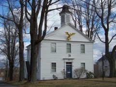 Goshen Historic Districtlisted 1982
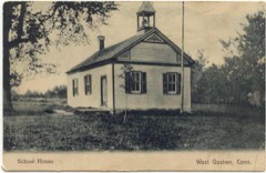 West Goshen Historic Districtlisted 1987
Topographic sheets covering this place
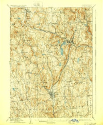
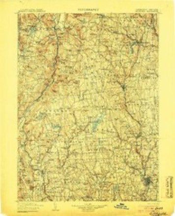
11 surveys from 32 printed sheetsMatched by testing this settlement's coordinate against the published boundary of every sheet in the United States Geological Survey's historical collection. Each opens the scanned sheet at the Survey.
- 1892 USGS Winsted quadrangle1:62500, 10 printings
- 1904 USGS Litchfield quadrangle1:125000, 3 printings
- 1947 USGS Hartford quadrangle1:250000, 2 printings
- 1948 USGS Hartford quadrangle1:250000, 2 printings
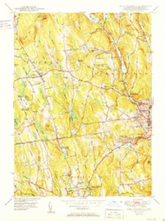
- 1951 USGS West Torrington quadrangle1:31680, 2 printings
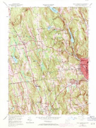
- 1956 USGS West Torrington quadrangle1:24000, 5 printings
- 1961 USGS Hartford quadrangle1:250000
- 1962 USGS Hartford quadrangle1:250000, 3 printings
- 1965 USGS Hartford quadrangle1:250000, 2 printings
- 1985 USGS Waterbury quadrangle1:100000
- 1993 USGS Waterbury quadrangle1:100000





In the county-history sources
11,945 words on this townshipHistory of Litchfield County, Connecticut, published 1881 names this settlement in its chapter on Goshen Town. These are the passages that mention it, exactly as the scans read.
" These individuals claimed their right under the towns of Hartford and Windsor, which brought on a violent conflict between the colony and these towns. In October of 1722, while the Assembly were in session at Hartford, some of the trespassers were arrested, and imprisoned at Hartford, but a mob was raised, the jail broken open, and the delinquents were set at liberty ; and so violent was the opposition of these towns to the acts of the Assembly that the civil authority was unable to execute the laws of the land. Finally, the Assembly, feeling the disastrous consequences of a protracted warfare of this nature, did, in the autumn of 1724, appoint a committee to investigate all the claims, and report thereon, that the difficulty might be amicably settled. This committee spent nearly two years in the investigation, and then reported that a division of this territory be made, giving one-half to the towns of Hartford and Windsor, and one-half to the colony. Hartford and Windsor should have the eastern division, and the colony the western. In May, 1726, the Assembly adopted substantially the report of the committee, and subsequently secured to these towns, Hartford and Windsor, by patent, all the disputed lands east of Litchfield, Goshen, and Norfolk, and retained the western section, viz., Goshen, Norfolk, Canaan, Cornwall, Kent, and Salisbury ; and thus an affair was adjusted which had retarded the settlement of these towns and threatened the whole colony with disastrous consequences.
Passage source: History of Litchfield County, Connecticut, published 1881.
"At the October session of the Assembly in 1726, a grant of three hundred acres of land in this town was made to James Wadsworth, Esq., of Durham, John Hall, Esq., of Wallingford, and Hezekiah Brainard, Esq., of Haddani. What the consideration was for this grant does not appear : probably it was for services rendered the colony. This survey was made by John Hitchcock, April 28, 1731. The northwest corner of this special grant was east of the road opposite the brick house of Capt. Jonatjhan Wadhams, and south of the school-house. The west line of the grant, running south three hundred rods, intersected the north line of Litchfield thirteen rods west of the north and south road, that passes the house of Harvey Brooks, thence east on Litchfield line one hundred and sixty rods. Thence north three hundred rods, and then west one hundred and sixty rods to the northwest bound, already described, near Capt. Wadhams. This grant has always borne the appellation ' the Squires Farm' because the three gentlemen to whom the grant was made all had the title esquire attached to their names respectively. It is said that the house owned and occupied by the widow and heir of the late Isaac Wadhams stands in the central part of the Squires Farm. But at the time of this survey the town had not been laid out by government, and was denominated Western Lands, or New Bantam, the Assembly not regarding at all the laying out of the town by Hartford and Windsor in 1722. But at their session in May, 1731, they enacted that their Western lands should be laid out into five townships, and appointed their committee to perform this business. The report of this committee as it respects this town bears date Oct. 15, 1731, describing the limits of the same, making the south line four miles and one hundred and ninety-six rods, the west line nine miles and sixty rods, the north line four miles and eighty-six rods, and the east line eight miles and one hundred and forty-six rods, showing that the south line is ten rods longer than the north line, and the west line two hundred and thirty-four rods longer than the east line. Soon after these towns were laid out the trustees of Yale College applied to the Assembly for a grant of land in aid of this institution, and in 1732 they made a grant of fifteen hundred acres to the trustees, three hundred acres in each of the five towns so recently laid out, and in January, 1737, the College Farm - so called - in this town was surveyed and its boundaries established. The dwelling-houses oi Messrs. Asa, Levcrett, and Cephsis Ives stand upon this grant, and also the house at the turnpike gate leading to Cornwall. On the 13th of October, 1737, the A.ssembly enacted that the township called Goshen should be divided into fifty-three rights, exclusive of former grants, referring to the Squires Farm and college. Two of the fifty-three rights were to be appropriated to the ministry, one of them to be the property of the first settled minister, and the other to remain for the support of the ministry in all aftertime. And a third right was to be for the support of schools. Fifty rights would remain for the proprietors of said townslii[>. The Assembly then resolved that this township should be sold in so many rights, at public auction, at the court-house in New Haven, to the higiiest bidder, commencing on the first Tuesday in December next (1737), and to be continued by adjournment until all the riglit-s were sold. Tiie conditions required of each i)roi)rietor were, that he or his agent should, within two years from the date of his purchase, enter ujmn Ills premises, build and finish a house thereon, no le-ss than eighteen feet square, and seven feet between sill and plate; clear, subdue, and fence six acres of said land, and continue to dwell thereon for the s|)ace of three successive years (unless prevented by death or unavoidable Providence), commencing after the expiration of the two years in which the specified conditions were to be performed ; and, furthermore, he must perform all orders and duties, and pay all taxes granted. If these conditions were performed, then his deed was valid ; but if any part of the conditions was omitted (extraordinarics excepted), his title was void and of no effect.
Passage source: History of Litchfield County, Connecticut, published 1881.
"The adjournnietit of tliis meeting on the 27th to the 28tli of the month was doubtless that they might arrange matters so as to transact busine.ns with greater dispatch the next day. We understand that each proprietor of one right in the town owned one fifty-third part of the town, exclusive of the Squires Farm and College Farm, but no man's right was yet located. And that each might have as fair a chance as possible in liis location, they agreed that but one hundred acres to each riglit should be located at that time, and that no one should select more than fifty acres until all the others had selected their fifty acres upon their respective rights. The method adopted to locate each man's fifty acres was this : there were fifty-three slips of paper cut and marked from No. 1 to 53. These papers were put into a hat or box, and the proprietors drew out one paper each, and according to tlie number the individual drew so he stood in the choice of his first fifty acres. The man who drew No. 1 had a right to select his fifty acres in any part of the town not encroaching upon the two farms s])ecified. He who drew No. 2 held the next choice, and so on to 5.S, an individual being designated to draw for the ministerial and school rights. But in the choice of the second fifty-acre lots to each individual proprietor there was no drawing for a choice ; for it was agreed that he who had the last choice in the first division should have tlie first choice in the second division; so that he who liad the first choice in the first division had the last choice in the second division. These preliminary steps being taken, the proprietors met on the 28th, appointed a committee for laying out the lots when chosen, and drew for their choice of lots. Aaron Cook drew No. 1 and had the first choice, Daniel Kichards the fifty-third. The meeting was tlien adjourned to the first Wednesday of December next, at 8 o'clock a.m., to meet at the house of Joseph Bird, in Litchfield, and the proprietors hastened to Goshen, each to search out and locate his future home, and where he should repose his mortal part. This is the day we celebrate at the distance of one entire century from those hardy adventurers. From this period we date the regular settlement of this town ; and whatever degree of interest we may feel on this occasion, we may rest assured our venerated fathers felt far more. They had to select for themselves and for theirs. Their personal interest and comfort were in a good degree involved in their choice. The labor of converting a wilderness into a fruitful field, and into smooth and green pastures, was theirs. Far distant was the day in their vision when the sun, with unobstructed rays and mellowing influences, should look down upon their soil as at this day. For a long period they could hope for the necessaries of life only, with a few conveniences and no luxuries, unless they were derived from the chase ! They knew the toil of felling the towering trees of the forest, of making roads, building bridges, erecting mills, fences, habitations, barns, school-houses, and a house for worship ; and it will appear in the sequel that these first settlers contemplated all these things from the commencement of their enterprise. Now, notwithstanding this was a peculiar race of men, prepared by the providence of God for bold and arduous undertakings, yet must they not have felt an interest and a solicitude while entering this forest for the first time which we do not and cannot feel ? Yet they were sustained and directed, and by the strength of their arms, and the perseverance of their labors, we their descendants are placed in the lap of ease and plenty. I have stated that Aaron Cook drew No. 1, and had the first choice in the first division of lots. He cliose - and we honor his choice - the south part of Town Hill, whereon now stand the brick house of the late Col. Moses Lyman, and the house of his son, iSamuel Lyman. Daniel Richards, who was last in choice in this division, chose the land lying southeast of Narshapogge Pond, now injudiciously called West Side Pond, and it embraced the land whereon now stands the three-story house known by the name Hudson house. I say this pond is injudiciously called West Side Pond, because it is entered in all ancient conveyances by its Indian name, Narshapogge, and because it is much more definite in its Indian name than in its present name ; for who that was not well acquainted with the use of terms here could decide which pond was meant by the term West Side Pond, whether it was this pond, or the one a little south of it? Beside, the Indian name is a much more dignified name ; and as it was prior to the one now in common use by thousands of years probably, it ought to be retained as a memorial of a mighty race that have passed away to make room for the more civilized, but more effeminate European ! And what is said of this pond applies with equal force to her sister a little south, which was called in the Indian tongue Marshapogge, but is now called Tyler Pond. Who for a moment can balance in his judgment in regard to the euphony of these two names? Not one. We say, then, let them bear their original names, and the names they hold in our records, and not attempt to filch from the poor Indian the right which God and nature gave him, to imprint the seal of his own language upon those everlasting hills, lakes, ponds, and streams ! Pardon me this digression and I will proceed. I have said this day one hundred years this town was settled by its proprietors, but these were not the first English inhabitants within this town. I have already spoken of the Squires Farm, and given its boundaries at the southeasterly part of the town, lying on Litchfield line. It is upon record that, in February, 1734, James Wadsworth, Esq., sold his onethird part of the Squires Farm to Ebenezer Luke and Isaac Hill, all of Wallingford, of this State ; that in February, 1736, there was a division of the whole farm between the owners, and that the southern third part fell to the share of said Hill. It appears, also, that in 1737, Ebenezer Hill came on to the west part of this south third of the farm, and built him a small framed house on the ground now improved for a barnyard by Harvey Brooks. The house stood east of the road as it then rau, but west of where it now runs. This same season, 17.37, Benjamin Frisbie bought of Luke Hill his third of the one hundred acres, divided between the said Hills, and built him a house a little north of the house of Ebenezer Hill, on the same side of the road. These two houses might have accommodated some few of the proprietors of the town while attending to the location and survey of their respective lots, but by far the greater portion must have reposed at night on the lap of indulgent nature, and slept under the protecting wing of high heaven. '
Passage source: History of Litchfield County, Connecticut, published 1881.
Machine-read from a century-old scan, so expect the errors a machine makes: misspelled names, dropped words, stray characters.
Read the whole chapter on Goshen Town - it names this place 10 more 10 times.
Fires near this place
127 since 1999Regional context, not property-specific evidence. The federal wildfire occurrence database lists 127 fires within 5 miles of Goshen between 1999 and 2020, burning about 38 acres in total. 2 started naturally. 1 was recorded as arson. Distance is straight-line from the map coordinates, so a fire counted here may appear on a neighbouring settlement's page as well.
| Reported cause | Fires |
|---|---|
| Missing data/not specified/undetermined | 92 |
| Debris and open burning | 17 |
| Recreation and ceremony | 13 |
| Natural | 2 |
| Equipment and vehicle use | 2 |
| Arson/incendiarism | 1 |
The most recent of them, most recent first, with the day each was reported and the service that recorded it.
| Date | Cause | Size | Reported by | Name on the report |
|---|---|---|---|---|
| 9 September 2006 | Missing data/not specified/undetermined | under an acre | Connecticut Division of Forestry | not named |
| 3 September 2017 | Missing data/not specified/undetermined | under an acre | Connecticut Division of Forestry | 56 BARON LN |
| 25 September 2020 | Missing data/not specified/undetermined | under an acre | Connecticut Division of Forestry | 263 W HYPERDALE DRIVE |
| 25 September 2016 | Missing data/not specified/undetermined | under an acre | Connecticut Division of Forestry | 761 MIGEON AVE TORRINGTON |
| 20 September 2008 | Missing data/not specified/undetermined | under an acre | Connecticut Division of Forestry | not named |
| 13 September 2016 | Missing data/not specified/undetermined | under an acre | Connecticut Division of Forestry | 1515 NORFOLK RD TORRINGTON |
| 13 September 2016 | Missing data/not specified/undetermined | 2.0 acres | Connecticut Division of Forestry | NORFOLK ROAD TORRINGTON |
| 13 September 2016 | Missing data/not specified/undetermined | 1.5 acres | Connecticut Division of Forestry | JOHN MINETTO STATE PARK |
Settlements close enough to share some of these fires:
Mines and quarries near this place
10 of 19 shownRegional context, not property-specific evidence. The federal mineral resources record lists 19 workings within 5 miles of Goshen: 16 past producers, 2 occurrences, 1 prospect. None of them still produces. What was taken out: Stone, Dimension, Stone, Granite, Nickel. Distance is straight-line from the map coordinates, so a quarry counted here may appear on a neighbouring settlement's page as well.
| Where | Site | Commodity | Status | Recorded |
|---|---|---|---|---|
| Cattey Pit | Sand and Gravel, Construction | Past Producer | ||
| Hodges Nickel and Sulfide Prospect | Copper, Nickel, Sulfur | Occurrence | Syntectonic Mafic Intrusion | |
| Torrington Borough Granite Gneiss Rock Quarry | Stone, Crushed/Broken | Past Producer | Unknown | |
| Mount Prospect | Nickel | Past Producer | Sulfides Of Hydrothermal | |
| Mount Prospect | Nickel | Prospect | ||
| Benedict Quarry | Granite | Past Producer | ||
| Costello Quarry | Granite | Past Producer | ||
| Gneiss Rock Quarry No. Ei-004 | Stone | Past Producer | Gneiss | |
| Gneiss Rock Quarry No. Ei-013 | Stone | Past Producer | Gneiss | |
| Gneiss Rock Quarry No. Fi-012 | Stone | Past Producer | Unknown |
Storms near this place
17 since 1995Regional context, not property-specific evidence. The National Weather Service names Goshen in 17 storm reports between 1995 and 2025: 8 thunderstorm wind, 6 hail, 2 lightning, 1 flash flood. The reports record 1 injury. Each account below is quoted exactly as the forecast office filed it, from the NOAA Storm Events Database, and each date opens the federal record of that event.
| When | Event | Place named | Harm | What the report says |
|---|---|---|---|---|
| June 2010 | Lightning | Goshen | 1 hurt | A woman was struck by lightning while she was riding a horse near Pie Hill Road in Goshen. |
| July 2002 | Thunderstorm Wind | Goshen | $5,000 | Thunderstorms erupted ahead of cold front, on the afternoon of July 19 across Litchfield County. One of the storms became briefly severe as it moved across the town of Goshen. The winds from the storm knocked down some trees in that town. |
| August 2017 | Lightning | Goshen | $1,000 | A tree was struck by lightning and caught fire. The time was estimated by radar. |
| May 2025 | Thunderstorm Wind | Goshen | - | A member of the public reported trees down on Route 4, Sharon Turnpike, just west of Goshen. |
| June 2024 | Thunderstorm Wind | Goshen | - | A large tree was blocking the road at Pumping Station Road near Timberlake Court. |
| June 2024 | Thunderstorm Wind | Goshen | - | A tree was downed on Route 4 in Goshen near Kimberly Road. |
| September 2021 | Flash Flood | Goshen | - | Road was reported closed due to flooding at the intersection of Route 63 and Hill House Road. |
| September 2017 | Hail | Goshen | - | Estimated quarter-size hail was reported via Facebook. |
| July 2014 | Hail | Goshen | - | Nickel size hail was reported during a thunderstorm in Goshen. |
| July 2014 | Thunderstorm Wind | West Goshen | - | A tree and wires were reported down on Bartholomew Hill Road in Goshen due to thunderstorm winds. |
| June 2011 | Hail | West Goshen | - | Nickel size hail was reported during a thunderstorm approximately 5 miles northwest of Litchfield. |
| July 2010 | Thunderstorm Wind | West Goshen | - | Trees were reported down along Route 4 in West Goshen due to strong thunderstorm winds. |
| June 2004 | Thunderstorm Wind | Goshen | - | Trees blown down. |
| July 1997 | Hail | Goshen | - | An isolated severe thunderstorm, which developed well ahead of a cold front, produced three-quarter inch hail at Goshen. |
| April 1995 | Thunderstorm Wind | Goshen | - | Power lines were knocked down in Goshen at 1254 EST. Poles and lines were downed in Sharon at 1255 EST. |
| April 2021 | Hail | Goshen | - | no account filed |
| May 2002 | Hail | Goshen | - | no account filed |
Nearest settlements
The eight closest, with where each one stands in the county. Distances are straight-line, computed from the Geographic Names Information System coordinates.
| Map | Place | Distance | Sheets |
|---|---|---|---|
| West Goshen | 1.4 miles | 35 | |
| Tyler Lake Heights | 2.4 miles | 35 | |
| Kelly Corner | 3.4 miles | 32 | |
| Drakeville | 3.9 miles | 32 | |
| Wrightville | 4.0 miles | 32 | |
| West Torrington | 4.4 miles | 32 | |
| East Cornwall | 4.6 miles | 35 | |
| North Goshen | 4.7 miles | 32 |
Provenance
This settlement is recorded in the Geographic Names Information System as feature 207374. The sheet list is computed by point-in-boundary test against the United States Geological Survey's historical topographic inventory. Both are works of the United States government and carry no copyright under 17 U.S.C. 105.
Wildfire. Short, Karen C. 2022. Spatial wildfire occurrence data for the United States, 1992-2020 [FPA_FOD_20221014]. 6th Edition. Fort Collins, CO: Forest Service Research Data Archive. https://doi.org/10.2737/RDS-2013-0009.6 Collected with United States Government funding and usable without additional permissions or fees.
Mines and quarries. USGS Mineral Resources Data System (MRDS) https://mrdata.usgs.gov/mrds/ A work of the United States government, no copyright under 17 U.S.C. 105.
Storms. NOAA National Centers for Environmental Information, Storm Events Database https://www.ncei.noaa.gov/stormevents/ A work of the United States government, no copyright under 17 U.S.C. 105. Narratives are quoted verbatim from the National Weather Service report and are not edited or summarised.